Elevation hydrology tools kent pena
•Download as PPTX, PDF•
0 likes•395 views

This document presents elevation hydrology tools that simplify watershed delineation and analysis. The tools allow for clipping data to an area of interest to reduce size, and streamlining processes like flow direction, accumulation, and stream network derivation. They also enable watershed delineation and attribute calculation, including area, average slope, and runoff curve number. The document provides an overview of Python scripting solutions used and defines the runoff curve number as an empirical parameter for predicting runoff or infiltration from rainfall excess that is widely used to determine approximate direct runoff from rainfall events based on land cover and soil group.
Report
Share
Report
Share

Recommended
Watershed development and drainage assessments
This document summarizes how GIS data and software can be used to accurately assess drainage districts and generate watersheds. Key details include generating watersheds from contour, parcel and soils data layers, accounting for sinks and peaks in elevation data, attributing computer-generated watersheds to match existing administrative boundaries, and using tools like ArcGIS and Draincalc to calculate equitable assessments for individual parcels based on watershed membership and overlay analysis. The process allows non-GIS users like local government officials to benefit from automated watershed and assessment generation to improve efficiency and accuracy over previous hand-drawn methods.
3D Analyst - Lake Lorelindu by GRASS
This document describes using the open source GIS software GRASS to calculate the volume of Lore Lindu Lake in Central Sulawesi, Indonesia. It details the steps taken, which include importing polygon and depth point data, creating a bathymetry map using inverse distance weighted interpolation, generating contour and slope maps, viewing the results in 3D, and calculating the lake volume as 143449194.374 cubic meters using the r.volume command. The document concludes that GRASS provides an accessible and flexible way to perform this hydrological analysis and 3D volume calculation.
3D Analyst - Lake, Jatiluhur
This document summarizes finding the volume of water in Jatiluhur Reservoir using 3D Analyst in ArcGIS. It details importing elevation data, creating an area of interest, cropping the data to the reservoir boundaries, and using 3D Analyst tools to calculate volume statistics. The volume of water held below the reservoir surface was computed to understand how much water it is holding.
Watershed analysis using GIS
This document discusses GIS tools and techniques for watershed analysis including DEM, fill sinks, flow direction, flow accumulation, conditional elevation, stream ordering, snapping pour points, watershed delineation, basin delineation, and calculating flow length. Key steps are opening a DEM, preprocessing the DEM with fill and flow tools, defining streams and pour points, delineating watersheds, and calculating attributes like flow length. The overall goal is to use GIS to analyze watersheds, drainage patterns, and water flow across landscapes.
Ahmad Mauliddin Vol Of Water In Bili Bili
The document describes using ArcGIS 3D Analyst to calculate the volume of water in Bili-Bili Reservoir in South Sulawesi Province, Indonesia. 3D Analyst allows users to visualize spatial data in three dimensions, determine heights anywhere on a surface, calculate volumetric differences between two surfaces, and work with 3D vector features. The analysis will use a topographic map and shapefile of the Bili-Bili Reservoir boundaries to find the volume of water.
3D Analyst - Watershed
Delineate a Watershed Area and Find the Streams of the Rivers Using Spatial and 3D Analyst
by Candra Dewi
3D Analyst - Watershed and Stream Network
A watershed is defined as the area of land that drains to a particular point along a stream. The boundary of a watershed is defined by the highest elevations surrounding the stream, and a drop of water falling outside this boundary will drain to another watershed. This document outlines steps to automatically delineate watershed areas and stream networks in ArcGIS using tools like flow direction, flow accumulation, and watershed. The process involves converting DEM data to raster format, removing sinks, and generating channels, stream links, and watersheds based on flow patterns and accumulation thresholds.
Technology~linkage data .
This document discusses three topics:
1) The importance of ground stations in satellite meteorology for weather prediction and monitoring global observations.
2) A concept for managing data from the SPURS project, which involves collecting data from various ocean platforms and sensors and integrating it with models and satellite observations.
3) A brief section about internet technology connections, datacenters, and networking connectivity.
3D Analyst - Watershed, Tomohon
The document summarizes a project to delineate a watershed area and identify streams in the Tomohon Agripolitan area of Indonesia using 3D modeling software. Key steps included creating a digital elevation model from SRTM data, removing errors from the DEM using ArcGIS tools, generating flow direction and accumulation rasters, identifying stream channels, assigning stream segments unique IDs, and using the results to generate the watershed boundary. 3D views of the area were also created in Global Mapper and ArcScene with overlays of rivers and roads.
3D Analyst - Watershed Lorelindu
This document summarizes steps taken to create a geographic information system (GIS) model of watershed areas in Lore Lindu National Park, Indonesia. The steps included: (1) creating a digital elevation model from satellite data, (2) removing errors, (3) generating flow direction and accumulation maps, (4) mapping stream channels based on areas with over 500 cells of accumulated flow, (5) generating stream links, (6) delineating watersheds, (7) visualizing the 3D model, and (8) comparing generated streams to topography.
Atmos - Tom hartley - Modelling Bird Behaviour to Progress Wind Farm Development
1. Atmos Consulting provides environmental and planning expertise for renewable energy projects, including modelling bird behaviour to assess impacts on sensitive species from wind farm development.
2. They developed a model to predict bird activity levels within wind farm airspace based on nest locations and ranging behaviour to substitute for observed activity levels from vantage point surveys for the Leadhills wind farm project.
3. This random collision risk modelling solution showed low risk of adverse impacts and allowed the project to gain approval, providing a method to address objections when survey data is limited.
Watershed Delineation Using ArcMap
For a new better version of this tutorial see my Google Slides with embedded videos.
https://docs.google.com/presentation/d/1MftEOT3uvYpCVwUaLMhsesm5Que-Kr7GQRV4pKZ2SNQ/edit?usp=sharing
This is a 2016 tutorial on how to do watershed delineation using ArcMap 10. It is an open education resource. Please let me know if you find it useful or see something that could be improved. Feel free to use it for teaching Geographic Information Science.
Tutorialinterpolationam en
This document provides a tutorial on interpolating hydrological variables in ArcGIS. It describes displaying observed data points on a map, creating a Thiessen polygons map to visualize areal characteristics, and using deterministic (inverse distance weighted and spline) and geostatistical (ordinary and universal kriging) interpolation methods. It compares the different interpolation results and discusses improving interpolation by adjusting search neighborhoods or using universal kriging instead of ordinary kriging.
Bluesky - Esri UK Annual Conference 2016
The document discusses using innovative GIS and environmental data to optimize vegetation management of power lines. It notes that trees are a major threat to power supplies in the UK. A new approach is presented that uses remote sensing to capture high-resolution spatial data, ArcGIS software to analyze distances between vegetation and conductors and classify risk, and 3D visualization to identify where encroachment is worst. This allows for prioritized, risk-based cutting plans to increase efficiency and reduce costs compared to traditional surveying methods.
3D Watershed Celebes
This document outlines the steps to derive watersheds in Central Celebes, Indonesia from SRTM data using 3D modeling software and ArcGIS tools:
1) Load and preprocess SRTM data to create a DEM raster, including cropping, filling blanks, converting projections, and saving as a GeoTIFF.
2) Perform terrain analysis in ArcGIS to calculate flow direction, flow accumulation, stream definition, stream segmentation, and catchment grid delineation using the ArcHydro tools.
3) View the resulting watersheds and hydrological networks in 3D in ArcScene by setting the appropriate layer properties and vertical exaggeration.
3D Analyst - Watershed from SRTM
This document describes the 7 main steps to create a watershed from SRTM DEM data using ArcGIS software: 1) Create a DEM from SRTM data and reproject it; 2) Remove sinks in the DEM; 3) Generate a flow direction raster; 4) Generate a flow accumulation raster; 5) Generate a stream channel raster; 6) Generate stream links; and 7) Generate the watershed polygons. Each step involves using different ArcGIS hydrology tools on the output of the previous step to delineate watershed boundaries.
Flood plain mapping
1. The document discusses flood plain mapping of the Jamuna River in Bangladesh using HEC-RAS and GIS software.
2. Steady flow water surface profiles were computed for 10 different discharges and flood plains were delineated for discharges of 500 cumecs, 10000 cumecs, and 30000 cumecs.
3. The results show flood risk for various discharges which will help engineers and designers make accurate decisions to protect against flooding.
spatial interoplation in GIS
The document discusses spatial interpolation techniques. Spatial interpolation is the process of using points with known values to estimate values at other points, turning raw data into useful information by adding context and values. It can predict unknown values for geographic point data like elevation, rainfall, or chemical concentration. Common uses of spatial interpolation in GIS include calculating properties of a surface at given points, providing contours for graphical displays, and aiding in spatial decision making like terrain analysis and hydrology. Interpolation methods can be classified as global or local, exact or approximate, stochastic or deterministic, and abrupt or smooth.
18 - DSS_NIH_Presentation-Sep-17
This document discusses a hydrology project in India that uses a decision support system (DSS) to analyze water resource scenarios. The DSS integrates tools and databases to help decision-makers analyze alternatives and consequences without an in-depth knowledge of modeling techniques. It provides timely information and allows scenario analysis. The river basin is divided into sub-basins modeled using hydrological and allocation models within the DSS to estimate components like rainfall, recharge, flow, and allocate surface and groundwater resources. The DSS is used to analyze scenarios like reservoir filling likelihoods and risks of low water levels under different planned water allocation scenarios.
3D Analyst - Watershed, Padang
The document discusses using ArcGIS spatial analyst tools to delineate watersheds in the Padang area of Indonesia. It involves creating a digital elevation model (DEM) from SRTM elevation data, then using hydrological modeling tools like Fill, Flow Direction, Flow Accumulation, and Watershed to generate vector layers representing streams, channels, and watershed boundaries. The final watershed delineation is viewed in 2D in ArcMap and 3D in ArcScene and Cosmo Player to understand the hydrological modeling process and watersheds in the Padang area.
3D Analyst - Watershed, Lombok
This document outlines the 7 main steps to delineate a watershed area in Lombok, Indonesia: 1) Create a digital elevation model from SRTM data, 2) Remove errors from the DEM, 3) Generate flow direction, 4) Generate flow accumulation, 5) Generate stream channels, 6) Generate stream links, 7) Generate the watershed area. ArcGIS and ArcScene software are used to complete the delineation and visualize the 3D watershed area.
markus_mueller_eresearchnz2016
This document discusses satellite image processing in a high-performance computing (HPC) environment. It provides three examples of satellite image analysis implemented on the Pan cluster: 1) pre-processing of Landsat images, 2) MODIS land surface temperature analysis of Antarctica, and 3) improving New Zealand's land cover database by identifying small woody patches. The key challenges discussed are the large volumes of satellite imagery data and implementing batch-level parallel processing in Python to efficiently analyze the data using HPC resources.
DSD-INT 2015 - Workshop processing with sentinel toolbox - Jos Maccabiani, Sk...
This document summarizes a presentation on using interferometric synthetic aperture radar (InSAR) to monitor ground deformation from space. It explains that InSAR allows wide-area and fine-resolution monitoring of ground deformation through clouds and at night. Examples are given of using InSAR to monitor deformation related to earthquakes and volcanoes. The presentation discusses how InSAR works by measuring phase differences between acquisitions to detect millimeter-level changes in ground position. It also addresses challenges like phase unwrapping and decorrelation, and shows examples of InSAR monitoring subsidence from oil/gas extraction and underground mining.
Watershed Delineation in ArcGIS
For a new better version of this tutorial see my Google Slides with embedded videos.
https://docs.google.com/presentation/d/1MftEOT3uvYpCVwUaLMhsesm5Que-Kr7GQRV4pKZ2SNQ/edit?usp=sharing
This is a 2019 tutorial on how to do watershed delineation using ArcMap 10. It is an open education resource. Please let me know if you find it useful or see something that could be improved. Feel free to use it for teaching Geographic Information Science.
Modelling of Short Duration Isopluvial Map For Raichur District Karnataka Moh...
Modelling of Short Duration Isopluvial Map For Raichur District Karnataka Moh...Mohammed Badiuddin Parvez
Everyoneacknowledges that it rains, runoff is generated for a design point of view we should know how much and how often it rains on our project location.Estimation of rainfall intensity is commonly required for the design of hydraulic and water resources engineering control structures. The present study aimed the Estimation of rainfall intensityin Raichur District using twenty five Rain gauge Station with 19 years of rainfall data (1998 to 2016). Log Normal Distribution, techniques are used to derived the rainfall intensity values of 2,5,10,15,30,60,120,720,1440 minutes of rainfall duration with different return period. The short duration IDF using daily rainfall data are presented, which is input for water resources projects. Isopluvial maps were developed for 25years, 50years, 75years and 100years return period
GIS for Infrastructure Management
The document discusses how GIS can be used as an information backbone to support effective decision making. It provides examples of how GIS has been used for capacity analysis, capital improvements planning, and developing asset management strategies. Specifically, it describes how GIS data, modeling, and analytics can help infrastructure managers make informed decisions, minimize risks, and save time and expenses when planning maintenance and capital projects.
Conjunuse
The document discusses developing a GIS-based decision support system to help with conjunctive water use in irrigation projects, which involves integrating the management of surface water and groundwater resources to meet objectives like augmenting canal supplies and controlling water tables; conjunctive use requires tools that can identify spatially homogenous units, assess recharge and pumping impacts on water tables using models, and identify suitable conjunctive use strategies through simulation and optimization; the proposed system would use GIS, models, and an expert system interface to help users make decisions about conjunctive water use problems.
SC7 Workshop 3: Big Data Challenges in Building a Global Earth Observation Sy...
This document discusses the challenges of building a global Earth observation system called GEOSS using big data. It notes that GEOSS involves over 100 member countries and participating organizations who collect petabytes of Earth observation data from satellites. The development of data cubes like the Australian Data Cube aims to calibrate and standardize this diverse satellite data to allow for comparison over time and across sensors. Continental-scale water mapping projects demonstrate the potential of aggregating decades of satellite imagery totaling over a petabyte of data to monitor issues relevant to sustainable development goals.
Wisconsin SCO Virtual Data Integration
This project explores virtually integrating parcel data from multiple Wisconsin counties through web map services rather than physically integrating the data. The project team has combined existing county web map services into a single online parcel map without exchanging or altering the underlying data. The presentation outlines the advantages of this approach, some challenges, and goals to investigate limitations and best practices for virtual data integration through web services.
Integrative mapping strategies jeremy bixby
This document discusses strategies for creating integrative mapping applications. It provides three key takeaways: 1) Integrative apps increase ROI by extending app lifespan, optimizing existing apps, and streamlining processes; 2) Technology should enhance business processes to optimize resource utilization; 3) Customers expect superior mobile experiences with standardized UIs, organizational branding integration, and emotional connections. It then discusses decreasing investment costs through tools like Esri FlexViewer and increasing value by ensuring usability, usefulness, and desirability.
More Related Content
What's hot
3D Analyst - Watershed, Tomohon
The document summarizes a project to delineate a watershed area and identify streams in the Tomohon Agripolitan area of Indonesia using 3D modeling software. Key steps included creating a digital elevation model from SRTM data, removing errors from the DEM using ArcGIS tools, generating flow direction and accumulation rasters, identifying stream channels, assigning stream segments unique IDs, and using the results to generate the watershed boundary. 3D views of the area were also created in Global Mapper and ArcScene with overlays of rivers and roads.
3D Analyst - Watershed Lorelindu
This document summarizes steps taken to create a geographic information system (GIS) model of watershed areas in Lore Lindu National Park, Indonesia. The steps included: (1) creating a digital elevation model from satellite data, (2) removing errors, (3) generating flow direction and accumulation maps, (4) mapping stream channels based on areas with over 500 cells of accumulated flow, (5) generating stream links, (6) delineating watersheds, (7) visualizing the 3D model, and (8) comparing generated streams to topography.
Atmos - Tom hartley - Modelling Bird Behaviour to Progress Wind Farm Development
1. Atmos Consulting provides environmental and planning expertise for renewable energy projects, including modelling bird behaviour to assess impacts on sensitive species from wind farm development.
2. They developed a model to predict bird activity levels within wind farm airspace based on nest locations and ranging behaviour to substitute for observed activity levels from vantage point surveys for the Leadhills wind farm project.
3. This random collision risk modelling solution showed low risk of adverse impacts and allowed the project to gain approval, providing a method to address objections when survey data is limited.
Watershed Delineation Using ArcMap
For a new better version of this tutorial see my Google Slides with embedded videos.
https://docs.google.com/presentation/d/1MftEOT3uvYpCVwUaLMhsesm5Que-Kr7GQRV4pKZ2SNQ/edit?usp=sharing
This is a 2016 tutorial on how to do watershed delineation using ArcMap 10. It is an open education resource. Please let me know if you find it useful or see something that could be improved. Feel free to use it for teaching Geographic Information Science.
Tutorialinterpolationam en
This document provides a tutorial on interpolating hydrological variables in ArcGIS. It describes displaying observed data points on a map, creating a Thiessen polygons map to visualize areal characteristics, and using deterministic (inverse distance weighted and spline) and geostatistical (ordinary and universal kriging) interpolation methods. It compares the different interpolation results and discusses improving interpolation by adjusting search neighborhoods or using universal kriging instead of ordinary kriging.
Bluesky - Esri UK Annual Conference 2016
The document discusses using innovative GIS and environmental data to optimize vegetation management of power lines. It notes that trees are a major threat to power supplies in the UK. A new approach is presented that uses remote sensing to capture high-resolution spatial data, ArcGIS software to analyze distances between vegetation and conductors and classify risk, and 3D visualization to identify where encroachment is worst. This allows for prioritized, risk-based cutting plans to increase efficiency and reduce costs compared to traditional surveying methods.
3D Watershed Celebes
This document outlines the steps to derive watersheds in Central Celebes, Indonesia from SRTM data using 3D modeling software and ArcGIS tools:
1) Load and preprocess SRTM data to create a DEM raster, including cropping, filling blanks, converting projections, and saving as a GeoTIFF.
2) Perform terrain analysis in ArcGIS to calculate flow direction, flow accumulation, stream definition, stream segmentation, and catchment grid delineation using the ArcHydro tools.
3) View the resulting watersheds and hydrological networks in 3D in ArcScene by setting the appropriate layer properties and vertical exaggeration.
3D Analyst - Watershed from SRTM
This document describes the 7 main steps to create a watershed from SRTM DEM data using ArcGIS software: 1) Create a DEM from SRTM data and reproject it; 2) Remove sinks in the DEM; 3) Generate a flow direction raster; 4) Generate a flow accumulation raster; 5) Generate a stream channel raster; 6) Generate stream links; and 7) Generate the watershed polygons. Each step involves using different ArcGIS hydrology tools on the output of the previous step to delineate watershed boundaries.
Flood plain mapping
1. The document discusses flood plain mapping of the Jamuna River in Bangladesh using HEC-RAS and GIS software.
2. Steady flow water surface profiles were computed for 10 different discharges and flood plains were delineated for discharges of 500 cumecs, 10000 cumecs, and 30000 cumecs.
3. The results show flood risk for various discharges which will help engineers and designers make accurate decisions to protect against flooding.
spatial interoplation in GIS
The document discusses spatial interpolation techniques. Spatial interpolation is the process of using points with known values to estimate values at other points, turning raw data into useful information by adding context and values. It can predict unknown values for geographic point data like elevation, rainfall, or chemical concentration. Common uses of spatial interpolation in GIS include calculating properties of a surface at given points, providing contours for graphical displays, and aiding in spatial decision making like terrain analysis and hydrology. Interpolation methods can be classified as global or local, exact or approximate, stochastic or deterministic, and abrupt or smooth.
18 - DSS_NIH_Presentation-Sep-17
This document discusses a hydrology project in India that uses a decision support system (DSS) to analyze water resource scenarios. The DSS integrates tools and databases to help decision-makers analyze alternatives and consequences without an in-depth knowledge of modeling techniques. It provides timely information and allows scenario analysis. The river basin is divided into sub-basins modeled using hydrological and allocation models within the DSS to estimate components like rainfall, recharge, flow, and allocate surface and groundwater resources. The DSS is used to analyze scenarios like reservoir filling likelihoods and risks of low water levels under different planned water allocation scenarios.
3D Analyst - Watershed, Padang
The document discusses using ArcGIS spatial analyst tools to delineate watersheds in the Padang area of Indonesia. It involves creating a digital elevation model (DEM) from SRTM elevation data, then using hydrological modeling tools like Fill, Flow Direction, Flow Accumulation, and Watershed to generate vector layers representing streams, channels, and watershed boundaries. The final watershed delineation is viewed in 2D in ArcMap and 3D in ArcScene and Cosmo Player to understand the hydrological modeling process and watersheds in the Padang area.
3D Analyst - Watershed, Lombok
This document outlines the 7 main steps to delineate a watershed area in Lombok, Indonesia: 1) Create a digital elevation model from SRTM data, 2) Remove errors from the DEM, 3) Generate flow direction, 4) Generate flow accumulation, 5) Generate stream channels, 6) Generate stream links, 7) Generate the watershed area. ArcGIS and ArcScene software are used to complete the delineation and visualize the 3D watershed area.
markus_mueller_eresearchnz2016
This document discusses satellite image processing in a high-performance computing (HPC) environment. It provides three examples of satellite image analysis implemented on the Pan cluster: 1) pre-processing of Landsat images, 2) MODIS land surface temperature analysis of Antarctica, and 3) improving New Zealand's land cover database by identifying small woody patches. The key challenges discussed are the large volumes of satellite imagery data and implementing batch-level parallel processing in Python to efficiently analyze the data using HPC resources.
DSD-INT 2015 - Workshop processing with sentinel toolbox - Jos Maccabiani, Sk...
This document summarizes a presentation on using interferometric synthetic aperture radar (InSAR) to monitor ground deformation from space. It explains that InSAR allows wide-area and fine-resolution monitoring of ground deformation through clouds and at night. Examples are given of using InSAR to monitor deformation related to earthquakes and volcanoes. The presentation discusses how InSAR works by measuring phase differences between acquisitions to detect millimeter-level changes in ground position. It also addresses challenges like phase unwrapping and decorrelation, and shows examples of InSAR monitoring subsidence from oil/gas extraction and underground mining.
Watershed Delineation in ArcGIS
For a new better version of this tutorial see my Google Slides with embedded videos.
https://docs.google.com/presentation/d/1MftEOT3uvYpCVwUaLMhsesm5Que-Kr7GQRV4pKZ2SNQ/edit?usp=sharing
This is a 2019 tutorial on how to do watershed delineation using ArcMap 10. It is an open education resource. Please let me know if you find it useful or see something that could be improved. Feel free to use it for teaching Geographic Information Science.
Modelling of Short Duration Isopluvial Map For Raichur District Karnataka Moh...
Modelling of Short Duration Isopluvial Map For Raichur District Karnataka Moh...Mohammed Badiuddin Parvez
Everyoneacknowledges that it rains, runoff is generated for a design point of view we should know how much and how often it rains on our project location.Estimation of rainfall intensity is commonly required for the design of hydraulic and water resources engineering control structures. The present study aimed the Estimation of rainfall intensityin Raichur District using twenty five Rain gauge Station with 19 years of rainfall data (1998 to 2016). Log Normal Distribution, techniques are used to derived the rainfall intensity values of 2,5,10,15,30,60,120,720,1440 minutes of rainfall duration with different return period. The short duration IDF using daily rainfall data are presented, which is input for water resources projects. Isopluvial maps were developed for 25years, 50years, 75years and 100years return period
GIS for Infrastructure Management
The document discusses how GIS can be used as an information backbone to support effective decision making. It provides examples of how GIS has been used for capacity analysis, capital improvements planning, and developing asset management strategies. Specifically, it describes how GIS data, modeling, and analytics can help infrastructure managers make informed decisions, minimize risks, and save time and expenses when planning maintenance and capital projects.
Conjunuse
The document discusses developing a GIS-based decision support system to help with conjunctive water use in irrigation projects, which involves integrating the management of surface water and groundwater resources to meet objectives like augmenting canal supplies and controlling water tables; conjunctive use requires tools that can identify spatially homogenous units, assess recharge and pumping impacts on water tables using models, and identify suitable conjunctive use strategies through simulation and optimization; the proposed system would use GIS, models, and an expert system interface to help users make decisions about conjunctive water use problems.
SC7 Workshop 3: Big Data Challenges in Building a Global Earth Observation Sy...
This document discusses the challenges of building a global Earth observation system called GEOSS using big data. It notes that GEOSS involves over 100 member countries and participating organizations who collect petabytes of Earth observation data from satellites. The development of data cubes like the Australian Data Cube aims to calibrate and standardize this diverse satellite data to allow for comparison over time and across sensors. Continental-scale water mapping projects demonstrate the potential of aggregating decades of satellite imagery totaling over a petabyte of data to monitor issues relevant to sustainable development goals.
What's hot (20)
Atmos - Tom hartley - Modelling Bird Behaviour to Progress Wind Farm Development
Atmos - Tom hartley - Modelling Bird Behaviour to Progress Wind Farm Development
DSD-INT 2015 - Workshop processing with sentinel toolbox - Jos Maccabiani, Sk...
DSD-INT 2015 - Workshop processing with sentinel toolbox - Jos Maccabiani, Sk...
Modelling of Short Duration Isopluvial Map For Raichur District Karnataka Moh...
Modelling of Short Duration Isopluvial Map For Raichur District Karnataka Moh...
SC7 Workshop 3: Big Data Challenges in Building a Global Earth Observation Sy...
SC7 Workshop 3: Big Data Challenges in Building a Global Earth Observation Sy...
Viewers also liked
Wisconsin SCO Virtual Data Integration
This project explores virtually integrating parcel data from multiple Wisconsin counties through web map services rather than physically integrating the data. The project team has combined existing county web map services into a single online parcel map without exchanging or altering the underlying data. The presentation outlines the advantages of this approach, some challenges, and goals to investigate limitations and best practices for virtual data integration through web services.
Integrative mapping strategies jeremy bixby
This document discusses strategies for creating integrative mapping applications. It provides three key takeaways: 1) Integrative apps increase ROI by extending app lifespan, optimizing existing apps, and streamlining processes; 2) Technology should enhance business processes to optimize resource utilization; 3) Customers expect superior mobile experiences with standardized UIs, organizational branding integration, and emotional connections. It then discusses decreasing investment costs through tools like Esri FlexViewer and increasing value by ensuring usability, usefulness, and desirability.
Open source web mapping system launch and demonstration andy swartz
Open source web mapping system launch and demonstration andy swartzWisconsin Land Information Association
The document discusses the benefits of exercise for mental health. Regular physical activity can help reduce anxiety and depression and improve mood and cognitive functioning. Exercise causes chemical changes in the brain that may help boost feelings of calmness, happiness and focus.2009 Fall Regional - GIS and Wildfire Management
The document discusses how GIS technology has improved wildfire management in Wisconsin by allowing for more detailed zone maps. It describes some destructive fires in the 1970s-1980s that showed the need for better emergency response planning. A partnership between the DNR and Wood County created a detailed emergency response atlas in 2007 that is now used for wildfire and other disaster responses. The atlas was recognized for engineering excellence and has led to improved cooperation between agencies.
Spring 2010 SAGIC Perspective
This document discusses several key land information issues facing state government in Wisconsin, including the lack of a statewide imagery acquisition strategy, uncertainty around authoritative statewide data layers, and the need for business case assessments for centralized data infrastructure and services. It also describes relevant technological advances like web services and political advances in government transparency. The document questions how the Wisconsin Land Information Program (WLIP) could be enhanced to better support state government needs, such as developing standards, policies and funding for statewide data layers and a central repository. It discusses whether WLIP should focus more on local government roles or take on broader statewide initiatives.
Vilas County Invasive Species Program
With natural resource conservation being such a hot topic, it is important to be able to inform and educate the public about invasive species dispersion and impacts. To assist with such efforts, the Vilas County Mapping Department has teamed with the Invasive Species Coordinator to help create effective teaching and reference materials that can be updated in a timely manner using GPS and other techniques. Examples of procedures and products will be showcased, as well as other invasive species issues and initiatives which illustrate departmental cooperation and creative funding.
Viewers also liked (6)
Open source web mapping system launch and demonstration andy swartz
Open source web mapping system launch and demonstration andy swartz
Similar to Elevation hydrology tools kent pena
Extreme Event-based Rainfal.pptx
This document discusses extreme event-based rainfall-runoff simulation utilizing GIS techniques. It covers:
- The importance of extreme event modeling for flood mitigation and infrastructure planning.
- How GIS techniques are used to integrate data like topography, land use, and rainfall for hydrological modeling.
- The key components of the modeling process including data preparation, rainfall-runoff modeling, calibration and validation.
- Current applications and the potential for future advances through new data sources and machine learning.
7 - AECOM Water Resources Seminar World Bank -16-Sept
The document discusses AECOM's work on rehabilitating the Pattamundai Canal System in Odisha, India. It overviews AECOM's scope of work, which included surveys, design, drawings and cost estimates. It describes the canal system and key challenges including lack of data on the old system. AECOM's methodology involved condition surveys, GIS mapping, designs for canal modifications and new structures, and contract documents. The process included surveys, investigation, planning, design, quantities and cost estimation, and completion documents.
Seven Most tenable applications of AI o Water Resources Management
AI or Artificial Intelligence is a pioneering technique that has enabled the creation of intelligent machines.or smart machines which has the power to self adapt based on the situation presented to it. It requires situations whose response is known and based on this training data set it learns the problems which it has to solve when it is ready. Due to the alarming success with AI in robotics, electronics etc fields the same technique is now used to solve the problems of water resource management.. This ppt shows seven most notable use of AI in water resources-based problems where satisfactory improvement has encouraged further application of the technique.
Rahul Bajpai M.tech Remote sensing & GIS RSACUP
This document discusses the application of radar remote sensing in flood management. It begins with introductions to radar remote sensing and flood management. Radar can be used for near real-time flood monitoring, assessing the nature of floods, and mapping of flood prone areas. Both ground-based and satellite radar data can be integrated. Digital elevation models generated from radar and other data sources are useful for flood management tasks like delineating watersheds and drainage networks. The document provides examples of how synthetic aperture radar images can be used to map flood extent, even in areas obscured by vegetation.
Application of remote sensing and gis for groundwater
Remote sensing and GIS techniques can contribute significantly to groundwater modeling efforts. Remote sensing provides spatial data on land cover, vegetation, rainfall, and terrain that are important model inputs. GIS allows integration of diverse data layers, conceptualization of recharge/discharge areas, and output visualization. However, remote sensing has limitations, such as an inability to directly measure groundwater levels or recharge. Overall, combining remote sensing, GIS, and field data can improve conceptual models and produce more accurate modeling results for groundwater management.
GIS-WaterSector (1).pptx
GIS is used in the water sector to map, analyze, and address issues through integrating geographical data with tabular records. Remote sensing involves detecting physical characteristics of an area from a distance, typically via satellite imagery. GIS integrates remote sensing data. GIS supports applications like watershed management through catchment delineation, extracting streams and mapping surface water bodies. It aids in irrigation planning, assessing water quality, and managing utilities, floods, and groundwater. The latest technologies applied to GIS in water resource management include 3D modeling, drone imagery, and satellite rainfall measurement.
INCENDIA
Using big data analytics and sensors, this proposal aims to improve urban water supply systems by detecting leaks and optimizing distribution networks. Sensors would monitor flow and pressure to reconstruct networks and identify breaks in correlations indicating leaks. Algorithms would optimize sensor placement. Detected leaks would be quickly addressed. This could save up to 25% of water annually by timely detecting transmission losses. A pilot in Ahmedabad is proposed, installing sensors over 8 months with funding from governments or companies. Benefits include reduced water gaps and costs, while risks like resistance to changes can be addressed through training and collaboration.
A Deep Learning use case for water end use detection by Roberto Díaz and José...
Deep Learning (DL) is a major breakthrough in artificial intelligence with a high potential for predictive applications.
https://www.bigdataspain.org/2017/talk/a-deep-learning-use-case-for-water-end-use-detection
Big Data Spain 2017
November 16th - 17th Kinépolis Madrid
Two Dimensional Flood Inundation Modelling In Urban Area Using WMS, HEC-RAS a...
This research presents a two-dimensional flood inundation modelling in urbanized areas when some features such as roads, buildings, and fences have great effect on flood propagation. Wadi Qows located in Jeddah City, Saudi Arabia was chosen as case study area because of the flood occurrence of 2009 causing lots of losses either economic or loss of life. The WMS and HEC-RAS program were used for a hydraulic simulation based on channel geometry built by incorporating urban features into DEM using GIS effectively. A resampling method of DEM 90 × 90 m become 10 × 10 m grid cell sizes was conducted to produce a higher resolution DEM suitable for urban flood inundation modelling. The results show that a higher resolution leads to increasing the average flood depth and decreasing the flood extent. Although the change of the grid cell sizes does not affect its elevation values, this approach is helpful to perform flood simulations in urban areas when high resolution DEM availability is limited. In addition, the integration of WMS, HEC-RAS and GIS are powerful tools for flood modelling in rural, mountainous and urban areas.
https://www.researchgate.net/publication/330004725_Two_Dimensional_Flood_Inundation_Modelling_in_Urban_Areas_Using_WMS_HEC-RAS_and_GIS_Case_Study_in_Jeddah_City_Saudi_Arabia_IEREK_Interdisciplinary_Series_for_Sustainable_Development
2016 conservation track: evaluating lidar derived synthetic streams as a ...
evaluating lidar derived synthetic streams as a source for national hydrography dataset flowlines
Application of Remote Sensing and GIS Technology for Pre and Post Flood Analy...
This study used remote sensing and GIS techniques to analyze flooding along the Chenab River in Pakistan in 2014. Satellite images from before and after the flood were classified and analyzed in ArcGIS to map the flooded areas. Field surveys were also conducted. The results identified the extent of flooding and assessed the impacted areas. In conclusion, the study demonstrated that remote sensing and GIS are valuable tools for flood hazard mapping and identifying prone areas to help with disaster management and planning.
Delineating high crash locations with the use of GIS
This document outlines a study that used GIS to delineate high crash locations and analyze relationships between crash characteristics and causal factors. The study objectives were to map high crash locations, conduct exploratory analysis of crash frequency and severity relationships with causal factors using GIS, and develop a model relating crash frequency to causal factors. Relevant literature, data sources on traffic and crashes, and the methodology used are described. The methodology involved geocoding crash and traffic data in GIS, selecting locations, and modeling crash frequency as a function of traffic volume, speed, street length, and control type. The results found relationships between higher crashes and increased traffic, speed, and signals and between lower crashes and increased street length.
Integrated disaster management system and emergency management system
IDMS is a scientific information system that supports safety management activities through cooperation with related organizations like meteorological and flood control offices. It collects and shares disaster situation information and provides command and control through central, metropolitan, and district control centers. The system manages facilities, hazardous areas, resources and accommodations to help with prevention, preparation, response and recovery from disasters.
Lidar and radar.pptx
Lidar technology has been used in Nepal for some infrastructure projects previously but the Survey Department of Nepal has now begun a nationwide lidar survey project. The project aims to survey the entire country over the next 7 years which will help with infrastructure development, disaster management, and understanding Nepal's hydropower potential. Lidar uses laser pulses to measure distance and when combined with GPS and image data, can create highly accurate 3D terrain models. The survey data is expected to benefit areas like infrastructure design, flood mapping, and feasibility studies.
069MSW405_Devendra Tamrakar_Presentation
This thesis evaluates TRMM satellite precipitation data over Nepal and its application in hydrologic modeling of the Narayani River Basin. Statistical comparisons of TRMM and gauge data from 2001-2008 show TRMM generally underestimates precipitation. The PINEHBV hydrologic model is set up and calibrated for the basin using TRMM data from 2004-2008, and validated for 2009-2010. The model simulation results are acceptable but could be improved by addressing TRMM underestimation biases and moving to a monthly or distributed model setup.
APPLICATIONS OF RS AND GIS FOR DEVELOPMENT OF SMALL HYDROPOWER PLANTS (SHP)
This document discusses using GIS and remote sensing tools to assess small hydropower potential in a systematic way. It describes how digital elevation models and satellite imagery can be used to map water resources and estimate energy potential from small hydro sites. GIS allows for integration of spatial data layers and rapid evaluation of sites over large areas. Case studies demonstrate how these tools were applied to identify suitable locations for small hydro projects in India and evaluate their technical and economic feasibility in a sustainable manner.
Discharge-Forecasting-of-Mahanadi-River-Basin.pptx
The study aimed to develop a machine learning model for discharge prediction in the Mahanadi River Basin using GIS data. GIS was used to create maps of spatial features, which were integrated into a linear regression model. The model showed potential for discharge forecasting but could be improved. Future work includes analyzing longer term rainfall and discharge data, comparing additional machine learning algorithms, and enhancing predictions to support water resource management.
Real-time Geographic Information System (GIS) for.pptx
This document proposes a real-time geographic information system (GIS) using a rule-based system to monitor water levels in an area. It discusses how GIS and web-based GIS works, including the client-server architecture. A rule-based system is proposed to process water level data from sensors using if-then rules. The system was implemented using PHP and MySQL to display water level monitoring information and maps to users. Testing showed the system accurately monitored potential water levels and displayed appropriate outputs and maps. The system allows local governments and the public to view real-time water level data and maps to help with water resource management.
Mandira singh shrestha
This document summarizes the development of a real-time flood outlook system for the Narayani River basin in Nepal. It describes the distribution of disasters in Nepal, with floods and landslides accounting for 35% of deaths. The model framework uses the MIKE platform with hydrologic and hydrodynamic models to provide 3-day lead time forecasts. Key data sources include satellite imagery, rainfall and temperature observations, and forecast data. Forecasts are disseminated online and through other channels. An example forecast for 2014 floods is provided. Remaining challenges include improving data availability and refining the flood alerts.
Geospatial Open Data and Urban Growth Modelling for Evidence-based Decision M...
This document provides an overview of using geospatial data and urban growth modeling for evidence-based decision making in smart cities. It discusses using satellite imagery and classification techniques to model urban growth over time. A hidden Markov model is proposed that incorporates temporal factors like GDP and interest rates to better predict land use and land cover changes. A case study of modeling urban growth in Pune, India from 2001-2014 is presented using Landsat satellite imagery and temporal data on economic and population indicators.
Similar to Elevation hydrology tools kent pena (20)
7 - AECOM Water Resources Seminar World Bank -16-Sept
7 - AECOM Water Resources Seminar World Bank -16-Sept
Seven Most tenable applications of AI o Water Resources Management
Seven Most tenable applications of AI o Water Resources Management
Application of remote sensing and gis for groundwater
Application of remote sensing and gis for groundwater
A Deep Learning use case for water end use detection by Roberto Díaz and José...
A Deep Learning use case for water end use detection by Roberto Díaz and José...
Two Dimensional Flood Inundation Modelling In Urban Area Using WMS, HEC-RAS a...
Two Dimensional Flood Inundation Modelling In Urban Area Using WMS, HEC-RAS a...
2016 conservation track: evaluating lidar derived synthetic streams as a ...
2016 conservation track: evaluating lidar derived synthetic streams as a ...
Application of Remote Sensing and GIS Technology for Pre and Post Flood Analy...
Application of Remote Sensing and GIS Technology for Pre and Post Flood Analy...
Delineating high crash locations with the use of GIS
Delineating high crash locations with the use of GIS
Integrated disaster management system and emergency management system
Integrated disaster management system and emergency management system
APPLICATIONS OF RS AND GIS FOR DEVELOPMENT OF SMALL HYDROPOWER PLANTS (SHP)
APPLICATIONS OF RS AND GIS FOR DEVELOPMENT OF SMALL HYDROPOWER PLANTS (SHP)
Discharge-Forecasting-of-Mahanadi-River-Basin.pptx
Discharge-Forecasting-of-Mahanadi-River-Basin.pptx
Real-time Geographic Information System (GIS) for.pptx
Real-time Geographic Information System (GIS) for.pptx
Geospatial Open Data and Urban Growth Modelling for Evidence-based Decision M...
Geospatial Open Data and Urban Growth Modelling for Evidence-based Decision M...
More from Wisconsin Land Information Association
Airphoto anomilies
This document provides a summary of various airphoto anomalies spotted from aerial views of different locations in Wisconsin. It was prepared by the North Central Wisconsin Regional Planning Commission and thanks regional planning commissions of East Central, Bay Lake, and Dane County. The anomalies spotted include a prescribed fire burn area in Juneau County, a corn maze in the Town of Scott in Lincoln County, a funky pond design in Wood County, a field layout near an airport runway in the Town of Grand Chute in Outagamie County, farming activity in Juneau County, and a horse showing track and hop field in Dane County.
A wikimap of landscape values in the bad river watershed carl sack
A wikimap of landscape values in the bad river watershed carl sackWisconsin Land Information Association
This document summarizes a wikimapping project in the Bad River Watershed that allowed local residents to share their landscape values online. The project was designed with user-centered and stakeholder input to empower local voices in land use decisions. A web-based wikimap was created for residents to identify important landscape features. Workshops were held to demonstrate the map and get public feedback. The project was evaluated based on how users engaged with the mapping system and whether it impacted perceptions of landscape values in the community. Funding was provided by the Cartography Specialty Group with special thanks to Dr. Robert E. Roth.Workshop using open source software for mobile data collection workshop - a...
Workshop using open source software for mobile data collection workshop - a...Wisconsin Land Information Association
Open Data Kit (ODK) is an open-source suite of tools that allows for mobile data collection and submission to an online server. It includes ODK Collect for mobile data entry, ODK Aggregate as a backend server for storage and analysis, and tools for building custom forms like ODK Build. The presentation provides an overview of installing and using the ODK system, including deploying Aggregate on Google App Engine or a local server, designing forms, collecting and analyzing data, and exporting it to formats like CSV, KML, and publishing to Google Fusion Tables. Examples are given of displaying collected data on maps and with charts through the ODK Aggregate interface.Wigicc's role in wisconsin jon schwitchtenberg
The Wisconsin Geographic Information Coordination Council (WIGICC) was created to coordinate geographic information statewide. It is comprised of 19 voting members from state and local government, tribal, private, non-profit, and education sectors. WIGICC works to improve access, utility, and value of geographic data through leadership, collaboration, data sharing, and advising decision-makers. Recent accomplishments include supporting statewide initiatives and representing geospatial interests to legislators.
Wi 590 nutrient management web application lisa morrison
The document discusses the benefits of exercise for mental health. Regular physical activity can help reduce anxiety and depression and improve mood and cognitive functioning. Exercise boosts blood flow, releases endorphins, and promotes changes in the brain which help enhance one's emotional well-being and mental clarity.
Surveying and land records management dean roth
This document discusses the land records review process in one county to identify common mistakes. It describes how the county assistant surveyor reviews Certified Survey Maps (CSMs), subdivision plats, and condominium plats submitted for recording, though not plats of survey. The review aims to ensure compliance with regulations and address issues like accurate parcel boundaries, public safety, and environmental concerns before updating tax and land records. The surveyor drafts parcel boundaries in CAD software and checks for errors in distances, areas, and legal descriptions compared to the submitted survey. Comments are provided to the applicant and other county departments for revision before recording.
Mapping spatial patterns of whai finder usage to measure community outreach e...
Mapping spatial patterns of whai finder usage to measure community outreach e...Wisconsin Land Information Association
This document summarizes research analyzing spatial patterns of usage of the WHAIFinder mapping tool to measure the effectiveness of community outreach. Usage data from over 16,000 visits by nearly 10,000 unique visitors over one year was collected and analyzed. Results found relatively uniform usage across Wisconsin with some underserved areas. A statistical model found a moderate relationship between visitor numbers and county population, and a stronger relationship with broadband access, though some variance remained unexplained. The research provides a quantitative method to evaluate information delivery and identify opportunities to improve outreach goals.Local gis in the statewide voter registration system sarah whitt
Local gis in the statewide voter registration system sarah whittWisconsin Land Information Association
This document discusses mapping tools in the SVRS system, the benefits and problems of mapping, and provides contact information for Zachary Robinson and Sarah Whitt at the Wisconsin government who can provide assistance with mapping in SVRS. It also thanks county and municipal GIS partners for their data assistance throughout the year.Li dar quality control a client's perspective - tyler grosshuesch
Li dar quality control a client's perspective - tyler grosshueschWisconsin Land Information Association
The document discusses the benefits of exercise for mental health. Regular physical activity can help reduce anxiety and depression and improve mood and cognitive function. Exercise causes chemical changes in the brain that may help protect against developing mental illness and improve symptoms for those who already suffer from conditions like anxiety and depression.Li dar meets wisconsinview jc nelson
The document discusses a collaboration between various Wisconsin organizations to coordinate LiDAR data access through hosting the data on WisconsinView. It notes the need for a centralized location for LiDAR data in Wisconsin. Through collaboration between Wisconsin organizations including WIGICC, WI DNR, WisconsinView, and others, LiDAR data collected by counties will be hosted on WisconsinView for public access. The objective is for WisconsinView to serve as a single location to access Wisconsin LiDAR data, starting with derived products and working towards hosting all collected LiDAR data.
Lakesheds and riverscapes extending wisconsin's hydro database with landsca...
Lakesheds and riverscapes extending wisconsin's hydro database with landsca...Wisconsin Land Information Association
The document summarizes efforts by the Wisconsin DNR to extend Wisconsin's hydrologic database with landscape attributes. Key points include:
- The DNR delineated HUC16 watersheds and 24K riparian zones for Wisconsin streams and lakes, assigning over 997 attributes to each.
- A neural network model was developed to estimate historic and future daily stream temperatures using watershed characteristics and weather data.
- The enhanced hydrologic database allows modeling of fish communities, nutrient loading, and how stream biology may be impacted by climate change.Lake habitat mapping with side scan sonar in nine wisconsin lakes - christine...
Lake habitat mapping with side scan sonar in nine wisconsin lakes - christine...Wisconsin Land Information Association
The document discusses the benefits of exercise for mental health. Regular physical activity can help reduce anxiety and depression and improve mood and cognitive functioning. Exercise causes chemical changes in the brain that may help protect against mental illness and improve symptoms.Integrating sanitary televising data with utility gis data within the city of...
Integrating sanitary televising data with utility gis data within the city of...Wisconsin Land Information Association
Matt Eitrem has been the GIS Coordinator for the City of Ashland, Wisconsin since 2008. In 2011-2012, 22% of the city's sanitary sewer mains were video inspected using GIS throughout the project. GIS was used in all phases from the request for proposals, implementation, quality assurance/quality control, and integrating the data. The contractor delivered data in an Access database and flat files that were directly imported into the GIS. Relationship classes and routing were set up to analyze the inspection and observation data in the GIS.Integrating high accuracy gps with esri's arc gis for windows mobile field so...
Integrating high accuracy gps with esri's arc gis for windows mobile field so...Wisconsin Land Information Association
The document discusses the benefits of exercise for mental health. Regular physical activity can help reduce anxiety and depression and improve mood and cognitive function. Exercise causes chemical changes in the brain that may help protect against mental illness and improve symptoms.Implementing arc gis 10.1 for the wisconsin dnr nhi portal levi felling
Implementing arc gis 10.1 for the wisconsin dnr nhi portal levi fellingWisconsin Land Information Association
The document discusses the benefits of exercise for mental health. Regular physical activity can help reduce anxiety and depression and improve mood and cognitive functioning. Exercise causes chemical changes in the brain that may help protect against mental illness and improve symptoms.Gis in parks and recreation the proragis website - trish nau
PRORAGIS is a national database launched in 2011 by the National Recreation and Park Association (NRPA) that allows park and recreation agencies to input data about their operations to benchmark against peers. It merged two previous NRPA tools - an operating ratio study and a GIS mapping model. Agencies can use PRORAGIS to compare budgets, facilities, and programs with similar agencies, assist with master planning, and help justify funding requests. Inputting data is free for agencies and involves filling out an online profile with information about jurisdiction, departments, programs, budgets, personnel, facilities, and maps of parks, trails, and amenities.
Geo moose project update brian fischer
The document provides a summary of the top 10 accomplishments for the GeoMoose project in 2012. Key points include establishing a project steering committee and request for comments process, completing the OSGEO incubation process, rewriting code to be more extensible, integrating the Dojo toolkit, improving documentation, developing more extensions and hooks, rewriting vector and feature editing layers, contributions from volunteers and funding partners, and plans for continued collaboration and a 2013 roadmap.
Developing mobile apps pick your poison - levi felling
The document discusses the benefits of exercise for mental health. Regular physical activity can help reduce anxiety and depression and improve mood and cognitive functioning. Exercise causes chemical changes in the brain that may help protect against mental illness and improve symptoms.
City of ashland an analysis of mobile gis through amazon elastic cloud comp...
City of ashland an analysis of mobile gis through amazon elastic cloud comp...Wisconsin Land Information Association
This document discusses how the City of Ashland, Wisconsin used Amazon EC2 cloud servers and ESRI's ArcGIS platform to provide mobile GIS access to field crews. Key points:
- Utility crews were issued Android tablets but needed access to GIS maps in the field. An Amazon EC2 server was set up within a week to serve map services to the tablets using the ArcGIS for Android app.
- The EC2 server allowed weekly updates of file geodatabases to be published as map services for field access. Data replication was set up between the on-premise server and EC2 to synchronize changes.
- Web maps were authored using the EC2 map services and shared privately with tabletA Journey Through Mobile Application Development - Brian Fischer
A Journey Through Mobile Application Development - Brian FischerWisconsin Land Information Association
Mobile applications are a hot topic these days. This presentation will take you through a journey of a mobile application development project from a project manager’s eyes. The presentation will discuss different phases of the project from definition to design to development. A couple different mobile applications will be demonstrated during the presentation. One application is a North Dakota road conditions app and the other a park and recreation app. Finally, the presentation will discuss the technology used and lessons learned through the journey.More from Wisconsin Land Information Association (20)
A wikimap of landscape values in the bad river watershed carl sack
A wikimap of landscape values in the bad river watershed carl sack
Workshop using open source software for mobile data collection workshop - a...
Workshop using open source software for mobile data collection workshop - a...
Wi 590 nutrient management web application lisa morrison
Wi 590 nutrient management web application lisa morrison
Mapping spatial patterns of whai finder usage to measure community outreach e...
Mapping spatial patterns of whai finder usage to measure community outreach e...
Local gis in the statewide voter registration system sarah whitt
Local gis in the statewide voter registration system sarah whitt
Li dar quality control a client's perspective - tyler grosshuesch
Li dar quality control a client's perspective - tyler grosshuesch
Lakesheds and riverscapes extending wisconsin's hydro database with landsca...
Lakesheds and riverscapes extending wisconsin's hydro database with landsca...
Lake habitat mapping with side scan sonar in nine wisconsin lakes - christine...
Lake habitat mapping with side scan sonar in nine wisconsin lakes - christine...
Integrating sanitary televising data with utility gis data within the city of...
Integrating sanitary televising data with utility gis data within the city of...
Integrating high accuracy gps with esri's arc gis for windows mobile field so...
Integrating high accuracy gps with esri's arc gis for windows mobile field so...
Implementing arc gis 10.1 for the wisconsin dnr nhi portal levi felling
Implementing arc gis 10.1 for the wisconsin dnr nhi portal levi felling
Gis in parks and recreation the proragis website - trish nau
Gis in parks and recreation the proragis website - trish nau
Developing mobile apps pick your poison - levi felling
Developing mobile apps pick your poison - levi felling
City of ashland an analysis of mobile gis through amazon elastic cloud comp...
City of ashland an analysis of mobile gis through amazon elastic cloud comp...
A Journey Through Mobile Application Development - Brian Fischer
A Journey Through Mobile Application Development - Brian Fischer
Elevation hydrology tools kent pena
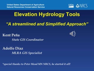
- 1. Elevation Hydrology Tools “A streamlined and Simplified Approach” Kent Peña State GIS Coordinator Adolfo Díaz MLRA GIS Specialist *special thanks to Peter Mead MN NRCS, he started it all!
- 2. The Nuts & Bolts • The tools are just a toolbox…no install • Leverage the use of clipping to an AOI to reduce data size • Streamline the creation of flow direction, accumulation and stream network derivatives • Watershed delineation and associated attributes, area, average slope, runoff curve number etc. • Creation of pool storage layers Overview of various unique python scripting solutions that were used
- 3. “So, what is a Runoff Curve Number?” The runoff curve number (also called a curve number or simply CN) is an empirical parameter used in hydrology for predicting direct runoff or infiltration from rainfall excess. It is widely used and is an efficient method for determining the approximate amount of direct runoff from a rainfall event in a particular area. Runoff Curve Numbers are calculated based on land cover and hydrologic soil group.