Download to read offline
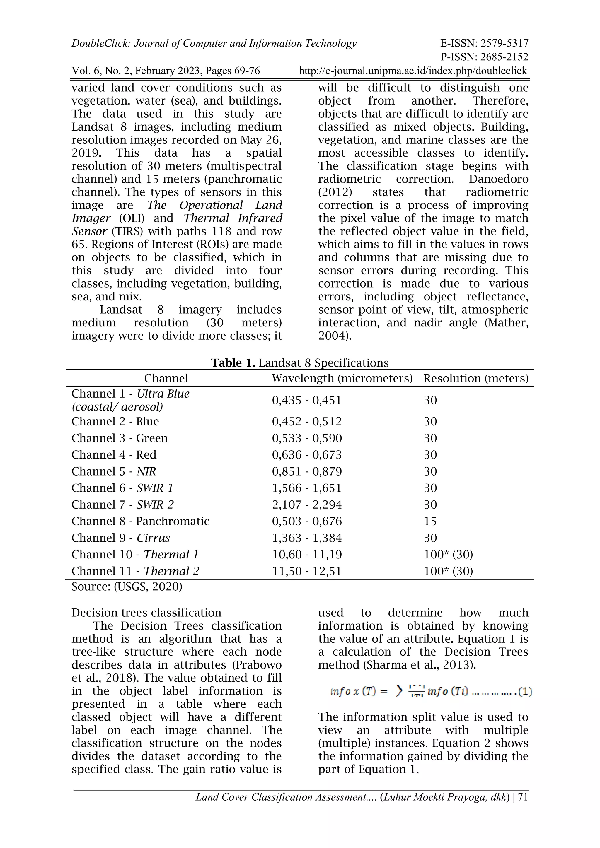
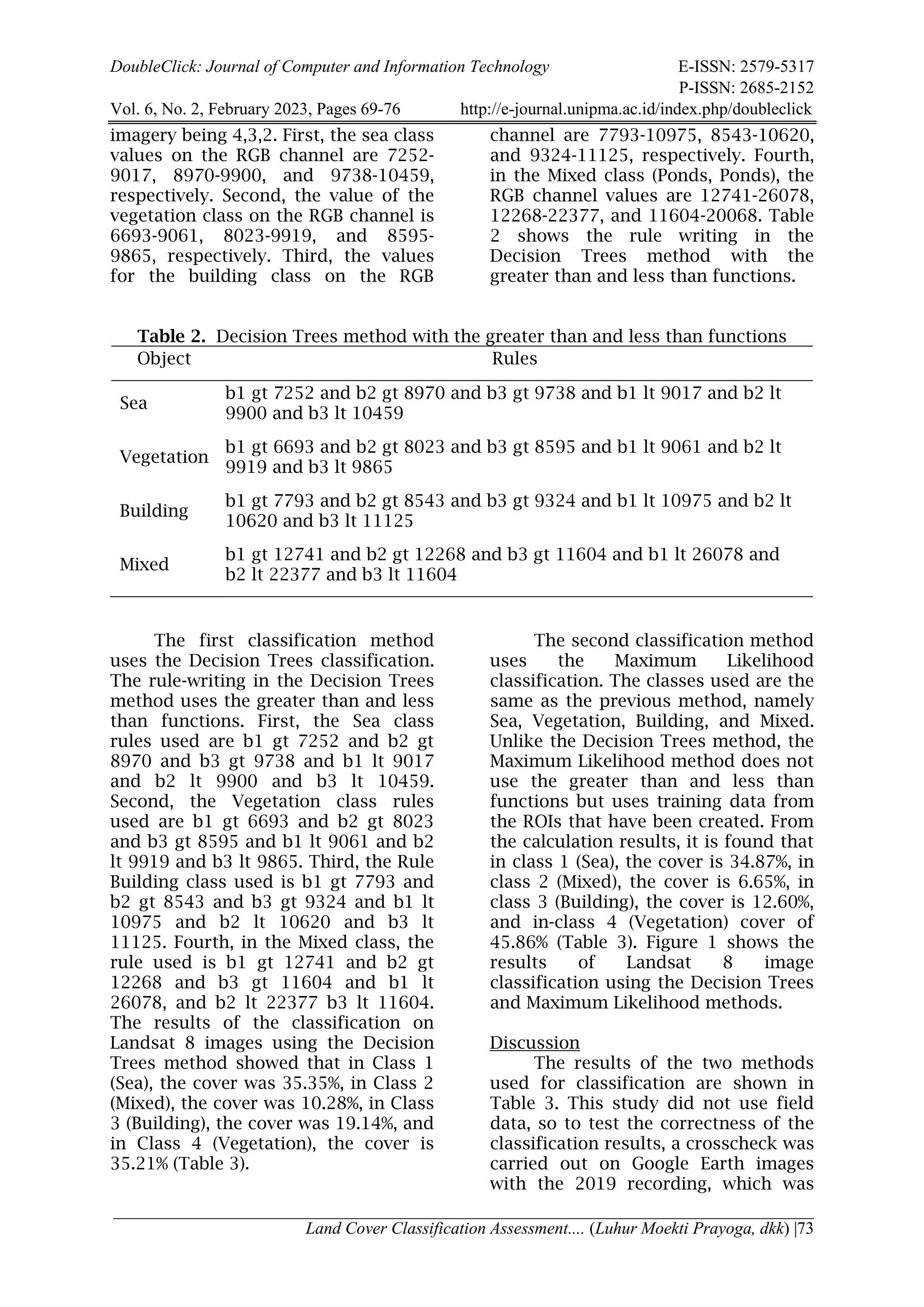
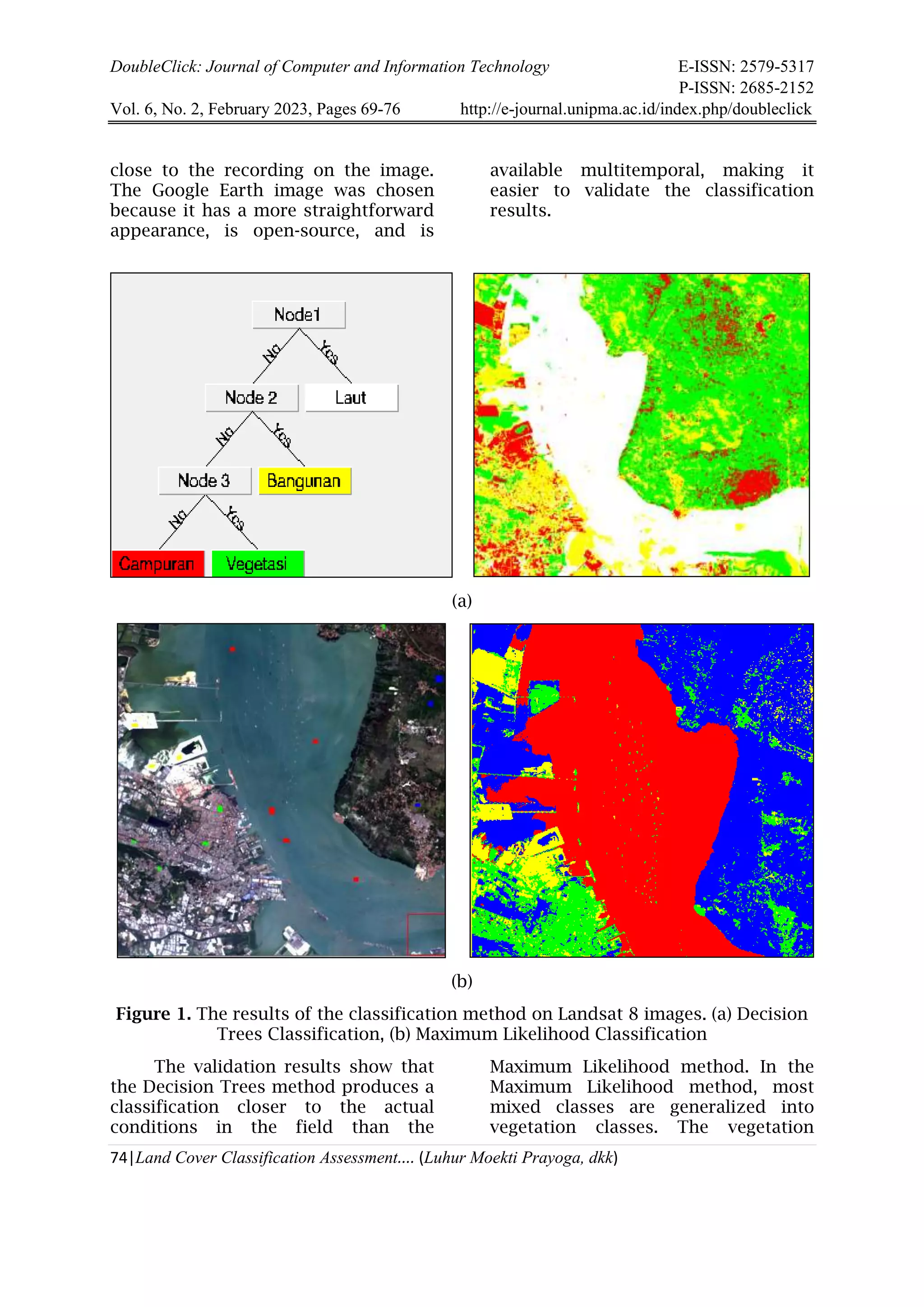
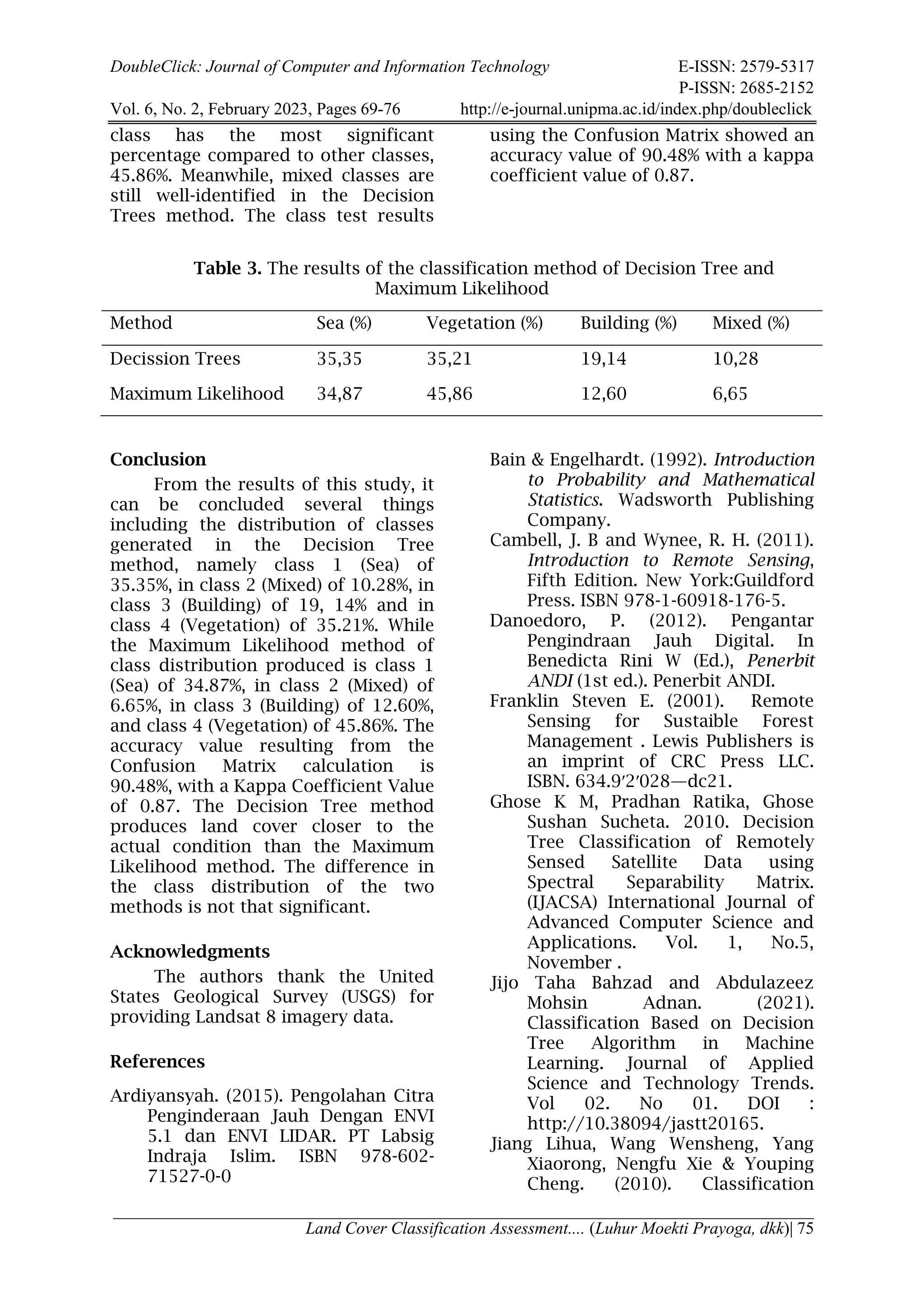

This document summarizes a study that compares land cover classification using decision trees and maximum likelihood classification algorithms on Landsat 8 satellite imagery of Surabaya and Bangkalan areas in Indonesia. Regions of interest were created for four land cover classes: vegetation, buildings, sea, and mixed. The decision trees method produced classification rules based on pixel values in red, green, and blue bands. Both methods achieved over 90% accuracy based on a confusion matrix. While results were similar, decision trees produced classifications closer to actual land cover conditions. The study was limited by using manual interpretation for validation; future work could incorporate larger validation datasets.