ISciences at the Hands-On Museum Local Tech Event
•Download as PPSX, PDF•
0 likes•362 views

A kid-friendly presentation explaining what ISciences does and giving examples of how our TerraViva mapping products can be used.

Recommended
Recommended
More Related Content
What's hot
What's hot (8)
Viewers also liked
Viewers also liked (9)
Similar to ISciences at the Hands-On Museum Local Tech Event
Similar to ISciences at the Hands-On Museum Local Tech Event (20)
More from ISCIENCES, L.L.C.
Recently uploaded
Recently uploaded (20)
ISciences at the Hands-On Museum Local Tech Event
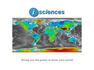
- 1. Giving you the power to know your world!
- 2. What does ISciences do? We study the Earth and its people. We help people understand the Earth. We help people understand how their actions change the Earth. Image Top: Political Boundaries (ISciences) Image Middle: Blue Marble (NASA) Image Bottom: Human Footprint (SEDAC)
- 3. How does ISciences do it? We find data about Earth and its people. We turn data into maps. We use maps to tell stories. Global temperatures on the rise. The story of Earth and its people is a story about change.
- 4. Making maps that tell stories.
- 5. What country will grow fastest in 2010? High population growth Low population growth Shrinking populations Projected population growth in Somalia is greatest (3.74%), and many other African nations are also growing at a fast rate. SourcePopulation Division of the Department of Economic and Social Affairs of the United Nations Secretariat, 2003. World Population Prospects: The 2002 Revision. Dataset on CD-ROM. New York: United Nations.
- 6. Where have people changed the environment the most? Large human influence cities roads Little/No human influence Map: Human Influence Index 2006 (SEDAC)
- 7. Which of these countries have the least Internet access? Most access Least access SourceInternational Telecommunications Union (ITU), 2003. World Telecommunication Development Report. Digital Access Index. Azerbaijan and Syria
- 8. Studying our living Earth through science and technology.
- 9. What is remote sensing? Sensors on satellites collect data (which is like taking pictures) of the earth. Then turn the data into images… Scientists receive the data. …and maps.
- 10. Helping people understand how their actions impact the future.
- 11. What can happen if we use too much water? The Aral Sea has shrunk dramatically as the rivers that feed it have been diverted and tapped for farms. Credit: University of Maryland Global Land Cover Facility and NASA Goddard Level 1 and Atmospheric Archive and Distribution System.
- 12. How have humans changed the oceans? This map shows human impact on marine ecosystems. Red means that humans have had a very high impact on these ocean areas. Map: Human Impact on Marine Ecosystems (NCEAS, 2008)
- 13. Can you see forests disappear? July 30, 2000 August 21, 2009 The state of Rondônia in western Brazil is one of the most deforested parts of the Amazon. The change in green tree cover is easy to see by comparing these 2000 and 2009 true-color images. Source: Images from the Moderate Resolution Imaging Spectroradiometer(MODIS) on NASA’s Terra satellite.
- 14. How much original wilderness is left in Michigan? Green areas are the only remaining wilderness. Map: Last of the Wild v2 (SEDAC)
- 15. Helping you understand the changing world.
- 16. How is the ozone layer changing? 1980 2008 In the 1980s, scientists realized the ozone layer of Earth’s atmosphere was thinning over the South Pole. Here, purple and dark blue areas show where ozone is thinnest. Source: NASA’s Total Ozone Mapping Spectrometer and the Royal Netherlands Meteorological Institute Ozone Monitoring Instrument.
- 17. Which country has the most people: India or China? China has the larger population. China’s population is 1,313,973,713. India’s population is 1,095,351,995. Highest population Lowest population Based on current growth rates, India’s population will become greater than China’s in 2029. Source CIA World Factbook Multiyear 2002-2006.
- 18. Which of these countries have the most Internet access? Most access Least access Sweden, Denmark, Iceland, Finland, Netherlands, Norway, United Kingdom, Switzerland, Austria, and Luxembourg SourceInternational Telecommunications Union (ITU), 2003. World Telecommunication Development Report. Digital Access Index.
- 19. Sustainability Science & Earth Information Products
- 20. Where is ISciences? ISciences is headquartered in Ann Arbor, Michigan and has offices in Burlington, Vermont and Washington, DC.