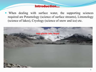
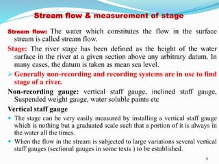
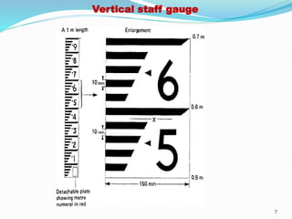
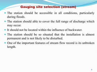
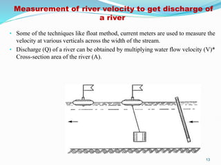
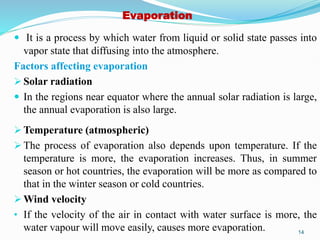
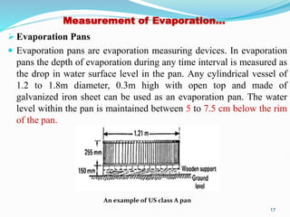
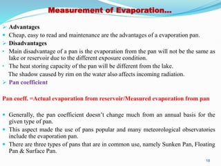
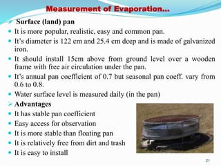
2. EGE 554 Engineering Hydrology and Hydrogeology
(Credit: 2 / 30 hours)
1. Stream Flow
Water stage, annual gages, crest stage gages, miscellaneous stage gages, selection
of station site. Discharge.
Reservoir evaporation, combination methods of estimating reservoir evaporation,
estimation of reservoir evaporation from pan evaporation and related
meteorological data, summary and appraisal of techniques for estimating reservoir
evaporation, increased water supplies through reduced evaporation.
2. Evapo-Transpiration
Factors affecting transpiration, measurement of transpiration. Water budget
determination of mean basin evapo-transpiration, field plot determination of
evapo-transpiration, lysimeter determination of evapotranspiration, estimating
potential evapo-transpiration from meteorological data, estimating actual evapo
transpiration from potential irrigation water requirements, controlling
evapotranspiration, equations for evapo-transpiration computations.
2
3. Introduction
The word hydrology is derived from the Greek words hydor, means
water and logos, which means science (or to study).
Thus in broad sense, hydrology is the science which is concerned
with all waters on Earth, its occurrence, distribution and circulation,
its physical and chemical properties, its effect on the environment
and on life of all forms.
From the view point of practical applications, Wisler and Brater
have defined hydrology as the science that deals with processes
governing the depletion and replenishment of water resources of
the land areas in the earth.
3
4. Introduction…
Hydrology is a highly interdisciplinary science.
It is a fact that engineering hydrology is generally familiar with
application point of view whereas scientific hydrology is familiar
with academic point of view.
Hydrology interacts with sciences like Hydrometeorology
(emphasizing the meteorological aspects), Hydrogeology
(emphasizing the geologic aspects), Geohydrology (emphasizing
the hydrologic aspects), Hydrobiology (emphasizing the biological
aspects), and so on.
4
5. Introduction…
When dealing with surface water, the supporting sciences
required are Potamology (science of surface streams), Limonology
(science of lakes), Cryology (science of snow and ice) etc.
5
Imja glacier lake, Nepal
6. Stream flow & measurement of stage
Stream flow: The water which constitutes the flow in the surface
stream is called stream flow.
Stage: The river stage has been defined as the height of the water
surface in the river at a given section above any arbitrary datum. In
many cases, the datum is taken as mean sea level.
Generally non-recording and recording systems are in use to find
stage of a river.
Non-recording gauge: vertical staff gauge, inclined staff gauge,
Suspended weight gauge, water soluble paints etc
Vertical staff gauge
The stage can be very easily measured by installing a vertical staff gauge
which is nothing but a graduated scale such that a portion of it is always in
the water all the times.
When the flow in the stream is subjected to large variations several vertical
staff gauges (sectional gauges in some texts ) to be established.
6
8. Gauging site selection (stream)
The station should be accessible in all conditions, particularly
during floods.
The station should able to cover the full range of discharge which
may occur.
It should not be located within the influence of backwater.
The station should be so situated that the installation is almost
permanent and is not likely to be disturbed.
One of the important features of stream flow record is its unbroken
length.
8
9. Inclined staff gauge
• Sometimes the gauge may be placed in an inclined position upon the
stream bank.
• It must be properly anchored in the slope of the natural bank of the river
channel.
• Proper care should be taken while installing the staff gauge to protect
them from damage by boats, debris etc.
Suspended weight gauge
• The river stage can also be measured normally by suspended weight gauge
in which a weight attached to a rope is lowered from a fixed reference
point on a bridge or other overhead structure till it touches the water
surface. By subtracting the length of the rope from the fixed reference
point, the stage is obtained.
• Beyond them, water soluble paints are also applied to know the stage
height.
9
10. Manual and automatic stage recorder
• Merits and demerits of manual stage recorder: Though the manual gauges
described above are simple and inexpensive, it is likely that the peak stage may
be missed when it occurs in between the observations. Recording gauges may be
installed to overcome these difficulties.
Recording gauge: Float type automatic stage recorder, bubble gauge
Float type automatic stage recorder
It normally consists of a float tied to one end of a cable running over a pulley. To
the other end of a cable, a counterweight is attached.
The float would be resting on the water surface and the counterweight always
keeps the cable in tension. Any change in water surface makes the float either to
rise or lower and this in turn makes the pulley rotate.
The movement of the pulley would activate a pen arm which rests on a clock-
driven drum, wrapped with a chart. The circumference of the drum represents
the time axis while the height of the drum represents stage. The clock and the
drum may be so designed that the chart runs for a specified time period like a
day or a week or a month etc.
10
12. Bubble Gauge (Reln betn prr and gas)
• In this gauge, compressed air or gas is made to bleed out at a very
small rate though an outlet placed at the bottom of the river.
• A pressure guage measures the gas pressure which in turn is equal
to the water column above the outlet.
• A small change in the water surface elevation is felt as a change in
pressure.
• The pressure gauge reads the new water depth which is transmitted
to a recorder.
Stage hydrograph
• A plot of stage against chronological time is known as stage
hydrograph. Stage data itself is of importance in flood warning and
flood protection works.
12
13. Measurement of river velocity to get discharge of
a river
• Some of the techniques like float method, current meters are used to measure the
velocity at various verticals across the width of the stream.
• Discharge (Q) of a river can be obtained by multiplying water flow velocity (V)*
Cross-section area of the river (A).
13
14. Evaporation
It is a process by which water from liquid or solid state passes into
vapor state that diffusing into the atmosphere.
Factors affecting evaporation
Solar radiation
In the regions near equator where the annual solar radiation is large,
the annual evaporation is also large.
Temperature (atmospheric)
The process of evaporation also depends upon temperature. If the
temperature is more, the evaporation increases. Thus, in summer
season or hot countries, the evaporation will be more as compared to
that in the winter season or cold countries.
Wind velocity
• If the velocity of the air in contact with water surface is more, the
water vapour will move easily, causes more evaporation. 14
15. Evaporation…
Quality of water
• The quality of water in the water body also affects the rate of
evaporation. The presence of any dissolved salts in water reduces
the rate of evaporation. For this reason, usually the evaporation
decreased by 1% for every 1% increase in the salinity of a water
body.
Atmospheric Pressure
• If the atmospheric pressure is more, there will be less evaporation.
Whereas, the decrease in atmospheric pressure would increase the
rate of evaporation.
Size of the water surface
• The amount of evaporation is directly proportional to the size of
water surface area. If the area is large, the evaporation will be more
and vice-versa.
15
16. Measurement of Evaporation
Evaporation is usually measured either by atmometers or by the
evaporation pans also known as the evaporimeters.
Atmometers
The atmometers are provided with some special surfaces which are
kept wet and from these surfaces the evaporation takes place.
There will be some source to continuously supply water and keep
the evaporating surface wet. The water loss observed at the source
is an indication of the evaporation.
The atmometers are not as common as the evaporation pans
because they do not have the large exposure. The rate of
evaporation recorded by atmometers is generally higher than the
evaporation recorded by evaporation pans.
16
17. Measurement of Evaporation…
Evaporation Pans
Evaporation pans are evaporation measuring devices. In evaporation
pans the depth of evaporation during any time interval is measured as
the drop in water surface level in the pan. Any cylindrical vessel of
1.2 to 1.8m diameter, 0.3m high with open top and made of
galvanized iron sheet can be used as an evaporation pan. The water
level within the pan is maintained between 5 to 7.5 cm below the rim
of the pan.
An example of US class A pan
17
18. Measurement of Evaporation…
Advantages
Cheap, easy to read and maintenance are the advantages of a evaporation pan.
Disadvantages
• Main disadvantage of a pan is the evaporation from the pan will not be the same as
lake or reservoir due to the different exposure condition.
• The heat storing capacity of the pan will be different from the lake.
The shadow caused by rim on the water also affects incoming radiation.
Pan coefficient
Pan coeff. =Actual evaporation from reservoir/Measured evaporation from pan
Generally, the pan coefficient doesn’t change much from an annual basis for the
given type of pan.
This aspect made the use of pans popular and many meteorological observatories
include the evaporation pan.
There are three types of pans that are in common use, namely Sunken Pan, Floating
Pan & Surface Pan.
18
19. Measurement of Evaporation…
Sunken Pan
This type of pan is used by U.S. Bureau of plant industry. It’s
diameter is 183 cm, depth is 61cm and rim above the ground is 10
cm. The Colorado sunken pan is square in shape and it’s pan
coefficient is 0.95.
Advantages: Certain boundary effects like direct solar heating on
sides and heat exchange from side walls are negligible.
Disadvantages:
It is difficult to maintain. Rusting may occur.
It is difficult to install
Difficult to detect leak
Difficult to estimate heat loss to soil from sides and bottom
19
20. Measurement of Evaporation…
Floating Pan
This pan is supported by drum floats and is kept floating in a lake.
The water levels in lake and pan are maintained as same while the
rim of the pan is 7.5cm above the water level.
Square pan is of side 90cm and 45cm deep
Floating pan is generally used by U.S. Geological survey
Generally it’s pan coefficient is recommended as 0.8.
Drawbacks
It is difficult to use because of accessibility
Splashing of water into and out of the pan is a problem
20
21. Measurement of Evaporation…
Surface (land) pan
It is more popular, realistic, easy and common pan.
It’s diameter is 122 cm and 25.4 cm deep and is made of galvanized
iron.
It should install 15cm above from ground level over a wooden
frame with free air circulation under the pan.
It’s annual pan coefficient of 0.7 but seasonal pan coeff. vary from
0.6 to 0.8.
Water surface level is measured daily (in the pan)
Advantages
It has stable pan coefficient
Easy access for observation
It is more stable than floating pan
It is relatively free from dirt and trash
It is easy to install
21
22. Empirical evaporation equations
There are many empirical equations that are suggested to estimate
evaporation from free water surface. Some of them are as follows:
Fitzgerald’s equation
Horton’s equation
Meyer’s equation
Rohwer’s equation
Lake Mead equation
(Also check water balance, energy balance, mass transfer and
combined methods to estimate evaporation)
(For details, W.B.)
22