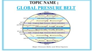
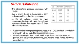
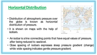
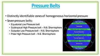
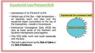
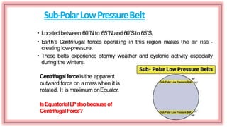
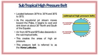
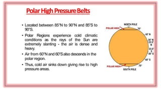
- The document discusses the global pressure belt system and how atmospheric pressure varies across the Earth. It describes seven major pressure belts: the equatorial low pressure belt, subtropical high pressure belts in both hemispheres, subpolar low pressure belts in both hemispheres, and polar high pressure belts in both hemispheres.
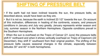
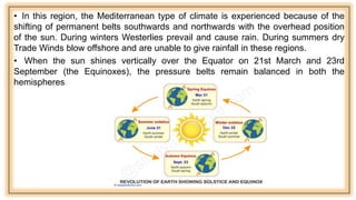
- The pressure belts are caused by differences in heating from the sun in the different latitudes, which causes air to rise in some areas and sink in others, creating horizontal differences in atmospheric pressure. The pressure belts also shift north and south slightly with the seasons as the overhead position of the sun changes.