Godcha forward
•
1 like•250 views

This document proposes developing an interactive street directory platform that integrates existing city council mapping data with geo-tagged aerial images, street views, and property data. The platform would allow users to search for and view information about properties and businesses, including photos, locations, details and ratings. It would provide value to city councils by helping them better manage assets and communicate with residents. The project aims to partner with 151 Malaysian city councils to offer the platform for a minimal annual fee while also creating new opportunities for local businesses and public participation.

Recommended
More Related Content
What's hot
What's hot (20)
Viewers also liked
Similar to Godcha forward
Similar to Godcha forward (20)
More from Ismail Ibrahim
More from Ismail Ibrahim (10)
Godcha forward
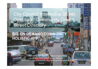
- 1. City Council Interactive Street Directory / Community Driven Street Directory GIS ON DEMAND COMMUNITY HOLISTIC APP. 79A, Jalan Seri Impian 1, Taman Impian Emas 81300, Johor Bahru, Johor, Malaysia 0197266411 Fax 075540339 http://www.godchageosense.com/
- 2. Project Description The project is to develop a beta street directory platform that integrate existing City Council mapping data with highly visualize geo contents such as aerial images and a geo coded property facet view. Interactive City Council Street Directory Street Map Property Map Property/Business Data Property Directory Property info Property photo The project involves link with map location • customizing existing mapping platform into city council interactive street directory, Business • design and integrate street view GPS log camera system Info for property image collection and geo coding. • Design and develop property listing and search engine Lat 1.48356° Property & Long 103.758° Service Rating High resolution aerial photo for better map visualization
- 3. Project Description (eco system) Business owner able to extend their Interactive City Council business reach via Street Directory (high visualization) city council interactive media Property Directory Property data City Council Property Owner Property Database Access (ID / Password) City Council able to Business access up to date data property, business City Council and asset status Business Database data. Open Public Search & View (Public able to view Property & public rating, status Service Rating events, reporting by geo tagging etc) Property directory can be extended for other city council assets and facility services such as traffic reports, assets such as traffic light or street light faulty, public transport, event announcement etc. Indexing City Status on An Interactive Platform
- 4. Value Proposition 151 Local Councils in Malaysia, where reside City Council survives on 80% of business residences 80% of business residences taxes. 70% of total population 70% of total population 90% higher income group 90% higher income group 90% of happening events 90% of happening events >80% ta is Gov Da ically ph Local Council needs to Geogra Better mange their territory Based Thus. City council Up to date asset status (respond time) Provide effective communication mediums needs location Provide environment for business to grow information platform Maintain & upgrade city life (GIS) Unfortunately >80% city council ran on deficit (poor) <30% can effort to have proper GIS platform 99% of city council website are not interactive and not participatory map based Proposal to provides free interactive street directory platform and partner with 151 city councils, charge minimum annual maintenance fees to Malaysia 500,000 business premises (owner). New income to city councils, new opportunity to existing businesses and providing public access to interactive city information. [With potential revenue for mobile access and premium data]
- 5. Content of The Project High visualization with ease navigation ü Property & Assets for public and business to ü search search, update property and city data within ü rating street mapping platform. Applications ü Complains ü Status The platform entice rich community contribution data ü Events on top of existing geo contents Concept – Utilizing images Public/ for property profiling, Property public tagging & owner street directory Facet premise update Photo Image Updating City Wide Aerial Image services Collaboration platform Map Data Geo Sense Sdn. Bhd. www.geosense.com.my
- 6. Technology Platform / Architecture and Plan Utilizing Cloud Computing Future multiple access Customizing eMap / GODCHA existing and Proven interactive street directory to cater for city council needs
- 7. Project Plan - Timeline / Milestone / Expenditure / Deliverables What Industry gets New IP Contents System Funding Requirement (RM) 46,000 28,000 24,000
- 8. Street Image Capturing System Camera sys 4 units Location & 4 unit Of the images CMOS video camera Lat 1.48356° Long 103.758° GPS CPU