Geo sense drone mapping solution
•Download as PPTX, PDF•
1 like•620 views

Geo Sense, more than 10 years in large scale drone mapping services. We provide, capturing, processing, analysis and hosting. Including GIS integration. Geo Sense is also producing small vertical take off and landing fixed wing (VTOL) mapping drone, G-Wing VTOL than minimise risk of crash or bad landing during take off and landing, which lower cost of drone maintenance. contact is for more detail info@geosense.com.my

Recommended
More Related Content
Similar to Geo sense drone mapping solution
Similar to Geo sense drone mapping solution (20)
More from Ismail Ibrahim
Recently uploaded
Recently uploaded (20)
Geo sense drone mapping solution
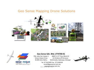
- 1. 79A, Jalan Seri Impian 1 Taman Impian Emas 81300 Johor Bahru 4800-3-2 3rd Floor Block A1 Jln Perdana off Persiaran Multimedia, Cyberjaya, Selangor Geo Sense Sdn. Bhd. (774700-D) Tel: 07 5623945 Fax: 07 5540339 ismaili@geosense.com.my www.geosense.com.myGeo Sense Sdn. Bhd. Geo Sense Mapping Drone Solutions
- 2. 10/2/2017 Geo Sense Sdn. Bhd. Geo Sense Drone Mapping Solutions Platform Coverage Per flight AGL 320m ≈ Sensor/Load Options Image processing Software Hosting Gwing VTOL FW Gwing FW Skywalker VTOL Skywalker FW Mugan VTOL FW 200ha 300ha 250ha 400ha 500ha Sony XW – RGB MAPIR RGB & NDVI All GPS- RTK optional Garmin GPS – RGB FLIR Duo Thermal
- 3. 10/2/2017 Geo Sense Sdn. Bhd. Geo Sense Skywalker Mapping Drone Mapping Productivity or Coverage Average Res. per pixel ≈3cm ≈5cm ≈8cm ≈10cm AGL 120m ≈100ha ≈150ha 200m ≈140ha ≈200ha 250m ≈180ha ≈250ha 300m ≈200ha ≈350ha Skywalker VTOL FW Vertical Take off and landing Skywalker FW Hand launch forward wing
- 4. 10/2/2017 Geo Sense Sdn. Bhd. Geo Sense Skywalker VTOL FW Mapping Drone Length 1270mm Wingspan 1830mm Datalink Range 5km MTOW 5kg Max Payload Weight 500g Aircraft General Spec. Performance VTOL FW Performance FW Crusing Speed 60km/h Wind Resistance 30km/h Travel Length 30km Max Endurance 40 min. Crusing Speed 60km/h Wind Resistance 30km/h Travel Length 60km Max Endurance 60min. Payload Options RGB Camera Sony , Garmin, Gopro NDVI Camera MAPIR Thermal FLIR Duo
- 5. G-Wing UAV : Interchangeable FW-VTOL 10/2/2017 Geo Sense Sdn. Bhd. G-Wing FW VTOL Vertical Take off and landing G-Wing FW Hand launch forward wing Mapping Productivity or Coverage Average Res. per pixel ≈3cm ≈5cm ≈8cm ≈10cm AGL 120m ≈100ha ≈120ha 200m ≈140ha ≈200ha 250m ≈180ha ≈240ha 300m ≈200ha ≈300ha
- 6. 10/2/2017 Geo Sense Sdn. Bhd. System Specification – G-Wing VTOL & FW
- 7. 10/2/2017 Geo Sense Sdn. Bhd. Mugin 2750mm H-Tail VTOL UAV Platform – for endurance >60min. Length 1900mm Wingspan 2750mm Datalink Range 10km MTOW 10kg Max Payload Weight 2500g Aircraft General Spec. Performance FW Crusing Speed 60km/h Wind Resistance 35km/h Travel Length 80km Max Endurance 90min. Mapping coverage 500ha to 700ha per mission
- 8. GEO SENSE DRONE FOR MAPPING & IMAGING - 10 YEARS IN DRONE MAPPING BUSINESS Geo Sense Sdn. Bhd. 8
- 9. Geo Sense Sdn. Bhd. Brief Background • Establish May 2006, MOF & Bumi Cert. • ICT, web GIS, drone mapping & remote sensing. Design and develop Drone for Imaging and Mapping • MSC Status, MITI Teras Teraju Listed Company • 100% Bumi Company • Johor Bahru & Cyberjaya Offices • Tech. Collaboration with Aerolab-UTM and Inst. Sustainable Agri of Cardoba Spain, UNITEN, Aerovel (Flexrotor) • Since 2007 - R&D drone development • Recipient Anugerah Perdana Menteri APICTA ICT eGov. Catergory in 2007 • Vision - leading tech company in unmanned aerial system
- 10. Organization Structure Image processing, application dev, & GIS data centreDroneLab - UAV Operation, maintenance and R&D, Geo Sense Sdn. Bhd.
- 11. Flight Planning UAV Installation Transferring Plan Launching Monitoring Recovering UAV Aerial Mapping – Process Flow Raw Images Mosaic / Stitching Tiling Overlaying Registration UAV Image Acquisition Image Processing Geo Sense Sdn. Bhd.
- 12. Geo Sense Sdn. Bhd. 12 Sample Ground Control & Flight Planning (G-Station)
- 13. Imej Satellite – resolusi Rendah, liputan awan & out dated UAV di gunakan bagi cerapan Kawasan keperluan Kejelasan tinggi membolehkan pemerhatian yang lebih terperinci Visualization – Sistem sokongan pembuat keputusanImej UAV di tampal (overlay) atas imej Satellite atau Maklumat sedia-ada Premium Geo. Data - Excecutive Support System Geo Sense Sdn. Bhd.
- 14. Unmanned Aerial Mapping Services Geo Sense Sdn. Bhd.
- 15. Geo Sense Sdn. Bhd. 15 Selected Projects Large scale drone mapping project 150km2 – 500km2 per project Geo Sense, specializing in large scale drone mapping City Council 250km2 Cadastral Mapping 500km2 Development Monitoring 150km2 Forestry & Water catchment Mapping 300km2
- 16. Visualization - Decision Support System Geo Sense Sdn. Bhd.