Download as PDF, PPTX


![GDAL | WKT for Spatial data
U.S.A
States
Cities
Canada
Roads
G_sys_Metadata
MongoDB Cluster
NYC
Chicago
……
Database
Collection
WKT
Feature
Layer
Datasource
|c_name | coord_d | src | type | Extent|
+----------------------+-------------------+
| Cities | 2 | 4326 | Point | [p1,p2]
| States | 2 | 4326 | Polygon | [p1,p2]
No spatial Index](https://image.slidesharecdn.com/givingmongodbthewaytoplaywiththegiscommunity-140805154658-phpapp02/75/Giving-MongoDB-a-Way-to-Play-with-the-GIS-Community-16-2048.jpg)
![GDAL | GeoJSON for spatial data
FID Geometry Name States Time Zone
10001 POINT(40.77, 73.98) NYC New York UTC-05:00
10002 POINT(41.90, 87.65) Chicago Illinois UTC-06:00
{
type: "Feature",
properties:
{
FID:10002
Name: Chicago,
States: Illinois,
Time Zone: UTC-06:00,
},
geometry:
{
type: "Point",
coordinates: [ 41.90 87.63]
}
}
GeoJSON
Geospatial Metadata collection](https://image.slidesharecdn.com/givingmongodbthewaytoplaywiththegiscommunity-140805154658-phpapp02/75/Giving-MongoDB-a-Way-to-Play-with-the-GIS-Community-17-2048.jpg)
![U.S.A
States
Cities
Canada
Roads
G_sys_Metadata
MongoDB Cluster
NYC
Chicago
……
Database
Collection
GeoJSON
Feature
Layer
Datasource
|c_name | coord_d | src | type | Extent|
+----------------------+-------------------+
| Cities | 2 | 4326 | Point | [p1,p2]
| States | 2 | 4326 | Polygon | [p1,p2]
GDAL | GeoJSON for spatial data](https://image.slidesharecdn.com/givingmongodbthewaytoplaywiththegiscommunity-140805154658-phpapp02/75/Giving-MongoDB-a-Way-to-Play-with-the-GIS-Community-18-2048.jpg)
![World
Canada
U.S.A
Oceans
Rivers
Cities
MongoDB Cluster
States
Rivers
……
Database
Collection
FeatureCollection
Layer
Dataset
Datasource
GDAL | FeatureCollection
{
"type": "FeatureCollection",
" crs " :{…}
" bbox " :[….]
"features":
[
{
"type": "Feature",
"geometry":
{
"type": "Point",
"coordinates": […]
},
"properties":
{"prop0": "value0"}
},
…
]
}](https://image.slidesharecdn.com/givingmongodbthewaytoplaywiththegiscommunity-140805154658-phpapp02/75/Giving-MongoDB-a-Way-to-Play-with-the-GIS-Community-19-2048.jpg)
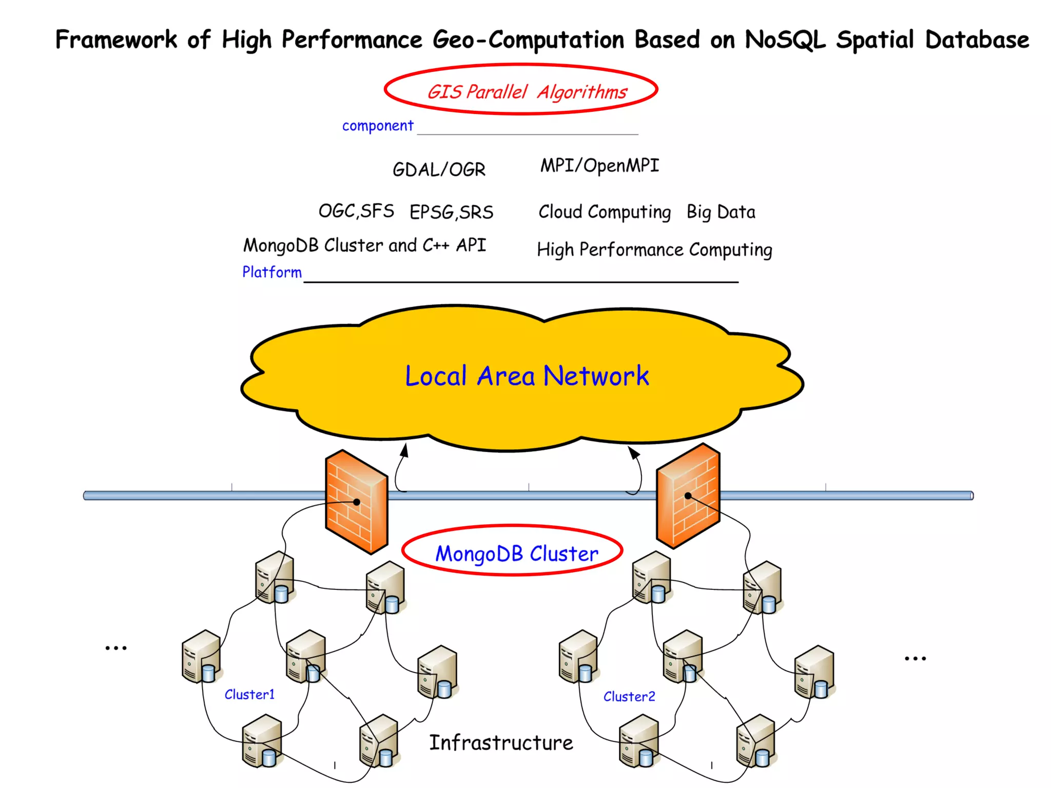


The document discusses the integration of MongoDB with the Geographic Information Systems (GIS) community, emphasizing its potential as a spatial database for handling geospatial data. It outlines the challenges of using existing systems like PostGIS and presents a GDAL driver designed for MongoDB to enhance its GIS capabilities. Additionally, it highlights the evolution of spatial database technologies and advocates for a collaborative approach to further develop MongoDB as a viable option in the GIS landscape.
Introduction to MongoDB's capabilities in GIS alongside existing technologies, aiming for big data applications.
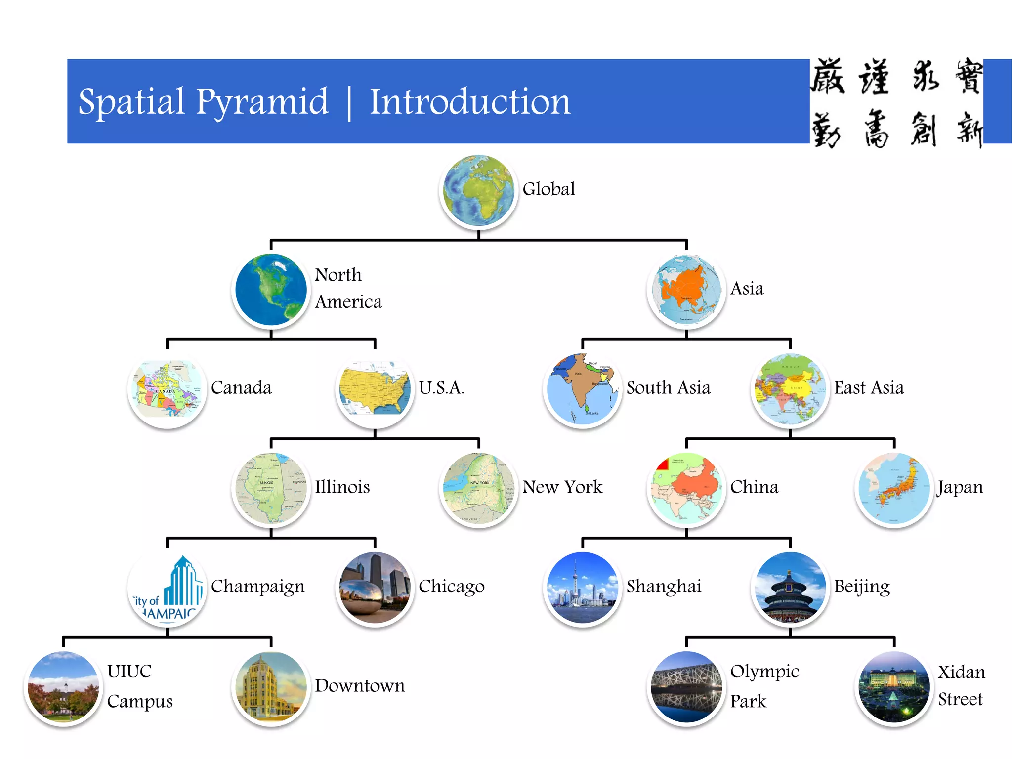
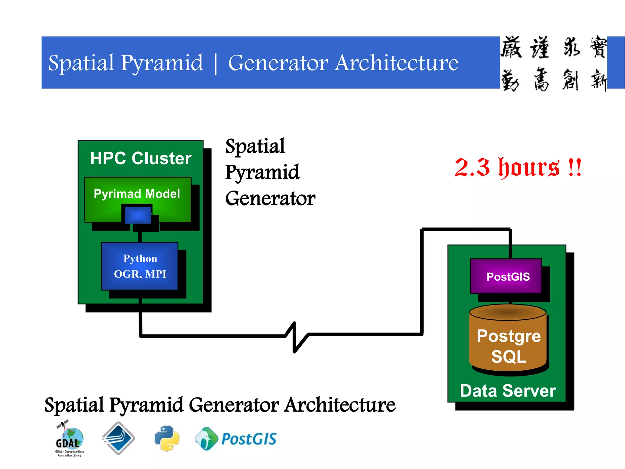
Introduction of the Spatial Pyramid concept, showcasing a global and multi-scalar spatial view.
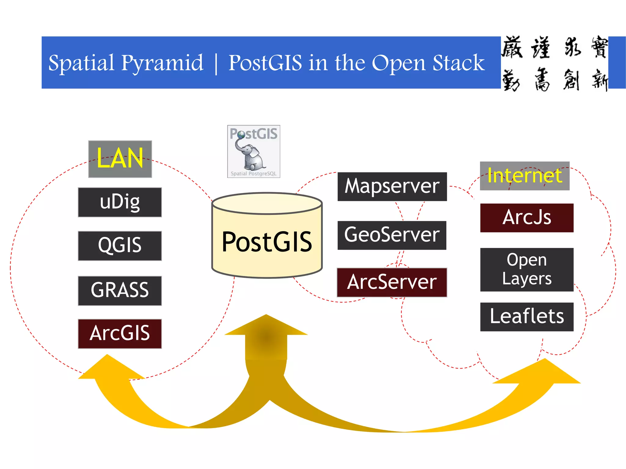
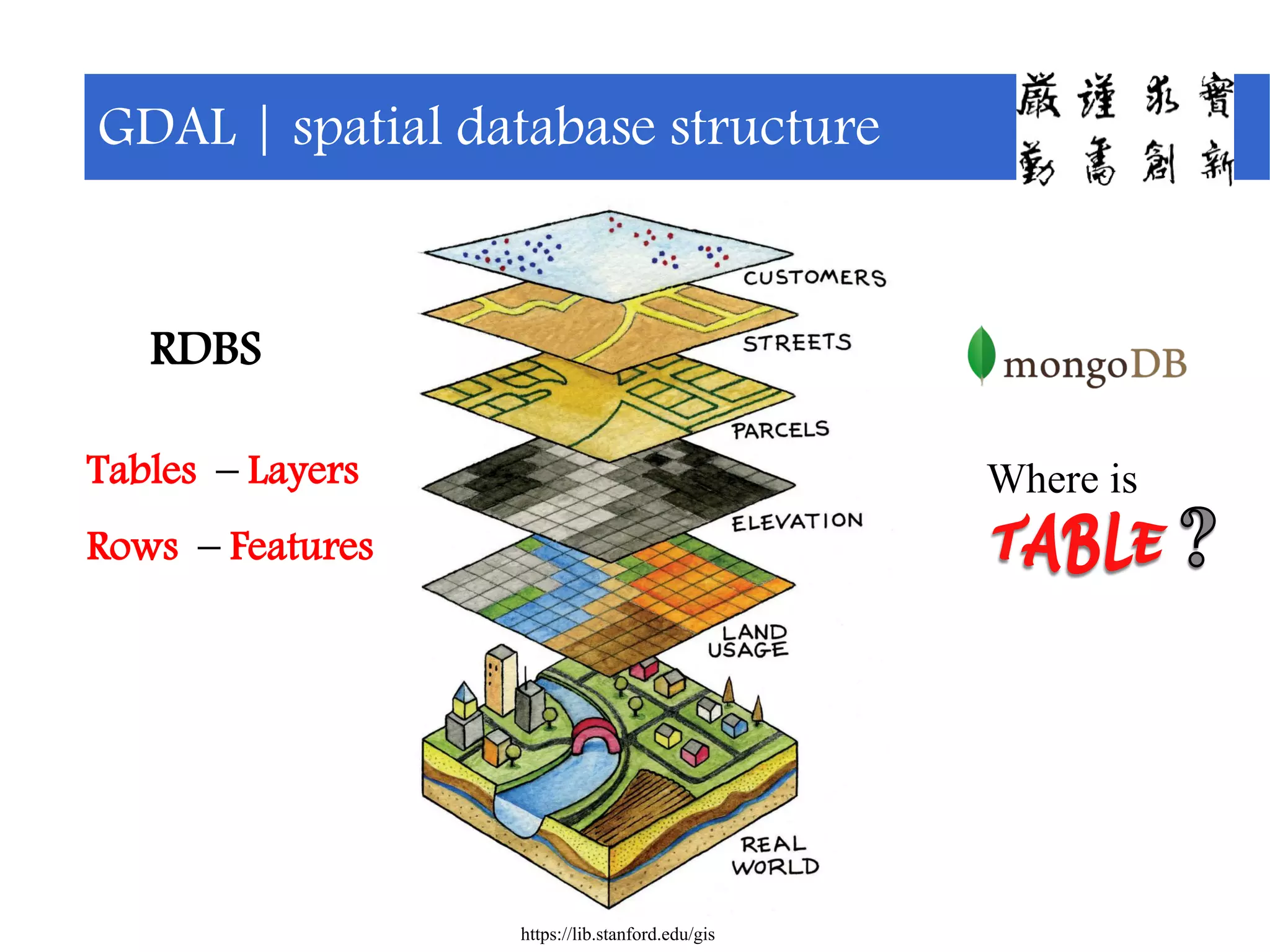
Overview of various GIS tools in the Open Stack and challenges of PostGIS compared to MongoDB.
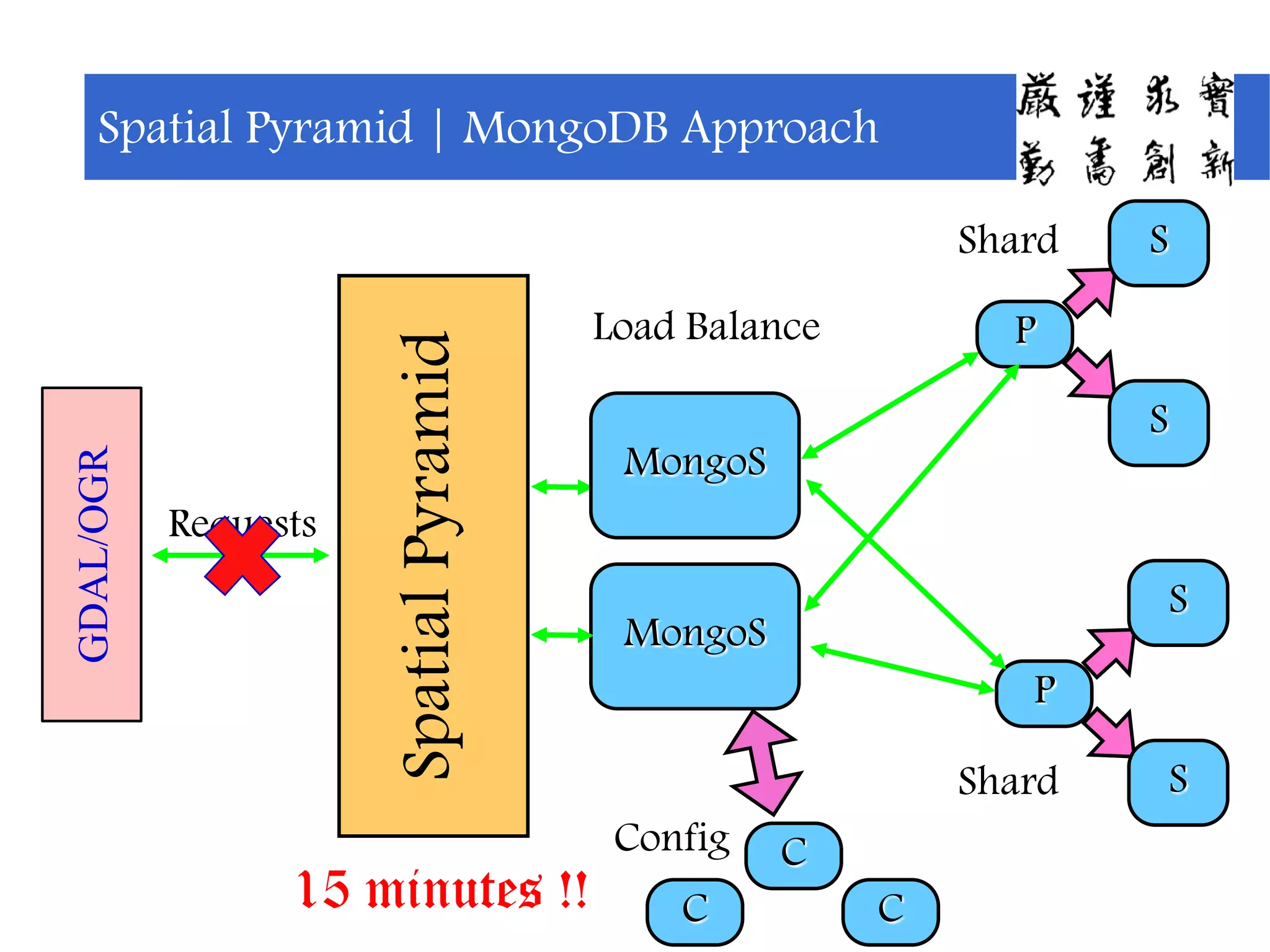
An innovative load balancing mechanism in MongoDB using the Spatial Pyramid framework.
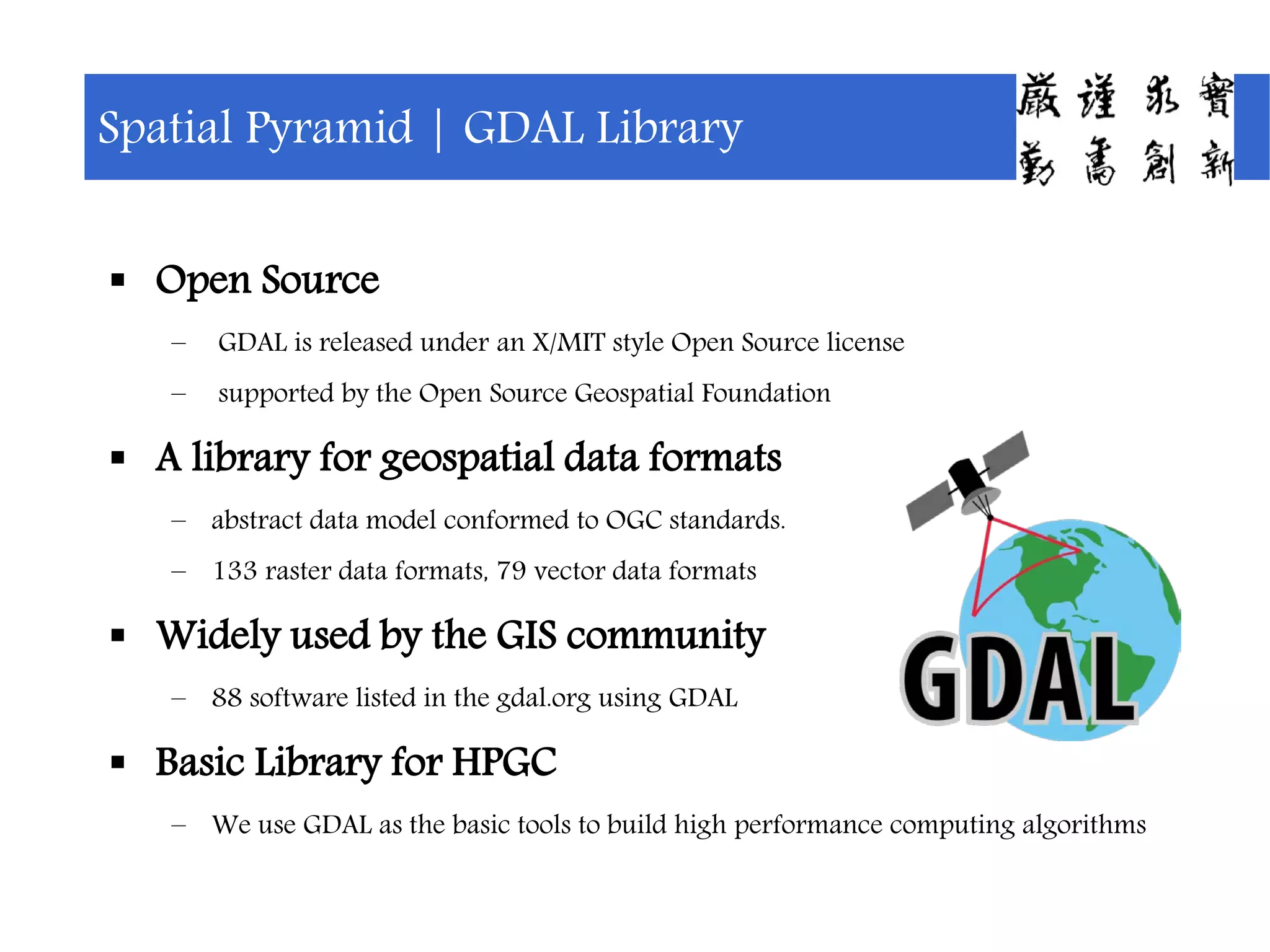
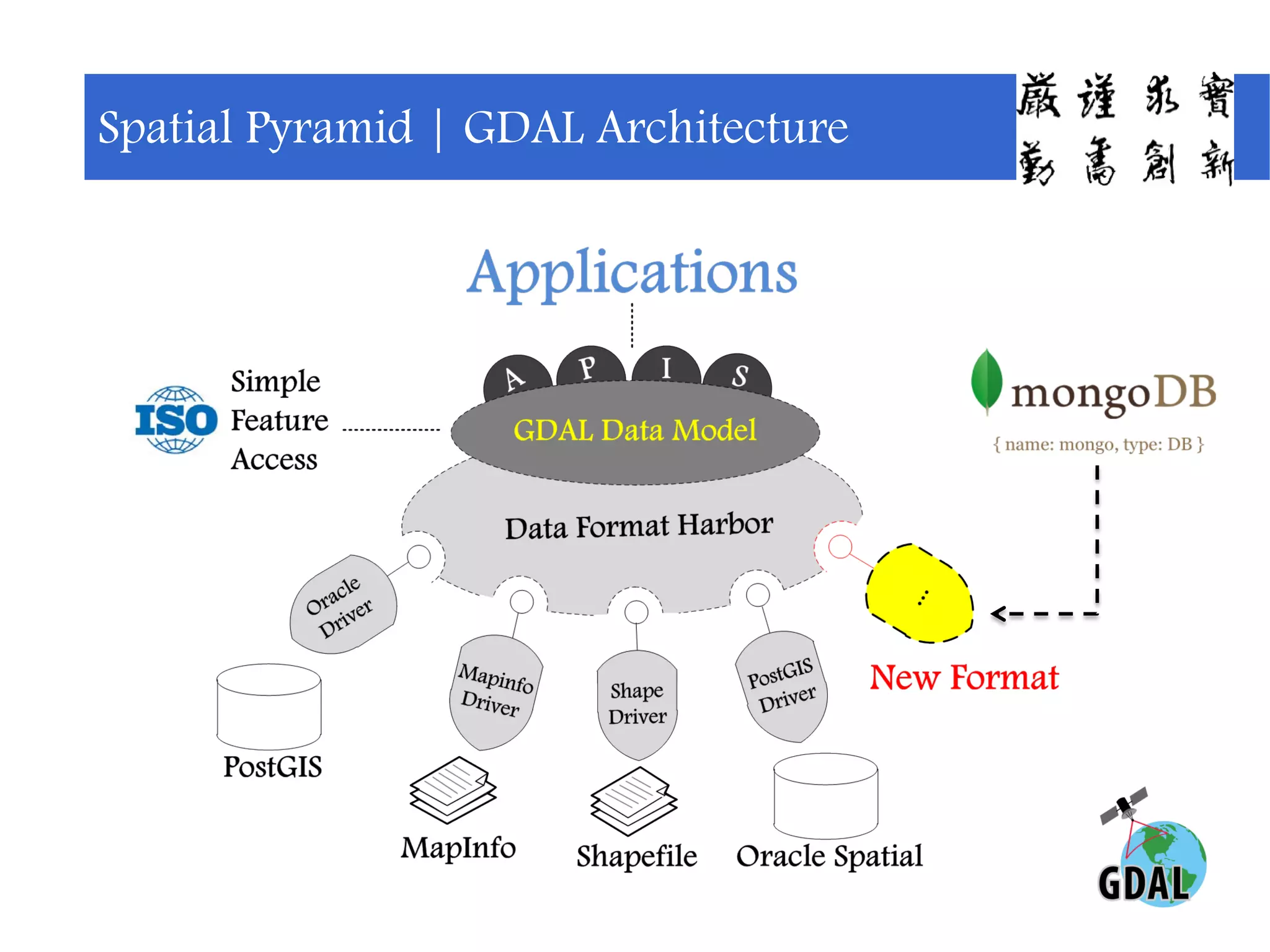
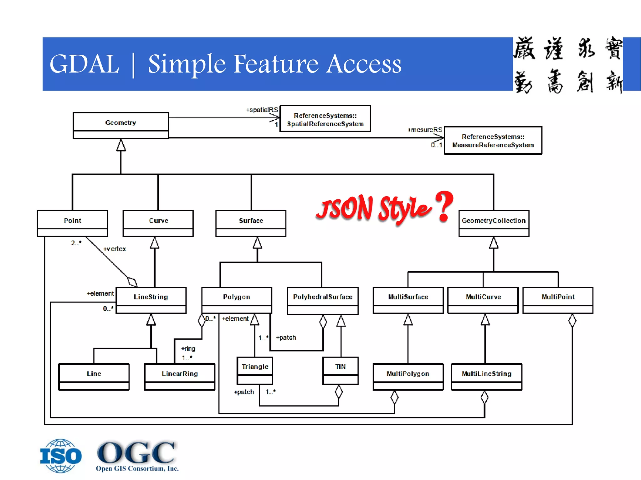
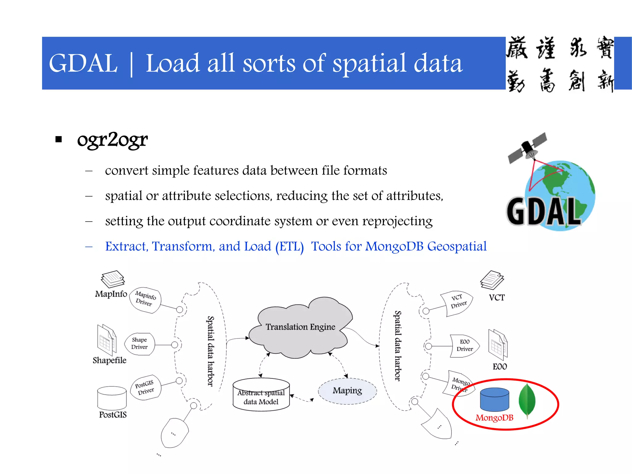
Features of the GDAL library for geospatial data, emphasizing its support for multiple formats and tools.
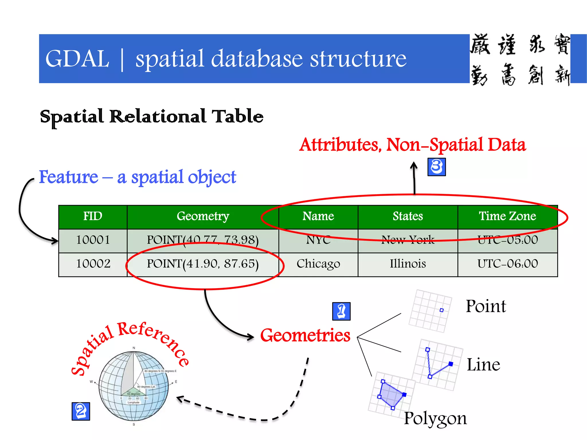
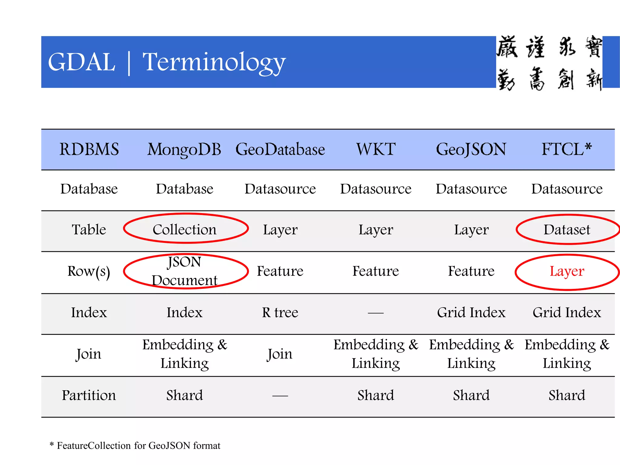
Detailed explanation of the spatial database attributes, structure, and support for different formats.
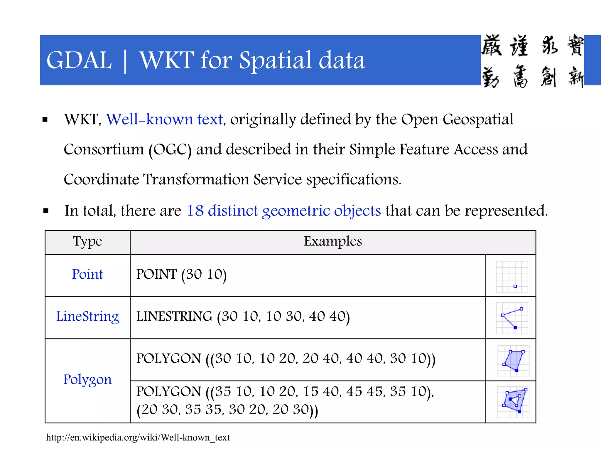
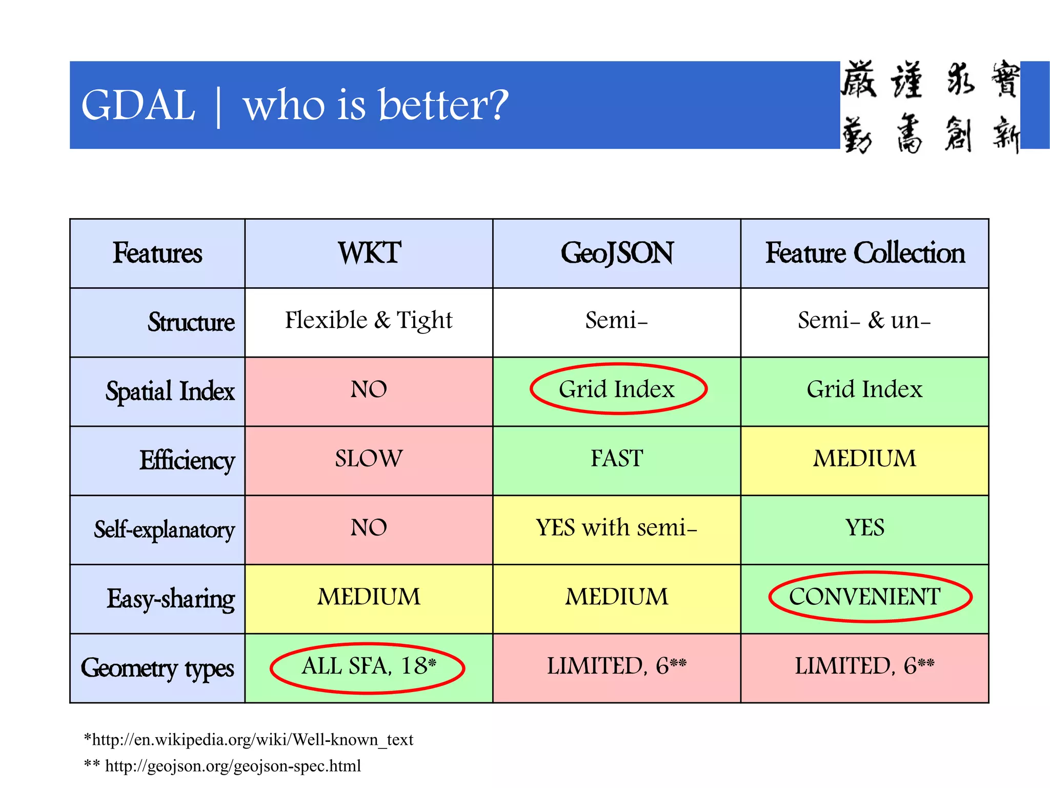
Definitions and examples of WKT and GeoJSON formats for representing spatial data and their structures.
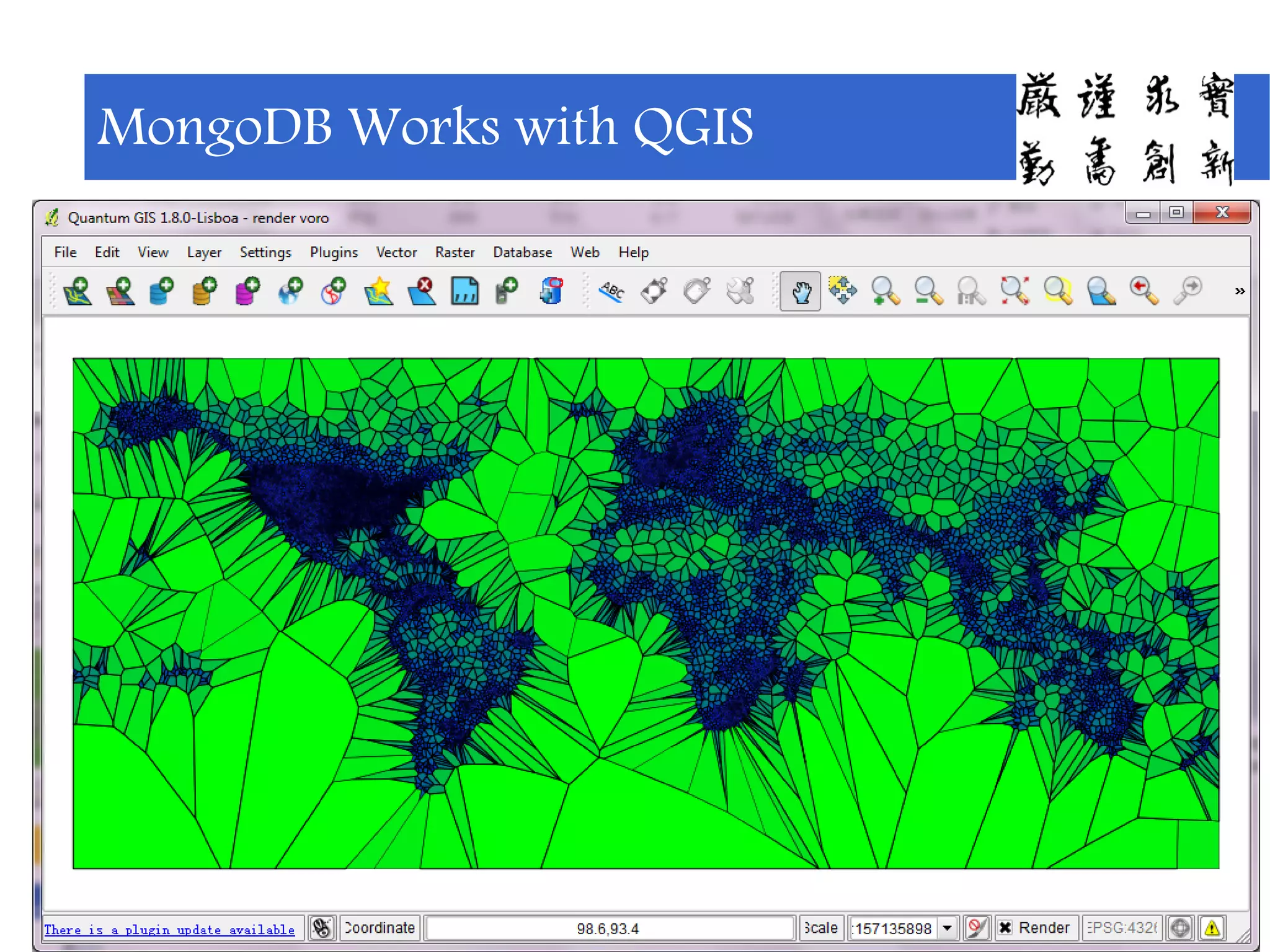
Opportunities for using MongoDB with various GIS software platforms like QGIS.
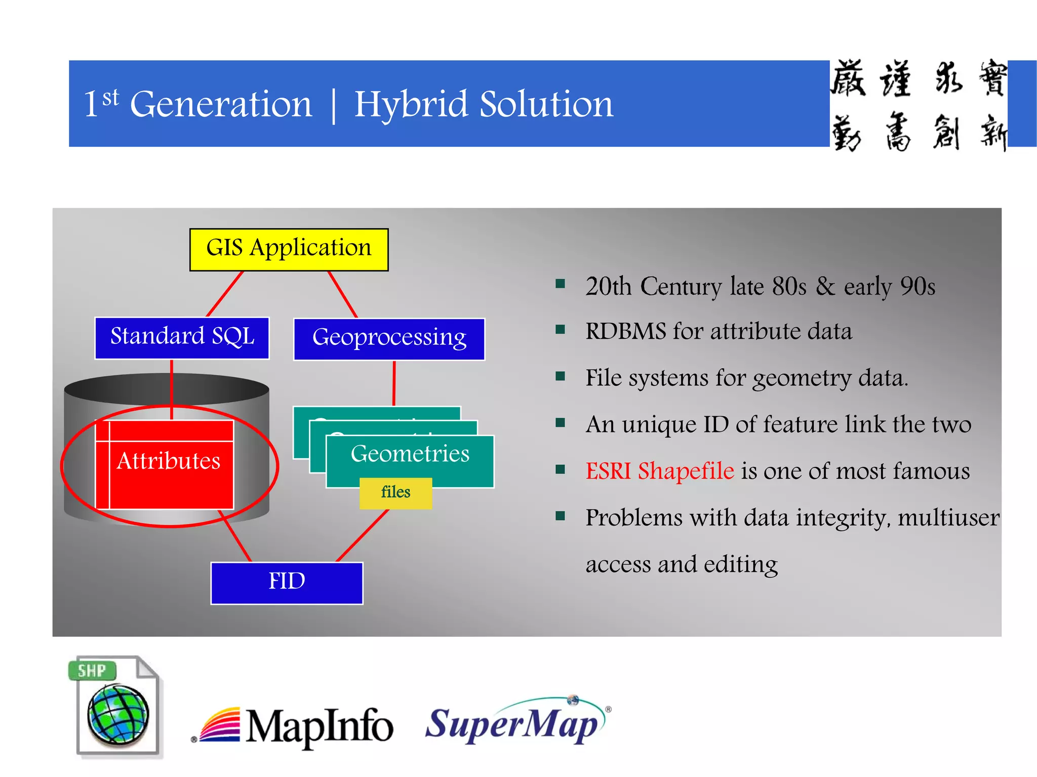
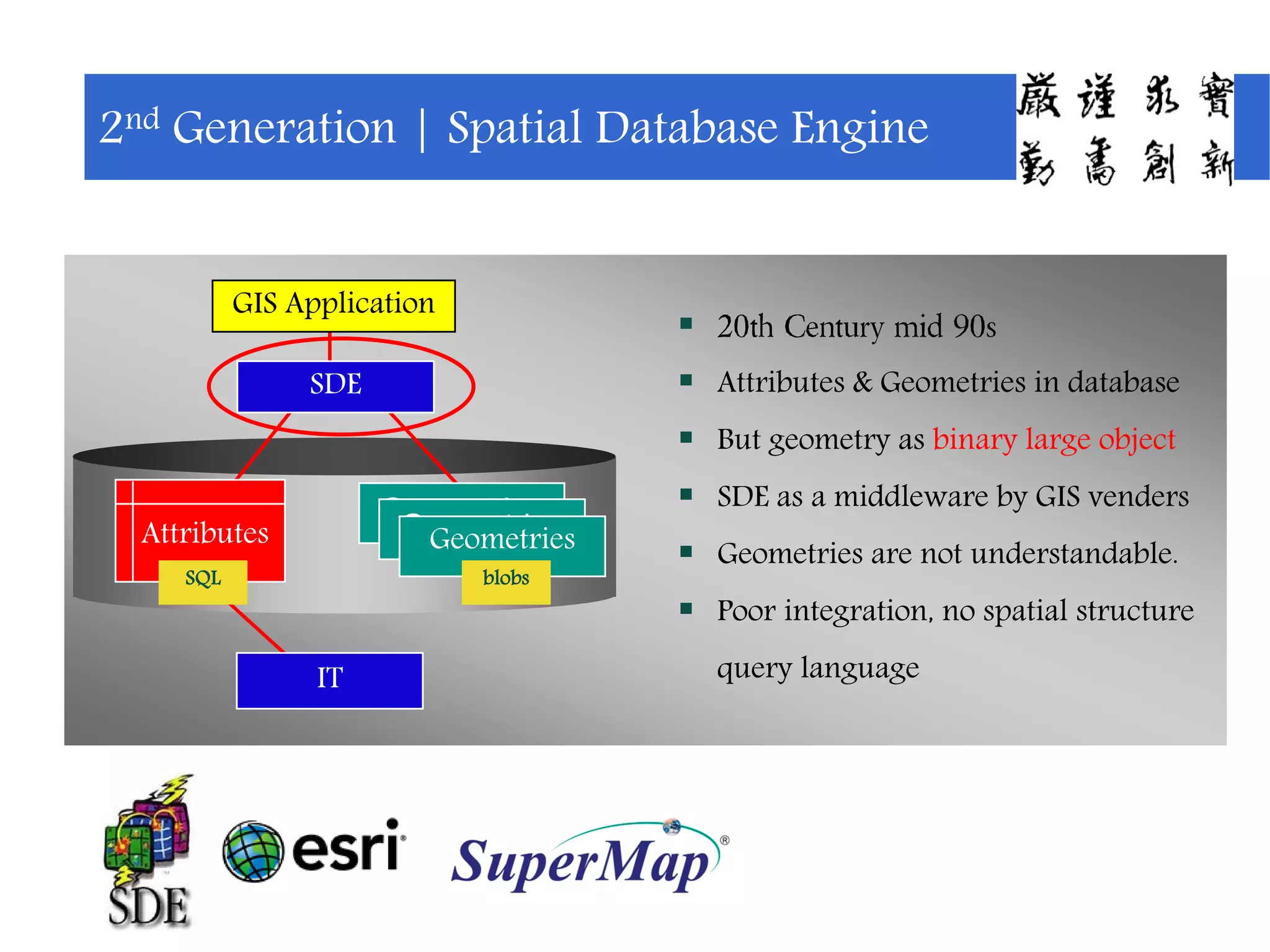
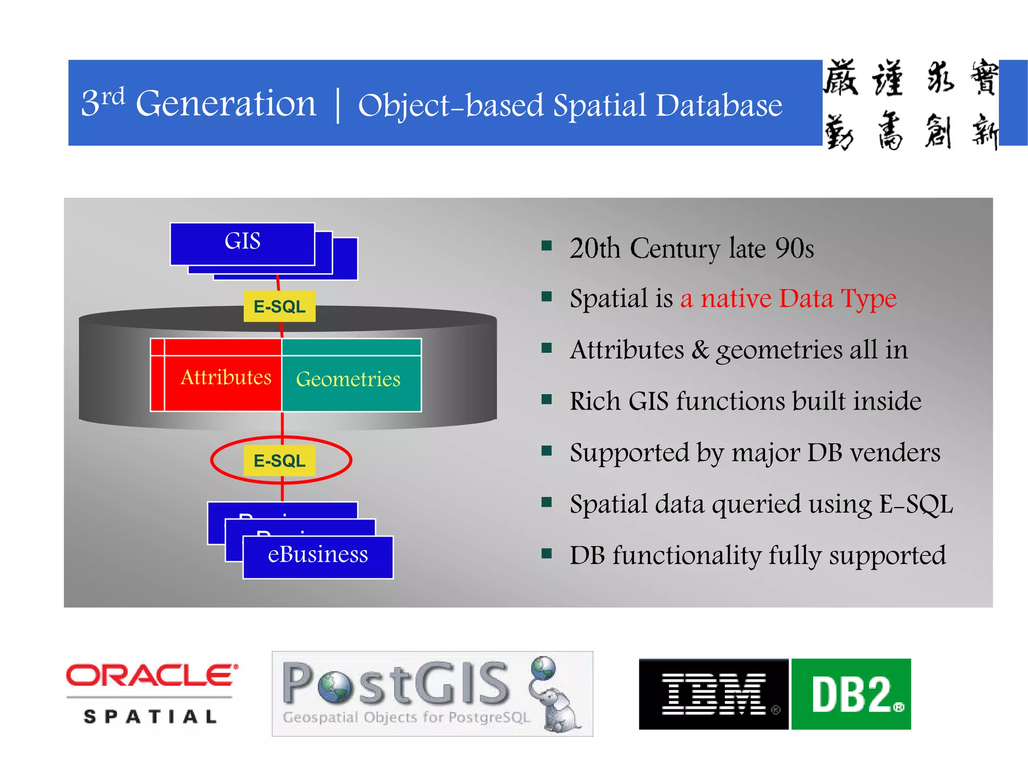
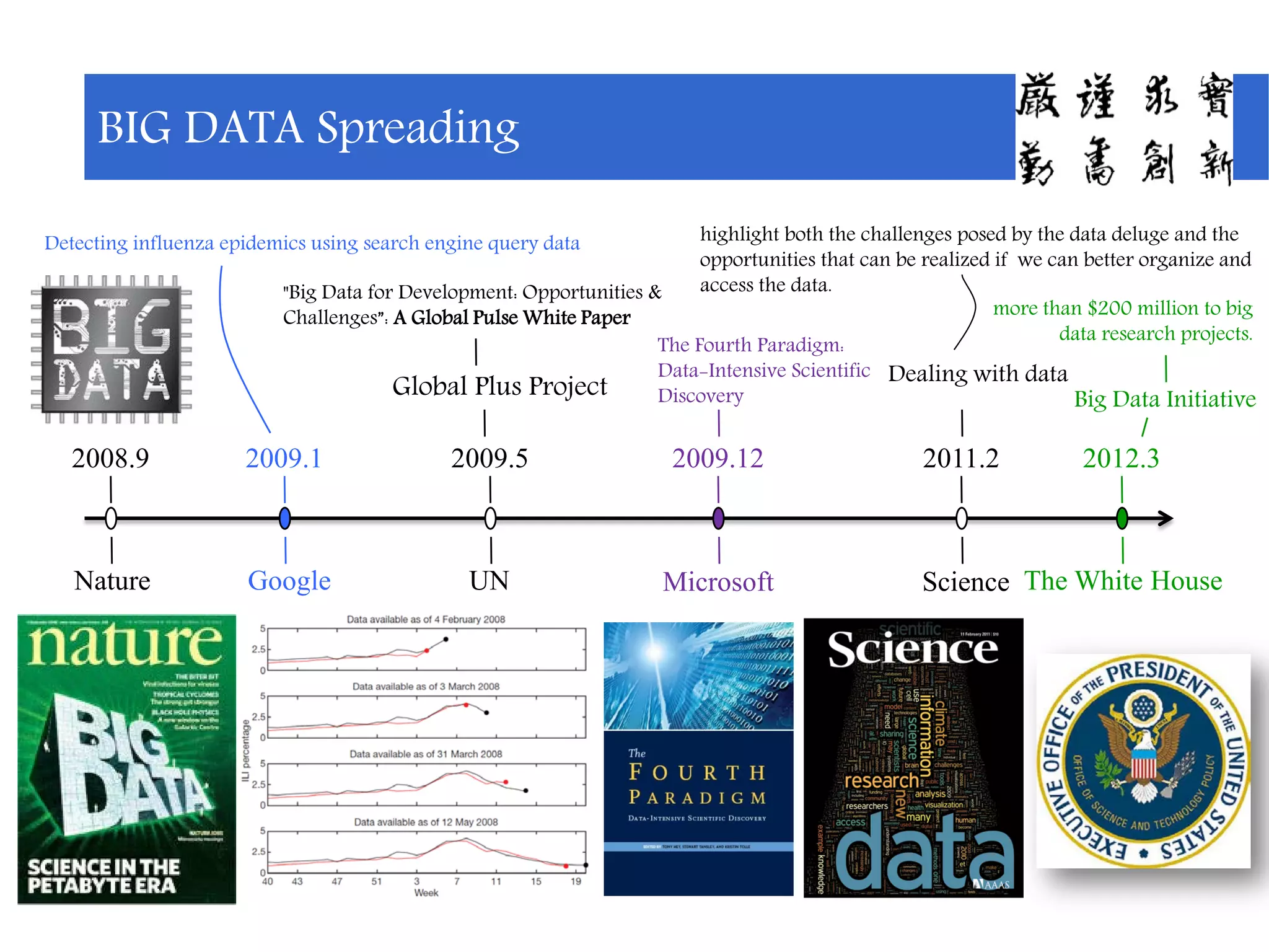
Historical context and evolution of spatial databases leading up to modern technologies.
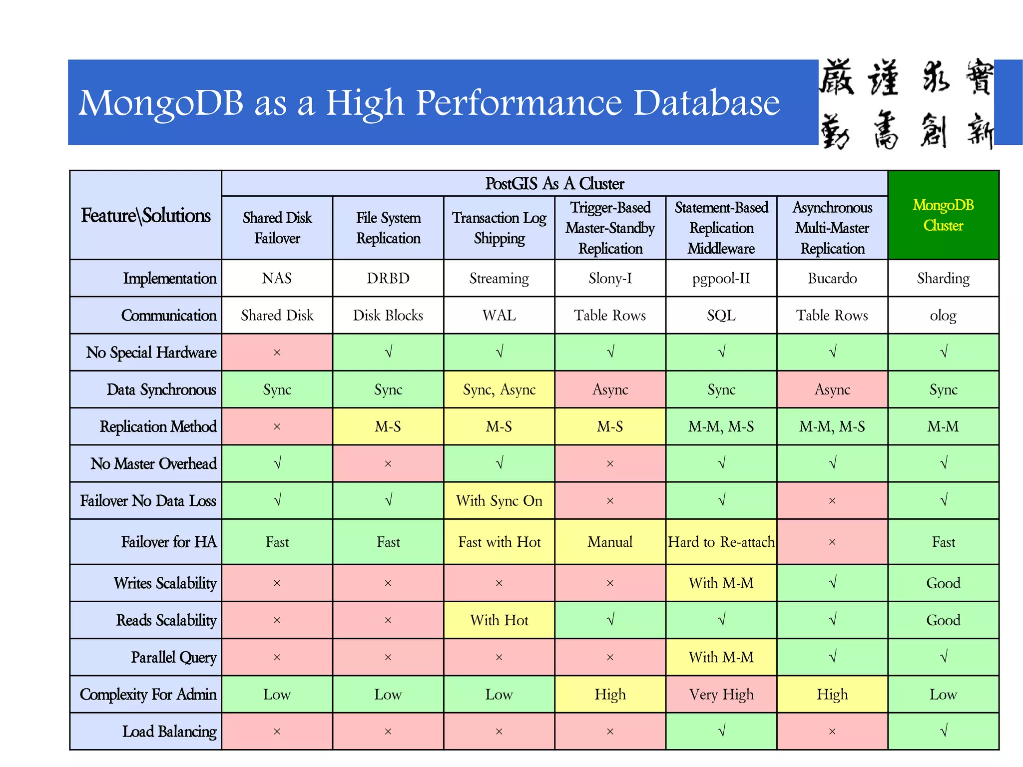
Comparison of performance features between PostGIS and MongoDB clusters focusing on replication.
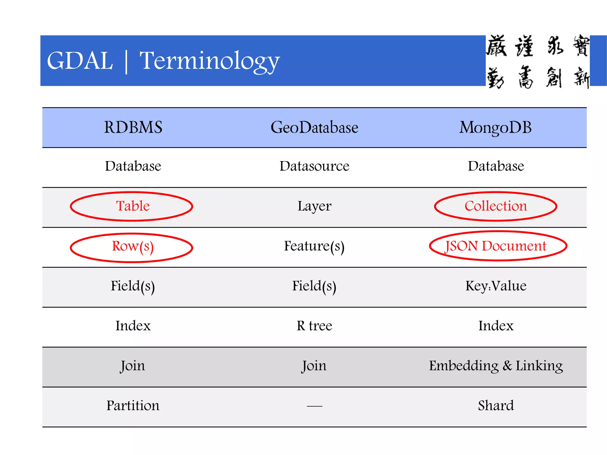
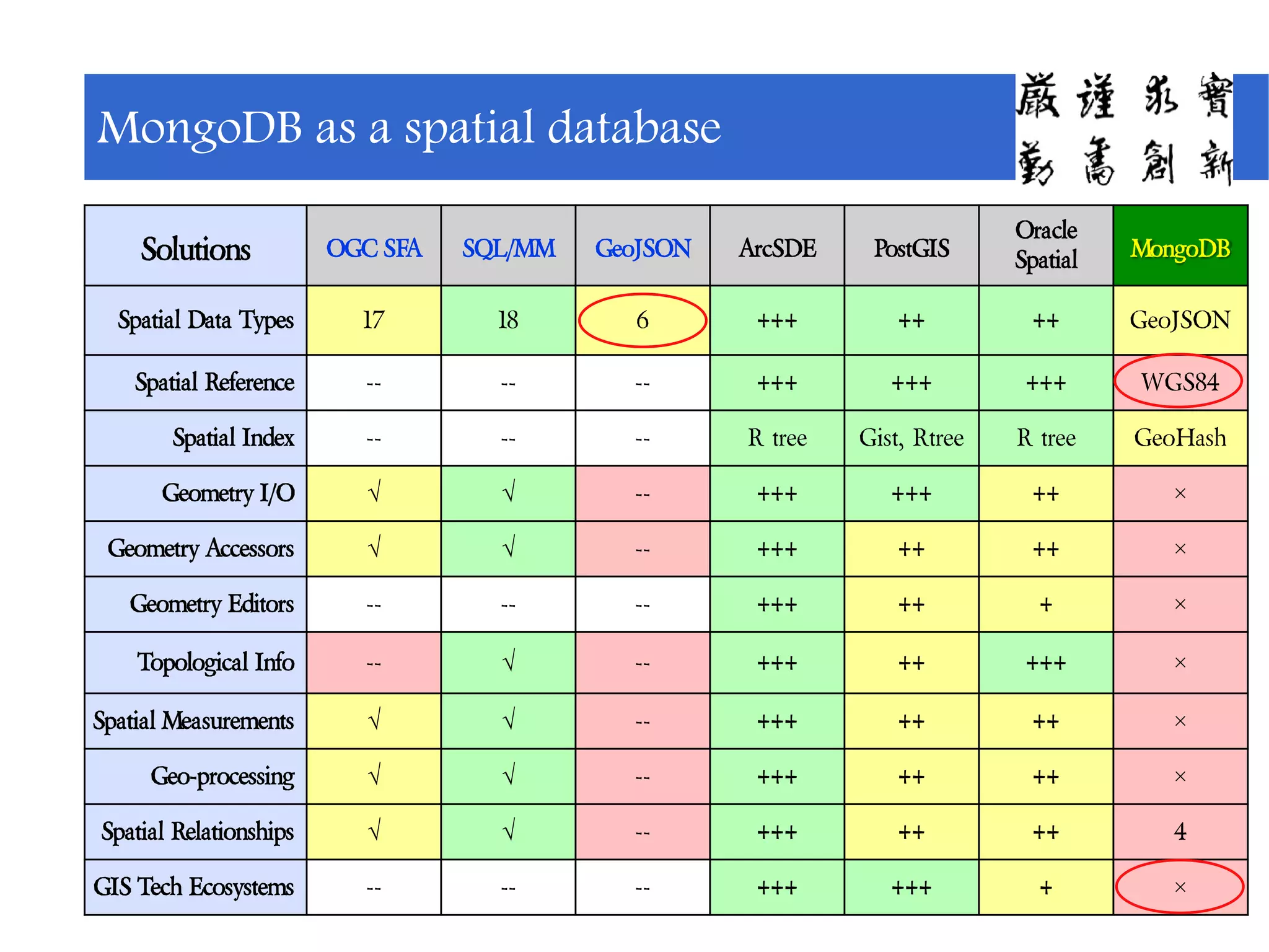
Overview of spatial data type support across different database systems including MongoDB.
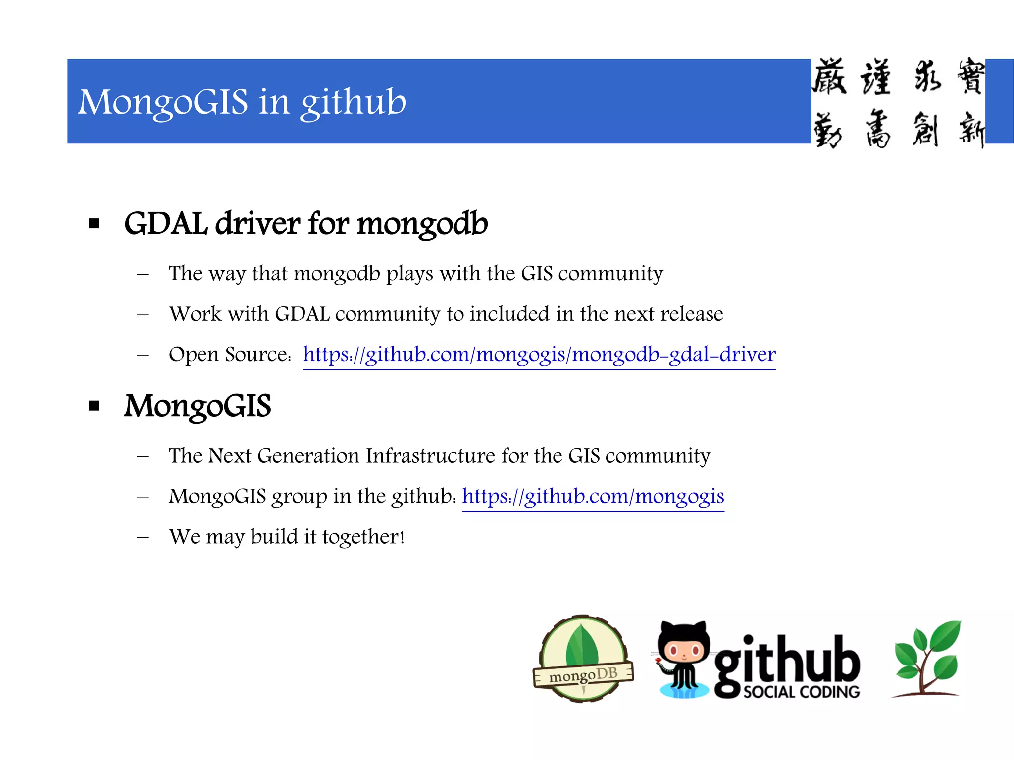
Discussion on MongoDB's GDAL driver development and prospects for community collaboration.
Expression of gratitude towards supporting institutions and individuals for their contributions.


![[FOSS4G KOREA 2014]Hadoop 상에서 MapReduce를 이용한 Spatial Big Data 집계와 시스템 구축](https://cdn.slidesharecdn.com/ss_thumbnails/foss4g2014hadoop-geohash-v02-140829035316-phpapp02-thumbnail.jpg?width=640&height=640&fit=bounds)


![MongoDB .local San Francisco 2020: Powering the new age data demands [Infosys]](https://cdn.slidesharecdn.com/ss_thumbnails/315pminfosysfinalsfoversionvocalpart1-200120221508-thumbnail.jpg?width=640&height=640&fit=bounds)