Download to read offline
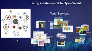

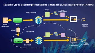
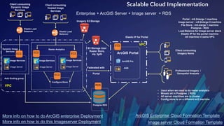


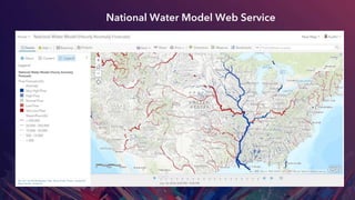

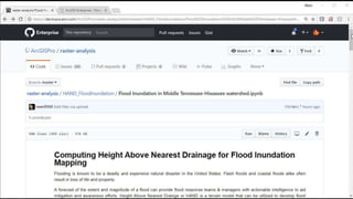
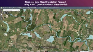


This document discusses scalable data analytics and visualization using cloud optimized services. It provides examples of leveraging cloud technologies like AWS and Azure to build scalable implementations for processing and serving large geospatial and earth observation datasets. This includes architectures for hosting high resolution raster data and services, global hydrologic modeling, and near real-time flood forecasting using NOAA's National Water Model.