This document contains summaries of four GIS projects:
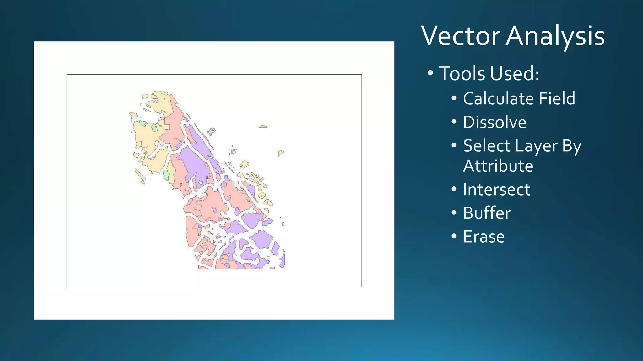
1) A spatial analysis of habitat protection and attributes in Alameda County.
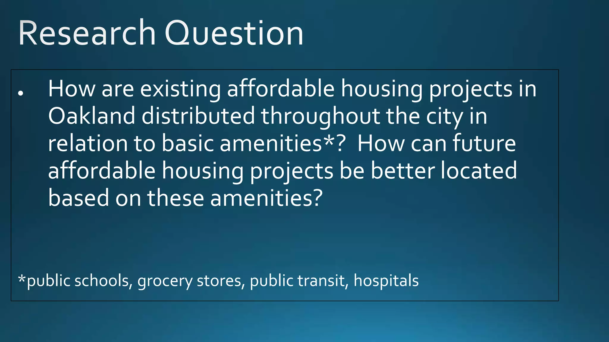
2) An analysis of the distribution of existing affordable housing projects in Oakland relative to amenities and a recommendation for future projects.
3) A study of schools within walking distance of fast food locations in San Francisco.
4) A map of housing density throughout Alameda County.


![ict_presentation_final_final_final[1].pptx](https://cdn.slidesharecdn.com/ss_thumbnails/ictpresentationfinalfinalfinal1-251230145259-2b4839bd-thumbnail.jpg?width=640&height=640&fit=bounds)


