SlideShare a Scribd company logo
1 of 13
Download to read offline
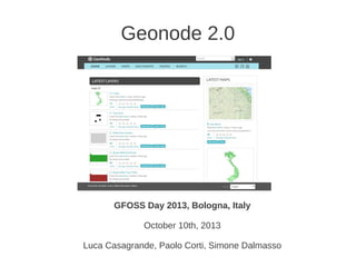
Geonode 2.0
GFOSS Day 2013, Bologna, Italy
October 10th, 2013
Luca Casagrande, Paolo Corti, Simone Dalmasso
What?
● GeoNode is a geospatial CMS
● a platform for the management and publication of geospatial data (SDI)
● open source platform built on other open source components
● allows non-specialized users to share data and create interactive maps
● data management tools for integrated creation of data, metadata, and map
visualizations
● each dataset in the system can be shared publicly or restricted to allow
access to only specific users
● social features like user profiles and commenting and rating systems allow for
the development of communities
● easily customizable
Who?
● Organizations using it: World Bank, CE JRC, UN WFP,
Ithaca, Harvard University, MapStory, OpenGeo
(Boundless)
● 50+ contributors, 10 developers with 100+ commits:
https://github.com/GeoNode/geonode/graphs/contributors
Where?
● Web site: http://geonode.org/
● GitHub: https://github.com/GeoNode/geonode
● Issue tracker: https://github.com/GeoNode/geonode/issues
● Documentation: http://docs.geonode.org/
● Demo site: http://beta.dev.geonode.org/
When?
● November 2010: GeoNode 1.0
● February 2012: GeoNode 1.1
● October 2012: GeoNode 1.2
● Now: GeoNode 2.0 beta 54
● In few weeks: GeoNode RC
● Before the end of the year: GeoNode 2.0
Architecture
● 100% Open Source!
http://docs.geonode.org/en/latest/reference/architecture.html#architecture
● * Python, Django, WSGI, Apache, OWSlib, gsconfig
● * GDAL, OGR, GEOS, PROJ.4
● * Tomcat, GeoServer, GeoTools
● * PostgreSQL, PostGIS
● * pycsw, GeoNetwork
● * Javascript, jQuery, OpenLayers, ExtJS, GeoExt, GeoExplorer
● * HTML, CSS, Bootstrap
● * GeoGit enabled
Architecture
Web services included
● OGC WMS - Web Map Service (GeoServer)
● OGC WFS/WFS-T - Web Feature Service (GeoServer)
● OGC WCS - Web Coverage Service (GeoServer)
● OGC CSW - Catalog Service for the Web (pycsw, GeoNetwork)
● OGC WMST - Web Map Tiling Service (GeoWebCache)
● REST GeoServer API
Web Services consumption
● GeoNode itself (federation)!
● Desktop GIS (QGIS, uDig, gvSIG, OPEN Jump, ArcGIS...)
● Client libraries (GDAL, OWSLib, GeoTools, OpenLayers, Leaflet,
gsconfig)
Spatial Database included
Input data format:
● shapefile, tiff, csv, kml
● any GeoServer data source, using the updatelayers
command line (PostGIS Raster, Oracle Spatial,
ArcSDE...)
Data are uploaded to a PostGIS Spatial database
Django Apps
● GeoNode internal Django apps (Base, Layers, Maps, Documents...)
● GeoNode itself is based on several Django apps (avatar, dialogos,
django_notification, django_pagination, django_taggit,...)
● It is easy to customize your own instance using other popular
Django apps (django-cms, django-mingus, django-schedule,
django-revision, django-social-auth, pyston)
Documentation
● documentation web site: http://docs.geonode.org/
● written in reST and built whit Sphinx
● translated using the i18n Sphinx support and the
Transifex platform:
https://www.transifex.com/projects/p/geonode/
Roadmap
● 2.1: Groups
● 2.1: Improved federation system
● 2.1: GeoNode API (GNIP 18,
https://github.com/GeoNode/geonode/wiki/GNI
P-18---GeoNode-API)
● 2.1+: support for other web map engine
(MapServer, Mapnik)

More Related Content

What's hot

One GeoNode, many GeoNodes
One GeoNode, many GeoNodesOne GeoNode, many GeoNodes
One GeoNode, many GeoNodesGeoSolutions
 
Geodatabase: The ArcGIS Mechanism for Data Management
Geodatabase: The ArcGIS Mechanism for Data ManagementGeodatabase: The ArcGIS Mechanism for Data Management
Geodatabase: The ArcGIS Mechanism for Data ManagementEsri South Africa
 
Using GeoServer for spatio-temporal data management with examples for MetOc a...
Using GeoServer for spatio-temporal data management with examples for MetOc a...Using GeoServer for spatio-temporal data management with examples for MetOc a...
Using GeoServer for spatio-temporal data management with examples for MetOc a...GeoSolutions
 
gps tracking techniques
gps tracking techniquesgps tracking techniques
gps tracking techniquespolsaurabh
 
Spatial data infrastructure in Kyrgyzstan
Spatial data infrastructure in KyrgyzstanSpatial data infrastructure in Kyrgyzstan
Spatial data infrastructure in KyrgyzstanUnison Group
 
mago3D 기술 워크샵 자료(한국어)
mago3D  기술 워크샵 자료(한국어)mago3D  기술 워크샵 자료(한국어)
mago3D 기술 워크샵 자료(한국어)SANGHEE SHIN
 
Free open source gis
Free open source gisFree open source gis
Free open source gisAshok Peddi
 
Enterprise GIS
Enterprise GIS Enterprise GIS
Enterprise GIS Esri
 
공간정보거점대학 PostGIS 고급과정
공간정보거점대학 PostGIS 고급과정공간정보거점대학 PostGIS 고급과정
공간정보거점대학 PostGIS 고급과정JungHwan Yun
 
GeoServer Developers Workshop
GeoServer Developers WorkshopGeoServer Developers Workshop
GeoServer Developers WorkshopJody Garnett
 
Introduction to GIS
Introduction to GISIntroduction to GIS
Introduction to GISJoey Li
 
DATABASE & WEBGIS - GIS BOOTCAMP
DATABASE & WEBGIS - GIS BOOTCAMPDATABASE & WEBGIS - GIS BOOTCAMP
DATABASE & WEBGIS - GIS BOOTCAMPKevin Ng'eno
 
Geographic Information System unit 1
Geographic Information System   unit 1Geographic Information System   unit 1
Geographic Information System unit 1sridevi5983
 
Applications of Arc GIS
Applications of Arc GISApplications of Arc GIS
Applications of Arc GISExtraPDFs
 
Introduction To Geographical Information System (GIS)
Introduction To Geographical Information System (GIS) Introduction To Geographical Information System (GIS)
Introduction To Geographical Information System (GIS) Ajay Singh Lodhi
 
GeoServer on Steroids
GeoServer on SteroidsGeoServer on Steroids
GeoServer on SteroidsGeoSolutions
 
공간정보거점대학 - PyQGIS 및 플러그인 개발
공간정보거점대학 - PyQGIS 및 플러그인 개발공간정보거점대학 - PyQGIS 및 플러그인 개발
공간정보거점대학 - PyQGIS 및 플러그인 개발MinPa Lee
 

What's hot (20)

One GeoNode, many GeoNodes
One GeoNode, many GeoNodesOne GeoNode, many GeoNodes
One GeoNode, many GeoNodes
 
Geodatabase: The ArcGIS Mechanism for Data Management
Geodatabase: The ArcGIS Mechanism for Data ManagementGeodatabase: The ArcGIS Mechanism for Data Management
Geodatabase: The ArcGIS Mechanism for Data Management
 
Using GeoServer for spatio-temporal data management with examples for MetOc a...
Using GeoServer for spatio-temporal data management with examples for MetOc a...Using GeoServer for spatio-temporal data management with examples for MetOc a...
Using GeoServer for spatio-temporal data management with examples for MetOc a...
 
gps tracking techniques
gps tracking techniquesgps tracking techniques
gps tracking techniques
 
Spatial data infrastructure in Kyrgyzstan
Spatial data infrastructure in KyrgyzstanSpatial data infrastructure in Kyrgyzstan
Spatial data infrastructure in Kyrgyzstan
 
mago3D 기술 워크샵 자료(한국어)
mago3D  기술 워크샵 자료(한국어)mago3D  기술 워크샵 자료(한국어)
mago3D 기술 워크샵 자료(한국어)
 
Introduction to GIS
Introduction to GISIntroduction to GIS
Introduction to GIS
 
Free open source gis
Free open source gisFree open source gis
Free open source gis
 
GIS file types
GIS file typesGIS file types
GIS file types
 
Enterprise GIS
Enterprise GIS Enterprise GIS
Enterprise GIS
 
공간정보거점대학 PostGIS 고급과정
공간정보거점대학 PostGIS 고급과정공간정보거점대학 PostGIS 고급과정
공간정보거점대학 PostGIS 고급과정
 
GeoServer Developers Workshop
GeoServer Developers WorkshopGeoServer Developers Workshop
GeoServer Developers Workshop
 
Introduction to GIS
Introduction to GISIntroduction to GIS
Introduction to GIS
 
DATABASE & WEBGIS - GIS BOOTCAMP
DATABASE & WEBGIS - GIS BOOTCAMPDATABASE & WEBGIS - GIS BOOTCAMP
DATABASE & WEBGIS - GIS BOOTCAMP
 
Geographic Information System unit 1
Geographic Information System   unit 1Geographic Information System   unit 1
Geographic Information System unit 1
 
Applications of Arc GIS
Applications of Arc GISApplications of Arc GIS
Applications of Arc GIS
 
Introduction To Geographical Information System (GIS)
Introduction To Geographical Information System (GIS) Introduction To Geographical Information System (GIS)
Introduction To Geographical Information System (GIS)
 
GeoServer on Steroids
GeoServer on SteroidsGeoServer on Steroids
GeoServer on Steroids
 
공간정보거점대학 - PyQGIS 및 플러그인 개발
공간정보거점대학 - PyQGIS 및 플러그인 개발공간정보거점대학 - PyQGIS 및 플러그인 개발
공간정보거점대학 - PyQGIS 및 플러그인 개발
 
Geodatabases
GeodatabasesGeodatabases
Geodatabases
 

Viewers also liked

Status of WorldMap, 2016
Status of WorldMap, 2016Status of WorldMap, 2016
Status of WorldMap, 2016Paolo Corti
 
Het gemak van een Geoportaal, Esri Nederland
Het gemak van een Geoportaal, Esri NederlandHet gemak van een Geoportaal, Esri Nederland
Het gemak van een Geoportaal, Esri NederlandEsriGISConferentie
 
Introduction to Metadata
Introduction to MetadataIntroduction to Metadata
Introduction to MetadataEUDAT
 
Spatial Data Infrastructure Best Practices with GeoNode
Spatial Data Infrastructure Best Practices with GeoNodeSpatial Data Infrastructure Best Practices with GeoNode
Spatial Data Infrastructure Best Practices with GeoNodeSebastian Benthall
 
Dublin Core Wereldwijd; Interoperabiliteit als een visie
Dublin Core Wereldwijd; Interoperabiliteit als een visieDublin Core Wereldwijd; Interoperabiliteit als een visie
Dublin Core Wereldwijd; Interoperabiliteit als een visieplatform meta-informatie
 
metadata & open source #osgeonl dag 2012
metadata & open source #osgeonl dag 2012 metadata & open source #osgeonl dag 2012
metadata & open source #osgeonl dag 2012 pvangenuchten
 
Metadata gebruiken, wat komt er bij kijken
Metadata gebruiken, wat komt er bij kijkenMetadata gebruiken, wat komt er bij kijken
Metadata gebruiken, wat komt er bij kijkenovonder
 
SEO bij Marketingfacts - 16 september 2014 Marketingfacts Updates
SEO bij Marketingfacts - 16 september 2014 Marketingfacts UpdatesSEO bij Marketingfacts - 16 september 2014 Marketingfacts Updates
SEO bij Marketingfacts - 16 september 2014 Marketingfacts UpdatesDanny Oosterveer
 
Optimaal inzetten van touchtables in ruimtelijke planvorming, Geodan
Optimaal inzetten van touchtables in ruimtelijke planvorming, GeodanOptimaal inzetten van touchtables in ruimtelijke planvorming, Geodan
Optimaal inzetten van touchtables in ruimtelijke planvorming, GeodanEsriGISConferentie
 
Metadata & Google: a love story
Metadata & Google: a love storyMetadata & Google: a love story
Metadata & Google: a love storyArne van Elk
 
Micro services and Containers
Micro services and ContainersMicro services and Containers
Micro services and ContainersRichard Harvey
 
Metadata an overview
Metadata an overviewMetadata an overview
Metadata an overviewrobin fay
 

Viewers also liked (14)

2 Ine De Visser Geonovum
2 Ine De Visser Geonovum2 Ine De Visser Geonovum
2 Ine De Visser Geonovum
 
Status of WorldMap, 2016
Status of WorldMap, 2016Status of WorldMap, 2016
Status of WorldMap, 2016
 
Het gemak van een Geoportaal, Esri Nederland
Het gemak van een Geoportaal, Esri NederlandHet gemak van een Geoportaal, Esri Nederland
Het gemak van een Geoportaal, Esri Nederland
 
Introduction to Metadata
Introduction to MetadataIntroduction to Metadata
Introduction to Metadata
 
Meta made in Gelderland
Meta made in GelderlandMeta made in Gelderland
Meta made in Gelderland
 
Spatial Data Infrastructure Best Practices with GeoNode
Spatial Data Infrastructure Best Practices with GeoNodeSpatial Data Infrastructure Best Practices with GeoNode
Spatial Data Infrastructure Best Practices with GeoNode
 
Dublin Core Wereldwijd; Interoperabiliteit als een visie
Dublin Core Wereldwijd; Interoperabiliteit als een visieDublin Core Wereldwijd; Interoperabiliteit als een visie
Dublin Core Wereldwijd; Interoperabiliteit als een visie
 
metadata & open source #osgeonl dag 2012
metadata & open source #osgeonl dag 2012 metadata & open source #osgeonl dag 2012
metadata & open source #osgeonl dag 2012
 
Metadata gebruiken, wat komt er bij kijken
Metadata gebruiken, wat komt er bij kijkenMetadata gebruiken, wat komt er bij kijken
Metadata gebruiken, wat komt er bij kijken
 
SEO bij Marketingfacts - 16 september 2014 Marketingfacts Updates
SEO bij Marketingfacts - 16 september 2014 Marketingfacts UpdatesSEO bij Marketingfacts - 16 september 2014 Marketingfacts Updates
SEO bij Marketingfacts - 16 september 2014 Marketingfacts Updates
 
Optimaal inzetten van touchtables in ruimtelijke planvorming, Geodan
Optimaal inzetten van touchtables in ruimtelijke planvorming, GeodanOptimaal inzetten van touchtables in ruimtelijke planvorming, Geodan
Optimaal inzetten van touchtables in ruimtelijke planvorming, Geodan
 
Metadata & Google: a love story
Metadata & Google: a love storyMetadata & Google: a love story
Metadata & Google: a love story
 
Micro services and Containers
Micro services and ContainersMicro services and Containers
Micro services and Containers
 
Metadata an overview
Metadata an overviewMetadata an overview
Metadata an overview
 

Similar to GeoNode 2.0: A geospatial CMS for managing and publishing geospatial data

GIS User to Web-GIS Developer Journey
GIS User to Web-GIS Developer JourneyGIS User to Web-GIS Developer Journey
GIS User to Web-GIS Developer JourneyTek Kshetri
 
Open source based software ‘gxt’ mangosystem
Open source based software ‘gxt’ mangosystemOpen source based software ‘gxt’ mangosystem
Open source based software ‘gxt’ mangosystemHaNJiN Lee
 
CartoDB Inside Out
CartoDB Inside OutCartoDB Inside Out
CartoDB Inside OutJorge Sanz
 
Mapping, GIS and geolocating data in Java @ JAX London
Mapping, GIS and geolocating data in Java @ JAX LondonMapping, GIS and geolocating data in Java @ JAX London
Mapping, GIS and geolocating data in Java @ JAX LondonJoachim Van der Auwera
 
Java Tech & Tools | Mapping, GIS and Geolocating Data in Java | Joachim Van d...
Java Tech & Tools | Mapping, GIS and Geolocating Data in Java | Joachim Van d...Java Tech & Tools | Mapping, GIS and Geolocating Data in Java | Joachim Van d...
Java Tech & Tools | Mapping, GIS and Geolocating Data in Java | Joachim Van d...JAX London
 
Mapping, GIS and geolocating data in Java
Mapping, GIS and geolocating data in JavaMapping, GIS and geolocating data in Java
Mapping, GIS and geolocating data in JavaJoachim Van der Auwera
 
GeoServer Ecosystem 2018
GeoServer Ecosystem 2018GeoServer Ecosystem 2018
GeoServer Ecosystem 2018Jody Garnett
 
Open Source GIS Stack: Data hub for flexibility, performance and effectiveness
Open Source GIS Stack: Data hub for flexibility, performance and effectivenessOpen Source GIS Stack: Data hub for flexibility, performance and effectiveness
Open Source GIS Stack: Data hub for flexibility, performance and effectivenesseHealth Africa
 
Integrating PostGIS in Web Applications
Integrating PostGIS in Web ApplicationsIntegrating PostGIS in Web Applications
Integrating PostGIS in Web ApplicationsCommand Prompt., Inc
 
Open Source GIS
Open Source GISOpen Source GIS
Open Source GISJoe Larson
 
OpenStreetMap : Open Licensed GeoData
OpenStreetMap : Open Licensed GeoDataOpenStreetMap : Open Licensed GeoData
OpenStreetMap : Open Licensed GeoDatagssg
 
OpenStreetMap : Open Licensed GeoData
OpenStreetMap : Open Licensed GeoDataOpenStreetMap : Open Licensed GeoData
OpenStreetMap : Open Licensed GeoDataHarry Wood
 
State of GeoNode 2019
State of GeoNode 2019State of GeoNode 2019
State of GeoNode 2019Paolo Corti
 
GI2012 buono-cnr-geo-platform
GI2012 buono-cnr-geo-platformGI2012 buono-cnr-geo-platform
GI2012 buono-cnr-geo-platformIGN Vorstand
 
gvSIG Suite: Open source software to implement Spatial Data Infrastructures
gvSIG Suite: Open source software to implement Spatial Data InfrastructuresgvSIG Suite: Open source software to implement Spatial Data Infrastructures
gvSIG Suite: Open source software to implement Spatial Data InfrastructuresAlvaro Anguix
 
GeoSDI: una piattaforma social di dati geografici basata sui principi di INSP...
GeoSDI: una piattaforma social di dati geografici basata sui principi di INSP...GeoSDI: una piattaforma social di dati geografici basata sui principi di INSP...
GeoSDI: una piattaforma social di dati geografici basata sui principi di INSP...Beniamino Murgante
 
Open Source Geospatial
Open Source GeospatialOpen Source Geospatial
Open Source GeospatialJody Garnett
 
MapStore Create, save and share maps and mashups @ GRASS-GFOSS 2013
MapStore Create, save and share maps and mashups @ GRASS-GFOSS 2013MapStore Create, save and share maps and mashups @ GRASS-GFOSS 2013
MapStore Create, save and share maps and mashups @ GRASS-GFOSS 2013GeoSolutions
 
OGC GeoPackage Support in ArcGIS
OGC GeoPackage Support in ArcGISOGC GeoPackage Support in ArcGIS
OGC GeoPackage Support in ArcGISMarten Hogeweg
 

Similar to GeoNode 2.0: A geospatial CMS for managing and publishing geospatial data (20)

GIS User to Web-GIS Developer Journey
GIS User to Web-GIS Developer JourneyGIS User to Web-GIS Developer Journey
GIS User to Web-GIS Developer Journey
 
Open source based software ‘gxt’ mangosystem
Open source based software ‘gxt’ mangosystemOpen source based software ‘gxt’ mangosystem
Open source based software ‘gxt’ mangosystem
 
CartoDB Inside Out
CartoDB Inside OutCartoDB Inside Out
CartoDB Inside Out
 
Mapping, GIS and geolocating data in Java @ JAX London
Mapping, GIS and geolocating data in Java @ JAX LondonMapping, GIS and geolocating data in Java @ JAX London
Mapping, GIS and geolocating data in Java @ JAX London
 
Java Tech & Tools | Mapping, GIS and Geolocating Data in Java | Joachim Van d...
Java Tech & Tools | Mapping, GIS and Geolocating Data in Java | Joachim Van d...Java Tech & Tools | Mapping, GIS and Geolocating Data in Java | Joachim Van d...
Java Tech & Tools | Mapping, GIS and Geolocating Data in Java | Joachim Van d...
 
Mapping, GIS and geolocating data in Java
Mapping, GIS and geolocating data in JavaMapping, GIS and geolocating data in Java
Mapping, GIS and geolocating data in Java
 
GeoServer Ecosystem 2018
GeoServer Ecosystem 2018GeoServer Ecosystem 2018
GeoServer Ecosystem 2018
 
Open Source GIS Stack: Data hub for flexibility, performance and effectiveness
Open Source GIS Stack: Data hub for flexibility, performance and effectivenessOpen Source GIS Stack: Data hub for flexibility, performance and effectiveness
Open Source GIS Stack: Data hub for flexibility, performance and effectiveness
 
Integrating PostGIS in Web Applications
Integrating PostGIS in Web ApplicationsIntegrating PostGIS in Web Applications
Integrating PostGIS in Web Applications
 
Open Source GIS
Open Source GISOpen Source GIS
Open Source GIS
 
OpenStreetMap : Open Licensed GeoData
OpenStreetMap : Open Licensed GeoDataOpenStreetMap : Open Licensed GeoData
OpenStreetMap : Open Licensed GeoData
 
OpenStreetMap : Open Licensed GeoData
OpenStreetMap : Open Licensed GeoDataOpenStreetMap : Open Licensed GeoData
OpenStreetMap : Open Licensed GeoData
 
State of GeoNode 2019
State of GeoNode 2019State of GeoNode 2019
State of GeoNode 2019
 
GI2012 buono-cnr-geo-platform
GI2012 buono-cnr-geo-platformGI2012 buono-cnr-geo-platform
GI2012 buono-cnr-geo-platform
 
gvSIG Suite: Open source software to implement Spatial Data Infrastructures
gvSIG Suite: Open source software to implement Spatial Data InfrastructuresgvSIG Suite: Open source software to implement Spatial Data Infrastructures
gvSIG Suite: Open source software to implement Spatial Data Infrastructures
 
GeoSDI: una piattaforma social di dati geografici basata sui principi di INSP...
GeoSDI: una piattaforma social di dati geografici basata sui principi di INSP...GeoSDI: una piattaforma social di dati geografici basata sui principi di INSP...
GeoSDI: una piattaforma social di dati geografici basata sui principi di INSP...
 
Open Source Geospatial
Open Source GeospatialOpen Source Geospatial
Open Source Geospatial
 
MapStore Create, save and share maps and mashups @ GRASS-GFOSS 2013
MapStore Create, save and share maps and mashups @ GRASS-GFOSS 2013MapStore Create, save and share maps and mashups @ GRASS-GFOSS 2013
MapStore Create, save and share maps and mashups @ GRASS-GFOSS 2013
 
Open layers
Open layersOpen layers
Open layers
 
OGC GeoPackage Support in ArcGIS
OGC GeoPackage Support in ArcGISOGC GeoPackage Support in ArcGIS
OGC GeoPackage Support in ArcGIS
 

More from Paolo Corti

Harvard Hypermap: An Open Source Framework for Making the World’s Geospatial ...
Harvard Hypermap: An Open Source Framework for Making the World’s Geospatial ...Harvard Hypermap: An Open Source Framework for Making the World’s Geospatial ...
Harvard Hypermap: An Open Source Framework for Making the World’s Geospatial ...Paolo Corti
 
Making Temporal Search Central in a Spatial Data Infrastructure
Making Temporal Search Central in a Spatial Data InfrastructureMaking Temporal Search Central in a Spatial Data Infrastructure
Making Temporal Search Central in a Spatial Data InfrastructurePaolo Corti
 
Maintaining spatial data infrastructures (SDIs) using distributed task queues
Maintaining spatial data infrastructures (SDIs) using distributed task queuesMaintaining spatial data infrastructures (SDIs) using distributed task queues
Maintaining spatial data infrastructures (SDIs) using distributed task queuesPaolo Corti
 
GeoNode per il Supporto alle Emergenze Umanitarie
GeoNode per il Supporto alle Emergenze UmanitarieGeoNode per il Supporto alle Emergenze Umanitarie
GeoNode per il Supporto alle Emergenze UmanitariePaolo Corti
 
Implementing an Open Source Spatiotemporal Search Platform for Spatial Data I...
Implementing an Open Source Spatiotemporal Search Platform for Spatial Data I...Implementing an Open Source Spatiotemporal Search Platform for Spatial Data I...
Implementing an Open Source Spatiotemporal Search Platform for Spatial Data I...Paolo Corti
 
Building an Open Source, Real-Time, Billion Object Spatio-Temporal Search Pla...
Building an Open Source, Real-Time, Billion Object Spatio-Temporal Search Pla...Building an Open Source, Real-Time, Billion Object Spatio-Temporal Search Pla...
Building an Open Source, Real-Time, Billion Object Spatio-Temporal Search Pla...Paolo Corti
 
GeoNode for Humanitarian Crisis and Risk Reduction
GeoNode for Humanitarian Crisis and Risk ReductionGeoNode for Humanitarian Crisis and Risk Reduction
GeoNode for Humanitarian Crisis and Risk ReductionPaolo Corti
 
L'utilizzo di software fee and open source nello European Forest Fire Informa...
L'utilizzo di software fee and open source nello European Forest Fire Informa...L'utilizzo di software fee and open source nello European Forest Fire Informa...
L'utilizzo di software fee and open source nello European Forest Fire Informa...Paolo Corti
 
Fire news management in the context of the European Forest Fire Information S...
Fire news management in the context of the European Forest Fire Information S...Fire news management in the context of the European Forest Fire Information S...
Fire news management in the context of the European Forest Fire Information S...Paolo Corti
 
Developing Geospatial software with Python, Part 1
Developing Geospatial software with Python, Part 1Developing Geospatial software with Python, Part 1
Developing Geospatial software with Python, Part 1Paolo Corti
 

More from Paolo Corti (10)

Harvard Hypermap: An Open Source Framework for Making the World’s Geospatial ...
Harvard Hypermap: An Open Source Framework for Making the World’s Geospatial ...Harvard Hypermap: An Open Source Framework for Making the World’s Geospatial ...
Harvard Hypermap: An Open Source Framework for Making the World’s Geospatial ...
 
Making Temporal Search Central in a Spatial Data Infrastructure
Making Temporal Search Central in a Spatial Data InfrastructureMaking Temporal Search Central in a Spatial Data Infrastructure
Making Temporal Search Central in a Spatial Data Infrastructure
 
Maintaining spatial data infrastructures (SDIs) using distributed task queues
Maintaining spatial data infrastructures (SDIs) using distributed task queuesMaintaining spatial data infrastructures (SDIs) using distributed task queues
Maintaining spatial data infrastructures (SDIs) using distributed task queues
 
GeoNode per il Supporto alle Emergenze Umanitarie
GeoNode per il Supporto alle Emergenze UmanitarieGeoNode per il Supporto alle Emergenze Umanitarie
GeoNode per il Supporto alle Emergenze Umanitarie
 
Implementing an Open Source Spatiotemporal Search Platform for Spatial Data I...
Implementing an Open Source Spatiotemporal Search Platform for Spatial Data I...Implementing an Open Source Spatiotemporal Search Platform for Spatial Data I...
Implementing an Open Source Spatiotemporal Search Platform for Spatial Data I...
 
Building an Open Source, Real-Time, Billion Object Spatio-Temporal Search Pla...
Building an Open Source, Real-Time, Billion Object Spatio-Temporal Search Pla...Building an Open Source, Real-Time, Billion Object Spatio-Temporal Search Pla...
Building an Open Source, Real-Time, Billion Object Spatio-Temporal Search Pla...
 
GeoNode for Humanitarian Crisis and Risk Reduction
GeoNode for Humanitarian Crisis and Risk ReductionGeoNode for Humanitarian Crisis and Risk Reduction
GeoNode for Humanitarian Crisis and Risk Reduction
 
L'utilizzo di software fee and open source nello European Forest Fire Informa...
L'utilizzo di software fee and open source nello European Forest Fire Informa...L'utilizzo di software fee and open source nello European Forest Fire Informa...
L'utilizzo di software fee and open source nello European Forest Fire Informa...
 
Fire news management in the context of the European Forest Fire Information S...
Fire news management in the context of the European Forest Fire Information S...Fire news management in the context of the European Forest Fire Information S...
Fire news management in the context of the European Forest Fire Information S...
 
Developing Geospatial software with Python, Part 1
Developing Geospatial software with Python, Part 1Developing Geospatial software with Python, Part 1
Developing Geospatial software with Python, Part 1
 

Recently uploaded

Story boards and shot lists for my a level piece
Story boards and shot lists for my a level pieceStory boards and shot lists for my a level piece
Story boards and shot lists for my a level piececharlottematthew16
 
My INSURER PTE LTD - Insurtech Innovation Award 2024
My INSURER PTE LTD - Insurtech Innovation Award 2024My INSURER PTE LTD - Insurtech Innovation Award 2024
My INSURER PTE LTD - Insurtech Innovation Award 2024The Digital Insurer
 
Are Multi-Cloud and Serverless Good or Bad?
Are Multi-Cloud and Serverless Good or Bad?Are Multi-Cloud and Serverless Good or Bad?
Are Multi-Cloud and Serverless Good or Bad?Mattias Andersson
 
Kotlin Multiplatform & Compose Multiplatform - Starter kit for pragmatics
Kotlin Multiplatform & Compose Multiplatform - Starter kit for pragmaticsKotlin Multiplatform & Compose Multiplatform - Starter kit for pragmatics
Kotlin Multiplatform & Compose Multiplatform - Starter kit for pragmaticscarlostorres15106
 
costume and set research powerpoint presentation
costume and set research powerpoint presentationcostume and set research powerpoint presentation
costume and set research powerpoint presentationphoebematthew05
 
Artificial intelligence in cctv survelliance.pptx
Artificial intelligence in cctv survelliance.pptxArtificial intelligence in cctv survelliance.pptx
Artificial intelligence in cctv survelliance.pptxhariprasad279825
 
Commit 2024 - Secret Management made easy
Commit 2024 - Secret Management made easyCommit 2024 - Secret Management made easy
Commit 2024 - Secret Management made easyAlfredo García Lavilla
 
SIP trunking in Janus @ Kamailio World 2024
SIP trunking in Janus @ Kamailio World 2024SIP trunking in Janus @ Kamailio World 2024
SIP trunking in Janus @ Kamailio World 2024Lorenzo Miniero
 
Pigging Solutions in Pet Food Manufacturing
Pigging Solutions in Pet Food ManufacturingPigging Solutions in Pet Food Manufacturing
Pigging Solutions in Pet Food ManufacturingPigging Solutions
 
Advanced Test Driven-Development @ php[tek] 2024
Advanced Test Driven-Development @ php[tek] 2024Advanced Test Driven-Development @ php[tek] 2024
Advanced Test Driven-Development @ php[tek] 2024Scott Keck-Warren
 
Gen AI in Business - Global Trends Report 2024.pdf
Gen AI in Business - Global Trends Report 2024.pdfGen AI in Business - Global Trends Report 2024.pdf
Gen AI in Business - Global Trends Report 2024.pdfAddepto
 
APIForce Zurich 5 April Automation LPDG
APIForce Zurich 5 April  Automation LPDGAPIForce Zurich 5 April  Automation LPDG
APIForce Zurich 5 April Automation LPDGMarianaLemus7
 
SAP Build Work Zone - Overview L2-L3.pptx
SAP Build Work Zone - Overview L2-L3.pptxSAP Build Work Zone - Overview L2-L3.pptx
SAP Build Work Zone - Overview L2-L3.pptxNavinnSomaal
 
Designing IA for AI - Information Architecture Conference 2024
Designing IA for AI - Information Architecture Conference 2024Designing IA for AI - Information Architecture Conference 2024
Designing IA for AI - Information Architecture Conference 2024Enterprise Knowledge
 
Dev Dives: Streamline document processing with UiPath Studio Web
Dev Dives: Streamline document processing with UiPath Studio WebDev Dives: Streamline document processing with UiPath Studio Web
Dev Dives: Streamline document processing with UiPath Studio WebUiPathCommunity
 
CloudStudio User manual (basic edition):
CloudStudio User manual (basic edition):CloudStudio User manual (basic edition):
CloudStudio User manual (basic edition):comworks
 
Scanning the Internet for External Cloud Exposures via SSL Certs
Scanning the Internet for External Cloud Exposures via SSL CertsScanning the Internet for External Cloud Exposures via SSL Certs
Scanning the Internet for External Cloud Exposures via SSL CertsRizwan Syed
 

Recently uploaded (20)

Story boards and shot lists for my a level piece
Story boards and shot lists for my a level pieceStory boards and shot lists for my a level piece
Story boards and shot lists for my a level piece
 
My INSURER PTE LTD - Insurtech Innovation Award 2024
My INSURER PTE LTD - Insurtech Innovation Award 2024My INSURER PTE LTD - Insurtech Innovation Award 2024
My INSURER PTE LTD - Insurtech Innovation Award 2024
 
Are Multi-Cloud and Serverless Good or Bad?
Are Multi-Cloud and Serverless Good or Bad?Are Multi-Cloud and Serverless Good or Bad?
Are Multi-Cloud and Serverless Good or Bad?
 
Kotlin Multiplatform & Compose Multiplatform - Starter kit for pragmatics
Kotlin Multiplatform & Compose Multiplatform - Starter kit for pragmaticsKotlin Multiplatform & Compose Multiplatform - Starter kit for pragmatics
Kotlin Multiplatform & Compose Multiplatform - Starter kit for pragmatics
 
costume and set research powerpoint presentation
costume and set research powerpoint presentationcostume and set research powerpoint presentation
costume and set research powerpoint presentation
 
Artificial intelligence in cctv survelliance.pptx
Artificial intelligence in cctv survelliance.pptxArtificial intelligence in cctv survelliance.pptx
Artificial intelligence in cctv survelliance.pptx
 
Commit 2024 - Secret Management made easy
Commit 2024 - Secret Management made easyCommit 2024 - Secret Management made easy
Commit 2024 - Secret Management made easy
 
SIP trunking in Janus @ Kamailio World 2024
SIP trunking in Janus @ Kamailio World 2024SIP trunking in Janus @ Kamailio World 2024
SIP trunking in Janus @ Kamailio World 2024
 
DMCC Future of Trade Web3 - Special Edition
DMCC Future of Trade Web3 - Special EditionDMCC Future of Trade Web3 - Special Edition
DMCC Future of Trade Web3 - Special Edition
 
E-Vehicle_Hacking_by_Parul Sharma_null_owasp.pptx
E-Vehicle_Hacking_by_Parul Sharma_null_owasp.pptxE-Vehicle_Hacking_by_Parul Sharma_null_owasp.pptx
E-Vehicle_Hacking_by_Parul Sharma_null_owasp.pptx
 
Pigging Solutions in Pet Food Manufacturing
Pigging Solutions in Pet Food ManufacturingPigging Solutions in Pet Food Manufacturing
Pigging Solutions in Pet Food Manufacturing
 
Advanced Test Driven-Development @ php[tek] 2024
Advanced Test Driven-Development @ php[tek] 2024Advanced Test Driven-Development @ php[tek] 2024
Advanced Test Driven-Development @ php[tek] 2024
 
Gen AI in Business - Global Trends Report 2024.pdf
Gen AI in Business - Global Trends Report 2024.pdfGen AI in Business - Global Trends Report 2024.pdf
Gen AI in Business - Global Trends Report 2024.pdf
 
APIForce Zurich 5 April Automation LPDG
APIForce Zurich 5 April  Automation LPDGAPIForce Zurich 5 April  Automation LPDG
APIForce Zurich 5 April Automation LPDG
 
SAP Build Work Zone - Overview L2-L3.pptx
SAP Build Work Zone - Overview L2-L3.pptxSAP Build Work Zone - Overview L2-L3.pptx
SAP Build Work Zone - Overview L2-L3.pptx
 
Designing IA for AI - Information Architecture Conference 2024
Designing IA for AI - Information Architecture Conference 2024Designing IA for AI - Information Architecture Conference 2024
Designing IA for AI - Information Architecture Conference 2024
 
Dev Dives: Streamline document processing with UiPath Studio Web
Dev Dives: Streamline document processing with UiPath Studio WebDev Dives: Streamline document processing with UiPath Studio Web
Dev Dives: Streamline document processing with UiPath Studio Web
 
CloudStudio User manual (basic edition):
CloudStudio User manual (basic edition):CloudStudio User manual (basic edition):
CloudStudio User manual (basic edition):
 
Scanning the Internet for External Cloud Exposures via SSL Certs
Scanning the Internet for External Cloud Exposures via SSL CertsScanning the Internet for External Cloud Exposures via SSL Certs
Scanning the Internet for External Cloud Exposures via SSL Certs
 
Hot Sexy call girls in Panjabi Bagh 🔝 9953056974 🔝 Delhi escort Service
Hot Sexy call girls in Panjabi Bagh 🔝 9953056974 🔝 Delhi escort ServiceHot Sexy call girls in Panjabi Bagh 🔝 9953056974 🔝 Delhi escort Service
Hot Sexy call girls in Panjabi Bagh 🔝 9953056974 🔝 Delhi escort Service
 

GeoNode 2.0: A geospatial CMS for managing and publishing geospatial data

  • 1. Geonode 2.0 GFOSS Day 2013, Bologna, Italy October 10th, 2013 Luca Casagrande, Paolo Corti, Simone Dalmasso
  • 2. What? ● GeoNode is a geospatial CMS ● a platform for the management and publication of geospatial data (SDI) ● open source platform built on other open source components ● allows non-specialized users to share data and create interactive maps ● data management tools for integrated creation of data, metadata, and map visualizations ● each dataset in the system can be shared publicly or restricted to allow access to only specific users ● social features like user profiles and commenting and rating systems allow for the development of communities ● easily customizable
  • 3. Who? ● Organizations using it: World Bank, CE JRC, UN WFP, Ithaca, Harvard University, MapStory, OpenGeo (Boundless) ● 50+ contributors, 10 developers with 100+ commits: https://github.com/GeoNode/geonode/graphs/contributors
  • 4. Where? ● Web site: http://geonode.org/ ● GitHub: https://github.com/GeoNode/geonode ● Issue tracker: https://github.com/GeoNode/geonode/issues ● Documentation: http://docs.geonode.org/ ● Demo site: http://beta.dev.geonode.org/
  • 5. When? ● November 2010: GeoNode 1.0 ● February 2012: GeoNode 1.1 ● October 2012: GeoNode 1.2 ● Now: GeoNode 2.0 beta 54 ● In few weeks: GeoNode RC ● Before the end of the year: GeoNode 2.0
  • 6. Architecture ● 100% Open Source! http://docs.geonode.org/en/latest/reference/architecture.html#architecture ● * Python, Django, WSGI, Apache, OWSlib, gsconfig ● * GDAL, OGR, GEOS, PROJ.4 ● * Tomcat, GeoServer, GeoTools ● * PostgreSQL, PostGIS ● * pycsw, GeoNetwork ● * Javascript, jQuery, OpenLayers, ExtJS, GeoExt, GeoExplorer ● * HTML, CSS, Bootstrap ● * GeoGit enabled
  • 8. Web services included ● OGC WMS - Web Map Service (GeoServer) ● OGC WFS/WFS-T - Web Feature Service (GeoServer) ● OGC WCS - Web Coverage Service (GeoServer) ● OGC CSW - Catalog Service for the Web (pycsw, GeoNetwork) ● OGC WMST - Web Map Tiling Service (GeoWebCache) ● REST GeoServer API
  • 9. Web Services consumption ● GeoNode itself (federation)! ● Desktop GIS (QGIS, uDig, gvSIG, OPEN Jump, ArcGIS...) ● Client libraries (GDAL, OWSLib, GeoTools, OpenLayers, Leaflet, gsconfig)
  • 10. Spatial Database included Input data format: ● shapefile, tiff, csv, kml ● any GeoServer data source, using the updatelayers command line (PostGIS Raster, Oracle Spatial, ArcSDE...) Data are uploaded to a PostGIS Spatial database
  • 11. Django Apps ● GeoNode internal Django apps (Base, Layers, Maps, Documents...) ● GeoNode itself is based on several Django apps (avatar, dialogos, django_notification, django_pagination, django_taggit,...) ● It is easy to customize your own instance using other popular Django apps (django-cms, django-mingus, django-schedule, django-revision, django-social-auth, pyston)
  • 12. Documentation ● documentation web site: http://docs.geonode.org/ ● written in reST and built whit Sphinx ● translated using the i18n Sphinx support and the Transifex platform: https://www.transifex.com/projects/p/geonode/
  • 13. Roadmap ● 2.1: Groups ● 2.1: Improved federation system ● 2.1: GeoNode API (GNIP 18, https://github.com/GeoNode/geonode/wiki/GNI P-18---GeoNode-API) ● 2.1+: support for other web map engine (MapServer, Mapnik)