SlideShare a Scribd company logo
1 of 34
Download to read offline
NIMISHA VERMA TY B.SC (2013-14) , ROLL NUMBER-441, BATCH-C , DEPARTMENT OF GEOLOGY
1
GEOLOGICAL AND GEOMORPHOLOGICAL STUDIES AROUND BHUJ & KACHCHH, GUJARAT
ESSENCE
Evidence suggests that field trips to rock outcrops play a
fundamental role in facilitating understanding of geological
concepts.
There are tremendous, epic tales lying in the rocks we walk over
every day and to learn how to read those stories on their own, one
technique for developing these conceptual skills is the field trip.
Instructors
Dr. Tanuuja Marathe
Dr. S.N.Mude
Prof. Devdutt Upasani
Prof. A.Dashputre
STUDY VISIT REPORT
2
CERTIFICATE
This is certify that Miss Nimisha Verma has participated and successfully completed the field
visit to parts of Kachchh and Ahmedabad, Gujarat from 6th January 2014 to 15th January
2014 as a part of syllabus of T.Y.B.Sc. Geology laid by the University of Pune for the
academic year 2013-14.
Tour in-charge: Head of Department:
Dr. Tanuuja Marathe Dr. R. N. Mache
STUDY VISIT REPORT
3
January 28, 2014
ACKNOWLEDGMENT
At the first instance, I would like to acknowledge a deep sense of gratitude to our Principal Dr.
Ravindrasinh G. Pardeshi for granting us permission to undertake the study tour. I would also like to
thank our Head of Department, Dr. R. N. Mache for his guidance and encouragement during the
planning of this study tour.
I would like to express my gratefulness to Dr. Tanuuja Marathe, for arranging a geologically fascinating
and a very enjoyable field tour which has given us so many good memories, that we will cherish
forever. I would also like to thank our teachers Dr. S. N. Mude, Prof. D. V. Upasani and Prof. Ameya
Dashputre for their valuable guidance in the field. The discussions we had with them were very helpful
to understand the subject better.
My special thanks to Dr. Mahesh Thakkar, Head, Department of Earth and Environmental Studies,
KSKV Kachchh University for his inputs on stratigraphy and geomorphology of the region. His lecture
on ‘The Geology and Tectonics of Kachchh’ gave us a clear picture about the deposition history of the
sediments and tectonics of Kachcch basin.
I would also like to express my gratitude to Mr. Gaurav Chauhan, for his guidance in planning of the
field traverses. My special thanks to Mr. Vanit and Mr. Pravin for accompanying us to the geologically
important places around Kachchh and also giving us information on the field during the entire field
work. I would thank Mr. Yashvir for arrangement of our logistics.
I would like to appreciate the assistance offered by the nonteaching staff of the department, especially
Mr. Mangesh Mahade and Mr. Manoj Taware during the fieldwork.
Last but not the least; I thank all my classmates for making this study tour one of the most memorable
tour of my life.
Thanking you,
Sincerely,
NIMISHA VERMA
STUDY VISIT REPORT
4
TABLE OF CONTENTS
CERTIFICATE …………………………………………………………………..2
ACKNOWLEDGEMENT …………………………………………………………..3
INTRODUCTION, BENEFITS, ESSENTIAL COMPONENTS FOR RECORDING AND
COLLECTING FIELD DATA……………………………………………………..…..5
GEOGRAPHY & GEOMORPHOLOGY OF KACHCHH……………………………6
PREVIUOS WORK LITERETURE…………………………………………………….8
CLIMATE…………………………………………………………………………...9
MESOZOIC STRATIGRAPHY OF KACHCHH-MAINLAND………………………...10
MESOZOIC STRATIGRAPHY OF KACHCHH-PACHHAM ISLAND………………...11
TERTIARY STRATIGRAPHY OF KACHCHH………………………………………..12
DAY1…………………………………………………………………………….13
DAY2…………………………………………………………………………….21
DAY3…………………………………………………………………………….24
DAY4…………………………………………………………………………….27
DAY5…………………………………………………………………………….28
DAY6…………………………………………………………………………….30
CONCLUSION & LIST OF SPECIMEN..…………………………………………...33
REFERENCES....…………………………………………………………………...34
STUDY VISIT REPORT
5
INTRODUCTION
In geology more than most sciences, field trips are seen as a technique to developing a proper sense of
space, scale and time. Lathrop & Ebbett assert that “the essence of field experience is fundamental”
both for geology student & for “anyone who is drawn to explore the enormity of earth history that
scientific inquiry can reveal”
BENEFITS
Field experiences are an important part of the life of the geosciences student & professional. Visiting to
fields helps students to see fundamental relationships & to learn to observe, collect & interpret data.
Field trips often form the social backbone of geosciences departments, bringing students & faculty
together to learn. Field trips can be the highlight of an elementary student’s year. Similarly, field trips
are an integral part of the professional geoscientists’ ongoing professional development providing
opportunities to see new & familiar areas.
Other benefits cited by field trip researchers include experience working with maps, diagrams, and field
equipments, socialization among colleagues and among students, and the development of a rapport
between teachers & students. Additionally, other benefits include a positive attitude toward the science
as a general concept & positive attitudes towards specific field trip locations.
If we need to conclude the outcome of the field trip, four points emerges out:
1) Field trips are important part of geological learning process.
2) Best geology field trips involve elements of both instructor lead explanation & student centered
exploration/discovery.
3) Geology field trips impart an important place beyond simply teaching science concepts.
4) Reviewing the trip afterwards is an important activity for cementing observations &
interpretations into a sense of conceptual understanding.
If I self assessed, I find improvement in categories i.e. sedimentary rock interpretation, metamorphic
rock interpretation, understanding plate tectonics, understanding landscape change and understanding
river processes.
ESSENTIAL COMPONENTS FOR RECORDING AND COLLECTING FIELD DATA
1) A Geologist’s Hammer
2) Clinometers/Brunton Compass/GPS
3) Toposheet and geological map of the area
4) Camera
5) Haversacks
6) A pair of chisels
7) Field note-book
8) Writing & drawing material
9) Measuring tapes
10)Magnifying lenses
11)Polythene bags & marker pens
STUDY VISIT REPORT
6
1 GEOGRAPHY & GEOMORPHOLOGY OF KACHCHH
1.1 LOCATION INFORMATION
The Rann of KACHCHH is a seasonally marshy region located in the Thar Desert biogeographic province
in Gujarat state of northwestern India and the Sind province of Pakistan. This inhospitable salty
lowland, rich in natural gas and a resting site for migratory Siberian birds, is part of India and
Pakistan’s ongoing border dispute concerning Sir Creek. The name “Rann” comes from the Hindi word
“ran” meaning “salt marsh”. Kachchh is the name of the district wherein it is situated. The Rann of
Kachchh comprises some 10,000 square miles (30,000 km2) between the Gulf of Kachchh and the
mouth of the Indus River in southern Pakistan. The Luni River, which originates in Rajasthan, empties
into the northeast corner of the Rann. Salt pool In India’s summer monsoon, the flat desert of salty
clay and mudflats, averaging 15 meters above sea level, fill with standing waters, interspersed with
sandy islets of thorny scrub, breeding grounds for some of the largest flocks of Greater and Lesser
flamingoes. At its greatest extent, the Gulf of Kachchh on the west (visible in the image directly below
the salt marshes) and the Gulf of Cambay on the east (the brown, sediment-tinged body of water on
the lower right) are both united during the monsoon.
`
FIGURE 1 SATELLITE VIEW OF KACHCHH REGION
1.2 GEOMORPHOLOGY
The Kachchh landscape comprises an array of tectonogenic geomorphic elements in the form of uplifts
and residual depressions. Elevated landforms are occupied by Mesozoic and Tertiary rocks, whereas
the residual depressions or low-lying regions between the uplifts consist of Quaternary sediment
successions marked alluvial river terraces in the rocky mainland and the mud-flats and salt pans in the
Great and Little Ranns and Banni Plains. Sedimentary rocks ranging in age from Jurassic to Eocene age
cover Kachcch region. These sediments have a zone of Deccan trap volcanics sandwiched between
STUDY VISIT REPORT
7
Jurassic rocks of the northern part and Eocene sedimentary in the south towards the coast.
Limestones, shales and sandstones are the most common rocks.
FIGURE 2 GEOLOGICAL MAP OF KACHCHH
Both Eocene and Jurassic rocks are fossiliferous. The Eocene rocks are exposed along the southern
fringe of the Kachcch peninsula as a thin band bounded by Deccan traps on the north.
The northern part of the Kachcch peninsula is covered by Recent marine deposits on which Jurassic
rocks form outcrops. The coastal areas have thick alluvial and marine sediments of recent origin. This
area seems to be undergoing some marine recession. A major paleo-rift valley lies along the east west
direction passing through the Kachcch region.
FIGURE 3 GEOLOGICAL MAP OF KACHCHH FIGURE 4 TOURIST MAP OF KACHCHH
STUDY VISIT REPORT
8
PREVIOUS WORK LITERATURE
Kachchh basin is a pericratonic rift basin in the western margin of India, which has preserved almost a
complete sequence of rocks from Triassic to Recent, punctuated by several stratigraphic breaks
between transgressive cycles.
Mesozoic rocks of Kachchh were first mapped by Wynne (1872) who classified the sequence into upper
and lower Jurassic Groups. Waagen (1875) proposed the popular four-fold subdivisions, namely,
Pachchham, Chari, Katrol and Umia Series. Rajnath (1932) restricted the term, Umia only to the lower
Umia of the Waggen; the upper Umia made up of non-marine beds with plant fossils was called by him
as Bhuj Series of Middle Cretaceous or even slightly younger age. Biswas (1977) recognized three main
lithologic provinces within the basin and rocks of each province were classified separately (Fig.2.1) and
named the units according to their stratotypes (Biswas, 1977). The lithostratigraphic sequence of
Mainland is divided into four formations named as the Jhurio (Jhura), Jumara, Jhuran and Bhuj
formations (Biswas, 1977, 1987).
The first Tertiary classification of the Tertiary sediments of Kachchh was first presented by Wynne
(1872). Wynne classified the Tertiary sediments into six groups:
6- Recent-Upper Tertiary
5- Argillaceous Group
4- Arenaceous Group
3- Nummulitic Group
2- Gypseous Shales
1- Sub-Nummulitic
Biswas (1965) proposed a new Time-Stratigraphic classification of the Tertiary sediments of Kachchh
based on chrono-stratotypes and detailed mapping of the time-rock units. Biostratigraphic zonal
schemes were proposed by many palaeontologists. Notable among these are works by Sen Gupta
(1964), Pandey (1982) and Samantha and Lahri (1985). The stratigraphy given by Biswas (1992) is
the widely accepted stratigraphy today.
FIGURE 5 TECTONIC MAP OF KACHCHH
69º
70º
71º
24º
23º
71º
70º
69º
23º
24º
N
Recent & Pliestocene Deposits
Tertiary
Deccan Trap
Mesozoic
Secondary Faults
Median High
Major Faults
Ï Plunging Anticline
Dome
ÿ Plunging Syncline
a
M
E
D
I
A
N
H
I
G
H
K A T H I A W A R
F A U L T
A L L A H B U N D F A U L T ? ?
M
A I N
L A N D F A U L T
M A I N L A N D
PU KU BU CU
WAGAD
UPLIFT
(After Biswas and Deshpande, 1970)
20 0 20 40 60 Kilometers
STUDY VISIT REPORT
9
CLIMATE
Gujarat lies in the tropical region however its proximity to the Arabian Sea reduces the climate
extremes and makes the climate more pleasant, comfortable and healthy. Kachchh region is
characterized by arid climate. The Tropic of Cancer passes through Kachchh. The area is far from the
rain bringing influence of monsoon. The monsoon prevails for a very short period.
Kutch experiences extreme climatic conditions characterized by sweltering summer and scanty rainfall.
The winter season is pleasant and mainly a good time to visit. The summer season in Kutch is
extremely hot and starts from the month of February and lasts till June. The weather is extremely hot
and the temperature can soar up to 48°Celsius. Tourists generally avoid visiting Kutch due to the
severe climatic conditions during this time. The Kutch region receives an average rainfall of around 14
inch every year. Though the area faces serious water scarcity, the rainfall helps in lowering the
temperature. It also helps in sustaining the agriculture in the area. Compared to the other two
seasons, the winter season in Kutch is much better and pleasant. It starts from the month of October
and lasts till January with average temperature ranging from 12°Celsius to 25°Celsius. The winter can
turn quite chilly when the mercury drops to as low as 2°Celsius sometimes. In spite of that, the winter
season is an ideal time to visit Kutch and woolen wear is a must.
FIGURE 6 TECTONIC MAP OF KACHCHH
STUDY VISIT REPORT
10
MESOZOIC STRATIGRAPHY OF KACHCHH
MAINLAND
AGE FORMATION MEMBER LITHOLOGY
(Lower Cretaceous
to Upper
Cretaceous)
Santonian (Upper
Cretaceous)
Aptian
(Lower Cretaceous)
Berriasian-(Lower
Cretaceous)
BHUJ
FORMATION
Upper Member
Ukra Member
Ghuneri Member
Huge thickness of non-marine
sandstones.
Whitish to pale brown, massive,
current bedded, coarse
Grained, well sorted sandstones
with kaolinitic shale and
ferruginous band alternations at
thick intervals
Olive green glauconitic
sandstones, green sands, green &
grey shales with thin fossiliferous
bands of purple iron- stone,
ferruginous mudstone and grey
limestone
Thick beds of red and yellow
sandstones alternated by
laminated zones comprising
ferruginous bands, fissile or
laminated sandstones and shales
`
Kimmeridgian
(Upper Jurassic) to
Valanginian
(Lower Cretaceous)
JHURAN
FORMATION
Thick sequence of alternating
beds of sandstone and shale
Callovian
(Middle Jurassic)
to
Oxfordian
(Upper Jurassic)
JUMARA
FORMATION
Thick argillaceous formation
Bathovian
to
Callovian
(Middle Jurassic)
JHURIO
FORMATION
Thick sequence of limestone &
shales with bands of golden
oolites.
STUDY VISIT REPORT
11
MESOZOIC STRATIGRAPHY OF KACHCHH
PACHHAM ISLAND
AGE FORMATION MEMBER LITHOLOGY
Callovian
(Middle
Jurassic)
GORADONGAR
FORMATION
Modar Hill Member
Raimalro Limestone
Gadputa Sandstone
Member
Goradongar Flagstone
Member
A sequence of limestone, shale
and sandstone
Grey coarse grained, massive, current
bedded sandstone. Olive grey
fossiliferous gypseous shale (Khavda
shale) with fossiliferous flagstone,
ferruginous limestone bands
Grey-yellow, fossiliferous limestone
with middle part cherty nodular.
Pale brown to pink, massive, current
bedded, medium to coarse grained
quartz arenite becoming calcareous
upwards
Thinnly bedded grey & yellow
fossiliferous limestones & golden
oolitic bands
Bathovian
(Middle
Jurassic)
KALADONGAR
FORMATION
Babia Cliff Sandstone
Member
Kaladongar Sandstone
Member
Dingy Hill Member
A thick sequence of
conglomerate, sandstone and
shale
Sandstone with olive green
fossiliferous siltstone
Grey-brown, massive, medium to
coarse grained quartz arenite
Pink –brown, massive, current bedded
sandstone with thin bands and lenses
of granite-pebble-conglomerate,
interbeds of shale, siltstones and thin
fossiliferous calcareous sandstones.
Thinly bedded alternations of green-
red siltstones and brown-grey, hard,
calcareous sandstones.
STUDY VISIT REPORT
12
TERTIARY STRATIGRAPHY OF KACHCHH
AGE FORMATION MEMBER LITHOLOGY
No definite age assigned.
Occurrence above middle
Miocene strata with a
prominent break and from
affinity of foraminifera a
tentative Pliocene age is
assigned.
SANDHAN
FORMATION
.
Upper part: - Hard calcareous grits overlain by pink
and grey mottled silty sandstone with calcareous
nodules.
Middle part: - conglomerates and coarse grained
sandstones with lenticular bosies of conglomerates.
Lower part: -Well sorted, medium to coarse
grained, massive, micaceous, quartzite sandstone.
Burdigalian
(Lower Miocene)
CHHASRA
FORMATION
Upper Siltstone Member.
Lower Claystone Member
A thick sequence of grey argillaceous beds.
Aquintanian
(Lower Miocene)
KHARI NADI
FORMATION
Laminated to very thinly bedded red and yellowish
mottled to variegated siltstone and very fine
grained sandstone with occasional grey and brown
gypseous claystone. A bluish grey claystone occurs
consistently occurs at the base.
Cross bedded, fine grained, micaceous sandstone in
middle and few thin fossiliferous marl and
limestone bed in upper part.
Late Oligocene
Early Oligocene
MANIYARA FORT
FORMATION
Bermoti Member
Coral Limestone Member
Lumpy Clay Member
Basal Member
A group of bedded, yellow to ochre colored
foraminiferal limestones with a basal grayish green
glauconitic siltstone overlying the Fulra limestone.
Ochre color and green pellets of glauconite in all
rock types readily distinguish this formation.
Late Middle Eocene
FULRA
LIMESTONE
Limestones: -
Fossiliferous micrites, biomicrites,
biomicrosparites locally silty.
Large saddled to undulated Discocyclina at base.
Middle Eocene
HARUDI
FORMATION
Upper part:-Calcareous claystone and siltstone
either occasional layers of gypsum and
carbonaceous shale.
Lower part: - Greenish Grey, splintery shale with
yellow limonitic partings.
Occasionally concretionary and oolitic limestone
bands. Nummulites obustus is the marker bed.
Upper member-no definite
age.
Middle member- Early
Eocene.
Lower member- Late
Paleocene
NAREDI
FORMATION
Ferruginous Claystone
Member
Assilina Limestone Member.
Gypseous Shale Member.
Dominantly argillaceous rocks
Paleocene
MATANOMADH
FORMATION
Brightly colored rock types with different
admixtures of clastics and volcanic material.
Red laterite, bauxite, lateritic trap pebble
conglomerate, trap wash/wacke, red and yellow
ferruginous clays, current bedded tuffaceous
sandstones, occasional layers of lignite.
Day1, Wednesday STUDY VISIT REPORT
13
LOCATION1: TAPKESHWARI TEMPLE
Info: 7-8 km EAST of Bhuj
STRATIGHRAPHIC HORIZON:
Jhuran Formation
(Age: Lower Cretaceous - Upper Jurassic)
Bhuj Formation
(Age: Lower Cretaceous – Upper Cretaceous)
SPOT1
LATITUDE: 23°10'52.9'' NORTH
LONGITUDE: 69°40'2.3'' EAST
ELEVATION: 192 m above Mean Sea Level
Observations:
 ROCK TYPE: Sandstone & Shale
 COLOUR: Pink & Yellow
 Duricrust formed on rocks
 Bedding Plane-Horizontal & jointed
 Thickness of the sequence (375-850 mts,
thickening towards West
 Remarks: Reddish brown Iron Deposit were
found on the outcrop
 The sequence showed the dominance of
Infra-littoral environment.
FIGURE 7 INFRA-LITTORAL ENVIRONMENT
 SKETCH:
FIGURE 8 SANDSTONE & SHALE
FIGURE 9 NODULES IN THE SNADSTONE
FIGURE 10 SANDSTONE BED SANWICHED BETWEEN TWO SHALE BEDS
Day1, Wednesday STUDY VISIT REPORT
14
SPOT2 AEOLIAN CAVE
LATITUDE: 23°10'49.2'' NORTH
LONGITUDE: 69°40'5.4'' EAST
ELEVATION: 240 m above Mean Sea Level
Observations:
 ROCK TYPE: Sandstone (Ferruginous &
Calcareous).
 COLOUR: Yellow & Brownish red.
 BEDDING PLANE PROPERTIES: Horizontal
 THICKNESS OF THE SEQUENCE: 400-900
mts, thickening towards West.
 SEDIMENTARY STRUCTURE: Herringbone
Herringbone cross-stratification is a type of
sedimentary structure formed in tidal areas,
where the current periodically flows in the
opposite direction in tidal areas, which have
bidirectional flow; structures are formed with
alternating layers of cross-beds dipping in
opposite directions that reflect the
alternating paleocurrent.
 REMARK: The area showed the presence of
fluvial to deltaic environment as well as tidal
flows. Absence of tabular cross stratification
and presence of trough cross stratification
was also observed.
 SKETCH:
FIGURE 11 HERRINGBONE
FIGURE 12 AEOLIAN CAVE
FIGURE 13 BANDINGS ON THE ROOF OF CAVE
FIGURE 14 ENTRANCE OF CAVE
Day1, Wednesday STUDY VISIT REPORT
15
SPOT3 PERICRATONIC RIFT BASIN
(KACHCHH)
LATITUDE: 23°10'53.5'' NORTH
LONGITUDE: 69°40'00.8'' EAST
ELEVATION: 235 m above Mean Sea Level
The word ‘pericratonic means peri-boundary,
cratonic-any stable land & rift means no movement
after fracturing.
Kachcch has been divided into four physiographic
divisions.
1- Mountains & Hills
2- Coastal Features
3- Banni Plain (low lying area with vegetation)
4- Rann of Kachcch (Swampy land or salt
encrustration)
Towards east was Little Rann of Kachcch whereas
towards west Great Rann of Kachcch could be
observed.
ORDER OF SUPERPOSITION & THICKNESS OF BEDS
Duricrust (Ferricrete): 253mts
Shale
Gritty Shale: 240mts
Gritty Sandstone
Shale
Sandstone
Shale
Sandstone: 192mts
FIGURE 15 NODULE
FIGURE 16 RIFT BASIN
FIGURE 17 BASIN TOP
FIGURE 18 TOP VIEW FROM THE BASIN
FIGURE 19 ROADSIDE VIEW FROM THE TOP OF THE BASIN
Day1, Wednesday STUDY VISIT REPORT
16
SPOT4 TRACE FOSSILS
LATITUDE: 23°10'52.2'' NORTH
LONGITUDE: 69°39'59.4'' EAST
ELEVATION: 253 m above Mean Sea Level
Observations:
 ROCK TYPE: Sandstone & Shale
 COLOUR: Yellowish Brown
Trace fossil, Skolithos along with vertical burrows
were observed.
SKOLITHOS: Skolithos ichnofossils are trace fossils
(ichnos is Greek for footprint). They are evidence of
faunal activity as opposed to regular fossils, which
consist of molds or casts of skeletal components or
body impressions. A trace fossil is a sedimentologic
or lithologic impression attributed to activity of an
animal or plant. Ichnofossils are divided into
categories according to the type of activity
indicated; locomotion (Repichnia), resting (Cubichnia),
dwelling (Domichnia), feeding (Fodinichnia) and
grazing (Pascichnia). Skolithos ichnofossils are of the
dwelling, or Domichnia type, which can include
burrows, borings, or other imprint type indications.
The primary use of trace fossils is in the
interpretation of the paleoenvironment. An
ichnofacies is a group of ichnofossils distributed over
a wide enough area to characterize the environment.
Ichnofacies are distinguished in type by their
predominance in fresh or salt water and in their
distance from the shoreline or littoral. The Skolithos
ichnofacies are characteristic of soft intertidal or
shallow sub tidal marine environments.
FIGURE 20 DIAGRAM OF SKOLITHOS (WWW.GEOLOGY.COM)
FIGURE 21 BURROWS
FIGURE 22 BURROW OF SKOLITHOS
FIGURE 23 BURROWS
FIGURE 24 BURROWS
Day1, Wednesday STUDY VISIT REPORT
17
LOCATION2: KRANTIGURU SHYAMJI KRISHNA VERMA KACHCHH UNIVERSITY
Lecture delivered by Dr.M.G.Thakkar
Time: 12:15 pm
Topic: “General Geology & Geomorphic Indicators of Faults in Kachcch”
Topic: General Geology & Geomorphic Indicators of Faults in Kachchh
An eminent personality in the field of Geology, Dr. M.G. Thakkar gave an influencing lecture on the evolution of
Kachchh.
As per the details provided by Mr. Thakkar, we learned the entire geology of Kachchh. He emphasized on
following points:
Geology of Kachchh starts with Badjotian. It is 170 million years old. Its pediment zones with alluvial fans are
concentrated near the hills.
During Jurassic it has been regarded as an open Embiment system i.e, half-graben basin. Later research says that
Kachchh leads to the study of strike-slip tectonics.
The three main uplifts in Kachchh are:
1- Kachchh mainland
2- Waghad Uplift (WU)
3- Island Belt Uplift
The young geomorphic indicators are as follows:
1- Scarps
2- Displaced alluvial & colluvial fans
3- Deep Valleys
4- Gorges
5- Pressure ridges
6- Unusual meanders
7- Slope change of terrain
8- River rejuvenation
9- Displaces quaternary units
10-Defunct river channels.
The present landscape of Kachchh is Quaternary. Entire Kachchh dips towards South with an angle of 10° but if
the dip-angle is 60-70 deg then we can say that we are near the major fault line.
Day1, Wednesday STUDY VISIT REPORT
18
LOCATION3: KHARI NADI GORGE
SPOT1 KHARI NADI
LATITUDE: 23°15'14'' NORTH
LONGITUDE: 69°37'50'' EAST
ELEVATION: 82 m above Mean Sea Level
Observations:
 ROCK TYPE: Sandstone
 COLOUR: Yellowish Brown
 STRATIGHRAPHIC HORIZON: Bhuj Formation
 TREND OF THE RIVER: NE-SW at present
location
 AGE OF THE RIVER: 18000-20000 Years
 RIVER TERRACE TYPE: Tectono-Erosional
GORGE
A gorge is a deep ravine between pairs of cliffs and
is most often carved from the landscape by the
erosive activity of a river over geologic timescales.
Rivers have a natural tendency to cut through
underlying surfaces so will eventually wear away
rock layers to lessen their own pitch slowing their
waters; given enough time, their bottoms will
gradually reach a baseline elevation—which is the
same elevation as the body of water it will
eventually drain into. This action, when the river
source and mouth are at much different base
elevations will form a canyon,[1] particularly through
regions where softer rock layers are intermingled
with harder layers more resistant to weathering.
Significance: Gorge is an indicator of Neotectonic
activity in the region. Potholes & elongated grooves
were observed that indicated the torrential flow.
 SKETCH:
FIGURE 25 GORGE AT KHARI NADI
FIGURE 26 BEDDINGS IN THE GORGE
FIGURE 27 GORGE INTERIOR
FIGURE 28 GORGE INTERIOR
Day1, Wednesday STUDY VISIT REPORT
19
SPOT2 MEGA CROSS BEDDING
LATITUDE: 23°15'0.3'' NORTH
LONGITUDE: 69°37'48'' EAST
ELEVATION: 82 m above Mean Sea Level
Observations:
 ROCK TYPE: Sandstone
 STRATIGHRAPHIC HORIZON: Bhuj Formation
 COLOUR: Yellowish Brown
 BEDDING PLANE PROPERTIES: Syn-
Depositional inclined beds.
 CALCAREOUS SILICEOUS: Calcareous
cement
 FOSSILS: Burrow tubes found
 REMARK: The steps present in the area were
indicating the presence of rapids in the area.
Rapids are sections of a river where the river
bed has a relatively steep gradient, causing
an increase in water velocity and turbulence.
FIGURE 29 WATER TURBULENCE (WWW.PANAROMIA.COM)
Rapids are hydrological features between a run (a
smoothly flowing part of a stream) and a cascade.
Rapids are characterized by the river becoming
shallower with some rocks exposed above the flow
surface. As flowing water splashes over and around
the rocks, air bubbles become mixed in with it and
portions of the surface acquire a white color, forming
what is called "whitewater". Rapids occur where the
bed material is highly resistant to the erosive power
of the stream in comparison with the bed
downstream of the rapids.
Mega cross bedding occurs either due to Deltaic
environment or by big aelion dunes but at present
spot it occurred due to the prevalence of deltaic
environment.
FIGURE 30 MEGA CROSS BEDING IN SANDSTONE
The burrow tubes were indicative of low energy &
bioturbation.
FIGURE 31 BURROW TUBES
FIGURE 32 BURROW TUBES
 SKETCH:
Day1, Wednesday STUDY VISIT REPORT
20
LOCATION4: KODKI FAULT
Info: 7-8 km EAST of Bhuj
LATITUDE: 23°14'35.7'' NORTH
LONGITUDE: 69°34'59.5'' EAST
ELEVATION: 130 m above Mean Sea Level
Observations:
 ROCK TYPE: Shale, Sandstone
 COLOUR: Yellowish Brown
 BEDDING PLANE PROPERTIES: Inclined Beds
 ATTITUDE OF BEDS:
STRIKE DIP
25°-215° 50°/115°
30°-210° 44°/110°
 SKETCH:
FIGURE 33 FAULTING IN SHALE AND SANDSTONE
FIGURE 34 FLOWAGE OF SHALE DUE TO SHEARING
FIGURE 35 FAULTING ON THE ROADSIDE
FIGURE 36 DOLERITE DYKES INTRUDING SANSTONE
FIGURE 37 NODULE IN SANDSTONE
Day 2, Thursday STUDY VISIT REPORT
21
LOCATION1: NEAR J P CEMENT MINES,
HARUDI VILLAGE
LATITUDE: 23°29'9.8'' NORTH
LONGITUDE: 68°41'33.1'' EAST
ELEVATION: 49 m above Mean Sea Level
Observations:
 ROCK TYPE: Limestone, fossiliferous-micrites
& biomicrites, ferricretes, somewhere
argillaceous bands found
 STRATIGHRAPHIC HORIZON: Fulra
Formation
 COLOUR: Yellowish, White
 BEDDING PLANE PROPERTIES: Horizontal
beds.
 CALCAREOUS SILICEOUS: Calcareous
cement
 FOSSILS: Nummulites, Gastropods, Pecten,
Trochus, Biomicrosparites dominated by
foraminifers (Discocyclina)
FIGURE 35 TURRITELLA (WWW.SCIENCE.COM)
 SKETCH:
FIGURE 36 NUMMULITIC LIMESTONE
FIGURE 37 OUTCROP SHOWING FULRA FORMATION
FIGURE 38 FARVIEW OF FULRA OUTCROP
FIGURE 39 FOSSILIFERROUS LIMESTONE SEEN IN FULRA FORMATION
Day 2, Thursday STUDY VISIT REPORT
22
LOCATION2: FERRICRETE HORIZON
LATITUDE: 23°31'36.1'' NORTH
LONGITUDE: 68°41'7.2'' EAST
ELEVATION: 78 m above Mean Sea Level
Observations:
 ROCK TYPE: Lower part was composed of
shale with limonitic limestone. Upper part
was composed of carbonaceous & gypsy
ferrous sandstone
 STRATIGHRAPHIC HORIZON: Harudi
Formation
 COLOUR: Yellowish, Brown
 BEDDING PLANE PROPERTIES: Horizontal
beds.
 FOSSILS: Burrows found
BURROWS: A burrow is a hole or tunnel
excavated into the ground by an animal to
create a space suitable for habitation,
temporary refuge, or as a byproduct of
locomotion.
 SKETCH:
FIGURE 40 BURROWS PRESERVED IN HARUDI FORMATION
FIGURE 41 FERRICRETE HORIZON
FIGURE 42 BURROWS FOUND IN SANDSTONE
FIGURE 43 BURROWS IN FERRICRETE ZONE
Day 2, Thursday STUDY VISIT REPORT
23
LOCATION3: RIVER SECTION
LATITUDE: 23°34'34.9'' NORTH
LONGITUDE: 68°38'38.3'' EAST
ELEVATION: 60 m above Mean Sea Level
Observations:
 ROCK TYPE: Upper claystone member (80%
clay, 20% sandstone), Acidilina limestone
member, Gypseous Shale member (Olive
green shale with glauconite)
 STRATIGHRAPHIC HORIZON: Naredi
Formation
 COLOUR: Brown
 BEDDING PLANE PROPERTIES: Horizontal
beds.
 FOSSILS: Gastropods, Lamellibranches.
BURROWS: A burrow is a hole or tunnel excavated
into the ground by an animal to create a space
suitable for habitation, temporary refuge, or as a
byproduct of locomotion.
FIGURE 44 GYPSEFERROUS SHALE
FIGURE 45 GYPSUM HORIZON
LOCATION4: KORI CREEK ON NARAYAN
SAROVAR ROAD
LATITUDE: 23°40'25.3'' NORTH
LONGITUDE: 68°32'44'' EAST
ELEVATION: 18 m above Mean Sea Level
Observations:
 ROCK TYPE: Limestone,(nummulitic, micritic &
sparitic) which was marshy yellow,
Glauconitic limestone, Marl (clay+limestone)
 STRATIGHRAPHIC HORIZON: Maniyara
Formation
 COLOUR: Yellow
 BEDDING PLANE PROPERTIES: Horizontal
beds.
 FOSSILS: Ichnofossils found in marl beds
 REMARK: Kori creek represented the contact
between marl & limestone.
FIGURE 46 CONTACT BETWEEN MARL AND LIMESTONE
FIGURE 47 BURROWS FOUND IN MARL BED
Day 3, Friday STUDY VISIT REPORT
24
LOCATION1: DYKE CUTTING JUMARA
FORMATION
Info: 10 km away from Hajipur Village
LATITUDE: 23°36'51.5'' NORTH
LONGITUDE: 69°9'48.1'' EAST
ELEVATION: 29 m above Mean Sea Level
Observations:
 ROCK TYPE: Dolerite (Pyroxene dominated
mafic rock containing plagioclase & augite)
 STRATIGRAPHIC HORIZON: Jumara
Formation
 ATTITUDE OF DYKE:
1) Trend of Dyke
On left hand side
E90°-W270°, E92°-W268°
On right hand side
E72°-W252°, E75°-W248°
2) Dip direction: 165°N-S15°W
3) Dip amount: 45°
4) Thickness of Dyke: 5mts
 REMARK: The dyke present on either side of
the road has been cut by the road. The road
acted as a strike-slip fault with dextral
movement. The trend of the fault (road) was
noted to be NE-SW.
 SKETCH:
FIGURE 48 DOLERITE DYKE (LEFT HAND SIDE EXPOSURE)
FIGURE 49 DOLERITE DYKE (LEFT HAND SIDE EXPOSURE)
FIGURE 50 DOLERITE DYKE (RIGHT HAND SIDE EXPOSURE)
FIGURE 51 DOLERITE DYKE (LEFT HAND SIDE EXPOSURE)
Day 3, Friday STUDY VISIT REPORT
25
LOCATION2: JUMARA DOME
SPOT1 Jumara Dome
Info: 3 km away from Jumara Village
LATITUDE: 23°41'27.6'' NORTH
LONGITUDE: 69°4'10.1'' EAST
ELEVATION: 28mts above Mean Sea Level
Observations:
 ROCK TYPE: Cherty-Limestone (Upper Jhurio)
 STRATIGHRAPHIC HORIZON: Jumara village
type section
 COLOUR: Yellowish
 THICKNESS OF SEQUENCE: 325mts (Jhurio)
 FOSSIL: Dhosa-oolite in upper Jumara
formation was found, the age being
Callovian
 REMARK: Jumara dome was 100 ft high. It is
in its mature stage.
Chronostratigraphic
classification of Kachcch
Lithostratigraphic
classification of Kachcch
Umiya (middleTethonian-
Neocomian)
Deccan Traps
Katrol (Middle
CallovianLlower
Tethonian)
Bhuj (Neocomian-
Santonian)
Chaari (Middle
Callovian)
Jhuran (Argovian-
Neocomian)
Pachcham Lower
Callovian)
Jumara (Callovian-
Oxfordian)
Jhurio (Upper Bathovian-
Callovian)
FIGURE 52 JUMARA DOME
SPOT2 Coralline Limestone
LATITUDE: 23°41'27.6'' NORTH
LONGITUDE: 69°4'10.1'' EAST
ELEVATION: 28mts above Mean Sea Level
Observations:
 ROCK TYPE: Coralline Limestone (Middle
Jhurio)
 STRATIGHRAPHIC HORIZON: Jumara
formation
 COLOUR: Grayish White
Corals are colonies of pyropes (multicellular
organism without tentacles). They are indicative of
tropic-subtropic environment. They are deposit
feeders.
Age of corals is middle Triassic recent. In all 62
types of corals are found. Some of them are as
follows:
1- Montlivalitia
2- Pseudosenia
3- Trochosmilia
FIGURE 53 CORALS FOUND NEAR JUMARA DOME
SPOT3 KMF-SCARP
Observations:
 ROCK TYPE: Sandstone
KMF stands for Kachcch mainland fault. KMF-Scrap is
the contact of Jhurio & Pachcham. The upper one is
Jhurio formation beneath which lies the Pachcham
formation.
Day 3, Friday STUDY VISIT REPORT
26
LOCATION3: TRIGONIA BED
LATITUDE: 23°47'3.4'' NORTH
LONGITUDE: 68°51'10.1'' EAST
ELEVATION: 30 m above Mean Sea Level
Observations:
 ROCK TYPE: Calcareous Sandstone
 STRATIGHRAPHIC HORIZON: Trigonia part
of Umia series
 AGE: Valangian
 THICKNESS OF SEQUENCE: 325mts (Jhurio)
 FOSSIL: Dhosa-oolite in upper Jumara
formation was found, the age being
Callovian
 CLASSIFICATION:
Kingdom-Animalia
Phyllum-Mollusca
Class-Bivalve
Order-Trigonidae
Genus-Trigonia
 REMARK: Trigonia is the marker-bed that
shows marine-transgression. It marks the
boundary between Jurassic & Valangian.
Now it has been well preserved in the
outcrop shown.Though trigonia is extinct now,
two of its genres viz Steingnella & Herzigona
were found.
 SKETCH:
FIGURE 54 TRIGONIA PART (UMIA SERIES)
FIGURE 55 FOSSILS EMBEDDED IN TRIGONIA BED
FIGURE 56 TRIGONIA EMBEDDED IN CALCAREOUS SANDSTONE
FIGURE 57 FOSSILIFERROUS TRIGONIA BED
Day 4, Saturday STUDY VISIT REPORT
27
LOCATION1: HABO HILL
Info: 16 km from E-W, 6 km from N-S)
LATITUDE: 23°22'34.6'' NORTH
LONGITUDE: 69°50'27.4'' EAST
ELEVATION: 50 mts above Mean Sea Level
Observations:
 ROCK TYPE: Gabbro, Calcareous Sandstone
 STRATIGHRAPHIC HORIZON: Jhurio &
Jumara
 COLOUR: Blackish-Green
 BEDDING PLANE PROPERTIES: Inclined Beds
 Height of Habo Hills: 974 ft
 ATTITUDE OF BEDS:
STRIKE DIP
85°-275° 23°/15°
20°-340° 18°/254°
30°-90° 21°/26°
 FOSSIL:
1- Dhosa-oolite (upper Jumara)
2- Golden-oolite (bathovian-callovian)
Habo dome approximately 20m high standing on a
Laccolith made of Gabbro was observed. Cooling
cracks were observed in Gabbro
(augite+plagioclase). Laccolith is a sheet like
intrusion which is convex upwards.
Habo is divided into five members:
1- Lodai member
2- Rudramata member
3- Zhikadi member
4- Drung member
5- Black limestone member
FIGURE 58 LACOLITH FOUND IN HABO HILL
LOCATION2: PACHCHAM ISLAND
LATITUDE: 23°56'10.2'' NORTH
LONGITUDE: 69°48'52.6'' EAST
ELEVATION: 496 mts above Mean Sea Level
Observations:
 ROCK TYPE: Sandstone, Carbonates,
Limestone, Shale stone
 STRATIGHRAPHIC HORIZON: Kaladongar
Formation
 REMARK: Kaladongar hill is the highest peak
of elevation 462-465 mts in Kachcch. It
resulted in due to the buffering effect of
Island Bela fault (IBF)
FIGURE 59 KALADONGAR
FIGURE 60 HIGHEST PEAK IN KACHCHH- KALADONGAR
 SKETCH:
Day 5, Sunday STUDY VISIT REPORT
28
LOCATION1: KODAKI VILLAGE NEAR
GANGAJI TEMPLE
SPOT1 Columnar joints in Sandstone
LATITUDE: 23°13'51.9'' NORTH
LONGITUDE: 69°33'28'' EAST
ELEVATION: 170mts above Mean Sea Level
Observations:
 ROCK TYPE: Sandstone
 STRATIGHRAPHIC HORIZON: Bhuj Formation
COLUMNAR JOINTS: Joints are fractures in rocks,
and columnar joints are a specific type of joint
pattern. Columnar joints contain aspects of both
petrology and structural geology, but the discussion
will address only the structural aspect. Columnar
joints are defined as parallel, prismatic columns in
basaltic flows and sometimes other rocks, and this
specific pattern is a result of cooling. The columns are
normally found in shallow intrusive or extrusive
igneous rock bodies, generally, basaltic, sills, dikes
and lava flows.
The columnar fractures are a result of the cooling
process. The basalt cools rapidly from the outside
toward the center, causing shrinkage cracks to form,
commonly, in a hexagonal pattern.
Types of columnar joints are:
1- Colonnade Joints:
2- Entablature Joints:
REMARK: Jumara dome was 100 ft high. It is in its
mature stage.
FIGURE 61 COLUMNAR JOINTS IN SANDSTONE
SPOT2 Doleritic Dyke
LATITUDE: 23°13'51.9'' NORTH
LONGITUDE: 69°33'28'' EAST
ELEVATION: 151mts above Mean Sea Level
Observations:
 ROCK TYPE: Sandstone
 STRATIGHRAPHIC HORIZON: Bhuj Formation
 COLOUR: Brownish-Yellow
 ATTITUDE OF DYKE:
1- Trend of dyke: NW-SE
2- Strike of Dyke: N14° E
 REMARK: The dyke was eroded from one
side & remained completely intact on the
side of the road.
Contact metamorphism had occurred on the
outcrop during the geological past which
gave the present day topography to it.
FIGURE 62 DYKE ON RIGHT HAND SIDE OF THE ROAD BENEATH
GANGAJI TEMPLE (COMPLETELY ERODED)
FIGURE 63 DYKE ON LEFT HAND SIDE OF THE ROAD BENEATH
GANGAJI TEMPLE (REMAINED UNERODED)
Day 5, Sunday STUDY VISIT REPORT
29
LOCATION2: DINODHAR HILL
LATITUDE: 23°27'18.5'' NORTH
LONGITUDE: 69°21'9.6'' EAST
ELEVATION: 173 mts above Mean Sea Level
Observations:
 ROCK TYPE: Sandstone & Shale
 STRATIGHRAPHIC HORIZON: Jhuran
Formation
 REMARK: A volcanic vent with lithology as
alkali olivine basalt, showing columnar
structure, intruding the Jhuran formation was
observed in the area. The age of the vent
was 65-69 millions years. Dinodar hill was
along the KMF (Kachcch Mainland Fault).
VOLCANO VENT: Vents are openings in the Earth's
crust from which magma and volcanic gases escape
onto the ground or into the atmosphere. Vents may
consist of a single, circular-shaped structure, a large
elongated fissure and fracture, or a tiny ground
crack. The release of volcanic gases and the eruption
of molten rock result in a wide assortment of edifices,
ranging from enormous shield volcanoes and
calderas to fumaroles and small hornitos.
FIGURE 64 VOLCANIC VENT WWW.PBS.ORG
FIGURE 65 DIAGRAM OF VOLCANIC VENT WWW.PBS.ORG
FIGURE 66 DINODHAR HILL
FIGURE 67 DINODHAR HILL
FIGURE 68 DINODHAR HILL
FIGURE 69 VOLCANIC VENT IN DINODHAR HILL
Day 6, Monday STUDY VISIT REPORT
30
INDRODA FOSSIL PARK
Indroda Dinosaur and Fossil Park is a precious
treasure spread over an area of about 400 hectares
on either bank of Sabarmati River in Gandhinagar,
the capital of Gujarat. It is considered to be the
second largest hatchery of dinosaur eggs in the
world. Regarded as India's Jurassic Park, it is run by
the Gujarat Ecological Education and Research
Foundation (GEER), and is the only dinosaur museum
in the country. The park consists of a zoo, massive
skeletons of sea mammals like the blue whale, as
well as a vast botanical garden, amphitheatre,
interpretation center and camping facilities. It also
has a Wilderness Park which is home to innumerable
species of birds, reptiles, hundreds of nilgais, langurs
and pea fowls in its vast forest.
FIGURE 70 ENTRANCE OF DINASAUR FOSSIL PARK
IMPORTANCE OF THE DINASAUR FOSSIL
Fossils are among the most valuable sources of
information about the Earth's history. They tell us
about the organisms that lived on Earth from the time
of the oldest fossils, about 3.8 billion years ago, to
the present. By studying fossils we can learn not only
about the creatures and plants of the distant past,
but how they grew, what they ate, how they
interacted, and many aspects of their behavior.
FIGURE 71 DINOSAUR FOSSIL (WWW.STAFF.OLYMPIA.ORG)
Fossils reveal many fascinating facts about the past,
but they do a lot more. Fossils are one of the most
useful aids to finding oil, because oil tends to
accumulate in the pores of particular rock layers.
Rocks of different ages contain different fossils.
Study of microscopic fossils brought up in chips of
rock during drilling of wells has led to many major
oil and gas discoveries. Also, the oil itself is derived
from fossil remains of ancient organisms.
Study of fossils has led to important new
understanding about how life evolved on earth and
about diseases, both ancient and modern. Fossils also
help us understand past climates, including ice ages
and periods that were warmer than our present
climate. Knowledge from the study of fossils is
helping geoscientists understand global warming and
its effects. By studying the catastrophic extinction of
the dinosaurs and many other life forms at the end
of the Cretaceous Period, geoscientists have gained
insight into the evolutionary implications of impacts
by extraterrestrial objects. Investigating the physical
and chemical characteristics of fossil organisms that
lived during times of drastic climatic change helps us
understand the implications of the changes we are
making in our own environment.
FIGURE 72 MEGALOSAURUS AT INDRODA FOSSIL PARK
FIGURE 73 MODEL OF MEGALOSAURUS AT INDRODA FOSSIL PARK
Day 6, Monday STUDY VISIT REPORT
31
VARIETIES OF DINOSAUR SPECIES FOUND
STEGOSAURUS
FIGURE 74 MODEL OF STEGO SAURUS AT INDRODA FOSSIL PARK
Stegosaurus meaning "roof lizard" or "covered
lizard" in reference to its bony plates is a genus of
armored stegosaurid dinosaur. They lived during the
Late Jurassic period. A large, heavily built,
herbivorous quadruped, Stegosaurus had a
distinctive and unusual posture, with a heavily
rounded back, short forelimbs, head held low to the
ground and a stiffened tail held high in the air. Its
array of plates and spikes has been the subject of
much speculation. The spikes were most likely used
for defense, while the plates have also been
proposed as a defensive mechanism, as well as
having display and thermoregulatory functions.
Stegosaurus had a relatively low brain-to-body mass
ratio. It had a short neck and small head, meaning it
most likely ate low-lying bushes and shrubs.
ALLOSAURUS
FIGURE 75 MODEL OF ALLOSAURUS AT INDRODA FOSSIL PARK
The name "Allosaurus" means "different lizard".
Allosaurus was a large bipedal predator. Its skull
was large and equipped with dozens of large, sharp
teeth. It averaged 8.5 m (28 ft) in length, though
fragmentary remains suggest it could have reached
over 12 m (39 ft). Relative to the large and
powerful hind limbs, its three-fingered forelimbs
were small, and the body was balanced by a long
and heavily muscled tail. It is classified as an
allosaurid, a type of carnosaurian theropod
dinosaur.
DENONYCHUS
FIGURE 76 MODEL OF DENONYCHUS AT INDRODA FOSSIL PARK
Deinonychus is a genus of carnivorous dromaeosaurid
ceolurosaurian dinosaurs. There is one described
species, Deinonychus antirrhopus. This species, which
could grow up to 3.4 meters (11 ft) long, lived
during the early Cretaceous Period, about 115–108
million years ago.
Based on the largest known specimens, Deinonychus
could reach at least 3.4 meters (11 ft 2 in) in length,
with a skull length of 410 mm (16.1 in), a hip height
of 0.87 meters (2 ft 10 in), and an estimated weight
of 73 kilograms (161 lb). [3] The skull was equipped
with powerful jaws lined with around seventy curved,
blade-like teeth.
MEGALOSAURUS
Megalosaurus was
one of the primary
dinosaurs to be
described.
Megalosaurus
have a compa-
ratively large
head and the
teeth were clearly
that of carnivore.
However, the longFIGURE 77 MODEL OF MEGALOSAURUS AT
INDRODA FOSSIL PARK
STUDY VISIT REPORT
32
tail would have balanced the body and head and so
Megalosaurus is now restored as a bipedal beast
like all other theropods, and about nine meters in
length. The structure of the cervical vertebrae
suggests that its neck would have been very supple.
To support its weight of around one tonne, the legs
were large and muscular. Like all theropods, it had
three onward facing toes and a single reversed one.
Although they had not reached the minuscule size of
later theropods like Tyrannosaurus, Megalosaurus
arms were small and almost certainly had three or
four fingers.
TYRANNOSAURUS
FIGURE 78 MODEL OF TYRANNOSAURUS AT INDRODA FOSSIL PARK
Tyrannosaurus rex was one of the largest meat-
eating dinosaurs that ever lived. Everything about
this ferocious predator, from its thick, heavy skull to
its 4-foot-long (1.2-meter-long) jaw, was designed
for maximum bone-crushing action.
Fossil evidence shows that Tyrannosaurus was about
40 feet (12 meters) long and about 15 to 20 feet
(4.6 to 6 meters) tall. Its strong thighs and long,
powerful tail helped it move quickly, and its massive
5-foot-long (1.5-meter-long) skull could bore into
prey.
T. rex's serrated, conical teeth were most likely used
to pierce and grip flesh, which it then ripped away
with its brawny neck muscles. Its two-fingered
forearms could probably seize prey, but they were
too short to reach its mouth.
RAJASAURUS NARMADENSIS
A stocky, carnivorous dinosaur with an unusual head
crest has been identified from bones collected in
India. American and Indian scientists, working with
support from the National Geographic Society, have
named the animal Rajasaurus narmadensis.
FIGURE 79 MODEL OF RAJASAURUS AT INDRODA FOSSIL PARK
IGUANODON
FIGURE 80 MODEL OF IGUANODON AT INDRODA FOSSIL PARK
Iguanodon was a plant-eating dinosaur that had a
conical spike on each thumb. This 30-foot-long
dinosaur lived during the early Cretaceous period,
about 135 to 125 million years ago.
Iguanodon was a dinosaur that had a horny,
toothless beak and tightly-packed cheek teeth. On
each hand, Iguanodon had four fingers plus a conical
thumb spike on each hand (that was perpendicular to
the other fingers). The thumb spikes may have been
used for defense or in obtaining food; it ranged
from 2 to 6 inches long.
STUDY VISIT REPORT
33
CONCLUSION
This field trip was an unforgettable experience for all of us & it was the last of this course. The trip
gave us the opportunity to see the rocks, unconformity, volcanic plug, sheeting joints, dykes, potholes
etc, and allow us to practice what we have learned in the Laboratory. The traverse around Kachchh
region proved to be very advantageous to understand the various aspects of Stratigraphy. Moreover,
the field trip allows us to explore our interest in Geology by learning more about the science. Now we
are more familiar with the subject.
Overall, the field trip was extremely positive. As a part of the Geology course program, which aim to
give the students an understanding of the structure of the Earth, physical and chemical processes that
occur within it, how these processes have given rise to present form through geological time, and how
they affect human lives, the field trip can be described as educational, inspirational & good experience
for all of us.
LIST OF SPECIMEN
1. Echinodermata
2. Lamellibranch
3. Gastropods
4. Gypsum
5. Piece of trigonia bed
6. Corals
STUDY VISIT REPORT
34
REFERENCES
 Biswas, S. K. (1965);A new classification on the Tertiary rocks of Kutch, Western India. Bulletin
of the Geological, Mining and Metallurgical Society of India, 35, pp. 1–6
 Biswas, S.K. (1977); Mesozoic rock-stratigraphy of Kutch. Quarterly Journal of the Geological
Mining and Metallurgical Society of India, 49(3 & 4), pp. 1-52
 Biswas, S.K. (1987); Regional tectonic framework, structure and evolution of the western
margin basins in India,Tectonophysics, 135, pp.307-327
 Biswas, S. K. (1992), Tertiary Stratigraphy of Kutch, The Palaeontological Society of India, 37,
pp. 1– 29
 Pandey J. (1982); Chronostratigraphic correlation of the Neogenesedimentaries of Western
Indian Shelf, Himalaya and Upper Assam, Special Publication Palaeontological Society of India,
1, pp. 95-129
 Rajnath (1932); A contribution to the stratigraphy of Cutch,Quarterly Journal of the Geological,
Mineralogical and Metallurgical Society of India, 4(4), pp. 161-174
 Sengupta B.K. (1963); Tertiary Biostratigraphy of a part of Northwestern Kutch, Journal
Geological Society of India, 5, pp. 138-150
 Waagen, W. (1875); Jurassic fauna of Kutch, PalaeontologiaIndica.Geological Survey of India,
Memoir, 9(1), pp. 247
 Wynne, A.B. (1872); Memoir on the Geology of Kutch, Memoir Geological Survey of India, 19
(2), pp. 269

More Related Content

What's hot

Geological mapping
Geological mappingGeological mapping
Geological mappingPramoda Raj
 
Metallogenic Epoch and Province
Metallogenic Epoch and Province Metallogenic Epoch and Province
Metallogenic Epoch and Province Nikhil Sherekar
 
Chhattisgarh basin
Chhattisgarh basinChhattisgarh basin
Chhattisgarh basinPramoda Raj
 
COAL MICROLITHOTYPES AND THEIR USAGE IN INTERPRETING DEPOSITION ENVIRONMENT
COAL MICROLITHOTYPES AND THEIR USAGE IN INTERPRETING DEPOSITION ENVIRONMENTCOAL MICROLITHOTYPES AND THEIR USAGE IN INTERPRETING DEPOSITION ENVIRONMENT
COAL MICROLITHOTYPES AND THEIR USAGE IN INTERPRETING DEPOSITION ENVIRONMENTOlusegun Ayobami Olatinpo
 
Southern granulite
Southern granuliteSouthern granulite
Southern granuliteSANDIP1992
 
Salt Range Field Report
Salt Range Field ReportSalt Range Field Report
Salt Range Field ReportAHMAD GHANI
 
GROUNDWATER PROVINCES IN INDIA
GROUNDWATER PROVINCES IN INDIAGROUNDWATER PROVINCES IN INDIA
GROUNDWATER PROVINCES IN INDIAharikrishnankch
 
Cratons of india
Cratons of indiaCratons of india
Cratons of indiaPramoda Raj
 
"Granites" Classification, Petrogenesis and Tectonic Descrimination
"Granites" Classification, Petrogenesis and Tectonic Descrimination"Granites" Classification, Petrogenesis and Tectonic Descrimination
"Granites" Classification, Petrogenesis and Tectonic DescriminationSamir Kumar Barik
 
Vindhyan supergroup
Vindhyan supergroupVindhyan supergroup
Vindhyan supergroupPramoda Raj
 
Lead and zinc deposits of india
Lead and zinc deposits of indiaLead and zinc deposits of india
Lead and zinc deposits of indiaPramoda Raj
 
Ore deposits (contact metamorphism)
Ore deposits (contact metamorphism)Ore deposits (contact metamorphism)
Ore deposits (contact metamorphism)knowledge
 

What's hot (20)

Geological mapping
Geological mappingGeological mapping
Geological mapping
 
Heavy minerals; IMSF, CU
Heavy minerals; IMSF, CUHeavy minerals; IMSF, CU
Heavy minerals; IMSF, CU
 
Deccan traps
Deccan trapsDeccan traps
Deccan traps
 
Metallogenic Epoch and Province
Metallogenic Epoch and Province Metallogenic Epoch and Province
Metallogenic Epoch and Province
 
Chhattisgarh basin
Chhattisgarh basinChhattisgarh basin
Chhattisgarh basin
 
COAL MICROLITHOTYPES AND THEIR USAGE IN INTERPRETING DEPOSITION ENVIRONMENT
COAL MICROLITHOTYPES AND THEIR USAGE IN INTERPRETING DEPOSITION ENVIRONMENTCOAL MICROLITHOTYPES AND THEIR USAGE IN INTERPRETING DEPOSITION ENVIRONMENT
COAL MICROLITHOTYPES AND THEIR USAGE IN INTERPRETING DEPOSITION ENVIRONMENT
 
Southern granulite
Southern granuliteSouthern granulite
Southern granulite
 
Geological Thermometers
Geological ThermometersGeological Thermometers
Geological Thermometers
 
Salt Range Field Report
Salt Range Field ReportSalt Range Field Report
Salt Range Field Report
 
GROUNDWATER PROVINCES IN INDIA
GROUNDWATER PROVINCES IN INDIAGROUNDWATER PROVINCES IN INDIA
GROUNDWATER PROVINCES IN INDIA
 
Cratons of india
Cratons of indiaCratons of india
Cratons of india
 
"Granites" Classification, Petrogenesis and Tectonic Descrimination
"Granites" Classification, Petrogenesis and Tectonic Descrimination"Granites" Classification, Petrogenesis and Tectonic Descrimination
"Granites" Classification, Petrogenesis and Tectonic Descrimination
 
Vindhyan supergroup
Vindhyan supergroupVindhyan supergroup
Vindhyan supergroup
 
Lead and zinc deposits of india
Lead and zinc deposits of indiaLead and zinc deposits of india
Lead and zinc deposits of india
 
Radioactive mineral deposits in india
Radioactive  mineral deposits in indiaRadioactive  mineral deposits in india
Radioactive mineral deposits in india
 
Sedimentary ore deposit environments
Sedimentary ore deposit environmentsSedimentary ore deposit environments
Sedimentary ore deposit environments
 
Ore deposits (contact metamorphism)
Ore deposits (contact metamorphism)Ore deposits (contact metamorphism)
Ore deposits (contact metamorphism)
 
Ore forming process
Ore forming processOre forming process
Ore forming process
 
Salt Range Field Report
Salt Range Field Report Salt Range Field Report
Salt Range Field Report
 
Bastar craton
Bastar cratonBastar craton
Bastar craton
 

Similar to Geological geomorphological-studies-kachchh-bhuj-report

EARTH SCIENCE AND HYDROCARBON EXPLORATION FIELD WORK
EARTH SCIENCE AND HYDROCARBON EXPLORATION FIELD WORKEARTH SCIENCE AND HYDROCARBON EXPLORATION FIELD WORK
EARTH SCIENCE AND HYDROCARBON EXPLORATION FIELD WORKSantosh Sharma
 
Geology and geological_timescale_of_bang
Geology and geological_timescale_of_bangGeology and geological_timescale_of_bang
Geology and geological_timescale_of_bangRahiMollaSarker
 
Presentation Biliographie Ugo Nanni
Presentation Biliographie Ugo NanniPresentation Biliographie Ugo Nanni
Presentation Biliographie Ugo NanniUgo Nanni
 
Shah fahad report(Salt range)
Shah fahad report(Salt range)Shah fahad report(Salt range)
Shah fahad report(Salt range)junaid57148sh
 
basin stratigraphic analysis of Tanga,Ruvu and mandawa basin in Tanzania
basin stratigraphic analysis of Tanga,Ruvu and mandawa basin in Tanzaniabasin stratigraphic analysis of Tanga,Ruvu and mandawa basin in Tanzania
basin stratigraphic analysis of Tanga,Ruvu and mandawa basin in TanzaniaEvèñ Vìvø Edúärð
 
Fateh Jhang Field Report
Fateh Jhang Field ReportFateh Jhang Field Report
Fateh Jhang Field ReportAHMAD GHANI
 
ghizer-hunza field report
ghizer-hunza field reportghizer-hunza field report
ghizer-hunza field reportWasal Khan
 
Geological fieldwork report
Geological fieldwork reportGeological fieldwork report
Geological fieldwork reportBhadra Thakuri
 
Geological Field report on Salt Range and Hazara Area
Geological Field report on Salt Range and Hazara AreaGeological Field report on Salt Range and Hazara Area
Geological Field report on Salt Range and Hazara AreaHamzaGujjar14
 
Gilgit field report by zeeshan (uoh )
Gilgit field report by zeeshan (uoh )Gilgit field report by zeeshan (uoh )
Gilgit field report by zeeshan (uoh )Zeeshan Wahab
 
Field report Gilgit Baltistan by Samiullah
Field report Gilgit Baltistan by SamiullahField report Gilgit Baltistan by Samiullah
Field report Gilgit Baltistan by Samiullahsami ullah
 
GEOLOGICAL MAPPING, PETROGRAPHIC STUDY and FIELD RELATION OF KARIGHATTA SCHIS...
GEOLOGICAL MAPPING, PETROGRAPHIC STUDY and FIELD RELATION OF KARIGHATTA SCHIS...GEOLOGICAL MAPPING, PETROGRAPHIC STUDY and FIELD RELATION OF KARIGHATTA SCHIS...
GEOLOGICAL MAPPING, PETROGRAPHIC STUDY and FIELD RELATION OF KARIGHATTA SCHIS...Pramoda Raj
 
A Brief Essay on The Gulf of Kutch and the Gujarat region Based on the study ...
A Brief Essay on The Gulf of Kutch and the Gujarat region Based on the study ...A Brief Essay on The Gulf of Kutch and the Gujarat region Based on the study ...
A Brief Essay on The Gulf of Kutch and the Gujarat region Based on the study ...Tina Gabel
 
The Unique Geoheritage of the Kachchh
The Unique Geoheritage of the Kachchh The Unique Geoheritage of the Kachchh
The Unique Geoheritage of the Kachchh Darshan Darji
 
Campbell_Craig_Thesis_Final
Campbell_Craig_Thesis_FinalCampbell_Craig_Thesis_Final
Campbell_Craig_Thesis_FinalCampbell Craig
 
Gilgit And Kohistan Field Report by Haseen azam Department of Geology Abdul w...
Gilgit And Kohistan Field Report by Haseen azam Department of Geology Abdul w...Gilgit And Kohistan Field Report by Haseen azam Department of Geology Abdul w...
Gilgit And Kohistan Field Report by Haseen azam Department of Geology Abdul w...haseen azam
 
Verslag geotektoniek-biharie-dwarka-gopie-jhan-jhan-samjhawan
Verslag geotektoniek-biharie-dwarka-gopie-jhan-jhan-samjhawanVerslag geotektoniek-biharie-dwarka-gopie-jhan-jhan-samjhawan
Verslag geotektoniek-biharie-dwarka-gopie-jhan-jhan-samjhawanArvind Dwarka
 
RESEARCH+ON+THE+INTERPLAY+BETWEEN_compressed
RESEARCH+ON+THE+INTERPLAY+BETWEEN_compressedRESEARCH+ON+THE+INTERPLAY+BETWEEN_compressed
RESEARCH+ON+THE+INTERPLAY+BETWEEN_compressedRuben Arismendy
 
Continental-Drift_Seafloor-spreading.pptx
Continental-Drift_Seafloor-spreading.pptxContinental-Drift_Seafloor-spreading.pptx
Continental-Drift_Seafloor-spreading.pptxryssabacani
 

Similar to Geological geomorphological-studies-kachchh-bhuj-report (20)

EARTH SCIENCE AND HYDROCARBON EXPLORATION FIELD WORK
EARTH SCIENCE AND HYDROCARBON EXPLORATION FIELD WORKEARTH SCIENCE AND HYDROCARBON EXPLORATION FIELD WORK
EARTH SCIENCE AND HYDROCARBON EXPLORATION FIELD WORK
 
Geology and geological_timescale_of_bang
Geology and geological_timescale_of_bangGeology and geological_timescale_of_bang
Geology and geological_timescale_of_bang
 
Presentation Biliographie Ugo Nanni
Presentation Biliographie Ugo NanniPresentation Biliographie Ugo Nanni
Presentation Biliographie Ugo Nanni
 
Shah fahad report(Salt range)
Shah fahad report(Salt range)Shah fahad report(Salt range)
Shah fahad report(Salt range)
 
basin stratigraphic analysis of Tanga,Ruvu and mandawa basin in Tanzania
basin stratigraphic analysis of Tanga,Ruvu and mandawa basin in Tanzaniabasin stratigraphic analysis of Tanga,Ruvu and mandawa basin in Tanzania
basin stratigraphic analysis of Tanga,Ruvu and mandawa basin in Tanzania
 
Fateh Jhang Field Report
Fateh Jhang Field ReportFateh Jhang Field Report
Fateh Jhang Field Report
 
ghizer-hunza field report
ghizer-hunza field reportghizer-hunza field report
ghizer-hunza field report
 
Geological fieldwork report
Geological fieldwork reportGeological fieldwork report
Geological fieldwork report
 
Geological Field report on Salt Range and Hazara Area
Geological Field report on Salt Range and Hazara AreaGeological Field report on Salt Range and Hazara Area
Geological Field report on Salt Range and Hazara Area
 
Gilgit field report by zeeshan (uoh )
Gilgit field report by zeeshan (uoh )Gilgit field report by zeeshan (uoh )
Gilgit field report by zeeshan (uoh )
 
Field report Gilgit Baltistan by Samiullah
Field report Gilgit Baltistan by SamiullahField report Gilgit Baltistan by Samiullah
Field report Gilgit Baltistan by Samiullah
 
GEOLOGICAL MAPPING, PETROGRAPHIC STUDY and FIELD RELATION OF KARIGHATTA SCHIS...
GEOLOGICAL MAPPING, PETROGRAPHIC STUDY and FIELD RELATION OF KARIGHATTA SCHIS...GEOLOGICAL MAPPING, PETROGRAPHIC STUDY and FIELD RELATION OF KARIGHATTA SCHIS...
GEOLOGICAL MAPPING, PETROGRAPHIC STUDY and FIELD RELATION OF KARIGHATTA SCHIS...
 
A Brief Essay on The Gulf of Kutch and the Gujarat region Based on the study ...
A Brief Essay on The Gulf of Kutch and the Gujarat region Based on the study ...A Brief Essay on The Gulf of Kutch and the Gujarat region Based on the study ...
A Brief Essay on The Gulf of Kutch and the Gujarat region Based on the study ...
 
The Unique Geoheritage of the Kachchh
The Unique Geoheritage of the Kachchh The Unique Geoheritage of the Kachchh
The Unique Geoheritage of the Kachchh
 
Campbell_Craig_Thesis_Final
Campbell_Craig_Thesis_FinalCampbell_Craig_Thesis_Final
Campbell_Craig_Thesis_Final
 
Gilgit And Kohistan Field Report by Haseen azam Department of Geology Abdul w...
Gilgit And Kohistan Field Report by Haseen azam Department of Geology Abdul w...Gilgit And Kohistan Field Report by Haseen azam Department of Geology Abdul w...
Gilgit And Kohistan Field Report by Haseen azam Department of Geology Abdul w...
 
1538
15381538
1538
 
Verslag geotektoniek-biharie-dwarka-gopie-jhan-jhan-samjhawan
Verslag geotektoniek-biharie-dwarka-gopie-jhan-jhan-samjhawanVerslag geotektoniek-biharie-dwarka-gopie-jhan-jhan-samjhawan
Verslag geotektoniek-biharie-dwarka-gopie-jhan-jhan-samjhawan
 
RESEARCH+ON+THE+INTERPLAY+BETWEEN_compressed
RESEARCH+ON+THE+INTERPLAY+BETWEEN_compressedRESEARCH+ON+THE+INTERPLAY+BETWEEN_compressed
RESEARCH+ON+THE+INTERPLAY+BETWEEN_compressed
 
Continental-Drift_Seafloor-spreading.pptx
Continental-Drift_Seafloor-spreading.pptxContinental-Drift_Seafloor-spreading.pptx
Continental-Drift_Seafloor-spreading.pptx
 

Recently uploaded

SPICE PARK APR2024 ( 6,793 SPICE Models )
SPICE PARK APR2024 ( 6,793 SPICE Models )SPICE PARK APR2024 ( 6,793 SPICE Models )
SPICE PARK APR2024 ( 6,793 SPICE Models )Tsuyoshi Horigome
 
VIP Call Girls Service Hitech City Hyderabad Call +91-8250192130
VIP Call Girls Service Hitech City Hyderabad Call +91-8250192130VIP Call Girls Service Hitech City Hyderabad Call +91-8250192130
VIP Call Girls Service Hitech City Hyderabad Call +91-8250192130Suhani Kapoor
 
CCS335 _ Neural Networks and Deep Learning Laboratory_Lab Complete Record
CCS335 _ Neural Networks and Deep Learning Laboratory_Lab Complete RecordCCS335 _ Neural Networks and Deep Learning Laboratory_Lab Complete Record
CCS335 _ Neural Networks and Deep Learning Laboratory_Lab Complete RecordAsst.prof M.Gokilavani
 
Extrusion Processes and Their Limitations
Extrusion Processes and Their LimitationsExtrusion Processes and Their Limitations
Extrusion Processes and Their Limitations120cr0395
 
MANUFACTURING PROCESS-II UNIT-2 LATHE MACHINE
MANUFACTURING PROCESS-II UNIT-2 LATHE MACHINEMANUFACTURING PROCESS-II UNIT-2 LATHE MACHINE
MANUFACTURING PROCESS-II UNIT-2 LATHE MACHINESIVASHANKAR N
 
AKTU Computer Networks notes --- Unit 3.pdf
AKTU Computer Networks notes ---  Unit 3.pdfAKTU Computer Networks notes ---  Unit 3.pdf
AKTU Computer Networks notes --- Unit 3.pdfankushspencer015
 
MANUFACTURING PROCESS-II UNIT-5 NC MACHINE TOOLS
MANUFACTURING PROCESS-II UNIT-5 NC MACHINE TOOLSMANUFACTURING PROCESS-II UNIT-5 NC MACHINE TOOLS
MANUFACTURING PROCESS-II UNIT-5 NC MACHINE TOOLSSIVASHANKAR N
 
College Call Girls Nashik Nehal 7001305949 Independent Escort Service Nashik
College Call Girls Nashik Nehal 7001305949 Independent Escort Service NashikCollege Call Girls Nashik Nehal 7001305949 Independent Escort Service Nashik
College Call Girls Nashik Nehal 7001305949 Independent Escort Service NashikCall Girls in Nagpur High Profile
 
(MEERA) Dapodi Call Girls Just Call 7001035870 [ Cash on Delivery ] Pune Escorts
(MEERA) Dapodi Call Girls Just Call 7001035870 [ Cash on Delivery ] Pune Escorts(MEERA) Dapodi Call Girls Just Call 7001035870 [ Cash on Delivery ] Pune Escorts
(MEERA) Dapodi Call Girls Just Call 7001035870 [ Cash on Delivery ] Pune Escortsranjana rawat
 
Booking open Available Pune Call Girls Koregaon Park 6297143586 Call Hot Ind...
Booking open Available Pune Call Girls Koregaon Park  6297143586 Call Hot Ind...Booking open Available Pune Call Girls Koregaon Park  6297143586 Call Hot Ind...
Booking open Available Pune Call Girls Koregaon Park 6297143586 Call Hot Ind...Call Girls in Nagpur High Profile
 
Introduction to IEEE STANDARDS and its different types.pptx
Introduction to IEEE STANDARDS and its different types.pptxIntroduction to IEEE STANDARDS and its different types.pptx
Introduction to IEEE STANDARDS and its different types.pptxupamatechverse
 
UNIT - IV - Air Compressors and its Performance
UNIT - IV - Air Compressors and its PerformanceUNIT - IV - Air Compressors and its Performance
UNIT - IV - Air Compressors and its Performancesivaprakash250
 
Call Girls Service Nashik Vaishnavi 7001305949 Independent Escort Service Nashik
Call Girls Service Nashik Vaishnavi 7001305949 Independent Escort Service NashikCall Girls Service Nashik Vaishnavi 7001305949 Independent Escort Service Nashik
Call Girls Service Nashik Vaishnavi 7001305949 Independent Escort Service NashikCall Girls in Nagpur High Profile
 
(PRIYA) Rajgurunagar Call Girls Just Call 7001035870 [ Cash on Delivery ] Pun...
(PRIYA) Rajgurunagar Call Girls Just Call 7001035870 [ Cash on Delivery ] Pun...(PRIYA) Rajgurunagar Call Girls Just Call 7001035870 [ Cash on Delivery ] Pun...
(PRIYA) Rajgurunagar Call Girls Just Call 7001035870 [ Cash on Delivery ] Pun...ranjana rawat
 
High Profile Call Girls Nagpur Meera Call 7001035870 Meet With Nagpur Escorts
High Profile Call Girls Nagpur Meera Call 7001035870 Meet With Nagpur EscortsHigh Profile Call Girls Nagpur Meera Call 7001035870 Meet With Nagpur Escorts
High Profile Call Girls Nagpur Meera Call 7001035870 Meet With Nagpur EscortsCall Girls in Nagpur High Profile
 
Coefficient of Thermal Expansion and their Importance.pptx
Coefficient of Thermal Expansion and their Importance.pptxCoefficient of Thermal Expansion and their Importance.pptx
Coefficient of Thermal Expansion and their Importance.pptxAsutosh Ranjan
 
KubeKraft presentation @CloudNativeHooghly
KubeKraft presentation @CloudNativeHooghlyKubeKraft presentation @CloudNativeHooghly
KubeKraft presentation @CloudNativeHooghlysanyuktamishra911
 
Call Girls in Nagpur Suman Call 7001035870 Meet With Nagpur Escorts
Call Girls in Nagpur Suman Call 7001035870 Meet With Nagpur EscortsCall Girls in Nagpur Suman Call 7001035870 Meet With Nagpur Escorts
Call Girls in Nagpur Suman Call 7001035870 Meet With Nagpur EscortsCall Girls in Nagpur High Profile
 
Introduction and different types of Ethernet.pptx
Introduction and different types of Ethernet.pptxIntroduction and different types of Ethernet.pptx
Introduction and different types of Ethernet.pptxupamatechverse
 

Recently uploaded (20)

SPICE PARK APR2024 ( 6,793 SPICE Models )
SPICE PARK APR2024 ( 6,793 SPICE Models )SPICE PARK APR2024 ( 6,793 SPICE Models )
SPICE PARK APR2024 ( 6,793 SPICE Models )
 
VIP Call Girls Service Hitech City Hyderabad Call +91-8250192130
VIP Call Girls Service Hitech City Hyderabad Call +91-8250192130VIP Call Girls Service Hitech City Hyderabad Call +91-8250192130
VIP Call Girls Service Hitech City Hyderabad Call +91-8250192130
 
CCS335 _ Neural Networks and Deep Learning Laboratory_Lab Complete Record
CCS335 _ Neural Networks and Deep Learning Laboratory_Lab Complete RecordCCS335 _ Neural Networks and Deep Learning Laboratory_Lab Complete Record
CCS335 _ Neural Networks and Deep Learning Laboratory_Lab Complete Record
 
Extrusion Processes and Their Limitations
Extrusion Processes and Their LimitationsExtrusion Processes and Their Limitations
Extrusion Processes and Their Limitations
 
MANUFACTURING PROCESS-II UNIT-2 LATHE MACHINE
MANUFACTURING PROCESS-II UNIT-2 LATHE MACHINEMANUFACTURING PROCESS-II UNIT-2 LATHE MACHINE
MANUFACTURING PROCESS-II UNIT-2 LATHE MACHINE
 
AKTU Computer Networks notes --- Unit 3.pdf
AKTU Computer Networks notes ---  Unit 3.pdfAKTU Computer Networks notes ---  Unit 3.pdf
AKTU Computer Networks notes --- Unit 3.pdf
 
MANUFACTURING PROCESS-II UNIT-5 NC MACHINE TOOLS
MANUFACTURING PROCESS-II UNIT-5 NC MACHINE TOOLSMANUFACTURING PROCESS-II UNIT-5 NC MACHINE TOOLS
MANUFACTURING PROCESS-II UNIT-5 NC MACHINE TOOLS
 
College Call Girls Nashik Nehal 7001305949 Independent Escort Service Nashik
College Call Girls Nashik Nehal 7001305949 Independent Escort Service NashikCollege Call Girls Nashik Nehal 7001305949 Independent Escort Service Nashik
College Call Girls Nashik Nehal 7001305949 Independent Escort Service Nashik
 
(MEERA) Dapodi Call Girls Just Call 7001035870 [ Cash on Delivery ] Pune Escorts
(MEERA) Dapodi Call Girls Just Call 7001035870 [ Cash on Delivery ] Pune Escorts(MEERA) Dapodi Call Girls Just Call 7001035870 [ Cash on Delivery ] Pune Escorts
(MEERA) Dapodi Call Girls Just Call 7001035870 [ Cash on Delivery ] Pune Escorts
 
DJARUM4D - SLOT GACOR ONLINE | SLOT DEMO ONLINE
DJARUM4D - SLOT GACOR ONLINE | SLOT DEMO ONLINEDJARUM4D - SLOT GACOR ONLINE | SLOT DEMO ONLINE
DJARUM4D - SLOT GACOR ONLINE | SLOT DEMO ONLINE
 
Booking open Available Pune Call Girls Koregaon Park 6297143586 Call Hot Ind...
Booking open Available Pune Call Girls Koregaon Park  6297143586 Call Hot Ind...Booking open Available Pune Call Girls Koregaon Park  6297143586 Call Hot Ind...
Booking open Available Pune Call Girls Koregaon Park 6297143586 Call Hot Ind...
 
Introduction to IEEE STANDARDS and its different types.pptx
Introduction to IEEE STANDARDS and its different types.pptxIntroduction to IEEE STANDARDS and its different types.pptx
Introduction to IEEE STANDARDS and its different types.pptx
 
UNIT - IV - Air Compressors and its Performance
UNIT - IV - Air Compressors and its PerformanceUNIT - IV - Air Compressors and its Performance
UNIT - IV - Air Compressors and its Performance
 
Call Girls Service Nashik Vaishnavi 7001305949 Independent Escort Service Nashik
Call Girls Service Nashik Vaishnavi 7001305949 Independent Escort Service NashikCall Girls Service Nashik Vaishnavi 7001305949 Independent Escort Service Nashik
Call Girls Service Nashik Vaishnavi 7001305949 Independent Escort Service Nashik
 
(PRIYA) Rajgurunagar Call Girls Just Call 7001035870 [ Cash on Delivery ] Pun...
(PRIYA) Rajgurunagar Call Girls Just Call 7001035870 [ Cash on Delivery ] Pun...(PRIYA) Rajgurunagar Call Girls Just Call 7001035870 [ Cash on Delivery ] Pun...
(PRIYA) Rajgurunagar Call Girls Just Call 7001035870 [ Cash on Delivery ] Pun...
 
High Profile Call Girls Nagpur Meera Call 7001035870 Meet With Nagpur Escorts
High Profile Call Girls Nagpur Meera Call 7001035870 Meet With Nagpur EscortsHigh Profile Call Girls Nagpur Meera Call 7001035870 Meet With Nagpur Escorts
High Profile Call Girls Nagpur Meera Call 7001035870 Meet With Nagpur Escorts
 
Coefficient of Thermal Expansion and their Importance.pptx
Coefficient of Thermal Expansion and their Importance.pptxCoefficient of Thermal Expansion and their Importance.pptx
Coefficient of Thermal Expansion and their Importance.pptx
 
KubeKraft presentation @CloudNativeHooghly
KubeKraft presentation @CloudNativeHooghlyKubeKraft presentation @CloudNativeHooghly
KubeKraft presentation @CloudNativeHooghly
 
Call Girls in Nagpur Suman Call 7001035870 Meet With Nagpur Escorts
Call Girls in Nagpur Suman Call 7001035870 Meet With Nagpur EscortsCall Girls in Nagpur Suman Call 7001035870 Meet With Nagpur Escorts
Call Girls in Nagpur Suman Call 7001035870 Meet With Nagpur Escorts
 
Introduction and different types of Ethernet.pptx
Introduction and different types of Ethernet.pptxIntroduction and different types of Ethernet.pptx
Introduction and different types of Ethernet.pptx
 

Geological geomorphological-studies-kachchh-bhuj-report

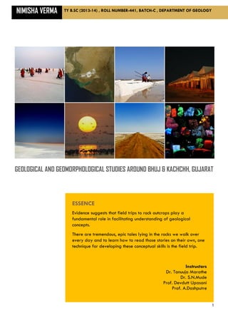
  • 1. NIMISHA VERMA TY B.SC (2013-14) , ROLL NUMBER-441, BATCH-C , DEPARTMENT OF GEOLOGY 1 GEOLOGICAL AND GEOMORPHOLOGICAL STUDIES AROUND BHUJ & KACHCHH, GUJARAT ESSENCE Evidence suggests that field trips to rock outcrops play a fundamental role in facilitating understanding of geological concepts. There are tremendous, epic tales lying in the rocks we walk over every day and to learn how to read those stories on their own, one technique for developing these conceptual skills is the field trip. Instructors Dr. Tanuuja Marathe Dr. S.N.Mude Prof. Devdutt Upasani Prof. A.Dashputre
  • 2. STUDY VISIT REPORT 2 CERTIFICATE This is certify that Miss Nimisha Verma has participated and successfully completed the field visit to parts of Kachchh and Ahmedabad, Gujarat from 6th January 2014 to 15th January 2014 as a part of syllabus of T.Y.B.Sc. Geology laid by the University of Pune for the academic year 2013-14. Tour in-charge: Head of Department: Dr. Tanuuja Marathe Dr. R. N. Mache
  • 3. STUDY VISIT REPORT 3 January 28, 2014 ACKNOWLEDGMENT At the first instance, I would like to acknowledge a deep sense of gratitude to our Principal Dr. Ravindrasinh G. Pardeshi for granting us permission to undertake the study tour. I would also like to thank our Head of Department, Dr. R. N. Mache for his guidance and encouragement during the planning of this study tour. I would like to express my gratefulness to Dr. Tanuuja Marathe, for arranging a geologically fascinating and a very enjoyable field tour which has given us so many good memories, that we will cherish forever. I would also like to thank our teachers Dr. S. N. Mude, Prof. D. V. Upasani and Prof. Ameya Dashputre for their valuable guidance in the field. The discussions we had with them were very helpful to understand the subject better. My special thanks to Dr. Mahesh Thakkar, Head, Department of Earth and Environmental Studies, KSKV Kachchh University for his inputs on stratigraphy and geomorphology of the region. His lecture on ‘The Geology and Tectonics of Kachchh’ gave us a clear picture about the deposition history of the sediments and tectonics of Kachcch basin. I would also like to express my gratitude to Mr. Gaurav Chauhan, for his guidance in planning of the field traverses. My special thanks to Mr. Vanit and Mr. Pravin for accompanying us to the geologically important places around Kachchh and also giving us information on the field during the entire field work. I would thank Mr. Yashvir for arrangement of our logistics. I would like to appreciate the assistance offered by the nonteaching staff of the department, especially Mr. Mangesh Mahade and Mr. Manoj Taware during the fieldwork. Last but not the least; I thank all my classmates for making this study tour one of the most memorable tour of my life. Thanking you, Sincerely, NIMISHA VERMA
  • 4. STUDY VISIT REPORT 4 TABLE OF CONTENTS CERTIFICATE …………………………………………………………………..2 ACKNOWLEDGEMENT …………………………………………………………..3 INTRODUCTION, BENEFITS, ESSENTIAL COMPONENTS FOR RECORDING AND COLLECTING FIELD DATA……………………………………………………..…..5 GEOGRAPHY & GEOMORPHOLOGY OF KACHCHH……………………………6 PREVIUOS WORK LITERETURE…………………………………………………….8 CLIMATE…………………………………………………………………………...9 MESOZOIC STRATIGRAPHY OF KACHCHH-MAINLAND………………………...10 MESOZOIC STRATIGRAPHY OF KACHCHH-PACHHAM ISLAND………………...11 TERTIARY STRATIGRAPHY OF KACHCHH………………………………………..12 DAY1…………………………………………………………………………….13 DAY2…………………………………………………………………………….21 DAY3…………………………………………………………………………….24 DAY4…………………………………………………………………………….27 DAY5…………………………………………………………………………….28 DAY6…………………………………………………………………………….30 CONCLUSION & LIST OF SPECIMEN..…………………………………………...33 REFERENCES....…………………………………………………………………...34
  • 5. STUDY VISIT REPORT 5 INTRODUCTION In geology more than most sciences, field trips are seen as a technique to developing a proper sense of space, scale and time. Lathrop & Ebbett assert that “the essence of field experience is fundamental” both for geology student & for “anyone who is drawn to explore the enormity of earth history that scientific inquiry can reveal” BENEFITS Field experiences are an important part of the life of the geosciences student & professional. Visiting to fields helps students to see fundamental relationships & to learn to observe, collect & interpret data. Field trips often form the social backbone of geosciences departments, bringing students & faculty together to learn. Field trips can be the highlight of an elementary student’s year. Similarly, field trips are an integral part of the professional geoscientists’ ongoing professional development providing opportunities to see new & familiar areas. Other benefits cited by field trip researchers include experience working with maps, diagrams, and field equipments, socialization among colleagues and among students, and the development of a rapport between teachers & students. Additionally, other benefits include a positive attitude toward the science as a general concept & positive attitudes towards specific field trip locations. If we need to conclude the outcome of the field trip, four points emerges out: 1) Field trips are important part of geological learning process. 2) Best geology field trips involve elements of both instructor lead explanation & student centered exploration/discovery. 3) Geology field trips impart an important place beyond simply teaching science concepts. 4) Reviewing the trip afterwards is an important activity for cementing observations & interpretations into a sense of conceptual understanding. If I self assessed, I find improvement in categories i.e. sedimentary rock interpretation, metamorphic rock interpretation, understanding plate tectonics, understanding landscape change and understanding river processes. ESSENTIAL COMPONENTS FOR RECORDING AND COLLECTING FIELD DATA 1) A Geologist’s Hammer 2) Clinometers/Brunton Compass/GPS 3) Toposheet and geological map of the area 4) Camera 5) Haversacks 6) A pair of chisels 7) Field note-book 8) Writing & drawing material 9) Measuring tapes 10)Magnifying lenses 11)Polythene bags & marker pens
  • 6. STUDY VISIT REPORT 6 1 GEOGRAPHY & GEOMORPHOLOGY OF KACHCHH 1.1 LOCATION INFORMATION The Rann of KACHCHH is a seasonally marshy region located in the Thar Desert biogeographic province in Gujarat state of northwestern India and the Sind province of Pakistan. This inhospitable salty lowland, rich in natural gas and a resting site for migratory Siberian birds, is part of India and Pakistan’s ongoing border dispute concerning Sir Creek. The name “Rann” comes from the Hindi word “ran” meaning “salt marsh”. Kachchh is the name of the district wherein it is situated. The Rann of Kachchh comprises some 10,000 square miles (30,000 km2) between the Gulf of Kachchh and the mouth of the Indus River in southern Pakistan. The Luni River, which originates in Rajasthan, empties into the northeast corner of the Rann. Salt pool In India’s summer monsoon, the flat desert of salty clay and mudflats, averaging 15 meters above sea level, fill with standing waters, interspersed with sandy islets of thorny scrub, breeding grounds for some of the largest flocks of Greater and Lesser flamingoes. At its greatest extent, the Gulf of Kachchh on the west (visible in the image directly below the salt marshes) and the Gulf of Cambay on the east (the brown, sediment-tinged body of water on the lower right) are both united during the monsoon. ` FIGURE 1 SATELLITE VIEW OF KACHCHH REGION 1.2 GEOMORPHOLOGY The Kachchh landscape comprises an array of tectonogenic geomorphic elements in the form of uplifts and residual depressions. Elevated landforms are occupied by Mesozoic and Tertiary rocks, whereas the residual depressions or low-lying regions between the uplifts consist of Quaternary sediment successions marked alluvial river terraces in the rocky mainland and the mud-flats and salt pans in the Great and Little Ranns and Banni Plains. Sedimentary rocks ranging in age from Jurassic to Eocene age cover Kachcch region. These sediments have a zone of Deccan trap volcanics sandwiched between
  • 7. STUDY VISIT REPORT 7 Jurassic rocks of the northern part and Eocene sedimentary in the south towards the coast. Limestones, shales and sandstones are the most common rocks. FIGURE 2 GEOLOGICAL MAP OF KACHCHH Both Eocene and Jurassic rocks are fossiliferous. The Eocene rocks are exposed along the southern fringe of the Kachcch peninsula as a thin band bounded by Deccan traps on the north. The northern part of the Kachcch peninsula is covered by Recent marine deposits on which Jurassic rocks form outcrops. The coastal areas have thick alluvial and marine sediments of recent origin. This area seems to be undergoing some marine recession. A major paleo-rift valley lies along the east west direction passing through the Kachcch region. FIGURE 3 GEOLOGICAL MAP OF KACHCHH FIGURE 4 TOURIST MAP OF KACHCHH
  • 8. STUDY VISIT REPORT 8 PREVIOUS WORK LITERATURE Kachchh basin is a pericratonic rift basin in the western margin of India, which has preserved almost a complete sequence of rocks from Triassic to Recent, punctuated by several stratigraphic breaks between transgressive cycles. Mesozoic rocks of Kachchh were first mapped by Wynne (1872) who classified the sequence into upper and lower Jurassic Groups. Waagen (1875) proposed the popular four-fold subdivisions, namely, Pachchham, Chari, Katrol and Umia Series. Rajnath (1932) restricted the term, Umia only to the lower Umia of the Waggen; the upper Umia made up of non-marine beds with plant fossils was called by him as Bhuj Series of Middle Cretaceous or even slightly younger age. Biswas (1977) recognized three main lithologic provinces within the basin and rocks of each province were classified separately (Fig.2.1) and named the units according to their stratotypes (Biswas, 1977). The lithostratigraphic sequence of Mainland is divided into four formations named as the Jhurio (Jhura), Jumara, Jhuran and Bhuj formations (Biswas, 1977, 1987). The first Tertiary classification of the Tertiary sediments of Kachchh was first presented by Wynne (1872). Wynne classified the Tertiary sediments into six groups: 6- Recent-Upper Tertiary 5- Argillaceous Group 4- Arenaceous Group 3- Nummulitic Group 2- Gypseous Shales 1- Sub-Nummulitic Biswas (1965) proposed a new Time-Stratigraphic classification of the Tertiary sediments of Kachchh based on chrono-stratotypes and detailed mapping of the time-rock units. Biostratigraphic zonal schemes were proposed by many palaeontologists. Notable among these are works by Sen Gupta (1964), Pandey (1982) and Samantha and Lahri (1985). The stratigraphy given by Biswas (1992) is the widely accepted stratigraphy today. FIGURE 5 TECTONIC MAP OF KACHCHH 69º 70º 71º 24º 23º 71º 70º 69º 23º 24º N Recent & Pliestocene Deposits Tertiary Deccan Trap Mesozoic Secondary Faults Median High Major Faults Ï Plunging Anticline Dome ÿ Plunging Syncline a M E D I A N H I G H K A T H I A W A R F A U L T A L L A H B U N D F A U L T ? ? M A I N L A N D F A U L T M A I N L A N D PU KU BU CU WAGAD UPLIFT (After Biswas and Deshpande, 1970) 20 0 20 40 60 Kilometers
  • 9. STUDY VISIT REPORT 9 CLIMATE Gujarat lies in the tropical region however its proximity to the Arabian Sea reduces the climate extremes and makes the climate more pleasant, comfortable and healthy. Kachchh region is characterized by arid climate. The Tropic of Cancer passes through Kachchh. The area is far from the rain bringing influence of monsoon. The monsoon prevails for a very short period. Kutch experiences extreme climatic conditions characterized by sweltering summer and scanty rainfall. The winter season is pleasant and mainly a good time to visit. The summer season in Kutch is extremely hot and starts from the month of February and lasts till June. The weather is extremely hot and the temperature can soar up to 48°Celsius. Tourists generally avoid visiting Kutch due to the severe climatic conditions during this time. The Kutch region receives an average rainfall of around 14 inch every year. Though the area faces serious water scarcity, the rainfall helps in lowering the temperature. It also helps in sustaining the agriculture in the area. Compared to the other two seasons, the winter season in Kutch is much better and pleasant. It starts from the month of October and lasts till January with average temperature ranging from 12°Celsius to 25°Celsius. The winter can turn quite chilly when the mercury drops to as low as 2°Celsius sometimes. In spite of that, the winter season is an ideal time to visit Kutch and woolen wear is a must. FIGURE 6 TECTONIC MAP OF KACHCHH
  • 10. STUDY VISIT REPORT 10 MESOZOIC STRATIGRAPHY OF KACHCHH MAINLAND AGE FORMATION MEMBER LITHOLOGY (Lower Cretaceous to Upper Cretaceous) Santonian (Upper Cretaceous) Aptian (Lower Cretaceous) Berriasian-(Lower Cretaceous) BHUJ FORMATION Upper Member Ukra Member Ghuneri Member Huge thickness of non-marine sandstones. Whitish to pale brown, massive, current bedded, coarse Grained, well sorted sandstones with kaolinitic shale and ferruginous band alternations at thick intervals Olive green glauconitic sandstones, green sands, green & grey shales with thin fossiliferous bands of purple iron- stone, ferruginous mudstone and grey limestone Thick beds of red and yellow sandstones alternated by laminated zones comprising ferruginous bands, fissile or laminated sandstones and shales ` Kimmeridgian (Upper Jurassic) to Valanginian (Lower Cretaceous) JHURAN FORMATION Thick sequence of alternating beds of sandstone and shale Callovian (Middle Jurassic) to Oxfordian (Upper Jurassic) JUMARA FORMATION Thick argillaceous formation Bathovian to Callovian (Middle Jurassic) JHURIO FORMATION Thick sequence of limestone & shales with bands of golden oolites.
  • 11. STUDY VISIT REPORT 11 MESOZOIC STRATIGRAPHY OF KACHCHH PACHHAM ISLAND AGE FORMATION MEMBER LITHOLOGY Callovian (Middle Jurassic) GORADONGAR FORMATION Modar Hill Member Raimalro Limestone Gadputa Sandstone Member Goradongar Flagstone Member A sequence of limestone, shale and sandstone Grey coarse grained, massive, current bedded sandstone. Olive grey fossiliferous gypseous shale (Khavda shale) with fossiliferous flagstone, ferruginous limestone bands Grey-yellow, fossiliferous limestone with middle part cherty nodular. Pale brown to pink, massive, current bedded, medium to coarse grained quartz arenite becoming calcareous upwards Thinnly bedded grey & yellow fossiliferous limestones & golden oolitic bands Bathovian (Middle Jurassic) KALADONGAR FORMATION Babia Cliff Sandstone Member Kaladongar Sandstone Member Dingy Hill Member A thick sequence of conglomerate, sandstone and shale Sandstone with olive green fossiliferous siltstone Grey-brown, massive, medium to coarse grained quartz arenite Pink –brown, massive, current bedded sandstone with thin bands and lenses of granite-pebble-conglomerate, interbeds of shale, siltstones and thin fossiliferous calcareous sandstones. Thinly bedded alternations of green- red siltstones and brown-grey, hard, calcareous sandstones.
  • 12. STUDY VISIT REPORT 12 TERTIARY STRATIGRAPHY OF KACHCHH AGE FORMATION MEMBER LITHOLOGY No definite age assigned. Occurrence above middle Miocene strata with a prominent break and from affinity of foraminifera a tentative Pliocene age is assigned. SANDHAN FORMATION . Upper part: - Hard calcareous grits overlain by pink and grey mottled silty sandstone with calcareous nodules. Middle part: - conglomerates and coarse grained sandstones with lenticular bosies of conglomerates. Lower part: -Well sorted, medium to coarse grained, massive, micaceous, quartzite sandstone. Burdigalian (Lower Miocene) CHHASRA FORMATION Upper Siltstone Member. Lower Claystone Member A thick sequence of grey argillaceous beds. Aquintanian (Lower Miocene) KHARI NADI FORMATION Laminated to very thinly bedded red and yellowish mottled to variegated siltstone and very fine grained sandstone with occasional grey and brown gypseous claystone. A bluish grey claystone occurs consistently occurs at the base. Cross bedded, fine grained, micaceous sandstone in middle and few thin fossiliferous marl and limestone bed in upper part. Late Oligocene Early Oligocene MANIYARA FORT FORMATION Bermoti Member Coral Limestone Member Lumpy Clay Member Basal Member A group of bedded, yellow to ochre colored foraminiferal limestones with a basal grayish green glauconitic siltstone overlying the Fulra limestone. Ochre color and green pellets of glauconite in all rock types readily distinguish this formation. Late Middle Eocene FULRA LIMESTONE Limestones: - Fossiliferous micrites, biomicrites, biomicrosparites locally silty. Large saddled to undulated Discocyclina at base. Middle Eocene HARUDI FORMATION Upper part:-Calcareous claystone and siltstone either occasional layers of gypsum and carbonaceous shale. Lower part: - Greenish Grey, splintery shale with yellow limonitic partings. Occasionally concretionary and oolitic limestone bands. Nummulites obustus is the marker bed. Upper member-no definite age. Middle member- Early Eocene. Lower member- Late Paleocene NAREDI FORMATION Ferruginous Claystone Member Assilina Limestone Member. Gypseous Shale Member. Dominantly argillaceous rocks Paleocene MATANOMADH FORMATION Brightly colored rock types with different admixtures of clastics and volcanic material. Red laterite, bauxite, lateritic trap pebble conglomerate, trap wash/wacke, red and yellow ferruginous clays, current bedded tuffaceous sandstones, occasional layers of lignite.
  • 13. Day1, Wednesday STUDY VISIT REPORT 13 LOCATION1: TAPKESHWARI TEMPLE Info: 7-8 km EAST of Bhuj STRATIGHRAPHIC HORIZON: Jhuran Formation (Age: Lower Cretaceous - Upper Jurassic) Bhuj Formation (Age: Lower Cretaceous – Upper Cretaceous) SPOT1 LATITUDE: 23°10'52.9'' NORTH LONGITUDE: 69°40'2.3'' EAST ELEVATION: 192 m above Mean Sea Level Observations:  ROCK TYPE: Sandstone & Shale  COLOUR: Pink & Yellow  Duricrust formed on rocks  Bedding Plane-Horizontal & jointed  Thickness of the sequence (375-850 mts, thickening towards West  Remarks: Reddish brown Iron Deposit were found on the outcrop  The sequence showed the dominance of Infra-littoral environment. FIGURE 7 INFRA-LITTORAL ENVIRONMENT  SKETCH: FIGURE 8 SANDSTONE & SHALE FIGURE 9 NODULES IN THE SNADSTONE FIGURE 10 SANDSTONE BED SANWICHED BETWEEN TWO SHALE BEDS
  • 14. Day1, Wednesday STUDY VISIT REPORT 14 SPOT2 AEOLIAN CAVE LATITUDE: 23°10'49.2'' NORTH LONGITUDE: 69°40'5.4'' EAST ELEVATION: 240 m above Mean Sea Level Observations:  ROCK TYPE: Sandstone (Ferruginous & Calcareous).  COLOUR: Yellow & Brownish red.  BEDDING PLANE PROPERTIES: Horizontal  THICKNESS OF THE SEQUENCE: 400-900 mts, thickening towards West.  SEDIMENTARY STRUCTURE: Herringbone Herringbone cross-stratification is a type of sedimentary structure formed in tidal areas, where the current periodically flows in the opposite direction in tidal areas, which have bidirectional flow; structures are formed with alternating layers of cross-beds dipping in opposite directions that reflect the alternating paleocurrent.  REMARK: The area showed the presence of fluvial to deltaic environment as well as tidal flows. Absence of tabular cross stratification and presence of trough cross stratification was also observed.  SKETCH: FIGURE 11 HERRINGBONE FIGURE 12 AEOLIAN CAVE FIGURE 13 BANDINGS ON THE ROOF OF CAVE FIGURE 14 ENTRANCE OF CAVE
  • 15. Day1, Wednesday STUDY VISIT REPORT 15 SPOT3 PERICRATONIC RIFT BASIN (KACHCHH) LATITUDE: 23°10'53.5'' NORTH LONGITUDE: 69°40'00.8'' EAST ELEVATION: 235 m above Mean Sea Level The word ‘pericratonic means peri-boundary, cratonic-any stable land & rift means no movement after fracturing. Kachcch has been divided into four physiographic divisions. 1- Mountains & Hills 2- Coastal Features 3- Banni Plain (low lying area with vegetation) 4- Rann of Kachcch (Swampy land or salt encrustration) Towards east was Little Rann of Kachcch whereas towards west Great Rann of Kachcch could be observed. ORDER OF SUPERPOSITION & THICKNESS OF BEDS Duricrust (Ferricrete): 253mts Shale Gritty Shale: 240mts Gritty Sandstone Shale Sandstone Shale Sandstone: 192mts FIGURE 15 NODULE FIGURE 16 RIFT BASIN FIGURE 17 BASIN TOP FIGURE 18 TOP VIEW FROM THE BASIN FIGURE 19 ROADSIDE VIEW FROM THE TOP OF THE BASIN
  • 16. Day1, Wednesday STUDY VISIT REPORT 16 SPOT4 TRACE FOSSILS LATITUDE: 23°10'52.2'' NORTH LONGITUDE: 69°39'59.4'' EAST ELEVATION: 253 m above Mean Sea Level Observations:  ROCK TYPE: Sandstone & Shale  COLOUR: Yellowish Brown Trace fossil, Skolithos along with vertical burrows were observed. SKOLITHOS: Skolithos ichnofossils are trace fossils (ichnos is Greek for footprint). They are evidence of faunal activity as opposed to regular fossils, which consist of molds or casts of skeletal components or body impressions. A trace fossil is a sedimentologic or lithologic impression attributed to activity of an animal or plant. Ichnofossils are divided into categories according to the type of activity indicated; locomotion (Repichnia), resting (Cubichnia), dwelling (Domichnia), feeding (Fodinichnia) and grazing (Pascichnia). Skolithos ichnofossils are of the dwelling, or Domichnia type, which can include burrows, borings, or other imprint type indications. The primary use of trace fossils is in the interpretation of the paleoenvironment. An ichnofacies is a group of ichnofossils distributed over a wide enough area to characterize the environment. Ichnofacies are distinguished in type by their predominance in fresh or salt water and in their distance from the shoreline or littoral. The Skolithos ichnofacies are characteristic of soft intertidal or shallow sub tidal marine environments. FIGURE 20 DIAGRAM OF SKOLITHOS (WWW.GEOLOGY.COM) FIGURE 21 BURROWS FIGURE 22 BURROW OF SKOLITHOS FIGURE 23 BURROWS FIGURE 24 BURROWS
  • 17. Day1, Wednesday STUDY VISIT REPORT 17 LOCATION2: KRANTIGURU SHYAMJI KRISHNA VERMA KACHCHH UNIVERSITY Lecture delivered by Dr.M.G.Thakkar Time: 12:15 pm Topic: “General Geology & Geomorphic Indicators of Faults in Kachcch” Topic: General Geology & Geomorphic Indicators of Faults in Kachchh An eminent personality in the field of Geology, Dr. M.G. Thakkar gave an influencing lecture on the evolution of Kachchh. As per the details provided by Mr. Thakkar, we learned the entire geology of Kachchh. He emphasized on following points: Geology of Kachchh starts with Badjotian. It is 170 million years old. Its pediment zones with alluvial fans are concentrated near the hills. During Jurassic it has been regarded as an open Embiment system i.e, half-graben basin. Later research says that Kachchh leads to the study of strike-slip tectonics. The three main uplifts in Kachchh are: 1- Kachchh mainland 2- Waghad Uplift (WU) 3- Island Belt Uplift The young geomorphic indicators are as follows: 1- Scarps 2- Displaced alluvial & colluvial fans 3- Deep Valleys 4- Gorges 5- Pressure ridges 6- Unusual meanders 7- Slope change of terrain 8- River rejuvenation 9- Displaces quaternary units 10-Defunct river channels. The present landscape of Kachchh is Quaternary. Entire Kachchh dips towards South with an angle of 10° but if the dip-angle is 60-70 deg then we can say that we are near the major fault line.
  • 18. Day1, Wednesday STUDY VISIT REPORT 18 LOCATION3: KHARI NADI GORGE SPOT1 KHARI NADI LATITUDE: 23°15'14'' NORTH LONGITUDE: 69°37'50'' EAST ELEVATION: 82 m above Mean Sea Level Observations:  ROCK TYPE: Sandstone  COLOUR: Yellowish Brown  STRATIGHRAPHIC HORIZON: Bhuj Formation  TREND OF THE RIVER: NE-SW at present location  AGE OF THE RIVER: 18000-20000 Years  RIVER TERRACE TYPE: Tectono-Erosional GORGE A gorge is a deep ravine between pairs of cliffs and is most often carved from the landscape by the erosive activity of a river over geologic timescales. Rivers have a natural tendency to cut through underlying surfaces so will eventually wear away rock layers to lessen their own pitch slowing their waters; given enough time, their bottoms will gradually reach a baseline elevation—which is the same elevation as the body of water it will eventually drain into. This action, when the river source and mouth are at much different base elevations will form a canyon,[1] particularly through regions where softer rock layers are intermingled with harder layers more resistant to weathering. Significance: Gorge is an indicator of Neotectonic activity in the region. Potholes & elongated grooves were observed that indicated the torrential flow.  SKETCH: FIGURE 25 GORGE AT KHARI NADI FIGURE 26 BEDDINGS IN THE GORGE FIGURE 27 GORGE INTERIOR FIGURE 28 GORGE INTERIOR
  • 19. Day1, Wednesday STUDY VISIT REPORT 19 SPOT2 MEGA CROSS BEDDING LATITUDE: 23°15'0.3'' NORTH LONGITUDE: 69°37'48'' EAST ELEVATION: 82 m above Mean Sea Level Observations:  ROCK TYPE: Sandstone  STRATIGHRAPHIC HORIZON: Bhuj Formation  COLOUR: Yellowish Brown  BEDDING PLANE PROPERTIES: Syn- Depositional inclined beds.  CALCAREOUS SILICEOUS: Calcareous cement  FOSSILS: Burrow tubes found  REMARK: The steps present in the area were indicating the presence of rapids in the area. Rapids are sections of a river where the river bed has a relatively steep gradient, causing an increase in water velocity and turbulence. FIGURE 29 WATER TURBULENCE (WWW.PANAROMIA.COM) Rapids are hydrological features between a run (a smoothly flowing part of a stream) and a cascade. Rapids are characterized by the river becoming shallower with some rocks exposed above the flow surface. As flowing water splashes over and around the rocks, air bubbles become mixed in with it and portions of the surface acquire a white color, forming what is called "whitewater". Rapids occur where the bed material is highly resistant to the erosive power of the stream in comparison with the bed downstream of the rapids. Mega cross bedding occurs either due to Deltaic environment or by big aelion dunes but at present spot it occurred due to the prevalence of deltaic environment. FIGURE 30 MEGA CROSS BEDING IN SANDSTONE The burrow tubes were indicative of low energy & bioturbation. FIGURE 31 BURROW TUBES FIGURE 32 BURROW TUBES  SKETCH:
  • 20. Day1, Wednesday STUDY VISIT REPORT 20 LOCATION4: KODKI FAULT Info: 7-8 km EAST of Bhuj LATITUDE: 23°14'35.7'' NORTH LONGITUDE: 69°34'59.5'' EAST ELEVATION: 130 m above Mean Sea Level Observations:  ROCK TYPE: Shale, Sandstone  COLOUR: Yellowish Brown  BEDDING PLANE PROPERTIES: Inclined Beds  ATTITUDE OF BEDS: STRIKE DIP 25°-215° 50°/115° 30°-210° 44°/110°  SKETCH: FIGURE 33 FAULTING IN SHALE AND SANDSTONE FIGURE 34 FLOWAGE OF SHALE DUE TO SHEARING FIGURE 35 FAULTING ON THE ROADSIDE FIGURE 36 DOLERITE DYKES INTRUDING SANSTONE FIGURE 37 NODULE IN SANDSTONE
  • 21. Day 2, Thursday STUDY VISIT REPORT 21 LOCATION1: NEAR J P CEMENT MINES, HARUDI VILLAGE LATITUDE: 23°29'9.8'' NORTH LONGITUDE: 68°41'33.1'' EAST ELEVATION: 49 m above Mean Sea Level Observations:  ROCK TYPE: Limestone, fossiliferous-micrites & biomicrites, ferricretes, somewhere argillaceous bands found  STRATIGHRAPHIC HORIZON: Fulra Formation  COLOUR: Yellowish, White  BEDDING PLANE PROPERTIES: Horizontal beds.  CALCAREOUS SILICEOUS: Calcareous cement  FOSSILS: Nummulites, Gastropods, Pecten, Trochus, Biomicrosparites dominated by foraminifers (Discocyclina) FIGURE 35 TURRITELLA (WWW.SCIENCE.COM)  SKETCH: FIGURE 36 NUMMULITIC LIMESTONE FIGURE 37 OUTCROP SHOWING FULRA FORMATION FIGURE 38 FARVIEW OF FULRA OUTCROP FIGURE 39 FOSSILIFERROUS LIMESTONE SEEN IN FULRA FORMATION
  • 22. Day 2, Thursday STUDY VISIT REPORT 22 LOCATION2: FERRICRETE HORIZON LATITUDE: 23°31'36.1'' NORTH LONGITUDE: 68°41'7.2'' EAST ELEVATION: 78 m above Mean Sea Level Observations:  ROCK TYPE: Lower part was composed of shale with limonitic limestone. Upper part was composed of carbonaceous & gypsy ferrous sandstone  STRATIGHRAPHIC HORIZON: Harudi Formation  COLOUR: Yellowish, Brown  BEDDING PLANE PROPERTIES: Horizontal beds.  FOSSILS: Burrows found BURROWS: A burrow is a hole or tunnel excavated into the ground by an animal to create a space suitable for habitation, temporary refuge, or as a byproduct of locomotion.  SKETCH: FIGURE 40 BURROWS PRESERVED IN HARUDI FORMATION FIGURE 41 FERRICRETE HORIZON FIGURE 42 BURROWS FOUND IN SANDSTONE FIGURE 43 BURROWS IN FERRICRETE ZONE
  • 23. Day 2, Thursday STUDY VISIT REPORT 23 LOCATION3: RIVER SECTION LATITUDE: 23°34'34.9'' NORTH LONGITUDE: 68°38'38.3'' EAST ELEVATION: 60 m above Mean Sea Level Observations:  ROCK TYPE: Upper claystone member (80% clay, 20% sandstone), Acidilina limestone member, Gypseous Shale member (Olive green shale with glauconite)  STRATIGHRAPHIC HORIZON: Naredi Formation  COLOUR: Brown  BEDDING PLANE PROPERTIES: Horizontal beds.  FOSSILS: Gastropods, Lamellibranches. BURROWS: A burrow is a hole or tunnel excavated into the ground by an animal to create a space suitable for habitation, temporary refuge, or as a byproduct of locomotion. FIGURE 44 GYPSEFERROUS SHALE FIGURE 45 GYPSUM HORIZON LOCATION4: KORI CREEK ON NARAYAN SAROVAR ROAD LATITUDE: 23°40'25.3'' NORTH LONGITUDE: 68°32'44'' EAST ELEVATION: 18 m above Mean Sea Level Observations:  ROCK TYPE: Limestone,(nummulitic, micritic & sparitic) which was marshy yellow, Glauconitic limestone, Marl (clay+limestone)  STRATIGHRAPHIC HORIZON: Maniyara Formation  COLOUR: Yellow  BEDDING PLANE PROPERTIES: Horizontal beds.  FOSSILS: Ichnofossils found in marl beds  REMARK: Kori creek represented the contact between marl & limestone. FIGURE 46 CONTACT BETWEEN MARL AND LIMESTONE FIGURE 47 BURROWS FOUND IN MARL BED
  • 24. Day 3, Friday STUDY VISIT REPORT 24 LOCATION1: DYKE CUTTING JUMARA FORMATION Info: 10 km away from Hajipur Village LATITUDE: 23°36'51.5'' NORTH LONGITUDE: 69°9'48.1'' EAST ELEVATION: 29 m above Mean Sea Level Observations:  ROCK TYPE: Dolerite (Pyroxene dominated mafic rock containing plagioclase & augite)  STRATIGRAPHIC HORIZON: Jumara Formation  ATTITUDE OF DYKE: 1) Trend of Dyke On left hand side E90°-W270°, E92°-W268° On right hand side E72°-W252°, E75°-W248° 2) Dip direction: 165°N-S15°W 3) Dip amount: 45° 4) Thickness of Dyke: 5mts  REMARK: The dyke present on either side of the road has been cut by the road. The road acted as a strike-slip fault with dextral movement. The trend of the fault (road) was noted to be NE-SW.  SKETCH: FIGURE 48 DOLERITE DYKE (LEFT HAND SIDE EXPOSURE) FIGURE 49 DOLERITE DYKE (LEFT HAND SIDE EXPOSURE) FIGURE 50 DOLERITE DYKE (RIGHT HAND SIDE EXPOSURE) FIGURE 51 DOLERITE DYKE (LEFT HAND SIDE EXPOSURE)
  • 25. Day 3, Friday STUDY VISIT REPORT 25 LOCATION2: JUMARA DOME SPOT1 Jumara Dome Info: 3 km away from Jumara Village LATITUDE: 23°41'27.6'' NORTH LONGITUDE: 69°4'10.1'' EAST ELEVATION: 28mts above Mean Sea Level Observations:  ROCK TYPE: Cherty-Limestone (Upper Jhurio)  STRATIGHRAPHIC HORIZON: Jumara village type section  COLOUR: Yellowish  THICKNESS OF SEQUENCE: 325mts (Jhurio)  FOSSIL: Dhosa-oolite in upper Jumara formation was found, the age being Callovian  REMARK: Jumara dome was 100 ft high. It is in its mature stage. Chronostratigraphic classification of Kachcch Lithostratigraphic classification of Kachcch Umiya (middleTethonian- Neocomian) Deccan Traps Katrol (Middle CallovianLlower Tethonian) Bhuj (Neocomian- Santonian) Chaari (Middle Callovian) Jhuran (Argovian- Neocomian) Pachcham Lower Callovian) Jumara (Callovian- Oxfordian) Jhurio (Upper Bathovian- Callovian) FIGURE 52 JUMARA DOME SPOT2 Coralline Limestone LATITUDE: 23°41'27.6'' NORTH LONGITUDE: 69°4'10.1'' EAST ELEVATION: 28mts above Mean Sea Level Observations:  ROCK TYPE: Coralline Limestone (Middle Jhurio)  STRATIGHRAPHIC HORIZON: Jumara formation  COLOUR: Grayish White Corals are colonies of pyropes (multicellular organism without tentacles). They are indicative of tropic-subtropic environment. They are deposit feeders. Age of corals is middle Triassic recent. In all 62 types of corals are found. Some of them are as follows: 1- Montlivalitia 2- Pseudosenia 3- Trochosmilia FIGURE 53 CORALS FOUND NEAR JUMARA DOME SPOT3 KMF-SCARP Observations:  ROCK TYPE: Sandstone KMF stands for Kachcch mainland fault. KMF-Scrap is the contact of Jhurio & Pachcham. The upper one is Jhurio formation beneath which lies the Pachcham formation.
  • 26. Day 3, Friday STUDY VISIT REPORT 26 LOCATION3: TRIGONIA BED LATITUDE: 23°47'3.4'' NORTH LONGITUDE: 68°51'10.1'' EAST ELEVATION: 30 m above Mean Sea Level Observations:  ROCK TYPE: Calcareous Sandstone  STRATIGHRAPHIC HORIZON: Trigonia part of Umia series  AGE: Valangian  THICKNESS OF SEQUENCE: 325mts (Jhurio)  FOSSIL: Dhosa-oolite in upper Jumara formation was found, the age being Callovian  CLASSIFICATION: Kingdom-Animalia Phyllum-Mollusca Class-Bivalve Order-Trigonidae Genus-Trigonia  REMARK: Trigonia is the marker-bed that shows marine-transgression. It marks the boundary between Jurassic & Valangian. Now it has been well preserved in the outcrop shown.Though trigonia is extinct now, two of its genres viz Steingnella & Herzigona were found.  SKETCH: FIGURE 54 TRIGONIA PART (UMIA SERIES) FIGURE 55 FOSSILS EMBEDDED IN TRIGONIA BED FIGURE 56 TRIGONIA EMBEDDED IN CALCAREOUS SANDSTONE FIGURE 57 FOSSILIFERROUS TRIGONIA BED
  • 27. Day 4, Saturday STUDY VISIT REPORT 27 LOCATION1: HABO HILL Info: 16 km from E-W, 6 km from N-S) LATITUDE: 23°22'34.6'' NORTH LONGITUDE: 69°50'27.4'' EAST ELEVATION: 50 mts above Mean Sea Level Observations:  ROCK TYPE: Gabbro, Calcareous Sandstone  STRATIGHRAPHIC HORIZON: Jhurio & Jumara  COLOUR: Blackish-Green  BEDDING PLANE PROPERTIES: Inclined Beds  Height of Habo Hills: 974 ft  ATTITUDE OF BEDS: STRIKE DIP 85°-275° 23°/15° 20°-340° 18°/254° 30°-90° 21°/26°  FOSSIL: 1- Dhosa-oolite (upper Jumara) 2- Golden-oolite (bathovian-callovian) Habo dome approximately 20m high standing on a Laccolith made of Gabbro was observed. Cooling cracks were observed in Gabbro (augite+plagioclase). Laccolith is a sheet like intrusion which is convex upwards. Habo is divided into five members: 1- Lodai member 2- Rudramata member 3- Zhikadi member 4- Drung member 5- Black limestone member FIGURE 58 LACOLITH FOUND IN HABO HILL LOCATION2: PACHCHAM ISLAND LATITUDE: 23°56'10.2'' NORTH LONGITUDE: 69°48'52.6'' EAST ELEVATION: 496 mts above Mean Sea Level Observations:  ROCK TYPE: Sandstone, Carbonates, Limestone, Shale stone  STRATIGHRAPHIC HORIZON: Kaladongar Formation  REMARK: Kaladongar hill is the highest peak of elevation 462-465 mts in Kachcch. It resulted in due to the buffering effect of Island Bela fault (IBF) FIGURE 59 KALADONGAR FIGURE 60 HIGHEST PEAK IN KACHCHH- KALADONGAR  SKETCH:
  • 28. Day 5, Sunday STUDY VISIT REPORT 28 LOCATION1: KODAKI VILLAGE NEAR GANGAJI TEMPLE SPOT1 Columnar joints in Sandstone LATITUDE: 23°13'51.9'' NORTH LONGITUDE: 69°33'28'' EAST ELEVATION: 170mts above Mean Sea Level Observations:  ROCK TYPE: Sandstone  STRATIGHRAPHIC HORIZON: Bhuj Formation COLUMNAR JOINTS: Joints are fractures in rocks, and columnar joints are a specific type of joint pattern. Columnar joints contain aspects of both petrology and structural geology, but the discussion will address only the structural aspect. Columnar joints are defined as parallel, prismatic columns in basaltic flows and sometimes other rocks, and this specific pattern is a result of cooling. The columns are normally found in shallow intrusive or extrusive igneous rock bodies, generally, basaltic, sills, dikes and lava flows. The columnar fractures are a result of the cooling process. The basalt cools rapidly from the outside toward the center, causing shrinkage cracks to form, commonly, in a hexagonal pattern. Types of columnar joints are: 1- Colonnade Joints: 2- Entablature Joints: REMARK: Jumara dome was 100 ft high. It is in its mature stage. FIGURE 61 COLUMNAR JOINTS IN SANDSTONE SPOT2 Doleritic Dyke LATITUDE: 23°13'51.9'' NORTH LONGITUDE: 69°33'28'' EAST ELEVATION: 151mts above Mean Sea Level Observations:  ROCK TYPE: Sandstone  STRATIGHRAPHIC HORIZON: Bhuj Formation  COLOUR: Brownish-Yellow  ATTITUDE OF DYKE: 1- Trend of dyke: NW-SE 2- Strike of Dyke: N14° E  REMARK: The dyke was eroded from one side & remained completely intact on the side of the road. Contact metamorphism had occurred on the outcrop during the geological past which gave the present day topography to it. FIGURE 62 DYKE ON RIGHT HAND SIDE OF THE ROAD BENEATH GANGAJI TEMPLE (COMPLETELY ERODED) FIGURE 63 DYKE ON LEFT HAND SIDE OF THE ROAD BENEATH GANGAJI TEMPLE (REMAINED UNERODED)
  • 29. Day 5, Sunday STUDY VISIT REPORT 29 LOCATION2: DINODHAR HILL LATITUDE: 23°27'18.5'' NORTH LONGITUDE: 69°21'9.6'' EAST ELEVATION: 173 mts above Mean Sea Level Observations:  ROCK TYPE: Sandstone & Shale  STRATIGHRAPHIC HORIZON: Jhuran Formation  REMARK: A volcanic vent with lithology as alkali olivine basalt, showing columnar structure, intruding the Jhuran formation was observed in the area. The age of the vent was 65-69 millions years. Dinodar hill was along the KMF (Kachcch Mainland Fault). VOLCANO VENT: Vents are openings in the Earth's crust from which magma and volcanic gases escape onto the ground or into the atmosphere. Vents may consist of a single, circular-shaped structure, a large elongated fissure and fracture, or a tiny ground crack. The release of volcanic gases and the eruption of molten rock result in a wide assortment of edifices, ranging from enormous shield volcanoes and calderas to fumaroles and small hornitos. FIGURE 64 VOLCANIC VENT WWW.PBS.ORG FIGURE 65 DIAGRAM OF VOLCANIC VENT WWW.PBS.ORG FIGURE 66 DINODHAR HILL FIGURE 67 DINODHAR HILL FIGURE 68 DINODHAR HILL FIGURE 69 VOLCANIC VENT IN DINODHAR HILL
  • 30. Day 6, Monday STUDY VISIT REPORT 30 INDRODA FOSSIL PARK Indroda Dinosaur and Fossil Park is a precious treasure spread over an area of about 400 hectares on either bank of Sabarmati River in Gandhinagar, the capital of Gujarat. It is considered to be the second largest hatchery of dinosaur eggs in the world. Regarded as India's Jurassic Park, it is run by the Gujarat Ecological Education and Research Foundation (GEER), and is the only dinosaur museum in the country. The park consists of a zoo, massive skeletons of sea mammals like the blue whale, as well as a vast botanical garden, amphitheatre, interpretation center and camping facilities. It also has a Wilderness Park which is home to innumerable species of birds, reptiles, hundreds of nilgais, langurs and pea fowls in its vast forest. FIGURE 70 ENTRANCE OF DINASAUR FOSSIL PARK IMPORTANCE OF THE DINASAUR FOSSIL Fossils are among the most valuable sources of information about the Earth's history. They tell us about the organisms that lived on Earth from the time of the oldest fossils, about 3.8 billion years ago, to the present. By studying fossils we can learn not only about the creatures and plants of the distant past, but how they grew, what they ate, how they interacted, and many aspects of their behavior. FIGURE 71 DINOSAUR FOSSIL (WWW.STAFF.OLYMPIA.ORG) Fossils reveal many fascinating facts about the past, but they do a lot more. Fossils are one of the most useful aids to finding oil, because oil tends to accumulate in the pores of particular rock layers. Rocks of different ages contain different fossils. Study of microscopic fossils brought up in chips of rock during drilling of wells has led to many major oil and gas discoveries. Also, the oil itself is derived from fossil remains of ancient organisms. Study of fossils has led to important new understanding about how life evolved on earth and about diseases, both ancient and modern. Fossils also help us understand past climates, including ice ages and periods that were warmer than our present climate. Knowledge from the study of fossils is helping geoscientists understand global warming and its effects. By studying the catastrophic extinction of the dinosaurs and many other life forms at the end of the Cretaceous Period, geoscientists have gained insight into the evolutionary implications of impacts by extraterrestrial objects. Investigating the physical and chemical characteristics of fossil organisms that lived during times of drastic climatic change helps us understand the implications of the changes we are making in our own environment. FIGURE 72 MEGALOSAURUS AT INDRODA FOSSIL PARK FIGURE 73 MODEL OF MEGALOSAURUS AT INDRODA FOSSIL PARK
  • 31. Day 6, Monday STUDY VISIT REPORT 31 VARIETIES OF DINOSAUR SPECIES FOUND STEGOSAURUS FIGURE 74 MODEL OF STEGO SAURUS AT INDRODA FOSSIL PARK Stegosaurus meaning "roof lizard" or "covered lizard" in reference to its bony plates is a genus of armored stegosaurid dinosaur. They lived during the Late Jurassic period. A large, heavily built, herbivorous quadruped, Stegosaurus had a distinctive and unusual posture, with a heavily rounded back, short forelimbs, head held low to the ground and a stiffened tail held high in the air. Its array of plates and spikes has been the subject of much speculation. The spikes were most likely used for defense, while the plates have also been proposed as a defensive mechanism, as well as having display and thermoregulatory functions. Stegosaurus had a relatively low brain-to-body mass ratio. It had a short neck and small head, meaning it most likely ate low-lying bushes and shrubs. ALLOSAURUS FIGURE 75 MODEL OF ALLOSAURUS AT INDRODA FOSSIL PARK The name "Allosaurus" means "different lizard". Allosaurus was a large bipedal predator. Its skull was large and equipped with dozens of large, sharp teeth. It averaged 8.5 m (28 ft) in length, though fragmentary remains suggest it could have reached over 12 m (39 ft). Relative to the large and powerful hind limbs, its three-fingered forelimbs were small, and the body was balanced by a long and heavily muscled tail. It is classified as an allosaurid, a type of carnosaurian theropod dinosaur. DENONYCHUS FIGURE 76 MODEL OF DENONYCHUS AT INDRODA FOSSIL PARK Deinonychus is a genus of carnivorous dromaeosaurid ceolurosaurian dinosaurs. There is one described species, Deinonychus antirrhopus. This species, which could grow up to 3.4 meters (11 ft) long, lived during the early Cretaceous Period, about 115–108 million years ago. Based on the largest known specimens, Deinonychus could reach at least 3.4 meters (11 ft 2 in) in length, with a skull length of 410 mm (16.1 in), a hip height of 0.87 meters (2 ft 10 in), and an estimated weight of 73 kilograms (161 lb). [3] The skull was equipped with powerful jaws lined with around seventy curved, blade-like teeth. MEGALOSAURUS Megalosaurus was one of the primary dinosaurs to be described. Megalosaurus have a compa- ratively large head and the teeth were clearly that of carnivore. However, the longFIGURE 77 MODEL OF MEGALOSAURUS AT INDRODA FOSSIL PARK
  • 32. STUDY VISIT REPORT 32 tail would have balanced the body and head and so Megalosaurus is now restored as a bipedal beast like all other theropods, and about nine meters in length. The structure of the cervical vertebrae suggests that its neck would have been very supple. To support its weight of around one tonne, the legs were large and muscular. Like all theropods, it had three onward facing toes and a single reversed one. Although they had not reached the minuscule size of later theropods like Tyrannosaurus, Megalosaurus arms were small and almost certainly had three or four fingers. TYRANNOSAURUS FIGURE 78 MODEL OF TYRANNOSAURUS AT INDRODA FOSSIL PARK Tyrannosaurus rex was one of the largest meat- eating dinosaurs that ever lived. Everything about this ferocious predator, from its thick, heavy skull to its 4-foot-long (1.2-meter-long) jaw, was designed for maximum bone-crushing action. Fossil evidence shows that Tyrannosaurus was about 40 feet (12 meters) long and about 15 to 20 feet (4.6 to 6 meters) tall. Its strong thighs and long, powerful tail helped it move quickly, and its massive 5-foot-long (1.5-meter-long) skull could bore into prey. T. rex's serrated, conical teeth were most likely used to pierce and grip flesh, which it then ripped away with its brawny neck muscles. Its two-fingered forearms could probably seize prey, but they were too short to reach its mouth. RAJASAURUS NARMADENSIS A stocky, carnivorous dinosaur with an unusual head crest has been identified from bones collected in India. American and Indian scientists, working with support from the National Geographic Society, have named the animal Rajasaurus narmadensis. FIGURE 79 MODEL OF RAJASAURUS AT INDRODA FOSSIL PARK IGUANODON FIGURE 80 MODEL OF IGUANODON AT INDRODA FOSSIL PARK Iguanodon was a plant-eating dinosaur that had a conical spike on each thumb. This 30-foot-long dinosaur lived during the early Cretaceous period, about 135 to 125 million years ago. Iguanodon was a dinosaur that had a horny, toothless beak and tightly-packed cheek teeth. On each hand, Iguanodon had four fingers plus a conical thumb spike on each hand (that was perpendicular to the other fingers). The thumb spikes may have been used for defense or in obtaining food; it ranged from 2 to 6 inches long.
  • 33. STUDY VISIT REPORT 33 CONCLUSION This field trip was an unforgettable experience for all of us & it was the last of this course. The trip gave us the opportunity to see the rocks, unconformity, volcanic plug, sheeting joints, dykes, potholes etc, and allow us to practice what we have learned in the Laboratory. The traverse around Kachchh region proved to be very advantageous to understand the various aspects of Stratigraphy. Moreover, the field trip allows us to explore our interest in Geology by learning more about the science. Now we are more familiar with the subject. Overall, the field trip was extremely positive. As a part of the Geology course program, which aim to give the students an understanding of the structure of the Earth, physical and chemical processes that occur within it, how these processes have given rise to present form through geological time, and how they affect human lives, the field trip can be described as educational, inspirational & good experience for all of us. LIST OF SPECIMEN 1. Echinodermata 2. Lamellibranch 3. Gastropods 4. Gypsum 5. Piece of trigonia bed 6. Corals
  • 34. STUDY VISIT REPORT 34 REFERENCES  Biswas, S. K. (1965);A new classification on the Tertiary rocks of Kutch, Western India. Bulletin of the Geological, Mining and Metallurgical Society of India, 35, pp. 1–6  Biswas, S.K. (1977); Mesozoic rock-stratigraphy of Kutch. Quarterly Journal of the Geological Mining and Metallurgical Society of India, 49(3 & 4), pp. 1-52  Biswas, S.K. (1987); Regional tectonic framework, structure and evolution of the western margin basins in India,Tectonophysics, 135, pp.307-327  Biswas, S. K. (1992), Tertiary Stratigraphy of Kutch, The Palaeontological Society of India, 37, pp. 1– 29  Pandey J. (1982); Chronostratigraphic correlation of the Neogenesedimentaries of Western Indian Shelf, Himalaya and Upper Assam, Special Publication Palaeontological Society of India, 1, pp. 95-129  Rajnath (1932); A contribution to the stratigraphy of Cutch,Quarterly Journal of the Geological, Mineralogical and Metallurgical Society of India, 4(4), pp. 161-174  Sengupta B.K. (1963); Tertiary Biostratigraphy of a part of Northwestern Kutch, Journal Geological Society of India, 5, pp. 138-150  Waagen, W. (1875); Jurassic fauna of Kutch, PalaeontologiaIndica.Geological Survey of India, Memoir, 9(1), pp. 247  Wynne, A.B. (1872); Memoir on the Geology of Kutch, Memoir Geological Survey of India, 19 (2), pp. 269