Download as PDF, PPTX


![GEOS
• Geometry Engine Open Source
In [3] from django.contrib.gis.geos import *
In [4]: point = GEOSGeometry('Point(0 10)')
In [5]: point.coords
Out[5]: (0.0, 10.0)
Friday, August 26, 2011](https://image.slidesharecdn.com/it-gam-geodjango-110826065055-phpapp02/85/GeoDjango-in-a-nutshell-19-320.jpg)
![In [7]: coords = ((0, 0), (0, 10), (10, 13), (0, 0))
In [8]: polygon = Polygon(coords)
In [9]: mpolygon = MultiPolygon(polygon)
Friday, August 26, 2011](https://image.slidesharecdn.com/it-gam-geodjango-110826065055-phpapp02/85/GeoDjango-in-a-nutshell-20-320.jpg)
![In [33]: polygon.wkt
Out[33]: 'POLYGON ((0.0000000000000000 0.0000000000000000,
0.0000000000000000 10.0000000000000000, 10.0000000000000000 13.0000000000000000,
0.0000000000000000 0.0000000000000000))'
In [34]: polygon.contains(Point(11, 12))
Out[34]: False
In [35]: polygon.json
Out[35]: '{ "type": "Polygon", "coordinates":
[ [ [ 0.000000, 0.000000 ], [ 0.000000, 10.000000 ],
[ 10.000000, 13.000000 ], [ 0.000000, 0.000000 ] ] ] }'
In [36]: polygon.kml
Out[36]: '<Polygon><outerBoundaryIs><LinearRing>
<coordinates>0.0,0.0,0 0.0,10.0,0 10.0,13.0,0 0.0,0.0,0</coordinates>
</LinearRing></outerBoundaryIs></Polygon>'
Friday, August 26, 2011](https://image.slidesharecdn.com/it-gam-geodjango-110826065055-phpapp02/85/GeoDjango-in-a-nutshell-21-320.jpg)
![GDAL
Geospatial Data Abstraction Library
In [2]: from django.contrib.gis.gdal import *
...
In [28]: k = DataSource('data/ukraine_administrative.shp')
In [29]: layer = k[0]
In [30]: layer
Out[30]: <django.contrib.gis.gdal.layer.Layer object at
0x10325f990>
In [31]: len(layer)
Out[31]: 9976
In [32]: layer.fields
Out[32]: ['NAME', 'ADMIN_LEVE']
Friday, August 26, 2011](https://image.slidesharecdn.com/it-gam-geodjango-110826065055-phpapp02/85/GeoDjango-in-a-nutshell-22-320.jpg)
![You can transform coordinates from one projection to
another
In [37]: s = SpatialReference(4326)
In [39]: k = GEOSGeometry('Point(10 10)', s)
In [40]: k.transform(900913)
Friday, August 26, 2011](https://image.slidesharecdn.com/it-gam-geodjango-110826065055-phpapp02/85/GeoDjango-in-a-nutshell-23-320.jpg)
![GeoIP
IP-based Geolocation binding to MaxMind
In [1]: from django.contrib.gis.utils import GeoIP
In [2]: g = GeoIP()
In [6]: g.country('it-jam.ciklum.net')
Out[6]: {'country_name': 'Ukraine', 'country_code': 'UA'}
In [7]: g.city('it-jam.ciklum.net')
Out[7]: {'city': None, 'region': None, 'area_code': 0, 'longitude': 32.0, 'country_code3': 'UKR',
'latitude': 49.0, 'postal_code': None, 'dma_code': 0, 'country_code': 'UA', 'country_name':
'Ukraine'}
In [8]: g.geos('it-jam.ciklum.net')
Out[8]: <Point object at 0x103482fd0>
In [9]: g.geos('it-jam.ciklum.net').coords
Out[9]: (32.0, 49.0)
Friday, August 26, 2011](https://image.slidesharecdn.com/it-gam-geodjango-110826065055-phpapp02/85/GeoDjango-in-a-nutshell-24-320.jpg)


![Example
In[8]: pnt = Point(40.187953, 49.9658546)
In[9]: Administrative.objects.get
(geodata__contains=pnt)
Out[10]: <Administrative: 9976>
Friday, August 26, 2011](https://image.slidesharecdn.com/it-gam-geodjango-110826065055-phpapp02/85/GeoDjango-in-a-nutshell-31-320.jpg)

![Distance, D
In [1]: from django.contrib.gis.measure import D
In [2]: dist = D(km=500)
In [3]: dist.mi
Out[3]: 310.68559611866698
In [4]: dist.rod
Out[4]: 99419.390757973422
Friday, August 26, 2011](https://image.slidesharecdn.com/it-gam-geodjango-110826065055-phpapp02/85/GeoDjango-in-a-nutshell-33-320.jpg)
![Area, A
In [1]: from django.contrib.gis.measure import A
In [2]: a = A(sq_m = 10)
In [3]: a.sq_km
Out[3]: 1.0000000000000001e-05
In [4]: a.sq_rod
Out[4]: 0.39536861034746451
Friday, August 26, 2011](https://image.slidesharecdn.com/it-gam-geodjango-110826065055-phpapp02/85/GeoDjango-in-a-nutshell-34-320.jpg)
![Distance queries*
In [10]: Checkin.objects.filter(geodata__distance_gte=(pnt, 7000))
Out[10]: [<Checkin: Ресторан «Домашня Кухня»>, <Checkin:
Великий Вiз>, <Checkin: Ресторан «Домашня Кухня»>,
<Checkin: Станція швидкісного трамвая "Польова">, <Checkin:
НТУУ "КПИ", корпус 7>]
Friday, August 26, 2011](https://image.slidesharecdn.com/it-gam-geodjango-110826065055-phpapp02/85/GeoDjango-in-a-nutshell-35-320.jpg)


![In [10]: k = Administrative.objects.kml().svg().perimeter
().point_on_surface().get(id=10)
In [11]: k.point_on_surface.coords
Out[11]: (22.153155999999999, 48.512821000000002)
In [12]: k.kml
Out[12]:
u'<LineString><coordinates>22.166018,48.5771299
Friday, August 26, 2011](https://image.slidesharecdn.com/it-gam-geodjango-110826065055-phpapp02/85/GeoDjango-in-a-nutshell-42-320.jpg)


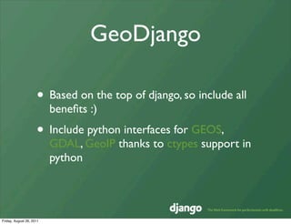
The document discusses GeoDjango, an open source geospatial framework for Django. It provides an overview of key concepts like geospatial data standards, geometry objects, and spatial databases. It also covers how GeoDjango integrates with Django and utilizes GEOS, GDAL, and GeoIP to support spatial lookups and measurements. A demo application and several real world uses of GeoDjango are highlighted.