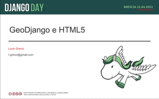


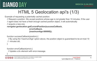
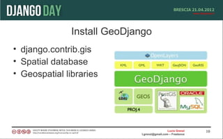


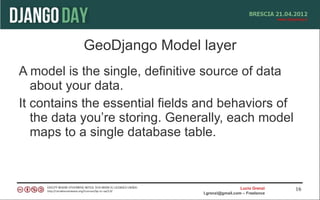

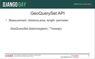
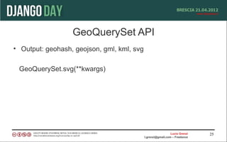


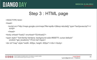

![Openlayer
<html>
<head>
<script src="http://openlayers.org/api/OpenLayers.js"></script>
<script> var points = []; </script>
<ul>
{% for point in interesting_points %}
<li>{{ point.name }} -- {{point.interestingness}}</li>
<script>points.push({{point.geometry.geojson|safe}});</script>
{% endfor %}
</ul> </scrpit>
</head>
<body onload="init()">
Intersting Points.<br />
<div id="map"></div>
</body></html>
Lucio Grenzi 36
l.grenzi@gmail.com – Freelance](https://image.slidesharecdn.com/geodjango-120428094033-phpapp02/85/Geodjango-36-320.jpg)
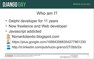
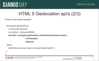
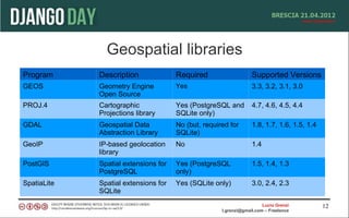
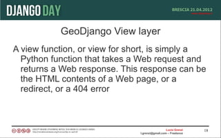
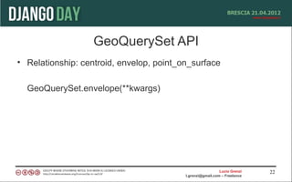
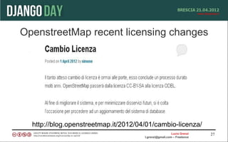
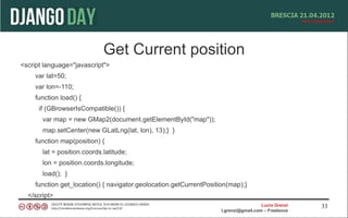
![Openlayer js script
<script type="text/javascript">
var map, base_layer, kml;
function init(){
map = new OpenLayers.Map('map');
base_layer = new OpenLayers.Layer.WMS( "OpenLayers WMS",
"http://labs.metacarta.com/wms/vmap0", {layers: 'basic'} );
var vectorLayer = new OpenLayers.Layer.Vector("Simple Geometry");
var point = new OpenLayers.Geometry.Point(-100.01, 55.78);
var pointFeature = new OpenLayers.Feature.Vector(point,null,null);
map.addLayer(vectorLayer);
map.setCenter(new OpenLayers.LonLat(point.x, point.y), 5);
vectorLayer.addFeatures([pointFeature]);
}
</script>
Lucio Grenzi 37
l.grenzi@gmail.com – Freelance](https://image.slidesharecdn.com/geodjango-120428094033-phpapp02/85/Geodjango-37-320.jpg)
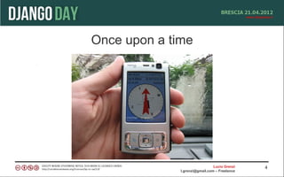
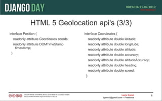
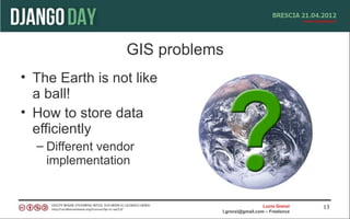
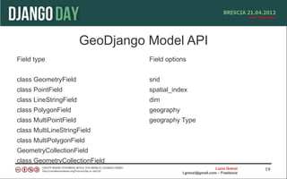
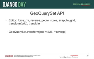
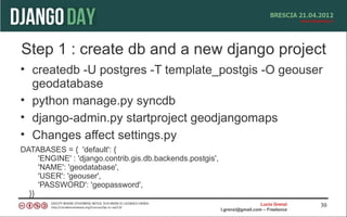
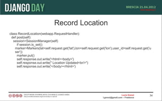
![Openlayer django script
vectors = OpenLayers.Layer.Vector("Simple Geometry");
for (var i = 0; i < points.length; i++) {
point = format.read(points[i])[0];
point.attributes = {'type':'point'};
vectors.addFeatures(point);
}
Lucio Grenzi 38
l.grenzi@gmail.com – Freelance](https://image.slidesharecdn.com/geodjango-120428094033-phpapp02/85/Geodjango-38-320.jpg)


Returns a GeoQuerySet containing geometries that represent the intersection of the given geometry with each feature in the GeoQuerySet. GeoQuerySet.union() Returns a single geometry that represents the union of all geometries in the GeoQuerySet. Lucio Grenzi 24 l.grenzi@gmail.com – Freelance


![PythonBrasil[8] closing](https://cdn.slidesharecdn.com/ss_thumbnails/pythonbrasil8closing-130219054907-phpapp02-thumbnail.jpg?width=640&height=640&fit=bounds)