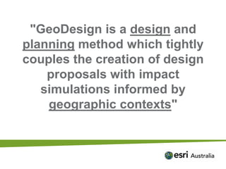
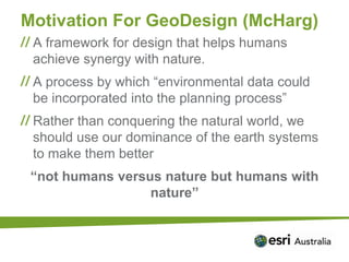
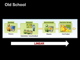
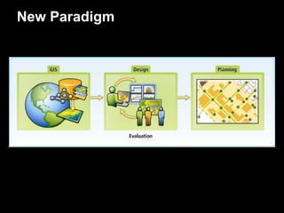
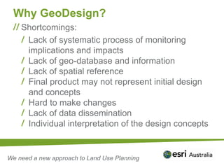
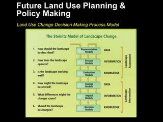
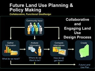
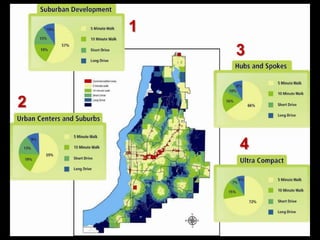
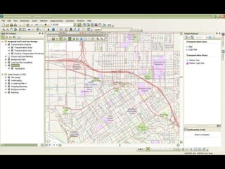
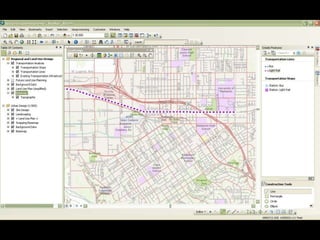
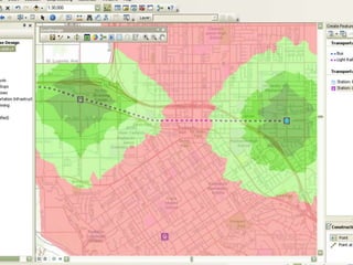
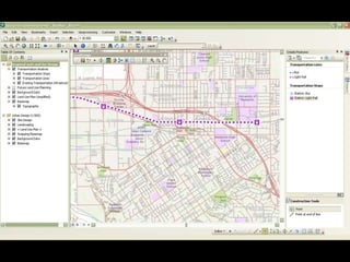
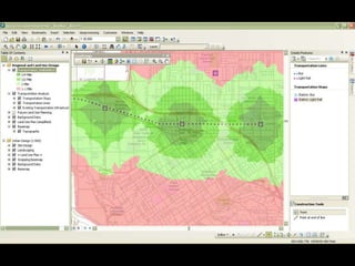
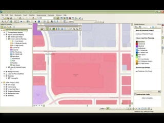
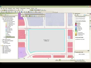
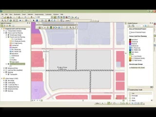
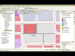
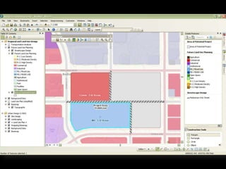
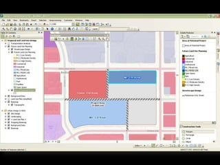
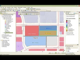
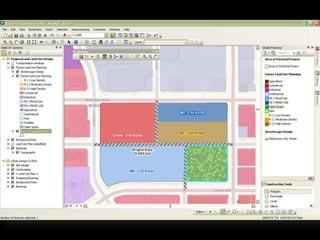
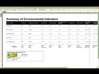
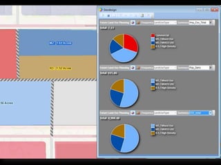
GeoDesign
for Collaborative Planning
Tom Gardner
What is Design?


    Design is the thought
    process comprising
     the creation of an
            entity
What makes design unique?

                     Imagination
      from imagination to rendition with zero impedance


                    Visualization
         maps, 3D views, animations, charts, reports


                    Assessment
     on the fly (as we design) and fully developed reports


                    Rapid Iteration
A Thought Process…
GeoDesign?
"GeoDesign is a design and
planning method which tightly
couples the creation of design
    proposals with impact
   simulations informed by
    geographic contexts"
Motivation For GeoDesign (McHarg)
 A framework for design that helps humans
 achieve synergy with nature.
 A process by which “environmental data could
 be incorporated into the planning process”
 Rather than conquering the natural world, we
 should use our dominance of the earth systems
 to make them better
 “not humans versus nature but humans with
                  nature”
Old School
New Paradigm
Why GeoDesign?
    Shortcomings:
     Lack of systematic process of monitoring
     implications and impacts
     Lack of geo-database and information
     Lack of spatial reference
     Final product may not represent initial design
     and concepts
     Hard to make changes
     Lack of data dissemination
     Individual interpretation of the design concepts


We need a new approach to Land Use Planning
Future Land Use Planning &
Policy Making
Land Use Change Decision Making Process Model
Future Land Use Planning &
       Policy Making
       Collaborative, Functional GeoDesign

                     Community Input                     Collaborative
                                                              and
                                                        Engaging Land
                                                              Use
                                                        Design Process
     Gather              Analyse              Compare           Create
   Information         Information           Alternatives


What do we have?       Where do we           How do we
                       Want to be?           get there?

                                                               Future Land
                                                                Use Plan
Some Examples
1
        3


2

        4
Transportation Planning
Redesign and Development
Where Could it be Applied?
 Pilbara Cities
 Super Towns
 …
GeoDesign
A New use for Old Tools

GeoDesign for Collaborative Planning

  • 1.
  • 9.
    What is Design? Design is the thought process comprising the creation of an entity
  • 10.
    What makes designunique? Imagination from imagination to rendition with zero impedance Visualization maps, 3D views, animations, charts, reports Assessment on the fly (as we design) and fully developed reports Rapid Iteration
  • 11.
  • 12.
  • 13.
    "GeoDesign is adesign and planning method which tightly couples the creation of design proposals with impact simulations informed by geographic contexts"
  • 14.
    Motivation For GeoDesign(McHarg) A framework for design that helps humans achieve synergy with nature. A process by which “environmental data could be incorporated into the planning process” Rather than conquering the natural world, we should use our dominance of the earth systems to make them better “not humans versus nature but humans with nature”
  • 15.
  • 16.
  • 17.
    Why GeoDesign? Shortcomings: Lack of systematic process of monitoring implications and impacts Lack of geo-database and information Lack of spatial reference Final product may not represent initial design and concepts Hard to make changes Lack of data dissemination Individual interpretation of the design concepts We need a new approach to Land Use Planning
  • 18.
    Future Land UsePlanning & Policy Making Land Use Change Decision Making Process Model
  • 19.
    Future Land UsePlanning & Policy Making Collaborative, Functional GeoDesign Community Input Collaborative and Engaging Land Use Design Process Gather Analyse Compare Create Information Information Alternatives What do we have? Where do we How do we Want to be? get there? Future Land Use Plan
  • 20.
  • 21.
    1 3 2 4
  • 22.
  • 29.
  • 41.
    Where Could itbe Applied? Pilbara Cities Super Towns …
  • 42.
    GeoDesign A New usefor Old Tools

Editor's Notes

  • #15 In his book Design with Nature (1969), Ian McHarg advocated a frameworkfor design that helps humans achieve synergy with nature. Design andplanning, which take into consideration both environmental and socialissues, help us to ensure that our resources are used appropriately andresponsibly, to help us move towards a better future (McHarg 1969).McHarg’s pioneering work not only had a fundamental influence on theup-and-coming field of environmental planning, but also simultaneouslystrengthened the core concepts of the young field of GIS as well.In his book, McHarg laid out a process by which “environmental datacould be incorporated into the planning process.” Rejecting the view of afuture modelled after some idyllic environmental past, he adopted the viewthat we should be using our dominance of the earth systems to help in theevolution of the natural world and make it better, rather than “conquer” it.Powerful anthropogenic influence over earth systems represents not just ahuge challenge, but an equally huge opportunity—not humans versus nature,but humans with nature.Today, more than ever before, it is importantto recognize the overwhelming impact of humans on the environment,and that the massive human impacts on the earth are a reality that is notgoing away, and that we stand at the crossroads. Thus, our challenge isproviding designers, engineers, planners, and others with a set of toolsand a framework for designing and managing the anthropogenic earth