Downloaded 18 times
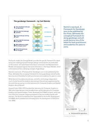


1. The document introduces the concept of geodesign, which combines geospatial data and analysis with design. 2. It discusses the history of geodesign, from its roots in early human settlement planning up through pioneers like McHarg, Steinitz, and Dangermond who helped formalize the concept and develop it using GIS technology. 3. Key figures like McHarg, Steinitz, Fisher, Goodchild, and Dangermond contributed to different aspects of geodesign through their work in fields like landscape architecture, regional planning, computer mapping, GIS science, and GIS technology development.


