Downloaded 24 times


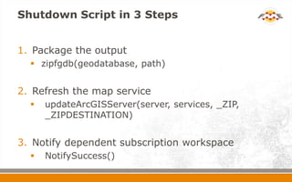
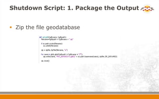


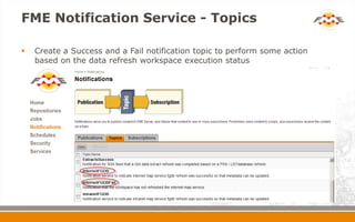

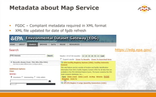
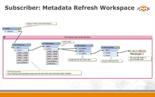
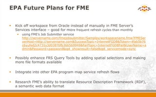


The document discusses how EPA automated the monthly refresh of spatial data in its Facility Registry Service (FRS) map service. It used FME to extract data from Oracle Spatial into a file geodatabase, then updated the underlying data for an ArcGIS Server map service. A Python script in FME packaged and deployed the new geodatabase, refreshed the map service, and notified other workflows. This automated a previously manual process and improved performance by moving from Oracle to a file-based system. EPA plans to trigger the FME workflow directly from Oracle and integrate it into other refresh flows.