This document discusses using 3D printing with GRASS GIS for scientific purposes. It notes that while GRASS GIS modules can currently interface with 3D printing workflows, extensions dedicated to 3D printing are expected soon. 3D printing extends 2D scientific communication by allowing haptic exploration of data without displays. The document outlines how 3D printing supports communicating scientific findings and envisions linking research articles, data, and 3D objects with persistent identifiers. Examples demonstrate using GRASS GIS to generate 3D prints of elevation models, geologic structures, and complex datasets like tsunami simulations for science communication.
3D-printing with GRASS GIS – a work in progress in report FOSS4G 2014Peter Löwe
As the amount of scientific data continues to grow, researchers need new tools to help them visualize complex data. Immersive data-visualisations are helpful, yet fail to provide tactile feedback and sensory feedback on spatial orientation, as provided from tangible objects.
The production of a tangible representation of a scientific data set is one step in a line of scientific thinking, leading from the physical world into scientific reasoning and back: The process starts with a physical observation, or from a data stream generated by an environmental sensor. This data stream is turned into a geo-referenced data set. This data is turned into a volume representation which is converted into command sequences for the printing device, leading to the creation of a 3D printout via additive manufacturing (“3D-printing”). As a last, but crucial step, this new object has to be documented and linked to the associated metadata, and curated in long term repositories to preserve its scientific meaning and context.
This presentation showcases a reference workflow to produce tangible 3D data-prints based on Free and Open Source Software (FOSS), using both GRASS GIS and Paraview. The workflow was successfully validated in various application scenarios using a RapMan printer to create 3D specimens of elevation models, geological underground models, ice penetrating radar soundings for planetology, and space time stacks for Tsunami model quality assessment.
From Artwork to Cyber Attacks: Lessons Learned in Building Knowledge Graphs u...Craig Knoblock
Over the last few years we have been building domain-specific knowledge graphs for a variety of real-world problems, including creating virtual museums, combating human trafficking, identifying illegal arms sales, and predicting cyber attacks. We have developed a variety of techniques to construct such knowledge graphs, including techniques for extracting data from online sources, aligning the data to a domain ontology, and linking the data across sources. In his talk I will present these techniques and describe our experience in applying Semantic Web technologies to build knowledge graphs for real-world problems.
A desk-research presentation showing the capacity, trends and foresights of 3D printing, especially related to the manufacturing industry and the emergence of the ´prosumer´ within the DYI community.
Accompanying article can be found here: http://www.barcinno.com/3dprinting/
Tags:
Additive manufacturing, 3D Printing, laminated object manufacturing, layered manufacturing, rapid prototyping (industrial), stereolithography, CAD/CAM, Fused deposition modelling, Laser sintering.
3D Scanning for 3D Printing: Making Reality Digital and then Physical Again, ...Melissa Tiffany
Using a series of compelling case studies, this updated presentation enhanced from just a year ago, will highlight the evolution, current capabilities, and future possibilities for realizing the potential of 3D scanning for 3D printing. Discussion will include background and observations on
the business of 3D scanning and 3D printing with clues to leveraging the explosion of 3D for other downstream design, analysis, and visualization demands. The practical challenges for converting 3D scan data into 3D print-ready files will also be discussed.
FARO 2014 3D Documentation Presentation by Direct Dimensions "3D Scanning for...Direct Dimensions, Inc.
Presentation at the 2014 FARO 3D Documentation Conference by Direct Dimensions called "3D Scanning for 3D Printing, Making Reality Digital, and then Physical Again, Part 2"
In this presentation, Victor Gramm describes what he's learned as a 3D Print enthusiast. Victor mentions free mentions free, low-cost, and open-source , as well as commercially available solutions for 3D Scanning, photogrammetry, and 3D Modeling. While not an expert on the topic, Victor employs his enthusiasm in an effort to gather consensus on the level of interest in these domains in his area, share what he's learned, and to elicit further dialogue on the topic.
Data Science in 2016: Moving up by Paco Nathan at Big Data Spain 2015Big Data Spain
The term 'Data Science' was first described in scientific literature about 15 years ago. It started to become a major trend in industry about 7 years ago.
O'Reilly Media surveys the industry extensively each year. In addition we get a good birds-eye view of industry trends through our conference programs and publications, working closely with some of the best practitioners in Data Science.
By now, the field has evolved far beyond its origins eclipsing an earlier generation of Business Intelligence and Data Warehousing approaches. Data Science is moving up, into the business verticals and government spheres of influence where it has true global impact.
This talk considers Data Science trends from the past three years in particular. What is emerging? Which parts are evolving? Which seem cluttered and poised for consolidation or other change?
Session presented at Big Data Spain 2015 Conference
15th Oct 2015
Kinépolis Madrid
http://www.bigdataspain.org
Event promoted by: http://www.paradigmatecnologico.com
Abstract: http://www.bigdataspain.org/program/thu/slot-2.html
Today, more than ever before, maps are being used to bring data to life. In this presentation I will demonstrate how geoviz can make data science more tangible by providing an interactive canvas for spatial data. Gregory Brunner will shows several examples of how maps are being used enhance how we communicate data and how this applies across all scales, including spatial, temporal, and size of data.
"Big Data" is term heard more and more in industry – but what does it really mean? There is a vagueness to the term reminiscent of that experienced in the early days of cloud computing. This has led to a number of implications for various industries and enterprises. These range from identifying the actual skills needed to recruit talent to articulating the requirements of a "big data" project. Secondary implications include difficulties in finding solutions that are appropriate to the problems at hand – versus solutions looking for problems. This presentation will take a look at Big Data and offer the audience with some considerations they may use immediately to assess the use of analytics in solving their problems.
The talk begins with an idea of how big "Big Data" can be. This leads to an appreciation of how important "Management Questions" are to assessing analytic needs. The fields of data and analysis have become extremely important and impact nearly all facets of life and business. During the talk we will look at the two pillars of Big Data – Data Warehousing and Predictive Analytics. Then we will explore the open source tools and datasets available to NATO action officers to work in this domain. Use cases relevant to NATO will be explored with the purpose of show where analytics lies hidden within many of the day-to-day problems of enterprises. The presentation will close with a look at the future. Advances in the area of semantic technologies continue. The much acclaimed consultants at Gartner listed Big Data and Semantic Technologies as the first- and third-ranked top technology trends to modernize information management in the coming decade. They note there is an incredible value "locked inside all this ungoverned and underused information." HQ SACT can leverage this powerful analytic approach to capture requirement trends when establishing acquisition strategies, monitor Priority Shortfall Areas, prepare solicitations, and retrieve meaningful data from archives.
Digital Science: Reproducibility and Visibility in AstronomyJose Enrique Ruiz
The science done in Astronomy is digital science, from observing proposals to final publication, to data and software used: each of the elements and actions involved in scientific output could be recorded in electronic form. This fact does not prevent the final outcome of an experiment is still difficult to reproduce. This procedure can be long, tedious, not easily accessible or understandable, even to the author. At the same time, we have a rich infrastructure of files, observational data and publications. This could be used more efficiently if we reach greater visibility of the scientific production, which avoids duplication of effort and reinvention.
Reproducibility is a cornerstone in scientific method, and extraction of relevant information in the current and future data flood is key in Astronomy. The AMIGA group (Analysis of the interstellar Medium of Isolated GAlaxies, IAA-CSIC, http://amiga.iaa.es) faces these two challenges in the European project "Wf4Ever: Advanced technologies for enhanced preservation workflow Science" to enable the preservation of the methodology in scalable semantic repositories to facilitate their discovery, access, inspection, exploitation and distribution. These repositories store the experiments on "Research Objects" whose main constituents are digital scientific workflows. These provide a comprehensive view and clear scientific interpretation of the experiment as well as the automation of the method, going beyond the usual pipelines that normally end up in data processing.
The quantitative leap in volume and complexity of the next generation of archives will need analysis and data mining tasks to live closer to the data, in computing and distributed storage environments, but they should also be modular enough to allow customization from scientists and be easily accessible to foster their dissemination among the community. Astronomy is a collaborative science, but it has also become highly specialized, as many other disciplines. Sharing, preservation, discovery and a much simplified access to resources in the composition of scientific workflows will enable astronomers to greatly benefit from each other’s highly specialized knowhow, they constitute a way to push Astronomy to share and publish not only results and data, but also processes and methodologies.
We will show how the use of scientific workflows can help to improve the reproducibility of the experiment and a more efficient exploitation of astronomical archives, as well as the visibility of the scientific methodology and its reuse.
3D Printing is basically a process for making a physical object from a three dimensional computer aided design CAD file via a layering approach. It encompasses many forms of technologies and materials as 3D printing is being used in almost all industries. 3D printers are a new generation of machines that can make pretty much anything from ceramic cups to plastic toys. They have become affordable enough to hit the mainstream. 3D printer can be purchased online or in stores, which gives people the ability to print items from anywhere in the world. Technology is always updating and evolving, and 3D printing is no expectation. This paper provides an overview of 3D printing and its applications. Matthew N. O. Sadiku | Uwakwe C. Chukwu | Abayomi Ajayi-Majebi | Sarhan M. Musa "3D Printing: An Introduction" Published in International Journal of Trend in Scientific Research and Development (ijtsrd), ISSN: 2456-6470, Volume-6 | Issue-7 , December 2022, URL: https://www.ijtsrd.com/papers/ijtsrd52421.pdf Paper URL: https://www.ijtsrd.com/humanities-and-the-arts/education/52421/3d-printing-an-introduction/matthew-n-o-sadiku
Help me build an international 3D printing community. Come here weekly to check out the latest trends, stats, and samples in 3D printing. Comments are welcome!
Fusing Multimedia Data Into Dynamic Virtual EnvironmentsRuofei Du
In spite of the dramatic growth of virtual and augmented reality (VR and AR) technology, content creation for immersive and dynamic virtual environments remains a significant challenge. In this dissertation, we present our research in fusing multimedia data, including text, photos, panoramas, and multi-view videos, to create rich and compelling virtual environments.
First, we present Social Street View, which renders geo-tagged social media in its natural geo-spatial context provided by 360° panoramas. Our system takes into account visual saliency and uses maximal Poisson-disc placement with spatio-temporal filters to render social multimedia in an immersive setting. We also present a novel GPU-driven pipeline for saliency computation in 360° panoramas using spherical harmonics (SH). Our spherical residual model can be applied to virtual cinematography in 360° videos.
We further present Geollery, a mixed-reality platform to render an interactive mirrored world in real time with three-dimensional (3D) buildings, user-generated content, and geo-tagged social media. We conduct a user study with 20 participants to qualitatively evaluate Social Street View and Geollery. The user study has identified several use cases for these systems, including immersive social storytelling, experiencing culture, and crowd-sourced tourism.
We next present Video Fields, a web-based interactive system to create, calibrate, and render dynamic videos overlaid on 3D scenes. Our system renders dynamic entities from multiple videos, using early and deferred texture sampling. Video Fields can be used for immersive surveillance in virtual environments. Furthermore, we present VRSurus and ARCrypt projects to explore the applications of gestures, haptic feedback, and visual cryptography in virtual and augmented reality environments.
Finally, we present our work on Montage4D, a real-time system for seamlessly fusing multi-view video textures with dynamic meshes. We use geodesics on meshes with view-dependent rendering to mitigate spatial occlusion seams while maintaining temporal consistency. Our experiments show significant enhancement in rendering quality, especially for salient regions such as faces. We believe that Social Street View, Geollery, Video Fields, and Montage4D will greatly facilitate several applications such as virtual tourism, immersive telepresence, and remote education.
Lecture at the three-week Summer School "Data Curation" for archaeologists from Sudan, Yemen, Libya, Palestine and Tunisia at the German Archaeological Institute in Berlin from 16 July to 5 August 2017.
The workshop was planned together with the Arab League Educational, Cultural and Scientific Organization (ALECSO), as well as with the Sudanese Anti-National Service for NCAM (National Corporation for Antiquities and Museums).
FAIR Workflows: A step closer to the Scientific Paper of the Futuredgarijo
Keynote presented at the Computational and Autonomous Workflows (CAW-2021) at the Oak Ridge National Laboratory. The keynote describes an overview of the different aspects to take into account when aiming to create FAIR workflows and associated resources.
Similar to Scientific 3D Printing with GRASS GIS (FOSSGIS 2014) (20)
INTEGRATION OPTIONS FOR PERSISTENT IDENTIFIERS IN OSGEO PROJECT REPOSITORIES:...Peter Löwe
As a contribution to the currently ongoing larger effort to establish Open Science as best practices in academia, this article focuses on the Open Source and Open Access tiers of the Open Science triad and community software projects. The current situation of research software development and the need to recognize it as a significant contribution to science is introduced in relation to Open Science. The adoption of the Open Science paradigms occurs at different speeds and on different levels within the various fields of science and crosscutting software communities. This is paralleled by the emerging of an underlying futuresafe technical infrastructure based on open standards to enable proper recognition for published articles, data, and software. Currently the number of journal publications about research software remains low in comparison to the amount of research code published on various software repositories in the WWW. Because common standards for the citation of software projects (containers) and versions of software are lacking, the FORCE11 group and the CodeMeta project recommending to establish Persistent Identifiers (PIDs), together with suitable metadata setss to reliably cite research software. This approach is compared to the best practices implemented by the OSGeo Foundation for geospatial community software projects. For GRASS GIS, a OSGeo project and one of the oldest geospatial open source community projects, the external requirements for DOI-based software citation are compared with the projects software documentation standards. Based on this status assessment, application scenarios are derived, how OSGeo projects can approach DOI-based software citation, both as a standalone option and also as a means to foster open access journal publications as part of reproducible Open Science.
FOSSGIS 2015: Das audiovisuelle Erbe der OSGeo-ProjektePeter Löwe
Die Menge der audiovisuellen Inhalte hat in den letzten Jahren stark zugenommen und wächst weiterhin stark. Die thematische Palette erstreckt sich dabei von Anleitungsvideos für Softwarekomponenten, über Ergebnis- und Datenvisualisierungen bis hin zur abstrahierten Darstellung der Evolution einzelner Softwareprojekte. Die Fülle dieser Fachinformationen wird noch hauptsächlich in Web2.0 Portalen wie Youtube oder Slideshare ausgetauscht. Daraus ergeben sich Probleme sowohl bezüglich der langfristigen Verfügbarkeit und der Auffindbarkeit anhand geeigneter Metadaten für die Nutzer. Eine zukunftssichere Alternative bietet die Nutzung von innovativen Bibliotheksdiensten, wie dem AV-Portal der Technischen Informationsbibliothek (TIB). Hier werden nicht nur die Metadaten eines Videos indexiert sondern ebenso die gesprochene Sprache, Texteinblendungen und Bildinformationen. Dies führt zu einer erheblich verbesserten Suche nach und in audiovisuellen Ressourcen. Durch die Verbindung eines DOI mit einem Media Fragment Identifier wird die sekundengenaue Zitierfähigkeit der Materialien gewährleistet.
Der Nutzen des Portals wird am Beispiel der erfolgreichen digitalen Erschließung des GRASS GIS Videos des U.S. Army Corps of Engineers Research Laboratory (CERL) aus dem Jahr 1987 demonstriert. Der Inhalt dieses historischen Videos bietet einen Einblick in die Frühphase der GIS Entwicklung. Die Erschließungsgeschichte des Videos seit 2004 ist ein Referenzfall für den aktuellen Stand und das sich abzeichnende Potential audiovisueller Information für die Geoinformatik und speziell den wissenschaftlichen Anwendern und Entwicklern in den OSGeo Projekten.
Unlocking conference videos by DOI/MFID for software project communitiesPeter Löwe
Das TIB AV-Portal der Technischen Informationsbibliothek in Hannover ist eine kunden- und bedarfsorientierte Plattform für hochwertige wissenschaftliche Videos aus dem Bereich Technik und Naturwissenschaften. Automatische Szenenerkennung sowie Text-, Audio- und Bildanalyse werden zur automatischen Anreicherung mit Metadaten genutzt. Die Filme sind mit einem Digital Object Identifier (DOI) und - auf Segmentbasis - mit Media Fragment Identifiern versehen, womit die Filme sekundengenau dereferenziert und zitiert werden können. Praxisnutzen und Potentiale dieser Infrastruktur für die Erschließung und Nachnutzung in Wissenschaft, Lehre und Industrie werden exemplarisch am Beispiel der FOSS4G-Konferenzvideos der Open Source Geospatial Foundation, vorgestellt.
The TIB|AV Portal : OSGeo conference videos as a resource for scientific res...Peter Löwe
This paper reports on new opportunities for research and education in Free and Open Source Geoinformatics as a translational part of Open Science, enabled the growing collection of OSGeo conference video recordings at the German National Library of Science and Technology (TIB). Since 2015, OSGeo conference recordings have been included to the collection sphere of TIB in information sciences. Currently, video content from selected national (FOSSGIS), regional (FOSS4G-NA) and global (FOSS4G) conferences is being actively collected. The annual growth exceeds 100 hours of new content relating to the OSGeo software projects and the OSGeo scientific-technical communities. This is seconded by retrospective acquisition of video material dating from past conferences, going back until 2002 to preserve this content, ensuring both long term availability and access. The audiovisual OSGeo-related content is provided through the TIB|AV Portal, a web-based platform for scientific audiovisual media providing state-of-the art multimedia analysis and retrieval. It implements the requirements by research libraries for reliable long term preservation. Metadata enhancement analysis provides extended search and retrieval options. Digital Object Identifiers (DOI) enable scientific citation of full videos, excerpts and still frames, use in education and also referral in social networks. This library-operated service infrastructure turns the audiovisual OSGeo-related content in a reliable source for science and education.
GIS Day 2015: Geoinformatics, Open Source and Videos - a library perspectivePeter Löwe
Digital audiovisual content has become an important communication channel in Science. The TIB|AV-Portal for audiovisual scientific-technical information meets the requirements to preserve such content and to provide innovative services for search and retrieval. Quality checked audiovisual content from Open Source Geoinformatics communities is constantly being acquired for the portal as a part of TIB's mission to preserve relevant content in applied computer sciences for science, industry, and the general public.
GRASS GIS, Star Trek and old Video Tape – a reference case on audiovisual pre...Peter Löwe
This presentation showcases new options for the preservation of audiovisual content in the OSGeo communities beyond the established software repositories or Youtube. Audiovisual content related to OSGeo projects such as training videos and screencasts can be preserved by advanced multimedia archiving and retrival services which are currently developed by the library community. This is demonstrated by the reference case of a newly discovered high resolution version of the GRASS GIS 1987 promotional video which made available from into the AV-portal of the German National Library of Science and Technology (TIB). The portal allows for extended search capabilities based on enhanced metadata derived by automated video analysis. This is a reference case for future preservation activities regarding semantic-enhanced Web2.0 content from OSGeo projects.
Tectonic Storytelling with Open Source and Digital Object Identifiers - a cas...Peter Löwe
The communication of advances in research to the common public for both education and decision making is an important aspect of scientific work. An even more crucial task is to gain recognition within the scientific community,
which is judged by impact factor and citation counts. Recently, the latter concepts have been extended from
textual publications to include data and software publications.
This paper presents a case study for science communication and data citation. For this, tectonic models, Free and Open Source Software (FOSS), best practices for data citation and a multimedia online-portal for scientific content
are combined. This approach creates mutual benefits for the stakeholders: Target audiences receive information on
the latest research results, while the use of Digital Object Identifiers (DOI) increases the recognition and citation of
underlying scientific data. This creates favourable conditions for every researcher as DOI names ensure citeability and long term availability of scientific research.
In the developed application, the FOSS tool for tectonic modelling GPlates is used to visualise and manipulate
plate-tectonic reconstructions and associated data through geological time. These capabilities are augmented by the Science on a Halfsphere project (SoaH) with a robust and intuitive visualisation hardware environment.
The tectonic models used for science communication are provided by the AGH University of Science and Technology.
They focus on the Silurian to Early Carboniferous evolution of Central Europe (Bohemian Massif) and were
interpreted for the area of the Geopark Bergstraße Odenwald based on the GPlates/SoaH hardware- and software stack.
As scientific story-telling is volatile by nature, recordings are a natural means of preservation for further use, reference and analysis. For this, the upcoming portal for audiovisual media of the German National Library of Science and Technology TIB is expected to become a critical service infrastructure. It allows complex search queries, including metadata such as DOI and media fragment identifiers (MFI), thereby linking data citation and science
communication.
Data Science: History repeated? – The heritage of the Free and Open Source GI...Peter Löwe
Data Science is described as the process of knowledge extraction from large data sets by means of scientific
methods. The discipline draws heavily from techniques and theories from many fields, which are jointly used to
furthermore develop information retrieval on structured or unstructured very large datasets. While the term Data
Science was already coined in 1960, the current perception of this field places is still in the first section of the hype cycle according to Gartner, being well en route from the technology trigger stage to the peak of inflated
expectations.
In our view the future development of Data Science could benefit from the analysis of experiences from
related evolutionary processes. One predecessor is the area of Geographic Information Systems (GIS). The
intrinsic scope of GIS is the integration and storage of spatial information from often heterogeneous sources, data
analysis, sharing of reconstructed or aggregated results in visual form or via data transfer. GIS is successfully
applied to process and analyse spatially referenced content in a wide and still expanding range of science
areas, spanning from human and social sciences like archeology, politics and architecture to environmental and
geoscientific applications, even including planetology.
This paper presents proven patterns for innovation and organisation derived from the evolution of GIS,
which can be ported to Data Science. Within the GIS landscape, three strategic interacting tiers can be denoted: i) Standardisation, ii) applications based on closed-source software, without the option of access to and analysis of the implemented algorithms, and iii) Free and Open Source Software (FOSS) based on freely accessible program code enabling analysis, education and ,improvement by everyone. This paper focuses on patterns gained from the synthesis of three decades of FOSS development. We identified best-practices which evolved from long term FOSS projects, describe the role of community-driven global umbrella organisations such as OSGeo, as well as the standardization of innovative services. The main driver is the acknowledgement of a meritocratic attitude.
These patterns follow evolutionary processes of establishing and maintaining a web-based democratic culture
spawning new kinds of communication and projects. This culture transcends the established compartmentation and
stratification of science by creating mutual benefits for the participants, irrespective of their respective research
interest and standing. Adopting these best practices will enable
The Evolution of Disaster Early Warning Systems in the TRIDEC Project Peter Löwe
The TRIDEC project (Collaborative, Complex, and Critical Decision Processes in Evolving Crises) focuses on real-time intelligent information management in the Earth management domain and its long-term applications. It is funded under the European Union’s seventh Framework Programme (FP7). The TRIDEC software framework is applied in two application environments, which include industrial subsurface drilling (ISD) and natural crisis management (NCM).
For each domain, three consecutive demonstrators with extended capabilities are developed and field-tested during the projects lifespan. This article focuses on the technical advances achieved by the light-, mid- and heavyweight NCM demonstrators for Tsunami Early Warning.
Earliest Galaxies in the JADES Origins Field: Luminosity Function and Cosmic ...Sérgio Sacani
We characterize the earliest galaxy population in the JADES Origins Field (JOF), the deepest
imaging field observed with JWST. We make use of the ancillary Hubble optical images (5 filters
spanning 0.4−0.9µm) and novel JWST images with 14 filters spanning 0.8−5µm, including 7 mediumband filters, and reaching total exposure times of up to 46 hours per filter. We combine all our data
at > 2.3µm to construct an ultradeep image, reaching as deep as ≈ 31.4 AB mag in the stack and
30.3-31.0 AB mag (5σ, r = 0.1” circular aperture) in individual filters. We measure photometric
redshifts and use robust selection criteria to identify a sample of eight galaxy candidates at redshifts
z = 11.5 − 15. These objects show compact half-light radii of R1/2 ∼ 50 − 200pc, stellar masses of
M⋆ ∼ 107−108M⊙, and star-formation rates of SFR ∼ 0.1−1 M⊙ yr−1
. Our search finds no candidates
at 15 < z < 20, placing upper limits at these redshifts. We develop a forward modeling approach to
infer the properties of the evolving luminosity function without binning in redshift or luminosity that
marginalizes over the photometric redshift uncertainty of our candidate galaxies and incorporates the
impact of non-detections. We find a z = 12 luminosity function in good agreement with prior results,
and that the luminosity function normalization and UV luminosity density decline by a factor of ∼ 2.5
from z = 12 to z = 14. We discuss the possible implications of our results in the context of theoretical
models for evolution of the dark matter halo mass function.
Seminar of U.V. Spectroscopy by SAMIR PANDASAMIR PANDA
Spectroscopy is a branch of science dealing the study of interaction of electromagnetic radiation with matter.
Ultraviolet-visible spectroscopy refers to absorption spectroscopy or reflect spectroscopy in the UV-VIS spectral region.
Ultraviolet-visible spectroscopy is an analytical method that can measure the amount of light received by the analyte.
Observation of Io’s Resurfacing via Plume Deposition Using Ground-based Adapt...Sérgio Sacani
Since volcanic activity was first discovered on Io from Voyager images in 1979, changes
on Io’s surface have been monitored from both spacecraft and ground-based telescopes.
Here, we present the highest spatial resolution images of Io ever obtained from a groundbased telescope. These images, acquired by the SHARK-VIS instrument on the Large
Binocular Telescope, show evidence of a major resurfacing event on Io’s trailing hemisphere. When compared to the most recent spacecraft images, the SHARK-VIS images
show that a plume deposit from a powerful eruption at Pillan Patera has covered part
of the long-lived Pele plume deposit. Although this type of resurfacing event may be common on Io, few have been detected due to the rarity of spacecraft visits and the previously low spatial resolution available from Earth-based telescopes. The SHARK-VIS instrument ushers in a new era of high resolution imaging of Io’s surface using adaptive
optics at visible wavelengths.
(May 29th, 2024) Advancements in Intravital Microscopy- Insights for Preclini...Scintica Instrumentation
Intravital microscopy (IVM) is a powerful tool utilized to study cellular behavior over time and space in vivo. Much of our understanding of cell biology has been accomplished using various in vitro and ex vivo methods; however, these studies do not necessarily reflect the natural dynamics of biological processes. Unlike traditional cell culture or fixed tissue imaging, IVM allows for the ultra-fast high-resolution imaging of cellular processes over time and space and were studied in its natural environment. Real-time visualization of biological processes in the context of an intact organism helps maintain physiological relevance and provide insights into the progression of disease, response to treatments or developmental processes.
In this webinar we give an overview of advanced applications of the IVM system in preclinical research. IVIM technology is a provider of all-in-one intravital microscopy systems and solutions optimized for in vivo imaging of live animal models at sub-micron resolution. The system’s unique features and user-friendly software enables researchers to probe fast dynamic biological processes such as immune cell tracking, cell-cell interaction as well as vascularization and tumor metastasis with exceptional detail. This webinar will also give an overview of IVM being utilized in drug development, offering a view into the intricate interaction between drugs/nanoparticles and tissues in vivo and allows for the evaluation of therapeutic intervention in a variety of tissues and organs. This interdisciplinary collaboration continues to drive the advancements of novel therapeutic strategies.
Professional air quality monitoring systems provide immediate, on-site data for analysis, compliance, and decision-making.
Monitor common gases, weather parameters, particulates.
This pdf is about the Schizophrenia.
For more details visit on YouTube; @SELF-EXPLANATORY;
https://www.youtube.com/channel/UCAiarMZDNhe1A3Rnpr_WkzA/videos
Thanks...!
Scientific 3D Printing with GRASS GIS (FOSSGIS 2014)
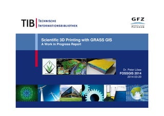
1. Scientific 3D Printing with GRASS GIS
A Work in Progress Report
Dr. Peter Löwe
FOSSGIS 2014
2014-03-20
2. 2
In a nutshell
• Interfacing GRASS GIS with 3D print workflows can be
done with the current GRASS modules.
• Prediction: Easy to use GRASS extensions for 3D
printing will come soon.
• Scientific 3D prints extend „flat“ 2D science
communication
• Decelerated haptic data access (no-display-needed)
• But there‘s more to it…
3. 3
Communicating scientific findings
The challenge:
• Picturing scientific data in one’s mind
• Communicating this vision to someone else
The need:
A tangible representation of scientific results.
1492 Today Future
?
4. 4
„The future is here“ (again)
The potential of „3D printing“ as
featured in the news:
5. 5
„The future is here“ (again)
The potential of „3D printing“ as
featured in the news:
• Guns !
6. 6
„The future is here“ (again)
The potential of „3D printing“ as
featured in the news:
• Guns !
• Human body parts !
7. 7
„The future is here“ (again)
The potential of „3D printing“ as
featured in the news:
• Guns !
• Human body parts !
• Clothes !
8. 8
„The future is here“ (again)
The potential of „3D printing“ as
featured in the news:
• Guns !
• Human body parts !
• Clothes !
• Candy !
9. 9
„The future is here“ (again)
The potential of „3D printing“ as
featured in the news:
• Guns !
• Human body parts !
• Clothes !
• Candy !
• Space Exploration !
10. 10
3D Printing, the Gartner hype cycle, and science
http://surveys.peerproduction.net/wp-content/uploads/2012/11/GoogleTrendsGartnerHypeCycle.png
3D Printing
2014
11. 11
3D Printing, the Gartner hype cycle, and science
http://surveys.peerproduction.net/wp-content/uploads/2012/11/GoogleTrendsGartnerHypeCycle.png
3D Printing
2014
12. 12
3D Printing, the Gartner hype cycle, and science
http://surveys.peerproduction.net/wp-content/uploads/2012/11/GoogleTrendsGartnerHypeCycle.png
3D Printing
2014
• Handpieces for science
communication
• among scientists
• towards the general
public
• Showpieces for
exhibitions / trade fairs
• Condensed information
on content and quality
• <your application goes
here>
but
13. 13
3D printing for science communication:
The larger picture
Technical Printing Process
Metadata Management
Scientific
Data
3D
Print
Scientist
Science
Communication
Target group
14. 14
The Scientific Library perspective – Why bother ?
• This is part of an emerging trend affecting (Geo-) Science and
Research, Libraries and the FOSS Communities.
• Identification, citation and preservation of scientific content needed.
• A tide of „born digital“ specimen, like 3D prints, is coming.
• Persistant identifiers are being introduced for scientific articles, data
and software – and 3D prints, e.g: Digital Object Identifiers (DOI).
16. 16
Nontextual materials: Past and present
The preservation of scientific data
specimen is already part of research:
"Der Heidelberger Karl-Theodor-Globus
von 1751 bis 2000
Vergangenes mit gegenwärtigen
Methoden für die Zukunft bewahren"
17. 17
Linking research articles, data and 3D objects:
Important for researchers … and research-based libraries
Digital Object
Identifier (DOI)
18. 18
Technische Informations Bibliothek (TIB)
German National Library of Science and Technology
Global supplier for scientific and technical information
Traditional text-based documents
19. 1919
GetInfo Portal
• 57 Mio. metadata indexed with access to the fulltext (document
delivery, national licences, pay-per-view)
• 160 Mio. documents available via metasearch
TIB – German National Library of Science and
Technology - Today
20. 2020
Strategy – Move beyond text
SimulationSimulation
Scientific FilmsScientific Films
3D Objects3D Objects
TextText
Research DataResearch Data
SoftwareSoftware
21. 21
• Worldwide first Digital Object Identifier (DOI) registration agency for
datasets (since 2005)
TIB – German National Library of Science and
Technology - DOI
22. 22
The road ahead
– the research library perspective
Ultimate Goal:
Interlinking and Search Across All
Types of Digital Assets.
23. 23
3D printing for
science communication: GRASS GIS angle
Technical Printing Process
Metadata Management
Scientific
Data
3D
Print
Scientist
Science
Communication
Target group
26. 26
GRASS
GIS
Technical overview
Data
Technical Printing Process
3D
Print
Scientific
Data
3D preprint:
vtk, etc.
png/pdf
3D preprints - just a gdal/ogr extension ?
Thematic generalisation is needed: r3.modules
Thematic generalisation
28. 28
Wanted: 3D print workflow trailblazers !
• Volume generalisation with r3.x-modules requires currently
these skills:
• Science Interpreter/Communicator: „What message to
convey ?“
• Technical/Software: create workflows in r3.mapcalc, script
these
• Admin/Pioneer: be able to install patches for GRASS7 due
to bugs (volume-related), help improve code maturity
29. 29
Example: Thematic generalisation with r3.mapcalc
• Task: Separation of geologic volumes along complex faults („cutting pane“)
• Requirement: Volume hulls must be continuous (no holes).
• Solution: „Growing“ of fault lines into cutting panes with r3.mapcalc.
Geologic
stratum
Faults
Tricky
part
30. 30
Multiple linked learning processes
Initial GIS-driven
experiments
GIS workflow
development
GIS modularisation
Stakeholders
Printing
Process
Expertise
INAF
Astrophysics Institute,
Rome
FabLab
„Wissenschaftsladen“
Potsdam
Materials
Hardware
Data Sources
Tsunami
Simulations
2D
Data
(Elevation
Models)
3D Data
(Geological
models,
soil
penetrating
radar)
Software
Workflows and Services
TIB Hannover
GFZ Potsdam
Osaka City University
36. 36
RapMan 3.2: Reality check
Raw
Material
Control
Unit
Print head,
cooling fan
Print in
progress
Marcel
Ludwig
Resident 3D
printing expert
at GFZ Potsdam
47. 47
Complex data sets:
Tsunami propagation space-time-cubes
• Space Time Cube
(STC) of tsunami
wave propagation.
• Complex wave
propagation in time
and space.
• Allows visual model
quality assessment.
• Produced by GFZ
Potsdam in 2012.
• On permanent
display at the Osaka
City University (2014)
3D Print
Tsunami
Model
Time
Lon/Lat
Tohoku
Shoreline
Pacific
48. 48
Recap: But there‘s more to it..
• Interfacing GRASS GIS with 3D print workflows can already done with
the current GRASS modules.
• Prediction: Easy to use GRASS extensions for 3D printing will come
soon.
• Scientific 3D Prints extend „flat“ 2D science communication
• Decelerated haptic data access (no-display-needed)
• Large potential for science communication
• The bigger picture of Open Science: Open Data, Open
Source, DOI
• Thematic generalisation via r3.x – modules.
• Much more coming