
Recommended
Recommended
More Related Content
What's hot
What's hot (19)
Similar to Field monitoring of an active fan using UAV photogrammetry prof. Herve Capart
Similar to Field monitoring of an active fan using UAV photogrammetry prof. Herve Capart (20)
Recently uploaded
Recently uploaded (20)
Field monitoring of an active fan using UAV photogrammetry prof. Herve Capart
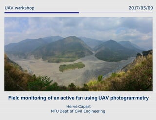
- 1. Field monitoring of an active fan using UAV photogrammetry UAV workshop 2017/05/09 Hervé Capart NTU Dept of Civil Engineering
- 2. Field site: Laonong River, Southwestern Taiwan 2
- 4. 2009-05-09 2009-08-17 (Satellite image source: FORMOSAT-2, NSPO)
- 5. Fan evolution observations 5 (Credit:BruceJ.B.H.Shyu)(Credit:M.L.Hsieh)
- 7. Carbon 14 dating of past fan deposits 7 (Credit:M.L.Hsieh)
- 8. Fan activity: upstream canyon backfill 8 Photosource:ForestBureau
- 9. Fan activity: upstream canyon backfill 9
- 10. Fan activity: debris channel avulsion 10
- 11. Fan activity: debris channel avulsion 11
- 12. Fan activity: damming of trunk river 12
- 13. Fan activity: damming of trunk river 13
- 14. Photo credit: Hsieh M.L. 14Fan activity: damming of trunk river
- 15. Fan activity: undermining of opposite bank 15
- 16. Elevated roadway proposal 16 Image credit: CECI
- 17. Elevated roadway proposal 17 山脊高程 EL.640m 山脊高程 EL.660m 河床便道 EL.620~640m 起點 97k+300 終點 98k+500 Image credit: CECI
- 18. Lab experiments (Chien-Ling Huang) 18
- 19. Multiple successive events 19 ScouredFresh
- 21. Photogrammetry using mirror array 21
- 22. Photogrammetry using mirror array 22 Mirror image Reconstructed DEM
- 23. Deposit thickness maps 23 ScouredFresh
- 24. Mathematical theory (Yiling Chen) 24
- 25. Field photogrammetry using UAV (Ray Wen and Jason Yang) 25
- 26. Photo by Ming-Chang Wen UAV specifications 26 Maximum loading 12 kg (general 7 kg) Maximum fly time 30 minute Maximum fly altitude 1. 5 Km Maximum remote distance Approximate 4 km Six-Propeller UAV Twin-gyro stabilizer
- 27. Ground control points 27 Total marker used 27 1000 m500 m0
- 28. Flight scheme 28
- 29. Merged analysis results (Chien-Ling Huang) 29 Resolution 0.3 m GCP Error 0.1 m
- 31. Quantitative comparison with total station transects 31 580 590 600 610 620 630 640 650 590 600 610 620 630 640 Elevation of Total station field survey (m) ElevationofPhotogrammetryDTM(m) elevation sample point r =1.0004 655 660 665 670 675 680 685 690 660 665 670 675 680 685 Elevation of Total station field survey (m) ElevationofPhotogrammetryDTM(m) elevation sample point R=0.99786
- 33. Advantages and limitations of UAV photogrammetry 33 Advantages: -Quick deployment -Low cost -Good accuracy -High resolution -Survey crew safety Limitations: -Need for ground control points -Limited distance and relief range -Ground occlusion by vegetation
- 34. Completed elevated roadway (opened to traffic 2017-04-29) 34 Photo courtesy C. C. Chern
- 35. Acknowledgements 35 Prof. Shih-Chung Jessy Kang’s CAE group and in particular Ming-Chang (Ray) Wen and Cheng Hsuan (Jason) Yang The NTU-CE morphohydraulics research group and in particular Chien-Ling Huang and Yiling Chen