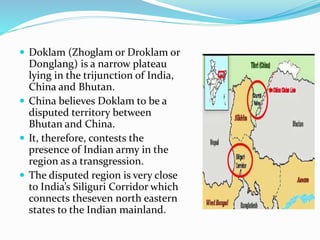
Downloaded 144 times


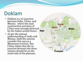
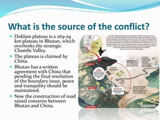
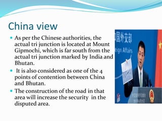
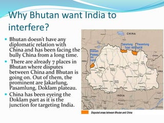


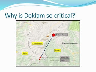
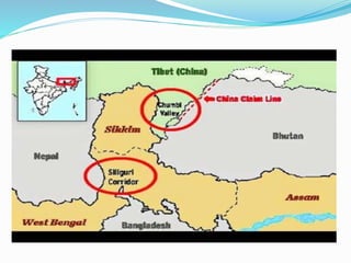


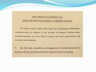


The document summarizes the Doklam border dispute between India, China, and Bhutan. It provides background on the disputed area of Doklam plateau and explains the strategic importance to both India and China. It discusses China's road construction activities that prompted the Indian military intervention on behalf of Bhutan. The summary also outlines the diplomatic efforts undertaken by India to resolve the issue and China's response and stance over its territorial claims in the region.


