De erfgoedradar: kansen voor vrijwilligers door Verbeek B., Seinen P., Werkgroep Innovatieve Meettechnieken tbv Archeologie (WIMA) (Nl.)
•Download as PPTX, PDF•
1 like•192 views

Studiedag 13 juni 2018: de rol van geofysisch onderzoek in het archeologieproces Presentatie van de lezing De erfgoedradar: kansen voor vrijwilligers door Verbeek B., Seinen P., Werkgroep Innovatieve Meettechnieken tbv Archeologie (WIMA) (Nl.)

Recommended
Recommended
More Related Content
Similar to De erfgoedradar: kansen voor vrijwilligers door Verbeek B., Seinen P., Werkgroep Innovatieve Meettechnieken tbv Archeologie (WIMA) (Nl.)
Similar to De erfgoedradar: kansen voor vrijwilligers door Verbeek B., Seinen P., Werkgroep Innovatieve Meettechnieken tbv Archeologie (WIMA) (Nl.) (20)
More from Onroerend Erfgoed
More from Onroerend Erfgoed (20)
Recently uploaded
Recently uploaded (20)
De erfgoedradar: kansen voor vrijwilligers door Verbeek B., Seinen P., Werkgroep Innovatieve Meettechnieken tbv Archeologie (WIMA) (Nl.)
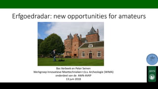
- 1. Erfgoedradar: new opportunities for amateurs Bas Verbeek en Peter Seinen Werkgroep Innovatieve Meettechnieken t.b.v. Archeologie (WIMA) onderdeel van de AWN-AVKP 13 juni 2018
- 2. Overview • AWN-AVKP-WIMA • Equipment • Workflow • Examples and results • Conclusions
- 3. About AWN-AVKP-WIMA • Most Dutch amateur archeologists are members of “Archeologische Werkgroep Nederland (AWN)” or local groups associated with the AWN. • The “Werkgroep Innovatieve Meetechnieken tbv Archeologie (WIMA)” is part of region 23: “Archeologische Vereniging Kempen-Peelland(AVKP)”. • WIMA focusses on surveying, researching, deploying, processing, presenting and demonstrating new innovative techniques - in particular Ground Penetrating Radar (GPR).
- 4. Our Mission • WIMA meets the demand for innovative surveying techniques to involve amateurs in non-destructive archaeological fieldwork within the existing legislation. • New surveying techniques offer opportunities not only for existing amateurs but also boost the image of archeology to attract a new generation of amateurs. • WIMA believes in synergy between professionals and amateurs. The accessibility of new survey techniques will not only give an impulse to archaeological research but also will improve the quality. • Conclusions from Vestigia report (Het gebruik van geofysische prospectietechnieken in de Nederlandse archeologie 2011): the need for more investments, field surveys and scientific debate.
- 5. WIMA results 2013 - 2018: • Pilot projects in late 2013 • Deployment of the Erfgoedradar in 2014 • 75 field surveys carried out in collaboration with amateurs, professionals and students • Step-by-step workflow designed using WIMA expertise • Articles in local newspapers, magazines and tv documentaries. • Participation in scientific debates and workshops • Book publication of findings and results (2019) wima.avkp@hccnet.nl www.erfgoedradar.nl
- 6. The Erfgoedradar – Sensing Heritage • No such thing as a commercial “Off The Shelf” device • There is no such thing as a “show me the archaeology button” • There is no such thing as a “position me in history button” • There is no such thing as a “synthesis button” • Hardware • GPR (500MHz) • GNSS (RTK) • Ruggedized Table PC • Software • RadarMAP (real time) • PRISM (post processing) • Golden Software (final mapping) • Workflow • Step by step “key to success” guide
- 7. Step 1: Preparation Step 2: Field work Step 3: Processing Step 4: Prospection Map Step 5: Interpretation -> back to Step 3-(2) Step 6: Testing and answering research question(s) Step 7: Conclusions Workflow:
- 8. Step 1: Preparations • Clear objectives and goals (intake form) • Prospection model • Research questions • Defining Plan of Approach: • Research question i.e. knowledge about geometry • Soil conditions i.e. contrast and depth • Terrain conditions i.e. GPR ground coupling • Location conditions i.e. RTK GNSS positioning
- 9. Step 2: Fieldwork • Verification fieldwork survey strategy Plan of Approach step 1 • Equipment parameters setup • parameters Bar-check (calibration and check X, Y, Z, V (RDP)) • Survey and data acquisition (good quality reflection data) • Field to finish data and file management
- 10. Step 3: Processing • Processing Raw data: Frequency filter, background noise removal, • Post processed data converting to (X,Y,Z,A) file: RD/LB/UTM of locale coordinates and Z-value: NAP/TAW or Groundlevel (MV) • Create 4D model • Create 3D model of the microrelief • Check models using visualizations: contour, amplitude slices, face-render, iso-plot and profiles
- 11. Step 4: Prospection map • Visual presentation of an "amplitude slice" map (level ground and local height ) of the data • Prospection based on degree of reflection and geometry (shape, size, depth, orientation and location) • NOTE: Prospection map is in a geophysical context
- 12. Step 5 : Interpretation • Merging the prospection map with known (archaeological) information (collaboration between WIMA, amateurs and professionals) • Verify data to the Feature Library or Synthetic Model • Identification based on degree of reflection and geometry (shape, size, depth, orientation and location) • Further analysis of the reflection radardiagrams • If necessary jump back to step 2-3 NOTE: Interpretation is in an archeological context
- 13. Step 6: Testing and answering • Assessment of prospection model • Answering research questions • Final Mapping, additional visualization and reporting of the results
- 14. Step 7: Conclusions • Adjust workflow to findings • Addition to the Feature Library
- 15. Examples and Results • 75 Projects: • archaeological periods • soil types • objects • bycatch • Highlights
- 16. Mierlo Castle
- 18. Paterskerk – Weert - 5 juni 1568
- 19. Excavation at ground level – Zandoerle
- 20. Conclusions • WIMA has shown that geophysics with GPR is efficient, scientifically validated and economically feasible and can be easily integrated in the archaeological process: Non-destructive GPR allows amateurs to participate fully in the archaeological process within the rules of the Valletta Convention; Adjusting and adapting expectations is a must. Like all techniques, GPR has known limitations - Focus on what you can see instead of what you can't see. Geophysics is a piece of the puzzle - not a magic box that makes a video of what is under the ground which answers all your questions; Amateurs generally work on a non-profit basis - costs are limited to equipment rental only.