Download to read offline
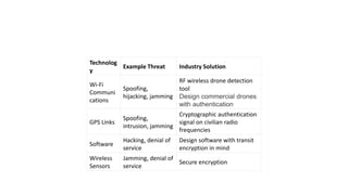
![• HUMAN ACTIVITY ANALYTICS
• GREENHOUSE GAS EMISSIONS
• WILDFIRE RISK FORECASTING
• EARTH OBSERVATION [ GIS etc.]
• FLOOD MONITORING
• DIGITAL FARMING
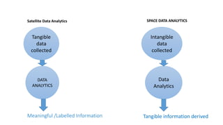
Primary Satellite data analytics SPACE DATA ANALYTICS
• PLANET CONSTITUENTS /
COMPOSITION
• PROBABILITY OF LIFE SAVING
MICROBES / ELEMENTS
• KNOWING ABOUT UNIVERSE](https://image.slidesharecdn.com/dataanalyticsspacefinal-200712163149/85/Data-analytics-space-final-3-320.jpg)
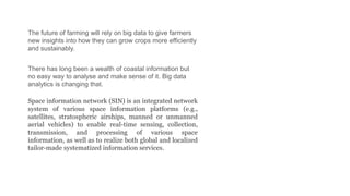
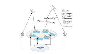
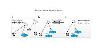

The document discusses space data analytics and various applications of analyzing data collected from satellites and space-based sensors. It provides examples of how satellite data can be used for applications like flood monitoring, wildfire risk forecasting, human activity analysis, and more. It also discusses challenges like spectrum sharing between sensors and the use of machine learning for tasks like space navigation, rocket landing, and analyzing data from planets.