
Recommended
More Related Content
What's hot
What's hot (20)
More from Amrata Yadav
Recently uploaded
Recently uploaded (20)
Classification of Gwalior based town planning parameters
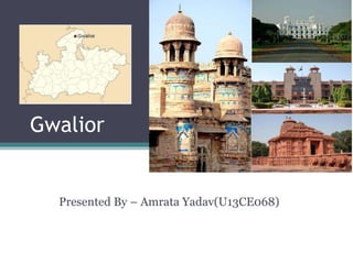
- 1. Gwalior Presented By – Amrata Yadav(U13CE068)
- 2. DEMOGRAPHIC CHARACTERSTICS 1. Population- • Gwalior has a population of around 19 lacs. • Males constitute 53% of the population and females 47%. • Gwalior has an average literacy rate of 87.2%, higher than the national average of 74%. • In Gwalior, 13% of the population is under 6 years of age.
- 3. 2.Religion • Hinduism is practised by the majority of the people in Gwalior (88.84%). • Other religions practised include Islam (8.58%), Jainism (1.41%), Sikhism (0.56%) and Christianity (0.29). Hindu Islam Jainism Sikhism Christianity
- 4. 3. Languages • Hindi in its standard form is widely spoken in Gwalior. Marathi is the second biggest language of the city, spoken by 20% of the population. • There is a strong Marathi influence in Gwalior due to Maratha Rule over the centuries.
- 5. GEOGRAPHY 1. Location and Elevation • Gwalior is located in northern Madhya Pradesh 300 km from Delhi. • Relatively level plain in topography. • It has an average elevation of 197 metres. Most part of it comes under Bundelkhand region. • Area- 780 square km
- 6. 2. Climate • Gwalior has a sub-tropical climate with 1. hot summers from late March to early July, 2. the humid monsoon season from late June to early October, and 3. a cool dry winter from early November to late February. • Gwalior receives 900 mm of rain on average per year, most of which is concentrated in the Monsoon months (from late June to early October)
- 8. Transport and connectivity 1. Railway Network- Gwalior is a major railway junction in the Northern central region. • Gwalior is one of the few places where both narrow gauge and broad gauge railways tracks are operational. • Gwalior is the terminus for the longest narrow gauge route operating in the world, covering a distance of 198 km from Gwalior Junction to Sheopur
- 10. 2. Road Network- • Gwalior is fairly well connected to other parts of Madhya Pradesh and India by national and state highways. • The proposed North-south-Corridor of the Golden- Quadrilateral Highway project passes through the city. • The Agra-Bombay national highway (NH3) passes through Gwalior, connecting it to Shivpuri on one end and Agra on the other. • There are bus services to and from all major and minor cities near Gwalior, including Bhopal, Agra, Delhi, Jabalpur, Jhansi, Jaipur, and Indore.
- 11. • Gwalior has an airport. It also has an Indian Air Force Base which stations fighters.
- 12. Recreational Places and Tourist Places in Gwalior Gwalior Fort Jai Vilas Mahal
- 13. Sas Bahu Temple Sun Temple Teli K Mandir
- 14. Tomb of Mohammad Ghaus Gwalior Zoo Madhav National Park
- 15. Economy of Gwalior • Gwalior is surrounded by 3 Industrial areas. • The important industries includes dairy, chemical, manufacturing, textiles, and other industries. • The tourism sector also puts an effect into the city's economy. • The Gwalior Trade Fair is an annual trade fair showcasing the economy of Gwalior.
- 16. Classification of City 1. Topography- Plain 2. Population wise- Metro City 3. Shape- Radial 4. General – Evolved city 5. Functional - Historical City 6. Growth of City- Natural Growth