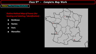
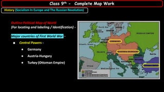
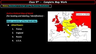
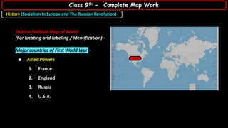
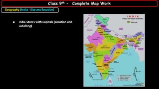
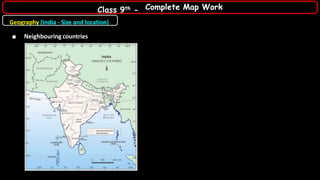
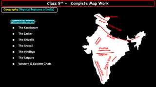
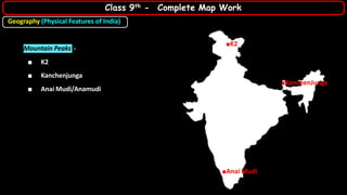
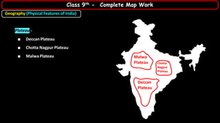
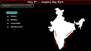
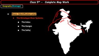
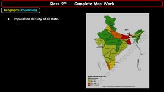
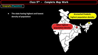
The document outlines a complete map work guide for 9th-grade social science, covering political maps of France and the major countries involved in World War I, both Central and Allied Powers. It also includes geographical information about India, such as states with capitals, mountain ranges, rivers, and climate patterns, along with historical themes like the French Revolution and socialism in Europe. Key features like population density across Indian states are also addressed, providing a comprehensive resource for students preparing for their final exams.