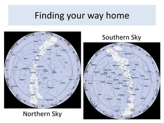
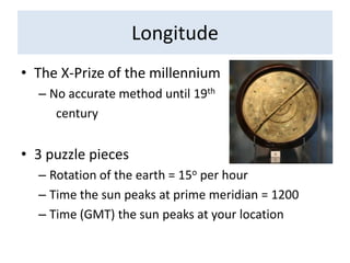
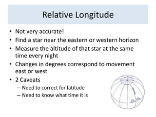
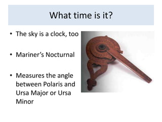
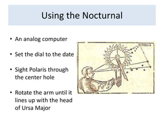
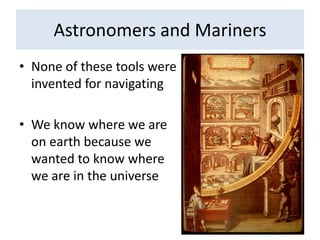
Sailing by Starlight: the Lost Art of Celestial NavigationAndrew Thaler
Do you know where you are?
Finding your way home
Finding your way homeSouthern SkyNorthern Sky
Finding your way homeHow do you travel in a straight line?Latitude hookMust be calibrated to a specific locationPolaris above the loop, head southPolaris below the loop, head northKamalWhy does this work?
Determining LatitudePolaristan θ = x/yθ = LatitudeXθHorizony
Determining LatitudeAccurate to within 1 Degree1 degree of latitude = 60 minutes1 minute = 1 nautical milePolaris is 430 light years away2.5 X 1015 milesIf surveyors were as accurate as Polaris - 0.0000000002 inchesIf Polaris was as accurate as a surveyors - 4,000,000,000 miles
Latitude is θCross staffQuadrantAstrolabeOctantSextant
LongitudeThe X-Prize of the millenniumNo accurate method until 19thcentury3 puzzle piecesRotation of the earth = 15o per hourTime the sun peaks at prime meridian = 1200Time (GMT) the sun peaks at your location
Relative LongitudeNot very accurate!Find a star near the eastern or western horizonMeasure the altitude of that star at the same time every nightChanges in degrees correspond to movement east or west2 CaveatsNeed to correct for latitudeNeed to know what time it is
What time is it?The sky is a clock, tooMariner’s NocturnalMeasures the angle between Polaris and Ursa Major or Ursa Minor
Using the NocturnalAn analog computer
Set the dial to the date
Sight Polaris through the center hole

Celestial navigation

  • 1.
    Sailing by Starlight:the Lost Art of Celestial NavigationAndrew Thaler
  • 2.
    Do you knowwhere you are?
  • 3.
  • 4.
    Finding your wayhomeSouthern SkyNorthern Sky
  • 5.
    Finding your wayhomeHow do you travel in a straight line?Latitude hookMust be calibrated to a specific locationPolaris above the loop, head southPolaris below the loop, head northKamalWhy does this work?
  • 6.
    Determining LatitudePolaristan θ= x/yθ = LatitudeXθHorizony
  • 7.
    Determining LatitudeAccurate towithin 1 Degree1 degree of latitude = 60 minutes1 minute = 1 nautical milePolaris is 430 light years away2.5 X 1015 milesIf surveyors were as accurate as Polaris - 0.0000000002 inchesIf Polaris was as accurate as a surveyors - 4,000,000,000 miles
  • 8.
    Latitude is θCrossstaffQuadrantAstrolabeOctantSextant
  • 9.
    LongitudeThe X-Prize ofthe millenniumNo accurate method until 19thcentury3 puzzle piecesRotation of the earth = 15o per hourTime the sun peaks at prime meridian = 1200Time (GMT) the sun peaks at your location
  • 10.
    Relative LongitudeNot veryaccurate!Find a star near the eastern or western horizonMeasure the altitude of that star at the same time every nightChanges in degrees correspond to movement east or west2 CaveatsNeed to correct for latitudeNeed to know what time it is
  • 11.
    What time isit?The sky is a clock, tooMariner’s NocturnalMeasures the angle between Polaris and Ursa Major or Ursa Minor
  • 12.
    Using the NocturnalAnanalog computer
  • 13.
    Set the dialto the date
  • 14.
    Sight Polaris throughthe center hole

Editor's Notes

  • #3 What would you do without all these things?
  • #4 Step 1 – figure out what hemisphere you’re inPlenty of ocean to get lost in
  • #5 Celestial pole – lucky if you’re in the north, polaris is at the poleLearn your landmarks – the two bears in the north, the southern cross in the southFind the southern pole by drawing a line from acrux and the tip of the cross and between agena and rigelcentaurus, lines intersect at the southern celestial pole
  • #8 20 billionths of an inch4 billion miles