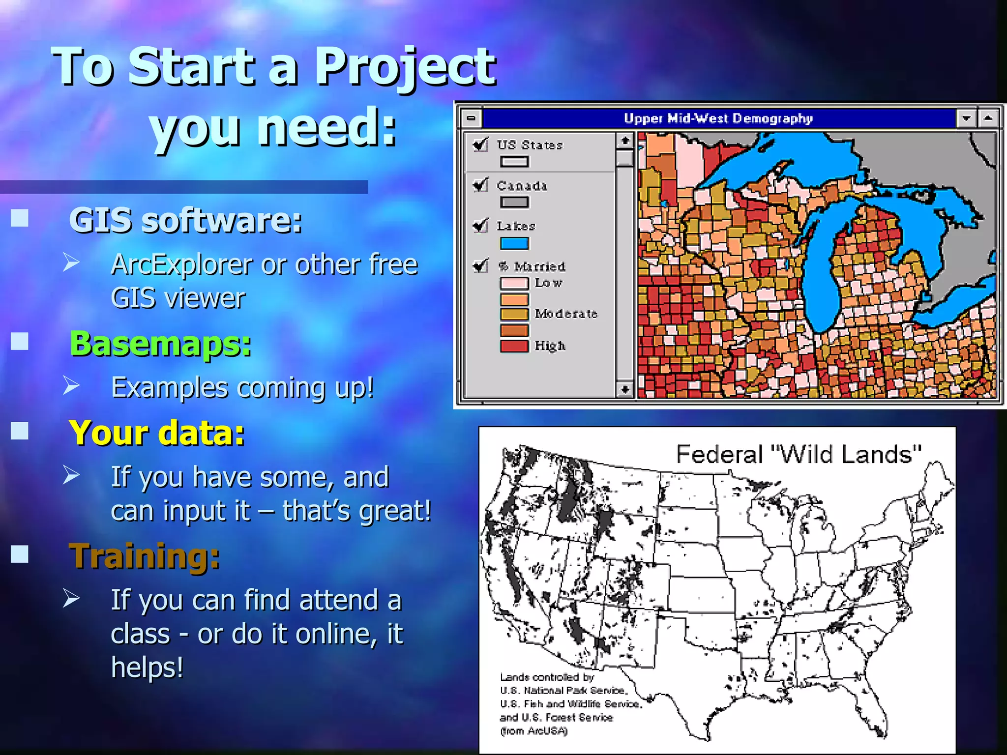
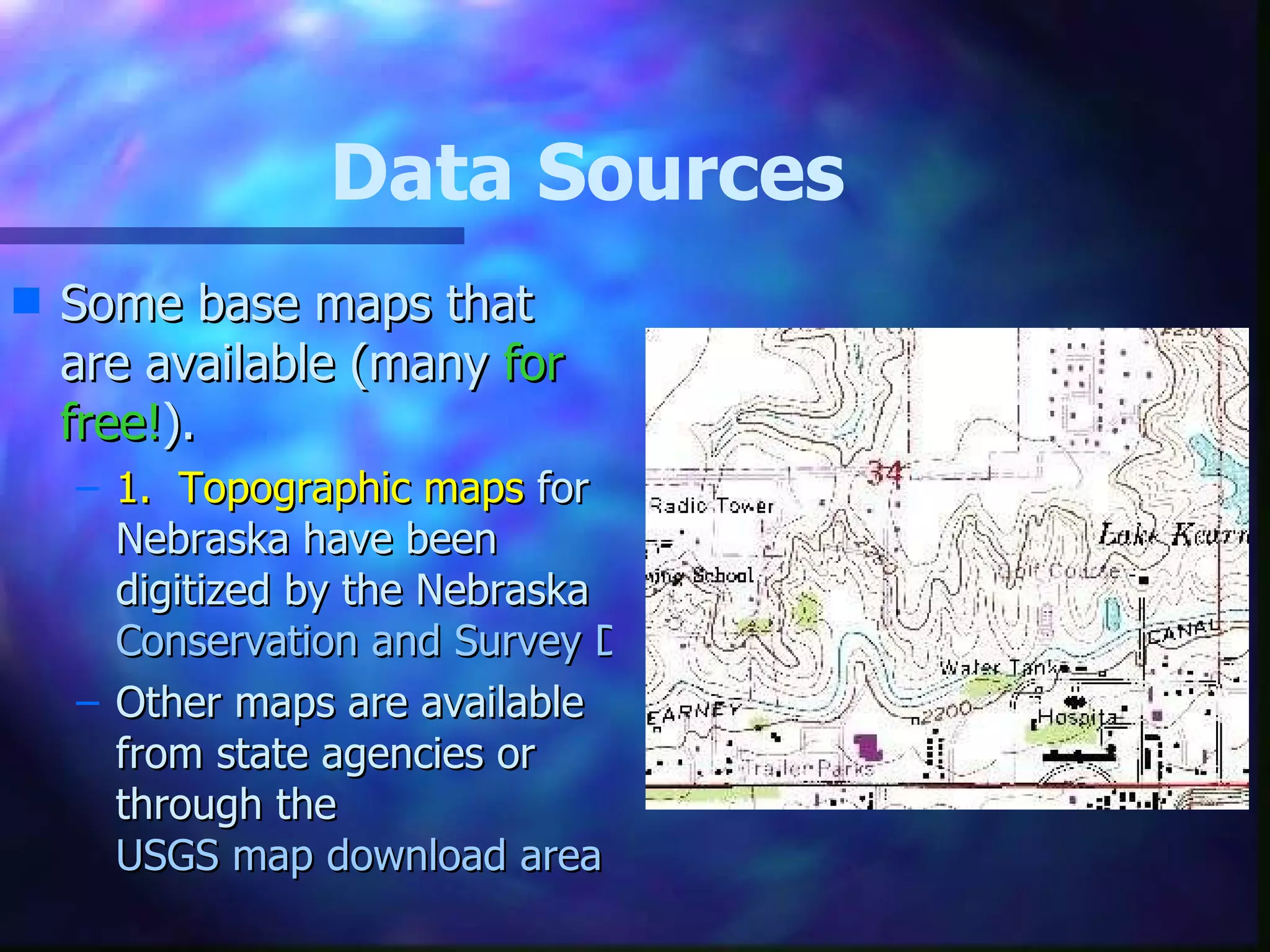
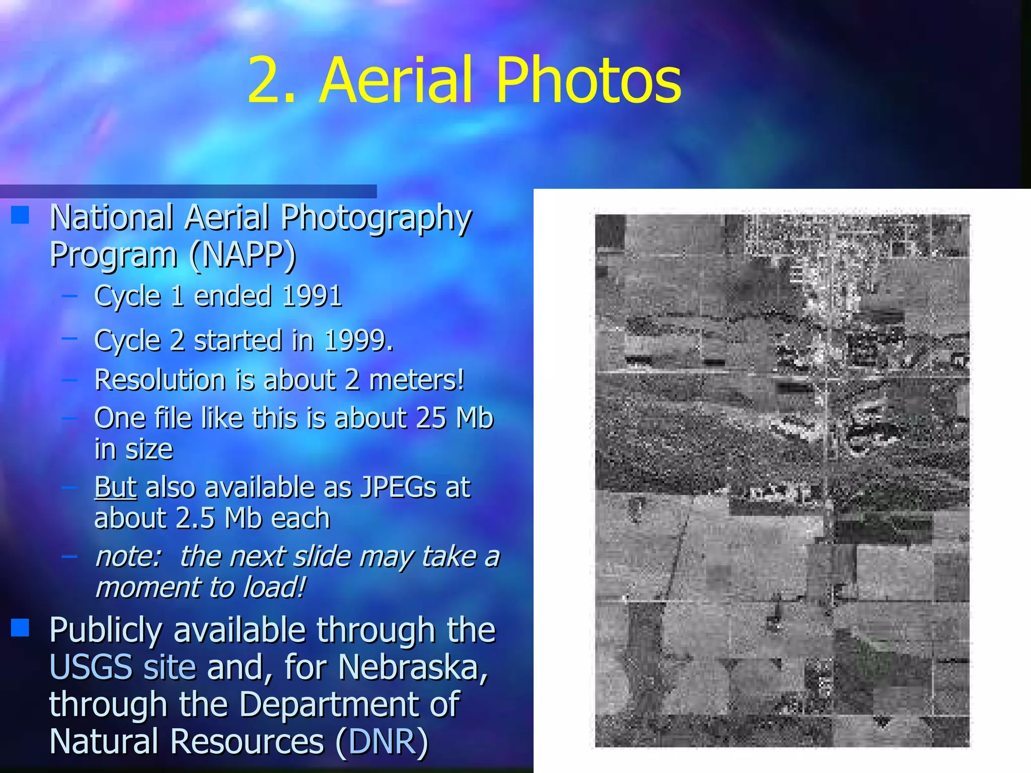
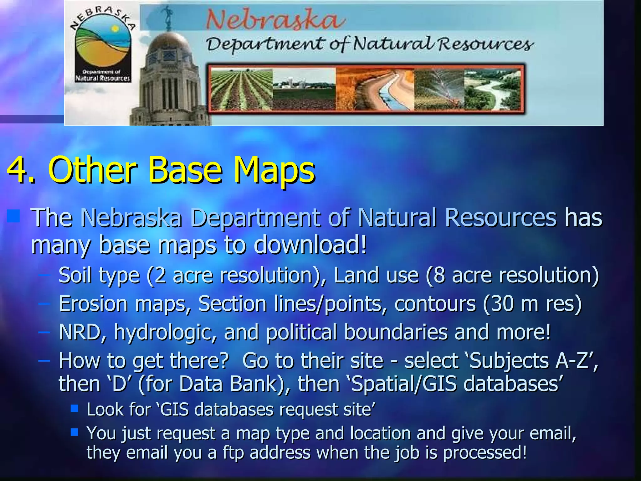
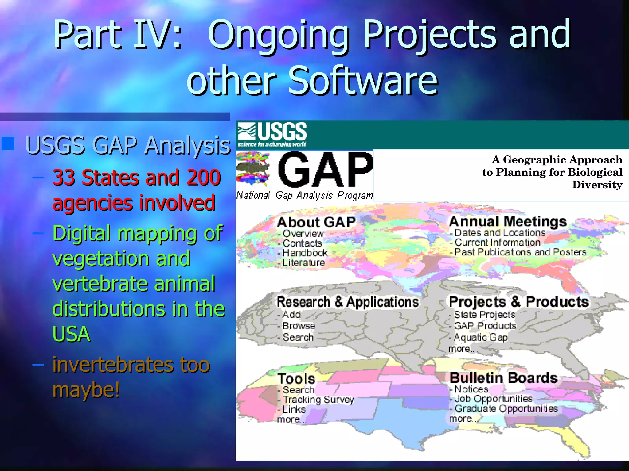
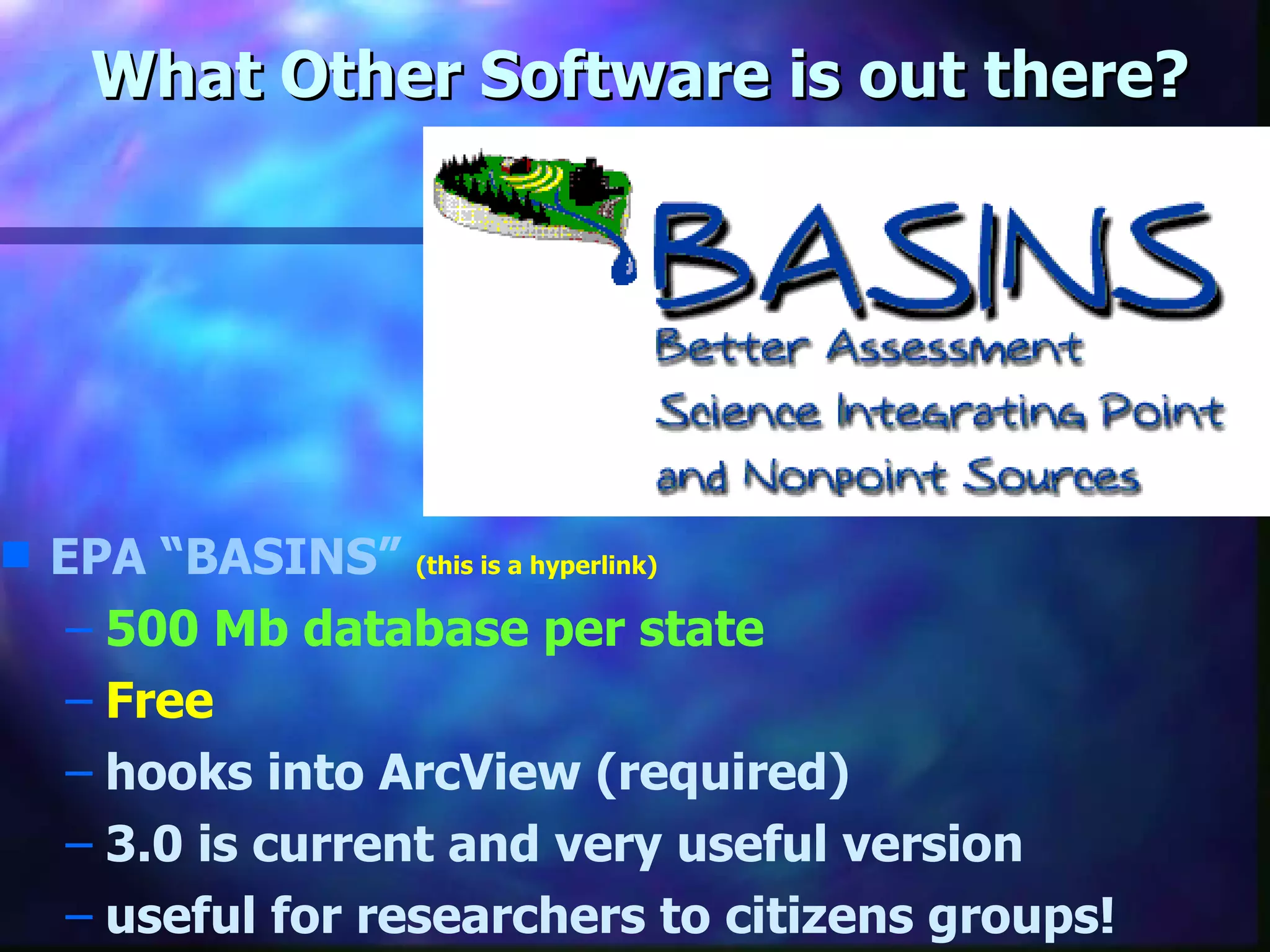
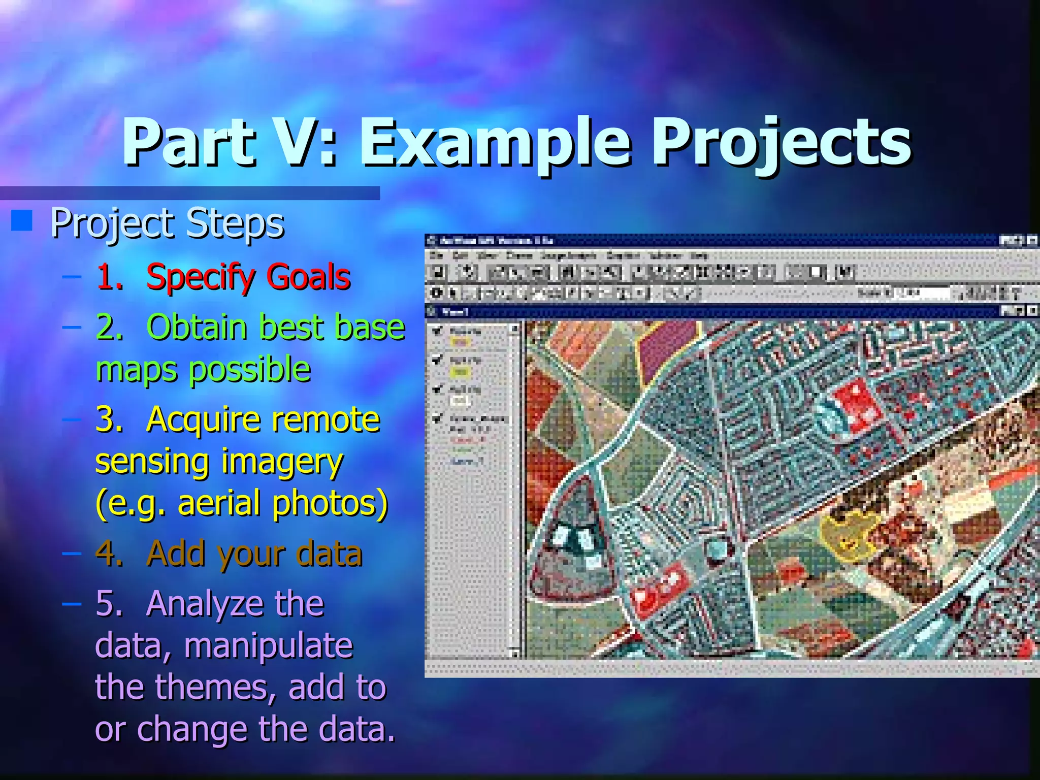
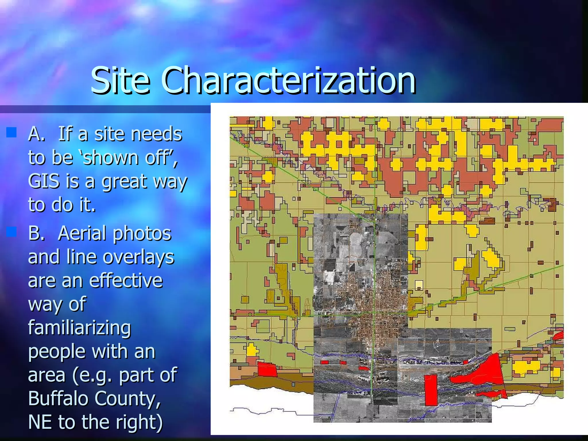
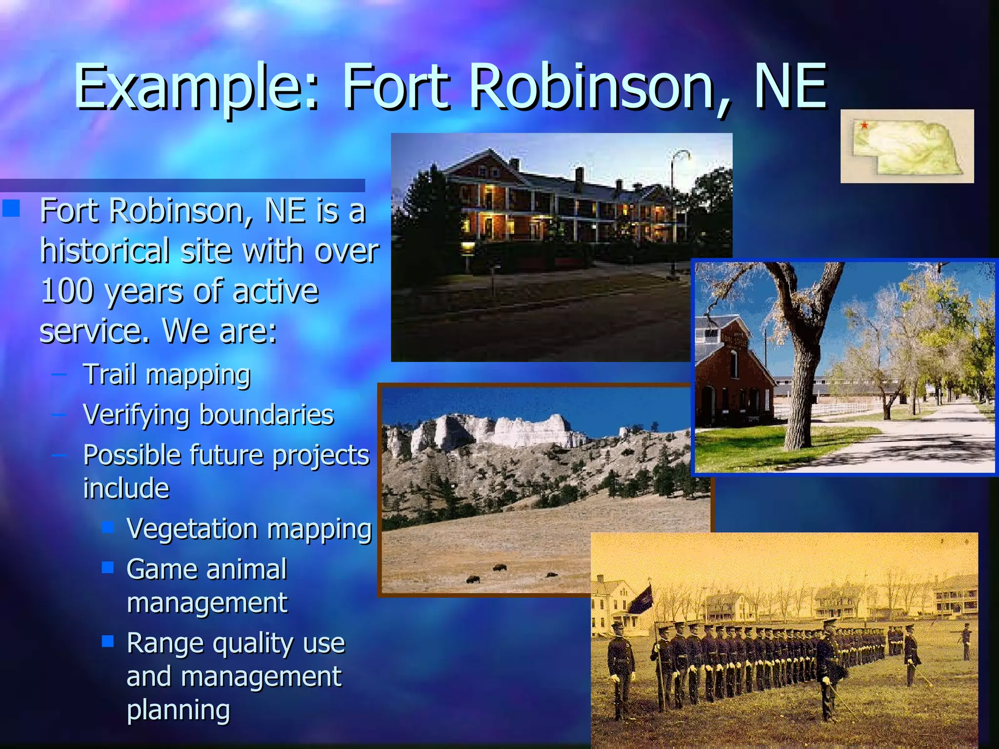
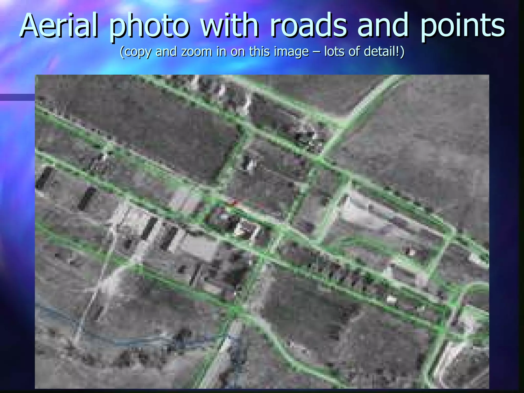
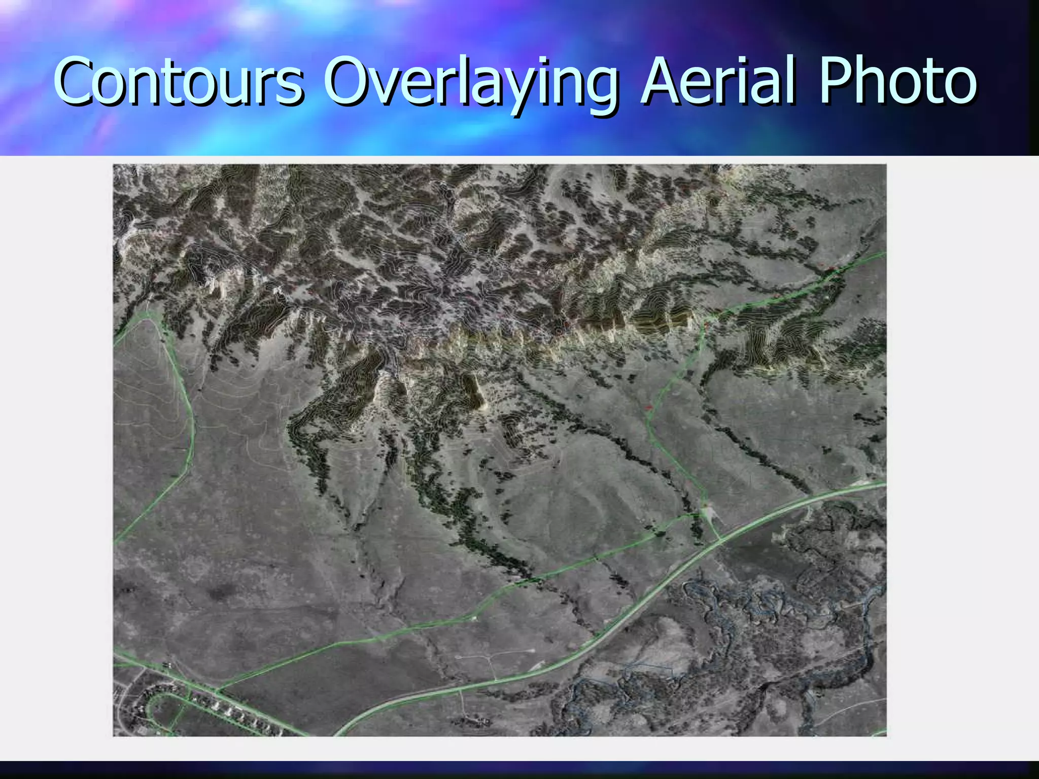
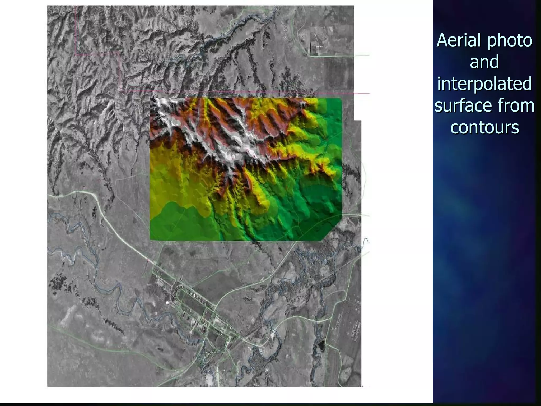
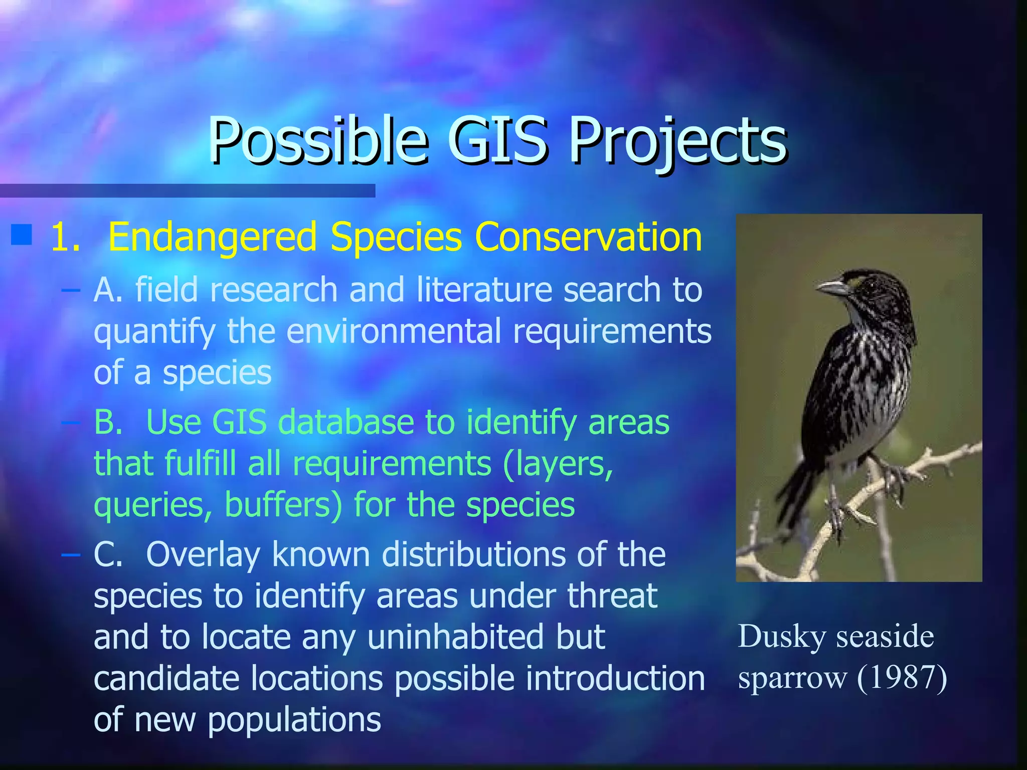
An introduction to data sources and possible projects.   Marc Albrecht University of Nebraska at Kearney Department of Biology GIS Resources and Projects
GIS Projects: An Overview Large companies and institutions are undertaking huge, complex GIS projects all the time. You have run across some examples.  The purpose here is to show you some of data sources available to you, and some project ideas that might be feasible in the classroom.
OK, Ready to get started? Part III:  Data sources: I use many Nebraska sources in this presentation because it is the state where I currently live.  Therefore I am most familiar with it resources.  Most states now have similar resources, as you find them, please share with us! Keep in mind the good part:  most data from state and Federal sources are FREE (maybe cost of duplication). Its not really free of course, but it does make you feel like your tax dollars are working for you!
To Start a Project you need: GIS software:   ArcExplorer or other free GIS viewer Basemaps: Examples coming up! Your data: If you have some, and can input it – that’s great! Training: If you can find attend a class - or do it online, it helps!
Data Sources Some base maps that are available (many  for free! ). 1.  Topographic maps  for Nebraska have been digitized by the Nebraska  Conservation and Survey Division Service Other maps are available from state agencies or through the  USGS map download area
2. Aerial Photos National Aerial Photography Program (NAPP)  Cycle 1 ended 1991 Cycle 2 started in 1999.   Resolution is about 2 meters! One file like this is about 25 Mb in size But  also available as JPEGs at about 2.5 Mb each note:  the next slide may take a moment to load! Publicly available through the  USGS site  and, for Nebraska, through the Department of Natural Resources ( DNR )
4. Other Base Maps The  Nebraska Department of Natural Resources  has many base maps to download! Soil type (2 acre resolution), Land use (8 acre resolution) Erosion maps, Section lines/points, contours (30 m res) NRD, hydrologic, and political boundaries and more! How to get there?  Go to their site - select ‘Subjects A-Z’, then ‘D’ (for Data Bank), then ‘Spatial/GIS databases’ Look for ‘GIS databases request site’ You just request a map type and location and give your email, they email you a ftp address when the job is processed!
Part IV:  Ongoing Projects and other Software USGS GAP Analysis 33 States and 200 agencies involved Digital mapping of vegetation and vertebrate animal distributions in the USA invertebrates too  maybe! A Geographic Approach to Planning for   Biological Diversity
What Other Software is out there? EPA “BASINS”   (this is a hyperlink) 500 Mb database per state Free hooks into ArcView (required) 3.0 is current and very useful version useful for researchers to citizens groups!
Spatially Distributed Data in BASINS Land use/land cover   Urbanized areas  Populated place locations  Reach File, version 1 (RF1) and RF3 Alpha Streams Soils (STATSGO)  Elevation (Digital Elevation Models)  Major roads  USGS hydrologic unit boundaries (accounting unit, cataloging unit)  Drinking water supply sites  Dam sites  EPA regional, state, and county boundaries  Federal and Indian Lands  Ecoregions
Part V: Example Projects Project Steps 1.  Specify Goals 2.  Obtain best base maps possible 3.  Acquire remote sensing imagery (e.g. aerial photos) 4.  Add your data 5.  Analyze the data, manipulate the themes, add to or change the data.
Site Characterization  A.  If a site needs to be ‘shown off’, GIS is a great way to do it.  B.  Aerial photos and line overlays are an effective way of familiarizing people with an area (e.g. part of Buffalo County, NE to the right)
Example: Fort Robinson, NE Fort Robinson, NE is a historical site with over 100 years of active service. We are: Trail mapping Verifying boundaries Possible future projects include  Vegetation mapping Game animal management Range quality use and management planning
Aerial photo with roads and points (copy and zoom in on this image – lots of detail!)
Contours Overlaying Aerial Photo
Aerial photo and interpolated surface from contours
Possible GIS Projects 1.  Endangered Species Conservation A. field research and literature search to quantify the environmental requirements of a species B.  Use GIS database to identify areas that fulfill all requirements (layers, queries, buffers) for the species C.  Overlay known distributions of the species to identify areas under threat and to locate any uninhabited but candidate locations possible introduction of new populations Dusky seaside sparrow (1987)
Thanks for viewing this presentation.  If you want to learn more about doing your own GIS projects, and more capabilities of GIS please  email  me.   Images in this presentation are from the  ESRI website , the  Nebraska DNR , the  Environmental Protection Agency , and the  U.S. Geological Service .  Please visit their sites to learn more! Thanks.  11/99.  The End!

C:\Documents And Settings\Sachink\Desktop\Shilpa Study\Gis Projects Test

  • 1.
    An introduction todata sources and possible projects. Marc Albrecht University of Nebraska at Kearney Department of Biology GIS Resources and Projects
  • 2.
    GIS Projects: AnOverview Large companies and institutions are undertaking huge, complex GIS projects all the time. You have run across some examples. The purpose here is to show you some of data sources available to you, and some project ideas that might be feasible in the classroom.
  • 3.
    OK, Ready toget started? Part III: Data sources: I use many Nebraska sources in this presentation because it is the state where I currently live. Therefore I am most familiar with it resources. Most states now have similar resources, as you find them, please share with us! Keep in mind the good part: most data from state and Federal sources are FREE (maybe cost of duplication). Its not really free of course, but it does make you feel like your tax dollars are working for you!
  • 4.
    To Start aProject you need: GIS software: ArcExplorer or other free GIS viewer Basemaps: Examples coming up! Your data: If you have some, and can input it – that’s great! Training: If you can find attend a class - or do it online, it helps!
  • 5.
    Data Sources Somebase maps that are available (many for free! ). 1. Topographic maps for Nebraska have been digitized by the Nebraska Conservation and Survey Division Service Other maps are available from state agencies or through the USGS map download area
  • 6.
    2. Aerial PhotosNational Aerial Photography Program (NAPP) Cycle 1 ended 1991 Cycle 2 started in 1999. Resolution is about 2 meters! One file like this is about 25 Mb in size But also available as JPEGs at about 2.5 Mb each note: the next slide may take a moment to load! Publicly available through the USGS site and, for Nebraska, through the Department of Natural Resources ( DNR )
  • 7.
    4. Other BaseMaps The Nebraska Department of Natural Resources has many base maps to download! Soil type (2 acre resolution), Land use (8 acre resolution) Erosion maps, Section lines/points, contours (30 m res) NRD, hydrologic, and political boundaries and more! How to get there? Go to their site - select ‘Subjects A-Z’, then ‘D’ (for Data Bank), then ‘Spatial/GIS databases’ Look for ‘GIS databases request site’ You just request a map type and location and give your email, they email you a ftp address when the job is processed!
  • 8.
    Part IV: Ongoing Projects and other Software USGS GAP Analysis 33 States and 200 agencies involved Digital mapping of vegetation and vertebrate animal distributions in the USA invertebrates too maybe! A Geographic Approach to Planning for Biological Diversity
  • 9.
    What Other Softwareis out there? EPA “BASINS” (this is a hyperlink) 500 Mb database per state Free hooks into ArcView (required) 3.0 is current and very useful version useful for researchers to citizens groups!
  • 10.
    Spatially Distributed Datain BASINS Land use/land cover Urbanized areas Populated place locations Reach File, version 1 (RF1) and RF3 Alpha Streams Soils (STATSGO) Elevation (Digital Elevation Models) Major roads USGS hydrologic unit boundaries (accounting unit, cataloging unit) Drinking water supply sites Dam sites EPA regional, state, and county boundaries Federal and Indian Lands Ecoregions
  • 11.
    Part V: ExampleProjects Project Steps 1. Specify Goals 2. Obtain best base maps possible 3. Acquire remote sensing imagery (e.g. aerial photos) 4. Add your data 5. Analyze the data, manipulate the themes, add to or change the data.
  • 12.
    Site Characterization A. If a site needs to be ‘shown off’, GIS is a great way to do it. B. Aerial photos and line overlays are an effective way of familiarizing people with an area (e.g. part of Buffalo County, NE to the right)
  • 13.
    Example: Fort Robinson,NE Fort Robinson, NE is a historical site with over 100 years of active service. We are: Trail mapping Verifying boundaries Possible future projects include Vegetation mapping Game animal management Range quality use and management planning
  • 14.
    Aerial photo withroads and points (copy and zoom in on this image – lots of detail!)
  • 15.
  • 16.
    Aerial photo andinterpolated surface from contours
  • 17.
    Possible GIS Projects1. Endangered Species Conservation A. field research and literature search to quantify the environmental requirements of a species B. Use GIS database to identify areas that fulfill all requirements (layers, queries, buffers) for the species C. Overlay known distributions of the species to identify areas under threat and to locate any uninhabited but candidate locations possible introduction of new populations Dusky seaside sparrow (1987)
  • 18.
    Thanks for viewingthis presentation. If you want to learn more about doing your own GIS projects, and more capabilities of GIS please email me. Images in this presentation are from the ESRI website , the Nebraska DNR , the Environmental Protection Agency , and the U.S. Geological Service . Please visit their sites to learn more! Thanks. 11/99. The End!