Download as PDF, PPTX

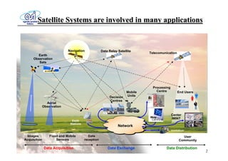
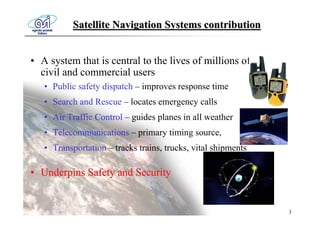
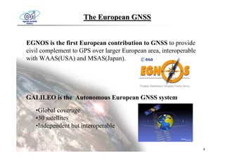
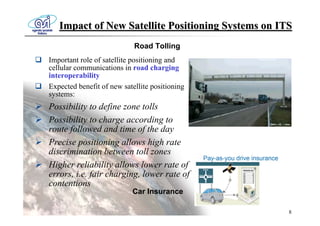


The document discusses the importance of satellite navigation systems, particularly the European GNSS (Galileo), in various sectors including public safety, transportation, and emergency services. It outlines the benefits of enhanced positioning technology for road tolling, emergency response, and monitoring hazardous goods transportation, improving safety and operational efficiency. Additionally, it addresses the need for policies to mitigate GNSS vulnerabilities and recommends advancements in receiver technologies.


![Sandrock _Telematics Pro [Sola Lettura]](https://cdn.slidesharecdn.com/ss_thumbnails/sandrocktelematicsprosolalettura-091027085048-phpapp02-thumbnail.jpg?width=640&height=640&fit=bounds)


