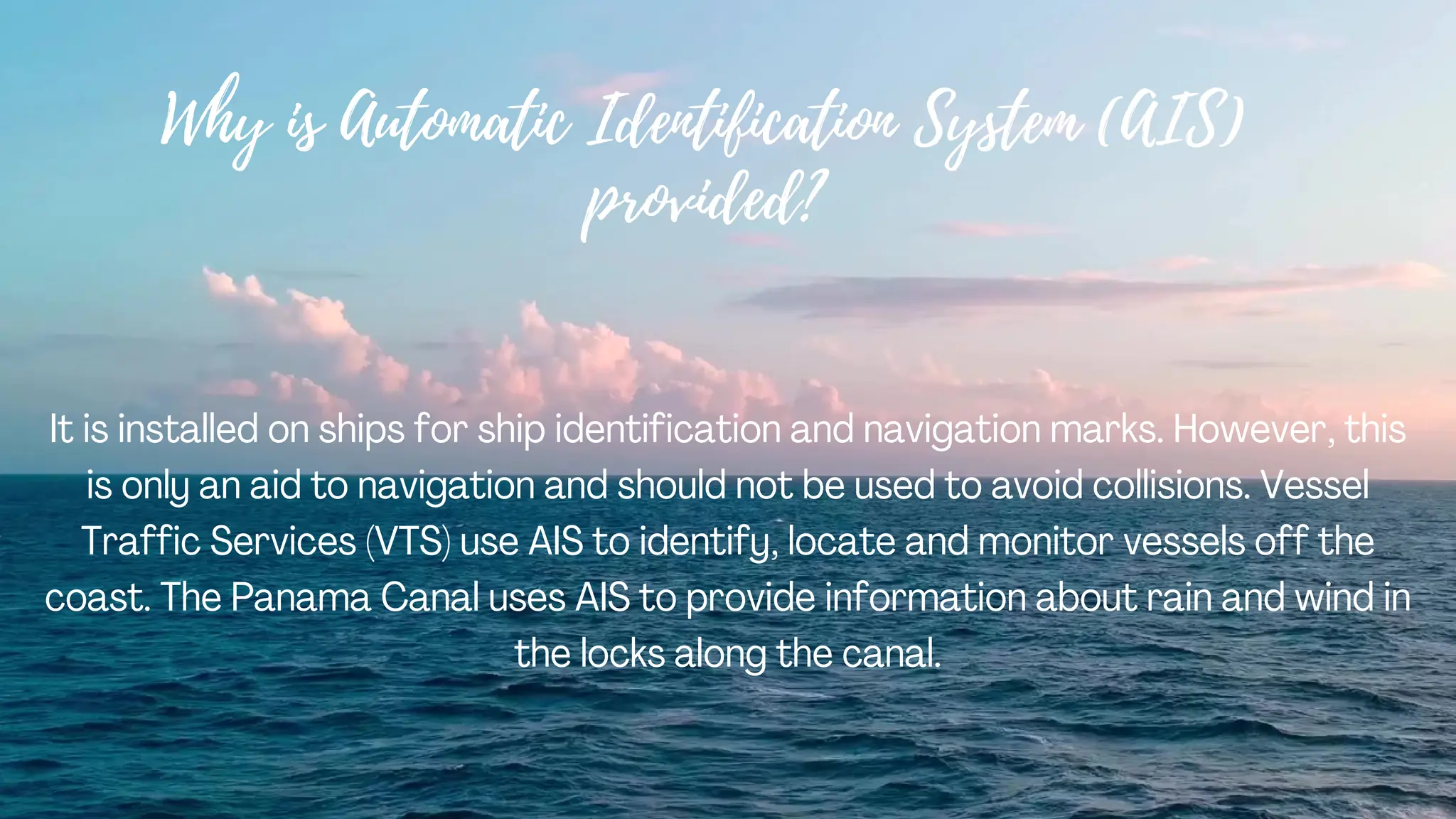
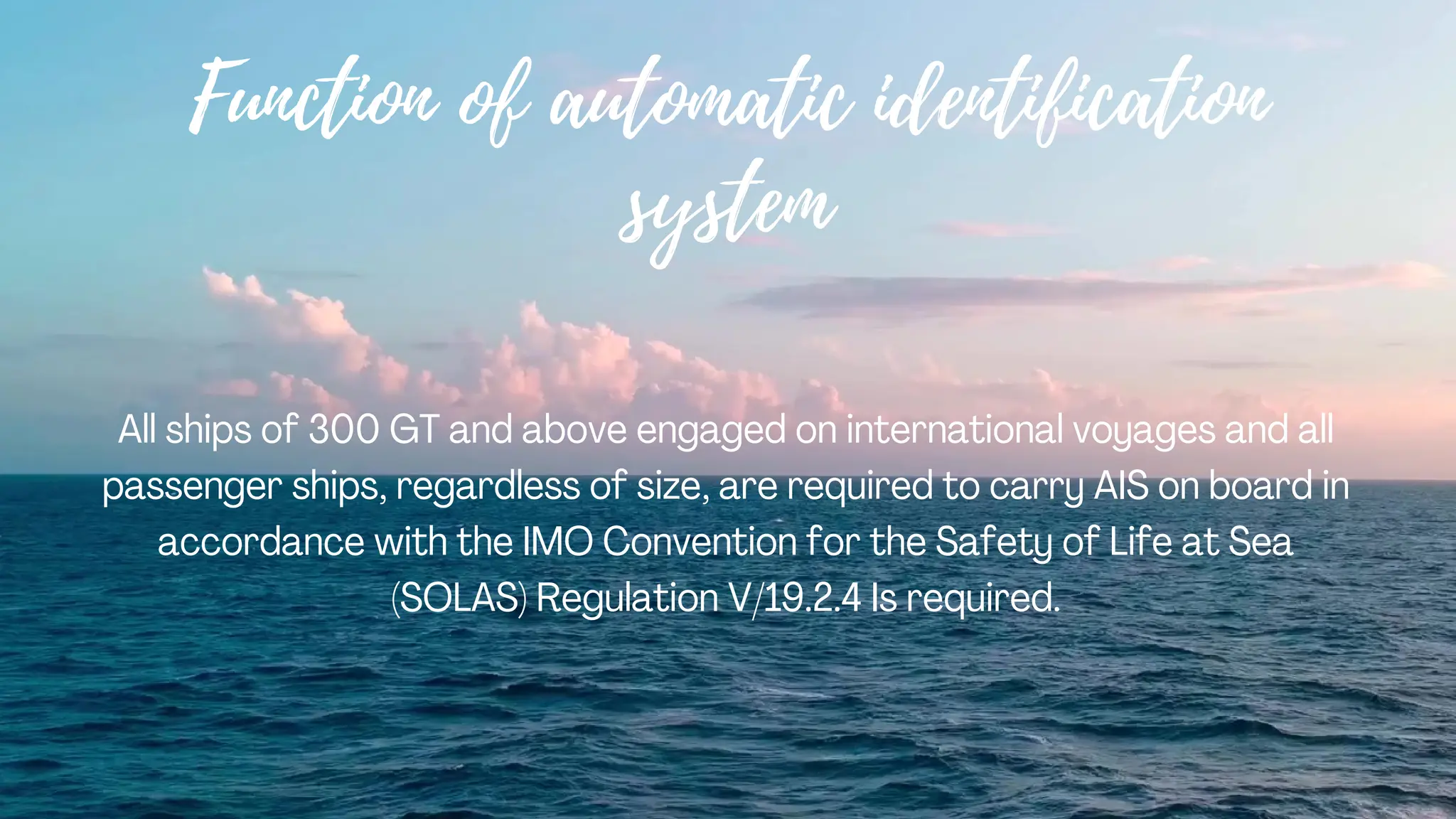
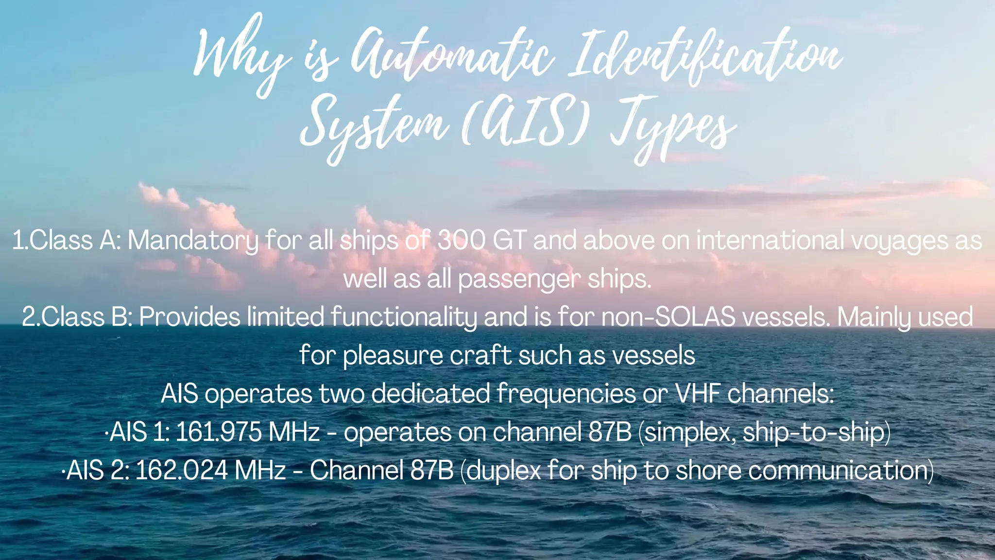
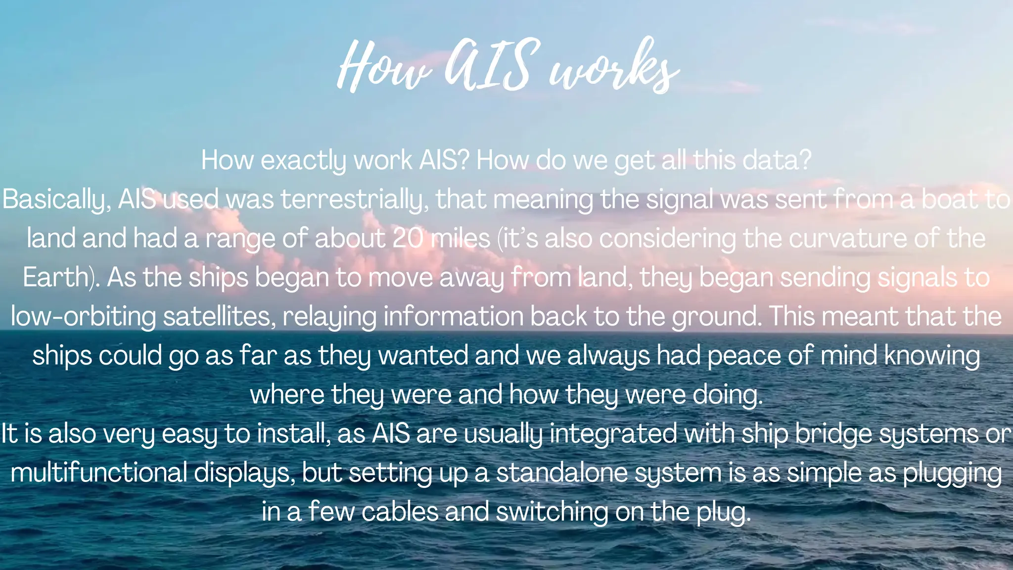
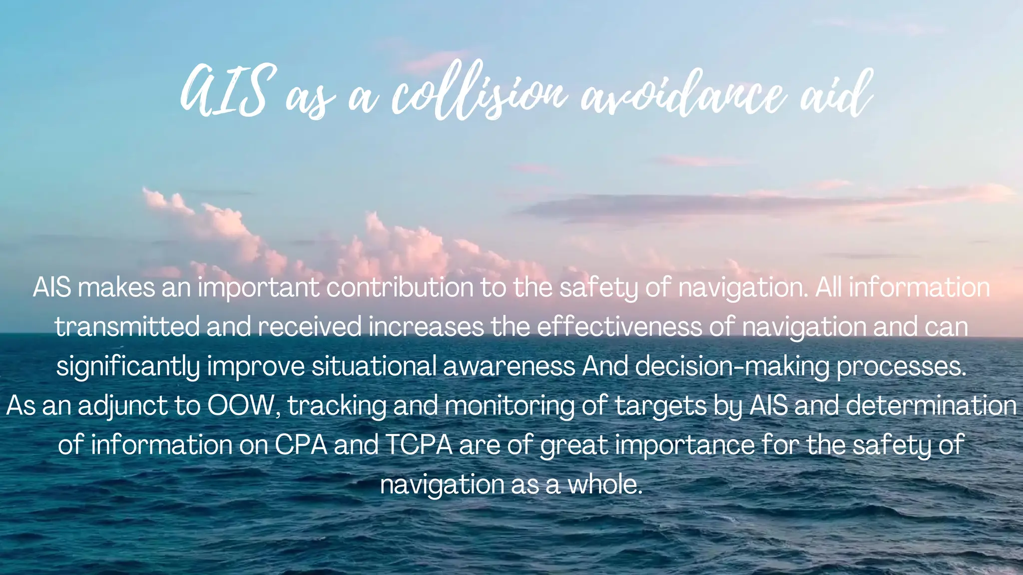
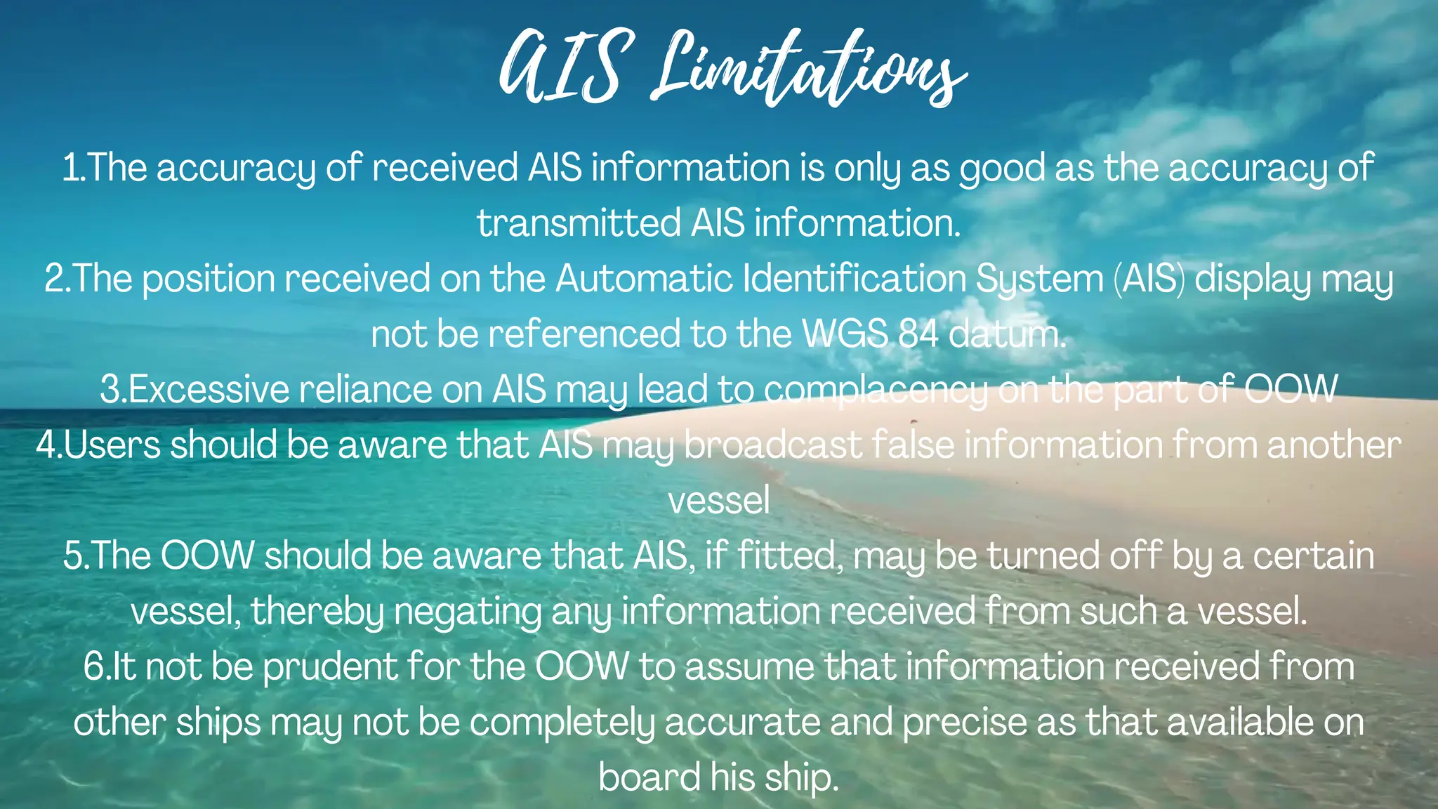
The Automatic Identification System (AIS) is a tracking system used in the maritime industry to improve the safety and management of vessel traffic. Its primary function is to allow ships and shore-based stations to automatically exchange information regarding their identity, position, speed, heading, and other relevant data. AIS is mandated by the International Maritime Organization (IMO) and is a crucial tool for enhancing maritime situational awareness, aiding in collision avoidance, and enabling efficient traffic management in busy waterways.
AIS operates through VHF radio frequencies, with AIS transponders installed on ships continuously broadcasting information such as the vessel's name, size, type, position, course, speed, navigational status, and other relevant details. Vessels equipped with AIS can receive this information from other nearby ships as well as coastal base stations. This exchange of data helps in improving the awareness of vessel movements, thereby reducing the risk of collisions and enhancing overall maritime security.
The information transmitted by AIS can also be received by satellite-based receivers, allowing for global tracking of vessels. This data is often used by authorities, port operators, and other stakeholders in the maritime industry for monitoring, traffic management, search and rescue operations, and to enforce maritime regulations.
AIS has significantly improved communication and awareness among vessels at sea, contributing to safer navigation and more effective maritime operations.
2. What is Automatic Identification System
(AIS)
Automatic Identification System is an
automatic tracking system this is displays
other vessels in the vicinity. The broadcast
transponder system operates in the VHF
mobile marine band.
3. Your ship is also visible on the screens of other
ships nearby, provided your ship is equipped
with AIS. If AIS is not fitted or not operational,
information is not exchanged on vessels via
AIS.
AIS onboard must be kept on at all times
unless the master considers that it should be
turned off for safety reasons or for any other
reason. The mode of operation of AIS is
continuous and autonomous
5. Why is Automatic Identification System (AIS)
provided?
It is installed on ships for ship identification and navigation marks. However, this
is only an aid to navigation and should not be used to avoid collisions. Vessel
Traffic Services (VTS) use AIS to identify, locate and monitor vessels off the
coast. The Panama Canal uses AIS to provide information about rain and wind in
the locks along the canal.
6. Function of automatic identification
system
All ships of 300 GT and above engaged on international voyages and all
passenger ships, regardless of size, are required to carry AIS on board in
accordance with the IMO Convention for the Safety of Life at Sea
(SOLAS) Regulation V/19.2.4 Is required.
7. Why is Automatic Identification
System (AIS) Types
1.Class A: Mandatory for all ships of 300 GT and above on international voyages as
well as all passenger ships.
2.Class B: Provides limited functionality and is for non-SOLAS vessels. Mainly used
for pleasure craft such as vessels
AIS operates two dedicated frequencies or VHF channels:
·AIS 1: 161.975 MHz - operates on channel 87B (simplex, ship-to-ship)
·AIS 2: 162.024 MHz - Channel 87B (duplex for ship to shore communication)
8. How AIS works
How exactly work AIS? How do we get all this data?
Basically, AIS used was terrestrially, that meaning the signal was sent from a boat to
land and had a range of about 20 miles (it’s also considering the curvature of the
Earth). As the ships began to move away from land, they began sending signals to
low-orbiting satellites, relaying information back to the ground. This meant that the
ships could go as far as they wanted and we always had peace of mind knowing
where they were and how they were doing.
It is also very easy to install, as AIS are usually integrated with ship bridge systems or
multifunctional displays, but setting up a standalone system is as simple as plugging
in a few cables and switching on the plug.
9. Data Transmitted
1.Static notification every 6 minutes
2.Information of Dynamic (course changes and Depends on speed )
3.Information of Voyage Related (Every 7 minutes, when data is modified or upon
request)
4.short safety message
10. As a surveillance tool AIS
In coastal waters, shore authorities may install automated AIS stations to monitor the
movement of vessels through the area.
Coastal stations can use AIS to monitor the movement of dangerous goods and
control commercial fishing operations in their waters. AIS can also be used for SAR
operations, allowing SAR officers to use AIS information to assess the availability of
other ships in the vicinity of the incident.
11. AIS as a collision avoidance aid
AIS makes an important contribution to the safety of navigation. All information
transmitted and received increases the effectiveness of navigation and can
significantly improve situational awareness And decision-making processes.
As an adjunct to OOW, tracking and monitoring of targets by AIS and determination
of information on CPA and TCPA are of great importance for the safety of
navigation as a whole.
12. AIS Limitations
1.The accuracy of received AIS information is only as good as the accuracy of
transmitted AIS information.
2.The position received on the Automatic Identification System (AIS) display may
not be referenced to the WGS 84 datum.
3.Excessive reliance on AIS may lead to complacency on the part of OOW
4.Users should be aware that AIS may broadcast false information from another
vessel
5.The OOW should be aware that AIS, if fitted, may be turned off by a certain
vessel, thereby negating any information received from such a vessel.
6.It not be prudent for the OOW to assume that information received from
other ships may not be completely accurate and precise as that available on
board his ship.