Downloaded 44 times


![J9707 19 July 2013
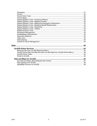
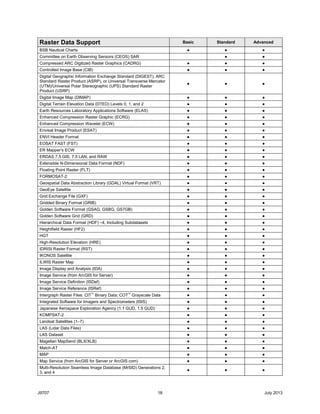
Raster Data Support Basic Standard Advanced
MrSID (MG4) Lidar ● ● ●
National Imagery Transmission Format (NITF), Including
Subdatasets
● ● ●
National Land Archive Production System (NLAPS) ● ● ●
National Oceanic and Atmospheric Administration (NOAA) GTX
Vertical Datum Shift
● ● ●
New Labeled US Geological Survey (USGS) Digital Orthophoto
Quadrangle (DOQ2)
● ● ●
NOAA Polar Orbiter Level 1b Dataset (AVHRR) ● ● ●
Oracle Spatial GeoRaster7
● ● ●
OrbView-3 Satellite ● ● ●
PCI .aux Labeled Raw Format (PAux) ● ● ●
PCI Geomatics PCIDSK (PIX)8
● ● ●
Planetary Data System (PDS)—National Aeronautics and Space
Administration (NASA) (IMG/LBL)
● ● ●
Portable Network Graphics ● ● ●
QuickBird Satellite ● ● ●
PCRaster (MAP)8
● ● ●
RADARSAT-2 ● ● ●
RapidEye Satellite ● ● ●
Raster Catalog ● ● ●
Raster Process Definition (RPDef) ● ● ●
Raster Product Format (RPF) ● ● ●
SAGA GIS Binary Grid ● ● ●
Sandia Synthetic Aperture (GFF) ● ● ●
Shuttle Radar Topography Mission (SRTM) ● ● ●
Spatial Data Transfer Standard (SDTS) ● ● ●
SPOT Satellites ● ● ●
Tables ● ● ●
Tagged Image File Format (TIFF) ● ● ●
Terragen Terrain (TER/TERRAIN) ● ● ●
Terrain ● ● ●
TerraSAR-X ● ● ●
USGS ASCII Digital Elevation Model8
● ● ●
USGS DOQ ● ● ●
Web Coverage Service (WCS; Open Geospatial Consortium, Inc.
[OGC] Standard)
● ● ●
Web Map Service (WMS, OGC Standard) ● ● ●
WorldView Satellites ● ● ●
XPixMap (XPM)8
● ● ●
Direct Read and Write of Raster Data
ERDAS IMAGINE ● ● ●
Esri Grid, Grid Stack, and Grid Stack File ● ● ●
Geodatabase Raster9
● ● ●
Graphic Interchange Format (GIF) ● ● ●
Joint File Interchange Format (JFIF) ● ● ●
Joint Photographic Experts Group ● ● ●
JPEG 2000 (JP2) ● ● ●
Portable Network Graphics ● ● ●
Tagged Image File Format (GeoTIFF tags are supported.) ● ● ●](https://image.slidesharecdn.com/arcgis102-desktop-functionality-matrix-130905134437-/85/ArcGIS10-2-Desktop-Functionality-Matrix-19-320.jpg)
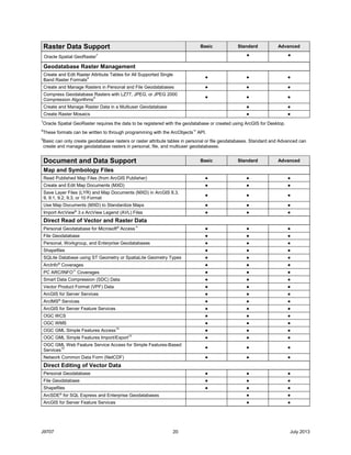
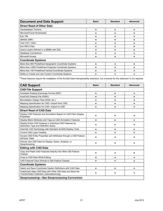
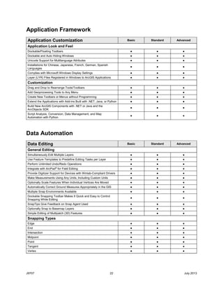
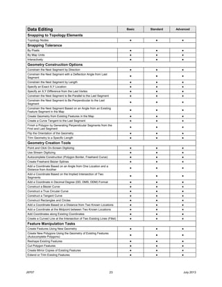
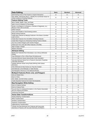


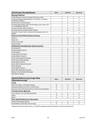


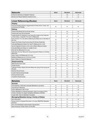


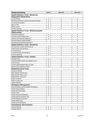


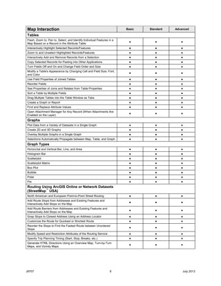
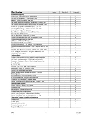
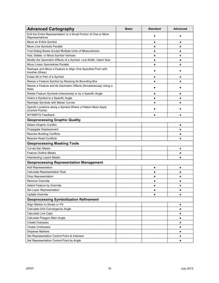
This document provides a functionality matrix for ArcGIS 10.2 for Desktop. It outlines the program's capabilities in areas such as mapping, page layout and printing, publishing and sharing maps and data, geoprocessing, labeling, advanced cartography, address matching, data support and interoperability, and CAD support. Specific functions are listed under each area, such as map interaction tools, different types of map display like raster data display, and direct read/write support of various data formats.