地雷・不発弾のArマップ(翻訳)
•Download as PPTX, PDF•
1 like•471 views

1) The team aims to map landmines and unexploded bombs using augmented reality (AR) to help prevent explosions and save lives. 2) A drone will detect mines, record their GPS locations, and send the data to a server to construct a mine database. An AR app will overlay the mine locations on maps in real-time. 3) The system seeks to automatically detect mines via drone, share real-time location data, and provide mine information and maps on smartphones through AR to help inform the public and reduce mine-related deaths.
Report
Share
Report
Share

Recommended
Slid share
Trail cameras have advanced greatly from their early iterations in the 1950s. Originally able to take only a single picture at a time with film, modern trail cameras can take hundreds of high-definition photos and videos using digital technology and large memory capacities. Early models also had limitations around only being able to capture during daylight hours, but now infrared technology allows trail cameras to detect motion and capture photos and videos day or night. In addition to monitoring wildlife, law enforcement also uses trail cameras to gather evidence against illegal activities like poaching or trespassing on private property. The price of trail cameras can range from around $70 for basic models to $500 or more for cameras with additional durabilities, attachments, and capabilities.
Nanosat eye in the sky Astronomy Society of Victoria
This is a talk I gave to the astronomy society of victoria's instrument making section. They are a cluey bunch of people who have built an amazing 20 inch telescope, and I'm hoping to engage them on the nanosat eye in the sky project to put a telescope into space.
Openstreetmap presentation of Mapping Party at FSMK camp
This document provides information about a mapping party organized by the Free Software Movement Karnataka to map areas using OpenStreetMap. It introduces OpenStreetMap and explains how to get started with mapping using a GPS-enabled smartphone and OSMTracker app. Details are given on registering an OSM account, using editing tools like iD and JOSM, OSM data structure of nodes, ways and tags, and how to upload tracked GPS data to OSM to start mapping.
Mobile Augmented Reality
This document summarizes a presentation about mobile augmented reality (AR). It discusses that AR enhances the real environment by combining real and virtual elements in real-time. Popular applications of AR include overlaying information in manuals, tourism maps, and educational materials. Current challenges to AR include photorealistic rendering, user perspective rendering, and occlusion handling with real objects. Popular AR devices discussed include Google Glass, Microsoft Hololens, Meta Spaceglasses, and AR apps on smartphones. The document also covers tracking techniques, including marker-based, markerless, and simultaneous localization and mapping methods.
Use of IT in intelligence collection
In modern days spying at international level is on high side both for business and for defense purpose. The states are used to take the help of gadgets to get the best to boost their infrastructure as well as to strengthen their security against their adversary.
라이브드론맵 (Live Drone Map) - 실시간 드론 매핑 솔루션
This document introduces Live Drone Map, a UAV-based rapid mapping and sharing solution. It consists of a UAV system that can automatically acquire geospatial data through sensors and process the data in real-time to generate orthoimages. The orthoimages are then uploaded and visualized in a cloud-based geospatial platform called Mago3D. This allows users to access and view mapping data updated in real-time from UAV flights through a web browser or mobile devices. The system is proposed to provide updated mapping for UN field operations by automating data acquisition, processing and sharing.
Raskar Computational Camera Fall 2009 Lecture 01
Keywords: Signal processing, Applied optics, Computer graphics and vision, Electronics, Art, and Online photo collections
A computational camera attempts to digitally capture the essence of visual information by exploiting the synergistic combination of task-specific optics, illumination, sensors and processing. We will discuss and play with thermal cameras, multi-spectral cameras, high-speed, and 3D range-sensing cameras and camera arrays. We will learn about opportunities in scientific and medical imaging, mobile-phone based photography, camera for HCI and sensors mimicking animal eyes.
We will learn about the complete camera pipeline. In several hands-on projects we will build several physical imaging prototypes and understand how each stage of the imaging process can be manipulated.
We will learn about modern methods for capturing and sharing visual information. If novel cameras can be designed to sample light in radically new ways, then rich and useful forms of visual information may be recorded -- beyond those present in traditional protographs. Furthermore, if computational process can be made aware of these novel imaging models, them the scene can be analyzed in higher dimensions and novel aesthetic renderings of the visual information can be synthesized.
In this couse we will study this emerging multi-disciplinary field -- one which is at the intersection of signal processing, applied optics, computer graphics and vision, electronics, art, and online sharing through social networks. We will examine whether such innovative camera-like sensors can overcome the tough problems in scene understanding and generate insightful awareness. In addition, we will develop new algorithms to exploit unusual optics, programmable wavelength control, and femto-second accurate photon counting to decompose the sensed values into perceptually critical elements.
Revolutionary gadgets
Revolutionary Gadgets, Technologies, Night Vision Devices,Self Driving, Drones and Home Assistance
Nd u can text me on :
naeemnazir906@gmail.com
Grand Challenges for Mixed Reality
Guest lecture on Grand Challenges for Mixed Reality. Taught by Mark Billinghurst on October 19th 2021 at the University of Canterbury
Ground Penetrating Radar (GPR) | Military | UXO
UXOs exist in regions that have encountered substantial bombing during past wars, such as Europe, Asia and the US.
UXOs deteriorate over time making them more sensitive and more likely to explode if disturbed.
UXOs prevent civil land use, are a danger to public safety and are a significant environmental concern.
Locating UXO prior to excavation is required to prevent serious consequences.
MECHANICAL PROJECTS ABSTRACT-Land mine detection and indication using gps and...
The document describes a land mine detection system that uses GPS and GSM technologies. The system involves fitting a vehicle with a metal detector to sense land mines. A GPS module determines the vehicle's latitude and longitude position. A Nokia GSM phone sends the mine position data via SMS messages to a remote PC. The system is powered by a microcontroller and other components like a GPS receiver, GSM mobile, stepper driver and motor. It aims to track land mine positions to allow for their safe removal.
GPR Military application | Finding Buried UXO
The document discusses how ground penetrating radar (GPR) can be used to detect unexploded ordnance (UXO). GPR emits radio waves into the ground and measures reflections to locate subsurface objects like bombs and artillery shells. It can detect both metallic and non-metallic UXO and provides depth information, overcoming limitations of other detection methods. The document provides examples of GPR successfully locating UXO at former bombing sites in Europe. GPR surveys generated cross-sections and depth slices to pinpoint UXO locations and ensure sites were safe for construction or land use.
Applications of AI in the geospatial domain
Presentation on applications of AI in the geospatial domain at the Fourth Edition of AI in Practice (6th November 2019, Startup Village, Amsterdam, The Netherlands)
Erik Van Der Zee, Enterprise Architect, Geodan
"Sensory Fusion for Scalable Indoor Navigation," a Presentation from Brain Corp
"Sensory Fusion for Scalable Indoor Navigation," a Presentation from Brain CorpEdge AI and Vision Alliance
For the full video of this presentation, please visit:
https://www.embedded-vision.com/platinum-members/embedded-vision-alliance/embedded-vision-training/videos/pages/may-2019-embedded-vision-summit-sinyavskiy
For more information about embedded vision, please visit:
http://www.embedded-vision.com
Oleg Sinyavskiy, Director of Research and Development at Brain Corp, presents the "Sensory Fusion for Scalable Indoor Navigation" tutorial at the May 2019 Embedded Vision Summit.
Indoor autonomous navigation requires using a variety of sensors in different modalities. Merging together RGB, depth, lidar and odometry data streams to achieve autonomous operation requires a fusion of sensory data. In this talk, Sinyavskiy describes his company's sensor-pack agnostic sensory fusion approach, which allows it to take advantage of the latest in sensor technology to achieve robust, safe and performant perception across a large fleet of industrial robots. He explains how Brain Corp addressed a number of sensory fusion challenges such as robust and safe obstacle detection, fusing geometric and semantic information and dealing with moving people and sensory blind spots.Unmanned Aerial Vehicle Application
1. Unmanned aerial vehicles (UAVs) equipped with sensors can quickly collect geospatial data through mobile mapping. This allows accurate 3D modeling of disaster sites from different vantage points.
2. The document describes a UAV-based mapping system developed between 2003-2009 that integrates positioning sensors, cameras, and laser scanners. It provides examples of UAV models and discusses how the system can be used for search and rescue, surveillance, law enforcement, infrastructure inspection, and aerial mapping.
3. Applications discussed include creating high-resolution digital surface models (DSMs) and maps of landslides in Japan and flooded areas in Thailand to support disaster assessment and monitoring. Multi-sensor integration and
Extended Reality in Game Design
- Extended reality (XR) includes augmented reality (AR) and virtual reality (VR) technologies that combine real and virtual environments.
- Unity supports major XR platforms through a plugin architecture that allows XR providers to integrate and expose common APIs.
- AR combines real and virtual images in real-time, allowing virtual objects to be interacted with in 3D registered space. VR immerses users in an entirely virtual environment replacing their perception of reality.
- Tools for developing XR applications in Unity include ARCore/ARKit plugins, particle systems, analytics, and VR-specific cameras.
Input and output devices
This document provides information on various input and output devices used in geomatics. It discusses aerial cameras, scanners, infrared emitters, and mice as input devices. It then describes 3D glasses, plotters, and display devices as output technologies. For each device type, it lists specific examples (e.g. metric cameras, flatbed scanners, space mice) and provides brief descriptions of their operating principles and applications.
Monte carlo methods in graphics and hacking
This document discusses Monte Carlo methods in computer graphics and system security. In computer graphics, path tracing uses Monte Carlo techniques to evaluate the rendering equation and model global illumination effects. Path tracing can now be done in real-time using GPUs. In system security, advanced fuzzing techniques combine symbolic analysis, genetic algorithms, and Monte Carlo tree search to rapidly find vulnerabilities in software without human intervention. Monte Carlo methods are well-suited for security applications where the target is like a black box.
Code Red: Mobile - A mobile scenario based training exercise for CFA firefigh...
CODE RED: MOBILE was a mobile training exercise for firefighters conducted at Hanging Rock Reserve in Central Victoria. It used visualizations created in the Crysis Wars game editor and viewed on iPads to simulate a bushfire scenario. GPS data was collected from participants and analyzed using ArcMap and Geotime software to evaluate performance. Preliminary results found that static visualizations were as useful as movies for training, but not enough firefighters passed a post-test, suggesting the exercise needs improvement. The author concludes mobile location-based scenarios have potential for emergency services training when combined with analysis of participant behavior data.
Drones! what else
Drones, also known as unmanned aerial vehicles (UAVs), can be used for both commercial and military purposes. They are aircraft controlled remotely or through autonomous systems. Drones are equipped with cameras, sensors and other technologies to perform tasks such as aerial photography, surveillance, product delivery and more. While drones provide advantages like low costs, risks to human life and operational flexibility, they also raise issues regarding privacy, civilian casualties and potential misuse if their abilities are not properly regulated.
Development of wearable object detection system & blind stick for visuall...
It is a wearable device. It has a camera, and it detects all living and non living object. This module detects moving object also. It is made with raspberry pi 3, and a camera. One headphone connect with raspberry pi. When this module detects items, it gave a sound output through headphone. Hence the blind man know that item, which is in-front of him or her. We made it in very low budget, and it is very helpful for visually challenged people. And the Blind stick help him to detect obstacles.
Implementing Camshift on a Mobile Robot for
Person Tracking and Pursuit_ICDM
This is the slides for a paper presented in ICDM workshop in Vancouver-Canada 2011.
In the paper we describe a Camshift implementation on mobile robotic system for tracking and pursuing a moving person with a monocular camera. Camshift algorithm uses color distribution information to track moving object. It is computationally efficient for working in real-time applications and robust to image noise. It can deal well with illumination changes, shadows and irregular objects motion (linear/non-linear). We compared the Camshift with a HSV color based tracking and our results show that the Camshift method outperformed the HSV color based tracking. Moreover, the former method is much more robust against different illumination conditions.
Paper link:
http://ieeexplore.ieee.org/xpl/login.jsp?tp=&arnumber=6137446&url=http%3A%2F%2Fieeexplore.ieee.org%2Fxpls%2Fabs_all.jsp%3Farnumber%3D6137446
2022 COMP4010 Lecture2: Perception
Lecture 2 in the 2022 COMP 4010 Lecture series on AR/VR and XR. This lecture is about human perception for AR/VR/XR experiences. This was taught by Mark Billinghurst at the University of South Australia in 2022.
Aijaz tango
Project Tango is a smartphone project by Google that uses motion tracking and depth perception to create a 3D model of the environment. It has an infrared projector, cameras, and sensors that allow it to track its position and map its surroundings in 3D. The phone emits infrared light pulses and records reflections to build detailed depth maps. Developers are exploring uses like augmented reality applications and helping robots perform tasks autonomously. The technology could also be integrated with devices like Google Glass in the future.
Poster Drone Based Aerial Imaging for Post-Disaster Reconnaissance by Theau H...
The document discusses using drones for post-disaster reconnaissance by collecting aerial images and videos. A DJI Phantom 2 Vision+ drone was selected for image collection. A MatLab program was developed to correct radial lens distortion in the drone images before using them to detect features like cracks. The program batches process photos and can extract frames from videos for correction. This allows infrastructure damage and geotechnical features to be identified from aerial images after disasters for reconstruction assessment.
Google Cardboard Virtual Reality
The document discusses Google Cardboard, a low-cost virtual reality headset developed by Google. It can turn smartphones into virtual reality displays. The cardboard headset contains lenses and magnets that allow users to view VR content on their phone through compatible apps. When placed in the headset, the phone's magnetometer detects button presses via magnet to control the VR experience. The headset allows users to explore various VR environments and experiences through apps like YouTube and Google Earth at a low price point, helping make VR more accessible.
Indoor Navigation
This document describes an indoor navigation Android application that uses Wi-Fi fingerprinting for localization and a routing algorithm to navigate between nodes on a map. It discusses challenges with GPS indoors and explores localization techniques including Wi-Fi, Bluetooth, and sensors. The application utilizes a SQLite database of Wi-Fi fingerprints mapped to locations, calculates the user's position by comparing live readings to stored values, and determines displacement using accelerometer and gyroscope data. It draws the user's position on a map and calculates a path between nodes using numbering to navigate between points of interest selected on the interface.
military surveillance robot
In the accomplishment of completion of our project on “WIRELESS SURVEILLANCE ROBOT” ,We would like to convey our special gratitude to our Project Guide Dr. Reeta Verma, Assistant Professor, Department of Electronics and Communication Engineering and Dr. Sanjay Mathur, Head, Department of Electronics and Communication Engineering.
Your valuable, guidance and suggestions helped us in various phases of the completion of this project. We will always be thankful to you in this regard.
We would also like to thank all our friends, family, seniors, PG Students and especially our classmates for their continues support and help during the making of this project. At last we individually like to thanks each one of us in the group for their support and contribution in making this project a success.
More Related Content
Similar to 地雷・不発弾のArマップ(翻訳)
Grand Challenges for Mixed Reality
Guest lecture on Grand Challenges for Mixed Reality. Taught by Mark Billinghurst on October 19th 2021 at the University of Canterbury
Ground Penetrating Radar (GPR) | Military | UXO
UXOs exist in regions that have encountered substantial bombing during past wars, such as Europe, Asia and the US.
UXOs deteriorate over time making them more sensitive and more likely to explode if disturbed.
UXOs prevent civil land use, are a danger to public safety and are a significant environmental concern.
Locating UXO prior to excavation is required to prevent serious consequences.
MECHANICAL PROJECTS ABSTRACT-Land mine detection and indication using gps and...
The document describes a land mine detection system that uses GPS and GSM technologies. The system involves fitting a vehicle with a metal detector to sense land mines. A GPS module determines the vehicle's latitude and longitude position. A Nokia GSM phone sends the mine position data via SMS messages to a remote PC. The system is powered by a microcontroller and other components like a GPS receiver, GSM mobile, stepper driver and motor. It aims to track land mine positions to allow for their safe removal.
GPR Military application | Finding Buried UXO
The document discusses how ground penetrating radar (GPR) can be used to detect unexploded ordnance (UXO). GPR emits radio waves into the ground and measures reflections to locate subsurface objects like bombs and artillery shells. It can detect both metallic and non-metallic UXO and provides depth information, overcoming limitations of other detection methods. The document provides examples of GPR successfully locating UXO at former bombing sites in Europe. GPR surveys generated cross-sections and depth slices to pinpoint UXO locations and ensure sites were safe for construction or land use.
Applications of AI in the geospatial domain
Presentation on applications of AI in the geospatial domain at the Fourth Edition of AI in Practice (6th November 2019, Startup Village, Amsterdam, The Netherlands)
Erik Van Der Zee, Enterprise Architect, Geodan
"Sensory Fusion for Scalable Indoor Navigation," a Presentation from Brain Corp
"Sensory Fusion for Scalable Indoor Navigation," a Presentation from Brain CorpEdge AI and Vision Alliance
For the full video of this presentation, please visit:
https://www.embedded-vision.com/platinum-members/embedded-vision-alliance/embedded-vision-training/videos/pages/may-2019-embedded-vision-summit-sinyavskiy
For more information about embedded vision, please visit:
http://www.embedded-vision.com
Oleg Sinyavskiy, Director of Research and Development at Brain Corp, presents the "Sensory Fusion for Scalable Indoor Navigation" tutorial at the May 2019 Embedded Vision Summit.
Indoor autonomous navigation requires using a variety of sensors in different modalities. Merging together RGB, depth, lidar and odometry data streams to achieve autonomous operation requires a fusion of sensory data. In this talk, Sinyavskiy describes his company's sensor-pack agnostic sensory fusion approach, which allows it to take advantage of the latest in sensor technology to achieve robust, safe and performant perception across a large fleet of industrial robots. He explains how Brain Corp addressed a number of sensory fusion challenges such as robust and safe obstacle detection, fusing geometric and semantic information and dealing with moving people and sensory blind spots.Unmanned Aerial Vehicle Application
1. Unmanned aerial vehicles (UAVs) equipped with sensors can quickly collect geospatial data through mobile mapping. This allows accurate 3D modeling of disaster sites from different vantage points.
2. The document describes a UAV-based mapping system developed between 2003-2009 that integrates positioning sensors, cameras, and laser scanners. It provides examples of UAV models and discusses how the system can be used for search and rescue, surveillance, law enforcement, infrastructure inspection, and aerial mapping.
3. Applications discussed include creating high-resolution digital surface models (DSMs) and maps of landslides in Japan and flooded areas in Thailand to support disaster assessment and monitoring. Multi-sensor integration and
Extended Reality in Game Design
- Extended reality (XR) includes augmented reality (AR) and virtual reality (VR) technologies that combine real and virtual environments.
- Unity supports major XR platforms through a plugin architecture that allows XR providers to integrate and expose common APIs.
- AR combines real and virtual images in real-time, allowing virtual objects to be interacted with in 3D registered space. VR immerses users in an entirely virtual environment replacing their perception of reality.
- Tools for developing XR applications in Unity include ARCore/ARKit plugins, particle systems, analytics, and VR-specific cameras.
Input and output devices
This document provides information on various input and output devices used in geomatics. It discusses aerial cameras, scanners, infrared emitters, and mice as input devices. It then describes 3D glasses, plotters, and display devices as output technologies. For each device type, it lists specific examples (e.g. metric cameras, flatbed scanners, space mice) and provides brief descriptions of their operating principles and applications.
Monte carlo methods in graphics and hacking
This document discusses Monte Carlo methods in computer graphics and system security. In computer graphics, path tracing uses Monte Carlo techniques to evaluate the rendering equation and model global illumination effects. Path tracing can now be done in real-time using GPUs. In system security, advanced fuzzing techniques combine symbolic analysis, genetic algorithms, and Monte Carlo tree search to rapidly find vulnerabilities in software without human intervention. Monte Carlo methods are well-suited for security applications where the target is like a black box.
Code Red: Mobile - A mobile scenario based training exercise for CFA firefigh...
CODE RED: MOBILE was a mobile training exercise for firefighters conducted at Hanging Rock Reserve in Central Victoria. It used visualizations created in the Crysis Wars game editor and viewed on iPads to simulate a bushfire scenario. GPS data was collected from participants and analyzed using ArcMap and Geotime software to evaluate performance. Preliminary results found that static visualizations were as useful as movies for training, but not enough firefighters passed a post-test, suggesting the exercise needs improvement. The author concludes mobile location-based scenarios have potential for emergency services training when combined with analysis of participant behavior data.
Drones! what else
Drones, also known as unmanned aerial vehicles (UAVs), can be used for both commercial and military purposes. They are aircraft controlled remotely or through autonomous systems. Drones are equipped with cameras, sensors and other technologies to perform tasks such as aerial photography, surveillance, product delivery and more. While drones provide advantages like low costs, risks to human life and operational flexibility, they also raise issues regarding privacy, civilian casualties and potential misuse if their abilities are not properly regulated.
Development of wearable object detection system & blind stick for visuall...
It is a wearable device. It has a camera, and it detects all living and non living object. This module detects moving object also. It is made with raspberry pi 3, and a camera. One headphone connect with raspberry pi. When this module detects items, it gave a sound output through headphone. Hence the blind man know that item, which is in-front of him or her. We made it in very low budget, and it is very helpful for visually challenged people. And the Blind stick help him to detect obstacles.
Implementing Camshift on a Mobile Robot for
Person Tracking and Pursuit_ICDM
This is the slides for a paper presented in ICDM workshop in Vancouver-Canada 2011.
In the paper we describe a Camshift implementation on mobile robotic system for tracking and pursuing a moving person with a monocular camera. Camshift algorithm uses color distribution information to track moving object. It is computationally efficient for working in real-time applications and robust to image noise. It can deal well with illumination changes, shadows and irregular objects motion (linear/non-linear). We compared the Camshift with a HSV color based tracking and our results show that the Camshift method outperformed the HSV color based tracking. Moreover, the former method is much more robust against different illumination conditions.
Paper link:
http://ieeexplore.ieee.org/xpl/login.jsp?tp=&arnumber=6137446&url=http%3A%2F%2Fieeexplore.ieee.org%2Fxpls%2Fabs_all.jsp%3Farnumber%3D6137446
2022 COMP4010 Lecture2: Perception
Lecture 2 in the 2022 COMP 4010 Lecture series on AR/VR and XR. This lecture is about human perception for AR/VR/XR experiences. This was taught by Mark Billinghurst at the University of South Australia in 2022.
Aijaz tango
Project Tango is a smartphone project by Google that uses motion tracking and depth perception to create a 3D model of the environment. It has an infrared projector, cameras, and sensors that allow it to track its position and map its surroundings in 3D. The phone emits infrared light pulses and records reflections to build detailed depth maps. Developers are exploring uses like augmented reality applications and helping robots perform tasks autonomously. The technology could also be integrated with devices like Google Glass in the future.
Poster Drone Based Aerial Imaging for Post-Disaster Reconnaissance by Theau H...
The document discusses using drones for post-disaster reconnaissance by collecting aerial images and videos. A DJI Phantom 2 Vision+ drone was selected for image collection. A MatLab program was developed to correct radial lens distortion in the drone images before using them to detect features like cracks. The program batches process photos and can extract frames from videos for correction. This allows infrastructure damage and geotechnical features to be identified from aerial images after disasters for reconstruction assessment.
Google Cardboard Virtual Reality
The document discusses Google Cardboard, a low-cost virtual reality headset developed by Google. It can turn smartphones into virtual reality displays. The cardboard headset contains lenses and magnets that allow users to view VR content on their phone through compatible apps. When placed in the headset, the phone's magnetometer detects button presses via magnet to control the VR experience. The headset allows users to explore various VR environments and experiences through apps like YouTube and Google Earth at a low price point, helping make VR more accessible.
Indoor Navigation
This document describes an indoor navigation Android application that uses Wi-Fi fingerprinting for localization and a routing algorithm to navigate between nodes on a map. It discusses challenges with GPS indoors and explores localization techniques including Wi-Fi, Bluetooth, and sensors. The application utilizes a SQLite database of Wi-Fi fingerprints mapped to locations, calculates the user's position by comparing live readings to stored values, and determines displacement using accelerometer and gyroscope data. It draws the user's position on a map and calculates a path between nodes using numbering to navigate between points of interest selected on the interface.
military surveillance robot
In the accomplishment of completion of our project on “WIRELESS SURVEILLANCE ROBOT” ,We would like to convey our special gratitude to our Project Guide Dr. Reeta Verma, Assistant Professor, Department of Electronics and Communication Engineering and Dr. Sanjay Mathur, Head, Department of Electronics and Communication Engineering.
Your valuable, guidance and suggestions helped us in various phases of the completion of this project. We will always be thankful to you in this regard.
We would also like to thank all our friends, family, seniors, PG Students and especially our classmates for their continues support and help during the making of this project. At last we individually like to thanks each one of us in the group for their support and contribution in making this project a success.
Similar to 地雷・不発弾のArマップ(翻訳) (20)
MECHANICAL PROJECTS ABSTRACT-Land mine detection and indication using gps and...
MECHANICAL PROJECTS ABSTRACT-Land mine detection and indication using gps and...
"Sensory Fusion for Scalable Indoor Navigation," a Presentation from Brain Corp
"Sensory Fusion for Scalable Indoor Navigation," a Presentation from Brain Corp
Code Red: Mobile - A mobile scenario based training exercise for CFA firefigh...
Code Red: Mobile - A mobile scenario based training exercise for CFA firefigh...
Development of wearable object detection system & blind stick for visuall...
Development of wearable object detection system & blind stick for visuall...
Implementing Camshift on a Mobile Robot for
Person Tracking and Pursuit_ICDM
Implementing Camshift on a Mobile Robot for
Person Tracking and Pursuit_ICDM
Poster Drone Based Aerial Imaging for Post-Disaster Reconnaissance by Theau H...
Poster Drone Based Aerial Imaging for Post-Disaster Reconnaissance by Theau H...
More from syamane
"Psychology of Video Games" Translaters' LightningTalk
『はじめて学ぶ ビデオゲームの心理学』を監訳してみた〜監訳というお仕事〜 (in Japanese) IGDA日本「オンライン交流会&ライトニングトーク」2022年12月22日
Experimental Gameplay Workshop 20年をふりかえる
Experimental Gameplay Workshop 20年をふりかえる
IGDA日本「オンライン交流会&ライトニングトーク」2022年4月28日 LT2
GGJ21瀬戸内オンライン事前勉強会 (in Japanese)
This document provides information about the Global Game Jam (GGJ) event that occurs annually. Some key points mentioned include that the GGJ is an international event held in January each year where game developers come together over a weekend to create games. Links are provided to the main GGJ website as well as success stories and information about past GGJ events from 2020 and 2021. The aim of the GGJ is to bring game developers together globally to network, collaborate and create new games in a short period of time.
IGDA Japan SIGAC Review 2019-2020 (in Japanese)
IGDA日本新年会(2020/1/13) https://www.igda.jp/?p=10388 https://www.igda.jp/?p=10507 での2019年ふりかえり&2020年展望スライド
ゲーム産学連携による人材育成 改訂2版 (in Japanese)
Presentation slide for IGDA Japan (2019/07/04).
IGDA日本 地域創生SIG準備会1 (2019) [改訂2版]
ゲームによる街おこし・地域おこしの可能性を探る
ゲームデザイン(2017) 教科書案内
大学の授業で使う教科書と授業参加案内です.
【追記】教科書はこのあと日本語訳が出版されました.日本語訳については「ゲームデザイン大学教科書の到来 (付録: 『ゲームデザインバイブル』正誤表案) 」(2019年11月1日)で解説しています.http://igdajac.blogspot.com/2019/11/blog-post.html
More from syamane (20)
"Psychology of Video Games" Translaters' LightningTalk
"Psychology of Video Games" Translaters' LightningTalk
Recently uploaded
Microsoft - Power Platform_G.Aspiotis.pdf
Revolutionizing Application Development
with AI-powered low-code, presentation by George Aspiotis, Sr. Partner Development Manager, Microsoft
Communications Mining Series - Zero to Hero - Session 1
This session provides introduction to UiPath Communication Mining, importance and platform overview. You will acquire a good understand of the phases in Communication Mining as we go over the platform with you. Topics covered:
• Communication Mining Overview
• Why is it important?
• How can it help today’s business and the benefits
• Phases in Communication Mining
• Demo on Platform overview
• Q/A
20240609 QFM020 Irresponsible AI Reading List May 2024
Everything I found interesting about the irresponsible use of machine intelligence in May 2024
Full-RAG: A modern architecture for hyper-personalization
Mike Del Balso, CEO & Co-Founder at Tecton, presents "Full RAG," a novel approach to AI recommendation systems, aiming to push beyond the limitations of traditional models through a deep integration of contextual insights and real-time data, leveraging the Retrieval-Augmented Generation architecture. This talk will outline Full RAG's potential to significantly enhance personalization, address engineering challenges such as data management and model training, and introduce data enrichment with reranking as a key solution. Attendees will gain crucial insights into the importance of hyperpersonalization in AI, the capabilities of Full RAG for advanced personalization, and strategies for managing complex data integrations for deploying cutting-edge AI solutions.
Cosa hanno in comune un mattoncino Lego e la backdoor XZ?
ABSTRACT: A prima vista, un mattoncino Lego e la backdoor XZ potrebbero avere in comune il fatto di essere entrambi blocchi di costruzione, o dipendenze di progetti creativi e software. La realtà è che un mattoncino Lego e il caso della backdoor XZ hanno molto di più di tutto ciò in comune.
Partecipate alla presentazione per immergervi in una storia di interoperabilità, standard e formati aperti, per poi discutere del ruolo importante che i contributori hanno in una comunità open source sostenibile.
BIO: Sostenitrice del software libero e dei formati standard e aperti. È stata un membro attivo dei progetti Fedora e openSUSE e ha co-fondato l'Associazione LibreItalia dove è stata coinvolta in diversi eventi, migrazioni e formazione relativi a LibreOffice. In precedenza ha lavorato a migrazioni e corsi di formazione su LibreOffice per diverse amministrazioni pubbliche e privati. Da gennaio 2020 lavora in SUSE come Software Release Engineer per Uyuni e SUSE Manager e quando non segue la sua passione per i computer e per Geeko coltiva la sua curiosità per l'astronomia (da cui deriva il suo nickname deneb_alpha).
How to Get CNIC Information System with Paksim Ga.pptx
Pakdata Cf is a groundbreaking system designed to streamline and facilitate access to CNIC information. This innovative platform leverages advanced technology to provide users with efficient and secure access to their CNIC details.
UiPath Test Automation using UiPath Test Suite series, part 6
Welcome to UiPath Test Automation using UiPath Test Suite series part 6. In this session, we will cover Test Automation with generative AI and Open AI.
UiPath Test Automation with generative AI and Open AI webinar offers an in-depth exploration of leveraging cutting-edge technologies for test automation within the UiPath platform. Attendees will delve into the integration of generative AI, a test automation solution, with Open AI advanced natural language processing capabilities.
Throughout the session, participants will discover how this synergy empowers testers to automate repetitive tasks, enhance testing accuracy, and expedite the software testing life cycle. Topics covered include the seamless integration process, practical use cases, and the benefits of harnessing AI-driven automation for UiPath testing initiatives. By attending this webinar, testers, and automation professionals can gain valuable insights into harnessing the power of AI to optimize their test automation workflows within the UiPath ecosystem, ultimately driving efficiency and quality in software development processes.
What will you get from this session?
1. Insights into integrating generative AI.
2. Understanding how this integration enhances test automation within the UiPath platform
3. Practical demonstrations
4. Exploration of real-world use cases illustrating the benefits of AI-driven test automation for UiPath
Topics covered:
What is generative AI
Test Automation with generative AI and Open AI.
UiPath integration with generative AI
Speaker:
Deepak Rai, Automation Practice Lead, Boundaryless Group and UiPath MVP
Presentation of the OECD Artificial Intelligence Review of Germany
Consult the full report at https://www.oecd.org/digital/oecd-artificial-intelligence-review-of-germany-609808d6-en.htm
Removing Uninteresting Bytes in Software Fuzzing
Imagine a world where software fuzzing, the process of mutating bytes in test seeds to uncover hidden and erroneous program behaviors, becomes faster and more effective. A lot depends on the initial seeds, which can significantly dictate the trajectory of a fuzzing campaign, particularly in terms of how long it takes to uncover interesting behaviour in your code. We introduce DIAR, a technique designed to speedup fuzzing campaigns by pinpointing and eliminating those uninteresting bytes in the seeds. Picture this: instead of wasting valuable resources on meaningless mutations in large, bloated seeds, DIAR removes the unnecessary bytes, streamlining the entire process.
In this work, we equipped AFL, a popular fuzzer, with DIAR and examined two critical Linux libraries -- Libxml's xmllint, a tool for parsing xml documents, and Binutil's readelf, an essential debugging and security analysis command-line tool used to display detailed information about ELF (Executable and Linkable Format). Our preliminary results show that AFL+DIAR does not only discover new paths more quickly but also achieves higher coverage overall. This work thus showcases how starting with lean and optimized seeds can lead to faster, more comprehensive fuzzing campaigns -- and DIAR helps you find such seeds.
- These are slides of the talk given at IEEE International Conference on Software Testing Verification and Validation Workshop, ICSTW 2022.
みなさんこんにちはこれ何文字まで入るの?40文字以下不可とか本当に意味わからないけどこれ限界文字数書いてないからマジでやばい文字数いけるんじゃないの?えこ...
ここ3000字までしか入らないけどタイトルの方がたくさん文字入ると思います。
Video Streaming: Then, Now, and in the Future
In his public lecture, Christian Timmerer provides insights into the fascinating history of video streaming, starting from its humble beginnings before YouTube to the groundbreaking technologies that now dominate platforms like Netflix and ORF ON. Timmerer also presents provocative contributions of his own that have significantly influenced the industry. He concludes by looking at future challenges and invites the audience to join in a discussion.
Goodbye Windows 11: Make Way for Nitrux Linux 3.5.0!
As the digital landscape continually evolves, operating systems play a critical role in shaping user experiences and productivity. The launch of Nitrux Linux 3.5.0 marks a significant milestone, offering a robust alternative to traditional systems such as Windows 11. This article delves into the essence of Nitrux Linux 3.5.0, exploring its unique features, advantages, and how it stands as a compelling choice for both casual users and tech enthusiasts.
Introducing Milvus Lite: Easy-to-Install, Easy-to-Use vector database for you...
Join us to introduce Milvus Lite, a vector database that can run on notebooks and laptops, share the same API with Milvus, and integrate with every popular GenAI framework. This webinar is perfect for developers seeking easy-to-use, well-integrated vector databases for their GenAI apps.
UiPath Test Automation using UiPath Test Suite series, part 5
Welcome to UiPath Test Automation using UiPath Test Suite series part 5. In this session, we will cover CI/CD with devops.
Topics covered:
CI/CD with in UiPath
End-to-end overview of CI/CD pipeline with Azure devops
Speaker:
Lyndsey Byblow, Test Suite Sales Engineer @ UiPath, Inc.
20 Comprehensive Checklist of Designing and Developing a Website
Dive into the world of Website Designing and Developing with Pixlogix! Looking to create a stunning online presence? Look no further! Our comprehensive checklist covers everything you need to know to craft a website that stands out. From user-friendly design to seamless functionality, we've got you covered. Don't miss out on this invaluable resource! Check out our checklist now at Pixlogix and start your journey towards a captivating online presence today.
GraphSummit Singapore | Graphing Success: Revolutionising Organisational Stru...
Sudheer Mechineni, Head of Application Frameworks, Standard Chartered Bank
Discover how Standard Chartered Bank harnessed the power of Neo4j to transform complex data access challenges into a dynamic, scalable graph database solution. This keynote will cover their journey from initial adoption to deploying a fully automated, enterprise-grade causal cluster, highlighting key strategies for modelling organisational changes and ensuring robust disaster recovery. Learn how these innovations have not only enhanced Standard Chartered Bank’s data infrastructure but also positioned them as pioneers in the banking sector’s adoption of graph technology.
Climate Impact of Software Testing at Nordic Testing Days
My slides at Nordic Testing Days 6.6.2024
Climate impact / sustainability of software testing discussed on the talk. ICT and testing must carry their part of global responsibility to help with the climat warming. We can minimize the carbon footprint but we can also have a carbon handprint, a positive impact on the climate. Quality characteristics can be added with sustainability, and then measured continuously. Test environments can be used less, and in smaller scale and on demand. Test techniques can be used in optimizing or minimizing number of tests. Test automation can be used to speed up testing.
Recently uploaded (20)
Communications Mining Series - Zero to Hero - Session 1
Communications Mining Series - Zero to Hero - Session 1
20240609 QFM020 Irresponsible AI Reading List May 2024
20240609 QFM020 Irresponsible AI Reading List May 2024
Full-RAG: A modern architecture for hyper-personalization
Full-RAG: A modern architecture for hyper-personalization
Cosa hanno in comune un mattoncino Lego e la backdoor XZ?
Cosa hanno in comune un mattoncino Lego e la backdoor XZ?
How to Get CNIC Information System with Paksim Ga.pptx
How to Get CNIC Information System with Paksim Ga.pptx
UiPath Test Automation using UiPath Test Suite series, part 6
UiPath Test Automation using UiPath Test Suite series, part 6
Presentation of the OECD Artificial Intelligence Review of Germany
Presentation of the OECD Artificial Intelligence Review of Germany
みなさんこんにちはこれ何文字まで入るの?40文字以下不可とか本当に意味わからないけどこれ限界文字数書いてないからマジでやばい文字数いけるんじゃないの?えこ...
みなさんこんにちはこれ何文字まで入るの?40文字以下不可とか本当に意味わからないけどこれ限界文字数書いてないからマジでやばい文字数いけるんじゃないの?えこ...
Goodbye Windows 11: Make Way for Nitrux Linux 3.5.0!
Goodbye Windows 11: Make Way for Nitrux Linux 3.5.0!
Introducing Milvus Lite: Easy-to-Install, Easy-to-Use vector database for you...
Introducing Milvus Lite: Easy-to-Install, Easy-to-Use vector database for you...
UiPath Test Automation using UiPath Test Suite series, part 5
UiPath Test Automation using UiPath Test Suite series, part 5
20 Comprehensive Checklist of Designing and Developing a Website
20 Comprehensive Checklist of Designing and Developing a Website
GraphSummit Singapore | Graphing Success: Revolutionising Organisational Stru...
GraphSummit Singapore | Graphing Success: Revolutionising Organisational Stru...
Climate Impact of Software Testing at Nordic Testing Days
Climate Impact of Software Testing at Nordic Testing Days
地雷・不発弾のArマップ(翻訳)
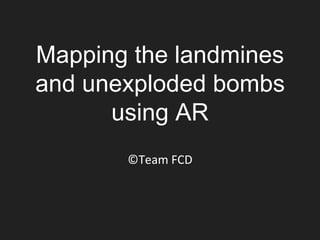
- 1. Mapping the landmines and unexploded bombs using AR ©Team FCD
- 2. Overview • Theme:Anti-Mine action (Landmines and unexploded bombs) •At a glance: The death toll taken by landmines rose to ten people per day in 2015 worldwide. Share the information of finding the mine to prevent exploding via Internet in real-time.
- 3. Team FCD members Programming • ゆーり (Yuri) • かふう (Cafoo) • 岡島 育海 (Okajima Ikumi) • 土戸 一輝 (Tsuchido Ikki) 3D Modeling • なめたけ (Nametake) • 八剣 (Hakken) Translation • Takahiro Nakaoku • Shinji R. Yamane
- 4. System Description • 1. Detect a mine from the sky • 1) Inspired by “Mine Kafon Drone” proposal , a dron to detect and remove mines. • 2) Develop our own drone to share the possible mine information • 2. Send a location of detected mine using GPS • 3. Indicate detected mine, completed mine clearance and unchecked areas are provided to users
- 5. System flowchart Source: Mine Kafon Drone (http://minekafon.org/) ①Discover mine by a drone ②Stock to Server ③Push to Smartphone. Send API Get API
- 6. Development environment • Detecting Mines: – Automatic mine detection by a smart drone – Report GPS location and possible mine type • Server: – Mine database construction. API is made by PHP • Client: – AR map, overviewing map, background knowledge of mine. Made by Unity. • Hardware: – Smartphone (capable of AR. We use Android as easy-to-get and cheaper price.)
- 7. First Blueprint Red spot indication is found mines. Put explanation by click. No found mine area is indicated by green areas. Unchecked areas is no indication.
- 8. Deliverable (On smartphone) Red spot indication is found mines. Put explanation by click. No found mine area is indicated by green areas. (no implemented) Unchecked areas is no indication. (no implemented)
- 9. Explain mine Drone-chan teaches us kind of mines! PMN2 120mm(diameter) * 53(height) This is one of the most famous Anti-personal land mine. This is bury in the ground and clump of bushes, and explode due to pressure on 5kg or more.
- 10. Our Prototype on Smartphone
- 11. Management of GPS data
- 12. Overview Map (not implemented)
- 13. •Automatic mine detection by a drone. •Real-time information sharing of detected mines •Mine information in anywhere, anytime by AR mapping using smartphone. •Check announced mine clearance and unchecked areas. •Provide the various knowledge of the different types of the mine from the App. Benefit of our tools
- 14. No more the human toll taken by land mine and unexploded bombs!