This power point file prepared by Dr. Greg Acciaioli, an anthropologist from the University of Western Australia in "Regionalism in State and non-State Perspective" seminar on Seminar Week Anthropology, Faculty of Social and Political Sciences, Universitas Indonesia, September 10th 2014. He shared his findings from ethnography research in Sulu Zone, the area termed by James Francis Warren. In this presentation, Acciaioli was showing to the audience how social exclusion happen in stateless local community in the area Borneo, Sulawesi, and the Southern Philippines. This presentation are showing to the audience about autocritic while the countries in Southeast Asia have campaign to build ASEAN Community 2015.
Southeast Asia is a subregion of Asia located east of India and south of China, consisting of mainland and maritime areas. The climate is mainly tropical, with wet and dry seasons. Over 593 million people live in the region, with diverse ethnicities and religions including Buddhism, Islam, and Christianity. The environment is biodiverse but faces threats from deforestation.
Evaluating a marine protected area in a developing country; Mafia Island Mari...Marcus C
This study evaluated the effectiveness of the Mafia Island Marine Park in Tanzania at protecting fish populations compared to adjacent intensively fished areas. The densities, biomass, and sizes of the ecologically and economically important blackspot snapper fish were compared between the marine park and fished areas using underwater visual censuses and catch data. Results showed the target species was over four times more dense and its biomass was six to ten times higher inside the marine park. Individual fish sizes were also on average 37% larger in the park. Higher fish numbers and biomass correlated with greater hard coral cover and habitat complexity. This supports the role of marine protected areas in conserving habitats and fisheries.
Research Inventy : International Journal of Engineering and Scienceinventy
Research Inventy : International Journal of Engineering and Science is published by the group of young academic and industrial researchers with 12 Issues per year. It is an online as well as print version open access journal that provides rapid publication (monthly) of articles in all areas of the subject such as: civil, mechanical, chemical, electronic and computer engineering as well as production and information technology. The Journal welcomes the submission of manuscripts that meet the general criteria of significance and scientific excellence. Papers will be published by rapid process within 20 days after acceptance and peer review process takes only 7 days. All articles published in Research Inventy will be peer-reviewed.
A comprehensive powerpoint on the geography of the Southeast Asian region. This was completed for a masters level course and is intended for community college or high school students. Includes many case studies from throughout Southeas Asia.
This document summarizes the climate, oceanography, habitats, and threats facing the Papuan Bird's Head Seascape region of eastern Indonesia. Key points:
- The region experiences distinct northwest and southeast monsoon seasons which influence wind, rainfall, and ocean currents.
- It contains over 600 coral species and 1,638 reef fish species, and is a global center of marine biodiversity. Habitats include coral reefs, mangroves, and sea turtle nesting beaches.
- Rapid development in industries like fisheries, oil/gas, and mining since 2001 has accelerated environmental deterioration through activities like coastal development and illegal fishing.
- However, the region's governments have also expanded marine
Groundwater studies related to tropical islands in Malaysia are briefly reviewed. Perspectives are addressed as three aspects: (a) study location, where groundwater studies in Malaysia are conducted in different types of tropical islands (b) methods, namely numerical modeling, geophysical investigations, hydrochemical analysis and geochemical modeling were applied in the studies of groundwater where numerical modeling is the most used method in groundwater studies of Malaysian coastal environment and tropical islands; (c) types of studies, where most of groundwater studies are more focused in investigating the groundwater resources and management as well as seawater intrusion using numerical models and geophysical investigations. This review revealed that main objectives in most of Malaysian groundwater studies in tropical islands are
This study examines how the threatened Moluccan cockatoo species incorporates human-modified forests in its habitat on Seram Island, Indonesia. Interviews with local villagers and surveys found that the cockatoo uses primary and old secondary forests for shelter and roosting, but also frequently feeds in certain human-modified forest types, especially damar forests and forest gardens. These forest types are suitable cockatoo habitat because they are less intensively managed and provide important food resources. The study suggests reconsidering conservation models to allow some local arboriculture practices within protected areas, as these human-modified forests contribute to cockatoo conservation and are important for villagers' livelihoods.
Marine protected areas (MPAs) are areas of ocean dedicated to protecting biodiversity and resources through legal means. They include habitats like coral reefs, seagrass beds, and mangroves. MPAs are important for protecting ecosystems from threats like development, pollution, overfishing, and climate change, which can damage populations and coral reefs. Effective MPAs are designed to be large, simple shapes to minimize edge effects, protect critical habitats, maintain connectivity between areas, and support ecosystem functions.
Biosphere reserves aim to reconcile biodiversity conservation and sustainable human use. They contain core, buffer, and transition zones and serve conservation, development, and research functions. World Heritage Sites are landmarks selected for cultural, historical, or scientific significance under international treaties. There are over 1,000 sites across 167 countries representing natural phenomena, stages of Earth's history, and examples of human creativity.
The document compares Endau Rompin National Park in Malaysia and Arches National Park in the United States. Both parks were established over 50 years ago to protect their natural landscapes. Endau Rompin National Park focuses on preserving its wildlife and natural habitat, while Arches National Park allows more recreational activities and was influenced by ancient human cultures that lived in the area. The parks differ in their locations, characteristics, and recreational opportunities available to visitors.
This document provides a comprehensive overview of Philippine and world geography, including key geographic concepts, locations, landforms, and other physical features. It begins by defining important imaginary lines and the five themes of geography. It then provides detailed information on the geography and physical features of the Philippines, including major mountains, rivers, provinces, regions, cities, and national symbols. Finally, it includes facts about world geography, defining continents, oceans, lakes, rivers, deserts, and other geographic elements around the globe.
India has a diverse landscape ranging from snow-capped Himalayan peaks to deserts and coastlines. Some key geographical facts about India include:
- Kanchenjunga is the highest mountain peak in India at 8,586 meters. The Siachen Glacier is the largest glacier in India.
- The Great Plain of North India is the largest alluvial plain in the world. The Sundarbans delta is the largest delta in India.
- Rajasthan is the largest state by area, while Goa is the smallest. The Andaman and Nicobar Islands are the largest union territory.
- The Indian mainland coastline stretches over 6,100 km. The total coastline
India is the seventh largest country in the world covering an area of 3.287 million square kilometers. It has a coastline of over 7,500 km and is located in South Asia between latitudes 8°4' N and 37°6' N and longitudes 68°7' E and 97°25' E. India experiences a tropical monsoon climate with temperatures varying greatly based on proximity to the equator, Himalayan mountains, and Arabian Sea. The country observes many religious and cultural festivals throughout the year. India has a population of over 1.3 billion people and has the world's fourth largest economy in terms of purchasing power parity with strong growth in recent decades.
This presentation formed the basis of the webinar organised for students of the College of Sciences and Engineering of the School of Technology, Environments and Design, University of Tasmania with the topic of ‘Geoheritage and Geotourism’. The take-aways from the webinair were
Geotourism is holistic and ‘place based’ with geology and landscapes as its base.
The right balance needs to be determined between exposing geosites for public visitation & geoconservation needs.
Geotourism must determine what measures are put in place or techniques used to respect geoconservation considerations.
Through the study of geomorphology, an understanding of landscapes can enhance outstanding, interpretative experiences for visitors.
The application of new digital technologies can add considerable value to the geotourism experience.
Geoheritage needs to embrace both fossil & mineral treasures.
This document discusses challenges and opportunities for developing geoparks in Australia. Some of the key challenges include competing land classification systems, federal politics, low public awareness of geoscience, and resistance from the mining industry and geological institutions. However, there are opportunities to advance geotourism by linking potential geoparks to existing protected areas like national parks and world heritage sites. Three scenarios are proposed for geopark development connected to the Willandra Lakes World Heritage Area, Blue Mountains World Heritage Area, and Warrumbungles National Park.
This document is testimony submitted to multiple Senate committees in support of bill SB 3090. It summarizes the management history of Mauna Kea and Haleakala observatory sites in Hawaii. It recommends that the University of Hawaii Institute for Astronomy (IfA) be appointed as the single comprehensive manager for the Mauna Kea Astronomy Precinct. It also recommends a joint partnership between the Office of Mauna Kea Management, National Parks Service, and Department of Interior for management of the Mauna Kea Natural/Cultural Preservation Area. The testimony provides background on the establishment and roles of IfA and OMKM in managing the observatory lands.
Evolving Geotourism as a Key Driver of Regional Development in Australia: Glo...Leisure Solutions®
The document discusses developing geotourism in Australia as a driver of regional economic development. It outlines the Australian Geoscience Council's plan to develop a national geotourism strategy. Key topics for the strategy include enhancing coordination of geoheritage listings, establishing procedures for assessing georegions, developing new geotrails, and collaborating across natural, cultural and mining heritage sectors to provide holistic geotourism experiences. Geotrails in particular are seen as a cost-effective way to promote regional areas and their geological features while respecting land access and management. The strategy aims to grow both geotourism and ecotourism in Australia.
Geotourism – Adding Value to Traditional Nature-based TourismLeisure Solutions®
The document discusses developing a National Geotourism Strategy in Australia. It defines geotourism as nature-based tourism that focuses on an area's geology and landscape. The strategy would coordinate geoheritage listings, develop new geotrails, and train geologists in interpretation skills. It emphasizes collaborating with groups involved in mining heritage, biodiversity, and indigenous culture to provide holistic geotourism experiences. The goal is to boost regional development and geoscience understanding through geotourism.
1. The coastal zone is the area where land and sea interact, making it dynamic but also vulnerable to natural disasters. Coastal zone management aims to balance environmental protection, economic activities, and human needs.
2. Integrated coastal zone management (ICZM) takes a coordinated, multi-disciplinary approach to managing the coastal zone in a sustainable manner. In India, ICZM focuses on reducing poverty, achieving development goals, and fostering sustainable livelihoods.
3. Key challenges to coastal zone management in India include unclear land use policies, widespread poverty, pollution, and potential impacts of climate change like sea level rise and increased storms. Initiatives are needed to improve governance, disseminate information, and
Enhancing the Pilbara Georegion Through Geotourism by Angus M RobinsonLeisure Solutions®
In recent years there has been a growing realisation that economic development in outback regional Australia needs to be built on the three sustainable core pillars of mining, agriculture and tourism. Geotourism, an emerging global phenomenon, is holistic and is an experiential form of nature (and culture – both indigenous and post European settlement based) tourism. Unlike ecotourism which focuses mainly on flora and fauna in essentially protected areas, geotourism can extend across both designated protected and unprotected areas, including those areas subject of existing agricultural and mining development. By raising awareness of the importance of the area’s geological heritage in history and society today, geotourism provides local communities with a sense of pride in their region and strengthens their identification with the region. Geotourism can be the generator of new jobs and innovative local enterprises as new sources of revenue, as well as the opportunity for existing remote area businesses to diversify into provision of visitor services, while the geological heritage of the region can be better managed and protected.
Embracing through geotourism the Pilbara Georegion’s world-famous North Pole stromatolites, given this geosite’s world class profile as the oldest living community fossils on the planet, has considerable potential in establishing Australia as a ‘must see’ destination for fossil-rich geoheritage visitation. Realisation of this potential, when combined with the parallel development of the truly unique Nilpena Ediacaran fossil assemblage site in South Australia’s Flinders Ranges, as well as the established Age of Dinosaurs museum in Winton in Western Queensland, will deliver for Australia an unparalleled tourism destination. For the emerging, high value, free and independent market in China, the availability of high profile ‘scenic areas’ such as the Pilbara Georegion, with its outstanding natural heritage and cultural values, offers outstanding ‘bucket list’ appeal.
Blue Mountains National Landscape and the National Geotourism StrategyLeisure Solutions®
The document discusses a national geotourism strategy for Australia and its application to the Blue Mountains World Heritage Area. It outlines how geotourism can celebrate the region's geoheritage by expanding mapping and using new technologies. It also discusses developing geotrails, collaborating across natural and cultural heritage, and training geologists in interpretation. The strategy aims to enhance coordination of geoheritage listings and establish assessment procedures to balance protection and visitation of important geosites.
The coastal zone of Bangladesh extends over 47,150 square kilometers and includes 147 sub-districts across 19 districts, accounting for 32% of the country's total area and home to 26% of its population. The coastal zone is divided into four main morphological zones: 1) the Ganges Tidal Floodplain west, 2) the Ganges Tidal Floodplain east, 3) the Meghna Deltaic Zone, and 4) the Eastern Hill Region. The coastal zone faces numerous vulnerabilities like sea level rise, coastal erosion, cyclones, pollution, salinity intrusion, flooding, and diseases. Integrated coastal zone management and other measures are needed to address these challenges.
Dr Melinda McHenry, Physical Geographer and Learning & Teaching Strategist at The University of Tasmania, has convened this webinar for her 'geo-professional' (geoscientists, geographers, geomorphologists etc) to focus on the development of geotourism through the National Geotourism Strategy (of the Australian Geoscience Council), from the perspective of a presenter with varied experience in a wide range of industry sectors.
.
Delivering a National Geotourism Strategy for Australia - Central Highlands G...Leisure Solutions®
The Central Highlands GeoRegion of Central Qld contains all the key components including geotrails in which a future mining park or UNESCO Global Geopark can be developed.
Seminar Week_Center for Anthropological Studies_Book Launch_Negara vs Santet_...Muki Trenggono Wicaksono
This power point file presented by Dr. Greg Acciaioli, an anthropologist from the University of Western Australia in Seminar Week Anthropology, Faculty of Social and Political Sciences. He gave his perspective as Dr. Nicholas' supervisor and as an anthropologist after read "The Entangled State" (English version from "Negara vs Santet" - translated version).
Climate Change: Its danger for our production and why it escapes our predictionMuki Trenggono Wicaksono
Our planet earth has a unique but complicated climate that presently is changing due to the influence that mankind’s activities appear to have on the composition of its atmosphere. There is general and widely held scientific consensus that the observed trends in atmospheric
and ocean temperature as well as climate extremes during the last century cannot be
explained solely by natural climate processes. From worldwide observations WMO (World
Meteorological Organization) concluded a long time ago that our planet is warming up. This
has to be considered a fact. The International Panel on Climate Change (IPCC), using
collected measurements of carbon dioxide, showed that it has increased from the start of the
industrial revolution, but that changes in land use have also played an important role. From
1960 till 2010 the average increase is estimated to have been less than a degree Celsius (0.7
ºC), while it was 0.85 ºC since 1880. The projection for the next 50 years is in the order of
one degree Celsius, with the emissions kept within the range of the IPCC scenarios.
It is generally accepted that, if for this century the temperature increase can be limited to 2
ºC, the damages will remain much more limited than when the scenarios give a 4 ºC increase
at the end of this century. Quantitative knowledge is helping us to find our way to policies
serving the purpose of adapting to the consequences of climate change. In the case of
temperature increases, for Arabica coffee in Tanzania and Apples in India, a solution could
be to go to higher, still colder grounds, although this disrupts living conditions and
biodiversity patterns. But if we think about the lowland tropics, there is no way out apart
from crop diversification and finding more heat tolerant varieties. This is abundantly
illustrated with rice in Indonesia and elsewhere, as well as maize in Africa and elsewhere. To
these effects of global warming, we have to add those from increasing climate variability and
more (and often more severe) extreme meteorological and climatological extreme events.
Examples from forestry and fisheries complement the picture of large scale upheavals of an
endangered production due to these consequences of climate change.
We must further note that since the very end of the previous century, the rate of global
warming has reduced by at least half of the rate in the last 50 years of that previous century.
This has been baptized “the hiatus”, a lack of continuity in the upgoing trend of global
temperature. So climate change rates reduce. Is this going to change our thinking? Many
explanations may actually be involved, including many oceanic and atmospheric processes.
But we have no clue about the ratios of their contributions, while the complexities are
enormous. However, we know so much less about how the sea surface temperatures are
determined by currents and deep waves than we understand on the atmospheric resultants.
Dokumen tersebut merupakan ringkasan dari penelitian mengenai hutan adat di Kabupaten Kerinci, Sumatra Barat. Dokumen tersebut menjelaskan tentang luas hutan adat di Kabupaten Kerinci, asal usul, lembaga pengelola, dan peraturan adat beberapa hutan adat di sana. Dokumen tersebut juga memberikan rekomendasi untuk riset dan kegiatan lebih lanjut mengenai pengelolaan hutan-hutan adat di daerah terse
Dokumen tersebut merangkum hasil penelitian mengenai hutan adat di Kabupaten Kerinci, Jawa Tengah. Terdapat delapan kasus hutan adat yang telah diidentifikasi dengan luasan total 2.398,14 hektar. Dokumen ini membahas proses pengukuhan hutan adat, peraturan adat yang mendukung pengelolaannya, serta berbagai aktor dan dinamika sosial yang terkait.
Dokumen tersebut membahas tentang pemetaan sosial sebagai pendekatan untuk mempelajari kehidupan masyarakat setempat secara partisipatif. Metode ini digunakan untuk mengidentifikasi struktur sosial, sistem tenurial tanah, dan hubungan masyarakat dengan hutan melalui wawancara, observasi, dan diskusi kelompok. Hasil pemetaan sosial bermanfaat untuk pengakuan masyarakat hukum adat dan penataan bat
The document provides background information on the Philippines being a center of marine biodiversity, with Palawan being its last biodiversity frontier. It then discusses Tubbataha Reefs Natural Park, located in the Sulu Sea, describing its geographical location, formation from ancient volcanic islands, and history of traditional use by local fishermen that is now protected. The biodiversity and reef systems of the Philippines are protected by international treaties.
Continental Synthesis - Africa biodiversity course 2021 Fatima Parker-AllieFatima Parker-Allie
This presentation provides a synthesis of biodiversity patterns on the African Continent. It also includes some of the biodiversity informatics efforts that has been taking place in Africa
Wetlands are important ecosystems that provide many economic and ecological benefits. They were once viewed negatively but that changed as people recognized their value. Wetlands are defined based on hydrology, hydric soils, and hydrophytic vegetation. Malaysia has many important wetland areas, mainly mangroves, that protect the coastline and support biodiversity and local communities.
Presentation made at the Sustainable Tourism in Small Island Developing States conference, 23-24 November 2017, Seychelles. A partnership of the Seychelles Sustainable Tourism Foundation, IUCN WCPA Tourism and Protected Areas Specialist Group, University of Seychelles, Paris Tourism Sorbonne (IREST), and Global Sustainable Tourism Council.
1. The document discusses forest law enforcement in Indonesia, outlining the country's biodiversity, ecosystems, threats to forests, and approaches to law enforcement.
2. Indonesia has high biodiversity due to its location between Asia and Australia, with 19 natural ecosystem types across its 17,000 islands. Major threats include habitat loss from forest fires, agricultural expansion, mining and illegal wildlife trade.
3. Indonesia addresses forest and land fires through multi-stakeholder prevention efforts like increased monitoring and patrols. Companies are strictly liable for fires in their concessions. Law enforcement targets illegal logging, fires and wildlife trafficking through investigations and sanctions.
Wildlife tourism refers to observing and interacting with local animal and plant life. It is an important part of tourism in many countries and involves activities like safaris, mountain tourism, and ecotourism. Landscapes and wildlife resources are key elements that contribute to the attractiveness of tourism destinations and offer opportunities for outdoor activities and experiences. These resources include national parks, mountains, deserts, coasts, rainforests, wetlands, reserves, coral reefs, volcanoes, glaciers, and savannahs. Each landscape type is home to unique flora and fauna and provides recreational activities for tourists.
This document discusses geotourism in Australia and China. It provides background on Angus Robinson, chair of the Geotourism Standing Committee of the Geological Society of Australia. It then discusses key geotourism locations in Australia like Jenolan Caves and differences between geotourism development in Australia and China. It outlines Australia's National Landscapes Program and describes some iconic landscapes. It also discusses geotrails and examples from Tasmania, Queensland, and other states. Important fossil sites and geological similarities/differences between the two countries are mentioned.
The document discusses zoogeography, which is the branch of biology concerned with the distribution of animals worldwide. It can be studied at three levels - geographical, regional, and local. At the geographical level, biogeographers analyze global distribution patterns and factors like climate. At the regional level, they focus on animal distributions within continents or ecosystems. At the local level, they study species distributions in relation to their environment and other species. The document also provides examples of different biogeographic regions and patterns of animal distribution.
The document summarizes the status of conservation efforts for the critically endangered Irrawaddy freshwater dolphin population found in Indonesia's Mahakam River. It notes that the population consists of approximately 43 individuals and their habitat is threatened by activities like wood plantations, mining, dams, and bycatch in fishing nets. Research discussed in the document showed that boat traffic significantly disrupted the dolphins' behavior. The document recommends continuing conservation efforts including monitoring the population, educating local communities who support protection efforts, and establishing protected areas to help ensure the survival of this unique dolphin population if their habitat and food supply can be protected.
Fish conservation zones as tools for fisheries management and conservation in...Mekong Fish Network
Fish Conservation Zones (FCZs), or areas that limit or prohibit fishing, have gained widespread popularity as fisheries management and conservation tools in marine and freshwater ecosystems around the world. By protecting critical habitats and allowing fish populations to increase in abundance, FCZs can serve dual purposes of protecting fish biodiversity and enhancing food security and livelihoods for local communities. Rapid development in the Mekong Basin has the potential to impact fish habitat and abundance, and effective fish conservation and management tools are urgently needed. Many organizations have engaged in establishing FCZs in the Mekong Basin, and FCZs number in the hundreds in Lao PDR alone. FISHBIO is working to establish FCZs in several villages on the mainstem Mekong River in northern Lao PDR, and has seen substantial local support for the concept. While FCZs are compelling in principle, the most important consideration is whether they are successful in practice. Biophysical, socio-economic and governance monitoring is greatly needed to address whether FCZs are effective tools for meeting their intended objectives. Both technological and community-based approaches can play an important role in the biological evaluation of FCZ effectiveness, and collecting such data could improve the management of FCZs throughout the region.
Fish conservation zones as tools for fisheries management and conservation in...FISHBIO
Fish Conservation Zones (FCZs), or areas that limit or prohibit fishing, have gained widespread popularity as fisheries management and conservation tools in marine and freshwater ecosystems around the world. By protecting critical habitats and allowing fish populations to increase in abundance, FCZs can serve dual purposes of protecting fish biodiversity and enhancing food security and livelihoods for local communities. Rapid development in the Mekong Basin has the potential to impact fish habitat and abundance, and effective fish conservation and management tools are urgently needed. Many organizations have engaged in establishing FCZs in the Mekong Basin, and FCZs number in the hundreds in Lao PDR alone. FISHBIO is working to establish FCZs in several villages on the mainstem Mekong River in northern Lao PDR, and has seen substantial local support for the concept. While FCZs are compelling in principle, the most important consideration is whether they are successful in practice. Biophysical, socio-economic and governance monitoring is greatly needed to address whether FCZs are effective tools for meeting their intended objectives. Both technological and community-based approaches can play an important role in the biological evaluation of FCZ effectiveness, and collecting such data could improve the management of FCZs throughout the region.
Sulawesi: The world eco-capital to sustainable future.UNSRAT
Sulawesi is the major island in the disputed Wallacea ecoregion. Its complexity in geological formation drives the islands to be the most ecologically intriguing habitat in the world. It is the place to invest the conservation capital to mantain the world's future.
The document provides an overview of the physical and human geography of Asia. It begins with introductions to the size and population of Asia. It then discusses the major geographic subregions of Asia including Southeast Asia, Southwest Asia, and others. For each subregion, it outlines the physical geography including climate, landforms, rivers, and vegetation as well as the human geography such as population patterns, economies, and history.
A coral reef is an underwater ecosystem characterized by reef-building corals. Coral reefs are important for many different reasons aside from supposedly containing the most diverse ecosystems on the planet. They:
• protect coastlines from the damaging effects of wave action and tropical storms
• provide habitats and shelter for many marine organisms
• are the source of nitrogen and other essential nutrients for marine food chains
• assist in carbon and nitrogen fixing
• nutrient recycling.
The document discusses places and landscapes, explaining that geography is the study of the physical features of the earth and human activity and how they relate. It notes that landscapes provide locations for connecting with nature and culture, and analyzing the interrelationship between humans and their environment globally and locally. The document also outlines some of the key physical and human geographic characteristics of the Philippines, including its location, size, shape, climate, landforms, natural resources, and how these affect lifestyle.
Manta Harvesting in the Alor and Solor Waters in Eastern Indonesia 2004Lida Pet
This document reports on monitoring activities related to manta harvesting in the Alor and Solor waters of Eastern Indonesia. It describes the methods used, including site visits and interviews. Key findings include:
1) Manta rays are harvested for their leather and meat, with meat exported for shark fin soup. Catches appear to be high based on preliminary calculations, potentially threatening manta populations.
2) Local communities in Lamakera and Lamalera depend on fishing and harvest mantas. Fishers use specific techniques and operate at certain times/locations. Annual manta catches in the hundreds are reported.
3) The report recommends establishing marine protected areas, enforcement programs, improving infrastructure and markets to reduce pressure
This document provides information about marine protected areas (MPAs), including definitions, classifications, and examples from around the world. Some key points:
- MPAs are designated areas of ocean that restrict human activity to protect biodiversity and natural/cultural resources. They range from no-take zones to multiple use areas.
- Criteria for selecting MPAs include biodiversity, habitats, genetic diversity, and economic/cultural value.
- Examples of large, well-known MPAs discussed are the Ross Sea Region MPA (Antarctica), Great Barrier Reef (Australia), and Galápagos Marine Reserve (Ecuador).
- India has over 30 marine sanctuaries and national
The Philippines is an archipelago located in Southeast Asia, between Taiwan and Borneo. It has over 7,600 islands, with a total land area of 300,000 square kilometers. The main islands are Luzon, Mindanao, Samar, Negros, Palawan, Panay, Mindoro, Leyte, Cebu, Bohol and Masbate. The Philippines geography includes extensive coastlines, mountains, valleys, plains, and plateaus. Its highest point is Mount Apo at 2,954 meters and lowest is the Philippine Deep in the sea at over 11 kilometers below sea level.
Post December 24, 2004 and 28 March, 2005 Sumatera Tsunami Damage Assessment.
In Aceh most remote Banyak Archipelago, which consist of 99 islands. One of them is the biggest green turtle rookery in Western Indonesia.
Similar to Acciaioli et al asaa 2014 paper v5 jc_Regionalism (20)
Predictably Improve Your B2B Tech Company's Performance by Leveraging DataKiwi Creative
Harness the power of AI-backed reports, benchmarking and data analysis to predict trends and detect anomalies in your marketing efforts.
Peter Caputa, CEO at Databox, reveals how you can discover the strategies and tools to increase your growth rate (and margins!).
From metrics to track to data habits to pick up, enhance your reporting for powerful insights to improve your B2B tech company's marketing.
- - -
This is the webinar recording from the June 2024 HubSpot User Group (HUG) for B2B Technology USA.
Watch the video recording at https://youtu.be/5vjwGfPN9lw
Sign up for future HUG events at https://events.hubspot.com/b2b-technology-usa/
End-to-end pipeline agility - Berlin Buzzwords 2024Lars Albertsson
We describe how we achieve high change agility in data engineering by eliminating the fear of breaking downstream data pipelines through end-to-end pipeline testing, and by using schema metaprogramming to safely eliminate boilerplate involved in changes that affect whole pipelines.
A quick poll on agility in changing pipelines from end to end indicated a huge span in capabilities. For the question "How long time does it take for all downstream pipelines to be adapted to an upstream change," the median response was 6 months, but some respondents could do it in less than a day. When quantitative data engineering differences between the best and worst are measured, the span is often 100x-1000x, sometimes even more.
A long time ago, we suffered at Spotify from fear of changing pipelines due to not knowing what the impact might be downstream. We made plans for a technical solution to test pipelines end-to-end to mitigate that fear, but the effort failed for cultural reasons. We eventually solved this challenge, but in a different context. In this presentation we will describe how we test full pipelines effectively by manipulating workflow orchestration, which enables us to make changes in pipelines without fear of breaking downstream.
Making schema changes that affect many jobs also involves a lot of toil and boilerplate. Using schema-on-read mitigates some of it, but has drawbacks since it makes it more difficult to detect errors early. We will describe how we have rejected this tradeoff by applying schema metaprogramming, eliminating boilerplate but keeping the protection of static typing, thereby further improving agility to quickly modify data pipelines without fear.
Beyond the Basics of A/B Tests: Highly Innovative Experimentation Tactics You...Aggregage
This webinar will explore cutting-edge, less familiar but powerful experimentation methodologies which address well-known limitations of standard A/B Testing. Designed for data and product leaders, this session aims to inspire the embrace of innovative approaches and provide insights into the frontiers of experimentation!
ViewShift: Hassle-free Dynamic Policy Enforcement for Every Data LakeWalaa Eldin Moustafa
Dynamic policy enforcement is becoming an increasingly important topic in today’s world where data privacy and compliance is a top priority for companies, individuals, and regulators alike. In these slides, we discuss how LinkedIn implements a powerful dynamic policy enforcement engine, called ViewShift, and integrates it within its data lake. We show the query engine architecture and how catalog implementations can automatically route table resolutions to compliance-enforcing SQL views. Such views have a set of very interesting properties: (1) They are auto-generated from declarative data annotations. (2) They respect user-level consent and preferences (3) They are context-aware, encoding a different set of transformations for different use cases (4) They are portable; while the SQL logic is only implemented in one SQL dialect, it is accessible in all engines.
#SQL #Views #Privacy #Compliance #DataLake
Open Source Contributions to Postgres: The Basics POSETTE 2024ElizabethGarrettChri
Postgres is the most advanced open-source database in the world and it's supported by a community, not a single company. So how does this work? How does code actually get into Postgres? I recently had a patch submitted and committed and I want to share what I learned in that process. I’ll give you an overview of Postgres versions and how the underlying project codebase functions. I’ll also show you the process for submitting a patch and getting that tested and committed.
4th Modern Marketing Reckoner by MMA Global India & Group M: 60+ experts on W...Social Samosa
The Modern Marketing Reckoner (MMR) is a comprehensive resource packed with POVs from 60+ industry leaders on how AI is transforming the 4 key pillars of marketing – product, place, price and promotions.
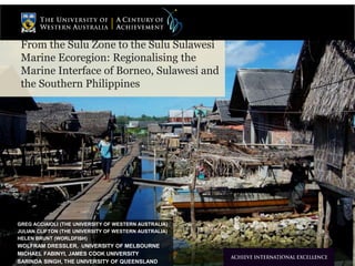
1. From the Sulu Zone to the Sulu Sulawesi
Marine Ecoregion: Regionalising the
Marine Interface of Borneo, Sulawesi and
the Southern Philippines
GREG ACCIAIOLI (THE UNIVERSITY OF WESTERN AUSTRALIA)
JULIAN CLIFTON (THE UNIVERSITY OF WESTERN AUSTRALIA)
HELEN BRUNT (WORLDFISH)
WOLFRAM DRESSLER, UNIVERSITY OF MELBOURNE
MICHAEL FABINYI, JAMES COOK UNIVERSITY
SARINDA SINGH, THE UNIVERSITY OF QUEENSLAND
2. The University of Western Australia
Regionalisation of Insular Southeast Asia
Arbitrariness of this region
• Alternative designations
• Archielagic Southeast Asia
• The Malay Archipelago
(Wallace)
• Tamadun Melayu
Included nation-states
• Brunei Darussalam
• Indonesia
• Malaysia
• Philippines
3. The University of Western Australia
Regions within Insular Southeast
Asia: Biogeographic
Wallace Line as faunal boundary
• Demarcating biogeographic zones
• West:
– Asiatic species
– Sunda shelf
• East:
– Australian species (with some Asiatic)
– Sahul shelf
Transition areas:
• Wallacea: islands not connected to
dry land of either land mass
– Between Wallace’s line and Lydekker’s Line
• Weber’s Line: tipping point
between dominance by Asian
species against those of Australia
origin
4. Regions within Insular Southeast
Asia: Cultural
Shelly Errington’s Centrist
Archipelago within Insular
Southeast Asia
• Composition:
• Java
• Bali
• Borneo
• Sulawesi
• Philippines
Differentiated from Exchange
Archipelago
• Sumatra (except Javanese-dominated
Lampung)
• Eastern Indonesia
– Lesser Sundas
– Maluku
The University of Western Australia
5. Regions within Insular Southeast Asia:
Economic, Political, Cross-cultural
The Sulu Zone (James F. Warren)
In part an economic trade-oriented Zone
• Extraction of raw products from southern
The University of Western Australia
frontiers
– Land products: birds’ nests, etc.
– Marine products tripang, etc.
• Northeast Borneo
• Coastal Sulawesi
• Central and Western Mindanao
• Assembly and exchange at Sulu Sultanate’s
entrepot, Jolo
– Transhipment to China and Elsewhere
Trade also entail political dimensions
• ‘ … not just a “spatial site” of economic,
cross-cultural and symbolic contact … a
meeting ground and arena of potential
antagonism and ... coercion, inequality and
conflict’ (Warren 2011)
• Piracy: response to colonial restrictions
• Slave raids for labour
• Continuing process of reconstructing ethnic
identity
Links to pressures from wider economic world of
colonial capitalism and free trade
6. The University of Western Australia
Sulu Zone definition
‘The Sulu Zone constituted a
Southeast Asian economic
region with a multi-ethnic pre-colonial
Malayo-Muslim state,
and an ethnically
heterogeneous set of societies
of diverse political backgrounds
and alignments that could be
set within a stratified hierarchy
of kinship oriented stateless
societies’, maritime nomadic
fishers and forest dwellers.’
(Warren 2011).
7. Emergent Conservation Zones in Insular Southeast Asia Region
The University of Western Australia
Global biodiversity hotspots
• 4 of 35 global hotspots found
in Insular Southeast
Asia/Melanesia
Coral Triangle (Indonesia,
Philippines, as ‘the hotspot for
marine diversity’ (Biodiversity
Hotspots: Distribution and
Protection of Conservation Priority
Areas, Zachos, Frank E., Habel,
Jan Christian (Eds.). Springer,
2011)
• (Indonesia
• Philippines
• Malaysia
• Timor Leste
• Papua New Guinea
• Solomon Islands
Figure 1. Species richness and endemism in Southeast Asia. The four biodiversity hotspots
overlapping Southeast Asia are highlighted in red. Bars represent the percentage
of species endemic to the respective hotspot. Numbers in parentheses represent total and
endemic species known to science, respectively. The island of Borneo includes the
political divisions of Brunei, Malaysia and Indonesia. The Indo-Burma hotspot includes part of
Bhutan, Nepal, eastern India, southern China, as well as islands such
as Hainan and the Andamans. Details of biodiversity hotspot boundaries, and numbers of total
and endemic species within each hotspot were taken from Conservation International [74].
9. The University of Western Australia
Nested Hierarchy of Conservation Zones:
Coral Triangle Initiative
Sulu Sulawesi Marine Ecoregion (NB: near overlap with Sulu Zone)
Semporna Priority Conservation Area
Tun Sakaran Marine Park
10. Hierarchy of Marine Conservation Zones and Partnerships:
Overlap and Complementarity in governance
The University of Western Australia
Coral Triangle Initiative
• Multilateral partnership between the
Nation-State Governments of Indonesia,
Malaysia, Papua New Guinea, Philippines,
Solomon Islands and Timor Leste
• Secondary Partners: Asian Development
Bank, Conservation International, The
Nature Conservancy (TNC), and the World
Wildlife Fund (WWF), the United States
Government (USAid), Australian
Government
11. Hierarchy of Marine Conservation Zones and Partnerships:
Overlap and Complementarity in governance
The University of Western Australia
Lead Organization
World Wildlife Fund (WWF)
Key Parties
Indonesia
Ministries of Environment
Ministry of Forestry
Ministry of Marine Affairs and Fisheries
Kehati Foundation
Foreign Affairs Department
Bunaken National Park
The Nature Conservancy
Development Planning Agencies of the
Provinces of Manado and East Kalimantan
WWF Indonesia
Malaysia
Department of Fisheries-Sabah
Sabah Parks
Sabah Wildlife Department
Ministry of Tourism
Culture and Environment
Universiti Malaysia Sabah
Drainage and Irrigation Department-Sabah
Sabah Forestry Department
Department of Town and Regional Planning-Sabah
Department of Fisheries-Malaysia
Ministry of Science, Technology and Environment
WWF Malaysia
Philippines
Department of Environment and Natural Resources
Department of Agriculture
Department of Interior and Local Government
Government of the Autonomous Region in Muslim
Mindanao
Philippine Council for Aquatic and Marine Research
and Development
Other Partners
Packard Foundation
U.S. National Oceanic and Atmospheric
Administration
U.S. State Department
Australian Department of Environment and Heritage
United States Agency for International Development
12. Stated Aims of Nested Conservation Areas: Overt Functions
The University of Western Australia
The five goals in the Coral Triangle Initiative Regional Plan of Action
• Priority seascapes designated and effectively managed.
• Ecosystem Approach to Management of Fisheries (EAFM) and other marine resources fully
applied.
• Marine Protected Areas (MPAs) established and effectively managed.
• Climate change adaptation measures achieved.
• Threatened species status improving.’
Foci of Sulu-Sulawesi Marine Ecoregion
• Seagrasses
• Mangroves
• Live Reef Fish Trade
Foci of Semporna Priority Conservation Area
• Coral reef protection
• Shark protection initiative
• Tourism enhancement
Overall management goals of Tun Sakaran Marine Park
• Protect, maintain and enhance biodiversity and the health of the environment.
• Maximise opportunities for economic development and sustainable resource use.
• Ensure local people are involved in, and benefit from, the creation of the park.
• Build community and public awareness about the importance of establishing and maintaining the
park.
– [Enviornmental Education for Inhabitants (Pride Program of RARE)]
13. Covert Functions of Marine Protected Areas: Securitisation
Overtly ‘to safeguard the rich diversity
of marine life found in the area’
(Chagos Conservation Trust)
• Resilience to climate change and
environmental disruptions
• 49% of reefs found in Indian
The University of Western Australia
Ocean
Covertly a securitisation move
• Forestall the movement back of
Chagossians evicted in the 1960s-
70s and insulation of US Air Force
Base on Diego Garcia
‘…the [Chagossians] would find it
difficult, if not impossible, to pursue their
claim for resettlement on the islands if
the entire Chagos Archipelago were a
marine reserve’
(2009 UK diplomatic cable published via
Wikileaks)
Chagos Marine Reserve
• Declared 1 April 2010 as a ‘fully
no-take marine reserve’
• Largest such reserve in the world
14. The University of Western Australia
Security concerns of Sabah
Illegal Migration in Sabah
• Labour migration from (eastern)
Indonesia
• Stateless people from southern
Philippines
• I.e. Maritime people of the Sulu
Zone
– Refugees from sectarian conflict in the southern
Philippines
– Sama diLaut (Bajau Laut)
– Tausug (Suluk)
‘Invasion’ of eastern Sabah on 11
February 2013
• 235 armed militants sent by claimant
to Sulu Sultanship, Jamalul Kiram III,
to reclaim eastern Sabah for the
Sultanate
– Continuing annual payment of 5300 MYR
($1700 USD): cession payment or rent?
• Routed by Malaysian military after 1
month, 1 week, 6 days standoff
– Operasi Daulat (Operation Sovereignty)
Attempted resuscitation of sphere of
influence of Sulu Zone
15. Creation of Eastern Security Zone (ESSZONE) – 25 March 2013
The University of Western Australia
16. Conservation zones as another form of disciplining populations
The University of Western Australia
WWF’s covert acknowledgement:
‘Furthermore, human migration and
complex socio-economic factors
pertaining to the development of
Sabah contribute to ecosystem
degradation.’
(http://www.wwf.org.my/about_wwf/wh
at_we_do/marine/sulu_sulawesi_marin
e_ecoregion_programme/ )
Conversion of inhabitants of various
conservation regions zones into
regions into ‘stakeholders’
Stakeholder as a new sort of ‘subject’
(à la Foucault)
• Subject to new forms of discipline
and hence domestication
Problems in ranking of stakeholders
Case study of Bajau Laut (Sama
diLaut) of Sulu-Sulawesi Marine
Ecoregion / Sulu Zone as doubly
estranged stakeholders
17. Stateless stakeholders: the
Sama Dilaut (Bajau Laut)
The University of Western Australia
Economic reliance on marine resources: food,
fuel and building materials
Reef and pelagic fishers
Cultural affiliation with maritime environment:
spiritual belief systems
Connectivity between Sama Dilaut communities dispersed across Southeast Asia
‘...[for Sama Dilaut], the eastern seas of island Southeast Asia are an intimately familiar space,
full of historically, culturally, and spiritually significant places’ (Nolde 2009)
18. Stateless stakeholders: the
Sama Dilaut (Bajau)
Sama Dilaut statelessness in Malaysia (Sabah):
- classification as ‘Philippine’ according to historic origin
- movement between Malaysian, Indonesian and Philippine waters
- absence of birth certificates / ID cards
- public perceptions and official reluctance
The University of Western Australia
19. The University of Western Australia
Differentiation of Bajau in Sabah
Bajau Laut (Sama Dilaut) as outsiders
Bajau Tempatan as insiders
• Malaysian Citizens
• Orientation to terrestrial settlements
– Bajau Omadal
– Bajau Selakan
– Etc.
• Landholders
– Some with land certificates
– Some with customary tenure
Ambivalent relationship to Bajau Laut
• Our ancestors were like that
• But now we are modern Malaysians
• Origins festivalised in Regatta Lepa
Bajau Laut label them ‘Bajau Kubang’
• ‘(Bajau of the [Pig/Water Buffalo] Sty’
20. Bajau Tempatan as Legitimate Stakeholders in Tun Sakaran Marine Park
The University of Western Australia
Three populations resident in Park
• Bajau Tempatan [Malaysian citizens]
• Suluk (Tausug) [Stateless]
• Bajau Laut (Bajau Palauh, Sama Dilaut)
[Stateless]
Continuing recognition of Bajau Tempatan land
rights
• Rent to be paid by Sabah Parks for ranger
stations
– Or located off the land
• Continuing performance of kenduri (i.e. Mandi
Safar)
– Possession by ancestral spirits of Bajau Tetagen and Bajau
Selakan as validating continuing ownership of land
• Official granting of permission for seaweed
cultivation,
– Permit process requires a Malaysian identity card (i.e. Malaysian
citizenship)
– Payment of a fee
– Restriction of 1 ha. / individual
21. The University of Western Australia
The Peripheral Position of the Bajau Laut & Suluk
Inclusive policy of Sabah Parks
• Allowance of Bajau Laut settlements on islands
• Inclusion in some environmental education programs
– Pride program of RARE (partner of TNC)
Tolerance of seaweed cultivation (without permit)
• Proliferation of Suluk seaweed cultivation in General
Use Zone (Zon Guna Umum DARK BLUE)
– Bajau Laut (e.g. Sibuan) as gleaners of Suluk seaweed plots
– Patron-client relations
Bajau Laut (e.g. Maega) emerging as seaweed cultivators in
own right
• Near shore plots without formal permits
No toleration of continuance of ‘traditional’ livelihood as reef
fishers
• Continuing exclusion from No-Take Zones (NTZs)
– Spawning Protection Zones (Zon Pemeliharaan RED)
– Conservation Zones (Zon Konservasi YELLOW)
• Continuing Fishing in
– Pelagic fishing (Zon Pelagik LIGHT BLUE)
– General Use Zone where no under seaweed cultivation
22. Exclusion: Resentment by the Bajau Tempatan
‘Squatting’ by Bajau Laut on island Land owned by Bajau
The University of Western Australia
Tempatan
• Periodic evictions
– Sibuan 2013
– Partnership of local Bajau Tempatan with local Chinese entrepreneur
– Projected dive resort
Resentment of tolerance by Sabah Parks of Suluk and Bajau
Laut seaweed cultivation
• ‘Why should they [Bajau Laut and Suluk] allowed to
cultivate any amount of seaweed without a permit?’
– Malaysian citizens must pay annually for permit
– Restriction to 1 ha. / permit
Formation of a corporation under the auspices of Lembaga
Kemajuan Ikan Malaysia (Foundation for Malaysian
Fisheries Progress)
• Founded by a Semporna-resident Bajau Tempatan
• By banding together in a cooperative/company can gain
a permit beyond 1 ha.
• Aim to displace Suluk seaweed cultivators from General
Use Zone north of Sebangkat
23. Double Estrangement of the Stateless Bajau Laut (and Suluk): Who
constitutes ‘The Community’ in Community Conservation?
Problematisation of unity/harmony of community in community conservation
• Agrawal and Gibson (1999) ‘Enchantment and Disenchantment: The
The University of Western Australia
Role of Community in Natural Resource Conservation’
Most notably locally resident Indigenous Peoples regarded as constituting
‘the community’ with whom to form joint/co-management
• E.g. Community conservation agreements in Lore Lindu National Park,
Central Sulawesi, Indonesia
– Deal only with the Lembaga Adat of Indigenous To Lindu
– Neglect of local settlers (Bugis spontaneous migrants, local transmigrants, etc.)
Analogous situation in Tun Sakaran Marine Park
• Primary orientation to maintaining rights of Bajau Tempatan (Indigenous
People of the Semporna region)
• (1st level) Estrangement of Stateless Bajau and Suluk from this
Conservation Community
– Tolerance of their habitation but restriction of livelihoods
– No protection against depredations of Bajau Tempatan
24. 2nd Level Estrangement: Continuing Marginalisation of Community
Members in the Marine Planning Processes of the Conservation
Zones of Insular Southeast Asia
The University of Western Australia
Continuing problems defined by:
1. How stakeholders are defined and
ranked in the nested conservation
zones/marine protected areas
2. How stakeholder participation is
implemented in these MPAs?
3. Continuing consequences of
statelessness and entailed marginality
for livelihoods, participation and
conservation enforcement for these
groups
25. 1) Defining stakeholders in the Coral Triangle
TNC/WWF (2008): ‘Individuals, groups or institutions who have a vested interest in the
natural resources of the project area and/or who potentially will be affected by project
activities and have something to gain or lose if conditions change or stay the same’
In principle recognition of need to enable marginalised communities to participate, with
specific considerations relating to Indigenous peoples
In practice, priority afforded to ensuring and managing participation of ‘key stakeholders’ in
TNC/WWF projects
- Grouping and ranking procedures utilised that ensure local communities are not regarded
as key stakeholders
The University of Western Australia
Source: TNC/WWF (2008) Capacity Action Planning for Protected Areas
Defining stakeholders in the
Coral Triangle
26. ‘It is imperative to involve the right people and agencies from the beginning to ensure the greatest level
of support possible’
‘Just because someone is a stakeholder does not mean that you will want them on your project team’
Explicit prioritisation of stakeholders favouring project
Clear potential for stereotyping
The University of Western Australia Sources: TNC (2005) http://www.conservationgateway.org/file/methodology-rank-social-and-institutional-stakeholders
TNC/WWF (2008) Capacity Action Planning for Protected Areas
Defining stakeholders in the
Coral Triangle (1)
27. Implementing participation in the
Coral Triangle
Meaningful participation restricted to high influence, high importance group
Subsistence users: two-way communication, but no commitment to act – information
gathering exercises
Other groups: one-way communication
The University of Western Australia
Influence (power)
High
Importance to
project
Low High
Low
Group: Government
Strategy: Collaborate
Group: Local elite/media
Strategy: Inform/consult
Group: Local resource users
Strategy: Consult
Group: General public
Strategy: Inform
Source: TNC (2009) Protected Area Management Planning: A Target-Based Approach
28. Implementing participation in the
Coral Triangle
Normative rationale Substantive rationale Instrumental rationale
The University of Western Australia
Who is to be included? Those who have a
Source: Adapted from Wesselink et al. (2011)
stake
Those who have
additional knowledge
Those with blocking power
and those needed for
implementation
What is included? Participants’ concerns
and views
Policy makers’
concerns and all other
knowledge
Policy makers’ concerns and
selected others’ knowledge
How is it included? In all stages and issues Only when it adds
substantive value
Only when it ensures smooth
implementation
Clear emphasis on instrumental rationale in Coral Triangle case
‘Key stakeholders’ are those judged to be in positions of power and influence
- goals and objectives reflect organisational priorities
- participation constructed to enhance chances of project success
29. Consequences for marginal
stateless groups and conservation
Stateless Sama Dilaut in maritime Malaysia
Sama Dilaut claims to marine resource tenure or
ownership rendered both
Illegal (view of government)
Illegitimate (view of Bajau Tempatan)
Unable to be recognised as ‘indigenous’ or
‘traditional’ culture
Exclusion from local stakeholder
community of Bajau Tempatan
Unlikely to be involved with legal or administrative
bureaucracy due to perceived personal risk
Peripheral minority group further marginalised
through statelessness
Dominant negative stereotype easily reinforced
Long term weakening of community identity through
continuing movements of Bajau Laut
Transitions of families to land / urban areas
The University of Western Australia
in search of livelihoods
30. The University of Western Australia
Continuing stereotypes
Evans (1922): ‘...the Bajau is a lazy spendthrift,
a liar, a cheat, a thief, a wheedler, a blusterer
and a swaggerer. Piracy, raiding and burning
Chinese shops...is the Bajau’s highest kind of
pleasure.’
Ali (2010): ‘[Bajau] children will end up doing
something illegal or contributing to social
problems in future as they do not receive
proper education...By exposing these children
to the importance of taking care of their health,
manners and self discipline, they will become
independent, aware of the importance to
sustain nature and many more.’
31. Consequences for marginal
stateless groups and conservation
Historically, Sama Dilaut communities maintained integrity through minimising outsider
groups’ influence and power
The University of Western Australia
Statelessness and conservation
Coral Triangle Initiative
- strengthening of State control over
borderlands and maritime space
- focused in region where borders are
diffuse, poorly enforced and actively
disputed
Marine conservation and management becomes symbol of State and alliance with powerful
international NGOs
- opposition or dissent implies rejection of State and rationale for conservation
- easy fit with historical and contemporary narratives of ‘sea nomads’
- non-participation outcomes may serve broader political objectives of controlling border
communities
32. Consequences for marginal
stateless groups and conservation
The University of Western Australia
Statelessness and conservation
Many other areas of concern regarding CTI (finance, enforcement, political co-operation,
NGO influence)
- but CTI programme will inevitably impact stateless and marginal communities’ livelihoods
Research questions
- do stateless communities have the capacity to participate more effectively in management?
- will states recognise use rights outside of ‘traditional’ or ‘indigenous’ envelope?
- can influential NGOs represent all users regardless of citizenship when planning shared
marine resources?
33. The University of Western Australia
CONCLUSIONS / RECOMMENDATIONS
Conclusions
Numbers of stateless stakeholders in Coral Triangle set
to increase: food insecurity, political instability, climate
change, individual mobility and willingness to migrate
Adherence to target-driven regional marine planning
engenders instrumental rationale for participation,
excluding local resource users
Concept of ‘stakeholders’ needs refining to reflect
differing political status of resource user community
Need to undo double estrangement/exclusion of Bajau
Laut
More expansive notions of local stakeholders not
necessarily seen as cohesive communities
States and NGOs must recognise benefits of more
inclusive approach for meeting long term conservation
outcomes
Editor's Notes
Bajau or Sama Bajau one of three groups of ‘sea nomads’ living on boats within SE Asia. Others: Moken and Orang Laut. Bajau are most dispersed of all three sea nomad groups, concentrated in eastern Indonesia, Sulu Zone and Nusa Tenggara. Origins thought to be southern Philippines, dispersed south and east around ninth century and often allied with various dominant regional rulers.
Relatively little studied, but key role in terms of marine resource management and planning.
Sabah, where most of Malaysian Bajau are found, treats Bajau as stateless. Economic and political reasons.
Stakeholder ranking: replaces importance to project with attitude towards project – positively or negatively ranked.
Final score determines level or extent of stakeholder participation
Key stakeholders – those in favour of project and in positions of power.
Grouping along lines of influence or power over project and importance to ensuring success of project.
High influence and high importance = government
High influence and low importance = media
Low influence and low importance = general public
Low influence and high importance = local resource users
Local resource users: low influence due political, economic or social status. High importance due to intensity of resource usage. Consultation: but no obligation to take views on board.
All three methods involve subjective evaluation of stakeholders’ power over project and dependency on resources. Claims over resources and attitude towards project can also be used as criteria
How does this fit with models of stakeholder participation? What justifications are used to devise methods of participation?
Normative – maximise of participation all stakeholders, irrespective of characteristics
Substantive – selective based on potential contribution towards value of decision-making. Intention is to improve decision-making and change policy if new information becomes available.
Instrumental – selective based on conformity with project goals and objectives. Intention to reduce conflicts and provide legitimacy for decisions.