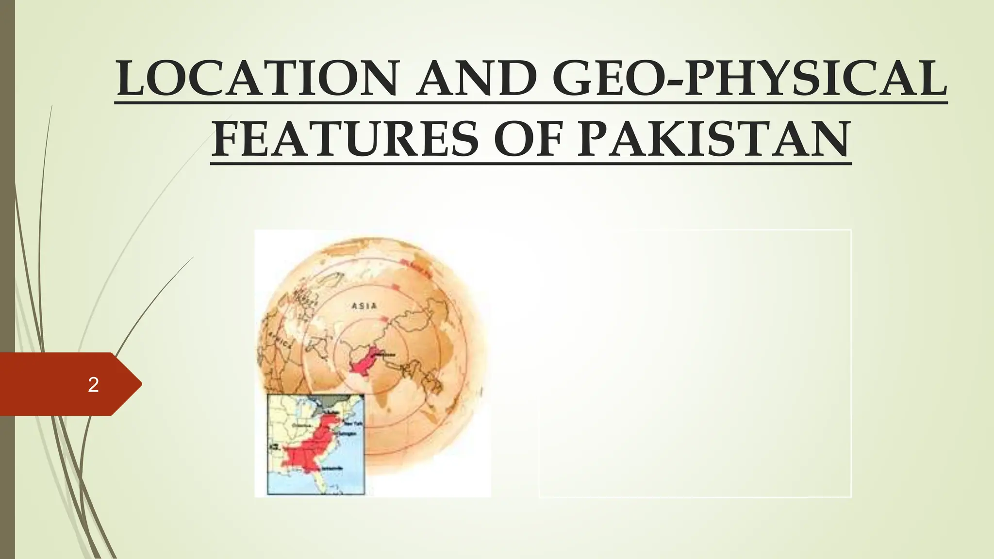
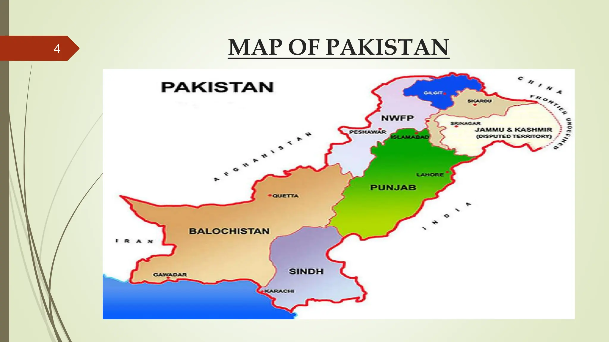
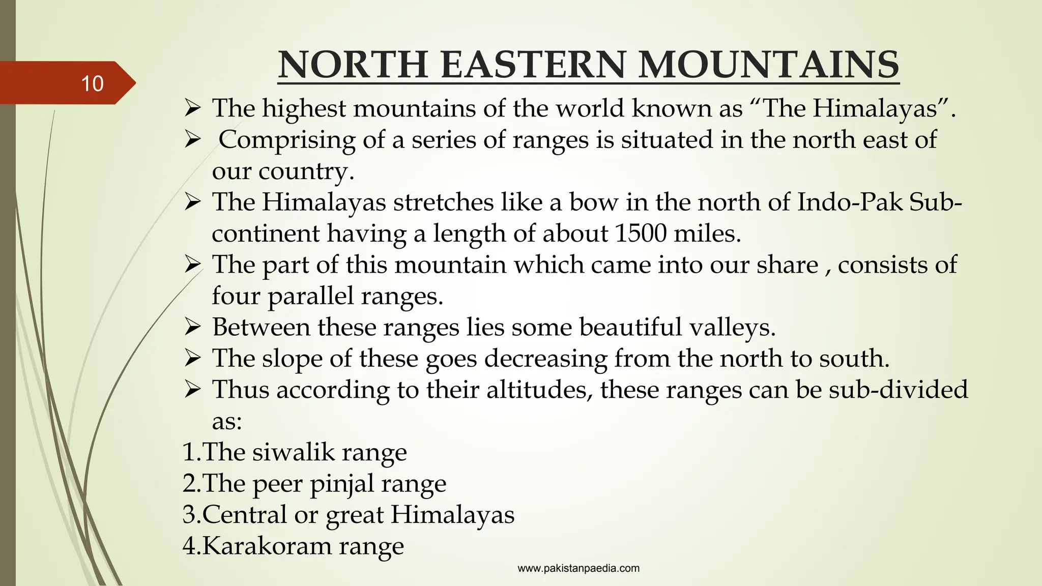
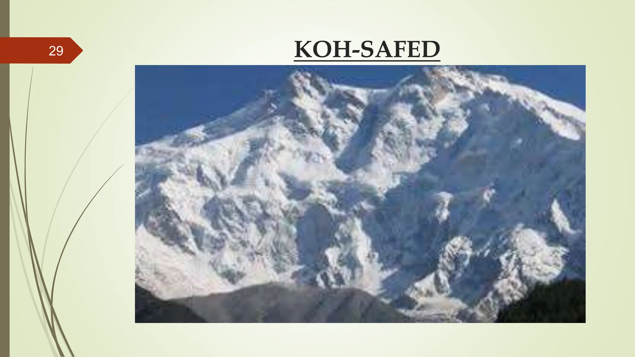
1
LOCATION AND GEO-PHYSICAL
FEATURES OF PAKISTAN
2
CONTENTS
 Map of Pakistan
 Location of Pakistan
 Boundaries/ neighbor countries of Pakistan
 Physical Features of Pakistan
 Physical Map of Pakistan
 North Eastern & North Western Mountains
 Some Important Passes
 The Indus Plain
 Plateaus
 Salt Range
 Deserts
3
MAP OF PAKISTAN
4
LOCATION OF PAKISTAN
Located between
Coordinates:
Latitude: 24 °N - 37 °N
Longitude: 61 °E – 76 °E
Total Area: 796,096 sq. km
Altitude:
Highest point: K-2 (8611m)
Deepest point: Dasu patan (6500m)
Lowest point: Sea level 0 (feet)
www.pakistanpaedia.com
5
LOCATION OF PAKISTAN
6
BOUNDARIES/ NEIGHBOUR COUNTRIES
OF PAKISTAN
COUNTRIES DIRECTION
LENGTH OF BORDER
(KM)
CHINA NORTH 592
INDIA EAST 1600
ARABIAN SEA SOUTH 1000
IRAN SOUTH WEST 850
AFGHANISTAN WEST 2250
7
PHYSICAL FEATURES OF PAKISTAN
 The study of physical map of Pakistan shows that Pakistan
has a number of peculiar features.
 The major part of our country consists of fertile alluvial plain
that is drained by the river Indus and its tributaries
 it has lofty mountains on the north and west
 A few deserts areas
 Pakistan can be divided into the following regions:
 North Eastern & North Western Mountains
 Indus Plain
 Plateaus
 Deserts
www.pakistanpaedia.com
8
PHYSICAL MAP OF PAKISTAN
9
NORTH EASTERN MOUNTAINS
10
 The highest mountains of the world known as “The Himalayas”.
 Comprising of a series of ranges is situated in the north east of
our country.
 The Himalayas stretches like a bow in the north of Indo-Pak Sub-
continent having a length of about 1500 miles.
 The part of this mountain which came into our share , consists of
four parallel ranges.
 Between these ranges lies some beautiful valleys.
 The slope of these goes decreasing from the north to south.
 Thus according to their altitudes, these ranges can be sub-divided
as:
1.The siwalik range
2.The peer pinjal range
3.Central or great Himalayas
4.Karakoram range
www.pakistanpaedia.com
NORTH EASTERN MOUNTAINS
11
NORTH EASTERN MOUNTAINS
THE SIWALIK RANGE:
 These are the line of low altitude hills
 situated adjacent to plain areas of Hazara district in
NWFP and Attock, Rawalpindi, Jhelum, Gujarat and
Sialkot district.
 Here these hills have a height of between 2000 to 3000
feet from the sea level.
www.pakistanpaedia.com
12
THE SIWALIK RANGE
13
NORTH EASTERN MOUNTAINS
THE PEER PINJAL RANGE
 These range lies further of the north and mostly run parallel
to the Siwalik hills.
 Beside Murree and Hazara hills , Peer pinjal range is one of
the famous ranges that lie in these areas.
 it has an average altitude of 14000 to 15000feet
 most of the peaks remains snow covered during winter.
 These are also covered with natural vegetation; forests are
also seen at some places.
www.pakistanpaedia.com
14
THE PEER PINJAL RANGE
15
NORTH EASTERN MOUNTAINS
THE CENTRAL OF GREAT HIMALAYA
 These mountains lie in between the Pir Pinjal range &
Karakoram range.
 These ranges have an average height of 2000 feet and
most of the peaks remain snow-covered throughout the
year.
 The highest peak of this range known as Nanga Parbet
lies in Kashmir has an height of about 26600 feet.
 The beautiful valley of Kashmir lies between the Pir
Pinjal range and the great Himalaya.
www.pakistanpaedia.com
16
THE CENTRAL OF GREAT HIMALAYA
17
NORTH EASTERN MOUNTAINS
THE KARAKORAM RANGE
 The famous Karakoram Range lies to the north of central Himalaya
in northern Kashmir and Gilgit area.
 This range has an average height of about 20000 feet above sea
level.
 The second highest peak of the world and highest peak of Pakistan,
Godwin Austin (K-2) having a height of 28,250 feet or 8475 meters
in this range near Gilgit.
 This peak was first conquered by an Italian expedition in 1954.
 The peak having a high altitude remain snow covered throughout
the year.
www.pakistanpaedia.com
18
THE KARAKORAM RANGE
19
SOME OF THE IMPORTANT PASSES
 The northeastern mountains of our country are quite
high.
 It is difficult to cross them easily, but these
mountains have a few passes
 Which are used for communication purpose.
 Some of the important passes are:
•The Babusar Pass
•The Lowari Pass
•The Shandur Pass
•The Muztagh Pass
www.countrystudies.us/Pakistan/
20
BABUSAR PASS LOWARI PASS
21
SHANDUR PASS MUZTAGH PASS
22
NORTH WESTERN MOUNTAINS
 The north western ranges of our country are also known as
western branches of the Himalayas mountains.
 These mountains consist of series parallel ranges and are lower in
altitude than the northeastern mountains.
 As most of these ranges lie outside the course of summer
monsoons coming from Arabian Sea, and so there the rainfall is
low and they are almost bare of natural vegetation.
 These mountains act as a boundary between Afghanistan, Iran and
our country.
www.countrystudies.us/Pakistan/
23
NORTH WESTERN MOUNTAINS
 These mountain ranges lie north to south, having some passes
in river, beds in the valleys.
 So the northwestern mountains can be sub-divided into
following divisions:
 The Hindu Kush
 The Koh Safed
 The Waziristan Mountains
 The Sulaiman Mountains
 The Keerthar Mountains
www.countrystudies.us/Pakistan/
24
NORTH WESTERN MOUNTAINS
25
THE HINDU KUSH
 Between the Indus and Kabul rivers lies the Hindu Kush range.
 The average height of this range is between 10,000 to 16,000 feet above sea
level.
 The highest peak of this area is known as Tirich Mir, having an altitude of
25230 feet.
 Most of the mountain remains snow-covered during winter months.
 The Kabul, Swat, Panjkora and Kunar flow through months.
 The minor ranges of this mountain. These entire rivers join the Indus from
the western side.
 The famous Khyber Pass lies south of the Kabul river.
 This pass is a historical trade route between Peshawar and Kabul, the
capital of Afghanistan.
www.countrystudies.us/Pakistan/
26
THE HINDU KUSH
27
KOH-SAFED
 South of the Kabul River up to Kurram pass lies the Safed Koh
range which runs east and west.
 These mountains have an average height of 12,000 feet and are
often covered with snow in winter.
 The river Kurram lies to the south of this range.
 The Kurram pass, which provides an easy route in to
Afghanistan, is situated near this range.
 Kohat is an important military base situated at the end of this
pass.
www.countrystudies.us/Pakistan/
28
KOH-SAFED
29
WAZIRISTAN HILLS
 Between the Kurram and the Gomal rivers lies the Waziristan
hills area.
 These hills have low altitude.
 These rivers after passing through Tochi pass join the Indus
Similarly Gomal River coming from Afghanistan joins Indus
near Dera Ismail Khan.
 Bannu at Tochi pass and Dera Ismail Khan at Gomal pass are
the important towns and military centers.
www.countrystudies.us/Pakistan/
30
WAZIRISTAN HILLS
31
THE SULAIMAN MOUNTAIN
 In the south of the Gomal river lies the Sulaiman mountain.
 It rims southward for a distance of about 300 miles.
 Its highest peak is known as Takhat-e-Sulaimani, whose height is
11,100 feet above sea level.
 At the southern end of the Sulaiman mountain, the Bugti and Mari
hills run from the southeast to the northwest.
 The Bolan is the main river of this region.
 The Bolan river passes through the Bolan Pass, which provides
communication facilities between Iran and Pakistan .
 Quetta is and important base at the northern end of Bolan pass.
www.countrystudies.us/Pakistan/
32
THE SULAIMAN MOUNTAIN
33
THE KERTHER MOUNTAINS
 In the west of lower Indus plain lies a hilly area known as
“The Kerther hills”.
 These hills are not high enough, their average height being
about 7000 feet.
 The Kerther hills are drained by the Hub and Layari stream
join the water of the Arabian sea near Karachi.
www.countrystudies.us/Pakistan/
34
THE KERTHER MOUNTAINS
35
THE INDUS PLAIN
 River Indus is the largest river of our country.
 This river after originating from northern slopes of Kailash
Range in Tibet (China) passing through the Himalaya and
enters in Pakistan's territory near Gilgit.
 In the upper region a number of streams join in it, but at the
later stage, some of its western and eastern join in it, but to at
the later stage, some of its western and eastern tributaries
make it more huge and vast in volume and speed.
 Its eastern tributaries are Sutlaj, Bias, Ravi, Chenab, and
Jhelum, while its western tributaries include rivers Swat,
Kunar, Panjkora, Kabul, Kurram, Tochi, Gomal, Bolan, etc
www.countrystudies.us/Pakistan/
36
THE INDUS PLAIN
All the plain areas of our country
have existed by the Sediment
brought by River Indus and its
tributaries.
The whole of the Indus Plain can be
sub-divided into three parts for
detailed study:
•The Upper Indus Plain
•The Lower Indus Plain
•The Indus Delta
37
THE UPPER INDUS PLAIN
38
 From the point of junction eastern tributaries of river Indus is known as
the upper Indus Plain.
 It includes most of the areas of Punjab Province.
 The upper Indus Plain has a height from 600 feet to 1000 feet.
 The northeastern part is comparatively higher. Although most of the
plain area has existed By the alluvia soil brought by the rivers, but near
Sargodha, Chiniot and Sangal, some old dry hiss appear above the plain.
 These are known as [Kinara hills].
 The five big rivers of Punjab drain this plain.
 The land that lies between the two rivers is known as [DOAB].
 Thus the area of Punjab plain can be divided into following Doabs:
i.Bari Doab
ii.The Rachna Doab
iii.The Chaj Doab
iv.The Sindh Sagar Doab
www.countrystudies.us/Pakistan/
THE UPPER INDUS PLAIN
39
THE LOWER INDUS PLAIN
 Mithankot is known as junction of Indus river and its eastern tributaries.
 Beyond Mithankot River Indus flows alone and carries not only its own
water, but also that of its eastern and western tributaries, while flowing
from the Province of Sindh, if becomes several miles wide especially
during the flood season.
 The river Indus flows very slowly and the silt carried by if is largely
deposited on its bed, thereby raising it above the level of the sandy plain.
 The land on either side is, therefore, protected by the construction of
embankments of bunds a number of difficulties has to be faced during
floods season
www.countrystudies.us/Pakistan/
40
THE LOWER INDUS PLAIN
41
THE INDUS DELTA
 The Indus delta begins near Thatta (Sindh) and the river
Indus by distributing itself into a number of branches joins
with the water of Arabian sea.
 The tidal Deltaic land covers an area.
 It is submerged during high tides , It has mangrove swamps.
 The old Deltaic land in the south are being reclaimed by the
canals of the Ghulam Muhammad barrage, still most of the
areas of lower plain are barren waste lands.
www.countrystudies.us/Pakistan/
42
THE INDUS DELTA
43
PLATEAUS
 The land surface of Pakistan is an amalgamation of varying
physical properties of the earth surface, i.e., from seashore to
deserts, plains and plateaus to finally towering pinnacles
rising to 28,000 feet and more.
 The plains of Pakistan include coastal area, upper and lower
Indus plain, the Baluchistan Plateau, Salt Range and Potwar
Plateau.
 Pakistan, a mostly a dry country characterized by extremes of
altitude and temperature, has three main river basins: Indus,
Kharan and Mekran.
www.countrystudies.us/Pakistan/
44
PLATEAUS
 The Indus Plain extends principally along the eastern side of
the river, and the Baluchistan Plateau lies to the south-west.
 Four other topographic areas are the narrow coastal plain
bordering the Arabian Sea;
 The Thar Desert on the border with India;
 The mountains of the north and north-west;
 The Kharan Basin,
 The west of the Baluchistan Plateau
www.countrystudies.us/Pakistan/
45
PLATEAUS
46
POTOWAR PLATEAU
 North of salt range the area of Rawalpindi Jhelum and
Mianwali districts are known as potwar plateau.
 These areas have also an uneven surface.
 The height of this plateau area varies from 1000 to 2000 feet
above sea level.
 A large part of plateau has been dissected and recoded by the
action of running water and it represents a varied land-escapes.
www.wwfpak.org
47
POTOWAR PLATEAU
 The valleys of Haro and Soan rivers pass across the Potwar
plateau.
 These are the important river of these areas and mostly flow
during rainy season.
 Thus due to scanty of rainfall and uneven surface these areas
are not suitable for agricultural activities, but most of the
minerals of our country such as mineral oil, iron, lime-stone,
etc., are found from the potwar plateau areas
www.wwfpak.org
48
POTOWAR PLATEAU
49
BALUCHISTAN PLATEAU
 This plateau lies to the west of the Sulaiman and Kirthar
mountains.
 Like potwar plateau, the dry hills run across the plateau from
the north east to the south west.
 These hills are about 1000 feet high.
 The Toba Kakar and Chaghai ranges in the north separate it
from Afghanistan.
 The Brahui and Makran ranges lie in the center and the
coastal Makran range skirts south of the plateau.
www.wwfpak.org
50
BALUCHISTAN PLATEAU
 A large areas in the north west is desert. Here there is a large salt lake
Hamun-I-mashkhel into which several small rivers small rivers drain.
 The only rivers of importance are the Zhob which joins with the Gomal in
the north, and the Porali, Hangol and Dasht which flow into the Arabian
sea in the south.
 The mountains in the north-east are higher than those in the south and
contain valuable deposit of coal, iron, chromite and other minerals.
 These areas receive a small amount of rain fall and there is scarcity of
water.
 So due to shortage of water and uneven surface these are not suitable for
cultivationl; In a few areas of Quetta and Pashin cultivation of various
crops is possible with the with the help of Kareez irrigation system, but
sheep rearing is the major occupation of the people living in the region.
www.wwfpak.org
51
BALUCHISTAN PLATEAU
52
SALT RANGE
 The areas of salt range begins in the east near the Jhelum in
the Jogi tilla and Bakralla ridges and runs south-west to the
north of the river Jhelum for some distance before turning
north west to cross the Indus near Kalabagh.
 West of the Indus the salt range continues south into the
districts of Bannu and Dera Ismail Khan.
 The average height of the range is about 2000 feet, but near
Sakesar it rises to about 5000 feet above sea level.
 Large quantities of rock salt and the minerals like gypsum
and coal are found in the range.
www.wwfpak.org
53
SALT RANGE
54
DESERTS IN PAKISTAN
 Although some desert areas of our country are parts of plain
but due to some difference in characteristics, these are known
as deserts.
 The following are the main desert areas found in our Punjab
and Sindh provinces:
 Thal Desert
 Cholistan Desert
 Nara & Tharparkar Desert
 Kharan Desert
www.wwfpak.org
55
DESERTS IN PAKISTAN
56
THAL DESERT
 The area between river Indus and Jhelum is known as Sindh
Sagar Doab.
 This includes the areas of Mianwali, Sargodha, Muzaffargarh
and Dera Ismail Khan district in the Province of Punjab.
 These areas are called Thal desert. Here rainfall is very low
and large numbers of sand dunes are found here & there,
often there are dust storms.
 Although a large area of this desert has been irrigated by
canals, still a vast areas are barren
www.wwfpak.org
57
THAL DESERT
58
CHOLISTAN DESERT
 The south boarder area of our Bahawalpur divison is known
as Cholistan.
 In fact, it is a part of Rajhistan desert situated adjacent to in
India, due to shortage of rainfall these areas have become
barren lands.
 Although the soil is fertile enough, but due of scarcity of
water cultivation is not possible.
www.wwfpak.org
59
CHOLISTAN DESERT
60
NARA & THARPARKAR DESERT
 The southern border areas of Khairpur district in
Sindh is known as Nara desert
 and border areas of Mirpur Khas and Sanghar
district are called Tharparkar or Thar desert.
 These are also part of Rajhistan desert in India.
www.wwfpak.org
61
NARA & THARPARKAR DESERT
62
NARA & THARPARKAR DESERT
63
KHARAN DESERT
 The Kharan Desert is a sand desert situated in
Balochistan province, Pakistan.
 All of Balochistan plateau is characterized by
extreme arid conditions and very barren terrain.
 However Kharan desert can be separated from the
rest of the arid landscape due to its sandy nature and
more even terrain, ranging from 1000 m in the north-
east to 500 m in the west.
www.wwfpak.org
64
KHARAN DESERT
65
SUMMARY
 Pakistan is the 36th largest nation by total area. It has a
1,046km (650mi) coastline along the Arabian Sea and the Gulf
of Oman. Pakistan is bordered by Afghanistan, Iran, India,
and China. Pakistan is also very close to Tajikistan, separated
by the Wakhan Corridor. Pakistan is strategically located
between the regions of South Asia, Central Asia, and the
Middle East. This prime location – combined with varied
natural resources, a diverse geography, and interesting
environment – make Pakistan a noteworthy country.
66
REFERENCE
 www.countrystudies.us/Pakistan/
 www.pakistanpaedia.com
 www.wwfpak.org
67
68

6. LOCATION & GEO-PHYSICAL FEATURES OF PAKISTAN.pptx

  • 1.
  • 2.
  • 3.
    CONTENTS  Map ofPakistan  Location of Pakistan  Boundaries/ neighbor countries of Pakistan  Physical Features of Pakistan  Physical Map of Pakistan  North Eastern & North Western Mountains  Some Important Passes  The Indus Plain  Plateaus  Salt Range  Deserts 3
  • 4.
  • 5.
    LOCATION OF PAKISTAN Locatedbetween Coordinates: Latitude: 24 °N - 37 °N Longitude: 61 °E – 76 °E Total Area: 796,096 sq. km Altitude: Highest point: K-2 (8611m) Deepest point: Dasu patan (6500m) Lowest point: Sea level 0 (feet) www.pakistanpaedia.com 5
  • 6.
  • 7.
    BOUNDARIES/ NEIGHBOUR COUNTRIES OFPAKISTAN COUNTRIES DIRECTION LENGTH OF BORDER (KM) CHINA NORTH 592 INDIA EAST 1600 ARABIAN SEA SOUTH 1000 IRAN SOUTH WEST 850 AFGHANISTAN WEST 2250 7
  • 8.
    PHYSICAL FEATURES OFPAKISTAN  The study of physical map of Pakistan shows that Pakistan has a number of peculiar features.  The major part of our country consists of fertile alluvial plain that is drained by the river Indus and its tributaries  it has lofty mountains on the north and west  A few deserts areas  Pakistan can be divided into the following regions:  North Eastern & North Western Mountains  Indus Plain  Plateaus  Deserts www.pakistanpaedia.com 8
  • 9.
    PHYSICAL MAP OFPAKISTAN 9
  • 10.
    NORTH EASTERN MOUNTAINS 10 The highest mountains of the world known as “The Himalayas”.  Comprising of a series of ranges is situated in the north east of our country.  The Himalayas stretches like a bow in the north of Indo-Pak Sub- continent having a length of about 1500 miles.  The part of this mountain which came into our share , consists of four parallel ranges.  Between these ranges lies some beautiful valleys.  The slope of these goes decreasing from the north to south.  Thus according to their altitudes, these ranges can be sub-divided as: 1.The siwalik range 2.The peer pinjal range 3.Central or great Himalayas 4.Karakoram range www.pakistanpaedia.com
  • 11.
  • 12.
    NORTH EASTERN MOUNTAINS THESIWALIK RANGE:  These are the line of low altitude hills  situated adjacent to plain areas of Hazara district in NWFP and Attock, Rawalpindi, Jhelum, Gujarat and Sialkot district.  Here these hills have a height of between 2000 to 3000 feet from the sea level. www.pakistanpaedia.com 12
  • 13.
  • 14.
    NORTH EASTERN MOUNTAINS THEPEER PINJAL RANGE  These range lies further of the north and mostly run parallel to the Siwalik hills.  Beside Murree and Hazara hills , Peer pinjal range is one of the famous ranges that lie in these areas.  it has an average altitude of 14000 to 15000feet  most of the peaks remains snow covered during winter.  These are also covered with natural vegetation; forests are also seen at some places. www.pakistanpaedia.com 14
  • 15.
  • 16.
    NORTH EASTERN MOUNTAINS THECENTRAL OF GREAT HIMALAYA  These mountains lie in between the Pir Pinjal range & Karakoram range.  These ranges have an average height of 2000 feet and most of the peaks remain snow-covered throughout the year.  The highest peak of this range known as Nanga Parbet lies in Kashmir has an height of about 26600 feet.  The beautiful valley of Kashmir lies between the Pir Pinjal range and the great Himalaya. www.pakistanpaedia.com 16
  • 17.
    THE CENTRAL OFGREAT HIMALAYA 17
  • 18.
    NORTH EASTERN MOUNTAINS THEKARAKORAM RANGE  The famous Karakoram Range lies to the north of central Himalaya in northern Kashmir and Gilgit area.  This range has an average height of about 20000 feet above sea level.  The second highest peak of the world and highest peak of Pakistan, Godwin Austin (K-2) having a height of 28,250 feet or 8475 meters in this range near Gilgit.  This peak was first conquered by an Italian expedition in 1954.  The peak having a high altitude remain snow covered throughout the year. www.pakistanpaedia.com 18
  • 19.
  • 20.
    SOME OF THEIMPORTANT PASSES  The northeastern mountains of our country are quite high.  It is difficult to cross them easily, but these mountains have a few passes  Which are used for communication purpose.  Some of the important passes are: •The Babusar Pass •The Lowari Pass •The Shandur Pass •The Muztagh Pass www.countrystudies.us/Pakistan/ 20
  • 21.
  • 22.
  • 23.
    NORTH WESTERN MOUNTAINS The north western ranges of our country are also known as western branches of the Himalayas mountains.  These mountains consist of series parallel ranges and are lower in altitude than the northeastern mountains.  As most of these ranges lie outside the course of summer monsoons coming from Arabian Sea, and so there the rainfall is low and they are almost bare of natural vegetation.  These mountains act as a boundary between Afghanistan, Iran and our country. www.countrystudies.us/Pakistan/ 23
  • 24.
    NORTH WESTERN MOUNTAINS These mountain ranges lie north to south, having some passes in river, beds in the valleys.  So the northwestern mountains can be sub-divided into following divisions:  The Hindu Kush  The Koh Safed  The Waziristan Mountains  The Sulaiman Mountains  The Keerthar Mountains www.countrystudies.us/Pakistan/ 24
  • 25.
  • 26.
    THE HINDU KUSH Between the Indus and Kabul rivers lies the Hindu Kush range.  The average height of this range is between 10,000 to 16,000 feet above sea level.  The highest peak of this area is known as Tirich Mir, having an altitude of 25230 feet.  Most of the mountain remains snow-covered during winter months.  The Kabul, Swat, Panjkora and Kunar flow through months.  The minor ranges of this mountain. These entire rivers join the Indus from the western side.  The famous Khyber Pass lies south of the Kabul river.  This pass is a historical trade route between Peshawar and Kabul, the capital of Afghanistan. www.countrystudies.us/Pakistan/ 26
  • 27.
  • 28.
    KOH-SAFED  South ofthe Kabul River up to Kurram pass lies the Safed Koh range which runs east and west.  These mountains have an average height of 12,000 feet and are often covered with snow in winter.  The river Kurram lies to the south of this range.  The Kurram pass, which provides an easy route in to Afghanistan, is situated near this range.  Kohat is an important military base situated at the end of this pass. www.countrystudies.us/Pakistan/ 28
  • 29.
  • 30.
    WAZIRISTAN HILLS  Betweenthe Kurram and the Gomal rivers lies the Waziristan hills area.  These hills have low altitude.  These rivers after passing through Tochi pass join the Indus Similarly Gomal River coming from Afghanistan joins Indus near Dera Ismail Khan.  Bannu at Tochi pass and Dera Ismail Khan at Gomal pass are the important towns and military centers. www.countrystudies.us/Pakistan/ 30
  • 31.
  • 32.
    THE SULAIMAN MOUNTAIN In the south of the Gomal river lies the Sulaiman mountain.  It rims southward for a distance of about 300 miles.  Its highest peak is known as Takhat-e-Sulaimani, whose height is 11,100 feet above sea level.  At the southern end of the Sulaiman mountain, the Bugti and Mari hills run from the southeast to the northwest.  The Bolan is the main river of this region.  The Bolan river passes through the Bolan Pass, which provides communication facilities between Iran and Pakistan .  Quetta is and important base at the northern end of Bolan pass. www.countrystudies.us/Pakistan/ 32
  • 33.
  • 34.
    THE KERTHER MOUNTAINS In the west of lower Indus plain lies a hilly area known as “The Kerther hills”.  These hills are not high enough, their average height being about 7000 feet.  The Kerther hills are drained by the Hub and Layari stream join the water of the Arabian sea near Karachi. www.countrystudies.us/Pakistan/ 34
  • 35.
  • 36.
    THE INDUS PLAIN River Indus is the largest river of our country.  This river after originating from northern slopes of Kailash Range in Tibet (China) passing through the Himalaya and enters in Pakistan's territory near Gilgit.  In the upper region a number of streams join in it, but at the later stage, some of its western and eastern join in it, but to at the later stage, some of its western and eastern tributaries make it more huge and vast in volume and speed.  Its eastern tributaries are Sutlaj, Bias, Ravi, Chenab, and Jhelum, while its western tributaries include rivers Swat, Kunar, Panjkora, Kabul, Kurram, Tochi, Gomal, Bolan, etc www.countrystudies.us/Pakistan/ 36
  • 37.
    THE INDUS PLAIN Allthe plain areas of our country have existed by the Sediment brought by River Indus and its tributaries. The whole of the Indus Plain can be sub-divided into three parts for detailed study: •The Upper Indus Plain •The Lower Indus Plain •The Indus Delta 37
  • 38.
    THE UPPER INDUSPLAIN 38  From the point of junction eastern tributaries of river Indus is known as the upper Indus Plain.  It includes most of the areas of Punjab Province.  The upper Indus Plain has a height from 600 feet to 1000 feet.  The northeastern part is comparatively higher. Although most of the plain area has existed By the alluvia soil brought by the rivers, but near Sargodha, Chiniot and Sangal, some old dry hiss appear above the plain.  These are known as [Kinara hills].  The five big rivers of Punjab drain this plain.  The land that lies between the two rivers is known as [DOAB].  Thus the area of Punjab plain can be divided into following Doabs: i.Bari Doab ii.The Rachna Doab iii.The Chaj Doab iv.The Sindh Sagar Doab www.countrystudies.us/Pakistan/
  • 39.
  • 40.
    THE LOWER INDUSPLAIN  Mithankot is known as junction of Indus river and its eastern tributaries.  Beyond Mithankot River Indus flows alone and carries not only its own water, but also that of its eastern and western tributaries, while flowing from the Province of Sindh, if becomes several miles wide especially during the flood season.  The river Indus flows very slowly and the silt carried by if is largely deposited on its bed, thereby raising it above the level of the sandy plain.  The land on either side is, therefore, protected by the construction of embankments of bunds a number of difficulties has to be faced during floods season www.countrystudies.us/Pakistan/ 40
  • 41.
  • 42.
    THE INDUS DELTA The Indus delta begins near Thatta (Sindh) and the river Indus by distributing itself into a number of branches joins with the water of Arabian sea.  The tidal Deltaic land covers an area.  It is submerged during high tides , It has mangrove swamps.  The old Deltaic land in the south are being reclaimed by the canals of the Ghulam Muhammad barrage, still most of the areas of lower plain are barren waste lands. www.countrystudies.us/Pakistan/ 42
  • 43.
  • 44.
    PLATEAUS  The landsurface of Pakistan is an amalgamation of varying physical properties of the earth surface, i.e., from seashore to deserts, plains and plateaus to finally towering pinnacles rising to 28,000 feet and more.  The plains of Pakistan include coastal area, upper and lower Indus plain, the Baluchistan Plateau, Salt Range and Potwar Plateau.  Pakistan, a mostly a dry country characterized by extremes of altitude and temperature, has three main river basins: Indus, Kharan and Mekran. www.countrystudies.us/Pakistan/ 44
  • 45.
    PLATEAUS  The IndusPlain extends principally along the eastern side of the river, and the Baluchistan Plateau lies to the south-west.  Four other topographic areas are the narrow coastal plain bordering the Arabian Sea;  The Thar Desert on the border with India;  The mountains of the north and north-west;  The Kharan Basin,  The west of the Baluchistan Plateau www.countrystudies.us/Pakistan/ 45
  • 46.
  • 47.
    POTOWAR PLATEAU  Northof salt range the area of Rawalpindi Jhelum and Mianwali districts are known as potwar plateau.  These areas have also an uneven surface.  The height of this plateau area varies from 1000 to 2000 feet above sea level.  A large part of plateau has been dissected and recoded by the action of running water and it represents a varied land-escapes. www.wwfpak.org 47
  • 48.
    POTOWAR PLATEAU  Thevalleys of Haro and Soan rivers pass across the Potwar plateau.  These are the important river of these areas and mostly flow during rainy season.  Thus due to scanty of rainfall and uneven surface these areas are not suitable for agricultural activities, but most of the minerals of our country such as mineral oil, iron, lime-stone, etc., are found from the potwar plateau areas www.wwfpak.org 48
  • 49.
  • 50.
    BALUCHISTAN PLATEAU  Thisplateau lies to the west of the Sulaiman and Kirthar mountains.  Like potwar plateau, the dry hills run across the plateau from the north east to the south west.  These hills are about 1000 feet high.  The Toba Kakar and Chaghai ranges in the north separate it from Afghanistan.  The Brahui and Makran ranges lie in the center and the coastal Makran range skirts south of the plateau. www.wwfpak.org 50
  • 51.
    BALUCHISTAN PLATEAU  Alarge areas in the north west is desert. Here there is a large salt lake Hamun-I-mashkhel into which several small rivers small rivers drain.  The only rivers of importance are the Zhob which joins with the Gomal in the north, and the Porali, Hangol and Dasht which flow into the Arabian sea in the south.  The mountains in the north-east are higher than those in the south and contain valuable deposit of coal, iron, chromite and other minerals.  These areas receive a small amount of rain fall and there is scarcity of water.  So due to shortage of water and uneven surface these are not suitable for cultivationl; In a few areas of Quetta and Pashin cultivation of various crops is possible with the with the help of Kareez irrigation system, but sheep rearing is the major occupation of the people living in the region. www.wwfpak.org 51
  • 52.
  • 53.
    SALT RANGE  Theareas of salt range begins in the east near the Jhelum in the Jogi tilla and Bakralla ridges and runs south-west to the north of the river Jhelum for some distance before turning north west to cross the Indus near Kalabagh.  West of the Indus the salt range continues south into the districts of Bannu and Dera Ismail Khan.  The average height of the range is about 2000 feet, but near Sakesar it rises to about 5000 feet above sea level.  Large quantities of rock salt and the minerals like gypsum and coal are found in the range. www.wwfpak.org 53
  • 54.
  • 55.
    DESERTS IN PAKISTAN Although some desert areas of our country are parts of plain but due to some difference in characteristics, these are known as deserts.  The following are the main desert areas found in our Punjab and Sindh provinces:  Thal Desert  Cholistan Desert  Nara & Tharparkar Desert  Kharan Desert www.wwfpak.org 55
  • 56.
  • 57.
    THAL DESERT  Thearea between river Indus and Jhelum is known as Sindh Sagar Doab.  This includes the areas of Mianwali, Sargodha, Muzaffargarh and Dera Ismail Khan district in the Province of Punjab.  These areas are called Thal desert. Here rainfall is very low and large numbers of sand dunes are found here & there, often there are dust storms.  Although a large area of this desert has been irrigated by canals, still a vast areas are barren www.wwfpak.org 57
  • 58.
  • 59.
    CHOLISTAN DESERT  Thesouth boarder area of our Bahawalpur divison is known as Cholistan.  In fact, it is a part of Rajhistan desert situated adjacent to in India, due to shortage of rainfall these areas have become barren lands.  Although the soil is fertile enough, but due of scarcity of water cultivation is not possible. www.wwfpak.org 59
  • 60.
  • 61.
    NARA & THARPARKARDESERT  The southern border areas of Khairpur district in Sindh is known as Nara desert  and border areas of Mirpur Khas and Sanghar district are called Tharparkar or Thar desert.  These are also part of Rajhistan desert in India. www.wwfpak.org 61
  • 62.
  • 63.
  • 64.
    KHARAN DESERT  TheKharan Desert is a sand desert situated in Balochistan province, Pakistan.  All of Balochistan plateau is characterized by extreme arid conditions and very barren terrain.  However Kharan desert can be separated from the rest of the arid landscape due to its sandy nature and more even terrain, ranging from 1000 m in the north- east to 500 m in the west. www.wwfpak.org 64
  • 65.
  • 66.
    SUMMARY  Pakistan isthe 36th largest nation by total area. It has a 1,046km (650mi) coastline along the Arabian Sea and the Gulf of Oman. Pakistan is bordered by Afghanistan, Iran, India, and China. Pakistan is also very close to Tajikistan, separated by the Wakhan Corridor. Pakistan is strategically located between the regions of South Asia, Central Asia, and the Middle East. This prime location – combined with varied natural resources, a diverse geography, and interesting environment – make Pakistan a noteworthy country. 66
  • 67.
  • 68.