USFWS Salt Marsh Sediment Augmentation Project Lessons
•
0 likes•120 views

The U.S. Fish & Wildlife Service conducted a thin layer sediment augmentation project at Seal Beach National Wildlife Refuge to address subsidence and sea level rise threatening the salt marsh habitat. Sediment dredged from a nearby harbor was sprayed over 10 acres in a thin layer to elevate the marsh surface. Extensive monitoring was conducted before, during, and for 5 years after construction to evaluate impacts to vegetation, birds, and other wildlife and the effectiveness of elevation gains. Lessons learned included better estimating sediment volumes needed and construction timelines. The project aims to develop long-term strategies for sustaining Pacific coast wetlands under climate change.

Recommended
More Related Content
What's hot
What's hot (11)
Viewers also liked
Viewers also liked (13)
Similar to USFWS Salt Marsh Sediment Augmentation Project Lessons
Similar to USFWS Salt Marsh Sediment Augmentation Project Lessons (20)
Recently uploaded
Recently uploaded (20)
USFWS Salt Marsh Sediment Augmentation Project Lessons
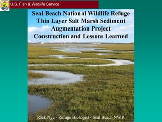
- 1. U.S. Fish & Wildlife Service Seal Beach National Wildlife Refuge Thin Layer Salt Marsh Sediment Augmentation Project Construction and Lessons Learned Rick NyeRick Nye -- Refuge BiologistRefuge Biologist -- Seal Beach NWRSeal Beach NWR
- 2. U.S. Fish & Wildlife Service ProblemProblem •• 965 acre refuge965 acre refuge -- 59% (565 acres)59% (565 acres) intertidal salt marshintertidal salt marsh •• Subsidence rate:Subsidence rate: -- 4.13mm/4.13mm/yryr (SE(SE ++ 1.21 mm/1.21 mm/yryr)) •• Relative Sea Level RiseRelative Sea Level Rise 6.23 mm/6.23 mm/yryr •• Subtidal in 60 yearsSubtidal in 60 years
- 3. U.S. Fish & Wildlife Service Dredge Material OpportunityDredge Material Opportunity
- 4. U.S. Fish & Wildlife Service Research & MonitoringResearch & Monitoring Timeline:Timeline: 66--mos Premos Pre--augmentation toaugmentation to 55--yrs Postyrs Post--augmentationaugmentation •• Site elevationsSite elevations •• Sediment depth overtimeSediment depth overtime •• Compaction rateCompaction rate •• Tidal creek reformationTidal creek reformation •• Vegetation % coverVegetation % cover •• Species compositionSpecies composition •• BiomassBiomass •• Cordgrass assessmentCordgrass assessment •• Plant PhysiologyPlant Physiology •• Invertebrate speciesInvertebrate species •• Eelgrass healthEelgrass health •• Ridgeway’s RailsRidgeway’s Rails •• other avian activityother avian activity •• Carbon sequestrationCarbon sequestration
- 5. U.S. Fish & Wildlife Service MitigationMitigation MeasuresMeasures •• Relocate rail nesting platformsRelocate rail nesting platforms •• Haze birds off project siteHaze birds off project site •• Minimize avian predator perchingMinimize avian predator perching •• Patrol pipeline for leaks, sea turtles, and marine mammalsPatrol pipeline for leaks, sea turtles, and marine mammals •• Conduct eelgrass surveys (pre, 1 year, 2 year)Conduct eelgrass surveys (pre, 1 year, 2 year) •• Vegetated “Buffer zone” of 50 ft. from waters edgeVegetated “Buffer zone” of 50 ft. from waters edge •• Silt barriers on augmentation siteSilt barriers on augmentation site •• InIn--water silt curtains for dredge operationswater silt curtains for dredge operations •• Monitor turbidityMonitor turbidity •• Minimize eelgrass impactMinimize eelgrass impact •• Keep bioKeep bio--monitor on sitemonitor on site
- 6. U.S. Fish & Wildlife Service ConstructionConstruction RequirementsRequirements •• PrePre--augmentation RTK surveyaugmentation RTK survey •• Install 10m gridInstall 10m grid •• Implement mitigation measuresImplement mitigation measures •• Test application methodsTest application methods •• Install sediment barrierInstall sediment barrier •• Install silt fencingInstall silt fencing •• Maintain 50 ft. bufferMaintain 50 ft. buffer •• Apply 10” sedimentApply 10” sediment ++ 1” at grid poles1” at grid poles ++ 1.8” between poles1.8” between poles •• Respond to unexpected issuesRespond to unexpected issues •• PostPost--augmentationaugmentation photogrammetry surveyphotogrammetry survey
- 7. U.S. Fish & Wildlife Service Photo by Rick Nye//USFWSPhoto by Rick Nye//USFWS Photo by Kirk Gilligan/USFWSPhoto by Kirk Gilligan/USFWS Photo by Rick Nye//USFWSPhoto by Rick Nye//USFWSPhoto by Kirk Gilligan/USFWSPhoto by Kirk Gilligan/USFWS Construction EquipmentConstruction Equipment
- 8. U.S. Fish & Wildlife Service Photo by Curtin MaritimePhoto by Curtin Maritime Photo by Rick Nye//USFWSPhoto by Rick Nye//USFWS NozzleNozzle SelectionSelection Photo by Rick Nye//USFWSPhoto by Rick Nye//USFWS Photo by Kirk Gilligan/USFWSPhoto by Kirk Gilligan/USFWS
- 9. U.S. Fish & Wildlife Service Source MaterialSource Material •• Better sampling of grain sizeBetter sampling of grain size •• Avoid pockets of garbageAvoid pockets of garbage •• Contract required trash pickContract required trash pick--upup Photo by Rick Nye//USFWSPhoto by Rick Nye//USFWS
- 10. U.S. Fish & Wildlife Service Spraying ImpactsSpraying Impacts Photo by Rick Nye//USFWSPhoto by Rick Nye//USFWS Photo by Rick Nye//USFWSPhoto by Rick Nye//USFWS •• Birds relatively undeterredBirds relatively undeterred •• Noise level ~60dBNoise level ~60dB •• Ridgeway’s rail hiding near equipmentRidgeway’s rail hiding near equipment Photo by Rick Nye//USFWSPhoto by Rick Nye//USFWS
- 11. U.S. Fish & Wildlife Service Sediment BarriersSediment Barriers Photo by Kirk Gilligan/USFWSPhoto by Kirk Gilligan/USFWS Photo by Curtin MaritimePhoto by Curtin Maritime Photo by Rick Nye//USFWSPhoto by Rick Nye//USFWS
- 12. U.S. Fish & Wildlife Service •• New sediment compactionNew sediment compaction –– 20% to 30% during 120% to 30% during 1stst 7272 hrshrs •• Variances in underlyingVariances in underlying marsh compactionmarsh compaction •• Coring verificationCoring verification –– AccessAccess –– Labor intensiveLabor intensive •• Bathtub/Lava effectBathtub/Lava effect •• Consistent pole installationConsistent pole installation standardsstandards –– Research TeamResearch Team –– ContractorContractor –– >500 grid + research poles>500 grid + research poles Estimating Depths During ConstructionEstimating Depths During Construction
- 13. U.S. Fish & Wildlife Service Final ElevationsFinal Elevations Photogrammetry surveyPhotogrammetry survey –– ●● 0.10.1 -- 0.050.05 ftft accuracyaccuracy Calculated sediment depthCalculated sediment depth –– ●● 9.6” on average9.6” on average ●● 40% of poles were 10” + 1”40% of poles were 10” + 1” ●● 6363% of poles were 10” + 2”% of poles were 10” + 2” ●● Large depth varianceLarge depth variance across 40% of the siteacross 40% of the site
- 14. U.S. Fish & Wildlife Service Estimation ErrorsEstimation Errors Construction timelineConstruction timeline –– Estimated: 1 monthEstimated: 1 month Actual: 1Actual: 1stst thirdthird -- 22 mosmos Remainder: 2Remainder: 2 wkswks ●● Equipment breakdownsEquipment breakdowns ●● Sediment barrierSediment barrier maintenancemaintenance Sediment volumeSediment volume –– Estimated:Estimated: 13,500 yd13,500 yd33 for 10.0 acfor 10.0 ac Actual:Actual: 16,875 yd16,875 yd33 for 7.87 acfor 7.87 ac Better estimate would be:Better estimate would be: 22,000 yd22,000 yd33 for 10.0 acfor 10.0 ac
- 15. U.S. Fish & Wildlife Service Funding and TimelinesFunding and Timelines •• Contractor bill for dredging and placementContractor bill for dredging and placement:: -- $$1.35 million1.35 million •• Time for planning, funding requests and permitting:Time for planning, funding requests and permitting: -- 2.5 years2.5 years •• PostPost--augmentation research and evaluation:augmentation research and evaluation: -- 5 years5 years -- $1.5 million (includes monitoring during construction)$1.5 million (includes monitoring during construction)
- 16. U.S. Fish & Wildlife Service DataData Dissemination & OutreachDissemination & Outreach •• Publish postPublish post--construction monitoring reports annuallyconstruction monitoring reports annually •• Refuge webpage to provide quarterly updates, reports,Refuge webpage to provide quarterly updates, reports, photos, & time lapse videophotos, & time lapse video •• Conduct a workshop/webinar to present monitoring resultsConduct a workshop/webinar to present monitoring results •• Prepare a final report with lessons learned andPrepare a final report with lessons learned and recommendations for future projectsrecommendations for future projects •• Research team regularly present their efforts atResearch team regularly present their efforts at conferencesconferences
- 17. U.S. Fish & Wildlife Service Big pictureBig picture Implement and evaluate thin layer placement as a adaptationImplement and evaluate thin layer placement as a adaptation strategy for regional sea level rise and climate change.strategy for regional sea level rise and climate change. Be able to use this strategy at regular intervals for long termBe able to use this strategy at regular intervals for long term sustainability of Pacific coast marshes.sustainability of Pacific coast marshes.
- 18. U.S. Fish & Wildlife Service ForFor further information contactfurther information contact:: Kirk GilliganKirk Gilligan Refuge ManagerRefuge Manager –– Seal Beach NWRSeal Beach NWR kkirk_gilligan@fws.govirk_gilligan@fws.gov 562562--598598--10241024 OrOr Vicki TouchstoneVicki Touchstone Refuge PlannerRefuge Planner –– San Diego NWR ComplexSan Diego NWR Complex vvictoria_touchstone@fws.govictoria_touchstone@fws.gov 619619--476476--9150 Ext. 1039150 Ext. 103 Reports and time lapse videos:Reports and time lapse videos: www.fws.gov/refuge/seal_beach/what_we_do/resourwww.fws.gov/refuge/seal_beach/what_we_do/resour ce_management/Sediment_Pilot_Project.htmlce_management/Sediment_Pilot_Project.html