SlideShare a Scribd company logo
1 of 1
Download to read offline
Poster template by ResearchPosters.co.za
Remote Sensing Satellites
P Nagarjuna
Dept .of ECE ,K L E F ,Vijayawada
Introduction
Satellite:A SATELLITE: A satellite is a moon,
planet or machine that orbits a planet or
star.
ARTIFICIAL SATELLITE: An object placed in orbit
around the earth or any body or planet in space
for scientific
studies or to provide applications.
Need for an Artificial Satellites
A
B
Orbit of Remote Sensing Satellites
Remote Sensing Satellite
RemoteSensing:SensingtheobjectsfromRemote
placei..eCollectionofinformationaboutobjector
eventwithouttouching it.
Artificial SatellitescarryingElectronicCamerasare
capableoftakingdetailedearthpicturescalledas
RemoteSensingSatellites.
Remote Sensing Instruments
Applications
Agricultureandsoil
Satellite-basedMultimediaApplications.
•Remotesensing.
•MobileCommunications&Navigation.
•Broadbanddata communications.
•Satellite-basedCommunicationsofStrategic Users.
•OverlayCommunicationsforNavigationSatellite Systems.
•DisasterManagementSupportwithSatellite-basedinformation &
services.
•CommunicationsduringDisasterRecovery.
Figure6
Figure7
ActiveMethods
1.RADAR
2. Scatterometer
3. LIDAR
4.LASER
ALTIMETER
PassiveMethods
1. Radiometer
2. Imaging
Radiometer
3. Spectrometer
Forestenvironment
Disastermanagement
Ocean
WaterandLand Resoucers
IRS
India has Launched 23 Remote sensing satellite in
that 8 completed their mission and one was failure
restarein service
References
Wikipedia
SHAR
ISRO
ISAC
Communication
Satellite

More Related Content

What's hot

Using deep learning in remote sensing
Using deep learning in remote sensingUsing deep learning in remote sensing
Using deep learning in remote sensingMohamed Yousif
 
Remote sensing and gis
Remote sensing and gisRemote sensing and gis
Remote sensing and gisNavneetJames
 
Solar med atlas 2011 agenda en
Solar med  atlas 2011 agenda enSolar med  atlas 2011 agenda en
Solar med atlas 2011 agenda enRCREEE
 
Forest Information Services OpenForests
Forest Information Services OpenForestsForest Information Services OpenForests
Forest Information Services OpenForestsAlexander Watson
 
Geospatial as an Accelerator of Impact: Already Converging!
Geospatial as an Accelerator of Impact: Already Converging!Geospatial as an Accelerator of Impact: Already Converging!
Geospatial as an Accelerator of Impact: Already Converging!Dawn Wright
 
Visualising geographical information in augmented reality - Geoforum 2016 - T...
Visualising geographical information in augmented reality - Geoforum 2016 - T...Visualising geographical information in augmented reality - Geoforum 2016 - T...
Visualising geographical information in augmented reality - Geoforum 2016 - T...EDINA, University of Edinburgh
 
The Perils and Promise of Environmental Data Science
The Perils and Promise of Environmental Data ScienceThe Perils and Promise of Environmental Data Science
The Perils and Promise of Environmental Data ScienceDawn Wright
 
Big Data in Science
Big Data in ScienceBig Data in Science
Big Data in ScienceFLARECAST
 
GEOGRAPHIC INFORMATION SYSTEM (GIS) & REMOTE SENSING (RS)
GEOGRAPHIC  INFORMATION  SYSTEM (GIS)  & REMOTE SENSING  (RS)GEOGRAPHIC  INFORMATION  SYSTEM (GIS)  & REMOTE SENSING  (RS)
GEOGRAPHIC INFORMATION SYSTEM (GIS) & REMOTE SENSING (RS)Harish kumar Lekkala
 
Anna univ Remote sensing and GIS
Anna univ Remote sensing and GIS Anna univ Remote sensing and GIS
Anna univ Remote sensing and GIS Mouna Guru
 
Natural England Update
Natural England UpdateNatural England Update
Natural England UpdateGreenSpace
 
Better Hackathon 2020 ETHZ - Comparing Static And Dynamic Effects Of Earthquakes
Better Hackathon 2020 ETHZ - Comparing Static And Dynamic Effects Of EarthquakesBetter Hackathon 2020 ETHZ - Comparing Static And Dynamic Effects Of Earthquakes
Better Hackathon 2020 ETHZ - Comparing Static And Dynamic Effects Of EarthquakesPRBETTER
 
Charlotte Gallant Presentation
Charlotte Gallant PresentationCharlotte Gallant Presentation
Charlotte Gallant PresentationCOGS Presentations
 
Comparing directional maps
Comparing directional mapsComparing directional maps
Comparing directional mapsRahul Rakshit
 
eMerges - Terra Cognita 2006 Workshop (ISWC)
eMerges - Terra Cognita 2006 Workshop (ISWC)eMerges - Terra Cognita 2006 Workshop (ISWC)
eMerges - Terra Cognita 2006 Workshop (ISWC)Vlad Tanasescu
 
FLARECAST - Das Automatische Vorhersagesystem für Sonnenflares
FLARECAST - Das Automatische Vorhersagesystem für SonnenflaresFLARECAST - Das Automatische Vorhersagesystem für Sonnenflares
FLARECAST - Das Automatische Vorhersagesystem für SonnenflaresFLARECAST
 

What's hot (20)

Using deep learning in remote sensing
Using deep learning in remote sensingUsing deep learning in remote sensing
Using deep learning in remote sensing
 
Remote sensing and gis
Remote sensing and gisRemote sensing and gis
Remote sensing and gis
 
Solar med atlas 2011 agenda en
Solar med  atlas 2011 agenda enSolar med  atlas 2011 agenda en
Solar med atlas 2011 agenda en
 
Forest Information Services OpenForests
Forest Information Services OpenForestsForest Information Services OpenForests
Forest Information Services OpenForests
 
Geospatial as an Accelerator of Impact: Already Converging!
Geospatial as an Accelerator of Impact: Already Converging!Geospatial as an Accelerator of Impact: Already Converging!
Geospatial as an Accelerator of Impact: Already Converging!
 
FOEposter
FOEposterFOEposter
FOEposter
 
Geospatial services ppt
Geospatial services pptGeospatial services ppt
Geospatial services ppt
 
Visualising geographical information in augmented reality - Geoforum 2016 - T...
Visualising geographical information in augmented reality - Geoforum 2016 - T...Visualising geographical information in augmented reality - Geoforum 2016 - T...
Visualising geographical information in augmented reality - Geoforum 2016 - T...
 
The Perils and Promise of Environmental Data Science
The Perils and Promise of Environmental Data ScienceThe Perils and Promise of Environmental Data Science
The Perils and Promise of Environmental Data Science
 
Big Data in Science
Big Data in ScienceBig Data in Science
Big Data in Science
 
GEOGRAPHIC INFORMATION SYSTEM (GIS) & REMOTE SENSING (RS)
GEOGRAPHIC  INFORMATION  SYSTEM (GIS)  & REMOTE SENSING  (RS)GEOGRAPHIC  INFORMATION  SYSTEM (GIS)  & REMOTE SENSING  (RS)
GEOGRAPHIC INFORMATION SYSTEM (GIS) & REMOTE SENSING (RS)
 
Anna univ Remote sensing and GIS
Anna univ Remote sensing and GIS Anna univ Remote sensing and GIS
Anna univ Remote sensing and GIS
 
Natural England Update
Natural England UpdateNatural England Update
Natural England Update
 
Better Hackathon 2020 ETHZ - Comparing Static And Dynamic Effects Of Earthquakes
Better Hackathon 2020 ETHZ - Comparing Static And Dynamic Effects Of EarthquakesBetter Hackathon 2020 ETHZ - Comparing Static And Dynamic Effects Of Earthquakes
Better Hackathon 2020 ETHZ - Comparing Static And Dynamic Effects Of Earthquakes
 
12
1212
12
 
Charlotte Gallant Presentation
Charlotte Gallant PresentationCharlotte Gallant Presentation
Charlotte Gallant Presentation
 
Comparing directional maps
Comparing directional mapsComparing directional maps
Comparing directional maps
 
eMerges - Terra Cognita 2006 Workshop (ISWC)
eMerges - Terra Cognita 2006 Workshop (ISWC)eMerges - Terra Cognita 2006 Workshop (ISWC)
eMerges - Terra Cognita 2006 Workshop (ISWC)
 
Adams Resume
Adams ResumeAdams Resume
Adams Resume
 
FLARECAST - Das Automatische Vorhersagesystem für Sonnenflares
FLARECAST - Das Automatische Vorhersagesystem für SonnenflaresFLARECAST - Das Automatische Vorhersagesystem für Sonnenflares
FLARECAST - Das Automatische Vorhersagesystem für Sonnenflares
 

Similar to Irsposter

Autonomous Spacecraft Navigation with Artificial Intelligence.pdf
Autonomous Spacecraft Navigation with Artificial Intelligence.pdfAutonomous Spacecraft Navigation with Artificial Intelligence.pdf
Autonomous Spacecraft Navigation with Artificial Intelligence.pdfheatblast616x
 
ARTIFICIAL intelligence technique for space exploration TECHNICAL SEMINAR.pptx
ARTIFICIAL intelligence technique for space exploration TECHNICAL SEMINAR.pptxARTIFICIAL intelligence technique for space exploration TECHNICAL SEMINAR.pptx
ARTIFICIAL intelligence technique for space exploration TECHNICAL SEMINAR.pptxPoorvikaNPoorvi
 
Design and Fabrication of Ground Station Antenna
Design and Fabrication of Ground Station AntennaDesign and Fabrication of Ground Station Antenna
Design and Fabrication of Ground Station Antennaijtsrd
 
Remote sensing and its applications in environment
Remote sensing and its applications in environmentRemote sensing and its applications in environment
Remote sensing and its applications in environmentMuhammad Sajjad
 
Satellite Antennas: Exploring their Functionality, Types, Applications and th...
Satellite Antennas: Exploring their Functionality, Types, Applications and th...Satellite Antennas: Exploring their Functionality, Types, Applications and th...
Satellite Antennas: Exploring their Functionality, Types, Applications and th...GQ Research
 
Data Collection via Synthetic Aperture Radiometry towards Global System
Data Collection via Synthetic Aperture Radiometry towards Global SystemData Collection via Synthetic Aperture Radiometry towards Global System
Data Collection via Synthetic Aperture Radiometry towards Global SystemIJERA Editor
 
Global positioning system
Global positioning systemGlobal positioning system
Global positioning systemDivya Lattoo
 
What is geostationary satellite
What is geostationary satelliteWhat is geostationary satellite
What is geostationary satelliteDPSG
 
Remote sensing by Priyanshu kumar, 9608684800
Remote sensing by Priyanshu kumar, 9608684800Remote sensing by Priyanshu kumar, 9608684800
Remote sensing by Priyanshu kumar, 9608684800PRIYANSHU KUMAR
 
Intelligent satellites
Intelligent satellitesIntelligent satellites
Intelligent satellitesClifford Stone
 

Similar to Irsposter (20)

About planet aerospace
About planet aerospaceAbout planet aerospace
About planet aerospace
 
Autonomous Spacecraft Navigation with Artificial Intelligence.pdf
Autonomous Spacecraft Navigation with Artificial Intelligence.pdfAutonomous Spacecraft Navigation with Artificial Intelligence.pdf
Autonomous Spacecraft Navigation with Artificial Intelligence.pdf
 
2014_Remote Sensing.pptx
2014_Remote Sensing.pptx2014_Remote Sensing.pptx
2014_Remote Sensing.pptx
 
GIS/RS Training
GIS/RS TrainingGIS/RS Training
GIS/RS Training
 
ARTIFICIAL intelligence technique for space exploration TECHNICAL SEMINAR.pptx
ARTIFICIAL intelligence technique for space exploration TECHNICAL SEMINAR.pptxARTIFICIAL intelligence technique for space exploration TECHNICAL SEMINAR.pptx
ARTIFICIAL intelligence technique for space exploration TECHNICAL SEMINAR.pptx
 
ARTIFICIAL intelligence technique for space exploration TECHNICAL SEMINAR.pptx
ARTIFICIAL intelligence technique for space exploration TECHNICAL SEMINAR.pptxARTIFICIAL intelligence technique for space exploration TECHNICAL SEMINAR.pptx
ARTIFICIAL intelligence technique for space exploration TECHNICAL SEMINAR.pptx
 
Design and Fabrication of Ground Station Antenna
Design and Fabrication of Ground Station AntennaDesign and Fabrication of Ground Station Antenna
Design and Fabrication of Ground Station Antenna
 
FactSheet_v12
FactSheet_v12FactSheet_v12
FactSheet_v12
 
Remote sensing and its applications in environment
Remote sensing and its applications in environmentRemote sensing and its applications in environment
Remote sensing and its applications in environment
 
Presentation1
Presentation1Presentation1
Presentation1
 
remote sensing
remote sensingremote sensing
remote sensing
 
Satellite Antennas: Exploring their Functionality, Types, Applications and th...
Satellite Antennas: Exploring their Functionality, Types, Applications and th...Satellite Antennas: Exploring their Functionality, Types, Applications and th...
Satellite Antennas: Exploring their Functionality, Types, Applications and th...
 
Data Collection via Synthetic Aperture Radiometry towards Global System
Data Collection via Synthetic Aperture Radiometry towards Global SystemData Collection via Synthetic Aperture Radiometry towards Global System
Data Collection via Synthetic Aperture Radiometry towards Global System
 
Global positioning system
Global positioning systemGlobal positioning system
Global positioning system
 
What is geostationary satellite
What is geostationary satelliteWhat is geostationary satellite
What is geostationary satellite
 
Geospatial_Center_Brochure_2016
Geospatial_Center_Brochure_2016Geospatial_Center_Brochure_2016
Geospatial_Center_Brochure_2016
 
Remote sensing by Priyanshu kumar, 9608684800
Remote sensing by Priyanshu kumar, 9608684800Remote sensing by Priyanshu kumar, 9608684800
Remote sensing by Priyanshu kumar, 9608684800
 
PPT.pptx
PPT.pptxPPT.pptx
PPT.pptx
 
Intelligent satellites
Intelligent satellitesIntelligent satellites
Intelligent satellites
 
Geoinformatics
GeoinformaticsGeoinformatics
Geoinformatics
 

Recently uploaded

Modernizing Legacy Systems Using Ballerina
Modernizing Legacy Systems Using BallerinaModernizing Legacy Systems Using Ballerina
Modernizing Legacy Systems Using BallerinaWSO2
 
Vector Search -An Introduction in Oracle Database 23ai.pptx
Vector Search -An Introduction in Oracle Database 23ai.pptxVector Search -An Introduction in Oracle Database 23ai.pptx
Vector Search -An Introduction in Oracle Database 23ai.pptxRemote DBA Services
 
"I see eyes in my soup": How Delivery Hero implemented the safety system for ...
"I see eyes in my soup": How Delivery Hero implemented the safety system for ..."I see eyes in my soup": How Delivery Hero implemented the safety system for ...
"I see eyes in my soup": How Delivery Hero implemented the safety system for ...Zilliz
 
Platformless Horizons for Digital Adaptability
Platformless Horizons for Digital AdaptabilityPlatformless Horizons for Digital Adaptability
Platformless Horizons for Digital AdaptabilityWSO2
 
MINDCTI Revenue Release Quarter One 2024
MINDCTI Revenue Release Quarter One 2024MINDCTI Revenue Release Quarter One 2024
MINDCTI Revenue Release Quarter One 2024MIND CTI
 
Why Teams call analytics are critical to your entire business
Why Teams call analytics are critical to your entire businessWhy Teams call analytics are critical to your entire business
Why Teams call analytics are critical to your entire businesspanagenda
 
الأمن السيبراني - ما لا يسع للمستخدم جهله
الأمن السيبراني - ما لا يسع للمستخدم جهلهالأمن السيبراني - ما لا يسع للمستخدم جهله
الأمن السيبراني - ما لا يسع للمستخدم جهلهMohamed Sweelam
 
UiPath manufacturing technology benefits and AI overview
UiPath manufacturing technology benefits and AI overviewUiPath manufacturing technology benefits and AI overview
UiPath manufacturing technology benefits and AI overviewDianaGray10
 
Design Guidelines for Passkeys 2024.pptx
Design Guidelines for Passkeys 2024.pptxDesign Guidelines for Passkeys 2024.pptx
Design Guidelines for Passkeys 2024.pptxFIDO Alliance
 
Corporate and higher education May webinar.pptx
Corporate and higher education May webinar.pptxCorporate and higher education May webinar.pptx
Corporate and higher education May webinar.pptxRustici Software
 
Less Is More: Utilizing Ballerina to Architect a Cloud Data Platform
Less Is More: Utilizing Ballerina to Architect a Cloud Data PlatformLess Is More: Utilizing Ballerina to Architect a Cloud Data Platform
Less Is More: Utilizing Ballerina to Architect a Cloud Data PlatformWSO2
 
Simplifying Mobile A11y Presentation.pptx
Simplifying Mobile A11y Presentation.pptxSimplifying Mobile A11y Presentation.pptx
Simplifying Mobile A11y Presentation.pptxMarkSteadman7
 
WSO2 Micro Integrator for Enterprise Integration in a Decentralized, Microser...
WSO2 Micro Integrator for Enterprise Integration in a Decentralized, Microser...WSO2 Micro Integrator for Enterprise Integration in a Decentralized, Microser...
WSO2 Micro Integrator for Enterprise Integration in a Decentralized, Microser...WSO2
 
Repurposing LNG terminals for Hydrogen Ammonia: Feasibility and Cost Saving
Repurposing LNG terminals for Hydrogen Ammonia: Feasibility and Cost SavingRepurposing LNG terminals for Hydrogen Ammonia: Feasibility and Cost Saving
Repurposing LNG terminals for Hydrogen Ammonia: Feasibility and Cost SavingEdi Saputra
 
How to Check CNIC Information Online with Pakdata cf
How to Check CNIC Information Online with Pakdata cfHow to Check CNIC Information Online with Pakdata cf
How to Check CNIC Information Online with Pakdata cfdanishmna97
 
Quantum Leap in Next-Generation Computing
Quantum Leap in Next-Generation ComputingQuantum Leap in Next-Generation Computing
Quantum Leap in Next-Generation ComputingWSO2
 
The Zero-ETL Approach: Enhancing Data Agility and Insight
The Zero-ETL Approach: Enhancing Data Agility and InsightThe Zero-ETL Approach: Enhancing Data Agility and Insight
The Zero-ETL Approach: Enhancing Data Agility and InsightSafe Software
 
Introduction to use of FHIR Documents in ABDM
Introduction to use of FHIR Documents in ABDMIntroduction to use of FHIR Documents in ABDM
Introduction to use of FHIR Documents in ABDMKumar Satyam
 
DEV meet-up UiPath Document Understanding May 7 2024 Amsterdam
DEV meet-up UiPath Document Understanding May 7 2024 AmsterdamDEV meet-up UiPath Document Understanding May 7 2024 Amsterdam
DEV meet-up UiPath Document Understanding May 7 2024 AmsterdamUiPathCommunity
 
JohnPollard-hybrid-app-RailsConf2024.pptx
JohnPollard-hybrid-app-RailsConf2024.pptxJohnPollard-hybrid-app-RailsConf2024.pptx
JohnPollard-hybrid-app-RailsConf2024.pptxJohnPollard37
 

Recently uploaded (20)

Modernizing Legacy Systems Using Ballerina
Modernizing Legacy Systems Using BallerinaModernizing Legacy Systems Using Ballerina
Modernizing Legacy Systems Using Ballerina
 
Vector Search -An Introduction in Oracle Database 23ai.pptx
Vector Search -An Introduction in Oracle Database 23ai.pptxVector Search -An Introduction in Oracle Database 23ai.pptx
Vector Search -An Introduction in Oracle Database 23ai.pptx
 
"I see eyes in my soup": How Delivery Hero implemented the safety system for ...
"I see eyes in my soup": How Delivery Hero implemented the safety system for ..."I see eyes in my soup": How Delivery Hero implemented the safety system for ...
"I see eyes in my soup": How Delivery Hero implemented the safety system for ...
 
Platformless Horizons for Digital Adaptability
Platformless Horizons for Digital AdaptabilityPlatformless Horizons for Digital Adaptability
Platformless Horizons for Digital Adaptability
 
MINDCTI Revenue Release Quarter One 2024
MINDCTI Revenue Release Quarter One 2024MINDCTI Revenue Release Quarter One 2024
MINDCTI Revenue Release Quarter One 2024
 
Why Teams call analytics are critical to your entire business
Why Teams call analytics are critical to your entire businessWhy Teams call analytics are critical to your entire business
Why Teams call analytics are critical to your entire business
 
الأمن السيبراني - ما لا يسع للمستخدم جهله
الأمن السيبراني - ما لا يسع للمستخدم جهلهالأمن السيبراني - ما لا يسع للمستخدم جهله
الأمن السيبراني - ما لا يسع للمستخدم جهله
 
UiPath manufacturing technology benefits and AI overview
UiPath manufacturing technology benefits and AI overviewUiPath manufacturing technology benefits and AI overview
UiPath manufacturing technology benefits and AI overview
 
Design Guidelines for Passkeys 2024.pptx
Design Guidelines for Passkeys 2024.pptxDesign Guidelines for Passkeys 2024.pptx
Design Guidelines for Passkeys 2024.pptx
 
Corporate and higher education May webinar.pptx
Corporate and higher education May webinar.pptxCorporate and higher education May webinar.pptx
Corporate and higher education May webinar.pptx
 
Less Is More: Utilizing Ballerina to Architect a Cloud Data Platform
Less Is More: Utilizing Ballerina to Architect a Cloud Data PlatformLess Is More: Utilizing Ballerina to Architect a Cloud Data Platform
Less Is More: Utilizing Ballerina to Architect a Cloud Data Platform
 
Simplifying Mobile A11y Presentation.pptx
Simplifying Mobile A11y Presentation.pptxSimplifying Mobile A11y Presentation.pptx
Simplifying Mobile A11y Presentation.pptx
 
WSO2 Micro Integrator for Enterprise Integration in a Decentralized, Microser...
WSO2 Micro Integrator for Enterprise Integration in a Decentralized, Microser...WSO2 Micro Integrator for Enterprise Integration in a Decentralized, Microser...
WSO2 Micro Integrator for Enterprise Integration in a Decentralized, Microser...
 
Repurposing LNG terminals for Hydrogen Ammonia: Feasibility and Cost Saving
Repurposing LNG terminals for Hydrogen Ammonia: Feasibility and Cost SavingRepurposing LNG terminals for Hydrogen Ammonia: Feasibility and Cost Saving
Repurposing LNG terminals for Hydrogen Ammonia: Feasibility and Cost Saving
 
How to Check CNIC Information Online with Pakdata cf
How to Check CNIC Information Online with Pakdata cfHow to Check CNIC Information Online with Pakdata cf
How to Check CNIC Information Online with Pakdata cf
 
Quantum Leap in Next-Generation Computing
Quantum Leap in Next-Generation ComputingQuantum Leap in Next-Generation Computing
Quantum Leap in Next-Generation Computing
 
The Zero-ETL Approach: Enhancing Data Agility and Insight
The Zero-ETL Approach: Enhancing Data Agility and InsightThe Zero-ETL Approach: Enhancing Data Agility and Insight
The Zero-ETL Approach: Enhancing Data Agility and Insight
 
Introduction to use of FHIR Documents in ABDM
Introduction to use of FHIR Documents in ABDMIntroduction to use of FHIR Documents in ABDM
Introduction to use of FHIR Documents in ABDM
 
DEV meet-up UiPath Document Understanding May 7 2024 Amsterdam
DEV meet-up UiPath Document Understanding May 7 2024 AmsterdamDEV meet-up UiPath Document Understanding May 7 2024 Amsterdam
DEV meet-up UiPath Document Understanding May 7 2024 Amsterdam
 
JohnPollard-hybrid-app-RailsConf2024.pptx
JohnPollard-hybrid-app-RailsConf2024.pptxJohnPollard-hybrid-app-RailsConf2024.pptx
JohnPollard-hybrid-app-RailsConf2024.pptx
 

Irsposter

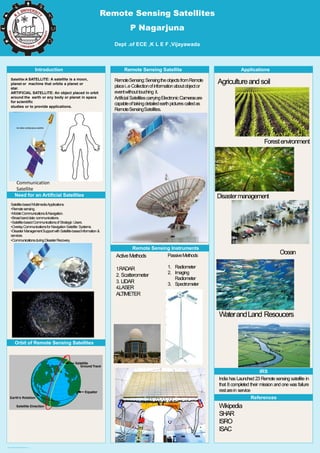
  • 1. Poster template by ResearchPosters.co.za Remote Sensing Satellites P Nagarjuna Dept .of ECE ,K L E F ,Vijayawada Introduction Satellite:A SATELLITE: A satellite is a moon, planet or machine that orbits a planet or star. ARTIFICIAL SATELLITE: An object placed in orbit around the earth or any body or planet in space for scientific studies or to provide applications. Need for an Artificial Satellites A B Orbit of Remote Sensing Satellites Remote Sensing Satellite RemoteSensing:SensingtheobjectsfromRemote placei..eCollectionofinformationaboutobjector eventwithouttouching it. Artificial SatellitescarryingElectronicCamerasare capableoftakingdetailedearthpicturescalledas RemoteSensingSatellites. Remote Sensing Instruments Applications Agricultureandsoil Satellite-basedMultimediaApplications. •Remotesensing. •MobileCommunications&Navigation. •Broadbanddata communications. •Satellite-basedCommunicationsofStrategic Users. •OverlayCommunicationsforNavigationSatellite Systems. •DisasterManagementSupportwithSatellite-basedinformation & services. •CommunicationsduringDisasterRecovery. Figure6 Figure7 ActiveMethods 1.RADAR 2. Scatterometer 3. LIDAR 4.LASER ALTIMETER PassiveMethods 1. Radiometer 2. Imaging Radiometer 3. Spectrometer Forestenvironment Disastermanagement Ocean WaterandLand Resoucers IRS India has Launched 23 Remote sensing satellite in that 8 completed their mission and one was failure restarein service References Wikipedia SHAR ISRO ISAC Communication Satellite