Managing Transboundary Risks in the Iullemeden Aquifer System (Dodo)

The document discusses the transboundary Iullemeden Aquifer System (IAS) shared by Mali, Niger, and Nigeria. It notes key issues facing sustainable management of the system's groundwater resources, including increasing water demand, climate change, land degradation, and lack of cooperation between countries. The project aims to establish capacity for identifying, reducing, and mitigating transboundary risks. It has made progress in developing shared maps and databases, modeling groundwater flow and interactions, and creating consultative mechanisms. Key ongoing challenges include further quantifying and analyzing transboundary risks, addressing lack of data through capacity building, rational joint management of surface and groundwater, and implementing cooperative management frameworks.

Recommended
Recommended
More Related Content
What's hot
What's hot (20)
Viewers also liked
Viewers also liked (19)
Similar to Managing Transboundary Risks in the Iullemeden Aquifer System (Dodo)
Similar to Managing Transboundary Risks in the Iullemeden Aquifer System (Dodo) (20)
More from Iwl Pcu
More from Iwl Pcu (20)
Managing Transboundary Risks in the Iullemeden Aquifer System (Dodo)
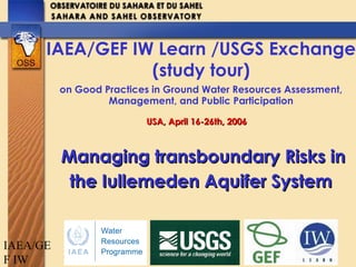
- 1. IAEA/GE F IW Managing transboundary Risks inManaging transboundary Risks in the Iullemeden Aquifer Systemthe Iullemeden Aquifer System IAEA/GEF IW Learn /USGS Exchange (study tour) on Good Practices in Ground Water Resources Assessment, Management, and Public Participation USA, April 16-26th, 2006USA, April 16-26th, 2006
- 3. IAEA/GE F IW •Countries : Mali, Niger, Nigeria Aquifers : • Cretaceous Intercalary Continental • Tertiary Terminal Continental • > 2000 billion m3 Niger river : • 30 billion m3 per year Area : 525 000 km² •Mali : 31000 km² (6%) •Niger : 434000 km² (83%) •Nigeria : 60000 km² (11%). Population : • 15 million (2000) • 28 million (2025) IAS OVERVIEW
- 4. IAEA/GE F IW NATURAL RESOURCES Non renewable Groundwater > 2000 billion m3 Surface water (Niger river) : 30 billion m3 /y « W » National parc (Niger Republic) 160 billion m3 /y to Atlantic ocean Fisheries > 200 species Livestock > 4 million cattle Irrigation land > 300 000 ha Renewable Groundwater > 2 billion m3
- 5. IAEA/GE F IW SHARED IAS ISSUES •Increased water demand because of growing population : 15 millions in 2000, double in 2025 •Climate Change/Variability Droughts, Floods •Decreased groundwater recharge rate •Land degradation 100 000 ha/year •Silting : river, lake, pools flood •Deforestation > 1 million ton firewood
- 6. IAEA/GE F IW SHARED IAS ISSUES • Lack of exchange information between countries sharing and exploiting the same resource • Lack of cooperation on aquifers although existing basins Authorities in the region : NBA, LGA, etc… • Aquifers only studied in the limits of the national borders
- 7. IAEA/GE F IW Within the goal of sustainable : •environmental protection and sub- regional and national development •cooperative framework for joint management of risk and uncertainty GENERAL OBJECTIVE To establish the capacity, to identify, reduce and mitigate transboundary risks from changing land and water use and from climate change in the shared Iullemeden Aquifer System
- 8. IAEA/GE F IW PROJECT OUTCOMES •Joint mechanisms for identification of transboundary risk issues in the IAS; •A joint development and conservation strategy for the IAS; •A joint tripartite legal and institutional cooperative framework for the IAS; •Joint programmes for awareness, participation and inter-governmental communication.
- 9. IAEA/GE F IW IAS PROJECT COMPONENTS •Transboundary Diagnostic Analysis ; •Strengthening the State of knowledge of IAS; •Awareness, Participation, Capacity Building; •Consultative Mechanism;
- 10. IAEA/GE F IW STEERING COMMITTEE (Periodic control and Evaluation) Countries : Partners : DNH - Mali - UNEP/GEF DRE/MHE/LCD - Niger - IAEA - ESA - IRD DHH/FWRM - Nigeria - FAO - IGRAC - GTZ STEERING COMMITTEE (Periodic control and Evaluation) Countries : Partners : DNH - Mali - UNEP/GEF DRE/MHE/LCD - Niger - IAEA - ESA - IRD DHH/FWRM - Nigeria - FAO - IGRAC - GTZ IAS Project - OSS : Implementing Agency - UNESCO : Scientific supervision IAS Project - OSS : Implementing Agency - UNESCO : Scientific supervision National Teams National Coordinator National Focal Point National Coordination Committee National Teams National Coordinator National Focal Point National Coordination Committee Scientific Audit Scientific Evaluation Validation of final reports Scientific Audit Scientific Evaluation Validation of final reports Experts Transboundary Diagnostic Analysis Consultative Mechanism Recharge Modelling Remote Sensing Experts Transboundary Diagnostic Analysis Consultative Mechanism Recharge Modelling Remote Sensing PROJECT STRUCTURE
- 11. IAEA/GE F IW •TDA (Mali, Niger and Nigeria) 3 major transboundary risks : ACHIEVEMENTS SO FAR : • Common digitalized maps (Topography & Geology) for a further risks analysis; • Land cover maps, DEM, Water balance; • Database (>17000 boreholes), GIS, Model; • Legal and consultative mechanism; 1. Modification of Water availability 2. Degradation of Water Quality, 3. Climate Change/Variability (impacts);
- 12. IAEA/GE F IW PARTIAL CAUSAL CHAIN ANALYSIS IMMEDIATE CAUSES TRANSBOUNDARY ISSUES UNDERLYING CAUSES IMPACTS ROOT CAUSES •Climatic changes, (reduced rainfall and runoff) •Recurrent droughts •Reduced connexion between surface water and groundwater because of silting, sand dunes established Groundwater resources scarcity •Increase in water demand (growth population, mining and agricultural activities) •Inadequate water infrastructure •Reduced groundwater recharge •Decline of artesian water pressure •Reduced renewable groundwater resource •Alternative water resources •Increasing population •Deficient political and legal practical framework •Inadequate basin awareness •Insufficient knowledge and participation in sustainable water resource management •Lack of consultative mechanism in groundwater resources management although several Basin Authorities •Deficiency in application of law •Lack of exchange of information High concentration of fluoride, nitrates Groundwater quality degradation •Pollution by urban, industrial and mining activities •Agricultural activities (pesticides, manures) •Land use and inadequate change in land use •Soil Salinisation •Less production in agriculture •Diseases •Alternative water resources
- 13. IAEA/GE F IW TRANSBOUNDARY ISSUES & MANIFESTATIONS ENVIRONMENTAL ISSUES EFFECTS & SYMPTOMS TRANSBOUNDARY MANIFESTATIONS STRATEGIC ACTIONS Groundwater resources scarcity •Increase of percentage of population without access of drinking water •Less agriculture (reduced area under irrigation) •Transfer water (big towns, mining areas) •Transboundary migration of the population increasing water demand in the new habitat •Increase potential conflicts between farmers and pastoralists using the same water point (well, dug well, boreholes) •Sustainable and jointly development of water resources •Operational consultative mechanism of water resource management (exchange data, groundwater exploitation modelling, ) to alert water scarcity Groundwater quality degradation •Change option in water demand (fluoride) •Less production of agriculture •Sanitation issues (diseases) •More importation of food •Change option of water use •Transport pollutions with effects on human population, ecosystem. •Transport of diseases •Prevention and control of risk pollution •“Pollutant-Payer”, taxes •Operational legal framework
- 14. IAEA/GE F IW Impacts of variability & climate change Variation pluviométrique de la Guinée (1931-2000) -1,5 -1 -0,5 0 0,5 1 1,5 1931 1938 1945 1952 1959 1966 1973 1980 1987 1994 années stDev Série1 Moy. mobile sur 5 pér. (Série1) ATTENTION ! La pluviométrie baisse Index de pluie annuelle à Bamako -2,5 -2 -1,5 -1 -0,5 0 0,5 1 1,5 2 2,5 1950 1960 1970 1980 1990 Cumulstandardisé Variabilité de la Pluviométrie Annuelle à Niamey : Ecart à la Moyenne (mm) -400 -300 -200 -100 0 100 200 300 400 500 1950 1954 1958 1962 1966 1970 1974 1978 1982 1986 1990 1994 1998 2002 Ecart(mm) Ecart / Moyenne (563 mm) Evolution des Débits annuels : Ecart à la Moyenne -500 -400 -300 -200 -100 0 100 200 300 400 500 600 1950 1954 1958 1962 1966 1970 1974 1978 1982 1986 1990 1994 1998 2002 Ecart(m3/s) Ecart / Moyenne (864 m3/s) -4,00 -3,00 -2,00 -1,00 0,00 1,00 2,00 3,00 4,00 1981 1982 1983 1984 1985 1986 1987 1988 1989 1990 1991 1992 1993 1994 1995 -4 -3 -2 -1 0 1 2 3 Ecr (Pluie) Ecr (Débit) CumulEcr.-Piézo. 2 5 8 11 14 17 20 23 13/07/1990 13/10/1990 13/01/1991 13/04/1991 13/07/1991 13/10/1991 13/01/1992 13/04/1992 13/07/1992 13/10/1992 13/01/1993 13/04/1993 13/07/1993 13/10/1993 13/01/1994 13/04/1994 13/07/1994 13/10/1994 13/01/1995 13/04/1995 13/07/1995 13/10/1995 13/01/1996 13/04/1996 13/07/1996 13/10/1996 13/01/1997 13/04/1997 13/07/1997 13/10/1997 13/01/1998 13/04/1998 13/07/1998 13/10/1998 13/01/1999 13/04/1999 13/07/1999 13/10/1999 13/01/2000 13/04/2000 13/07/2000 NigerMaliGuinée
- 15. IAEA/GE F IW Erosion and silting in Niger river Development of sand dunes IMMEDIATE CAUSE : CLIMATIC CHANGE
- 16. IAEA/GE F IW UNDERLYING CAUSE : Water pollution
- 17. IAEA/GE F IW IMMEDIATE CAUSE : FLUORIDE (>6mg/l) Bony Fluorosis Apatite in Intercalary Continental aquifer: Ca5 (PO4 )3 (OH, F, Cl) More than 300 victims mainly children incurably deformed
- 18. IAEA/GE F IW COMMON DIGITALIZED GEOLOGICAL MAP
- 19. IAEA/GE F IW IAS DATABASEIAS DATABASE 17000 points d’eau inventoriés
- 20. IAEA/GE F IW 1940-19501940-1950 1950-19601950-1960 1960-19701960-1970 1970-19801970-1980 1980-19901980-1990 1990-20001990-2000 2000-20072000-2007 EVOLUTION OF WATER POINTS 1940 2007 > 17000 water points
- 21. IAEA/GE F IW IAS GEOMETRYIAS GEOMETRY
- 22. IAEA/GE F IW Dynamic linkage between Database, GIS and Model (PM5) to facilitate data transfer INTERFACE DA-GIS-MODELINTERFACE DA-GIS-MODEL
- 23. IAEA/GE F IW CI & CT MODELING: Boundary limits Continental intercalaire Continental Terminal 1. Groundwater assessment 2. Groundwater-Surface water interactions 3. Assessment of the impact of climate variability
- 24. IAEA/GE F IW Continental intercalaire Continental Terminal 1. Groundwater flow: NIGER & MALI NIGERIA 2. Groundwater-Surface water interactions PIEZOMETRY of Ci & CTPIEZOMETRY of Ci & CT
- 25. IAEA/GE F IW IAS MODEL : Water Balance CONTINENTAL TERMINAL INPUT (m3/s) OUTPUT (m3/s) Recharge 3,294 Niger River 2,509 Leakance from Ci 0,016 Dallols 0,423 Goulbi Rima River 0,378 Total Input (CT) 3,31 Total Output (CT) 3,31 CONTINENTAL INTERCALAIRE INPUT (m3/s) OUTPUT (m3/s) Recharge 0,548 Niger River 1,468 North part supply 0,288 Leakance to CT 0,016 Goulbi Rima River 0,648 Total Input (Ci) 1,484 Total Output (CT) 1,484
- 26. IAEA/GE F IW IAS MODEL : System flow Ci CT N iger Rima Ci CT Recharge Niger
- 27. IAEA/GE F IW Evolution of water abstraction IAS Since 1995, Abstractions exceed Recharge (red line)
- 28. IAEA/GE F IW Applied Isotopes Techniques
- 29. IAEA/GE F IW REMOTE SENSING : PILOT SITES
- 30. IAEA/GE F IW ESA Tiger Initiative (NWSAS & IAS) Elaboration of land cover maps and Digital Elevation Models (DEM) Estimation of water abstraction for irrigation Estimation of water requirements for crops Water Balance Capacity building : national workshops in NWSAS & IAS AQUIFER Project
- 32. IAEA/GE F IW COMITE DE PILOTAGE (Niveau Politique) SECRETAIRE Facilitateur) MALI Comité Technique NIGER Comité Technique NIGERIA Comté Technique STEERING COMMITTE (Political level) SECRETARY Facilitator) MALI Technical Committee NIGER Technical Committee NIGERIA Technical Committee TEMPORAL CONSULTATIVE MECHANISM
- 33. IAEA/GE F IW EXECUTIVE SECRETARY Maintenance of Database; coordination national committee activities ; preparation of decisions to the Steering committee MALI Technical Committee NIGER Technical Committee NIGERIA Technical Committee STEERING COMMITTEE (Political Level) PERMANENT CONSULTATIVE MECHANISM
- 34. IAEA/GE F IW •Quantification and Analysis of Transboundary risks in IAS (TDA SAP ; Modeling) •Addressing lack of data/information : A need for country capacity building •Rational management of surface water and groundwater ; and •Implementing consultative mechanism for cooperation and coordination. CHALLENGES