Ch 5 b remote sensing
•
0 likes•106 views

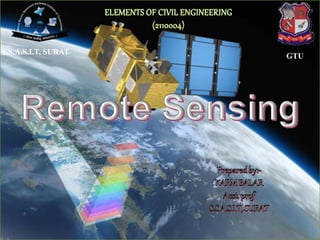
REMOTE SENSING FOR THE SUBJECT OF DM. BCE, BCT AS PER THE GTU SYLLABUS

Recommended
More Related Content
What's hot
What's hot (20)
Similar to Ch 5 b remote sensing
Similar to Ch 5 b remote sensing (20)
More from Shree Swami atmanand saraswati inst. of technology, surat
More from Shree Swami atmanand saraswati inst. of technology, surat (20)
Recently uploaded
Recently uploaded (20)
Ch 5 b remote sensing
- 2. REMOTE SENSING • Remote sensing is defined as the technique of obtaining information about objects through the analysis of data collected by special instruments that are not in physical contact with the objects of investigation. • Collection of information about an object without coming into physical contact. • The information needs a physical carrier to travel from the objects/events to the sensors through an intervening medium. • The electromagnetic radiation is normally used as an information carrier in remote sensing. • The output of a remote sensing system is usually an image representing the scene being observed.
- 3. Remote Sensing Weather forecasting Google mapping
- 4. • The technology of modern remote sensing began with the invention of the camera more than 150 years ago. • The idea and practice of looking down at the Earth's surface emerged in the 1840s when pictures were taken from cameras secured to tethered balloons for purposes of topographic mapping. • Satellite remote sensing can be traced to the early days of the space age (both Russian and American programs) and actually began as a dual approach to imaging surfaces using several types of sensors from spacecraft. • The term "remote sensing," first used in the United States in the 1950s by Ms. Evelyn Pruitt of the U.S. HISTORY
- 5. ELEMENTS INVOLVED IN REMOTE SENSING 1. Energy Source or Illumination (A) 2. Radiation and the Atmosphere (B) 3. Interaction with the Object (C) 4. Recording of Energy by the Sensor (D) 5. Transmission, Reception and Processing (E) 6. Interpretation and Analysis (F) 7. Application (G)
- 6. Energy Source or Illumination The first requirement for remote sensing is to have a energy source, which illuminates or provides electromagnetic energy to the target of interest. Sensors can be classified as passive or active, based on the source of energy they are using. Sensors, which sense natural radiations, either emitted or reflected from the Earth, are called Passive Sensors. Most of the remote sensing sensors are passive in nature, which measure the solar radiation reflected from the target. On the other hand, the sensors which produce their own electromagnetic radiation are called Active Sensors.
- 7. Interaction with the Target As energy travels from its source to the target, it will come in contact with & interact with the atmosphere it passes through. This interaction may take place a second time as the energy travels from the target to the sensor. Once the energy makes its way to the target through the atmosphere, it interacts with the target depending on the properties of both the target & the radiation. A number of interactions are possible when electromagnetic energy encounters matter, whether solid, liquid or gas.
- 8. Recording of Energy by the sensors After the energy has been scattered by or emitted from the target, we require a sensor to collect and record the electromagnetic radiation. The sensors are popularly known by the EMR region they sense. Remote sensing can be broadly classified as Optical and Microwave. In Optical Remote Sensing, sensors detect solar radiation in the visible, near, middle & thermal infrared wavelength regions, reflected/scattered or emitted from the Earth. When Sensors work in the region of electromagnetic waves with frequencies between 10⁹ and 10¹² Hz is called Microwave Remote Sensing.
- 9. Transmission, Reception and processing The energy recorded by the sensor has to be transmitted, often in electronic form, to a receiving and processing station at earth where the data are processed and stored in digital form.
- 10. Interpretation and Analysis The processed data is interpreted, visually and/or digitally to extract information about the target which was illuminated. Specialized instruments/hardware and software are used for this purpose that are commonly known as Image Processing Tools. The final element of the remote sensing process is achieved when we apply the extracted information in solving a particular problem. Specialists working in each application field/theme generally are able to carry out this task.
- 11. REMOTE SENSING SENSORS • Active Remote Sensors :- Active remote sensing uses an artificial source for energy. For example the satellite itself can send a pulse of energy which can interact with the target. In active remote sensing, humans can control the nature (wavelength, power, duration) of the source energy. Active remote sensing can be carried out during day and night and in all weather conditions.
- 12. Passive remote sensing:- Passive remote sensing depends on a natural source to provide energy. For example sun is the most powerful and commonly used source of energy for passive remote sensing. The satellite sensor in this case records primarily the radiation that is reflected from the target.
- 13. ACTIVE & PASSIVE REMOTE SENSING
- 14. ADVANTAGES OF REMOTE SENSING:- • Provides a regional view (large areas). • Provides repetitive looks at the same area. • Remote sensors "see" over a broader. portion of the spectrum than the human eye. • Provides geo-referenced, digital, data. • Some remote sensors operate in all seasons, at night, and in bad weather.
- 15. DISADVANTAGE OF REMOTE SENSING:- • Expensive to build and operate • Needs ground verification • Not the best tool for small areas • Needs expert system to extract data
- 16. APPLICATIONS OF REMOTE SENSING • Meteorology Profiling of atmospheric temp. and water vapor Measuring wind velocity • Oceanography Measurements of sea surface temperature Mapping ocean currents • Glaciology Mapping motion of sea ice and ice sheets Determining the navigability of the sea • Geology Identification of rock types Location of geological faults and anomalies
- 17. APPLICATIONS OF REMOTE SENSING • Agriculture Monitoring the extend and type of vegetation Mapping soil types • Hydrology Assessing water resources Forecasting melt water run-off from snow • Disaster control Warning of sand and dust storms, flooding Monitoring of pollution
Editor's Notes
- Google mapping