SlideShare a Scribd company logo
1 of 2
Download to read offline
How to get started working with Heightmaps.
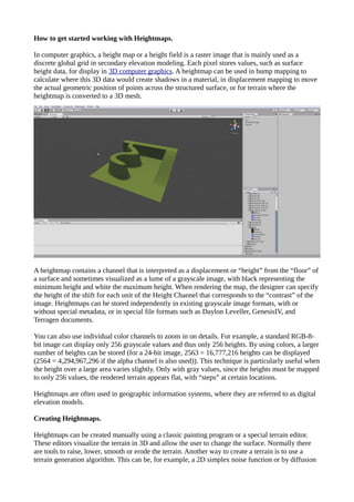
In computer graphics, a height map or a height field is a raster image that is mainly used as a
discrete global grid in secondary elevation modeling. Each pixel stores values, such as surface
height data, for display in 3D computer graphics. A heightmap can be used in bump mapping to
calculate where this 3D data would create shadows in a material, in displacement mapping to move
the actual geometric position of points across the structured surface, or for terrain where the
heightmap is converted to a 3D mesh.
A heightmap contains a channel that is interpreted as a displacement or “height” from the “floor” of
a surface and sometimes visualized as a lume of a grayscale image, with black representing the
minimum height and white the maximum height. When rendering the map, the designer can specify
the height of the shift for each unit of the Height Channel that corresponds to the “contrast” of the
image. Heightmaps can be stored independently in existing grayscale image formats, with or
without special metadata, or in special file formats such as Daylon Leveller, GenesisIV, and
Terragen documents.
You can also use individual color channels to zoom in on details. For example, a standard RGB-8-
bit image can display only 256 grayscale values and thus only 256 heights. By using colors, a larger
number of heights can be stored (for a 24-bit image, 2563 = 16,777,216 heights can be displayed
(2564 = 4,294,967,296 if the alpha channel is also used)). This technique is particularly useful when
the height over a large area varies slightly. Only with gray values, since the heights must be mapped
to only 256 values, the rendered terrain appears flat, with “steps” at certain locations.
Heightmaps are often used in geographic information systems, where they are referred to as digital
elevation models.
Creating Heightmaps.
Heightmaps can be created manually using a classic painting program or a special terrain editor.
These editors visualize the terrain in 3D and allow the user to change the surface. Normally there
are tools to raise, lower, smooth or erode the terrain. Another way to create a terrain is to use a
terrain generation algorithm. This can be, for example, a 2D simplex noise function or by diffusion
limited aggregation. Another method is the reconstruction of heightmaps from real data, e.g. with a
synthetic aperture radar.
Programs that use Heightmaps.
Heightmaps are often used in terrain playback software and modern video games. Heightmaps are
an ideal way to store digital terrain heights. Compared to a normal polygonal mesh, they require
much less storage space at a certain level of detail. Most modern 3D computer modeling programs
can use data from heightmaps in the form of bump, normal, or displacement maps to quickly and
accurately create complex terrain and other surfaces.
In the first games with software rendering, the elements often represented the heights of columns of
voxels rendered with ray casting. In most recent games, the elements represent the height coordinate
of polygons in a mesh.
Thank you for visiting.

More Related Content

What's hot

image processing project course ludhiana
image processing project course ludhianaimage processing project course ludhiana
image processing project course ludhianadeepikakaler1
 
Necto 16 training 7 geo-analytics
Necto 16 training 7   geo-analyticsNecto 16 training 7   geo-analytics
Necto 16 training 7 geo-analyticsPanorama Software
 
Dynamic Mapping of Raster Data (IV 2009)
Dynamic Mapping of Raster Data (IV 2009)Dynamic Mapping of Raster Data (IV 2009)
Dynamic Mapping of Raster Data (IV 2009)Matthias Trapp
 
Assignment vector raster
Assignment vector rasterAssignment vector raster
Assignment vector rasterfredsk2006
 
Map Design and Symbology in GIS Environment
Map Design and Symbology in GIS EnvironmentMap Design and Symbology in GIS Environment
Map Design and Symbology in GIS EnvironmentKaium Chowdhury
 
Where2.0Now - Finding the heat in Thematic Maps
Where2.0Now - Finding the heat in Thematic MapsWhere2.0Now - Finding the heat in Thematic Maps
Where2.0Now - Finding the heat in Thematic MapsJohn Fagan
 
5 spatial data editing
5 spatial data editing5 spatial data editing
5 spatial data editinganita bodke
 
Introduction to gis
Introduction to gisIntroduction to gis
Introduction to gisJay_mittal
 
Digitization arc gis
Digitization arc gisDigitization arc gis
Digitization arc gisAshok Peddi
 
Introduction to Infographics Designing
Introduction to Infographics DesigningIntroduction to Infographics Designing
Introduction to Infographics DesigningJin Castor
 
Web design: print to web
Web design: print to webWeb design: print to web
Web design: print to webKenneth Field
 
GIS in Geography
GIS in GeographyGIS in Geography
GIS in Geographyaatkinson7
 
Australia's Environment Explorer: Quick Tour
Australia's Environment Explorer: Quick TourAustralia's Environment Explorer: Quick Tour
Australia's Environment Explorer: Quick Touraijmvandijk
 
Terminology and Basic Questions About GIS
Terminology and Basic Questions About GISTerminology and Basic Questions About GIS
Terminology and Basic Questions About GISMrinmoy Majumder
 

What's hot (20)

image processing project course ludhiana
image processing project course ludhianaimage processing project course ludhiana
image processing project course ludhiana
 
Necto 16 training 7 geo-analytics
Necto 16 training 7   geo-analyticsNecto 16 training 7   geo-analytics
Necto 16 training 7 geo-analytics
 
What is gis
What is gisWhat is gis
What is gis
 
Dynamic Mapping of Raster Data (IV 2009)
Dynamic Mapping of Raster Data (IV 2009)Dynamic Mapping of Raster Data (IV 2009)
Dynamic Mapping of Raster Data (IV 2009)
 
DTM DEM Generation
DTM DEM GenerationDTM DEM Generation
DTM DEM Generation
 
Georeferencing
GeoreferencingGeoreferencing
Georeferencing
 
Cartographic map design
Cartographic map designCartographic map design
Cartographic map design
 
Assignment vector raster
Assignment vector rasterAssignment vector raster
Assignment vector raster
 
Map Design and Symbology in GIS Environment
Map Design and Symbology in GIS EnvironmentMap Design and Symbology in GIS Environment
Map Design and Symbology in GIS Environment
 
Where2.0Now - Finding the heat in Thematic Maps
Where2.0Now - Finding the heat in Thematic MapsWhere2.0Now - Finding the heat in Thematic Maps
Where2.0Now - Finding the heat in Thematic Maps
 
5 spatial data editing
5 spatial data editing5 spatial data editing
5 spatial data editing
 
Introduction to gis
Introduction to gisIntroduction to gis
Introduction to gis
 
Digitization arc gis
Digitization arc gisDigitization arc gis
Digitization arc gis
 
Introduction to Infographics Designing
Introduction to Infographics DesigningIntroduction to Infographics Designing
Introduction to Infographics Designing
 
Three dimensional (3D) GIS
Three dimensional (3D) GISThree dimensional (3D) GIS
Three dimensional (3D) GIS
 
Surfer
SurferSurfer
Surfer
 
Web design: print to web
Web design: print to webWeb design: print to web
Web design: print to web
 
GIS in Geography
GIS in GeographyGIS in Geography
GIS in Geography
 
Australia's Environment Explorer: Quick Tour
Australia's Environment Explorer: Quick TourAustralia's Environment Explorer: Quick Tour
Australia's Environment Explorer: Quick Tour
 
Terminology and Basic Questions About GIS
Terminology and Basic Questions About GISTerminology and Basic Questions About GIS
Terminology and Basic Questions About GIS
 

Similar to Heightmaps intro

Fly thru
Fly thruFly thru
Fly thruAli Sam
 
Creating Slope-Enhanced Shaded Relief Using Global Mapper
Creating Slope-Enhanced Shaded Relief Using Global MapperCreating Slope-Enhanced Shaded Relief Using Global Mapper
Creating Slope-Enhanced Shaded Relief Using Global MapperKent D. Brown
 
QGIS Training.pptx
QGIS Training.pptxQGIS Training.pptx
QGIS Training.pptxSeemaAjay7
 
Powerpoint
PowerpointPowerpoint
Powerpointdcmatic
 
Terra formation control or how to move mountains
Terra formation control or how to move mountainsTerra formation control or how to move mountains
Terra formation control or how to move mountainsijcga
 
Introduction to Computer graphics
Introduction to Computer graphicsIntroduction to Computer graphics
Introduction to Computer graphicsLOKESH KUMAR
 
Prayas session cgi & cga by – soumalya nandy
Prayas session cgi & cga by – soumalya nandyPrayas session cgi & cga by – soumalya nandy
Prayas session cgi & cga by – soumalya nandyTenet Systems Pvt Ltd
 
Graphics pipelining
Graphics pipeliningGraphics pipelining
Graphics pipeliningAreena Javed
 
Designing Great Web Maps
Designing Great Web MapsDesigning Great Web Maps
Designing Great Web MapsEsri
 
Introduction to gis and arc gis
Introduction to gis and arc gis Introduction to gis and arc gis
Introduction to gis and arc gis Saad Raja
 
GIS - Unit 3-1.pptx for geographical information systems
GIS - Unit 3-1.pptx for geographical information systemsGIS - Unit 3-1.pptx for geographical information systems
GIS - Unit 3-1.pptx for geographical information systemsHarshavarthan24
 
Desktop Softwares for Unmanned Aerial Systems(UAS))
Desktop Softwares for Unmanned Aerial Systems(UAS))Desktop Softwares for Unmanned Aerial Systems(UAS))
Desktop Softwares for Unmanned Aerial Systems(UAS))Kamal Shahi
 
Chapter 1 fundamentals of digital imaging
Chapter 1  fundamentals of digital imagingChapter 1  fundamentals of digital imaging
Chapter 1 fundamentals of digital imagingZCELPROPS
 

Similar to Heightmaps intro (20)

Fly thru
Fly thruFly thru
Fly thru
 
Creating Slope-Enhanced Shaded Relief Using Global Mapper
Creating Slope-Enhanced Shaded Relief Using Global MapperCreating Slope-Enhanced Shaded Relief Using Global Mapper
Creating Slope-Enhanced Shaded Relief Using Global Mapper
 
QGIS Training.pptx
QGIS Training.pptxQGIS Training.pptx
QGIS Training.pptx
 
Powerpoint
PowerpointPowerpoint
Powerpoint
 
Terra formation control or how to move mountains
Terra formation control or how to move mountainsTerra formation control or how to move mountains
Terra formation control or how to move mountains
 
Introduction to Computer graphics
Introduction to Computer graphicsIntroduction to Computer graphics
Introduction to Computer graphics
 
Prayas session cgi & cga by – soumalya nandy
Prayas session cgi & cga by – soumalya nandyPrayas session cgi & cga by – soumalya nandy
Prayas session cgi & cga by – soumalya nandy
 
Graphics pipelining
Graphics pipeliningGraphics pipelining
Graphics pipelining
 
Mpwhelp Eng[1]
Mpwhelp Eng[1]Mpwhelp Eng[1]
Mpwhelp Eng[1]
 
Designing Great Web Maps
Designing Great Web MapsDesigning Great Web Maps
Designing Great Web Maps
 
L3 cmp technicalfile_180911
L3 cmp technicalfile_180911L3 cmp technicalfile_180911
L3 cmp technicalfile_180911
 
Normal Mapping / Computer Graphics - IK
Normal Mapping / Computer Graphics - IKNormal Mapping / Computer Graphics - IK
Normal Mapping / Computer Graphics - IK
 
Building story maps
Building story mapsBuilding story maps
Building story maps
 
Introduction to gis and arc gis
Introduction to gis and arc gis Introduction to gis and arc gis
Introduction to gis and arc gis
 
Data sources and input in GIS
Data  sources and input in GISData  sources and input in GIS
Data sources and input in GIS
 
GIS - Unit 3-1.pptx for geographical information systems
GIS - Unit 3-1.pptx for geographical information systemsGIS - Unit 3-1.pptx for geographical information systems
GIS - Unit 3-1.pptx for geographical information systems
 
Desktop Softwares for Unmanned Aerial Systems(UAS))
Desktop Softwares for Unmanned Aerial Systems(UAS))Desktop Softwares for Unmanned Aerial Systems(UAS))
Desktop Softwares for Unmanned Aerial Systems(UAS))
 
Geographic information system
Geographic information systemGeographic information system
Geographic information system
 
Chapter 1 fundamentals of digital imaging
Chapter 1  fundamentals of digital imagingChapter 1  fundamentals of digital imaging
Chapter 1 fundamentals of digital imaging
 
GIS in Nutshell
GIS in NutshellGIS in Nutshell
GIS in Nutshell
 

More from VisCircle

My living-bloom
My living-bloomMy living-bloom
My living-bloomVisCircle
 
La botte-gardian
La botte-gardianLa botte-gardian
La botte-gardianVisCircle
 
Echtzeit 3d-ocean
Echtzeit 3d-oceanEchtzeit 3d-ocean
Echtzeit 3d-oceanVisCircle
 
Caib 3d-tischlerei-konfigurator
Caib 3d-tischlerei-konfiguratorCaib 3d-tischlerei-konfigurator
Caib 3d-tischlerei-konfiguratorVisCircle
 
Hyundai renderings
Hyundai renderingsHyundai renderings
Hyundai renderingsVisCircle
 
3d brille-skalpell
3d brille-skalpell3d brille-skalpell
3d brille-skalpellVisCircle
 
Schmuck konfigurator-3d
Schmuck konfigurator-3dSchmuck konfigurator-3d
Schmuck konfigurator-3dVisCircle
 
Hdst 3d-konfigurator
Hdst 3d-konfiguratorHdst 3d-konfigurator
Hdst 3d-konfiguratorVisCircle
 
Honda konfigurator-3dmodellierung
Honda konfigurator-3dmodellierungHonda konfigurator-3dmodellierung
Honda konfigurator-3dmodellierungVisCircle
 
3d virtueller-showroom
3d virtueller-showroom3d virtueller-showroom
3d virtueller-showroomVisCircle
 
Ar media-plugin
Ar media-pluginAr media-plugin
Ar media-pluginVisCircle
 
Oculus quest-app2
Oculus quest-app2Oculus quest-app2
Oculus quest-app2VisCircle
 
Google vr-creation-app
Google vr-creation-appGoogle vr-creation-app
Google vr-creation-appVisCircle
 
Varjo chroma-keying
Varjo chroma-keyingVarjo chroma-keying
Varjo chroma-keyingVisCircle
 
Virtual reality-architektur
Virtual reality-architekturVirtual reality-architektur
Virtual reality-architekturVisCircle
 
Kinemac 2-3d-animationen
Kinemac 2-3d-animationenKinemac 2-3d-animationen
Kinemac 2-3d-animationenVisCircle
 
Augmented reality-realistisch
Augmented reality-realistischAugmented reality-realistisch
Augmented reality-realistischVisCircle
 
Apple augmented-reality-brille
Apple augmented-reality-brilleApple augmented-reality-brille
Apple augmented-reality-brilleVisCircle
 
Herausforderungen produktkonfiguration
Herausforderungen produktkonfigurationHerausforderungen produktkonfiguration
Herausforderungen produktkonfigurationVisCircle
 

More from VisCircle (20)

My living-bloom
My living-bloomMy living-bloom
My living-bloom
 
Maruti omni
Maruti omniMaruti omni
Maruti omni
 
La botte-gardian
La botte-gardianLa botte-gardian
La botte-gardian
 
Echtzeit 3d-ocean
Echtzeit 3d-oceanEchtzeit 3d-ocean
Echtzeit 3d-ocean
 
Caib 3d-tischlerei-konfigurator
Caib 3d-tischlerei-konfiguratorCaib 3d-tischlerei-konfigurator
Caib 3d-tischlerei-konfigurator
 
Hyundai renderings
Hyundai renderingsHyundai renderings
Hyundai renderings
 
3d brille-skalpell
3d brille-skalpell3d brille-skalpell
3d brille-skalpell
 
Schmuck konfigurator-3d
Schmuck konfigurator-3dSchmuck konfigurator-3d
Schmuck konfigurator-3d
 
Hdst 3d-konfigurator
Hdst 3d-konfiguratorHdst 3d-konfigurator
Hdst 3d-konfigurator
 
Honda konfigurator-3dmodellierung
Honda konfigurator-3dmodellierungHonda konfigurator-3dmodellierung
Honda konfigurator-3dmodellierung
 
3d virtueller-showroom
3d virtueller-showroom3d virtueller-showroom
3d virtueller-showroom
 
Ar media-plugin
Ar media-pluginAr media-plugin
Ar media-plugin
 
Oculus quest-app2
Oculus quest-app2Oculus quest-app2
Oculus quest-app2
 
Google vr-creation-app
Google vr-creation-appGoogle vr-creation-app
Google vr-creation-app
 
Varjo chroma-keying
Varjo chroma-keyingVarjo chroma-keying
Varjo chroma-keying
 
Virtual reality-architektur
Virtual reality-architekturVirtual reality-architektur
Virtual reality-architektur
 
Kinemac 2-3d-animationen
Kinemac 2-3d-animationenKinemac 2-3d-animationen
Kinemac 2-3d-animationen
 
Augmented reality-realistisch
Augmented reality-realistischAugmented reality-realistisch
Augmented reality-realistisch
 
Apple augmented-reality-brille
Apple augmented-reality-brilleApple augmented-reality-brille
Apple augmented-reality-brille
 
Herausforderungen produktkonfiguration
Herausforderungen produktkonfigurationHerausforderungen produktkonfiguration
Herausforderungen produktkonfiguration
 

Recently uploaded

SORA AI: Will It Be the Future of Video Creation?
SORA AI: Will It Be the Future of Video Creation?SORA AI: Will It Be the Future of Video Creation?
SORA AI: Will It Be the Future of Video Creation?Searchable Design
 
Mastering SEO in the Evolving AI-driven World
Mastering SEO in the Evolving AI-driven WorldMastering SEO in the Evolving AI-driven World
Mastering SEO in the Evolving AI-driven WorldScalenut
 
marketing strategy of tanishq word PPROJECT.pdf
marketing strategy of tanishq word PPROJECT.pdfmarketing strategy of tanishq word PPROJECT.pdf
marketing strategy of tanishq word PPROJECT.pdfarsathsahil
 
CALL ON ➥8923113531 🔝Call Girls Hazratganj Lucknow best sexual service Online
CALL ON ➥8923113531 🔝Call Girls Hazratganj Lucknow best sexual service OnlineCALL ON ➥8923113531 🔝Call Girls Hazratganj Lucknow best sexual service Online
CALL ON ➥8923113531 🔝Call Girls Hazratganj Lucknow best sexual service Onlineanilsa9823
 
GreenSEO April 2024: Join the Green Web Revolution
GreenSEO April 2024: Join the Green Web RevolutionGreenSEO April 2024: Join the Green Web Revolution
GreenSEO April 2024: Join the Green Web RevolutionWilliam Barnes
 
Unraveling the Mystery of Roanoke Colony: What Really Happened?
Unraveling the Mystery of Roanoke Colony: What Really Happened?Unraveling the Mystery of Roanoke Colony: What Really Happened?
Unraveling the Mystery of Roanoke Colony: What Really Happened?elizabethella096
 
The Pitfalls of Keyword Stuffing in SEO Copywriting
The Pitfalls of Keyword Stuffing in SEO CopywritingThe Pitfalls of Keyword Stuffing in SEO Copywriting
The Pitfalls of Keyword Stuffing in SEO CopywritingJuan Pineda
 
Jai Institute for Parenting Program Guide
Jai Institute for Parenting Program GuideJai Institute for Parenting Program Guide
Jai Institute for Parenting Program Guidekiva6
 
VIP Call Girls In Green Park 9654467111 Escorts Service
VIP Call Girls In Green Park 9654467111 Escorts ServiceVIP Call Girls In Green Park 9654467111 Escorts Service
VIP Call Girls In Green Park 9654467111 Escorts ServiceSapana Sha
 
What are the 4 characteristics of CTAs that convert?
What are the 4 characteristics of CTAs that convert?What are the 4 characteristics of CTAs that convert?
What are the 4 characteristics of CTAs that convert?Juan Pineda
 
pptx.marketing strategy of tanishq. pptx
pptx.marketing strategy of tanishq. pptxpptx.marketing strategy of tanishq. pptx
pptx.marketing strategy of tanishq. pptxarsathsahil
 
How videos can elevate your Google rankings and improve your EEAT - Benjamin ...
How videos can elevate your Google rankings and improve your EEAT - Benjamin ...How videos can elevate your Google rankings and improve your EEAT - Benjamin ...
How videos can elevate your Google rankings and improve your EEAT - Benjamin ...Benjamin Szturmaj
 
April 2024 - VBOUT Partners Meeting Group
April 2024 - VBOUT Partners Meeting GroupApril 2024 - VBOUT Partners Meeting Group
April 2024 - VBOUT Partners Meeting GroupVbout.com
 
Do More with Less: Navigating Customer Acquisition Challenges for Today's Ent...
Do More with Less: Navigating Customer Acquisition Challenges for Today's Ent...Do More with Less: Navigating Customer Acquisition Challenges for Today's Ent...
Do More with Less: Navigating Customer Acquisition Challenges for Today's Ent...Search Engine Journal
 
How to Leverage Behavioral Science Insights for Direct Mail Success
How to Leverage Behavioral Science Insights for Direct Mail SuccessHow to Leverage Behavioral Science Insights for Direct Mail Success
How to Leverage Behavioral Science Insights for Direct Mail SuccessAggregage
 

Recently uploaded (20)

SORA AI: Will It Be the Future of Video Creation?
SORA AI: Will It Be the Future of Video Creation?SORA AI: Will It Be the Future of Video Creation?
SORA AI: Will It Be the Future of Video Creation?
 
Mastering SEO in the Evolving AI-driven World
Mastering SEO in the Evolving AI-driven WorldMastering SEO in the Evolving AI-driven World
Mastering SEO in the Evolving AI-driven World
 
marketing strategy of tanishq word PPROJECT.pdf
marketing strategy of tanishq word PPROJECT.pdfmarketing strategy of tanishq word PPROJECT.pdf
marketing strategy of tanishq word PPROJECT.pdf
 
CALL ON ➥8923113531 🔝Call Girls Hazratganj Lucknow best sexual service Online
CALL ON ➥8923113531 🔝Call Girls Hazratganj Lucknow best sexual service OnlineCALL ON ➥8923113531 🔝Call Girls Hazratganj Lucknow best sexual service Online
CALL ON ➥8923113531 🔝Call Girls Hazratganj Lucknow best sexual service Online
 
How to Create a Social Media Plan Like a Pro - Jordan Scheltgen
How to Create a Social Media Plan Like a Pro - Jordan ScheltgenHow to Create a Social Media Plan Like a Pro - Jordan Scheltgen
How to Create a Social Media Plan Like a Pro - Jordan Scheltgen
 
Top 5 Breakthrough AI Innovations Elevating Content Creation and Personalizat...
Top 5 Breakthrough AI Innovations Elevating Content Creation and Personalizat...Top 5 Breakthrough AI Innovations Elevating Content Creation and Personalizat...
Top 5 Breakthrough AI Innovations Elevating Content Creation and Personalizat...
 
GreenSEO April 2024: Join the Green Web Revolution
GreenSEO April 2024: Join the Green Web RevolutionGreenSEO April 2024: Join the Green Web Revolution
GreenSEO April 2024: Join the Green Web Revolution
 
Unraveling the Mystery of Roanoke Colony: What Really Happened?
Unraveling the Mystery of Roanoke Colony: What Really Happened?Unraveling the Mystery of Roanoke Colony: What Really Happened?
Unraveling the Mystery of Roanoke Colony: What Really Happened?
 
BUY GMAIL ACCOUNTS PVA USA IP INDIAN IP GMAIL
BUY GMAIL ACCOUNTS PVA USA IP INDIAN IP GMAILBUY GMAIL ACCOUNTS PVA USA IP INDIAN IP GMAIL
BUY GMAIL ACCOUNTS PVA USA IP INDIAN IP GMAIL
 
The Pitfalls of Keyword Stuffing in SEO Copywriting
The Pitfalls of Keyword Stuffing in SEO CopywritingThe Pitfalls of Keyword Stuffing in SEO Copywriting
The Pitfalls of Keyword Stuffing in SEO Copywriting
 
Jai Institute for Parenting Program Guide
Jai Institute for Parenting Program GuideJai Institute for Parenting Program Guide
Jai Institute for Parenting Program Guide
 
The Future of Brands on LinkedIn - Alison Kaltman
The Future of Brands on LinkedIn - Alison KaltmanThe Future of Brands on LinkedIn - Alison Kaltman
The Future of Brands on LinkedIn - Alison Kaltman
 
VIP Call Girls In Green Park 9654467111 Escorts Service
VIP Call Girls In Green Park 9654467111 Escorts ServiceVIP Call Girls In Green Park 9654467111 Escorts Service
VIP Call Girls In Green Park 9654467111 Escorts Service
 
What are the 4 characteristics of CTAs that convert?
What are the 4 characteristics of CTAs that convert?What are the 4 characteristics of CTAs that convert?
What are the 4 characteristics of CTAs that convert?
 
pptx.marketing strategy of tanishq. pptx
pptx.marketing strategy of tanishq. pptxpptx.marketing strategy of tanishq. pptx
pptx.marketing strategy of tanishq. pptx
 
How videos can elevate your Google rankings and improve your EEAT - Benjamin ...
How videos can elevate your Google rankings and improve your EEAT - Benjamin ...How videos can elevate your Google rankings and improve your EEAT - Benjamin ...
How videos can elevate your Google rankings and improve your EEAT - Benjamin ...
 
April 2024 - VBOUT Partners Meeting Group
April 2024 - VBOUT Partners Meeting GroupApril 2024 - VBOUT Partners Meeting Group
April 2024 - VBOUT Partners Meeting Group
 
Do More with Less: Navigating Customer Acquisition Challenges for Today's Ent...
Do More with Less: Navigating Customer Acquisition Challenges for Today's Ent...Do More with Less: Navigating Customer Acquisition Challenges for Today's Ent...
Do More with Less: Navigating Customer Acquisition Challenges for Today's Ent...
 
How to Leverage Behavioral Science Insights for Direct Mail Success
How to Leverage Behavioral Science Insights for Direct Mail SuccessHow to Leverage Behavioral Science Insights for Direct Mail Success
How to Leverage Behavioral Science Insights for Direct Mail Success
 
No Cookies No Problem - Steve Krull, Be Found Online
No Cookies No Problem - Steve Krull, Be Found OnlineNo Cookies No Problem - Steve Krull, Be Found Online
No Cookies No Problem - Steve Krull, Be Found Online
 

Heightmaps intro

  • 1. How to get started working with Heightmaps. In computer graphics, a height map or a height field is a raster image that is mainly used as a discrete global grid in secondary elevation modeling. Each pixel stores values, such as surface height data, for display in 3D computer graphics. A heightmap can be used in bump mapping to calculate where this 3D data would create shadows in a material, in displacement mapping to move the actual geometric position of points across the structured surface, or for terrain where the heightmap is converted to a 3D mesh. A heightmap contains a channel that is interpreted as a displacement or “height” from the “floor” of a surface and sometimes visualized as a lume of a grayscale image, with black representing the minimum height and white the maximum height. When rendering the map, the designer can specify the height of the shift for each unit of the Height Channel that corresponds to the “contrast” of the image. Heightmaps can be stored independently in existing grayscale image formats, with or without special metadata, or in special file formats such as Daylon Leveller, GenesisIV, and Terragen documents. You can also use individual color channels to zoom in on details. For example, a standard RGB-8- bit image can display only 256 grayscale values and thus only 256 heights. By using colors, a larger number of heights can be stored (for a 24-bit image, 2563 = 16,777,216 heights can be displayed (2564 = 4,294,967,296 if the alpha channel is also used)). This technique is particularly useful when the height over a large area varies slightly. Only with gray values, since the heights must be mapped to only 256 values, the rendered terrain appears flat, with “steps” at certain locations. Heightmaps are often used in geographic information systems, where they are referred to as digital elevation models. Creating Heightmaps. Heightmaps can be created manually using a classic painting program or a special terrain editor. These editors visualize the terrain in 3D and allow the user to change the surface. Normally there are tools to raise, lower, smooth or erode the terrain. Another way to create a terrain is to use a terrain generation algorithm. This can be, for example, a 2D simplex noise function or by diffusion
  • 2. limited aggregation. Another method is the reconstruction of heightmaps from real data, e.g. with a synthetic aperture radar. Programs that use Heightmaps. Heightmaps are often used in terrain playback software and modern video games. Heightmaps are an ideal way to store digital terrain heights. Compared to a normal polygonal mesh, they require much less storage space at a certain level of detail. Most modern 3D computer modeling programs can use data from heightmaps in the form of bump, normal, or displacement maps to quickly and accurately create complex terrain and other surfaces. In the first games with software rendering, the elements often represented the heights of columns of voxels rendered with ray casting. In most recent games, the elements represent the height coordinate of polygons in a mesh. Thank you for visiting.