3. Introduction
Theindian regional navigation satellite system or IRNSS
InApril 2016,with the last launch of constellation satellite ,
IRNSSwas renamed “NAVIC” by indian prime minister
‘Narendra modi’.
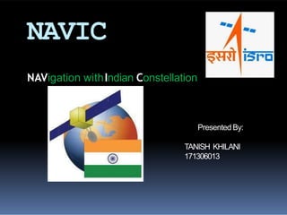
NAVIC–Navigation with IndianConstellation
NAVICmeans“sailor” or “navigator” in Sanskrit, Hindi and
many other indianlanguages.
An autonomous regional satellite navigation system.
provide accurate real –time positioning and timing services
over India and the region extending to 1500 km (930 miles )
around india.
4. Why l aunched?
Accessto foreign government controlled
‘Global Navigation Satellite Systems ‘ is not
guaranteed in hostilesituations
Ashappened to the Indian Military in 1999
when it wasdependent on theAmericanGPS
during the kargilwar.
5. Other Navigation satellite system
USA–Global
positioning system
(GPS)
RUSSIA–Glonass
EU-Gallileo
CHINA–Beiduo(BDS)
INDIA –NAVIC(IRNSS)
6. The Beginning
Approved by governmentof
india inMay 2006
Thetotal cost of the project is
expected to beRs1420crores
The fullsystem comprises 9
satellites
3satellites inGEOorbit
4 satellites inGSOorbit
2 on the ground asstand by
9. Space Segment
o Minimum number of
satellites required for
IRNSS constellation is
worked out to be 7 (3
geo and 4 gso ).
o The 3 geo will be located
at 32.5°, 83° and 131.5°
East. and
o the 4 gso have their
longitude crossings 55°
east and 111.75ºEast (two
in each plane).
10. NAVIC navigation signals
BAND SPS RS
L5 (1176.45MHz) BPSK BOC(5,2)
Sband(2492.028 MHz) BPSK BOC(5,2)
CDMARanging frequencies
up link : 6712.0MHz(BW 24 MHz)
Down link : 3412.0MHz(BW 24 MHz)
12. Satellites
IRNSS-1A:
Built at ISRO satellite centre , Bangalore .
It has a lift mass of 1380 kg and carries a navigation
pay load and c- band ranging transponder, which
operate in L5 band(1176.45 MHz)and s
band(2492.028)MHz .
IRNSS-1B:
It was placed in geo synchronous orbit on 4 april 2014
aboard the PSLV-C24 rocket from sathish dawan space
centre , sriharikota.
The IRNSS -1B satellites weighs 1,432 kg and has two
payloads : navigation payload and cdma ranging payload in
addition with a laser retro-reflector.
13. IRNSS-1C:
It was placed in GSO on 16 oct 2014 aboard PSLV-C26
from the sathish dawan space centre,sriharikota
IRNSS-1C satellite has two payloads :navigation payload
and cdma ranging payload
The navigation system so developed will be a regional one
targeted towards south asia .
The both 1B and 1C design of the payload
makes the IRNSS system inter-operable
and compatible with GPS and Galileo. . The
satellite will provide Navigation ,tracking and
mapping services
14. IRNSS 1-D:
It is fourth out of seven in the IRNSS satellite
system.
It was successfully launched using indian
PSLV –C27 on 28 march 2015.
IRNSS 1-E:
It is the fifth IRNSS satellite. it was launched
on 20 january 2016 using indian PSLV-C31.
A highly accurate Rubidium atomic clock is
part of the navigation payload of the satellite
It carries two types of payloads – navigation
and cdma ranging.
15. IRNSS-1F :
It is the sixth IRNSS satellite . It was launched on 10
march 2016 using indian PSLV-c32.
IRNSS-1G:
It is the seventh IRNSS satellite. It was launched
on 28 april 2016 using indian PSLV-C33,which
conclude the setting up of the IRNSS.
17. Clock failure
In 2017 it was announced that three rubidium atomic
clocks on board IRNSS -1A have all failed .
This rendors the satellite somewhat redundant
and requires replacement .
Although the satellite still performs other functions
,the data will be coarse ,and this cannot be used
for accurate measurement.
Isro plans to replace it with IRNSS-1H in the second
half of 2017.
18. GPS Vs NAVIC
• More accurate than theAmericanGPSsystem.
•UnlikeAmericanGPS,Isro is recommending asmall
additional hardware in handheld devices that can
receive S-Band signals from IRNSSsatellites and
inclusion of acode in the phone software to receive L-
Band signals.
•Both these L and S-band signals received are being
calculated by aspecial embedded software which
reducesthe errors causedby atmospheric disturbances
significantly. This, in turn, gives asuperior quality
location accuracythan theAmericanGPSsystem
21. Conclusion
NAVIC (Navigation with Indian Constellation) is an Operational
name of IRNSS.
Independent Indian Regional Navigation Satellite System
provide accurate position information service to users in India
as well as the region extending up to 1500 km from its
boundary.
In this Programme there are two levels of service/access to
data
1. Standard Positioning Service (SPS)
-which is provided to all the users
2. Restricted Service (RS)
- which is an encrypted service provided only to the authorised
users like Indian Security forces.
• NAVIChastotal of 7 satellites of which 3 are in GEO(GeoStationary)
orbit and 4 are in GSO (GeoSynchronous) orbit.