
Recommended
More Related Content
What's hot
What's hot (20)
Similar to Comparing GPS and India's NavIC Satellite Navigation Systems
Similar to Comparing GPS and India's NavIC Satellite Navigation Systems (20)
Recently uploaded
Recently uploaded (20)
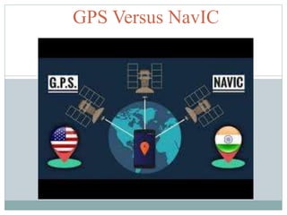
Comparing GPS and India's NavIC Satellite Navigation Systems
- 2. Global Positioning System GPS (Global Positioning System) tracks the entire globe and is maintained by the USA. GPS is a Space based Global navigation Satellite system that provides location and time information. Freely accessible by anyone with a GPS receiver. The GPS had a position accuracy of 5 meters. GPS is easy to navigate as it tracks and tells the direction, position ..etc to the User.
- 3. Navigation with Indian Constellation (NavIC ) Navic is the operational name of the Indian Regional Navigation Satellite System (IRNSS) developed by ISRO. There are currently Seven IRNSS satellites in geosynchronous and geostationary orbits. Navic has been designed to focus especially on India and adjoining regions 1500 Kms (930 mi) around it, with plans for further extension around India.
- 4. NavIC Services… NavIC will provide two types of Services Standard Positioning Service to all users Encrypted Restricted Service to authorized users(like Military). NavIC will provide drivers and other users in India with visual and voice navigation. Its primary beneficiaries will be Indian mariners and fishermen, who are being provided with NavIC handsets.
- 5. NavIC System Supports… NavIC is designed for a position accuracy better than 20 meters in India. Navic uses a different frequency band and Integrating NavIC also requires hardware changes on the chipset. So NavIC Support cannot be extended to older phones. The first phone in India with NavIC support is Realme X50 Pro 5G
- 6. GPS versus NavIC GPS NavIC GPS or Global Positioning System tracks the entire globe and is maintained by the USA. Navic is the operational name of the Indian Regional Navigation Satellite System (IRNSS) developed by ISRO, INDIA. First Satellite Launch : 1978 First Satellite Launch : 2013 GPS uses a single frequency band (L band ). NavIC satellites use dual frequency bands :: L5 band (1176.45 MHz) and S band (2492.028 MHz), GPS makes calculations a bit more complex due to single frequency band. NavIC system is relatively more accurate due to dual frequency bands .
- 7. GPS versus NavIC GPS NavIC Lifetime of each Satellite : 10 Years Lifetime of each Satellite : 12 Years GPS requires 24 Satellites to be operational and has around 31 satellites in orbit. NavIC currently consists of 8 Satellites. Precision : 5 Meters Precision : 20 Meters for Civilian and :10 Meters for Military
- 8. Applications of NavIC Terrestrial, Aerial and Marine navigation Disaster Management Geodetic Data Capture Precise Timing ad Mapping Vehicle Tracking and fleet Management.