
Recommended
Recommended
More Related Content
What's hot
What's hot (13)
Viewers also liked
Viewers also liked (18)
Similar to Winter 2011 12 forecast
Similar to Winter 2011 12 forecast (17)
Recently uploaded
Recently uploaded (20)
Winter 2011 12 forecast
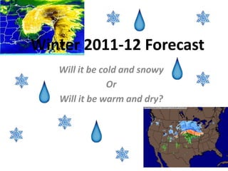
- 1. Winter 2011-12 Forecast Will it be cold and snowy Or Will it be warm and dry?
- 2. La Nina 1. Weak-Mod. La Nina across the Equatorial Pacific continues. I expect it too continue through out Winter peaking between -0.7 and -1.3 on the ONI. 2. -PDO continues to rage on in the Pacific and I expect the PDO to continue its negative phase through out Winter. 3. +AMO across the Atlantic continues but notice it isn’t overly warm. I expect the AMO to continue its warm phase through Winter but some Climate Models suggest a Weak –AMO next year? I don’t expect it have any significant effect though.
- 3. SST Comparisons 2010 2011 Now last year ATM we had a Moderate-Strong La Nina going on compared to Weak-Moderate this year. Notice we have a deeply negative PDO this year like last year along with a +AMO across the Atlantic but notice it was much warmer last year than this year? SST’s are much cooler however this year than last year along with slightly different North Atlantic SST anomalies.
- 4. SST comparisons continued 2008 2011 Notice this year we have a much stronger Nina but the PDO index and the GOA index is very similar to this year. AMO was similar in some ways but we can notice a –AMO starting to take shape in 2008 with cooling anomalies across Western Europe/Africa with different North Atlantic SST anomalies. Pacific wise it compares nicely.
- 5. Weak-Mod. La Nina’s Typical Weak-Moderate La Nina’s as shown above, often mean warmer than normal temp. anomalies across SE USA and SW USA with below normal temperature anomalies across the NE, GL’s region, towards the Plains and much of Western Canada. Storm track can vary yearly however.
- 6. Highly Negative PDO/La Nina Winters Most highly negative PDO Winters along with –ENSO featured above normal temp. anomalies across most of Southern United States and below normal temp. anomalies across the NE, GL’s region and Western North America or in other words “Typical La Nina Pattern”. Nice Strong Aleutian HP across the Pacific as you can see above. BTW most of W. Europe is below normal in terms of temps.
- 7. -PDO/+AMO and –ENSO Winters We notice it resembles a “typical” La Nina pattern somewhat with below normal temp. anomalies across Western North America and extending towards the GL’s region and warmer than normal temperature anomalies across most of Eastern Canada towards Atlantic Canada as result of the +AMO and WB –NAO. We also notice the HP anomaly in the Pacific is closer to Siberia allowing for a Strong PV across the Canadian Side.
- 8. NAO and AO Above is a typical –NAO/AO and +NAO/AO setup. As you can see above most of North America is often very cold relative to normal during a –NAO given the consistent troughs and Strong PV situated across Canada. On the top right is the seasonal DJFM NAO index and notice through much of the 40’s thru the 70’s the NAO was mostly negative, correlating well with the PDO. IMO I believe the NAM has more connection with the PDO than the NAO/AO. A +NAO/+AO if often the opposite with a strong Bermuda High in the Atlantic.
- 9. NAO and -ENSO DJF avg. NAO <-0.5 but >-1.5 DJF avg. NAO >0.5 but <1.5 I think you can see that most –NAO Winters often featured below normal temp. anomalies Across most of North America through the Mid Atlantic region with above normal temp. Anomalies across NFL and Labrador given the –NAO block and the opposite for when the NAO was positive. Either way a –NAO would be great for most everyone and either phase for The PNW/SW B.C.
- 10. -QBO and -NAO Instead of explaining the relationship between the QBO and NAO you can clearly see it above with strong –NAO blocking across the Arctic with below normal temp. anomalies across Eastern NA and most of Western Europe. The NAO/QBO correlate well. It seems as though we may see a +QBO at 50mb and –QBO and 30mb this Winter so I’d expect a slightly stronger Aleutian Ridge across the Pacific given the -PDO/-PNA anomaly.
- 11. Low Solar Years Low Solar years suggest that much of North America will feature below normal temp. anomalies with a slightly –NAO/AO anomaly across the North along with below normal Temp. anomalies across Europe as well. Typical Nina pattern across the West though with slightly above normal temp. anomalies across far Southern USA. Despite the increase in Sunspots over the past few months the AP index/KP index has remained very low, and that leads to me say this Winter will feature a –NAO/-AO anomaly along with the SST config. across the Atlantic though I don’t expect it to be as negative as the past two Winters.
- 12. Overall Teleconnections Summary • I expect a Weak-Mod La Nina this Winter peaking between -0.7 and -1.3 on the ONI. • I expect a –QBO at 30hpa mostly with transitioning values at 50hpa. • Low AP Index, -QBO, SST config. in the Atlantic will likely lead to more “blocking” this Winter though I don’t expect huge negative anomalies this Winter. • -PDO/+AMO this Winter • Transitional PNA Index with a fluctuating EPO.
- 13. DJF Temps. By Snowstorms
- 15. December Temps. By Snowstorms
- 16. January Temps. By: Snowstorms
- 17. February Temps. By: Snowstorms
- 18. Overall Summary Now I did not add monthly snowfall maps because I believe its bullshit creating monthly snowfall maps because of so many uncertainties. My DJF snowfall map represents snowfall greater than 5cm (2”) compared to normal. Overall I believe this Winter should be great nationwide with great snowfall opportunities for many. I had a hard time figuring temperatures out for December but after analyzing many indices/climatology I believe I made the right decision for December. I do expect a lot of clippers and perhaps a few Gulf Low’s this Winter with the possibility of 1-2 Nor'easters. I don’t expect huge blocking like the past two Winters but I expect a mostly negative AO/NAO index in January/February and neutral-slightly negative PNA along with a mostly negative EPO. As for Europe I do see a cold and snowy Winter for Western Europe but I believe most of December should be mostly calm but January and February will likely be fairly cold and snowy with the blocking setting up again. Any questions and comments will be appreciated. By: Snowstorms