SUMO ( SIMULATION OF URBAN MOBILITY)
•Download as PPTX, PDF•
0 likes•422 views

MADE BY SHRIKRISHNA KESHARWANI 1ST YR ASSIGNMENT MASTERS OF TECHNOLOGY TRANSPORTATION ENGINEERING NIT WARANGAL

Recommended
Recommended
More Related Content
What's hot
What's hot (20)
Similar to SUMO ( SIMULATION OF URBAN MOBILITY)
Similar to SUMO ( SIMULATION OF URBAN MOBILITY) (20)
More from shrikrishna kesharwani
More from shrikrishna kesharwani (20)
Recently uploaded
Recently uploaded (20)
SUMO ( SIMULATION OF URBAN MOBILITY)
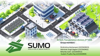
- 1. Group members- Shrikrishna Kesharwani (22CEM3R23) Abhishek Singh Baghel (22CEM3R02) Niharika Joshi (22CEM3R15) Gudem Prudhvi Raj (22CEM3R09) M.Tech, Transportation division, 2nd SEM.
- 2. TABLE OF CONTENTS- INTRODUCTION FEATURES MICROSCOPIC SIMULATION MODEL VISSIM VS SUMO STEPS OUTPUT
- 3. LINKS TO DOWNLOAD • For Sumo, visit the following link: https://sumo.dlr.de/docs/Downloads.php • For Notepad++, visit the following link: https://notepad-plus- plus.org/downloads/ • For Python, visit the following link: https://www.python.org/downloads/
- 4. INTRODUCTION • Sumo (Simulation of Urban Mobility) is an open-source, microscopic traffic simulation software designed to help researchers, engineers, and urban planners understand and optimize transportation systems in urban areas. • Sumo also offers a user-friendly interface, extensive documentation, and a variety of tools for visualization and data analysis, making it a popular choice for transportation researchers and practitioners around the world. • With its open-source license, Sumo is freely available for use, modification, and distribution.
- 5. FEATURES-
- 6. FEATURES-
- 7. MACROSCOPIC SIMULATION MODEL The macroscopic simulation model are based on the deterministic relationship of the flow, speed, and density of the traffic stream. The simulation in a macroscopic model takes place on a section-by-section basis rather than by tracking individual vehicles.
- 8. MESO-SCOPIC SIMULATION MODEL The mesoscopic simulation models combine the properties of both microscopic and macroscopic simulation models. Traffic flow unit in this type of simulation is individual vehicle but the movement is using the approach of the macroscopic mode. Mesoscopic simulation takes place on an aggregate level and does not consider dynamic speed/volume relationship.
- 9. MICROSCOPIC SIMULATION MODEL The microscopic model simulate the movement of individual vehicles based on car- following and lane-changing theories. Typically, vehicles enter a transportation network using a statistical distribution of arrivals. The microscopic model incorporate sub-models for acceleration, speed adaptation, lane-changing, gap acceptance etc., to describe how vehicles move and interact with each other and with the infrastructure.
- 10. DIFFERENCES AND BENEFITS OF SUMO AND VISSIM Purpose: Sumo is an open-source traffic simulation software that allows users to simulate traffic in urban areas, including pedestrians, bicycles, and public transportation. PTV Vissim, on the other hand, is a commercial software that provides detailed simulations of all types of traffic on road networks, including highways, arterials, and intersections. Modeling capabilities: Sumo has several modules for modeling different aspects of urban traffic, including vehicle routing, public transportation, and pedestrian movement. PTV Vissim offers advanced modeling capabilities for complex traffic scenarios, including signalized and unsignalized intersections, roundabouts, and public transportation systems.
- 11. Interface and usability: Sumo has a command-line interface that requires users to have programming skills to use effectively. PTV Vissim has a graphical user interface that is easy to use and navigate, making it more accessible to users without programming skills. Cost: Sumo is open-source and free to use, while PTV Vissim is a commercial software with a license fee. The cost of PTV Vissim can be significant, depending on the number of licenses needed and the level of support required. DIFFERENCES AND BENEFITS SUMO AND VISSIM
- 12. SUMO INPUT (Network + Route file) Emission Output (CO2, CO, NOX etc.) Lane, Edge, Lane change Position, Speed, Vehicle angle
- 13. OPEN STREET NETWORK (OSM) Open Street Map (OSM) is a free, open-source map of the world created by volunteers. It allows users to view and edit maps, adding new features and updating existing ones. Roads, Buildings Landmarks, Borders Point of interest (Restaurants, Shops etc) Street Names, Address, Public Transportation
- 14. BRIEF OF STEPS Search and download Open Street Map. Convert the map into SUMO NETWORK. Add trip and route to the network using build-in PYTHON scripts. Setup the SUMO configuration.
- 15. CREATE NETWORK
- 16. DEMAND
- 17. SIMULATION
- 18. OUTPUT Floating Car Data (FCD) • The Floating Car Data is an output file that contains the location, speed, vehicle angle, position, lane along with other information for every vehicle in network at every time step. • The FCD is just like a GPS device for each vehicle.
- 19. 1. Raw vehicle position dump:- Contains every edges and lanes each vehicle position and speeds for each simulation step. 2. Emission Output:- Amount of CO2, CO, HC, NOX, Fuel, Noise emitted by the vehicle in the actual simulation step. 3. Full Output:- Dump every information contained in the network, including emission, speed, position and lane.
- 21. THANKS