SlideShare a Scribd company logo
1 of 14
Download to read offline
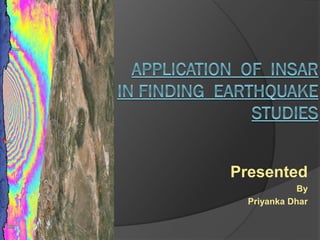
Presented
By
Priyanka Dhar
❖ INTRODUCTION
❖ SIMPLISTIC VIEW OF InSAR
❖ TYPES OF INTERFEROMETRY
❖ DERFORMATION MAPPING WITH InSAR
❖ INTERFEROGRAM GENERATION
❖ INTERPREATING TECHNIQUE OF INTERFEROGRAM
❖ OVERVIEW OF GeoGateway IN EARTHQUAKE STUDY
❖ REFERENCES
INTRODUCTION
• An Earthquake is the sudden shaking of Earth surface caused by
releasing of energy in the Earth’s lithosphere that creates seismic waves.
• Earthquake disaster can cause loss of life, damage property.
• To alleviate the adverse impact of
earthquakes, various kinds of geophysical
techniques are utilised for earthquake
mechanism research.
• Ground or space based techniques
such as seismographs which record the
seismic wave, levelling measurements of
relative deformation of the surface and
the GNSS such as GPS that offers vertical
and horizontal movement information are
commonly used to monitor earthquakes.
• Synthetic Aperture Radar (SAR) imagery is produced by reflecting radar
signals off a target area and measuring the two way travel time back to the
satellite.
• The SAR interferometry technique uses two SAR images of the same
area acquired at different times and "interferes" (differences) them, resulting
in maps called interferograms that show ground-surface displacement
(range change) between the two time periods.
• View of SAR phase
Phase of image 1
2
1
Phase of image 2
SAR PHASE
TYPES OF INTERFEROMETRY
• There has two main classes of interferometry
✓ Cross- track Interferometer
✓ Along- track Interferometer
CROSS- TRACK IROMETNTERFEER ALONG- TRACK INTERFEROMETER
DEFORMATION MAPPING WITH InSAR
InSAR Phase
difference
INTERFEROGRAM GENERATION
• Interferograms are maps of relative ground-surface change that are
constructed from InSAR data to help scientists understand how tectonic or
human activities, such as groundwater pumping and hydrocarbon production,
cause the land surface to uplift or subside.
• For generating Interferogram need two radar images.
Line of sight (LOS) SOURCE : GeoGateway _user_Guide
INTERPREATING INTERFEROGRAMS
There has 3 simple steps to interpreat a interferogram.
Step 1
In InSAR fringes count the number between two
points on the interferogram, where one fringe is
denote one complete color cycle (i.e. red, orange,
yellow, green, blue, purple).
Step 2
Multiply the number of fringes by 28 mm,
because there are 2 fringes, the maximum
displacement (at the bottom of the bowl),
is 56 mm.
SOURCE : nasa.gov.in
INTERPREATING INTERFEROGRAM
Step 3
If the ground moved closer (uplift) or
farther away (subsidence) from the satellite
by matching how the colors change
between the two points with the InSAR
scale bar. If the range is increase (i.e. red,
orange, yellow, green, blue, purple) it
indicates subsidence, and a decrease in
range indicates uplift.
SOURCE : nasa.gov.in
OVERVIEW OF Geo Gateway IN
EARTHQUAKE STUDY
❑ Select Data Products
SOURCE : GeoGateway _user_Guide
❑ Displaying Individual Lines
SOURCE : GeoGateway _user_Guide
❑ Line of Sight Tools
SOURCE : GeoGateway _user_Guide
REFERENCES
▪ InSAR Technique for Earthquake Studies By Youtian Liu, Geoscience and Earth
Observing Systems Group (GEOS) School of Civil and Environmental Engineering Faculty
of Engineering, The University of New South Wales Sydney, NSW 2052, Australia August
2015, DOI: 10.1080/19475683.2015.1068221
▪ Massonnet, D. et al. The displacement field of the Landers Earthquake mapped by
radar interferometry. Nature 364, 138–142 (1993).
▪ “How satellite InSAR has grown from opportunistic science to routine monitoring over
the last decade”- Juliet Biggs & Tim J. Wright , Nature Communications volume 11,
Article number: 3863 (2020)
▪ https://www.usgs.gov/centers/ca-water-ls/science/interferometric-synthetic-aperture-
radar-insar InSAR- USGS
▪ Introduction to SAR Interferometry- Eric Fielding, http://arset.gsfc.nasa.gov
▪ The global CMT project 2004–2010: Centroid-moment tensors for 13,017 earthquakes.
EKSTRÖM, G., NETTLES, M. & DZIEWOŃSKI, A. M. 2012. Physics of the Earth and
Planetary Interiors, 200–201, 1-9.
▪
https://www.google.com/url?sa=i&url=https%3A%2F%2Fwww.researchgate.net%2Ffigure
%2FPrinciple-of-the-InSAR-techniques-the-phase-difference-observed-by-comparing-two-
SAR_fig1_342916517&psig=AOvVaw3AzRY5NWDJRu-
MNwF6i_SC&ust=1618847476153000&source=images&cd=vfe&ved=0CAIQjRxqFwoTCL
CRxPiSiPACFQAAAAAdAAAAABAD
▪ GeoGateway_User_guide
Application of InSAR in finding Earthquake Studies

More Related Content

What's hot

Envi sat satellite
Envi sat satelliteEnvi sat satellite
Envi sat satelliteEhsanYousaf1
 
Application of Remote Sensing in Civil Engineering
Application of Remote Sensing in Civil EngineeringApplication of Remote Sensing in Civil Engineering
Application of Remote Sensing in Civil EngineeringIEI GSC
 
HYPERSPECTRAL RS IN MINERAL MAPPING
HYPERSPECTRAL RS IN MINERAL MAPPINGHYPERSPECTRAL RS IN MINERAL MAPPING
HYPERSPECTRAL RS IN MINERAL MAPPINGAbhiram Kanigolla
 
Remote Sensing Data Acquisition,Scanning/Imaging systems
Remote Sensing Data Acquisition,Scanning/Imaging systemsRemote Sensing Data Acquisition,Scanning/Imaging systems
Remote Sensing Data Acquisition,Scanning/Imaging systemsdaniyal rustam
 
Remote Sensing And GIS Application In Mineral , Oil , Ground Water MappingMin...
Remote Sensing And GIS Application In Mineral , Oil , Ground Water MappingMin...Remote Sensing And GIS Application In Mineral , Oil , Ground Water MappingMin...
Remote Sensing And GIS Application In Mineral , Oil , Ground Water MappingMin...Swetha A
 
INTRODUCTION TO REMOTE SENSING
 INTRODUCTION TO REMOTE SENSING INTRODUCTION TO REMOTE SENSING
INTRODUCTION TO REMOTE SENSINGGhassan Hadi
 
Data acquisition Platforms
Data acquisition PlatformsData acquisition Platforms
Data acquisition PlatformsSumant Diwakar
 
Meteorological Satellites
Meteorological SatellitesMeteorological Satellites
Meteorological SatellitesManoj Barman
 
Remote Sensing - by IUT CEE'10
Remote Sensing - by IUT CEE'10Remote Sensing - by IUT CEE'10
Remote Sensing - by IUT CEE'10rifatrahim
 
Soil separability through remote sensing for land evaluation
Soil separability through remote sensing for land evaluationSoil separability through remote sensing for land evaluation
Soil separability through remote sensing for land evaluationdathan cs
 
Multi Spectral Scanning Systems
Multi Spectral Scanning SystemsMulti Spectral Scanning Systems
Multi Spectral Scanning SystemsSenthamizhan M
 
Remote sensing in Civil Engineering
Remote sensing in Civil EngineeringRemote sensing in Civil Engineering
Remote sensing in Civil EngineeringManishkumar Dubey
 
Remote Sensing Platforms and Sensors
Remote Sensing Platforms and SensorsRemote Sensing Platforms and Sensors
Remote Sensing Platforms and SensorsUday kumar Devalla
 
Seismic reflection at lang kawi
Seismic reflection at lang kawiSeismic reflection at lang kawi
Seismic reflection at lang kawiAmin khalil
 

What's hot (20)

Remote sensing
Remote sensingRemote sensing
Remote sensing
 
Envi sat satellite
Envi sat satelliteEnvi sat satellite
Envi sat satellite
 
Application of Remote Sensing in Civil Engineering
Application of Remote Sensing in Civil EngineeringApplication of Remote Sensing in Civil Engineering
Application of Remote Sensing in Civil Engineering
 
Ikonos
IkonosIkonos
Ikonos
 
HYPERSPECTRAL RS IN MINERAL MAPPING
HYPERSPECTRAL RS IN MINERAL MAPPINGHYPERSPECTRAL RS IN MINERAL MAPPING
HYPERSPECTRAL RS IN MINERAL MAPPING
 
Remote Sensing Data Acquisition,Scanning/Imaging systems
Remote Sensing Data Acquisition,Scanning/Imaging systemsRemote Sensing Data Acquisition,Scanning/Imaging systems
Remote Sensing Data Acquisition,Scanning/Imaging systems
 
Remote Sensing And GIS Application In Mineral , Oil , Ground Water MappingMin...
Remote Sensing And GIS Application In Mineral , Oil , Ground Water MappingMin...Remote Sensing And GIS Application In Mineral , Oil , Ground Water MappingMin...
Remote Sensing And GIS Application In Mineral , Oil , Ground Water MappingMin...
 
INTRODUCTION TO REMOTE SENSING
 INTRODUCTION TO REMOTE SENSING INTRODUCTION TO REMOTE SENSING
INTRODUCTION TO REMOTE SENSING
 
Data acquisition Platforms
Data acquisition PlatformsData acquisition Platforms
Data acquisition Platforms
 
Remote sensing
Remote sensingRemote sensing
Remote sensing
 
Remote sensing
Remote sensing Remote sensing
Remote sensing
 
Meteorological Satellites
Meteorological SatellitesMeteorological Satellites
Meteorological Satellites
 
Data collection
Data collectionData collection
Data collection
 
Remote Sensing - by IUT CEE'10
Remote Sensing - by IUT CEE'10Remote Sensing - by IUT CEE'10
Remote Sensing - by IUT CEE'10
 
Soil separability through remote sensing for land evaluation
Soil separability through remote sensing for land evaluationSoil separability through remote sensing for land evaluation
Soil separability through remote sensing for land evaluation
 
Multi Spectral Scanning Systems
Multi Spectral Scanning SystemsMulti Spectral Scanning Systems
Multi Spectral Scanning Systems
 
Remote sensing for
Remote sensing forRemote sensing for
Remote sensing for
 
Remote sensing in Civil Engineering
Remote sensing in Civil EngineeringRemote sensing in Civil Engineering
Remote sensing in Civil Engineering
 
Remote Sensing Platforms and Sensors
Remote Sensing Platforms and SensorsRemote Sensing Platforms and Sensors
Remote Sensing Platforms and Sensors
 
Seismic reflection at lang kawi
Seismic reflection at lang kawiSeismic reflection at lang kawi
Seismic reflection at lang kawi
 

Similar to Application of InSAR in finding Earthquake Studies

Landslide monitoring systems & techniques
Landslide monitoring systems & techniquesLandslide monitoring systems & techniques
Landslide monitoring systems & techniquesmaneeb
 
Unit 1 introduction to remote sensing
Unit  1 introduction to remote sensing Unit  1 introduction to remote sensing
Unit 1 introduction to remote sensing Dhanalakshmi Dasari
 
Lake sediment thickness estimation using ground penetrating radar
Lake sediment thickness estimation using ground penetrating radarLake sediment thickness estimation using ground penetrating radar
Lake sediment thickness estimation using ground penetrating radareSAT Publishing House
 
SAR Interferometry Technique
SAR Interferometry TechniqueSAR Interferometry Technique
SAR Interferometry TechniqueNopphawanTamkuan
 
Rahul seminar2 2_for_slideshare.pptx
Rahul seminar2 2_for_slideshare.pptxRahul seminar2 2_for_slideshare.pptx
Rahul seminar2 2_for_slideshare.pptxRahulSingh769902
 
2D MASW ANALYSIS FOR GEOTECHNICAL ENGINEERING
2D MASW ANALYSIS FOR GEOTECHNICAL ENGINEERING2D MASW ANALYSIS FOR GEOTECHNICAL ENGINEERING
2D MASW ANALYSIS FOR GEOTECHNICAL ENGINEERINGAli Osman Öncel
 
Principles of remote sensing
Principles of remote sensingPrinciples of remote sensing
Principles of remote sensingPramoda Raj
 
DELINEATION OF LANDSLIDE AREA USING SAR INTERFEROMETRY AND D-INSAR :A CASE ST...
DELINEATION OF LANDSLIDE AREA USING SAR INTERFEROMETRY AND D-INSAR :A CASE ST...DELINEATION OF LANDSLIDE AREA USING SAR INTERFEROMETRY AND D-INSAR :A CASE ST...
DELINEATION OF LANDSLIDE AREA USING SAR INTERFEROMETRY AND D-INSAR :A CASE ST...SUJAN GHIMIRE
 
Remote sensing by Priyanshu kumar, 9608684800
Remote sensing by Priyanshu kumar, 9608684800Remote sensing by Priyanshu kumar, 9608684800
Remote sensing by Priyanshu kumar, 9608684800PRIYANSHU KUMAR
 
Seismic Refraction Test
Seismic Refraction TestSeismic Refraction Test
Seismic Refraction TestMaliha Mehr
 
Surveying ii ajith sir class6
Surveying ii ajith sir class6Surveying ii ajith sir class6
Surveying ii ajith sir class6SHAMJITH KM
 
Radar remote sensing, P K MANI
Radar remote sensing, P K MANIRadar remote sensing, P K MANI
Radar remote sensing, P K MANIP.K. Mani
 
Remote sensing: Its Application & Types
Remote sensing: Its Application & TypesRemote sensing: Its Application & Types
Remote sensing: Its Application & Typesasdfg484362
 
Microwave remote sensing
Microwave remote sensingMicrowave remote sensing
Microwave remote sensingRohit Kumar
 

Similar to Application of InSAR in finding Earthquake Studies (20)

RS_GIS_GPS.pdf
RS_GIS_GPS.pdfRS_GIS_GPS.pdf
RS_GIS_GPS.pdf
 
Landslide monitoring systems & techniques
Landslide monitoring systems & techniquesLandslide monitoring systems & techniques
Landslide monitoring systems & techniques
 
Unit 1 introduction to remote sensing
Unit  1 introduction to remote sensing Unit  1 introduction to remote sensing
Unit 1 introduction to remote sensing
 
Lake sediment thickness estimation using ground penetrating radar
Lake sediment thickness estimation using ground penetrating radarLake sediment thickness estimation using ground penetrating radar
Lake sediment thickness estimation using ground penetrating radar
 
Microwave remote sensing
Microwave remote sensingMicrowave remote sensing
Microwave remote sensing
 
Hydrography
Hydrography Hydrography
Hydrography
 
SAR Interferometry Technique
SAR Interferometry TechniqueSAR Interferometry Technique
SAR Interferometry Technique
 
Rahul seminar2 2_for_slideshare.pptx
Rahul seminar2 2_for_slideshare.pptxRahul seminar2 2_for_slideshare.pptx
Rahul seminar2 2_for_slideshare.pptx
 
2D MASW ANALYSIS FOR GEOTECHNICAL ENGINEERING
2D MASW ANALYSIS FOR GEOTECHNICAL ENGINEERING2D MASW ANALYSIS FOR GEOTECHNICAL ENGINEERING
2D MASW ANALYSIS FOR GEOTECHNICAL ENGINEERING
 
Principles of remote sensing
Principles of remote sensingPrinciples of remote sensing
Principles of remote sensing
 
DELINEATION OF LANDSLIDE AREA USING SAR INTERFEROMETRY AND D-INSAR :A CASE ST...
DELINEATION OF LANDSLIDE AREA USING SAR INTERFEROMETRY AND D-INSAR :A CASE ST...DELINEATION OF LANDSLIDE AREA USING SAR INTERFEROMETRY AND D-INSAR :A CASE ST...
DELINEATION OF LANDSLIDE AREA USING SAR INTERFEROMETRY AND D-INSAR :A CASE ST...
 
Ligo E Lab
Ligo E LabLigo E Lab
Ligo E Lab
 
Remote sensing by Priyanshu kumar, 9608684800
Remote sensing by Priyanshu kumar, 9608684800Remote sensing by Priyanshu kumar, 9608684800
Remote sensing by Priyanshu kumar, 9608684800
 
Seismic Refraction Test
Seismic Refraction TestSeismic Refraction Test
Seismic Refraction Test
 
IJET-V3I2P9
IJET-V3I2P9IJET-V3I2P9
IJET-V3I2P9
 
Surveying ii ajith sir class6
Surveying ii ajith sir class6Surveying ii ajith sir class6
Surveying ii ajith sir class6
 
MODERN SURVEYING TECHNIQUES
MODERN SURVEYING TECHNIQUESMODERN SURVEYING TECHNIQUES
MODERN SURVEYING TECHNIQUES
 
Radar remote sensing, P K MANI
Radar remote sensing, P K MANIRadar remote sensing, P K MANI
Radar remote sensing, P K MANI
 
Remote sensing: Its Application & Types
Remote sensing: Its Application & TypesRemote sensing: Its Application & Types
Remote sensing: Its Application & Types
 
Microwave remote sensing
Microwave remote sensingMicrowave remote sensing
Microwave remote sensing
 

Recently uploaded

From Event to Action: Accelerate Your Decision Making with Real-Time Automation
From Event to Action: Accelerate Your Decision Making with Real-Time AutomationFrom Event to Action: Accelerate Your Decision Making with Real-Time Automation
From Event to Action: Accelerate Your Decision Making with Real-Time AutomationSafe Software
 
Transforming Data Streams with Kafka Connect: An Introduction to Single Messa...
Transforming Data Streams with Kafka Connect: An Introduction to Single Messa...Transforming Data Streams with Kafka Connect: An Introduction to Single Messa...
Transforming Data Streams with Kafka Connect: An Introduction to Single Messa...HostedbyConfluent
 
Neo4j - How KGs are shaping the future of Generative AI at AWS Summit London ...
Neo4j - How KGs are shaping the future of Generative AI at AWS Summit London ...Neo4j - How KGs are shaping the future of Generative AI at AWS Summit London ...
Neo4j - How KGs are shaping the future of Generative AI at AWS Summit London ...Neo4j
 
🐬 The future of MySQL is Postgres 🐘
🐬  The future of MySQL is Postgres   🐘🐬  The future of MySQL is Postgres   🐘
🐬 The future of MySQL is Postgres 🐘RTylerCroy
 
Automating Business Process via MuleSoft Composer | Bangalore MuleSoft Meetup...
Automating Business Process via MuleSoft Composer | Bangalore MuleSoft Meetup...Automating Business Process via MuleSoft Composer | Bangalore MuleSoft Meetup...
Automating Business Process via MuleSoft Composer | Bangalore MuleSoft Meetup...shyamraj55
 
08448380779 Call Girls In Friends Colony Women Seeking Men
08448380779 Call Girls In Friends Colony Women Seeking Men08448380779 Call Girls In Friends Colony Women Seeking Men
08448380779 Call Girls In Friends Colony Women Seeking MenDelhi Call girls
 
Injustice - Developers Among Us (SciFiDevCon 2024)
Injustice - Developers Among Us (SciFiDevCon 2024)Injustice - Developers Among Us (SciFiDevCon 2024)
Injustice - Developers Among Us (SciFiDevCon 2024)Allon Mureinik
 
How to convert PDF to text with Nanonets
How to convert PDF to text with NanonetsHow to convert PDF to text with Nanonets
How to convert PDF to text with Nanonetsnaman860154
 
A Domino Admins Adventures (Engage 2024)
A Domino Admins Adventures (Engage 2024)A Domino Admins Adventures (Engage 2024)
A Domino Admins Adventures (Engage 2024)Gabriella Davis
 
04-2024-HHUG-Sales-and-Marketing-Alignment.pptx
04-2024-HHUG-Sales-and-Marketing-Alignment.pptx04-2024-HHUG-Sales-and-Marketing-Alignment.pptx
04-2024-HHUG-Sales-and-Marketing-Alignment.pptxHampshireHUG
 
[2024]Digital Global Overview Report 2024 Meltwater.pdf
[2024]Digital Global Overview Report 2024 Meltwater.pdf[2024]Digital Global Overview Report 2024 Meltwater.pdf
[2024]Digital Global Overview Report 2024 Meltwater.pdfhans926745
 
Tech-Forward - Achieving Business Readiness For Copilot in Microsoft 365
Tech-Forward - Achieving Business Readiness For Copilot in Microsoft 365Tech-Forward - Achieving Business Readiness For Copilot in Microsoft 365
Tech-Forward - Achieving Business Readiness For Copilot in Microsoft 3652toLead Limited
 
GenCyber Cyber Security Day Presentation
GenCyber Cyber Security Day PresentationGenCyber Cyber Security Day Presentation
GenCyber Cyber Security Day PresentationMichael W. Hawkins
 
Enhancing Worker Digital Experience: A Hands-on Workshop for Partners
Enhancing Worker Digital Experience: A Hands-on Workshop for PartnersEnhancing Worker Digital Experience: A Hands-on Workshop for Partners
Enhancing Worker Digital Experience: A Hands-on Workshop for PartnersThousandEyes
 
FULL ENJOY 🔝 8264348440 🔝 Call Girls in Diplomatic Enclave | Delhi
FULL ENJOY 🔝 8264348440 🔝 Call Girls in Diplomatic Enclave | DelhiFULL ENJOY 🔝 8264348440 🔝 Call Girls in Diplomatic Enclave | Delhi
FULL ENJOY 🔝 8264348440 🔝 Call Girls in Diplomatic Enclave | Delhisoniya singh
 
Salesforce Community Group Quito, Salesforce 101
Salesforce Community Group Quito, Salesforce 101Salesforce Community Group Quito, Salesforce 101
Salesforce Community Group Quito, Salesforce 101Paola De la Torre
 
Kalyanpur ) Call Girls in Lucknow Finest Escorts Service 🍸 8923113531 🎰 Avail...
Kalyanpur ) Call Girls in Lucknow Finest Escorts Service 🍸 8923113531 🎰 Avail...Kalyanpur ) Call Girls in Lucknow Finest Escorts Service 🍸 8923113531 🎰 Avail...
Kalyanpur ) Call Girls in Lucknow Finest Escorts Service 🍸 8923113531 🎰 Avail...gurkirankumar98700
 
Google AI Hackathon: LLM based Evaluator for RAG
Google AI Hackathon: LLM based Evaluator for RAGGoogle AI Hackathon: LLM based Evaluator for RAG
Google AI Hackathon: LLM based Evaluator for RAGSujit Pal
 
WhatsApp 9892124323 ✓Call Girls In Kalyan ( Mumbai ) secure service
WhatsApp 9892124323 ✓Call Girls In Kalyan ( Mumbai ) secure serviceWhatsApp 9892124323 ✓Call Girls In Kalyan ( Mumbai ) secure service
WhatsApp 9892124323 ✓Call Girls In Kalyan ( Mumbai ) secure servicePooja Nehwal
 
My Hashitalk Indonesia April 2024 Presentation
My Hashitalk Indonesia April 2024 PresentationMy Hashitalk Indonesia April 2024 Presentation
My Hashitalk Indonesia April 2024 PresentationRidwan Fadjar
 

Recently uploaded (20)

From Event to Action: Accelerate Your Decision Making with Real-Time Automation
From Event to Action: Accelerate Your Decision Making with Real-Time AutomationFrom Event to Action: Accelerate Your Decision Making with Real-Time Automation
From Event to Action: Accelerate Your Decision Making with Real-Time Automation
 
Transforming Data Streams with Kafka Connect: An Introduction to Single Messa...
Transforming Data Streams with Kafka Connect: An Introduction to Single Messa...Transforming Data Streams with Kafka Connect: An Introduction to Single Messa...
Transforming Data Streams with Kafka Connect: An Introduction to Single Messa...
 
Neo4j - How KGs are shaping the future of Generative AI at AWS Summit London ...
Neo4j - How KGs are shaping the future of Generative AI at AWS Summit London ...Neo4j - How KGs are shaping the future of Generative AI at AWS Summit London ...
Neo4j - How KGs are shaping the future of Generative AI at AWS Summit London ...
 
🐬 The future of MySQL is Postgres 🐘
🐬  The future of MySQL is Postgres   🐘🐬  The future of MySQL is Postgres   🐘
🐬 The future of MySQL is Postgres 🐘
 
Automating Business Process via MuleSoft Composer | Bangalore MuleSoft Meetup...
Automating Business Process via MuleSoft Composer | Bangalore MuleSoft Meetup...Automating Business Process via MuleSoft Composer | Bangalore MuleSoft Meetup...
Automating Business Process via MuleSoft Composer | Bangalore MuleSoft Meetup...
 
08448380779 Call Girls In Friends Colony Women Seeking Men
08448380779 Call Girls In Friends Colony Women Seeking Men08448380779 Call Girls In Friends Colony Women Seeking Men
08448380779 Call Girls In Friends Colony Women Seeking Men
 
Injustice - Developers Among Us (SciFiDevCon 2024)
Injustice - Developers Among Us (SciFiDevCon 2024)Injustice - Developers Among Us (SciFiDevCon 2024)
Injustice - Developers Among Us (SciFiDevCon 2024)
 
How to convert PDF to text with Nanonets
How to convert PDF to text with NanonetsHow to convert PDF to text with Nanonets
How to convert PDF to text with Nanonets
 
A Domino Admins Adventures (Engage 2024)
A Domino Admins Adventures (Engage 2024)A Domino Admins Adventures (Engage 2024)
A Domino Admins Adventures (Engage 2024)
 
04-2024-HHUG-Sales-and-Marketing-Alignment.pptx
04-2024-HHUG-Sales-and-Marketing-Alignment.pptx04-2024-HHUG-Sales-and-Marketing-Alignment.pptx
04-2024-HHUG-Sales-and-Marketing-Alignment.pptx
 
[2024]Digital Global Overview Report 2024 Meltwater.pdf
[2024]Digital Global Overview Report 2024 Meltwater.pdf[2024]Digital Global Overview Report 2024 Meltwater.pdf
[2024]Digital Global Overview Report 2024 Meltwater.pdf
 
Tech-Forward - Achieving Business Readiness For Copilot in Microsoft 365
Tech-Forward - Achieving Business Readiness For Copilot in Microsoft 365Tech-Forward - Achieving Business Readiness For Copilot in Microsoft 365
Tech-Forward - Achieving Business Readiness For Copilot in Microsoft 365
 
GenCyber Cyber Security Day Presentation
GenCyber Cyber Security Day PresentationGenCyber Cyber Security Day Presentation
GenCyber Cyber Security Day Presentation
 
Enhancing Worker Digital Experience: A Hands-on Workshop for Partners
Enhancing Worker Digital Experience: A Hands-on Workshop for PartnersEnhancing Worker Digital Experience: A Hands-on Workshop for Partners
Enhancing Worker Digital Experience: A Hands-on Workshop for Partners
 
FULL ENJOY 🔝 8264348440 🔝 Call Girls in Diplomatic Enclave | Delhi
FULL ENJOY 🔝 8264348440 🔝 Call Girls in Diplomatic Enclave | DelhiFULL ENJOY 🔝 8264348440 🔝 Call Girls in Diplomatic Enclave | Delhi
FULL ENJOY 🔝 8264348440 🔝 Call Girls in Diplomatic Enclave | Delhi
 
Salesforce Community Group Quito, Salesforce 101
Salesforce Community Group Quito, Salesforce 101Salesforce Community Group Quito, Salesforce 101
Salesforce Community Group Quito, Salesforce 101
 
Kalyanpur ) Call Girls in Lucknow Finest Escorts Service 🍸 8923113531 🎰 Avail...
Kalyanpur ) Call Girls in Lucknow Finest Escorts Service 🍸 8923113531 🎰 Avail...Kalyanpur ) Call Girls in Lucknow Finest Escorts Service 🍸 8923113531 🎰 Avail...
Kalyanpur ) Call Girls in Lucknow Finest Escorts Service 🍸 8923113531 🎰 Avail...
 
Google AI Hackathon: LLM based Evaluator for RAG
Google AI Hackathon: LLM based Evaluator for RAGGoogle AI Hackathon: LLM based Evaluator for RAG
Google AI Hackathon: LLM based Evaluator for RAG
 
WhatsApp 9892124323 ✓Call Girls In Kalyan ( Mumbai ) secure service
WhatsApp 9892124323 ✓Call Girls In Kalyan ( Mumbai ) secure serviceWhatsApp 9892124323 ✓Call Girls In Kalyan ( Mumbai ) secure service
WhatsApp 9892124323 ✓Call Girls In Kalyan ( Mumbai ) secure service
 
My Hashitalk Indonesia April 2024 Presentation
My Hashitalk Indonesia April 2024 PresentationMy Hashitalk Indonesia April 2024 Presentation
My Hashitalk Indonesia April 2024 Presentation
 

Application of InSAR in finding Earthquake Studies

  • 2. ❖ INTRODUCTION ❖ SIMPLISTIC VIEW OF InSAR ❖ TYPES OF INTERFEROMETRY ❖ DERFORMATION MAPPING WITH InSAR ❖ INTERFEROGRAM GENERATION ❖ INTERPREATING TECHNIQUE OF INTERFEROGRAM ❖ OVERVIEW OF GeoGateway IN EARTHQUAKE STUDY ❖ REFERENCES
  • 3. INTRODUCTION • An Earthquake is the sudden shaking of Earth surface caused by releasing of energy in the Earth’s lithosphere that creates seismic waves. • Earthquake disaster can cause loss of life, damage property. • To alleviate the adverse impact of earthquakes, various kinds of geophysical techniques are utilised for earthquake mechanism research. • Ground or space based techniques such as seismographs which record the seismic wave, levelling measurements of relative deformation of the surface and the GNSS such as GPS that offers vertical and horizontal movement information are commonly used to monitor earthquakes.
  • 4. • Synthetic Aperture Radar (SAR) imagery is produced by reflecting radar signals off a target area and measuring the two way travel time back to the satellite. • The SAR interferometry technique uses two SAR images of the same area acquired at different times and "interferes" (differences) them, resulting in maps called interferograms that show ground-surface displacement (range change) between the two time periods. • View of SAR phase Phase of image 1 2 1 Phase of image 2 SAR PHASE
  • 5. TYPES OF INTERFEROMETRY • There has two main classes of interferometry ✓ Cross- track Interferometer ✓ Along- track Interferometer CROSS- TRACK IROMETNTERFEER ALONG- TRACK INTERFEROMETER
  • 6. DEFORMATION MAPPING WITH InSAR InSAR Phase difference
  • 7. INTERFEROGRAM GENERATION • Interferograms are maps of relative ground-surface change that are constructed from InSAR data to help scientists understand how tectonic or human activities, such as groundwater pumping and hydrocarbon production, cause the land surface to uplift or subside. • For generating Interferogram need two radar images. Line of sight (LOS) SOURCE : GeoGateway _user_Guide
  • 8. INTERPREATING INTERFEROGRAMS There has 3 simple steps to interpreat a interferogram. Step 1 In InSAR fringes count the number between two points on the interferogram, where one fringe is denote one complete color cycle (i.e. red, orange, yellow, green, blue, purple). Step 2 Multiply the number of fringes by 28 mm, because there are 2 fringes, the maximum displacement (at the bottom of the bowl), is 56 mm. SOURCE : nasa.gov.in
  • 9. INTERPREATING INTERFEROGRAM Step 3 If the ground moved closer (uplift) or farther away (subsidence) from the satellite by matching how the colors change between the two points with the InSAR scale bar. If the range is increase (i.e. red, orange, yellow, green, blue, purple) it indicates subsidence, and a decrease in range indicates uplift. SOURCE : nasa.gov.in
  • 10. OVERVIEW OF Geo Gateway IN EARTHQUAKE STUDY ❑ Select Data Products SOURCE : GeoGateway _user_Guide
  • 11. ❑ Displaying Individual Lines SOURCE : GeoGateway _user_Guide
  • 12. ❑ Line of Sight Tools SOURCE : GeoGateway _user_Guide
  • 13. REFERENCES ▪ InSAR Technique for Earthquake Studies By Youtian Liu, Geoscience and Earth Observing Systems Group (GEOS) School of Civil and Environmental Engineering Faculty of Engineering, The University of New South Wales Sydney, NSW 2052, Australia August 2015, DOI: 10.1080/19475683.2015.1068221 ▪ Massonnet, D. et al. The displacement field of the Landers Earthquake mapped by radar interferometry. Nature 364, 138–142 (1993). ▪ “How satellite InSAR has grown from opportunistic science to routine monitoring over the last decade”- Juliet Biggs & Tim J. Wright , Nature Communications volume 11, Article number: 3863 (2020) ▪ https://www.usgs.gov/centers/ca-water-ls/science/interferometric-synthetic-aperture- radar-insar InSAR- USGS ▪ Introduction to SAR Interferometry- Eric Fielding, http://arset.gsfc.nasa.gov ▪ The global CMT project 2004–2010: Centroid-moment tensors for 13,017 earthquakes. EKSTRÖM, G., NETTLES, M. & DZIEWOŃSKI, A. M. 2012. Physics of the Earth and Planetary Interiors, 200–201, 1-9. ▪ https://www.google.com/url?sa=i&url=https%3A%2F%2Fwww.researchgate.net%2Ffigure %2FPrinciple-of-the-InSAR-techniques-the-phase-difference-observed-by-comparing-two- SAR_fig1_342916517&psig=AOvVaw3AzRY5NWDJRu- MNwF6i_SC&ust=1618847476153000&source=images&cd=vfe&ved=0CAIQjRxqFwoTCL CRxPiSiPACFQAAAAAdAAAAABAD ▪ GeoGateway_User_guide