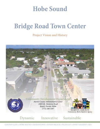
SlideShare a Scribd company logo
1 of 16
Download to read offline
Hobe Sound
Bridge Road Town Center
Project Vision and History
Community Development Department
Martin County Administrative Center
2401 S.E. Monterey Road
Stuart, Florida 34996
(772) 288-5497
Dynamic Innovative Sustainable
GOLDEN GATE • hobe sound • indiantown • jensen beach • palm city • port salerno • rio
Dynamic Innovative Sustainable
GOLDEN GATE • hobe sound • indiantown • jensen beach • palm city • port salerno • rio
Martin County Board of County Commissioners
District 1	 Doug Smith
District 2	 Ed Fielding, Chair
District 3	 Ann Scott, Vice Chair
District 4	 Sarah Heard
District 5	John Haddox
Martin County Community Redevelopment Agency
District 1	 Doug Smith
District 2	 Ed Fielding, Chair
District 3	 Ann Scott, Vice Chair
District 4	 Sarah Heard
District 5	John Haddox
Community development Staff
Kev Freeman, Director
Edward Erfurt, Urban Designer
Nancy Johnson, Community Development Specialist
Pinal Gandhi-Savdas, Community Development Specialist
Hobe Sound.................................................................. 3
Executive Summary...................................................... 5
Bridge Road Main Street
Project History.............................................................. 9
South Martin County Visioning Charrette
Community Redevelopment Plan
Zoning Overlays
Community Visioning
Parking Study
NOW Visioning
Bridge Road Town Center........................................... 17
Hobe Sound Sewer Project
Design Vision
Engineering Design
Utility Coordination
Innovative Design
Implementation ......................................................... 25
Incremental Implementation
FEC Parking
Bridge Road Parking
Table of Contents
3
Martin County Community Redevelopment Agency
Redevelopment in Action
Martin County Board of County Commissioners
Your County, Your Community
2
Hobe Sound
CRA Area: Hobe Sound
Plan Adoption: December 2000
Total Area: 1,024 Acres
Area Highlights:
•	 Southern Gateway into Martin County from
Jupiter Island and Palm Beach
•	 Access to FEC Rail
Special Designations:
•	 Mixed-Use Overlay
Area Summary
5
Martin County Community Redevelopment Agency
Redevelopment in Action
Martin County Board of County Commissioners
Your County, Your Community
4
Executive Summary
Bridge Road Main Street
Plans to enhance Bridge Road have been ongoing
through the Hobe Sound Neighborhood Advisory
Committee (NAC) and the Hobe Sound Community
Redevelopment Plan since 1998, with precursor goals
identified as early as 1994. Bridge Road was targeted
as the #1 focus area in the 2010 NOW Visioning
community report. The vision for Bridge Road is that
of a sustainable neighborhood “Main Street” setting
that will support a vibrant downtown for all.
On November 18, 2010 the Hobe Sound
Neighborhood Advisory Committee (NAC) directed
Community Development Department (CDD) staff
to look at improvements to the Bridge Road corridor.
Study objectives included:
•	 Evaluate parking configuration to increase the
amount of parking stalls available
•	 Improve vehicular and pedestrian safety
•	 Evaluate the undergrounding of overhead lines
and consolidation of utilities
•	 Add sidewalks for walkability
•	 Reduce speeds
•	 Address unique conditions and needs of
existing businesses
Following this directive, staff held a public workshop
on February 10, 2011 with property owners and
business owners along the Bridge Road Corridor as
part of the initial discovery phase. From this meeting
staff developed two to three conceptual drawings
for each property in conjunction with the individual
property owner or business owner. These sketches
were prioritized over the next several months and
formed the basis of the conceptual plan for the
corridor.
Bridge Road
Bridge Road
Bridge Road
COMMUNITY
REDEVELOPMENT PLAN
PREPARED FOR MARTIN COUNTY
ADOPTED: DECEMBER 19, 2000
REVISED: October 2009
Bridge Road
Martin County Community Redevelopment Agency
Hobe Sound Community Redevelopment Area
7
Martin County Community Redevelopment Agency
Redevelopment in Action
Martin County Board of County Commissioners
Your County, Your Community
6
Environmental analysis, geotechnical report, title
search and right of way abandonment were completed
as of March 2012 in cooperation with Martin County
Engineering Survey and Property Management
Division. The acquisition of necessary right of way to
ensure alignment of the corridor and implementation
of project elements as outlined in the conceptual
design plan. The Hobe Sound NAC motioned for
staff to proceed with the initiation of Right of Way
donations necessary to implement the project at their
September 22, 2011 meeting. The Martin County
Board of County Commissioners approved the
acceptance of all future Right-of-Way donations at
their May 08, 2012 meeting. Construction drawings
went underway in 2013.
In March 2014, staff met with property owners and
business owners along the Bridge Road Corridor to
gather site specific feedback on how the project will
impact their business/property. The staff provided
detailed design including parking, signage and
streetscape enhancements for each property along with
the corridor design plan. For most part, the property
owners understood the benefits of the project and
wanted the CRA to proceed with the plan.
The following concerns were identified during the
meeting with individual property owners/business:
•	 Losing existing designated parking spaces
available on lot and how it will impact tenant
getting occupational license
•	 Signage alternatives
•	 Head out parking vs. head in parking
•	 Density impact with land donation
•	 Donation agreement are lengthy and complex
•	 Prefer construction to begin in summer vs.
during season
The staff continued to work with property owners in
addressing their site specific concerns. The comments
that staff received from the property/business owners
were provided to the consultant (Brian Good, Kimley
Horn) to see how we can modify the design to
accommodate the changes requested.
The conceptual plan was proposed and unanimously
accepted by the Hobe Sound Neighborhood Advisory
Committee at their September 22, 2011 meeting.
Community Development staff was next instructed
to pursue a contract for 100% construction drawings
that would include parking facilities, underground
electrical distribution, underground franchise
communication, relocation and consolidation of
potable water main, stormwater management facilities,
roadway improvements, and aesthetic improvements
along the corridor.
FPL requested easement within the parcel located
in the Bridge Road/Lares Avenue to provide for the
necessary transformer box to be located within the
parcel. This would remove sight line impediments
from the Bridge Road/Lares Ave intersection and help
consolidate easements into one parcel. We scheduled
a multiple calls with FP&L, property owner (who
lives out of state) and staff to identify location for the
transformer box within a private parcel. The owner
agreed to provide easements on private property. This
was a huge success in order to achieve hardening of
utilities.
In March 2014, staff met with South Martin Regional
Utilities (SMRU) to discuss the proposed Bridge Road
Improvement Project and the opportunity to replace
the water service lines that are outdated. SMRU agreed
to run some models and cost estimate to replace the
potable water main lines and identify budget for the
project.
The County received 90% drawing plans in July
2014. Due to limited TIF funds available, the project
will be completed in phases. The next step is for the
consultant to provide construction plans for Phase
I, which will include undergrounding of utilities,
improvements on Service Road and improvements at
the intersection of Bridge Road and Dixie Highway.
Additional phases are to be completed as additional
TIF funds becomes available in the future. Since the
project cancelled, all work has stopped.
9
Martin County Community Redevelopment Agency
Redevelopment in Action
Martin County Board of County Commissioners
Your County, Your Community
8
Project History
Page 22
Contextual Site Analysis
HOBE SOUND COMMUNITY REDEVELOPMENT PLAN
South Martin County Visioning
Charrette
In 1994, Martin County held the South Martin County
Visioning Charrette. The Charrette established a vision
for the future development of the southern portion
of Martin County. In 1995 the report was adopted by
the Board of County Commissions. The plan includes
a recommendation to encourage redevelopment
of Bridge Road as a traditional Main Street. This
recommendation from the Charrette Report formed
the foundation for the Hobe Sound Community
Redevelopment Plan.
These early plans provided the County and Residents
a vision for the future and a focus area for Hobe.
Following the adoption of this plan, community
members continued to meet to discuss how to advance
this community vision. In the late 1990’s other
neighborhoods in Martin County were explore the
Florida Community Redevelopment Act, and the use
of a Community Redevelopment Agency to assist in
the implementation of this vision.
Relationship to County-Wide Vision
COMMUNITY
REDEVELOPMENT PLAN
PREPARED FOR MARTIN COUNTY
ADOPTED: DECEMBER 19, 2000
REVISED: October 2009
Bridge Road
Martin County Community Redevelopment Agency
Hobe Sound Community Redevelopment Area
11
Martin County Community Redevelopment Agency
Redevelopment in Action
Martin County Board of County Commissioners
Your County, Your Community
10
Project: Bridge Road "Main Street"
Improved Bridge Road Area Concept Sketch
Existing Bridge Road Area
What will I be when I grow up?
Thursday, January 8 6 p.m.
Hobe Sound Civic Center, 8980 Olympus Street
The first in a series of public planning sessions for
Hobe Sound’s “Main Street”
Bridge Road from US1 to A1A/Dixie Hwy.
Sponsored by the Martin County CRA—Community Redevelopment Agency
& its Hobe Sound Neighborhood Advisory Committee 772/463-3288
What do the
business owners
need?
What do the
property
owners
need?
What are the
community’s
other needs?
How do we get from
the VISION
in the Hobe Sound
Redevelopment Plan
to ACTION
from the private and
public sectors?
Owners are
encouraged
to attend!
Manage
Access to
Parking Lots
Street Trees
in Bulbouts
Reorganize
Parking to
Angle Pedestrian/
Bike Enhanced
Intersection
Relocate Sidewalk
Between Buildings
and Angle Parking
Future Mixed-Use
Redevelopment
Extend
Sidewalk
LaresAve
A1A
Bridge Road
Left: The following images
are the supportive planning
sheets and referenced diagrams
developed by the Hobe Sound
Community, recommenced by
the Neighborhood Advisory
Committee, and adopted
by the Board of County
Commissioners.
Community Redevelopment Plan
The planning and community workshops for the
Hobe Sound Community Redevelopment Area
occurred through 2000. The Hobe Sound Community
Redevelopment Plan was adopted by the Board of
County Commissioners in December 2000.
The Redevelopment Plan was developed with
the community in public meetings through the
Neighborhood Advisory Committee. These
recommendations were organized and prioritized
in the Community Redevelopment Plan. The plan
intended to be developed over time, as funding became
available.
The Hobe Sound Redevelopment Plan identified
the Bridge Road “Main Street” as one of the main
objectives of the plan. The plan identifies Bridge
Road as the center of the commercial main street
of the redevelopment area. The plan includes goals
that overlap with the Bridge Road project such as the
need for neighborhood infill, a focus on commercial
development in Town Center, and enhancement to the
community connections.
Bridge Road
Martin County Community Redevelopment Agency
Hobe Sound Community Redevelopment Area
13
Martin County Community Redevelopment Agency
Redevelopment in Action
Martin County Board of County Commissioners
Your County, Your Community
12
Zoning Overlays
The Board of County Commissioners adopted the
Hobe Sound Zoning Overlay in September 2001
which supported the community vision through the
Martin County Land Development Regulations. These
regulations provided the opportunity for small scale
infill and mixed-use development in Hobe Sound.
The following year, the Board adopted the Hobe
Sound Design Regulations which expanded the detail
of the zoning requirements to include architectural
requirements, and requirements for enhancements
in the public right of way. However, the lack of
infrastructure made it difficult for the redevelopment
of properties on Bridge Road and Dixie Highway.
T R E A S U R E C O A S T R E G I O N A L P L A N N I N G C O U N C I L
I n d i a n R i v e r - M a r t i n - S t . L u c i e - P a l m B e a c h
BRIDGE ROAD LOOKING WEST: CHANGE OVER TIME 12
hobe sound design regulations final report.qxd 02/24/2003 4:15 PM Page 12
T R E A S U R E C O A S T R E G I O N A L P L A N N I N G C O U N C I L
I n d i a n R i v e r - M a r t i n - S t . L u c i e - P a l m B e a c h
BRIDGE ROAD LOOKING WEST: EXISTING CONDITION 8
hobe sound design regulations final report.qxd 02/24/2003 4:15 PM Page 8
Hobe Sound
T:gmdldrscodificationall_codes_codifiedart3_div6_CRA_inhouse_codart3_div6_CRA_11-15-06.doc
Above The Zoning Overlay supports the implementation of the
Bridge Road Improvements through redevelopment.
Right Top The Design Regulations include a series of illustrations
and additional requirements to implement the community vision for
Bridge Road.
Parking and
Transportation
in Community
Redevelopment
Areas
A case study of the Hobe Sound
and Old Palm City CRAs
September, 2006
16
There are no bike lanes in the Hobe Sound commercial district.
Public transit
The Martin County Council on Ageing operates the Community Coach throughout Martin
County. Though it is technically a public transit service for all residents, it is not suitable for
use by the general public. No fixed-line service operates in Hobe Sound and current residential
densities will not support effective transit.
Automobile facilities
All roads in the Hobe Sound commercial district are two lanes apart from US 1. A one-lane
southbound frontage follows Dixie Highway. On Bridge Road there are turning lanes for the
Market Place center.
There are currently 516 spaces servicing 144,093 sq ft of commercial space in the Hobe
Sound downtown area. All parking is available free of charge to users.
Between Lares Avenue and Dixie Highway, most spaces are directly adjacent to the street
and lie perpendicular to the flow of traffic, a significant problem for drivers and traffic flow
on Bridge Road. During peak season the spaces here can be full, though it is normally easy to
find parking in front of businesses. The Market Place shopping center is outside the mixed-use
overlay, though important to note that the parking lot is generally only half full at most. In fact,
it is so underused that for a time local residents used it as an unofficial used car sales lot.
For the most part, spaces on the Dixie Highway frontage road are underused. Around
developed land they are used during the day, but drivers seem unwilling to park more than a few
Existing parking
Bridge Road 278
Dixie frontage
road
135
Dixie Highway 55
FEC ROW 30
Neighborhood
streets
18
Total 516
steps from their destination. The parking on the FEC right-of-
way is seldom used and when it is, vacant parking exists further
down Dixie Highway. Residents seem unwilling to walk, even
though to walk the entire length of this parking would take on
average just seven minutes.
PILOP implementation
The Hobe Sound Parking Fee District encompasses properties
in and around the mixed-use overlay that can easily share
parking facilities both on- and off-street. The district
incorporates commercial property in close proximity to the
overlay inside a residential neighborhood, where it is desirable
to provide parking off-site rather than in on-site parking lots.
Bridge Road
Mars Street
Anstis Street
Apollo
St
Adonis
St
Olympus St
Venus St
Mercury Street
Saturn Street
Athena St
O
ld
PostO
ffice
Alley
Dixie
Highw
ay
VulcanAve
US1
HerculesAvenue
LaresAvenue
ShellAvenue
GomezAve
Nassau
St
Below: Existing parking in Hobe
Sound, shown in red. The Market
Place shopping center on Bridge Road
is included.
16
Pedestrian facilities
A four-foot wide sidewalk runs along the south side of Bridge Road from US 1 to Lares Avenue.
Fragments of sidewalk exist on many older sites though they service nearby parking spaces
rather than pedestrian traffic. A narrow sidewalk runs along the Dixie Highway frontage road
in front of most developed property. Another sidewalk runs the length of the FEC right-of-way
parking for access to these spaces.
Bicycling facilities
There are no bike lanes in the Hobe Sound commercial district.
Public transit
The Martin County Council on Ageing operates the Community Coach throughout Martin
County. Though it is technically a public transit service for all residents, it is not suitable for
use by the general public. No fixed-line service operates in Hobe Sound and current residential
densities will not support effective transit.
Automobile facilities
All roads in the Hobe Sound commercial district are two lanes apart from US 1. A one-lane
southbound frontage follows Dixie Highway. On Bridge Road there are turning lanes for the
Market Place center.
There are currently 516 spaces servicing 144,093 sq ft of commercial space in the Hobe
Sound downtown area. All parking is available free of charge to users.
Between Lares Avenue and Dixie Highway, most spaces are directly adjacent to the street
and lie perpendicular to the flow of traffic, a significant problem for drivers and traffic flow
on Bridge Road. During peak season the spaces here can be full, though it is normally easy to
find parking in front of businesses. The Market Place shopping center is outside the mixed-use
overlay, though important to note that the parking lot is generally only half full at most. In fact,
it is so underused that for a time local residents used it as an unofficial used car sales lot.
For the most part, spaces on the Dixie Highway frontage road are underused. Around
developed land they are used during the day, but drivers seem unwilling to park more than a few
Existing parking
Bridge Road 278
Dixie frontage
road
135
Dixie Highway 55
FEC ROW 30
Neighborhood
streets
18
Total 516
steps from their destination. The parking on the FEC right-of-
way is seldom used and when it is, vacant parking exists further
down Dixie Highway. Residents seem unwilling to walk, even
though to walk the entire length of this parking would take on
average just seven minutes.
PILOP implementation
The Hobe Sound Parking Fee District encompasses properties
in and around the mixed-use overlay that can easily share
parking facilities both on- and off-street. The district
incorporates commercial property in close proximity to the
overlay inside a residential neighborhood, where it is desirable
to provide parking off-site rather than in on-site parking lots.
Bridge Road
Mars Street
Anstis Street
Apollo
St
Adonis
St
Olympus St
Venus St
Mercury
Street
Saturn
Street
Athena St
O
ld
PostO
ffic
e
Alley
Dix
ie
Hig
hw
ay
VulcanAve
US1
HerculesAvenue
LaresAvenue
Shell
Avenue
GomezAve
Nassau
St
Below: Existing parking in Hobe
Sound, shown in red. The Market
Place shopping center on Bridge Road
is included.
The number and location of spaces
The number of parking spaces that can be provided in the rights-of-way is enormous. There are
many opportunities for expanding on-street parking; Curbside spaces can be added to all roads
fronting mixed-use or commercial property. The Dixie Highway frontage road can be extended
from Venus Street to Saturn Street. Finally, the Bridge Road right-of-way between the railway
and Gomez Avenue is 110 feet wide, large enough to handle 55 off-street parking spaces. More
than 100 new spaces can be added along the FEC right-of-way. New on-street parking will add
917 spaces throughout the district. There are currently 183 on-street parking spaces in Hobe
Sound.
Bridge Road
Currently, the Bridge Road right-of-way is not uniform and varies from 40 to 70 feet in width.It
Above left: Standard 50-feet right-of-way for neighborhood streets
Above right: Vulcan Avenue, showing a landscaped buffer from the
adjacent residential uses
Left: Olympus Street, a focal point for pedestrian activity
Rights-of-way
Olympus Street 80’
Bridge Road 70’
Vulcan Avenue 60’
Dixie Highway
frontage road
40’
All others 50’
Potential on-street parking
Local streets 263
Bridge Road 135
Dixie Highway
frontage road
180
Bridge Road at
Gomez Ave
55
18
The number and location of spaces
The number of parking spaces that can be provided in the rights-of-way is enormous. There are
many opportunities for expanding on-street parking; Curbside spaces can be added to all roads
fronting mixed-use or commercial property. The Dixie Highway frontage road can be extended
from Venus Street to Saturn Street. Finally, the Bridge Road right-of-way between the railway
and Gomez Avenue is 110 feet wide, large enough to handle 55 off-street parking spaces. More
than 100 new spaces can be added along the FEC right-of-way. New on-street parking will add
917 spaces throughout the district. There are currently 183 on-street parking spaces in Hobe
Sound.
Bridge Road
Currently, the Bridge Road right-of-way is not uniform and varies from 40 to 70 feet in width.It
is necessary that the road has a 70-foot right-of-way to install two bike lanes, two lanes of
on-street parking, and 11-foot wide sidewalks. Most parcels create only a 40-foot clearance,
however these properties were developed when a building setback was in place. The building
line is 15 feet back and in line with the proposed 70-foot right-of-way. Existing buildings do not
encroach in the proposed right-of-way. Just over 30,000 sq ft of property inside the proposed
right-of-way is privately owned.
Though landowners might be hesitant to give up any land area, it is essential they do. These
property owners can today build to the front lot line and were effectively given developable
space when the building setbacks were eliminated with the creation of the mixed-use overlay.
The new right-of-way will provide users better access to properties through on-street parking,
a bike lane, and large sidewalks. The current situation is dangerous and does not allow for
Above left: Standard 50-feet right-of-way for neighborhood streets
Above right: Vulcan Avenue, showing a landscaped buffer from the
adjacent residential uses
Left: Olympus Street, a focal point for pedestrian activity
Rights-of-way
Olympus Street 80’
Bridge Road 70’
Vulcan Avenue 60’
Dixie Highway
frontage road
40’
All others 50’
Potential on-street parking
Local streets 263
Bridge Road 135
Dixie Highway
frontage road
180
Bridge Road at
Gomez Ave
55
FEC Right-of-way 162
Dixie Highway 35
Shell Ave, Saturn
Street, & Nassau
Street
269
Total 1,100 18
The number and location of spaces
The number of parking spaces that can be provided in the rights-of-way is enormous. There are
many opportunities for expanding on-street parking; Curbside spaces can be added to all roads
fronting mixed-use or commercial property. The Dixie Highway frontage road can be extended
from Venus Street to Saturn Street. Finally, the Bridge Road right-of-way between the railway
and Gomez Avenue is 110 feet wide, large enough to handle 55 off-street parking spaces. More
than 100 new spaces can be added along the FEC right-of-way. New on-street parking will add
917 spaces throughout the district. There are currently 183 on-street parking spaces in Hobe
Sound.
Bridge Road
Currently, the Bridge Road right-of-way is not uniform and varies from 40 to 70 feet in width.It
is necessary that the road has a 70-foot right-of-way to install two bike lanes, two lanes of
on-street parking, and 11-foot wide sidewalks. Most parcels create only a 40-foot clearance,
however these properties were developed when a building setback was in place. The building
line is 15 feet back and in line with the proposed 70-foot right-of-way. Existing buildings do not
encroach in the proposed right-of-way. Just over 30,000 sq ft of property inside the proposed
right-of-way is privately owned.
Though landowners might be hesitant to give up any land area, it is essential they do. These
property owners can today build to the front lot line and were effectively given developable
space when the building setbacks were eliminated with the creation of the mixed-use overlay.
The new right-of-way will provide users better access to properties through on-street parking,
a bike lane, and large sidewalks. The current situation is dangerous and does not allow for
Above left: Standard 50-feet right-of-way for neighborhood streets
Above right: Vulcan Avenue, showing a landscaped buffer from the
adjacent residential uses
Left: Olympus Street, a focal point for pedestrian activity
Rights-of-way
Olympus Street 80’
Bridge Road 70’
Vulcan Avenue 60’
Dixie Highway
frontage road
40’
All others 50’
Potential on-street parking
Local streets 263
Bridge Road 135
Dixie Highway
frontage road
180
Bridge Road at
Gomez Ave
55
FEC Right-of-way 162
Dixie Highway 35
Shell Ave, Saturn
Street, & Nassau
Street
269
Total 1,100
Parking Study
In 2006, Community Development Department Staff
evaluated the parking needs for the redevlopment
areas following the principles promoted by famed
University of California Professor, Donald Shoup.
Shoup’s work book “The High Cost of Free Parking,”
had recently been published which explains how better
parking policies can improve cities, the economy, and
the environment.
This report outlined a series of key elements needed
to implement transportation improvements that are
part of the Palm City and Hobe Sound Redevelopment
Plans. Such improvements include:
•	 Generous sidewalks
•	 Shade trees, benches, and awnings to make the
sidewalk more inviting
•	 Less on-site parking and less of it visible from
the main street
•	 More on-street parking, shared parking among
several businesses, parking lots and parking
garages
•	 Encourage more people to walk or bicycle to
the downtown area
•	 Encourage people to park once and walk to
multiple stores or offices
•	 Encourage more compact development and
discourage the unnecessary use of increasingly
valuable land for surface parking.
The parking study also highlighted the need to create
a unified parking code with shared and reduced
parking rates for redevelopment, the establishment of
a parking trust fund, and utilizing public rights of way
for on-street parking to meet redevelopment parking
requirements.
This report was shared with the Neighborhood
Advisory Committees, local businesses, and local
chamber of commerce. These ideas were also
implemented into the Martin County Land Code,
and utilized in the redevelopment of parcels in the
Community Redevelopment Areas.
Above Exerts from the parking study specific to the Community
Redevelopment Overlays for Hobe Sound, including the inventory of
existing parking and possible parking configurations.
Community Visioning
As the Sewer Project began to come to completion in
early 2007, Staff began working with the community
to explore how to develop plans for a more attractive
“Main Street” in the traditional Hobe Sound
downtown on Bridge Road and A1A. The goal of
this planning was to provide improvements to the
street’s look and function so that shoppers are drawn
to it and want to spend time moving from shop to
shop, as adopted in the vision in the Hobe Sound
Redevelopment Plan.
The local resident and Chair of the Neighborhood
Advisory Committee, Tom Fucigna, developed a
citizen plan that included a comprehensive list of
desired features for the downtown Hobe Sound. This
work was presented to the Neighborhood Advisory
Committee which supported these ideas.
This planning identified specific goals that could
be achieved within the existing ROW limits and/
or within an ideal expanded, consistent ROW, and
continue pursuing attainment of those goals at every
opportunity. The goal is to attain the vision of a
sustainable, integrated town and neighborhood setting.
Bridge Road
Martin County Community Redevelopment Agency
Hobe Sound Community Redevelopment Area
15
Martin County Community Redevelopment Agency
Redevelopment in Action
Martin County Board of County Commissioners
Your County, Your Community
14
NOW Visioning
In 2009, the Community Development Department
hired a new Director, Kev Freeman. He began a series
called the Neighborhood Opportunities Workshop
(NOW) Visioning. These two day public workshops
provided the residents, property owners, and business
owners of the community redevelopment area a venue
to share the strengths, weaknesses and opportunities of
their community. This public input built consensus on
the Recommended Activity Focus areas.
In the case of Hobe Sound the Recommended Activity
Focus area was the Bridge Road/A1A Corridor and the
Banner Lake Neighborhood.
Specific to Bridge Road, the community expressed the
need for the following:
•	 Master Design
•	 Small Town Character
•	 On Street Parking
•	 Underground Utilities
Stormwater Design Toolkit
In 2012, the CRA amended the Master Stormwater
and Utility plan to encourage sustainable development
practices. The Stormwater Design Toolkit serves to
demonstrate how the natural environment can be
incorporated into redevelopment efforts in a positive
way.
This plan was funded in part with a Grant From the
South Florida Water Management District with the
purpose of supporting the implementation of these
tools for future public investments.
This plain language document identifies stormwater
best management practices which enhance both the
built and natural environment. The management
practices outlined often result in significant cost
savings upon implementation, as demonstrated by
projects such as Mapp Road in the Palm City and
Bridge Road in Hobe Sound.
The Stormwater Design Toolkit was showcased
during a staff presentation at the American Planning
Association - Florida Chapter annual conference
sessions held September 2012.
The NOW Visioning demonstrated that the Hobe
Sound community had tremendous pride in their
community and that any Activity Focus would need
to reflect this pride. Bridge Road is the center of this
community and affords the potential of consolidating
the ‘small town feel’ that the community is determined
to retain and emphasize. The first Activity Focus
should therefore be aimed at cementing Bridge Road
as the ‘Main Street’ of the Hobe Sound community.
CRA actions should therefore be aimed at a consensus
design approach to revitalize and support businesses.
17
Martin County Community Redevelopment Agency
Redevelopment in Action
Martin County Board of County Commissioners
Your County, Your Community
16
Bridge Road Town Center
Hobe Sound Sewer Project
In 2004, the Community Redevelopment Agency
began to plan for the Hobe Sound Sewer project which
would provide public utilities to the commercial
properties on Dixie Highway and Bridge Road. The
planning not only included the expansion of the
utilities but also the physical design of both Dixie
Highway and Bridge Road. In 2005, the CRA in
coordination with South Martin County Utilities
began the engineering design of the project.
In 2007, the planning and engineering was complete.
The Hobe Sound downtown sewer project is the first
major capital improvement accomplished in any of
the CRA areas in the 9 years in Martin County and
required a planning and funding strategy to maximize
the Community Redevelopment Trust Fund in the
CRA.
The ultimate cost to install the sewer and make all of
the roadway improvements exceeded the available
funding, so the project was intentionally phased.
The first phase included the necessary underground
waste water system. Staff would work on right of way
acquisition, and additional funding sources for future
surface level improvements.
The installation of the wastewater line was completed
by 2008, which provided service to over 70 businesses
and several single family lots that back onto Post Office
Alley.
Bridge Road
Martin County Community Redevelopment Agency
Hobe Sound Community Redevelopment Area
19
Martin County Community Redevelopment Agency
Redevelopment in Action
Martin County Board of County Commissioners
Your County, Your Community
18
Design Vision
In 2009 the CRA began to explore the next steps to
implement the community vision for Bridge Road.
During this analysis several small demonstration
projects were implemented. The first was the addition
of 10 parallel on-street parking stalls on Bridge Road.
These spaces facilitated the facilitated leasing of vacant
office/retail space which attracted more than $90,000
of private investment, the county reported lower
speeds on Bridge Road, and the community became
very engaged and focused on implementing more
improvements on Bridge Road.
November 2010, the Hobe Sound NAC prioritized the
improvements to the Bridge Road, and requested the
formal design process to begin.
This work started with a public workshop in February
2011 with property owners and business owners
along the Bridge Road Corridor. Staff listened to
the community and staff developed two to three
conceptual drawings for each property in conjunction
with the individual property owner or business owner.
These sketches were prioritized over the next several
months and formed the basis of the conceptual plan
for the corridor.
With the community consensus on the vision, the
CRA contracted with Kimley-Horn in May for
2011 to prepare a more detailed concept plan. In
September 2011, the conceptual plan was proposed
and unanimously accepted by the Hobe Sound
Neighborhood Advisory Committee.
The Plan included the following project Priorities:
1.	 Safety for vehicles and pedestrians
2.	 The same if not more parking
3.	 Undergrounding of aerial utilities
4.	 Provide for stormwater management facilities
5.	 Aesthetic improvements along the corridor
Engineering Design
In November 2011, the CRA contracted with Kimley
Horn to prepare full design plans, which included
Environmental analysis, geotechnical report, title
search and right of way abandonment were completed
in cooperation with Martin County Engineering
Survey and Property Management Division. These
plans would include a design that could be constructed
in phases. The initial design would include the build-
out of Bridge Road. The design could be implemented
as property owners agreed to donate right of way, and
as funding became available.
On May 8, 2012, The Martin County Board of County
Commissioners approved the acceptance of all
future Right-of-Way donations along Bridge Road.
In October 2012, Kimley Horn had submitted 60%
drawings for review by Martin County.
During the spring of 2014 staff met with property
owners and business owners along the Bridge Road
Corridor to and provided detailed design including
parking, signage and streetscape enhancements for
each property along with the corridor design plan.
The staff continued to work with property owners in
addressing their site specific concerns.
Bridge Road
Bridge Road
Bridge Road
Bridge Road
Martin County Community Redevelopment Agency
Hobe Sound Community Redevelopment Area
21
Martin County Community Redevelopment Agency
Redevelopment in Action
Martin County Board of County Commissioners
Your County, Your Community
20
Property Management
The Hobe Sound Bridge Road “Main Street” project
will provide enhanced street design requiring varying
sizes of additional ROW (4’ - 28’) for the roadway, on-
street parking, sidewalks and landscaping.
The project is based upon the voluntary donations for
the addtional ROW’s from the adjacent land owners.
On May 8, 2012 - The Martin County Board of County
Commissioners approved the acceptance of all future
ROW donations from the twelve property owners and
authorized to execute any and all documents necessary
to complete the transactions.
In late 2012, staff met with the property owners to help
them understand how and why their property is being
affected and acquired.
In 2014, staff began initial phase of negotiations by
providing contract to purchase the necessary property
and sketch showing the effect of the acquisition.
1 2
3 4 5 6 7 8 9 10
11
12
SE BRIDGE RD
SEDIXIEHWY
SELARESAVE
SE MARS ST
SE APOLLO ST
SE CERES ST
SE ANSTIS PL
SELARESAVE
SEOLDPOSTOFFICEALLEY
SEDIXIEHWY(SERVICEROAD)
MARTIN COUNTY
ENGINEERING DEPARTMENT
SURVEY DIVISION
PROPERTY MANAGEMENT
NOT TO SCALEË2011 AERIAL
E X H I B I T O N L YE X H I B I T O N L Y
SEFEDERALHWY
SE
DIXIE
HW
Y
SE BRIDGE RD
SEGOMEZAVE
SELARESAVE
Bridge Road
Main Street Project
Site
1 - 34-38-42-000-087-00030-20000
2 - 34-38-42-000-087-00040-00000
3 - 34-48-42-000-078-00040-90000
4 - 34-38-42-000-078-00050-60000
5 - 34-38-42-000-078-00060-40000
6 - 34-38-42-000-078-00070-20000
7 - 34-38-42-000-078-00080-00000
8 - 34-38-42-000-078-00081-90000
9 - 34-38-42-000-078-00090-80000
10- 34-38-42-000-078-00100-60000
11- 34-38-42-029-024-05570-70000
12- 34-38-42-029-024-05550-10000
PARCEL ID NUMBERS
Bridge Road
Martin County Community Redevelopment Agency
Hobe Sound Community Redevelopment Area
23
Martin County Community Redevelopment Agency
Redevelopment in Action
Martin County Board of County Commissioners
Your County, Your Community
22
Utility Coordination
Throughout the design process staff had meet with all
of the representatives of the franchise utilities along
Bridge Road. These meetings provided staff the insight
on the existing conditions, and provided the utility
providers ample awareness of the proposed project.
In 2012, Staff met with South Martin Regional
Utilities (SMRU) to discuss the proposed Bridge Road
Improvement Project. They shared that there were
several water services on Bridge Road, dating back
to the 1920’s. Through this coordination they shared
their desire to replace the waterlines on Bridge Road.
This provides a cost savings and an opportunity to
replace the water service lines that are outdated.
Staff also met with FPL where several options were
explored to harden and underground their service
lines. FPL identified several locations where easements
would need to be acquired on private property such as
the parcel located in the Bridge Road/Lares Avenue.
This easement would to provide for the necessary
location for a transformer box, and would remove
sight line impediments from the Bridge Road/Lares
Avenue.
The planning staff in the Community Development
Department was able to coordinate this request with
the property owner by illustrating how this easement
could improve the development potential for this site.
Innovative Design
The existing conditions along Bridge Road requires
innovative engineering designs that meet new Florida
Department of Transportation (FDOT) Traditional
Neighborhood Design Standards (TND), which have
not been adopted by Martin County. In June 2014, The
NAC made a motion to request the County Engineer
to support the application of FDOT TND standards to
the Bridge Road Improvement Project.
Building on the work found in the Stormwater Toolkit,
our consultant was able to design an innovative
stormwater management system for Bridge Road. The
South Florida Water Management District supported
this innovation and actually referenced the Martin
County Stormwater Toolkit detail sheets.
By July 2014 90% construction drawings were
complete. Due to limited TIF funds, the project will
be completed in phases. Staff worked with the NAC
to prioritize the phasing of this project. Phase I will
include the undergrounding of utilities which is a
required first step, improvements at the intersection of
Bridge Road and Dixie Highway which is a safety and
transportation bottleneck. Additional phases are to be
completed as additional TIF funds become available,
and as properties redevelop.
25
Martin County Community Redevelopment Agency
Redevelopment in Action
Bridge Road
Martin County Community Redevelopment Agency
Martin County Board of County Commissioners
Your County, Your Community
24
Implementation
Incremental Implementation
The Community Redevelopment Plan establishes
a long term community vision for the future of the
redevelopment area. The Community Development
Department seeks opportunities to advance this
vision with each capital investment through adaptive
innovation. This lean approach to infrastructure
supports the implementation of the community vision
incrementally over time.
FEC Parking
In 2005, the Community Redevelopment Agency
coordinated with local businesses and property owners
to construct 25 additional on-street parking on Dixie
Highway near Bridge Road. This project included
a negotiated land lease with the Florida East Coast
Railway, the repaving, restriping, and new landscaping,
to the frontage road from Bridge Road to Apollo
Avenue.
The construction of this project included funding
from the Tax Increment Financing (TIF) and allocated
District from Commissioner Weberman.
In 2006 the Florida Redevelopment Association (FRA)
recognized Martin County’s CRA for this project.
Bridge Road
Martin County Community Redevelopment Agency
Hobe Sound Community Redevelopment Area
27
Martin County Community Redevelopment Agency
Redevelopment in Action
Martin County Board of County Commissioners
Your County, Your Community
26
Post Office Alley
The CRA partnered with Martin County Engineering
to pave Post Office Alley with pervious asphalt. This
project used innovative stormwater management tools
to reduce County maintenance, prevent washout, and
provide a paved surface for deliveries to businesses on
A1A/Dixie Highway.
Pervious Asphalt was identified as the best solution
over standard asphalt paving. The total project cost is
much lower, and the project time line was dramatically
reduced. In addition, the material is easy to install and
can be readily removed and reused as necessary.
The average cost of an asphalt roadway with typical
stormwater management practices is $1 million
a linear mile. This includes fees for engineering
services, permitting, infrastructure such as pipes,
gutters and curbing and cost of sub-grade materials.
Innovative material choices like pervious asphalt can
be installed directly over a dirt road without the need
for exhaustive engineering drawings, state permits and
other underground and off-site infrastructure for a
cost of $320,000.00 a linear mile. Innovative material
choices like pervious asphalt demonstrates significant
cost savings to Martin County residents in comparison
to conventional practices.
Project Type:
•	 Paving
•	 Innovative Stormwater Management
Funding Source:
•	 Tax Increment Financing (TIF) $59,000
Status: Completed
Project Manager: Bonnie Landry, AICP, CNUA
Above: The two sections above show Post Office Alley prior to the
installation of environmentally friendly pervious asphalt, and after
the work is completed. Pervious asphalt is an effective means of
managing stormwater runoff.
Bridge Road Parking
In 2010 – Demonstration project installed 10 on-street
parking stalls on Bridge Road – facilitated leasing of
vacant 	office space – attracted more than $90,000 of
private investment.

More Related Content

What's hot

Creating a Complete Street Active Transportation Network - Marita Roos
Creating a Complete Street Active Transportation Network - Marita RoosCreating a Complete Street Active Transportation Network - Marita Roos
Creating a Complete Street Active Transportation Network - Marita Roos
BikeTexas
 
Gardiner East EA Public Forum 3 (Feb062014) - panels
Gardiner East EA Public Forum 3 (Feb062014) - panelsGardiner East EA Public Forum 3 (Feb062014) - panels
Gardiner East EA Public Forum 3 (Feb062014) - panels
GardinerEast
 
Gateway ASP_letter_print_Hews.Kalhori.Odogu
Gateway ASP_letter_print_Hews.Kalhori.OdoguGateway ASP_letter_print_Hews.Kalhori.Odogu
Gateway ASP_letter_print_Hews.Kalhori.Odogu
TEGA ODOGU
 
Document Finished
Document FinishedDocument Finished
Document Finished
Gregg Boyd
 

What's hot (20)

Public Utility Corridor in Lick Creek Park
Public Utility Corridor in Lick Creek ParkPublic Utility Corridor in Lick Creek Park
Public Utility Corridor in Lick Creek Park
 
Ocean City's adopted Master Plan re-examination 2012
Ocean City's adopted Master Plan re-examination 2012Ocean City's adopted Master Plan re-examination 2012
Ocean City's adopted Master Plan re-examination 2012
 
Jasper Downtown Riverfront Master Plan draft
Jasper Downtown Riverfront Master Plan draftJasper Downtown Riverfront Master Plan draft
Jasper Downtown Riverfront Master Plan draft
 
EIR Scoping Meeting 7 18-17 presentation
EIR Scoping Meeting 7 18-17 presentationEIR Scoping Meeting 7 18-17 presentation
EIR Scoping Meeting 7 18-17 presentation
 
Removing Toronto's Expressway One Piece at a Time
Removing Toronto's Expressway One Piece at a TimeRemoving Toronto's Expressway One Piece at a Time
Removing Toronto's Expressway One Piece at a Time
 
Creating a Complete Street Active Transportation Network - Marita Roos
Creating a Complete Street Active Transportation Network - Marita RoosCreating a Complete Street Active Transportation Network - Marita Roos
Creating a Complete Street Active Transportation Network - Marita Roos
 
Splost Projects
Splost ProjectsSplost Projects
Splost Projects
 
CHA Redevelopment Plan April 2015
CHA Redevelopment Plan April 2015CHA Redevelopment Plan April 2015
CHA Redevelopment Plan April 2015
 
Gardiner East EA Public Forum 3 (Feb062014) - panels
Gardiner East EA Public Forum 3 (Feb062014) - panelsGardiner East EA Public Forum 3 (Feb062014) - panels
Gardiner East EA Public Forum 3 (Feb062014) - panels
 
TOD City Zoning, Permits, and Related Approval Processes
TOD City Zoning, Permits, and Related Approval ProcessesTOD City Zoning, Permits, and Related Approval Processes
TOD City Zoning, Permits, and Related Approval Processes
 
Gateway ASP_letter_print_Hews.Kalhori.Odogu
Gateway ASP_letter_print_Hews.Kalhori.OdoguGateway ASP_letter_print_Hews.Kalhori.Odogu
Gateway ASP_letter_print_Hews.Kalhori.Odogu
 
Arrington Road & Harpers Ferry Road Alignment
Arrington Road & Harpers Ferry Road AlignmentArrington Road & Harpers Ferry Road Alignment
Arrington Road & Harpers Ferry Road Alignment
 
2015 Hawaii Congress of Planning Officials -- AICP Law
2015 Hawaii Congress of Planning Officials -- AICP Law2015 Hawaii Congress of Planning Officials -- AICP Law
2015 Hawaii Congress of Planning Officials -- AICP Law
 
Clairemont CPG Ad Hoc Subcommittee Meeting
Clairemont CPG Ad Hoc Subcommittee MeetingClairemont CPG Ad Hoc Subcommittee Meeting
Clairemont CPG Ad Hoc Subcommittee Meeting
 
Document Finished
Document FinishedDocument Finished
Document Finished
 
Delivering the Rehabilitation of the F.G. Gardiner Expressway
Delivering the Rehabilitation of the F.G. Gardiner ExpresswayDelivering the Rehabilitation of the F.G. Gardiner Expressway
Delivering the Rehabilitation of the F.G. Gardiner Expressway
 
Leveraging the Honolulu Rail Transit Project for Economic Growth and Building...
Leveraging the Honolulu Rail Transit Project for Economic Growth and Building...Leveraging the Honolulu Rail Transit Project for Economic Growth and Building...
Leveraging the Honolulu Rail Transit Project for Economic Growth and Building...
 
Broadview Heights Master Plan: Public Meeting #3
Broadview Heights Master Plan: Public Meeting #3Broadview Heights Master Plan: Public Meeting #3
Broadview Heights Master Plan: Public Meeting #3
 
Our Future Valley - May 25, 2021 Committee of the Whole
Our Future Valley - May 25, 2021 Committee of the Whole Our Future Valley - May 25, 2021 Committee of the Whole
Our Future Valley - May 25, 2021 Committee of the Whole
 
9/9 FRI 11:00 | Getting It Done: Partnerships Now and for the Future 2
9/9 FRI 11:00 | Getting It Done: Partnerships Now and for the Future 29/9 FRI 11:00 | Getting It Done: Partnerships Now and for the Future 2
9/9 FRI 11:00 | Getting It Done: Partnerships Now and for the Future 2
 

Viewers also liked

Microbiology Research Thesis
Microbiology Research ThesisMicrobiology Research Thesis
Microbiology Research Thesis
David Rabideau
 

Viewers also liked (18)

Bruce Dehnert Art Overview - brief ppt
Bruce Dehnert Art Overview - brief pptBruce Dehnert Art Overview - brief ppt
Bruce Dehnert Art Overview - brief ppt
 
Your Organizational Security Probably Sucks
Your Organizational Security Probably SucksYour Organizational Security Probably Sucks
Your Organizational Security Probably Sucks
 
2015_Mapp_Road
2015_Mapp_Road2015_Mapp_Road
2015_Mapp_Road
 
Bb citizenship stage 2
Bb citizenship stage 2Bb citizenship stage 2
Bb citizenship stage 2
 
Usama CV
Usama CVUsama CV
Usama CV
 
Microbiology Research Thesis
Microbiology Research ThesisMicrobiology Research Thesis
Microbiology Research Thesis
 
Chủ đề 1 : 身体 - Cơ thể
Chủ đề 1 : 身体 - Cơ thểChủ đề 1 : 身体 - Cơ thể
Chủ đề 1 : 身体 - Cơ thể
 
CJF Lourens Resume
CJF Lourens ResumeCJF Lourens Resume
CJF Lourens Resume
 
Tiếng lóng1
Tiếng lóng1Tiếng lóng1
Tiếng lóng1
 
đơN truyển dụng
đơN truyển dụngđơN truyển dụng
đơN truyển dụng
 
Trộm cắp
Trộm cắpTrộm cắp
Trộm cắp
 
đạI từ nghi vấn -- 基本疑问代词
đạI từ nghi vấn  --  基本疑问代词đạI từ nghi vấn  --  基本疑问代词
đạI từ nghi vấn -- 基本疑问代词
 
Bo ngu ket qua 1
Bo ngu ket qua   1Bo ngu ket qua   1
Bo ngu ket qua 1
 
Síntesi de recerca de l'ARMIF
Síntesi de recerca de l'ARMIFSíntesi de recerca de l'ARMIF
Síntesi de recerca de l'ARMIF
 
Triển lãm
Triển lãmTriển lãm
Triển lãm
 
再&又
再&又再&又
再&又
 
Duadonkhachsanbay
DuadonkhachsanbayDuadonkhachsanbay
Duadonkhachsanbay
 
Vitquay
VitquayVitquay
Vitquay
 

Similar to 2015_Bridge_Road

Capitol Hill Cc 12110
Capitol Hill Cc 12110Capitol Hill Cc 12110
Capitol Hill Cc 12110
jseattle
 
Fairgrounds Roadway Widening Public Hearing (March 17, 2015)
Fairgrounds Roadway Widening Public Hearing (March 17, 2015)Fairgrounds Roadway Widening Public Hearing (March 17, 2015)
Fairgrounds Roadway Widening Public Hearing (March 17, 2015)
City of Midland
 
Torrey pines road corridor study final
Torrey pines road corridor study finalTorrey pines road corridor study final
Torrey pines road corridor study final
kday1
 
K-7-Corridor-Study-Final-Report_01
K-7-Corridor-Study-Final-Report_01K-7-Corridor-Study-Final-Report_01
K-7-Corridor-Study-Final-Report_01
Andrea Hutchins
 

Similar to 2015_Bridge_Road (20)

Dumbarton Crossbay
Dumbarton Crossbay Dumbarton Crossbay
Dumbarton Crossbay
 
Forest Hills Initiative Presentation Revised Version
Forest Hills Initiative Presentation   Revised VersionForest Hills Initiative Presentation   Revised Version
Forest Hills Initiative Presentation Revised Version
 
Commercial strip4.29.13
Commercial strip4.29.13Commercial strip4.29.13
Commercial strip4.29.13
 
2017 Comp Plan/UDO Review
2017 Comp Plan/UDO Review2017 Comp Plan/UDO Review
2017 Comp Plan/UDO Review
 
Planning Department Response to Primary Questions re: Johnwoods
Planning Department Response to Primary Questions re: JohnwoodsPlanning Department Response to Primary Questions re: Johnwoods
Planning Department Response to Primary Questions re: Johnwoods
 
Gardiner East EA - Public Forum 5 Panels
Gardiner East EA - Public Forum 5 PanelsGardiner East EA - Public Forum 5 Panels
Gardiner East EA - Public Forum 5 Panels
 
Capitol Hill Cc 12110
Capitol Hill Cc 12110Capitol Hill Cc 12110
Capitol Hill Cc 12110
 
Fairgrounds Roadway Widening Public Hearing (March 17, 2015)
Fairgrounds Roadway Widening Public Hearing (March 17, 2015)Fairgrounds Roadway Widening Public Hearing (March 17, 2015)
Fairgrounds Roadway Widening Public Hearing (March 17, 2015)
 
Executive Summary: Schematic Design, Finance Strategy and Next Steps
Executive Summary: Schematic Design, Finance Strategy and Next StepsExecutive Summary: Schematic Design, Finance Strategy and Next Steps
Executive Summary: Schematic Design, Finance Strategy and Next Steps
 
Torrey pines road corridor study final
Torrey pines road corridor study finalTorrey pines road corridor study final
Torrey pines road corridor study final
 
Beacon Street Construction Proposal 10/15/12
Beacon Street Construction Proposal 10/15/12Beacon Street Construction Proposal 10/15/12
Beacon Street Construction Proposal 10/15/12
 
How the West was One Gold Rush Survival Kit
How the West was One Gold Rush Survival KitHow the West was One Gold Rush Survival Kit
How the West was One Gold Rush Survival Kit
 
Reston Transportation Funding Plan: Community Meeting: Nov. 7, 2016
Reston Transportation Funding Plan: Community Meeting: Nov. 7, 2016Reston Transportation Funding Plan: Community Meeting: Nov. 7, 2016
Reston Transportation Funding Plan: Community Meeting: Nov. 7, 2016
 
D3 Overcoming Provincialism
D3 Overcoming ProvincialismD3 Overcoming Provincialism
D3 Overcoming Provincialism
 
MAPC's Sustainable Communities Regional Planning Grant Project Posters
MAPC's Sustainable Communities Regional Planning Grant Project PostersMAPC's Sustainable Communities Regional Planning Grant Project Posters
MAPC's Sustainable Communities Regional Planning Grant Project Posters
 
K-7-Corridor-Study-Final-Report_01
K-7-Corridor-Study-Final-Report_01K-7-Corridor-Study-Final-Report_01
K-7-Corridor-Study-Final-Report_01
 
A5 Form Based Codes
A5 Form Based CodesA5 Form Based Codes
A5 Form Based Codes
 
2040TransportationMasterPlan.pdf
2040TransportationMasterPlan.pdf2040TransportationMasterPlan.pdf
2040TransportationMasterPlan.pdf
 
2019 Comprehensive Plan and UDO Annual Review
2019 Comprehensive Plan and UDO Annual Review2019 Comprehensive Plan and UDO Annual Review
2019 Comprehensive Plan and UDO Annual Review
 
Miami-Dade MPO 2015 Transportation Summit Presentation
Miami-Dade MPO 2015 Transportation Summit PresentationMiami-Dade MPO 2015 Transportation Summit Presentation
Miami-Dade MPO 2015 Transportation Summit Presentation
 

2015_Bridge_Road

  • 1. Hobe Sound Bridge Road Town Center Project Vision and History Community Development Department Martin County Administrative Center 2401 S.E. Monterey Road Stuart, Florida 34996 (772) 288-5497 Dynamic Innovative Sustainable GOLDEN GATE • hobe sound • indiantown • jensen beach • palm city • port salerno • rio
  • 2. Dynamic Innovative Sustainable GOLDEN GATE • hobe sound • indiantown • jensen beach • palm city • port salerno • rio Martin County Board of County Commissioners District 1 Doug Smith District 2 Ed Fielding, Chair District 3 Ann Scott, Vice Chair District 4 Sarah Heard District 5 John Haddox Martin County Community Redevelopment Agency District 1 Doug Smith District 2 Ed Fielding, Chair District 3 Ann Scott, Vice Chair District 4 Sarah Heard District 5 John Haddox Community development Staff Kev Freeman, Director Edward Erfurt, Urban Designer Nancy Johnson, Community Development Specialist Pinal Gandhi-Savdas, Community Development Specialist
  • 3. Hobe Sound.................................................................. 3 Executive Summary...................................................... 5 Bridge Road Main Street Project History.............................................................. 9 South Martin County Visioning Charrette Community Redevelopment Plan Zoning Overlays Community Visioning Parking Study NOW Visioning Bridge Road Town Center........................................... 17 Hobe Sound Sewer Project Design Vision Engineering Design Utility Coordination Innovative Design Implementation ......................................................... 25 Incremental Implementation FEC Parking Bridge Road Parking Table of Contents
  • 4. 3 Martin County Community Redevelopment Agency Redevelopment in Action Martin County Board of County Commissioners Your County, Your Community 2 Hobe Sound CRA Area: Hobe Sound Plan Adoption: December 2000 Total Area: 1,024 Acres Area Highlights: • Southern Gateway into Martin County from Jupiter Island and Palm Beach • Access to FEC Rail Special Designations: • Mixed-Use Overlay Area Summary
  • 5. 5 Martin County Community Redevelopment Agency Redevelopment in Action Martin County Board of County Commissioners Your County, Your Community 4 Executive Summary Bridge Road Main Street Plans to enhance Bridge Road have been ongoing through the Hobe Sound Neighborhood Advisory Committee (NAC) and the Hobe Sound Community Redevelopment Plan since 1998, with precursor goals identified as early as 1994. Bridge Road was targeted as the #1 focus area in the 2010 NOW Visioning community report. The vision for Bridge Road is that of a sustainable neighborhood “Main Street” setting that will support a vibrant downtown for all. On November 18, 2010 the Hobe Sound Neighborhood Advisory Committee (NAC) directed Community Development Department (CDD) staff to look at improvements to the Bridge Road corridor. Study objectives included: • Evaluate parking configuration to increase the amount of parking stalls available • Improve vehicular and pedestrian safety • Evaluate the undergrounding of overhead lines and consolidation of utilities • Add sidewalks for walkability • Reduce speeds • Address unique conditions and needs of existing businesses Following this directive, staff held a public workshop on February 10, 2011 with property owners and business owners along the Bridge Road Corridor as part of the initial discovery phase. From this meeting staff developed two to three conceptual drawings for each property in conjunction with the individual property owner or business owner. These sketches were prioritized over the next several months and formed the basis of the conceptual plan for the corridor. Bridge Road Bridge Road Bridge Road COMMUNITY REDEVELOPMENT PLAN PREPARED FOR MARTIN COUNTY ADOPTED: DECEMBER 19, 2000 REVISED: October 2009
  • 6. Bridge Road Martin County Community Redevelopment Agency Hobe Sound Community Redevelopment Area 7 Martin County Community Redevelopment Agency Redevelopment in Action Martin County Board of County Commissioners Your County, Your Community 6 Environmental analysis, geotechnical report, title search and right of way abandonment were completed as of March 2012 in cooperation with Martin County Engineering Survey and Property Management Division. The acquisition of necessary right of way to ensure alignment of the corridor and implementation of project elements as outlined in the conceptual design plan. The Hobe Sound NAC motioned for staff to proceed with the initiation of Right of Way donations necessary to implement the project at their September 22, 2011 meeting. The Martin County Board of County Commissioners approved the acceptance of all future Right-of-Way donations at their May 08, 2012 meeting. Construction drawings went underway in 2013. In March 2014, staff met with property owners and business owners along the Bridge Road Corridor to gather site specific feedback on how the project will impact their business/property. The staff provided detailed design including parking, signage and streetscape enhancements for each property along with the corridor design plan. For most part, the property owners understood the benefits of the project and wanted the CRA to proceed with the plan. The following concerns were identified during the meeting with individual property owners/business: • Losing existing designated parking spaces available on lot and how it will impact tenant getting occupational license • Signage alternatives • Head out parking vs. head in parking • Density impact with land donation • Donation agreement are lengthy and complex • Prefer construction to begin in summer vs. during season The staff continued to work with property owners in addressing their site specific concerns. The comments that staff received from the property/business owners were provided to the consultant (Brian Good, Kimley Horn) to see how we can modify the design to accommodate the changes requested. The conceptual plan was proposed and unanimously accepted by the Hobe Sound Neighborhood Advisory Committee at their September 22, 2011 meeting. Community Development staff was next instructed to pursue a contract for 100% construction drawings that would include parking facilities, underground electrical distribution, underground franchise communication, relocation and consolidation of potable water main, stormwater management facilities, roadway improvements, and aesthetic improvements along the corridor. FPL requested easement within the parcel located in the Bridge Road/Lares Avenue to provide for the necessary transformer box to be located within the parcel. This would remove sight line impediments from the Bridge Road/Lares Ave intersection and help consolidate easements into one parcel. We scheduled a multiple calls with FP&L, property owner (who lives out of state) and staff to identify location for the transformer box within a private parcel. The owner agreed to provide easements on private property. This was a huge success in order to achieve hardening of utilities. In March 2014, staff met with South Martin Regional Utilities (SMRU) to discuss the proposed Bridge Road Improvement Project and the opportunity to replace the water service lines that are outdated. SMRU agreed to run some models and cost estimate to replace the potable water main lines and identify budget for the project. The County received 90% drawing plans in July 2014. Due to limited TIF funds available, the project will be completed in phases. The next step is for the consultant to provide construction plans for Phase I, which will include undergrounding of utilities, improvements on Service Road and improvements at the intersection of Bridge Road and Dixie Highway. Additional phases are to be completed as additional TIF funds becomes available in the future. Since the project cancelled, all work has stopped.
  • 7. 9 Martin County Community Redevelopment Agency Redevelopment in Action Martin County Board of County Commissioners Your County, Your Community 8 Project History Page 22 Contextual Site Analysis HOBE SOUND COMMUNITY REDEVELOPMENT PLAN South Martin County Visioning Charrette In 1994, Martin County held the South Martin County Visioning Charrette. The Charrette established a vision for the future development of the southern portion of Martin County. In 1995 the report was adopted by the Board of County Commissions. The plan includes a recommendation to encourage redevelopment of Bridge Road as a traditional Main Street. This recommendation from the Charrette Report formed the foundation for the Hobe Sound Community Redevelopment Plan. These early plans provided the County and Residents a vision for the future and a focus area for Hobe. Following the adoption of this plan, community members continued to meet to discuss how to advance this community vision. In the late 1990’s other neighborhoods in Martin County were explore the Florida Community Redevelopment Act, and the use of a Community Redevelopment Agency to assist in the implementation of this vision. Relationship to County-Wide Vision COMMUNITY REDEVELOPMENT PLAN PREPARED FOR MARTIN COUNTY ADOPTED: DECEMBER 19, 2000 REVISED: October 2009
  • 8. Bridge Road Martin County Community Redevelopment Agency Hobe Sound Community Redevelopment Area 11 Martin County Community Redevelopment Agency Redevelopment in Action Martin County Board of County Commissioners Your County, Your Community 10 Project: Bridge Road "Main Street" Improved Bridge Road Area Concept Sketch Existing Bridge Road Area What will I be when I grow up? Thursday, January 8 6 p.m. Hobe Sound Civic Center, 8980 Olympus Street The first in a series of public planning sessions for Hobe Sound’s “Main Street” Bridge Road from US1 to A1A/Dixie Hwy. Sponsored by the Martin County CRA—Community Redevelopment Agency & its Hobe Sound Neighborhood Advisory Committee 772/463-3288 What do the business owners need? What do the property owners need? What are the community’s other needs? How do we get from the VISION in the Hobe Sound Redevelopment Plan to ACTION from the private and public sectors? Owners are encouraged to attend! Manage Access to Parking Lots Street Trees in Bulbouts Reorganize Parking to Angle Pedestrian/ Bike Enhanced Intersection Relocate Sidewalk Between Buildings and Angle Parking Future Mixed-Use Redevelopment Extend Sidewalk LaresAve A1A Bridge Road Left: The following images are the supportive planning sheets and referenced diagrams developed by the Hobe Sound Community, recommenced by the Neighborhood Advisory Committee, and adopted by the Board of County Commissioners. Community Redevelopment Plan The planning and community workshops for the Hobe Sound Community Redevelopment Area occurred through 2000. The Hobe Sound Community Redevelopment Plan was adopted by the Board of County Commissioners in December 2000. The Redevelopment Plan was developed with the community in public meetings through the Neighborhood Advisory Committee. These recommendations were organized and prioritized in the Community Redevelopment Plan. The plan intended to be developed over time, as funding became available. The Hobe Sound Redevelopment Plan identified the Bridge Road “Main Street” as one of the main objectives of the plan. The plan identifies Bridge Road as the center of the commercial main street of the redevelopment area. The plan includes goals that overlap with the Bridge Road project such as the need for neighborhood infill, a focus on commercial development in Town Center, and enhancement to the community connections.
  • 9. Bridge Road Martin County Community Redevelopment Agency Hobe Sound Community Redevelopment Area 13 Martin County Community Redevelopment Agency Redevelopment in Action Martin County Board of County Commissioners Your County, Your Community 12 Zoning Overlays The Board of County Commissioners adopted the Hobe Sound Zoning Overlay in September 2001 which supported the community vision through the Martin County Land Development Regulations. These regulations provided the opportunity for small scale infill and mixed-use development in Hobe Sound. The following year, the Board adopted the Hobe Sound Design Regulations which expanded the detail of the zoning requirements to include architectural requirements, and requirements for enhancements in the public right of way. However, the lack of infrastructure made it difficult for the redevelopment of properties on Bridge Road and Dixie Highway. T R E A S U R E C O A S T R E G I O N A L P L A N N I N G C O U N C I L I n d i a n R i v e r - M a r t i n - S t . L u c i e - P a l m B e a c h BRIDGE ROAD LOOKING WEST: CHANGE OVER TIME 12 hobe sound design regulations final report.qxd 02/24/2003 4:15 PM Page 12 T R E A S U R E C O A S T R E G I O N A L P L A N N I N G C O U N C I L I n d i a n R i v e r - M a r t i n - S t . L u c i e - P a l m B e a c h BRIDGE ROAD LOOKING WEST: EXISTING CONDITION 8 hobe sound design regulations final report.qxd 02/24/2003 4:15 PM Page 8 Hobe Sound T:gmdldrscodificationall_codes_codifiedart3_div6_CRA_inhouse_codart3_div6_CRA_11-15-06.doc Above The Zoning Overlay supports the implementation of the Bridge Road Improvements through redevelopment. Right Top The Design Regulations include a series of illustrations and additional requirements to implement the community vision for Bridge Road. Parking and Transportation in Community Redevelopment Areas A case study of the Hobe Sound and Old Palm City CRAs September, 2006 16 There are no bike lanes in the Hobe Sound commercial district. Public transit The Martin County Council on Ageing operates the Community Coach throughout Martin County. Though it is technically a public transit service for all residents, it is not suitable for use by the general public. No fixed-line service operates in Hobe Sound and current residential densities will not support effective transit. Automobile facilities All roads in the Hobe Sound commercial district are two lanes apart from US 1. A one-lane southbound frontage follows Dixie Highway. On Bridge Road there are turning lanes for the Market Place center. There are currently 516 spaces servicing 144,093 sq ft of commercial space in the Hobe Sound downtown area. All parking is available free of charge to users. Between Lares Avenue and Dixie Highway, most spaces are directly adjacent to the street and lie perpendicular to the flow of traffic, a significant problem for drivers and traffic flow on Bridge Road. During peak season the spaces here can be full, though it is normally easy to find parking in front of businesses. The Market Place shopping center is outside the mixed-use overlay, though important to note that the parking lot is generally only half full at most. In fact, it is so underused that for a time local residents used it as an unofficial used car sales lot. For the most part, spaces on the Dixie Highway frontage road are underused. Around developed land they are used during the day, but drivers seem unwilling to park more than a few Existing parking Bridge Road 278 Dixie frontage road 135 Dixie Highway 55 FEC ROW 30 Neighborhood streets 18 Total 516 steps from their destination. The parking on the FEC right-of- way is seldom used and when it is, vacant parking exists further down Dixie Highway. Residents seem unwilling to walk, even though to walk the entire length of this parking would take on average just seven minutes. PILOP implementation The Hobe Sound Parking Fee District encompasses properties in and around the mixed-use overlay that can easily share parking facilities both on- and off-street. The district incorporates commercial property in close proximity to the overlay inside a residential neighborhood, where it is desirable to provide parking off-site rather than in on-site parking lots. Bridge Road Mars Street Anstis Street Apollo St Adonis St Olympus St Venus St Mercury Street Saturn Street Athena St O ld PostO ffice Alley Dixie Highw ay VulcanAve US1 HerculesAvenue LaresAvenue ShellAvenue GomezAve Nassau St Below: Existing parking in Hobe Sound, shown in red. The Market Place shopping center on Bridge Road is included. 16 Pedestrian facilities A four-foot wide sidewalk runs along the south side of Bridge Road from US 1 to Lares Avenue. Fragments of sidewalk exist on many older sites though they service nearby parking spaces rather than pedestrian traffic. A narrow sidewalk runs along the Dixie Highway frontage road in front of most developed property. Another sidewalk runs the length of the FEC right-of-way parking for access to these spaces. Bicycling facilities There are no bike lanes in the Hobe Sound commercial district. Public transit The Martin County Council on Ageing operates the Community Coach throughout Martin County. Though it is technically a public transit service for all residents, it is not suitable for use by the general public. No fixed-line service operates in Hobe Sound and current residential densities will not support effective transit. Automobile facilities All roads in the Hobe Sound commercial district are two lanes apart from US 1. A one-lane southbound frontage follows Dixie Highway. On Bridge Road there are turning lanes for the Market Place center. There are currently 516 spaces servicing 144,093 sq ft of commercial space in the Hobe Sound downtown area. All parking is available free of charge to users. Between Lares Avenue and Dixie Highway, most spaces are directly adjacent to the street and lie perpendicular to the flow of traffic, a significant problem for drivers and traffic flow on Bridge Road. During peak season the spaces here can be full, though it is normally easy to find parking in front of businesses. The Market Place shopping center is outside the mixed-use overlay, though important to note that the parking lot is generally only half full at most. In fact, it is so underused that for a time local residents used it as an unofficial used car sales lot. For the most part, spaces on the Dixie Highway frontage road are underused. Around developed land they are used during the day, but drivers seem unwilling to park more than a few Existing parking Bridge Road 278 Dixie frontage road 135 Dixie Highway 55 FEC ROW 30 Neighborhood streets 18 Total 516 steps from their destination. The parking on the FEC right-of- way is seldom used and when it is, vacant parking exists further down Dixie Highway. Residents seem unwilling to walk, even though to walk the entire length of this parking would take on average just seven minutes. PILOP implementation The Hobe Sound Parking Fee District encompasses properties in and around the mixed-use overlay that can easily share parking facilities both on- and off-street. The district incorporates commercial property in close proximity to the overlay inside a residential neighborhood, where it is desirable to provide parking off-site rather than in on-site parking lots. Bridge Road Mars Street Anstis Street Apollo St Adonis St Olympus St Venus St Mercury Street Saturn Street Athena St O ld PostO ffic e Alley Dix ie Hig hw ay VulcanAve US1 HerculesAvenue LaresAvenue Shell Avenue GomezAve Nassau St Below: Existing parking in Hobe Sound, shown in red. The Market Place shopping center on Bridge Road is included. The number and location of spaces The number of parking spaces that can be provided in the rights-of-way is enormous. There are many opportunities for expanding on-street parking; Curbside spaces can be added to all roads fronting mixed-use or commercial property. The Dixie Highway frontage road can be extended from Venus Street to Saturn Street. Finally, the Bridge Road right-of-way between the railway and Gomez Avenue is 110 feet wide, large enough to handle 55 off-street parking spaces. More than 100 new spaces can be added along the FEC right-of-way. New on-street parking will add 917 spaces throughout the district. There are currently 183 on-street parking spaces in Hobe Sound. Bridge Road Currently, the Bridge Road right-of-way is not uniform and varies from 40 to 70 feet in width.It Above left: Standard 50-feet right-of-way for neighborhood streets Above right: Vulcan Avenue, showing a landscaped buffer from the adjacent residential uses Left: Olympus Street, a focal point for pedestrian activity Rights-of-way Olympus Street 80’ Bridge Road 70’ Vulcan Avenue 60’ Dixie Highway frontage road 40’ All others 50’ Potential on-street parking Local streets 263 Bridge Road 135 Dixie Highway frontage road 180 Bridge Road at Gomez Ave 55 18 The number and location of spaces The number of parking spaces that can be provided in the rights-of-way is enormous. There are many opportunities for expanding on-street parking; Curbside spaces can be added to all roads fronting mixed-use or commercial property. The Dixie Highway frontage road can be extended from Venus Street to Saturn Street. Finally, the Bridge Road right-of-way between the railway and Gomez Avenue is 110 feet wide, large enough to handle 55 off-street parking spaces. More than 100 new spaces can be added along the FEC right-of-way. New on-street parking will add 917 spaces throughout the district. There are currently 183 on-street parking spaces in Hobe Sound. Bridge Road Currently, the Bridge Road right-of-way is not uniform and varies from 40 to 70 feet in width.It is necessary that the road has a 70-foot right-of-way to install two bike lanes, two lanes of on-street parking, and 11-foot wide sidewalks. Most parcels create only a 40-foot clearance, however these properties were developed when a building setback was in place. The building line is 15 feet back and in line with the proposed 70-foot right-of-way. Existing buildings do not encroach in the proposed right-of-way. Just over 30,000 sq ft of property inside the proposed right-of-way is privately owned. Though landowners might be hesitant to give up any land area, it is essential they do. These property owners can today build to the front lot line and were effectively given developable space when the building setbacks were eliminated with the creation of the mixed-use overlay. The new right-of-way will provide users better access to properties through on-street parking, a bike lane, and large sidewalks. The current situation is dangerous and does not allow for Above left: Standard 50-feet right-of-way for neighborhood streets Above right: Vulcan Avenue, showing a landscaped buffer from the adjacent residential uses Left: Olympus Street, a focal point for pedestrian activity Rights-of-way Olympus Street 80’ Bridge Road 70’ Vulcan Avenue 60’ Dixie Highway frontage road 40’ All others 50’ Potential on-street parking Local streets 263 Bridge Road 135 Dixie Highway frontage road 180 Bridge Road at Gomez Ave 55 FEC Right-of-way 162 Dixie Highway 35 Shell Ave, Saturn Street, & Nassau Street 269 Total 1,100 18 The number and location of spaces The number of parking spaces that can be provided in the rights-of-way is enormous. There are many opportunities for expanding on-street parking; Curbside spaces can be added to all roads fronting mixed-use or commercial property. The Dixie Highway frontage road can be extended from Venus Street to Saturn Street. Finally, the Bridge Road right-of-way between the railway and Gomez Avenue is 110 feet wide, large enough to handle 55 off-street parking spaces. More than 100 new spaces can be added along the FEC right-of-way. New on-street parking will add 917 spaces throughout the district. There are currently 183 on-street parking spaces in Hobe Sound. Bridge Road Currently, the Bridge Road right-of-way is not uniform and varies from 40 to 70 feet in width.It is necessary that the road has a 70-foot right-of-way to install two bike lanes, two lanes of on-street parking, and 11-foot wide sidewalks. Most parcels create only a 40-foot clearance, however these properties were developed when a building setback was in place. The building line is 15 feet back and in line with the proposed 70-foot right-of-way. Existing buildings do not encroach in the proposed right-of-way. Just over 30,000 sq ft of property inside the proposed right-of-way is privately owned. Though landowners might be hesitant to give up any land area, it is essential they do. These property owners can today build to the front lot line and were effectively given developable space when the building setbacks were eliminated with the creation of the mixed-use overlay. The new right-of-way will provide users better access to properties through on-street parking, a bike lane, and large sidewalks. The current situation is dangerous and does not allow for Above left: Standard 50-feet right-of-way for neighborhood streets Above right: Vulcan Avenue, showing a landscaped buffer from the adjacent residential uses Left: Olympus Street, a focal point for pedestrian activity Rights-of-way Olympus Street 80’ Bridge Road 70’ Vulcan Avenue 60’ Dixie Highway frontage road 40’ All others 50’ Potential on-street parking Local streets 263 Bridge Road 135 Dixie Highway frontage road 180 Bridge Road at Gomez Ave 55 FEC Right-of-way 162 Dixie Highway 35 Shell Ave, Saturn Street, & Nassau Street 269 Total 1,100 Parking Study In 2006, Community Development Department Staff evaluated the parking needs for the redevlopment areas following the principles promoted by famed University of California Professor, Donald Shoup. Shoup’s work book “The High Cost of Free Parking,” had recently been published which explains how better parking policies can improve cities, the economy, and the environment. This report outlined a series of key elements needed to implement transportation improvements that are part of the Palm City and Hobe Sound Redevelopment Plans. Such improvements include: • Generous sidewalks • Shade trees, benches, and awnings to make the sidewalk more inviting • Less on-site parking and less of it visible from the main street • More on-street parking, shared parking among several businesses, parking lots and parking garages • Encourage more people to walk or bicycle to the downtown area • Encourage people to park once and walk to multiple stores or offices • Encourage more compact development and discourage the unnecessary use of increasingly valuable land for surface parking. The parking study also highlighted the need to create a unified parking code with shared and reduced parking rates for redevelopment, the establishment of a parking trust fund, and utilizing public rights of way for on-street parking to meet redevelopment parking requirements. This report was shared with the Neighborhood Advisory Committees, local businesses, and local chamber of commerce. These ideas were also implemented into the Martin County Land Code, and utilized in the redevelopment of parcels in the Community Redevelopment Areas. Above Exerts from the parking study specific to the Community Redevelopment Overlays for Hobe Sound, including the inventory of existing parking and possible parking configurations. Community Visioning As the Sewer Project began to come to completion in early 2007, Staff began working with the community to explore how to develop plans for a more attractive “Main Street” in the traditional Hobe Sound downtown on Bridge Road and A1A. The goal of this planning was to provide improvements to the street’s look and function so that shoppers are drawn to it and want to spend time moving from shop to shop, as adopted in the vision in the Hobe Sound Redevelopment Plan. The local resident and Chair of the Neighborhood Advisory Committee, Tom Fucigna, developed a citizen plan that included a comprehensive list of desired features for the downtown Hobe Sound. This work was presented to the Neighborhood Advisory Committee which supported these ideas. This planning identified specific goals that could be achieved within the existing ROW limits and/ or within an ideal expanded, consistent ROW, and continue pursuing attainment of those goals at every opportunity. The goal is to attain the vision of a sustainable, integrated town and neighborhood setting.
  • 10. Bridge Road Martin County Community Redevelopment Agency Hobe Sound Community Redevelopment Area 15 Martin County Community Redevelopment Agency Redevelopment in Action Martin County Board of County Commissioners Your County, Your Community 14 NOW Visioning In 2009, the Community Development Department hired a new Director, Kev Freeman. He began a series called the Neighborhood Opportunities Workshop (NOW) Visioning. These two day public workshops provided the residents, property owners, and business owners of the community redevelopment area a venue to share the strengths, weaknesses and opportunities of their community. This public input built consensus on the Recommended Activity Focus areas. In the case of Hobe Sound the Recommended Activity Focus area was the Bridge Road/A1A Corridor and the Banner Lake Neighborhood. Specific to Bridge Road, the community expressed the need for the following: • Master Design • Small Town Character • On Street Parking • Underground Utilities Stormwater Design Toolkit In 2012, the CRA amended the Master Stormwater and Utility plan to encourage sustainable development practices. The Stormwater Design Toolkit serves to demonstrate how the natural environment can be incorporated into redevelopment efforts in a positive way. This plan was funded in part with a Grant From the South Florida Water Management District with the purpose of supporting the implementation of these tools for future public investments. This plain language document identifies stormwater best management practices which enhance both the built and natural environment. The management practices outlined often result in significant cost savings upon implementation, as demonstrated by projects such as Mapp Road in the Palm City and Bridge Road in Hobe Sound. The Stormwater Design Toolkit was showcased during a staff presentation at the American Planning Association - Florida Chapter annual conference sessions held September 2012. The NOW Visioning demonstrated that the Hobe Sound community had tremendous pride in their community and that any Activity Focus would need to reflect this pride. Bridge Road is the center of this community and affords the potential of consolidating the ‘small town feel’ that the community is determined to retain and emphasize. The first Activity Focus should therefore be aimed at cementing Bridge Road as the ‘Main Street’ of the Hobe Sound community. CRA actions should therefore be aimed at a consensus design approach to revitalize and support businesses.
  • 11. 17 Martin County Community Redevelopment Agency Redevelopment in Action Martin County Board of County Commissioners Your County, Your Community 16 Bridge Road Town Center Hobe Sound Sewer Project In 2004, the Community Redevelopment Agency began to plan for the Hobe Sound Sewer project which would provide public utilities to the commercial properties on Dixie Highway and Bridge Road. The planning not only included the expansion of the utilities but also the physical design of both Dixie Highway and Bridge Road. In 2005, the CRA in coordination with South Martin County Utilities began the engineering design of the project. In 2007, the planning and engineering was complete. The Hobe Sound downtown sewer project is the first major capital improvement accomplished in any of the CRA areas in the 9 years in Martin County and required a planning and funding strategy to maximize the Community Redevelopment Trust Fund in the CRA. The ultimate cost to install the sewer and make all of the roadway improvements exceeded the available funding, so the project was intentionally phased. The first phase included the necessary underground waste water system. Staff would work on right of way acquisition, and additional funding sources for future surface level improvements. The installation of the wastewater line was completed by 2008, which provided service to over 70 businesses and several single family lots that back onto Post Office Alley.
  • 12. Bridge Road Martin County Community Redevelopment Agency Hobe Sound Community Redevelopment Area 19 Martin County Community Redevelopment Agency Redevelopment in Action Martin County Board of County Commissioners Your County, Your Community 18 Design Vision In 2009 the CRA began to explore the next steps to implement the community vision for Bridge Road. During this analysis several small demonstration projects were implemented. The first was the addition of 10 parallel on-street parking stalls on Bridge Road. These spaces facilitated the facilitated leasing of vacant office/retail space which attracted more than $90,000 of private investment, the county reported lower speeds on Bridge Road, and the community became very engaged and focused on implementing more improvements on Bridge Road. November 2010, the Hobe Sound NAC prioritized the improvements to the Bridge Road, and requested the formal design process to begin. This work started with a public workshop in February 2011 with property owners and business owners along the Bridge Road Corridor. Staff listened to the community and staff developed two to three conceptual drawings for each property in conjunction with the individual property owner or business owner. These sketches were prioritized over the next several months and formed the basis of the conceptual plan for the corridor. With the community consensus on the vision, the CRA contracted with Kimley-Horn in May for 2011 to prepare a more detailed concept plan. In September 2011, the conceptual plan was proposed and unanimously accepted by the Hobe Sound Neighborhood Advisory Committee. The Plan included the following project Priorities: 1. Safety for vehicles and pedestrians 2. The same if not more parking 3. Undergrounding of aerial utilities 4. Provide for stormwater management facilities 5. Aesthetic improvements along the corridor Engineering Design In November 2011, the CRA contracted with Kimley Horn to prepare full design plans, which included Environmental analysis, geotechnical report, title search and right of way abandonment were completed in cooperation with Martin County Engineering Survey and Property Management Division. These plans would include a design that could be constructed in phases. The initial design would include the build- out of Bridge Road. The design could be implemented as property owners agreed to donate right of way, and as funding became available. On May 8, 2012, The Martin County Board of County Commissioners approved the acceptance of all future Right-of-Way donations along Bridge Road. In October 2012, Kimley Horn had submitted 60% drawings for review by Martin County. During the spring of 2014 staff met with property owners and business owners along the Bridge Road Corridor to and provided detailed design including parking, signage and streetscape enhancements for each property along with the corridor design plan. The staff continued to work with property owners in addressing their site specific concerns. Bridge Road Bridge Road Bridge Road
  • 13. Bridge Road Martin County Community Redevelopment Agency Hobe Sound Community Redevelopment Area 21 Martin County Community Redevelopment Agency Redevelopment in Action Martin County Board of County Commissioners Your County, Your Community 20 Property Management The Hobe Sound Bridge Road “Main Street” project will provide enhanced street design requiring varying sizes of additional ROW (4’ - 28’) for the roadway, on- street parking, sidewalks and landscaping. The project is based upon the voluntary donations for the addtional ROW’s from the adjacent land owners. On May 8, 2012 - The Martin County Board of County Commissioners approved the acceptance of all future ROW donations from the twelve property owners and authorized to execute any and all documents necessary to complete the transactions. In late 2012, staff met with the property owners to help them understand how and why their property is being affected and acquired. In 2014, staff began initial phase of negotiations by providing contract to purchase the necessary property and sketch showing the effect of the acquisition. 1 2 3 4 5 6 7 8 9 10 11 12 SE BRIDGE RD SEDIXIEHWY SELARESAVE SE MARS ST SE APOLLO ST SE CERES ST SE ANSTIS PL SELARESAVE SEOLDPOSTOFFICEALLEY SEDIXIEHWY(SERVICEROAD) MARTIN COUNTY ENGINEERING DEPARTMENT SURVEY DIVISION PROPERTY MANAGEMENT NOT TO SCALEË2011 AERIAL E X H I B I T O N L YE X H I B I T O N L Y SEFEDERALHWY SE DIXIE HW Y SE BRIDGE RD SEGOMEZAVE SELARESAVE Bridge Road Main Street Project Site 1 - 34-38-42-000-087-00030-20000 2 - 34-38-42-000-087-00040-00000 3 - 34-48-42-000-078-00040-90000 4 - 34-38-42-000-078-00050-60000 5 - 34-38-42-000-078-00060-40000 6 - 34-38-42-000-078-00070-20000 7 - 34-38-42-000-078-00080-00000 8 - 34-38-42-000-078-00081-90000 9 - 34-38-42-000-078-00090-80000 10- 34-38-42-000-078-00100-60000 11- 34-38-42-029-024-05570-70000 12- 34-38-42-029-024-05550-10000 PARCEL ID NUMBERS
  • 14. Bridge Road Martin County Community Redevelopment Agency Hobe Sound Community Redevelopment Area 23 Martin County Community Redevelopment Agency Redevelopment in Action Martin County Board of County Commissioners Your County, Your Community 22 Utility Coordination Throughout the design process staff had meet with all of the representatives of the franchise utilities along Bridge Road. These meetings provided staff the insight on the existing conditions, and provided the utility providers ample awareness of the proposed project. In 2012, Staff met with South Martin Regional Utilities (SMRU) to discuss the proposed Bridge Road Improvement Project. They shared that there were several water services on Bridge Road, dating back to the 1920’s. Through this coordination they shared their desire to replace the waterlines on Bridge Road. This provides a cost savings and an opportunity to replace the water service lines that are outdated. Staff also met with FPL where several options were explored to harden and underground their service lines. FPL identified several locations where easements would need to be acquired on private property such as the parcel located in the Bridge Road/Lares Avenue. This easement would to provide for the necessary location for a transformer box, and would remove sight line impediments from the Bridge Road/Lares Avenue. The planning staff in the Community Development Department was able to coordinate this request with the property owner by illustrating how this easement could improve the development potential for this site. Innovative Design The existing conditions along Bridge Road requires innovative engineering designs that meet new Florida Department of Transportation (FDOT) Traditional Neighborhood Design Standards (TND), which have not been adopted by Martin County. In June 2014, The NAC made a motion to request the County Engineer to support the application of FDOT TND standards to the Bridge Road Improvement Project. Building on the work found in the Stormwater Toolkit, our consultant was able to design an innovative stormwater management system for Bridge Road. The South Florida Water Management District supported this innovation and actually referenced the Martin County Stormwater Toolkit detail sheets. By July 2014 90% construction drawings were complete. Due to limited TIF funds, the project will be completed in phases. Staff worked with the NAC to prioritize the phasing of this project. Phase I will include the undergrounding of utilities which is a required first step, improvements at the intersection of Bridge Road and Dixie Highway which is a safety and transportation bottleneck. Additional phases are to be completed as additional TIF funds become available, and as properties redevelop.
  • 15. 25 Martin County Community Redevelopment Agency Redevelopment in Action Bridge Road Martin County Community Redevelopment Agency Martin County Board of County Commissioners Your County, Your Community 24 Implementation Incremental Implementation The Community Redevelopment Plan establishes a long term community vision for the future of the redevelopment area. The Community Development Department seeks opportunities to advance this vision with each capital investment through adaptive innovation. This lean approach to infrastructure supports the implementation of the community vision incrementally over time. FEC Parking In 2005, the Community Redevelopment Agency coordinated with local businesses and property owners to construct 25 additional on-street parking on Dixie Highway near Bridge Road. This project included a negotiated land lease with the Florida East Coast Railway, the repaving, restriping, and new landscaping, to the frontage road from Bridge Road to Apollo Avenue. The construction of this project included funding from the Tax Increment Financing (TIF) and allocated District from Commissioner Weberman. In 2006 the Florida Redevelopment Association (FRA) recognized Martin County’s CRA for this project.
  • 16. Bridge Road Martin County Community Redevelopment Agency Hobe Sound Community Redevelopment Area 27 Martin County Community Redevelopment Agency Redevelopment in Action Martin County Board of County Commissioners Your County, Your Community 26 Post Office Alley The CRA partnered with Martin County Engineering to pave Post Office Alley with pervious asphalt. This project used innovative stormwater management tools to reduce County maintenance, prevent washout, and provide a paved surface for deliveries to businesses on A1A/Dixie Highway. Pervious Asphalt was identified as the best solution over standard asphalt paving. The total project cost is much lower, and the project time line was dramatically reduced. In addition, the material is easy to install and can be readily removed and reused as necessary. The average cost of an asphalt roadway with typical stormwater management practices is $1 million a linear mile. This includes fees for engineering services, permitting, infrastructure such as pipes, gutters and curbing and cost of sub-grade materials. Innovative material choices like pervious asphalt can be installed directly over a dirt road without the need for exhaustive engineering drawings, state permits and other underground and off-site infrastructure for a cost of $320,000.00 a linear mile. Innovative material choices like pervious asphalt demonstrates significant cost savings to Martin County residents in comparison to conventional practices. Project Type: • Paving • Innovative Stormwater Management Funding Source: • Tax Increment Financing (TIF) $59,000 Status: Completed Project Manager: Bonnie Landry, AICP, CNUA Above: The two sections above show Post Office Alley prior to the installation of environmentally friendly pervious asphalt, and after the work is completed. Pervious asphalt is an effective means of managing stormwater runoff. Bridge Road Parking In 2010 – Demonstration project installed 10 on-street parking stalls on Bridge Road – facilitated leasing of vacant office space – attracted more than $90,000 of private investment.