2. Trimble TX8
3D LASER SCANNER
Trimble MX2
MOBILE MAPPING
Trimble UX5 HP
AERIAL IMAGING
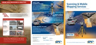
Versatile Mobile Mapping
for Geospatial Surveys
Range Accuracy Measurement Rate
250m up to 1cm
Dual laser head:
72000 points per second
Capacity Sensor Resolution Range
up to 50 min flight time 36 megapixels 52km
Range Accuracy Measurement Rate
340m 2mm / 80m
1 million points
per second
static laser scanning solution mobile spatial mapping solution aerial imaging solution
High Performance for
Demanding Applications
The Trimble TX8 is ideal for capturing detailed data on
existing conditions. Making high-speed measurements
without compromising range or precision, the Trimble
TX8 delivers high-density 3D point clouds.
Applications
GIS
• Assets Management
• Road Maintenance
• Services
• Utilities
Water
• Combined Bathymetry
• Waterways
• Harbours
• Logistics
Logistic
• Transportation
• Airports
• Harbours
• Industrial
Mining
• Stockpiles
• Volume Computations
• Monitoring
• Site Inspection
Earthworks
• Stockpiles
• Volume Computations
• Roading
• Site Inspections
Applications
• Boundary & topographic surveys
• Survey grade mapping
• Power line modeling
• Shoreline mapping
• Site & route planning
• Progress monitoring / reporting
• As-built surveys
• Resource mapping
• Disaster analyses
• Volume determinations
• Quarry inspections
• Asset inspection
Gulf Positioning provides the services you need to effectively manage your projectMAP | MEASURE | MODEL
High Precision for
Survey Applications
The Trimble UX5 HP is a professional aerial mapping
system, designed to capture the highest image
accuracy for survey applications. New UX5 High
Precision includes an integrated Trimble GNSS
receiver and a powerful new camera.
Applications
2D Modeling
3D Animations
3D Modeling
Aerial LiDAR
As-Built Surveys
BIM Conversion
CAD Conversion
Construction Monitoring
Deformation Analysis
Floor Flatness
GIS Integration
Land Surveying
Photogrammetry
Revit Modeling CAD
Scan to BIM
Terrestrial Laser Scanning