Download to read offline


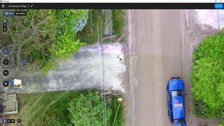

![18 | www.pix4d.com
“[...] Being able to work offline is crucial [...]”
Nick Guadagnoli,
Technology Solutions Manager for 4Rivers Equipment
What makes Pix4Dfields
unique #1?
In field results
Create maps rapidly (no internet
connection required) for decision making
and action, without leaving the field](https://image.slidesharecdn.com/uascoaprilrmuaspmeetupwpix4d-200415000551/85/UAS-RMUASP-Meetup-with-PIX4D-18-320.jpg)
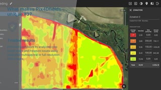
![What makes Pix4Dfields
unique #2?
Reliable maps
Always get maps of your fields and crops
at any critical stage regardless of satellite
availability and cloud cover.
“Processing speed coupled with great
analytics, [...] No other software can
achieve this level of efficiency”
Nicholaus Helwig
Owner Pinpoint Aerial Solutions](https://image.slidesharecdn.com/uascoaprilrmuaspmeetupwpix4d-200415000551/85/UAS-RMUASP-Meetup-with-PIX4D-19-320.jpg)
![What makes Pix4Dfields
unique #4?
Connected
Connect your data to platforms like the
John Deere Operations Center,
synchronize and access your data in-
office and in-field for streamlined
collaboration
“it also eliminates mistakes caused by
handwritten documentation [...] which can
lead to costly crop destruction due to
under or over-application of the product.”](https://image.slidesharecdn.com/uascoaprilrmuaspmeetupwpix4d-200415000551/85/UAS-RMUASP-Meetup-with-PIX4D-22-320.jpg)


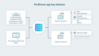

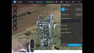

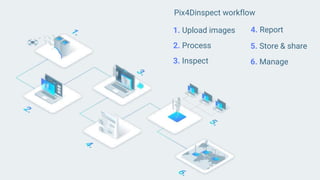


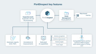


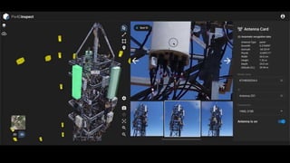


The summary discusses the RMUASP April Virtual Meetup agenda and announcements. It mentions that several in-person events were postponed due to COVID-19, including the Spring UAS Round Up in April and Xponential in May. Pix4D then presented on their new photogrammetry products, including Pix4Dmapper, Pix4Dreact, Pix4Dfields, Pix4Dsurvey, Pix4Dmatic, Pix4Dscan, and Pix4Dinspect. They also discussed their training platform and opportunities for certification.


