
Recommended
Recommended
More Related Content
What's hot
What's hot (20)
Similar to PHILIPPINE-CULTURE-LESSON-1.pptx
Similar to PHILIPPINE-CULTURE-LESSON-1.pptx (20)
Recently uploaded
Recently uploaded (20)
PHILIPPINE-CULTURE-LESSON-1.pptx
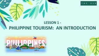
- 1. LESSON 1 - PHILIPPINE TOURISM: AN INTRODUCTION T H C 3 1 9
- 4. Tourism • Tourism is the act and process of spending time away from home in pursuit of recreation, relaxation, and pleasure, while making use of the commercial provision of services. • Tourism is the activities of persons traveling to and staying in places outside their usual environment for not more than one year for leisure, business, and other purposes.
- 5. Tourist • Travelers who stay at least 24 hours at their destination. • Travelers who stay not more than 24 hours at their destination. Excurtionist VS
- 6. D e p a r t m e n t o f T o u r i s m • The Department of Tourism (Filipino: Kagawaran ng Turismo, DOT) is the executive department of the Philippine government responsible for the regulation of the Philippine tourism industry and the promotion of the Philippines as a tourist destination. • In 1973, President Ferdinand Marcos created a new cabinet-level Department of Tourism (DOT) by splitting the Department of Trade and Tourism into two separate departments. Included in the new Department of Tourism, the agency Philippine Tourism Authority (PTA) and the Philippine Convention Bureau (PCB) were created.
- 7. DOT Secretary • Maria Esperanza Christina Garcia Frasco • (born December 25, 1981) is the current Secretary of the Department of Tourism after being appointed by President Ferdinand “Bongbong” Marcos Jr. in 2022, and the youngest member of the Cabinet so far.
- 9. B A S I C F A C T S A B O U T T H E P H I L I P P I N E S Country Name: Republic of the Philippines Official Language: Filipino and English Capital: Manila Flag: The national flag consists of awhite equilateral triangle atthe hoist, with a blue stripeextending from its upper sideand a red stripe extendingfrom its lower side. Insideeach angle of the triangle is ayellow five-pointed star, andin its center is a yellow sunwith eight rays. National Anthem: Lupang Hinirang Head of State: Ferdinand "Bongbong" Romualdez Marcos Jr
- 10. B A S I C F A C T S A B O U T T H E P H I L I P P I N E S Geographic Division: 3 Major Island Group:Luzon, Visayas andMindanao Religion: 80 % of Filipinos belong to theRoman Catholic faith, wheremany practices and beliefs arerooted. About 15 % is Muslim,and these people can be foundbasically in Mindanao. The rest ofthe population is made upmostly of smaller Christiandenominations and Buddhists Literacy Rate: 96.29% Highest Point: Mount Apo
- 12. Geography • The Philippines is an archipelago of 7,641 islands (Barile 2017). It is bounded by the east by the Pacific ocean, on the south by Celebes Sea, and on the west and north by the South China Sea.
- 13. Largest Island in the Philippines • Luzon Island, located in the northern region of the archipelago, Having an area of 42,458 square miles, Luzon is further subdivided into four major areas—Northern Luzon, Central Luzon, Southern Luzon, and the National Capital Region. Smallest Island in the Philippines • The Philippines consists of thousands of islands and there is no known smallest island using any known technical definition and due to high tide and low tide variations.
- 14. REGIONS • REGION I - ILOCOS • REGION II - CAGAYAN VALLEY • REGION III - CENTRAL LUZON • REGION IV-A - SOUTHERN TAGALOG • REGION IV-B - MIMAROPA • REGION V - BICOL • REGION VI - WESTERN VISAYAS • REGION VII - CENTRAL VISAYAS
- 15. REGIONS • REGION VIII - EASTERN VISAYAS • REGION IX - WESTERN MINDANAO • REGION X - NORTHERN MINDANAO • Region XI - SOUTHERN MINDANAO • Region XII - CENTRAL MINDANAO • Region XIII - CARAGA REGION • ARMM - AUTONOMOUS REGION OF MUSLIM MINDANAO • CAR - CORDILLERA ADMINISTRATIVE REGION • NCR - NATIONAL CAPITAL REGION
- 16. Climate Infor mation • The first half of the year, from January to May, is the best time to visit the country. November to February is cool, while March to May is hot and dry. June to October is rainy, with the months between July and September characterized by typhoons. Average temperature is 78 degrees F/25 degrees C; average humidity is 77%.
- 17. IATA Codes
- 18. I n t e r n a t i o n a l A i r T r a n s p o r t A s s o c i a t i o n • An IATA airport code, also known as an IATA location identifier, IATA station code, or simply a location identifier, is a three-character alphanumeric geocode designating many airports and metropolitan areas around the world, defined by the International Air Transport Association.
- 20. AIRPORT NAME IATA CODE NAIA MNL MACTAN CEBU INTERNATIONAL AIRPORT CEB ILOILO INTERNTAINAL AIRPORT ILO DAVAO INTERNATIONAL AIRPORT DVO CLARK INTERNATIONAL AIRPORT CRK GENERAL SANTOS INTERNATIONAL AIRPORT GES
- 21. TIME ZONE
- 22. • A time zone is an area which observes a uniform standard time for legal, commercial and social purposes. Time zones tend to follow the boundaries between countries and their subdivisions instead of strictly following longitude, because it is convenient for areas in frequent communication to keep the same time. • All time zones are defined as offsets from Coordinated Universal Time (UTC), ranging from UTC−12:00 to UTC+14:00.
- 24. Map Reading and GPS
- 25. PA P E R M A P V S G P S M A P
- 26. PA P E R M A P V S G P S M A P • A paper map is a simple, time-tested means for connecting you to your surroundings, spatially and directionally. Using an atlas or a fold-out paper map, I can estimate mileage extremely accurately and get a better sense of travel time, obstacles, and how long various legs of the trip will take. • What GPS map means? • The Global Positioning System (GPS) is a navigation system using satellites, a receiver and algorithms to synchronize location, velocity and time data for air, sea and land travel
- 28. P h o n e t i c A l p h a b e t
- 29. W h a t I s M i l i t a r y T i m e ? • Military time is a day clock that measures hours to 24 instead of 12 hours like civilian time. Military time is used to avoid confusion between a.m. and p.m. hours. The 24-clock is used by militaries, most European countries, and businesses engaged in 24-hour operations, like airlines and railroads.
- 30. MILITARY TIME
- 31. H o w D o Y o u R e a d M i l i t a r y T i m e ? • Military time read and spoken to four digits. A leading 0 is read or spoken for the first 12 hours of the day. On radio and for maximum clarity, every digit is spoken. When reading or in casual conversation, times can be read as three- or four-digit numbers: • 0000 – Midnight and the start of the day is called "Zero hundred hours." • 0100 – One a.m. is "Zero one hundred hours." • 0630 – 6:30 a.m. is "Zero six-thirty," or (better) "Zero six-three-zero." • 1045 – 10:45 a.m. is read or spoken as "Ten hundred forty-five" or "Ten hundred four-five." • 1159 – A minute before noon is "Eleven hundred fifty-nine" or "Eleven hundred five- niner."
- 32. M i d n i g h t I n M i l i t a r y T i m e • In the 24-hour format, midnight has two designations, • 0000 and 2400 • If your day begins at midnight, you use 0000 in military time, pronounced "zero hundred hours." • If your day ends at midnight, you end your day at 2400, pronounced "24 hundred hours."
- 33. THANK YOU!
Editor's Notes
- Started as a private initiative to promote the Philippines as a major travel destination, the Philippine Tourist & Travel Association was organized in 1950. In 1956, the Board of Travel and Tourist Industry was created by Congress As stipulated in the Integrated Reorganization Plan in 1972 sanctioned as a law under Presidential Decree No. 2, as amended, the Department of Trade and Tourism was established, reorganizing the then Department of Commerce and Industry. A Philippine Tourism Commission was created under the unified Trade and Tourism Department to oversee the growth of the tourism industry as a source of economic benefit for the country.
- The Philippines is a beautiful and archipelagic country. On top of its natural and cultural/heritage attractions are the friendliest, most hardworking, and considered the most hospitable people in the world. Filipinos are bilingual, making it easy for foreign tourists communicate with locals of different destinations.
- is the country's largest and most populous island. It also has the greatest population among the three island groups. which is home to the country's capital, Manila and is the country's center of economic, social, cultural, and financial development (Vallejo 2014 and Valdeavilla 2018).
- is the country's largest and most populous island. It also has the greatest population among the three island groups. which is home to the country's capital, Manila and is the country's center of economic, social, cultural, and financial development (Vallejo 2014 and Valdeavilla 2018).
- is the country's largest and most populous island. It also has the greatest population among the three island groups. which is home to the country's capital, Manila and is the country's center of economic, social, cultural, and financial development (Vallejo 2014 and Valdeavilla 2018).