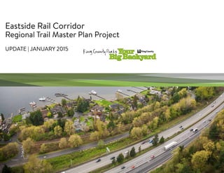
4. EASTSIDE RAIL CORRIDOR REGIONAL TRAIL MASTER PLAN PROJECT
4
Coordinating Efforts
Sound Transit
• East Link light rail
• Operations and Maintenance
Facility (OMSF) final design
• Sound Transit Phase 3 plan
Puget Sound Energy
• Energize Eastside process
City of Kirkland
City of Redmond
Washington State Dept. of
Transportation
Others
5. EASTSIDE RAIL CORRIDOR REGIONAL TRAIL MASTER PLAN PROJECT
5
Master Plan Progress
• Corridor inventories complete
• Ecological resources
• Narrow right-of-way/
encroachments
• Intersections/crossings
• Steep slopes
• Historic resources
• Adjacent land uses
• Coordinating with partner
jurisdictions to finalize trail
connection studies
6. EASTSIDE RAIL CORRIDOR REGIONAL TRAIL MASTER PLAN PROJECT
6
77 WETLANDS
37 STREAMS
28 JURISDICTIONAL DITCHES
MAJOR STREAM CROSSINGS:
MAY CREEK
COAL CREEK
STURTEVANT CREEK
W.TRIB KELSEY CREEK
Ecological Resources
7. EASTSIDE RAIL CORRIDOR REGIONAL TRAIL MASTER PLAN PROJECT
7
3.1 MILES LESS THAN 50’ WIDTH
2.3 MILES 50’-75’ WIDTH
6.8 MILES 75’-100’
4 MILES 100’+
Narrow Right-Of-Way/
Encroachments
8. EASTSIDE RAIL CORRIDOR REGIONAL TRAIL MASTER PLAN PROJECT
8
19 ROADS
(11 ARTERIALS, 8 LOCAL ROADS)
18 DRIVEWAYS
MAJOR ROAD CROSSINGS:
SE 1ST ST (BELLEVUE)
NE 6TH ST (BELLEVUE)
NE 8TH ST (BELLEVUE)
WILLOWS ROAD (WOODINVILLE)
Intersections/Crossings
9. EASTSIDE RAIL CORRIDOR REGIONAL TRAIL MASTER PLAN PROJECT
9
Steep Slopes
9.3 MILES OVER 20% SIDE-SLOPE
• 7.8 MILES 20%-40% SIDE-SLOPE
• 1.5 MILES OVER 40% SIDE-SLOPE
10. EASTSIDE RAIL CORRIDOR REGIONAL TRAIL MASTER PLAN PROJECT
10
Historic Resources
• Railroad artifacts throughout
the corridor- signs, switches,
signals, tracks and ties.
• Wilburton Trestle historically
significant.
• Railroad story is an opportunity
for interpretation and design
expression.
11. EASTSIDE RAIL CORRIDOR REGIONAL TRAIL MASTER PLAN PROJECT
11
Adjacent Land Uses
(including both sides of ROW)
13.5 MILES RESIDENTIAL
10 MILES INDUSTRIAL
5.3 MILES COMMERCIAL/
OFFICE
1.5 MILES AGRICULTURE
1.1 MILES PARKS & OPEN SPACE
12. EASTSIDE RAIL CORRIDOR REGIONAL TRAIL MASTER PLAN PROJECT
12
Combined Corridor Constraints
3.1 MILES UNCONSTRAINED CORRIDOR
(Over 75’ width, no water resources, under 20% slope)
• 3.1 miles less than 50’ width
• 6.5 miles adjacent to water resources
• 6.6 miles over 20% side-slope
14. EASTSIDE RAIL CORRIDOR REGIONAL TRAIL MASTER PLAN PROJECT
14
Master Plan Development
• Begins with RAC vision and goals
-- Long-term vision
-- Multiple uses
• Specific to Regional Trail Master Plan
-- Fits in corridor with respective
multiple uses
15. EASTSIDE RAIL CORRIDOR REGIONAL TRAIL MASTER PLAN PROJECT
15
Opportunities:
• Non-motorized transportation
• Recreational opportunities and
equitable access
• Community economic development/
quality of life
Guiding Principles:
• Plan for a Regional Trail without
Precluding Future Use for Transit and
Utilities
• Meet Railbanking obligations
16. EASTSIDE RAIL CORRIDOR REGIONAL TRAIL MASTER PLAN PROJECT
16
MULTIPLE USE PLANNING ENVELOPES
18’
20’
98’
35’
25’
REGIONAL TRAIL
MINIMUM STANDARD
Baseline Space Needs
MULTIPLE USE PLANNING ENVELOPES
18’
SEWER GAS
20’
98’
35’
25’
17. EASTSIDE RAIL CORRIDOR REGIONAL TRAIL MASTER PLAN PROJECT
17
Narrow, Sloping Corridor
• In this narrow section, all uses
can only be accommodated with
elevated light rail tracks.
60’60’
60’
18. EASTSIDE RAIL CORRIDOR REGIONAL TRAIL MASTER PLAN PROJECT
18
Narrow, Sloping Corridor: Existing Condition
Existing section shows railbed
with adjacent road and residences.
19. EASTSIDE RAIL CORRIDOR REGIONAL TRAIL MASTER PLAN PROJECT
19
Narrow, Sloping Corridor: Multiple Use Option
Elevated light rail may allow
space for both heavy rail and
utilities along with a trail.
20. EASTSIDE RAIL CORRIDOR REGIONAL TRAIL MASTER PLAN PROJECT
20
Narrow, Sloping Corridor: Trail Placement Alternatives
Trail off railbed may allow future
uses without relocating trail.
Trail on railbed would likely
need relocation to allow
other uses.
21. EASTSIDE RAIL CORRIDOR REGIONAL TRAIL MASTER PLAN PROJECT
21
75’
75’
75’
Sloping Corridor with Wetland
Potential multi-use layouts locate a
trail on boardwalk in the wetland area,
with rail uses upslope and power lines
downslope. It may not be possible to
accommodate all uses with
at-grade light rail.
75’
22. EASTSIDE RAIL CORRIDOR REGIONAL TRAIL MASTER PLAN PROJECT
22
Sloping Corridor with Wetland: Existing Condition
Existing section shows forested wetland
and adjacent commercial use.
23. EASTSIDE RAIL CORRIDOR REGIONAL TRAIL MASTER PLAN PROJECT
23
Sloping Corridor with Wetland: Multi-Use Option I
One multi-use scenario includes
at-grade light rail and trail
on elevated boardwalk
along with power
transmission.
Future reestablishment of
freight rail may require
relocation of trail or
power lines.
24. EASTSIDE RAIL CORRIDOR REGIONAL TRAIL MASTER PLAN PROJECT
24
Sloping Corridor with Wetland: Multi-Use Option II
Elevated light rail could allow
space for light rail, heavy rail,
trail, and power transmission.
25. EASTSIDE RAIL CORRIDOR REGIONAL TRAIL MASTER PLAN PROJECT
25
Sloping Corridor with Wetland: Trail Placement Alternatives
Trail developed on boardwalk preserves
railbed for potential future uses.
Trail developed on the railbed
avoids wetland impacts prior to
development of other uses.
26. EASTSIDE RAIL CORRIDOR REGIONAL TRAIL MASTER PLAN PROJECT
26
VISIONING
∙ Engage public and stakeholders
∙ Communicate RAC Vision
∙ Develop and communicate KC
Parks vision and goals
ANALYSIS
∙ Engage public and stakeholders
∙ Begin SEPA scoping
∙ Identify alternatives for achieving
goals and objectives
∙ Evaluate tradeoffs and impacts
DELIVERABLES
∙ Engage public and stakeholders
∙ Issue Draft Master Plan/EIS
∙ Review comments
∙ Discuss implementation strategies
and priorities
∙ Select preferred alternative
∙ Issue Final Master Plan/EIS
∙ Council adoption (Q3, 2016)
1ST AND 2ND QUARTER 2015 1ST AND 2ND QUARTER 20163RD AND 4TH QUARTER 2015