Construction of joka majherhat phase-i metro corridor considering the requirement of mrts in city of kolkata
•Download as PPT, PDF•
10 likes•4,886 views


Recommended
Recommended
More Related Content
What's hot
What's hot (20)
Viewers also liked
Viewers also liked (20)
Similar to Construction of joka majherhat phase-i metro corridor considering the requirement of mrts in city of kolkata
Similar to Construction of joka majherhat phase-i metro corridor considering the requirement of mrts in city of kolkata (20)
More from Rajesh Prasad
More from Rajesh Prasad (20)
Recently uploaded
Recently uploaded (20)
Construction of joka majherhat phase-i metro corridor considering the requirement of mrts in city of kolkata
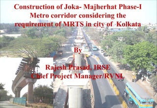
- 1. Construction of Joka- Majherhat Phase-I Metro corridor considering the requirement of MRTS in city of Kolkata By Rajesh Prasad, IRSE Chief Project Manager/RVNL
- 2. CONTENTS Kolkata : A few highlights Various modes of Transport Problems of high vehicular growth Why to have more Metro in megacity like Kolkata? Cost Analysis for Viaduct vis-à-vis Underground. Role of RVNL for implementation of Metro Corridors in Kolkata Planning and Execution of Joka – BBD Bag Part Section Drawing Management System Launching of Segments.
- 3. KOLKATA : City of Joy Also known as – Cultural Capital of India Literary Capital of India City of Creative Energy City of Architecture City of Brides of India City of Football in India Paris of East of India
- 4. City of Job Charnock (1690) (3 villages - Kalikata, Sutanuti & Gobindpur) “City of Processions” Jawahar Lal Nehru “A Dying City” Rajiv Gandhi “ City of Joy” Dominique Lapierre “Don’t worry Kolkata” Usha Uthup
- 5. KOLKATA : (Calcutta - Gateway to Eastern Region) Kolkata was the capital of India till 1912.Kolkata was the capital of India till 1912. The second train in India from Howrah to Hooghly in 1854The second train in India from Howrah to Hooghly in 1854 The first Tramways ServicesThe first Tramways Services in Indiain India (horse drawn) in(horse drawn) in Kolkata in 1873Kolkata in 1873 The first u/g Metro Railway in India started in Kolkata inThe first u/g Metro Railway in India started in Kolkata in 19841984 The circular Railway in 1990.The circular Railway in 1990. A city with all different modes of transportation.A city with all different modes of transportation. 84 KMs Metro network was sanctioned by Ministry of84 KMs Metro network was sanctioned by Ministry of
- 6. KOLKATA being turned into CITY OF SORROW
- 7. Tram Service Water Transport Bus Service Circular Railway Metro Railway
- 8. Tram Service at a glance In eighties 275 cars used to carry 0.75 million passengers. As per RITES - 2004 trams carry 1.90 lakh passenger on an average week day.
- 9. 68 KMs double track of standard gauge in operation of which only 25 kms are in reserved right-of-way. Tram tracks have become major source of problem due to inadequate maintenance, non- investment of capital and mixed traffic operation. 6 KMs removed in July 2011 Joka - B.B.D. Bag Metro Section. Tram Service at Kolkata
- 10. Water Transport System at and around Kolkata In Kolkata and Howrah, water ferries are used through the extensive ghats like Fairlie Ghat, Howrah Ghat, Shibpur Ghat, Prinsep Ghat, Cossipore Ghat. There were plans to start utilizing the canals running through the city as water- transport network.
- 11. BUS SYSTEM Kolkata State Transport Corporation (KSTC) Kolkata Tramway Company (KTC) West Bengal Surface Transport Corporation (WBSTC) North Bengal State Transport Corporation (NBSTC) South Bengal State Transport Corporation (SBSTC) Private Bus Syndicates Other Hired/Charted Bus Operators.
- 12. The construction of Circular Railway from DDJ to Princep Ghat (13.42 km) was sanctioned in the year 1983 - 84 at a total cost of Rs. 35.49 Crore. The construction work was taken in hand in July '1983 and full of stretch of 13.42 km was opened for passenger traffic in June '1990. Section between Princep Ghat and Majerhat was opened in 2006. Circular RailwayCircular Railway
- 13. Existing Metro net work
- 14. North-South Axis (Dum Dum to Tollygunge) 16.45 Kms was sanctioned on 1.6.1972. 1st Commercial run of the 1st Underground Metro Rly in India commenced on 24.10.1984 (between Esplanade and Bhowanipur (now Netaji Bhavan) Section wise opening in stages :- Section Distance Opening Date Esplanade - Netaji Bhavan 3.40 km 24.10.1984 Dum Dum - Belgachia 2.15 km 12.11.1984 Tollygunge -Netaji Bhavan 4.24 km 29.04.1986 Belgachia - Shyambazar 1.62 km 13.08.1994 Esplanade -Chandni Chowk 0.71 km 02.10.1994 Chandni Chowk - Central 0.60 km 19.02.1995 Shyambazar - Girish Park 1.93 km 19.02.1995 Dum Dum - Tollygunge 16.45 km 27.09.1995
- 15. POPULATION AND VEHICLE GROWTH
- 16. K M Area– Population ( in Lakhs) 54.56 57.84 68.46 78.74
- 17. Kolkata – Population As per INDIA 2011 Area (Sq. Km) Population North 24 Parganas 4094 89.30 Lakhs South 24 Parganas 9660 69.09 Lakhs In 2000 Kolkata - 13.1 million In 2015 Kolkata – 17.1 million
- 18. Kolkata – Population The density of population is 33,000 per square kilometer. Overcrowding has reached virtually intolerable proportions in many sections of the city. Kolkata has experienced a high rate of population growth for more than a century.
- 19. Kolkata (KMA)– Vehicles Total No. of vehicles as on 31 March 2010 – 18.75 Lakhs More than 10000 new vehicles are being registered in Kolkata per month
- 20. COMPARISION OF THREE METRO CITIES (AREA AND ROAD LENGTH) Source –Transport Department
- 21. About Existing Roads of Kolkata • Road space of Kolkata is about-6%. But effective Road space available for traffic movement is 5% only. • Road space of Delhi - 23%, Mumbai - 18% Chennai - 14%
- 22. Traffic Congestion is a normal phenomenon Frequent traffic congestion at most traffic junctions along the Metro Corridor of Kolkata
- 23. Air Pollution STANDARD RPM & NOX = 60,SPM = 140 Daily average micro gms / m3 Source -PCB
- 24. Present Average Noise levelPresent Average Noise level Peak Noise level recordedPeak Noise level recorded Permitted Noise levelPermitted Noise level Noise Pollution Contd.. 70 dB70 dB 80 dB80 dB 60 dB60 dB
- 25. Noise Pollution Location Noise Level (dB) Howrah Bridge Approach 97 Moulali, Bara Bazar 95 Hazra, Jadavpur, New Market 80 Zone Day Night Industrial 75 70 Commercial 65 55 Residential 55 45 Silence Zone 50 50 Noise Pollution Standards
- 26. Widening of RoadsWidening of Roads Limited ScopeLimited Scope due to lack ofdue to lack of road spaceroad space Remedies to the Traffic ProblemsRemedies to the Traffic Problems
- 27. Construction of Flyover-Construction of Flyover- Limited scope due to financialLimited scope due to financial and space involvementand space involvement Remedies to the Traffic Problems in KolkataRemedies to the Traffic Problems in Kolkata
- 28. Remedies to the Traffic ProblemsRemedies to the Traffic Problems Surface Metro SystemSurface Metro System Not Possible due to non availabilityNot Possible due to non availability of large open, continuousof large open, continuous strech of landstrech of land • Frequent CrossingFrequent Crossing will pose problemwill pose problem
- 29. Grade Separated Mass Rapid Transit SystemGrade Separated Mass Rapid Transit System (Most appropriate solution)(Most appropriate solution)
- 30. Metro Rail - Advantages Requires 1/5th energy per passenger km compared to road-based transport system. Causes less noise, no air pollution and eco friendly transport system. Occupies no road space if underground and only about 3.0 mtrs width of the road if elevated More reliable, comfortable and safer than road based systems Reduces journey time.
- 31. KOLKATA METRO BEING EXECUTED BY RVNL SALIENT FEATURES
- 32. SEORAPFULI BARRACKPUR TITAGARH RISHRA KHARDAH SODEPUR KONNAGAR AGARPARA DANKUNI UTTARPARA BELA NAGAR BELGHARIA BISARPARA NEW BARRACKPUR BIRATI RAJCHANDRAPUR BALLY BALLY HALT BELUR LILUAH TIKIAPARADASNAGAR RAMRAJATALA HOWRAH PADMAPUKUR BRACE BRIDGE MAJHERHAT NEW ALIPORE TOLLYGUNGE LAKE GARDENS DHAKURIA JADABPUR BAGHA JATIN GARIA NARENDRAPUR SEALDAH GURUDAS HALT BIDHAN NAGAR RD. DUM DUM DUM DUM CANT. DURGA NAGARBARANAGAR RD. DUM DUM ROAD HIND MOTOR SHRIRAMPUR SOUTH 24 PARGANAS GOBRA SANTRAGACHI BALLYGUNGE PARK CIRCUS BALLY GHAT DAKSHINESWAR SHALIMAR KOLKATA SHOBHABAZAR PARK STREET RABINDRA SAROBAR MAHANAYAK UTTAM KUMAR NEW GARIA SHAHID KHUDIRAM NETAJI SHAHID SURYASEN GEETANJALI KAVI NAZRUL RABINDRA SADAN MAIDAN J.D PARK NETAJI BHAVAN KALIGHAT ESPLANADE CHANDNI CHOWK M.G ROAD CENTRAL GIRISH PARK SHYAM BAZAR BELGACHIA NOAPARA BARANAGAR BIMAN BANDAR DAKSHINESWAR B.B.D BAGH JOKA PROP.BARANAGAR-BARRACKPORE P R O P . N O A P A R A - B A R A S A T M E T R O E X T N . JOKA KM.-1.16 BEHALA CHOWRASTA KM.4.87 MAJERHAT KM.8.26 KHIDDIRPUR KM.10.740 PARK ST. KM.13.42 HASTINGS KM.11.55 MOMINPUR KM.9.456 THAKURPUKUR BAZAR KM.1.45 SAKHER BAZAR KM.2.97 BEHALA BAZAR KM.6.08 TARATALA KM.7.25 KM.0.00 KM.15.56 KM.15.86 ESPLANADE PANIHATI KHARDAH TITAGARH RAMKRISHNA PALLI SHANTI NAGAR JESSOR RD DUM DUM CANT 2.60KM 5.0KM 4.55KM 2.5KM KAMARHATI 2.5KM 4.5KM 6.0KM 8.0KM 10.0KM 12.5KM AGARPARA RUBY HOSPITAL SCIENCE CITY E.W CORRIDOR D E P O T SATYAJIT ROY MUKUND PUR KALIKA PUR V I P BAZAR CHINGRIGHATA NICCO PARK SECTOR V RAJARHAT NEW TOWN HALDIRAM CONVENTION CENTER (2.0Km EX.BARANAGAR) (0.0Km) (5.2Km EX.DUM DUM) (0.0Km) (2.09Km EX.DMI) (UP 6.15Km) (DN 6.4Km) BIRATI (UP 7.75Km) (DN 8.00Km) NEW BARRACKPUR (UP 10.75Km) (DN 11.00Km) MADHYAMGRAM (UP 13.35Km) (DN 13.60Km) HRIDAYPUR (UP 15.80Km) (DN 16.05Km) BARASAT (UP 17.88Km) (DN 18.13Km) Under operation -22.3 Km Dumdum-Kavi Nazrul New Metro Rail Projects by RVNL Joka-BBD Bag, 16.75 km Noapara- Baranagar- Dakshineswar-Barackpur -14.50 km Dumdum- Barasat via Airport -18.13 km by Metro Railway Kolkata Recently commissioned-2.90 Km Kavi Nazrul – Kavi Subhash Dumdum-Noapara by Metro Railway Kolkata Howrah Maidan Salt lake Sec-v E-W CORRIDOR Under Construction by KMRCL NEW TOWN New Garia- Dumdum- via New Town 32.00 km BARANAGAR AIRPORT BARANAGAR NEW GARIA NEW TOWN AIRPORT NEW GARIA METRO RAIL IN KOLKATA
- 33. (1) Route alignment: Noapara(Ex.) to Baranagar (2.627Km) & Baranagar to Dakshineswar (2Km). Baranagar to Barrackpore (12.5 Km) Metro Corridor. Joka to BBD Bag Via Majerhat (16.72Km) Metro Corridor. DumDum Airport to New Garia (32Km) Metro Corridor.
- 34. Salient Feature of Joka-BBD Bagh Metro Corridor • Total Length (Jaka -BBD Bag) - 16.75Km. • Elevated – (Joka - Mominpur) - 9.0 Km. • Underground – (Mominpur-BBD Bag) - 7.75Km. • Total No of Stations – 13 nos Elevated- 8 nos Underground- 5 nos Passenger Interface at – Majerhat (Suburban and Circular Railway). Park Street and Esplanade Metro Railway Station. Depot is to be setup Near Bakarahat Road adjacent to Chorialkhal.
- 35. Raw proposal at the stage of Sanction RITES engaged as Consultant for DPR etc. DDC contract engaged, IIT Delhi made proof consultant Clearance taken from State Govt. (Police, PWD, KMC, Environment etc.) Contract for Viaduct for Joka – Mominpur awarded in Dec’2010 and Stations in April 2012 Decision on removal of tramlines in May’ 2011.
- 36. Foundation Stone was laid by her Excellency, President of India, on 22.09.2010. Work for Viaduct awarded to M/s Simplex infrastructures on 28.12.10 and stations in April 2012 CES is DDC for viaduct and Stations and IIT Delhi is the proof consultant. Construction of piles, pile caps, piers and Girder is in progress between Joka & Majerhat (1185 nos. piles completed, 276 nos. pile cap completed, 273 nos. pier completed and 233 nos. Girder erected).
- 39. Details of the existing Diamond Harbour RoadDetails of the existing Diamond Harbour Road DETAILS OF D. H. ROAD AT STATIONS FOR JOKA-MOMINPUR SECTION (Facing BBD Bag) Chainage Location ROW LHS C.W. RHS C.W. Median Width Planned Width JOKA 0 Start 38.18 6.61 6.94 7.88 2X7.5Center 38.88 6.24 6.45 9.92 End 36.69 5.41 6.74 11.90 MAJERHAT 7607 Center 15.45 40.06 Off the Road Flyover MOMINPUR 8625 Start 25.99 13.32 5.83 1.06 2X7.5Center 26.33 12.53 5.89 1.07 End 25.87 13.36 8.56 1.06
- 40. Station Planning Joka Majerhat Corridor Name of Station Chainage (in km) Distance from previous Station (in m) Rail level (RL in m) Height/ Depth from Adjacent Ground Platform Types and Nos Alignment Description 1. Joka 00 -- 16.249 12.5 Side Platform - 2 Elevated, straight 1. Thakurpukar 1.455 1455 17.854 12.5 Side Platform - 2 Elevated, straight 1. Sakher Bazar 2.675 1220 17.896 12.5 Side Platform - 2 Elevated, straight 1. Behala Chowrasta 4.128 1453 18.961 12.5 Side Platform - 2 Elevated, straight 1. Behala Bazar 5.465 1337 19.916 12.5 Side Platform - 2 Elevated, straight 1. Taratala 6.450 0985 17.793 12.5 Side Platform - 2 Elevated, straight 1. Majerhat 7.607 1157 18.199 12.5 Side Platform - 2 Elevated, straight 1. Mominpur 8.625 1018 17.730 12.5 Side Platform - 2 Elevated, straight
- 41. Typical Station Layout 7500 7500 ¢ 2 5500MIN3000MIN 940 150 50 1090 3000 1520 2100 D=STAIRCASE/ ESCALATOR d=WORKING SPACE / FOOTPATH OPTION-2 7.5m CWBUILTUPEDGE 2500Dd BUILTUPEDGE 2500 D d 23000
- 42. Joka MID Section Thakkurrpuk ur MID Section ShakherBaz ar MID Section Behala Chowrasta MID Section Behala Bazar MID Section TaratalaMID Section Majerhat MID Section Mominp ur Chainage 0.00 0.65 1.46 1.81 2.68 2.99 4.13 4.45 5.46 6.1 6.45 6.72 7.607 8.13 8.625 PF Length 180m 180m 180m 180m 180m 180m 180m 180m High point Low Point High point Low Point High point Low Point High point Low Point High point Low Point High point Low Point High point Low Point High point Rail Level 16.5 14.824 18.4 15.352 17.8 16.172 19.1 16.419 19.8 15.183 17.8 14.98 18.199 14.9 17.73 Ground Level 3.317 3.35 4.791 4.445 4.189 4.968 5.682 6.129 6.074 6.184 4.588 4.69 6.692 4.63 5.515 Gradient 388 227 115 355 190 389 119 299 139 134 96 276 159 175 Energy saving due to gradient
- 43. Lithological log indicates the presence of a clay bed at the top of the geological succession with thickness varying from 10-40 mts. There is a further alternate clay and sand bed. A group of granular aquifer is found between 250-650 mts. below ground level. Geotechnical Details
- 44. Zone Number Approximate Chainage (km) Location Zone-I 0.000 to +1455 Joka Station to Thakurpukur Station Zone-II +1455 to +2675 Thakurpukur Station to Sakher Bazar Station Zone-III +2675 to +4128 Sakher Bazar Station to Behala Chowrasta Station Zone-IV +4128 to +5465 Behala Chowrasta Station to Behala Bazar Station Zone-V A +5465 to +6260 Behala Bazar Station to Taratala StationZone-V B +6260 to +6600 Zone-V C +6600 to +6900 Zone-VI +6900 to +7744 Taratala Station to Mazerhat Station Zone-VII +7744 to +8755 Mazerhat Station to Mominpur Station Zone-VIII 0.000 to -1250 Joka Station to Depot
- 45. TYPICAL SUBSOIL PROFILE IN JOKA-MAJERHAT SECTION
- 46. PILE CAPACITY 1200mm diameter piles are being used in the construction. For bored pile, load bearing capacity is calculated according to IS:2911 (Part-I/Sec-2)-1979. A summary of pile capacities along with the shaft length proposed is presented below: Pile diameter (mm) Pile cut-off level below EGL Horizont al Pile capacity (t) Vertical Pile capacity (t) Pile shaft length (m) 1200 2.3m 21.8t Maximum = 606 Maximum = 40 Minimum =384 Minimum =25 Average= 484 Average= 31.5
- 47. Sequence :Sequence : Road Widening Barricading on the Central Verge Checking of Utility Removal / sifting of utilities Execution of Metro Corridor (pile, Pile Cap, Pier) Setting of Two Casting yards at Pailan
- 49. Quality Control Lab at PailanQuality Control Lab at Pailan
- 50. Batching Plant + Casting Yard at PailanBatching Plant + Casting Yard at Pailan
- 56. Auto launching in Progress at Joka Site
- 57. Erection of Launching girder
- 58. Behala Chowrasta: Launching of Segments
- 59. Auto launching in Progress at Joka Site
- 60. ROAD DIVERSION FOR THIRD LAUNCHING GIRDER
- 62. Managing Drawing and DetailsManaging Drawing and Details inin Joka – Majerhat Metro Site.Joka – Majerhat Metro Site.
- 64. Precast Post tensioned segmental single cell box girders of spans varying from 19m to 31m with increments of 3m for standard spans. 50m Cast-in-place post tensioned box girder. Precast post tensioned I-girder made continuous for 4 spans at cross-over location. 2-span continuous post tensioned precast segmental box girder. STRUCTURETYPESSTRUCTURETYPES
- 65. Elastomeric bearings for transferring normal loads. Reaction block with/without cable restrainer for seismic loads. POT-PTFE bearings for long spans. STRUCTURETYPESSTRUCTURETYPES
- 66. Concentric piers of 1.95m circular section with heights varying from 11m to 18m (difference between Rail Top Level to Top of Pilecap). Inverted L-piers up to 2.0m maximum eccentricity between centre line of track and pier section. Portal piers at obligatory locations. STRUCTURETYPESSTRUCTURETYPES
- 67. 1200mm dia bored cast-in-situ reinforced concrete pile. Pile shaft length varying from 25m to 40m depending upon various types of soil strata. STRUCTURETYPESSTRUCTURETYPES
- 69. 10 types for standard simply supported spans based on span length and radius of curvature for 320 actual superstructure configurations. Two extreme radii of curvature are considered. One is the maximum radius, R → ∞ for straight alignment and other is the minimum radius of 202m. 5 types for non-standard spans. DESIGNTYPESDESIGNTYPES
- 70. 5 types of elastomeric bearings. 3 different sets of POT-PTFE bearings. DESIGNTYPESDESIGNTYPES
- 71. 41 design types for concentric piersand common piers for 275 actual pier configurations based on height of substructure, span on both side and curvature of alignment. This results in 15 types of reinforcement arrangement with reinforcement % varying from 1.50% to 5.40%. 11 design types for inverted L-piers for 30 actual pier configurations based eccentricity between track centerline and pier centerline in addition to those mentioned above. This results in 3 types of reinforcement arrangement with reinforcement % varying from 1.50% to 2.10%. (Contd…) DESIGNTYPESDESIGNTYPES
- 72. 2 design types for portal piers for 8 piers, one with two legs and other with three legs. DESIGNTYPESDESIGNTYPES 4- and 5-pile groups, in general.
- 76. Block Section wise details • Joka – Thakurpukur (P/26 to P/72) • Thakurpukur– Sakherbazar (P/73 to P/110) • Sabherbazar– Behala Chowrasta (P/111 to P/157) • Behala Chowrasta– Behala Bazar (P/158 to P/200) • Behala Bazar—Taratala (P/201 to P/232)
- 77. Erection of Girder - Scheme
- 78. Erection of Launching girder
- 79. PRECAST SEGMENTS Fabrication of reinforcement cage
- 80. PRECAST SEGMENTS Lifting of reinforcement cage using lifting beam Placement of reinforcement cage in shutter
- 81. PRECAST SEGMENTS Fixing of HDPE sheathing pipe for HT Strands Fixing of rail for inner trolley
- 82. PRECAST SEGMENTS Placement of inner trolley
- 83. PRECAST SEGMENTS Segment ready for casting
- 86. PRECAST SEGMENTS Application of curing compound and curing with water
- 103. LAUNCHING GIRDER BEING AUTO LAUNCHED
- 105. FIRST LAUNCHING GIRDER SECOND LAUNCHING GIRDER Launching Girder- I & II
- 106. Third Launching Girder Launching Girder- III & IV Fourth Launching Girder
- 107. Auto launching in Progress at Joka Site
- 108. Casting of Parapet
- 109. Erection of Parapet
- 110. Majerhat Station
- 111. GENERAL SUB-SOIL CHARACTERISTICS OF KOLKATA Normal Calcutta Deposit The Upper zone covering the softer components of normally consolidated subsoil, which in this region extends approximately about 15 metres below ground level. The second horizon comprises the stiffer or denser components occurring just beneath the first horizon and extends down to about 50 metres or more below the ground level. River Channel Deposits Superimposed features over the typical subsoil deposits of this region and basically consist of silty sand to sandy silt of considerable thickness. At a few locations the upper portion of this deposit has exhibited clayey silt to silty clay, most probably, in lenticular form. The sand deposit has been generally found to be fine to medium coarse.
- 112. Lifting of Segments/Erection of girders started in March 2012 within 2 years of sanction.
- 113. JOKA MAINTENANCE DEPOT :JOKA MAINTENANCE DEPOT :
- 114. Joka Depot Layout PlanJoka Depot Layout Plan
- 116. PROBLEM AREAS : Cross Road at Taratala
- 117. PROBLEM AREAS : Land of C-Comens / KOPT
- 118. Mint Boundary Wall PROBLEM AREAS : Land of MINT / KOPT
- 119. Mint Post Office PROBLEM AREAS : Land of MINT / KoPT
- 120. PROBLEM AREAS : Rehabilitation India plus Hutments / KOPT