SlideShare a Scribd company logo
1 of 64
Arc Hydro: GIS for Water Resources
• Arc Hydro
– Hydronetwork
– Drainage systems
– Channels
– Time Series
– Modeling
– Hydrologic integration
The Arc Hydro data model and
application tools are in the public
domain
GIS in Water Resources
Consortium
Bringing together these two communities by using a
common geospatial data model
Arc Hydro design took 3 years from 1999 - 2002
GIS
CRWR
CRWR
Water
Resources
Hydrologic Information System
Analysis, Modeling,
Decision Making
Arc Hydro
Geodatabase
Geographic Data Model
• Conceptual Model – a set of concepts that describe
a subject and allow reasoning about it
• Mathematical Model – a conceptual model
expressed in equations
• Data Model – a conceptual model expressed in a
data structure
• Geographic Data Model – a data model for
describing and reasoning about the world
What is Arc Hydro?
• A geographic data model for storing
geospatial and temporal water resources
data in ArcGIS
– A set of hydro objects built on top of
ArcObjects
– A set of standardized attributes
– A vocabulary for describing data (glossary)
– A toolset for implementing the data model
Flow
Time
Time Series
Hydrography
Hydro Network
Channel System
Drainage System
Arc Hydro Data Model
ArcGIS Hydro Data Model
Hydrography Hydrology
Streams
Drainage Areas
Hydrography
Channels
Terrain Surfaces
Rainfall Response
Digital Orthophotos
Data Model
Based on
Inventory
Data Model Based on Behavior
Follow a drop of water from where it falls on the
land, to the stream, and all the way to the ocean.
Integrating Data Inventory using
a Behavioral Model
Relationships between
objects linked by tracing path
of water movement
Streams
Watersheds Waterbody
Monitoring Points
Arc Hydro Framework Input Data
!(
!(
!(!(
!( !(!( !(
!( !(!(
!(
!(
!(!(
!(
!( !(!( !(
!( !(
!( !(!(
!( !(
!(
!(
!(
!(
!(
!(!(!( !(
!(
!(
!(
!( !(!(!( !( !(!(!( !(!(
!( !(!(
!( !(!(
!(
!(
!(!(!(
!(
!(
!(
!(
!(
!(
!(
!(
!(
!(
!(!(
!(
!(
Feature
Waterbody
HydroID
HydroCode
FType
Name
AreaSqKm
JunctionID
HydroPoint
HydroID
HydroCode
FType
Name
JunctionID
Watershed
HydroID
HydroCode
DrainID
AreaSqKm
JunctionID
NextDownID
ComplexEdgeFeature
EdgeType
Flow line
Shoreline
HydroEdge
HydroID
HydroCode
ReachCode
Name
LengthKm
LengthDown
FlowDir
FType
EdgeType
Enabled
SimpleJunctionFeature
1
HydroJunction
HydroID
HydroCode
NextDownID
LengthDown
DrainArea
FType
Enabled
AncillaryRole
*
1
*
HydroNetw ork
*
HydroJunction
HydroID
HydroCode
NextDownID
LengthDown
DrainArea
FType
Enabled
AncillaryRole
HydroJunction
HydroID
HydroCode
NextDownID
LengthDown
DrainArea
FType
Enabled
AncillaryRole
Arc Hydro Framework
National Hydro Data Programs
http://www.crwr.utexas.edu/giswr/nhdconf/nationalhydro.html
National Elevation Dataset
(NED)
National Hydrography Dataset
(NHD)
Watershed Boundary DatasetElevation Derivatives for
National Application (EDNA)
Arc Hydro Framework Dataset
for the Guadalupe Basin
HydroNetwork through Canyon Lake
Generic Junction
(for topological
connection of edges)
Flowlines through water body
Network Tracing
Upstream Tracing Downstream Tracing
HydroJunction has Waterbody Relationship
NWS forecast
Watersheds
(flooding)
EPA TMDL
Segments
(water quality)
TNRCC water
availability points
(water supply)
Guadalupe
HydroNetwork
Watersheds of the Guadalupe Basin
Scales of representation of Drainage Systems
Basins – drainage areas for water
resources management
Catchments – subdivision of
Basin into elementary drainage
areas by physical rules
Digital Elevation Model –
land surface terrain grid cells
Watersheds – subdivision of Basin
for a particular hydrologic purpose
Channel Cross-Section
Direction of Flow
Cross-Section
Channel
Channel ProfileLines
Guadalupe Network
Study area only
1.4 km!
1/2 meter Digital Ortho Photography
Study Area (Guadalupe river near Seguin, TX)
Boat setup for data collection
The electronic depth sounder operates in a similar way to radar It sends out an
electronic pulse which echoes back from the bed. The echo is timed electronically
and transposed into a reading of the depth of water.
Depth Sounder (Echo Sounder)
Differential GPS: Bank to Boat
GPS gives the location of each point collected in terms of
latitude and longitude. Two locations for differential GPS.
Channel Data
Each point has (x,y,z)
Interpolation
Points are interpolated
in ArcMap to produce a
continuous surface.
Centerline
Define the centerline along
the thalweg of the channel
Measure in ArcGIS
0
54.37 154.41
281.36
A PolylineM can store
m-values at each vertex
along with x and y
coordinates.
Measures are assigned in
meters
Coordinate Transformation
m is measure along
the centerline
r is distance across the
river from the
centerline
Sinuous river becomes
straight when
transformed into (m,r)
co-ordinates.
Coordinate Transformation
Sinuous river
Profile line and cross-sections
Straightened river
Straightened River in 3D
Data back to x,y coordinates
Original river in X,Y Profile lines and cross-sections in (x,y)
created using FishNet in (m,r).
Profile Lines and Cross Sections in 3D
Bird’s eye view!
TSDateTime
FeatureID
TSType
TSValue
Arc Hydro Time Series Object
National Water Information System
Web access to USGS
water resources data
Arc Hydro NWIS data
retrieval tool
Retrieving NWIS Data
• Select Gage
Layer
• Enter Period of
Record
Streamflow Time Series
Arc Hydro Time Series Table
Time Series Extracted to Excel
(In Excel, use Data/Get External Data to query Geodatabase)
Geodatabase
view
Excel
view
Nexrad Data for Florida
• Real-time Nexrad data
supplied every 15
minutes on a 2km grid
• Data from 14 radars
calibrated with 435
rain gages
• At end of month more
careful calibration is
done for historical rain
map archive
HRAP Cells for Nexrad Data
Average area = 14.5 km2
GIS and Hydrologic Modeling:
Where are we now?
• All the major hydrologic models have GIS data
support systems
– HEC-GeoHMS, HEC-GeoRAS, GIS-Weasel for MMS,
Mike-11GIS, WMS, ….
• An extensive body of experience in terrain
processing for hydrology has been built up
• Standardized national geospatial datasets for
hydrology
– National Elevation Dataset, EDNA, National
Hydrography Dataset, Watershed Boundary Dataset
GIS and Hydrologic Modeling:
Where are we going to?
• Integrated data and modeling systems e.g. Corps
Water Management System, EPA Basins, DHI Mike
Objects, …..
– Integration of observational (time series) data, geospatial
data, model-derived data
• Integration of vector, raster and time series data in a
database management system
• A language (vocabulary and grammar) for
communicating between databases and models e.g.
XML
Arc Hydro and Modeling
• Intrinsic Modeling – within a particular
application eg Excel, ArcGIS, custom
objects
• Dynamic Linked Library – tightly coupled
package of functions (e.g. LibHydro from
HEC)
• Independent Modeling – separate
hydrologic model with data exchange
Dynamic Linked Library
Can have
Fortran
subroutines
in a DLL
Muskingum
flow routing
Independent Hydrologic Model
VB progam reads and writes
text files
Analysis, Modeling,
Decision Making
Arc Hydro
Geodatabase
Visual Basic
ArcGIS
Relational Database
(Access)
Excel
Interfaces to Arc Hydro Data and Models
Atmospheric Water
Soil Water Surface Water
Groundwater
Vertical and Horizontal
Water Balance
Decoupling
and
connecting
hydrologic
systems
Model Building in ArcGIS 9
What software do you need?
• ArcView 8.2
– Viewing, querying existing geodatabases
– Editing feature classes and adding data
• Spatial Analyst for ArcGIS
– To operate the raster tools in Arc Hydro
• ArcInfo 8.2
– To build geometric networks and create new
relationships
Arc Hydro tools and data model are on CD at back of
Arc Hydro book and available on web at
http://archydro.crwr.utexas.edu
Learning Arc Hydro
• “Arc Hydro—GIS for Water Resources” book
from ESRI Press
• Tutorial on tools and sample dataset on CD at
back of book
• Exercises in Fall 2002 GIS in Water Resources
class http://www.ce.utexas.edu/prof/maidment
• GISWR website
http://www.crwr.utexas.edu/giswr
• ESRI’s Arc Online (discussion forum)

More Related Content

What's hot

Climate change impact assessment on hydrology on river basins
Climate change impact assessment on hydrology on river basinsClimate change impact assessment on hydrology on river basins
Climate change impact assessment on hydrology on river basinsAbhiram Kanigolla
 
Stream flow measurement
Stream flow  measurementStream flow  measurement
Stream flow measurementKiran Yadav
 
ARTIFICIAL RECHARGE OF GROUNDWATER
ARTIFICIAL RECHARGE OF GROUNDWATERARTIFICIAL RECHARGE OF GROUNDWATER
ARTIFICIAL RECHARGE OF GROUNDWATERNamitha M R
 
Seminar on Hydrological modelling
Seminar on Hydrological modellingSeminar on Hydrological modelling
Seminar on Hydrological modellingvishvam Pancholi
 
Water security and ecosystem services
Water security and ecosystem servicesWater security and ecosystem services
Water security and ecosystem servicesChristina Parmionova
 
Chapter one. River morphology.pptx
Chapter one. River morphology.pptxChapter one. River morphology.pptx
Chapter one. River morphology.pptxAmanuel Beza
 
1. Introduction Environmental Hydrology & Hydraulics.pdf
1. Introduction Environmental Hydrology & Hydraulics.pdf1. Introduction Environmental Hydrology & Hydraulics.pdf
1. Introduction Environmental Hydrology & Hydraulics.pdfmohamedabdo876288
 
Economic Valuation of water resources
Economic Valuation of water resources Economic Valuation of water resources
Economic Valuation of water resources virgo_az
 
Abstractions of precipitation ppt
Abstractions of precipitation pptAbstractions of precipitation ppt
Abstractions of precipitation pptpradeepkumawat4142
 
Introduction to Hydro informatics
Introduction to Hydro informatics Introduction to Hydro informatics
Introduction to Hydro informatics Mrinmoy Majumder
 
Chapter 3 surface water hydrology
Chapter 3 surface water hydrologyChapter 3 surface water hydrology
Chapter 3 surface water hydrologyMohammed Salahat
 
Lesson 12 river basin features
Lesson 12   river basin featuresLesson 12   river basin features
Lesson 12 river basin featuresDavid Rogers
 
Hydraulic structures pdf
Hydraulic structures pdfHydraulic structures pdf
Hydraulic structures pdfSaqib Imran
 

What's hot (20)

Climate change impact assessment on hydrology on river basins
Climate change impact assessment on hydrology on river basinsClimate change impact assessment on hydrology on river basins
Climate change impact assessment on hydrology on river basins
 
Sediments transport
Sediments transportSediments transport
Sediments transport
 
Stream flow measurement
Stream flow  measurementStream flow  measurement
Stream flow measurement
 
ARTIFICIAL RECHARGE OF GROUNDWATER
ARTIFICIAL RECHARGE OF GROUNDWATERARTIFICIAL RECHARGE OF GROUNDWATER
ARTIFICIAL RECHARGE OF GROUNDWATER
 
Seminar on Hydrological modelling
Seminar on Hydrological modellingSeminar on Hydrological modelling
Seminar on Hydrological modelling
 
Modern Trends in Hydrogeology
Modern Trends in HydrogeologyModern Trends in Hydrogeology
Modern Trends in Hydrogeology
 
Water security and ecosystem services
Water security and ecosystem servicesWater security and ecosystem services
Water security and ecosystem services
 
Chapter one. River morphology.pptx
Chapter one. River morphology.pptxChapter one. River morphology.pptx
Chapter one. River morphology.pptx
 
GROUNDWATER MODELING SYSTEM
GROUNDWATER MODELING SYSTEMGROUNDWATER MODELING SYSTEM
GROUNDWATER MODELING SYSTEM
 
1. Introduction Environmental Hydrology & Hydraulics.pdf
1. Introduction Environmental Hydrology & Hydraulics.pdf1. Introduction Environmental Hydrology & Hydraulics.pdf
1. Introduction Environmental Hydrology & Hydraulics.pdf
 
Water Chapter 1 Fetter - Applied Hydrogeology
Water Chapter 1 Fetter - Applied Hydrogeology Water Chapter 1 Fetter - Applied Hydrogeology
Water Chapter 1 Fetter - Applied Hydrogeology
 
Economic Valuation of water resources
Economic Valuation of water resources Economic Valuation of water resources
Economic Valuation of water resources
 
Water Resource Management
Water Resource ManagementWater Resource Management
Water Resource Management
 
Abstractions of precipitation ppt
Abstractions of precipitation pptAbstractions of precipitation ppt
Abstractions of precipitation ppt
 
Introduction to Hydro informatics
Introduction to Hydro informatics Introduction to Hydro informatics
Introduction to Hydro informatics
 
Stream flow
Stream flow Stream flow
Stream flow
 
Chapter 3 surface water hydrology
Chapter 3 surface water hydrologyChapter 3 surface water hydrology
Chapter 3 surface water hydrology
 
Lesson 12 river basin features
Lesson 12   river basin featuresLesson 12   river basin features
Lesson 12 river basin features
 
Hydraulic structures pdf
Hydraulic structures pdfHydraulic structures pdf
Hydraulic structures pdf
 
Climate Change Impacts on Hydrology and Water Quality
Climate Change Impacts on Hydrology and Water QualityClimate Change Impacts on Hydrology and Water Quality
Climate Change Impacts on Hydrology and Water Quality
 

Similar to Arc hydro

NMFWA ArcHydro: An Introduction
NMFWA ArcHydro: An IntroductionNMFWA ArcHydro: An Introduction
NMFWA ArcHydro: An IntroductionMichael DeMers
 
Implementing a VO archive for datacubes of galaxies
Implementing a VO archive for datacubes of galaxiesImplementing a VO archive for datacubes of galaxies
Implementing a VO archive for datacubes of galaxiesJose Enrique Ruiz
 
2016_NGWA_SUMMIT_HydroDaVE_Presentation_Final
2016_NGWA_SUMMIT_HydroDaVE_Presentation_Final2016_NGWA_SUMMIT_HydroDaVE_Presentation_Final
2016_NGWA_SUMMIT_HydroDaVE_Presentation_FinalEric Chiang
 
A FOSS approach to Integrated Water Resource Management
A FOSS approach to Integrated Water Resource ManagementA FOSS approach to Integrated Water Resource Management
A FOSS approach to Integrated Water Resource ManagementEnvironmental Intelligence Lab
 
A FOSS approach to Integrated Water Resource Management. The case study of Re...
A FOSS approach to Integrated Water Resource Management. The case study of Re...A FOSS approach to Integrated Water Resource Management. The case study of Re...
A FOSS approach to Integrated Water Resource Management. The case study of Re...Carolina Arias Muñoz
 
Geospatial data & Web Portals for IWRM:-NRSC Perspective By Dr. J.R. Sharma
Geospatial data &  Web Portals for IWRM:-NRSC Perspective  By Dr. J.R. SharmaGeospatial data &  Web Portals for IWRM:-NRSC Perspective  By Dr. J.R. Sharma
Geospatial data & Web Portals for IWRM:-NRSC Perspective By Dr. J.R. Sharmaindiawrm
 
Arc gis introduction-ppt
Arc gis introduction-pptArc gis introduction-ppt
Arc gis introduction-pptAshok Peddi
 
Numerial modeling of flood wave propagation
Numerial modeling of flood wave propagationNumerial modeling of flood wave propagation
Numerial modeling of flood wave propagationAhmed Saleh, Ph.D
 
Building a unified data pipeline in Apache Spark
Building a unified data pipeline in Apache SparkBuilding a unified data pipeline in Apache Spark
Building a unified data pipeline in Apache SparkDataWorks Summit
 
ERFEG Seminar Fall 2008
ERFEG Seminar Fall 2008ERFEG Seminar Fall 2008
ERFEG Seminar Fall 2008shirabay
 
JHydro - an implementation of the digital watershed
JHydro - an implementation of the digital watershedJHydro - an implementation of the digital watershed
JHydro - an implementation of the digital watershedsilli
 
DSD-INT 2020 BlueEarth Engine - hydroMT - model builder framework
DSD-INT 2020 BlueEarth Engine - hydroMT - model builder frameworkDSD-INT 2020 BlueEarth Engine - hydroMT - model builder framework
DSD-INT 2020 BlueEarth Engine - hydroMT - model builder frameworkDeltares
 
Apdm 101 Arc Gis Pipeline Data Model (1)
Apdm 101 Arc Gis Pipeline Data Model  (1)Apdm 101 Arc Gis Pipeline Data Model  (1)
Apdm 101 Arc Gis Pipeline Data Model (1)David Nichter, GISP
 
Daniel Irwin - Crossrail: Future-Proofing Railway Asset Management
Daniel Irwin - Crossrail: Future-Proofing Railway Asset ManagementDaniel Irwin - Crossrail: Future-Proofing Railway Asset Management
Daniel Irwin - Crossrail: Future-Proofing Railway Asset ManagementGeoEnable Limited
 
Wastewater networks modeling using info works cs
Wastewater networks modeling using info works csWastewater networks modeling using info works cs
Wastewater networks modeling using info works csAHMED NADIM JILANI
 
Scalable Data Analytics and Visualization with Cloud Optimized Services
Scalable Data Analytics and Visualization with Cloud Optimized ServicesScalable Data Analytics and Visualization with Cloud Optimized Services
Scalable Data Analytics and Visualization with Cloud Optimized ServicesGlobus
 

Similar to Arc hydro (20)

NMFWA ArcHydro: An Introduction
NMFWA ArcHydro: An IntroductionNMFWA ArcHydro: An Introduction
NMFWA ArcHydro: An Introduction
 
Implementing a VO archive for datacubes of galaxies
Implementing a VO archive for datacubes of galaxiesImplementing a VO archive for datacubes of galaxies
Implementing a VO archive for datacubes of galaxies
 
Working with HDF and netCDF Data in ArcGIS: Tools and Case Studies
Working with HDF and netCDF Data in ArcGIS: Tools and Case StudiesWorking with HDF and netCDF Data in ArcGIS: Tools and Case Studies
Working with HDF and netCDF Data in ArcGIS: Tools and Case Studies
 
2016_NGWA_SUMMIT_HydroDaVE_Presentation_Final
2016_NGWA_SUMMIT_HydroDaVE_Presentation_Final2016_NGWA_SUMMIT_HydroDaVE_Presentation_Final
2016_NGWA_SUMMIT_HydroDaVE_Presentation_Final
 
DA_MAP
DA_MAPDA_MAP
DA_MAP
 
A FOSS approach to Integrated Water Resource Management
A FOSS approach to Integrated Water Resource ManagementA FOSS approach to Integrated Water Resource Management
A FOSS approach to Integrated Water Resource Management
 
A FOSS approach to Integrated Water Resource Management. The case study of Re...
A FOSS approach to Integrated Water Resource Management. The case study of Re...A FOSS approach to Integrated Water Resource Management. The case study of Re...
A FOSS approach to Integrated Water Resource Management. The case study of Re...
 
Geospatial data & Web Portals for IWRM:-NRSC Perspective By Dr. J.R. Sharma
Geospatial data &  Web Portals for IWRM:-NRSC Perspective  By Dr. J.R. SharmaGeospatial data &  Web Portals for IWRM:-NRSC Perspective  By Dr. J.R. Sharma
Geospatial data & Web Portals for IWRM:-NRSC Perspective By Dr. J.R. Sharma
 
ArcGIS and Multi-D: Tools & Roadmap
ArcGIS and Multi-D: Tools & RoadmapArcGIS and Multi-D: Tools & Roadmap
ArcGIS and Multi-D: Tools & Roadmap
 
Arc gis introduction-ppt
Arc gis introduction-pptArc gis introduction-ppt
Arc gis introduction-ppt
 
Numerial modeling of flood wave propagation
Numerial modeling of flood wave propagationNumerial modeling of flood wave propagation
Numerial modeling of flood wave propagation
 
Building a unified data pipeline in Apache Spark
Building a unified data pipeline in Apache SparkBuilding a unified data pipeline in Apache Spark
Building a unified data pipeline in Apache Spark
 
ERFEG Seminar Fall 2008
ERFEG Seminar Fall 2008ERFEG Seminar Fall 2008
ERFEG Seminar Fall 2008
 
JHydro - an implementation of the digital watershed
JHydro - an implementation of the digital watershedJHydro - an implementation of the digital watershed
JHydro - an implementation of the digital watershed
 
DSD-INT 2020 BlueEarth Engine - hydroMT - model builder framework
DSD-INT 2020 BlueEarth Engine - hydroMT - model builder frameworkDSD-INT 2020 BlueEarth Engine - hydroMT - model builder framework
DSD-INT 2020 BlueEarth Engine - hydroMT - model builder framework
 
Apdm 101 Arc Gis Pipeline Data Model (1)
Apdm 101 Arc Gis Pipeline Data Model  (1)Apdm 101 Arc Gis Pipeline Data Model  (1)
Apdm 101 Arc Gis Pipeline Data Model (1)
 
Daniel Irwin - Crossrail: Future-Proofing Railway Asset Management
Daniel Irwin - Crossrail: Future-Proofing Railway Asset ManagementDaniel Irwin - Crossrail: Future-Proofing Railway Asset Management
Daniel Irwin - Crossrail: Future-Proofing Railway Asset Management
 
Wastewater networks modeling using info works cs
Wastewater networks modeling using info works csWastewater networks modeling using info works cs
Wastewater networks modeling using info works cs
 
Ragain Sess1 102209
Ragain Sess1 102209Ragain Sess1 102209
Ragain Sess1 102209
 
Scalable Data Analytics and Visualization with Cloud Optimized Services
Scalable Data Analytics and Visualization with Cloud Optimized ServicesScalable Data Analytics and Visualization with Cloud Optimized Services
Scalable Data Analytics and Visualization with Cloud Optimized Services
 

Recently uploaded

GDSC ASEB Gen AI study jams presentation
GDSC ASEB Gen AI study jams presentationGDSC ASEB Gen AI study jams presentation
GDSC ASEB Gen AI study jams presentationGDSCAESB
 
Structural Analysis and Design of Foundations: A Comprehensive Handbook for S...
Structural Analysis and Design of Foundations: A Comprehensive Handbook for S...Structural Analysis and Design of Foundations: A Comprehensive Handbook for S...
Structural Analysis and Design of Foundations: A Comprehensive Handbook for S...Dr.Costas Sachpazis
 
VIP Call Girls Service Kondapur Hyderabad Call +91-8250192130
VIP Call Girls Service Kondapur Hyderabad Call +91-8250192130VIP Call Girls Service Kondapur Hyderabad Call +91-8250192130
VIP Call Girls Service Kondapur Hyderabad Call +91-8250192130Suhani Kapoor
 
Introduction and different types of Ethernet.pptx
Introduction and different types of Ethernet.pptxIntroduction and different types of Ethernet.pptx
Introduction and different types of Ethernet.pptxupamatechverse
 
OSVC_Meta-Data based Simulation Automation to overcome Verification Challenge...
OSVC_Meta-Data based Simulation Automation to overcome Verification Challenge...OSVC_Meta-Data based Simulation Automation to overcome Verification Challenge...
OSVC_Meta-Data based Simulation Automation to overcome Verification Challenge...Soham Mondal
 
(PRIYA) Rajgurunagar Call Girls Just Call 7001035870 [ Cash on Delivery ] Pun...
(PRIYA) Rajgurunagar Call Girls Just Call 7001035870 [ Cash on Delivery ] Pun...(PRIYA) Rajgurunagar Call Girls Just Call 7001035870 [ Cash on Delivery ] Pun...
(PRIYA) Rajgurunagar Call Girls Just Call 7001035870 [ Cash on Delivery ] Pun...ranjana rawat
 
MANUFACTURING PROCESS-II UNIT-2 LATHE MACHINE
MANUFACTURING PROCESS-II UNIT-2 LATHE MACHINEMANUFACTURING PROCESS-II UNIT-2 LATHE MACHINE
MANUFACTURING PROCESS-II UNIT-2 LATHE MACHINESIVASHANKAR N
 
SPICE PARK APR2024 ( 6,793 SPICE Models )
SPICE PARK APR2024 ( 6,793 SPICE Models )SPICE PARK APR2024 ( 6,793 SPICE Models )
SPICE PARK APR2024 ( 6,793 SPICE Models )Tsuyoshi Horigome
 
Internship report on mechanical engineering
Internship report on mechanical engineeringInternship report on mechanical engineering
Internship report on mechanical engineeringmalavadedarshan25
 
Study on Air-Water & Water-Water Heat Exchange in a Finned Tube Exchanger
Study on Air-Water & Water-Water Heat Exchange in a Finned Tube ExchangerStudy on Air-Water & Water-Water Heat Exchange in a Finned Tube Exchanger
Study on Air-Water & Water-Water Heat Exchange in a Finned Tube ExchangerAnamika Sarkar
 
Architect Hassan Khalil Portfolio for 2024
Architect Hassan Khalil Portfolio for 2024Architect Hassan Khalil Portfolio for 2024
Architect Hassan Khalil Portfolio for 2024hassan khalil
 
(ANVI) Koregaon Park Call Girls Just Call 7001035870 [ Cash on Delivery ] Pun...
(ANVI) Koregaon Park Call Girls Just Call 7001035870 [ Cash on Delivery ] Pun...(ANVI) Koregaon Park Call Girls Just Call 7001035870 [ Cash on Delivery ] Pun...
(ANVI) Koregaon Park Call Girls Just Call 7001035870 [ Cash on Delivery ] Pun...ranjana rawat
 
Microscopic Analysis of Ceramic Materials.pptx
Microscopic Analysis of Ceramic Materials.pptxMicroscopic Analysis of Ceramic Materials.pptx
Microscopic Analysis of Ceramic Materials.pptxpurnimasatapathy1234
 
Decoding Kotlin - Your guide to solving the mysterious in Kotlin.pptx
Decoding Kotlin - Your guide to solving the mysterious in Kotlin.pptxDecoding Kotlin - Your guide to solving the mysterious in Kotlin.pptx
Decoding Kotlin - Your guide to solving the mysterious in Kotlin.pptxJoão Esperancinha
 
IMPLICATIONS OF THE ABOVE HOLISTIC UNDERSTANDING OF HARMONY ON PROFESSIONAL E...
IMPLICATIONS OF THE ABOVE HOLISTIC UNDERSTANDING OF HARMONY ON PROFESSIONAL E...IMPLICATIONS OF THE ABOVE HOLISTIC UNDERSTANDING OF HARMONY ON PROFESSIONAL E...
IMPLICATIONS OF THE ABOVE HOLISTIC UNDERSTANDING OF HARMONY ON PROFESSIONAL E...RajaP95
 
Current Transformer Drawing and GTP for MSETCL
Current Transformer Drawing and GTP for MSETCLCurrent Transformer Drawing and GTP for MSETCL
Current Transformer Drawing and GTP for MSETCLDeelipZope
 
Call Girls Service Nagpur Tanvi Call 7001035870 Meet With Nagpur Escorts
Call Girls Service Nagpur Tanvi Call 7001035870 Meet With Nagpur EscortsCall Girls Service Nagpur Tanvi Call 7001035870 Meet With Nagpur Escorts
Call Girls Service Nagpur Tanvi Call 7001035870 Meet With Nagpur EscortsCall Girls in Nagpur High Profile
 
High Profile Call Girls Nagpur Isha Call 7001035870 Meet With Nagpur Escorts
High Profile Call Girls Nagpur Isha Call 7001035870 Meet With Nagpur EscortsHigh Profile Call Girls Nagpur Isha Call 7001035870 Meet With Nagpur Escorts
High Profile Call Girls Nagpur Isha Call 7001035870 Meet With Nagpur Escortsranjana rawat
 

Recently uploaded (20)

GDSC ASEB Gen AI study jams presentation
GDSC ASEB Gen AI study jams presentationGDSC ASEB Gen AI study jams presentation
GDSC ASEB Gen AI study jams presentation
 
9953056974 Call Girls In South Ex, Escorts (Delhi) NCR.pdf
9953056974 Call Girls In South Ex, Escorts (Delhi) NCR.pdf9953056974 Call Girls In South Ex, Escorts (Delhi) NCR.pdf
9953056974 Call Girls In South Ex, Escorts (Delhi) NCR.pdf
 
Structural Analysis and Design of Foundations: A Comprehensive Handbook for S...
Structural Analysis and Design of Foundations: A Comprehensive Handbook for S...Structural Analysis and Design of Foundations: A Comprehensive Handbook for S...
Structural Analysis and Design of Foundations: A Comprehensive Handbook for S...
 
VIP Call Girls Service Kondapur Hyderabad Call +91-8250192130
VIP Call Girls Service Kondapur Hyderabad Call +91-8250192130VIP Call Girls Service Kondapur Hyderabad Call +91-8250192130
VIP Call Girls Service Kondapur Hyderabad Call +91-8250192130
 
Introduction and different types of Ethernet.pptx
Introduction and different types of Ethernet.pptxIntroduction and different types of Ethernet.pptx
Introduction and different types of Ethernet.pptx
 
OSVC_Meta-Data based Simulation Automation to overcome Verification Challenge...
OSVC_Meta-Data based Simulation Automation to overcome Verification Challenge...OSVC_Meta-Data based Simulation Automation to overcome Verification Challenge...
OSVC_Meta-Data based Simulation Automation to overcome Verification Challenge...
 
(PRIYA) Rajgurunagar Call Girls Just Call 7001035870 [ Cash on Delivery ] Pun...
(PRIYA) Rajgurunagar Call Girls Just Call 7001035870 [ Cash on Delivery ] Pun...(PRIYA) Rajgurunagar Call Girls Just Call 7001035870 [ Cash on Delivery ] Pun...
(PRIYA) Rajgurunagar Call Girls Just Call 7001035870 [ Cash on Delivery ] Pun...
 
MANUFACTURING PROCESS-II UNIT-2 LATHE MACHINE
MANUFACTURING PROCESS-II UNIT-2 LATHE MACHINEMANUFACTURING PROCESS-II UNIT-2 LATHE MACHINE
MANUFACTURING PROCESS-II UNIT-2 LATHE MACHINE
 
SPICE PARK APR2024 ( 6,793 SPICE Models )
SPICE PARK APR2024 ( 6,793 SPICE Models )SPICE PARK APR2024 ( 6,793 SPICE Models )
SPICE PARK APR2024 ( 6,793 SPICE Models )
 
Internship report on mechanical engineering
Internship report on mechanical engineeringInternship report on mechanical engineering
Internship report on mechanical engineering
 
Study on Air-Water & Water-Water Heat Exchange in a Finned Tube Exchanger
Study on Air-Water & Water-Water Heat Exchange in a Finned Tube ExchangerStudy on Air-Water & Water-Water Heat Exchange in a Finned Tube Exchanger
Study on Air-Water & Water-Water Heat Exchange in a Finned Tube Exchanger
 
Architect Hassan Khalil Portfolio for 2024
Architect Hassan Khalil Portfolio for 2024Architect Hassan Khalil Portfolio for 2024
Architect Hassan Khalil Portfolio for 2024
 
(ANVI) Koregaon Park Call Girls Just Call 7001035870 [ Cash on Delivery ] Pun...
(ANVI) Koregaon Park Call Girls Just Call 7001035870 [ Cash on Delivery ] Pun...(ANVI) Koregaon Park Call Girls Just Call 7001035870 [ Cash on Delivery ] Pun...
(ANVI) Koregaon Park Call Girls Just Call 7001035870 [ Cash on Delivery ] Pun...
 
Microscopic Analysis of Ceramic Materials.pptx
Microscopic Analysis of Ceramic Materials.pptxMicroscopic Analysis of Ceramic Materials.pptx
Microscopic Analysis of Ceramic Materials.pptx
 
Decoding Kotlin - Your guide to solving the mysterious in Kotlin.pptx
Decoding Kotlin - Your guide to solving the mysterious in Kotlin.pptxDecoding Kotlin - Your guide to solving the mysterious in Kotlin.pptx
Decoding Kotlin - Your guide to solving the mysterious in Kotlin.pptx
 
IMPLICATIONS OF THE ABOVE HOLISTIC UNDERSTANDING OF HARMONY ON PROFESSIONAL E...
IMPLICATIONS OF THE ABOVE HOLISTIC UNDERSTANDING OF HARMONY ON PROFESSIONAL E...IMPLICATIONS OF THE ABOVE HOLISTIC UNDERSTANDING OF HARMONY ON PROFESSIONAL E...
IMPLICATIONS OF THE ABOVE HOLISTIC UNDERSTANDING OF HARMONY ON PROFESSIONAL E...
 
Current Transformer Drawing and GTP for MSETCL
Current Transformer Drawing and GTP for MSETCLCurrent Transformer Drawing and GTP for MSETCL
Current Transformer Drawing and GTP for MSETCL
 
Call Girls Service Nagpur Tanvi Call 7001035870 Meet With Nagpur Escorts
Call Girls Service Nagpur Tanvi Call 7001035870 Meet With Nagpur EscortsCall Girls Service Nagpur Tanvi Call 7001035870 Meet With Nagpur Escorts
Call Girls Service Nagpur Tanvi Call 7001035870 Meet With Nagpur Escorts
 
High Profile Call Girls Nagpur Isha Call 7001035870 Meet With Nagpur Escorts
High Profile Call Girls Nagpur Isha Call 7001035870 Meet With Nagpur EscortsHigh Profile Call Girls Nagpur Isha Call 7001035870 Meet With Nagpur Escorts
High Profile Call Girls Nagpur Isha Call 7001035870 Meet With Nagpur Escorts
 
★ CALL US 9953330565 ( HOT Young Call Girls In Badarpur delhi NCR
★ CALL US 9953330565 ( HOT Young Call Girls In Badarpur delhi NCR★ CALL US 9953330565 ( HOT Young Call Girls In Badarpur delhi NCR
★ CALL US 9953330565 ( HOT Young Call Girls In Badarpur delhi NCR
 

Arc hydro

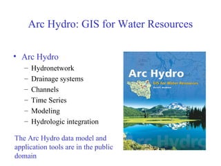
  • 1. Arc Hydro: GIS for Water Resources • Arc Hydro – Hydronetwork – Drainage systems – Channels – Time Series – Modeling – Hydrologic integration The Arc Hydro data model and application tools are in the public domain
  • 2. GIS in Water Resources Consortium Bringing together these two communities by using a common geospatial data model Arc Hydro design took 3 years from 1999 - 2002 GIS CRWR CRWR Water Resources
  • 3. Hydrologic Information System Analysis, Modeling, Decision Making Arc Hydro Geodatabase
  • 4. Geographic Data Model • Conceptual Model – a set of concepts that describe a subject and allow reasoning about it • Mathematical Model – a conceptual model expressed in equations • Data Model – a conceptual model expressed in a data structure • Geographic Data Model – a data model for describing and reasoning about the world
  • 5. What is Arc Hydro? • A geographic data model for storing geospatial and temporal water resources data in ArcGIS – A set of hydro objects built on top of ArcObjects – A set of standardized attributes – A vocabulary for describing data (glossary) – A toolset for implementing the data model
  • 6. Flow Time Time Series Hydrography Hydro Network Channel System Drainage System Arc Hydro Data Model
  • 7.
  • 8. ArcGIS Hydro Data Model Hydrography Hydrology
  • 9. Streams Drainage Areas Hydrography Channels Terrain Surfaces Rainfall Response Digital Orthophotos Data Model Based on Inventory
  • 10. Data Model Based on Behavior Follow a drop of water from where it falls on the land, to the stream, and all the way to the ocean.
  • 11. Integrating Data Inventory using a Behavioral Model Relationships between objects linked by tracing path of water movement
  • 13. !( !( !(!( !( !(!( !( !( !(!( !( !( !(!( !( !( !(!( !( !( !( !( !(!( !( !( !( !( !( !( !( !(!(!( !( !( !( !( !( !(!(!( !( !(!(!( !(!( !( !(!( !( !(!( !( !( !(!(!( !( !( !( !( !( !( !( !( !( !( !(!( !( !( Feature Waterbody HydroID HydroCode FType Name AreaSqKm JunctionID HydroPoint HydroID HydroCode FType Name JunctionID Watershed HydroID HydroCode DrainID AreaSqKm JunctionID NextDownID ComplexEdgeFeature EdgeType Flow line Shoreline HydroEdge HydroID HydroCode ReachCode Name LengthKm LengthDown FlowDir FType EdgeType Enabled SimpleJunctionFeature 1 HydroJunction HydroID HydroCode NextDownID LengthDown DrainArea FType Enabled AncillaryRole * 1 * HydroNetw ork * HydroJunction HydroID HydroCode NextDownID LengthDown DrainArea FType Enabled AncillaryRole HydroJunction HydroID HydroCode NextDownID LengthDown DrainArea FType Enabled AncillaryRole Arc Hydro Framework
  • 14. National Hydro Data Programs http://www.crwr.utexas.edu/giswr/nhdconf/nationalhydro.html National Elevation Dataset (NED) National Hydrography Dataset (NHD) Watershed Boundary DatasetElevation Derivatives for National Application (EDNA)
  • 15. Arc Hydro Framework Dataset for the Guadalupe Basin
  • 16. HydroNetwork through Canyon Lake Generic Junction (for topological connection of edges) Flowlines through water body
  • 17. Network Tracing Upstream Tracing Downstream Tracing
  • 19. NWS forecast Watersheds (flooding) EPA TMDL Segments (water quality) TNRCC water availability points (water supply) Guadalupe HydroNetwork Watersheds of the Guadalupe Basin
  • 20. Scales of representation of Drainage Systems Basins – drainage areas for water resources management Catchments – subdivision of Basin into elementary drainage areas by physical rules Digital Elevation Model – land surface terrain grid cells Watersheds – subdivision of Basin for a particular hydrologic purpose
  • 21.
  • 22. Channel Cross-Section Direction of Flow Cross-Section Channel
  • 25. 1/2 meter Digital Ortho Photography Study Area (Guadalupe river near Seguin, TX)
  • 26. Boat setup for data collection
  • 27. The electronic depth sounder operates in a similar way to radar It sends out an electronic pulse which echoes back from the bed. The echo is timed electronically and transposed into a reading of the depth of water. Depth Sounder (Echo Sounder)
  • 28. Differential GPS: Bank to Boat GPS gives the location of each point collected in terms of latitude and longitude. Two locations for differential GPS.
  • 29. Channel Data Each point has (x,y,z)
  • 30. Interpolation Points are interpolated in ArcMap to produce a continuous surface.
  • 31. Centerline Define the centerline along the thalweg of the channel
  • 32. Measure in ArcGIS 0 54.37 154.41 281.36 A PolylineM can store m-values at each vertex along with x and y coordinates. Measures are assigned in meters
  • 33. Coordinate Transformation m is measure along the centerline r is distance across the river from the centerline Sinuous river becomes straight when transformed into (m,r) co-ordinates.
  • 34. Coordinate Transformation Sinuous river Profile line and cross-sections Straightened river
  • 36. Data back to x,y coordinates Original river in X,Y Profile lines and cross-sections in (x,y) created using FishNet in (m,r).
  • 37. Profile Lines and Cross Sections in 3D Bird’s eye view!
  • 39. National Water Information System Web access to USGS water resources data Arc Hydro NWIS data retrieval tool
  • 40. Retrieving NWIS Data • Select Gage Layer • Enter Period of Record
  • 41. Streamflow Time Series Arc Hydro Time Series Table
  • 42. Time Series Extracted to Excel (In Excel, use Data/Get External Data to query Geodatabase) Geodatabase view Excel view
  • 43.
  • 44.
  • 45.
  • 46.
  • 47.
  • 48.
  • 49.
  • 50. Nexrad Data for Florida • Real-time Nexrad data supplied every 15 minutes on a 2km grid • Data from 14 radars calibrated with 435 rain gages • At end of month more careful calibration is done for historical rain map archive
  • 51. HRAP Cells for Nexrad Data Average area = 14.5 km2
  • 52.
  • 53. GIS and Hydrologic Modeling: Where are we now? • All the major hydrologic models have GIS data support systems – HEC-GeoHMS, HEC-GeoRAS, GIS-Weasel for MMS, Mike-11GIS, WMS, …. • An extensive body of experience in terrain processing for hydrology has been built up • Standardized national geospatial datasets for hydrology – National Elevation Dataset, EDNA, National Hydrography Dataset, Watershed Boundary Dataset
  • 54. GIS and Hydrologic Modeling: Where are we going to? • Integrated data and modeling systems e.g. Corps Water Management System, EPA Basins, DHI Mike Objects, ….. – Integration of observational (time series) data, geospatial data, model-derived data • Integration of vector, raster and time series data in a database management system • A language (vocabulary and grammar) for communicating between databases and models e.g. XML
  • 55. Arc Hydro and Modeling • Intrinsic Modeling – within a particular application eg Excel, ArcGIS, custom objects • Dynamic Linked Library – tightly coupled package of functions (e.g. LibHydro from HEC) • Independent Modeling – separate hydrologic model with data exchange
  • 56. Dynamic Linked Library Can have Fortran subroutines in a DLL Muskingum flow routing
  • 57. Independent Hydrologic Model VB progam reads and writes text files
  • 58. Analysis, Modeling, Decision Making Arc Hydro Geodatabase Visual Basic ArcGIS Relational Database (Access) Excel Interfaces to Arc Hydro Data and Models
  • 59. Atmospheric Water Soil Water Surface Water Groundwater Vertical and Horizontal Water Balance
  • 61. Model Building in ArcGIS 9
  • 62.
  • 63. What software do you need? • ArcView 8.2 – Viewing, querying existing geodatabases – Editing feature classes and adding data • Spatial Analyst for ArcGIS – To operate the raster tools in Arc Hydro • ArcInfo 8.2 – To build geometric networks and create new relationships Arc Hydro tools and data model are on CD at back of Arc Hydro book and available on web at http://archydro.crwr.utexas.edu
  • 64. Learning Arc Hydro • “Arc Hydro—GIS for Water Resources” book from ESRI Press • Tutorial on tools and sample dataset on CD at back of book • Exercises in Fall 2002 GIS in Water Resources class http://www.ce.utexas.edu/prof/maidment • GISWR website http://www.crwr.utexas.edu/giswr • ESRI’s Arc Online (discussion forum)

Editor's Notes

  1. Notes: Industrial partners: ESRI, Danish Hydraulic Institute, Camp,Dresser and McKee, Dodson and Associates Government partners: Federal: EPA, USGS, Corps of Engineers (Hydrologic Engineering Center) State: Texas Natural Resource Conservation Commission, Texas Water Development Board Local: Lower Colorado River Authority, City of Austin, Dept of Watershed Protection Academic Partners: University of Texas, Brigham Young University, Utah State University
  2. This is the full Arc Hydro data model, which contains components for additional classes for drainage areas, hydrography, channels, network events, and Time series data.
  3. The Arc Hydro Framework is a simplified version of the full Arc Hydro data model designed for an entry level user who just wants to put together a basic data set for streams, watersheds, waterbodies and hydro points like stream gages and water quality monitoring points
  4. The Arc Hydro framework is built on a Hydro Network made up of HydroEdges (stream lines) and HydroJunctions (points of interest on the lines). The watersheds, waterbodies and hydropoints are connected to the hydronetwork using relationships with the hydro junctions (blue lines in the diagram).
  5. Before we get into detail let’s quickly define a channel and a cross-section. A river of stream Channel is a conduit or water course carrying water flow under gravity. A Cross-Section refers to the section of a channel taken normal to the direction of the flow.
  6. It is important to relate other features such as embankments and the extent of inundation with the main channel itself and see everything as an integrated system rather than as individual components. An embankment profile provides useful information regarding breaches or identifies the location of possible overspilling. Historical flood extent information is very useful for checking the validity of a flood model. These longitudinal view of channel features are stored as ProfileLines in this model. These are linear features. Currently five different features are supported such as Thalweg, left and right banks, left and right flood lines. ProfileLines and CrossSections are linked through Channel_ID.