
Recommended
Recommended
More Related Content
What's hot
What's hot (11)
Viewers also liked
Viewers also liked (20)
Similar to Geospatial data & Web Portals for IWRM:-NRSC Perspective By Dr. J.R. Sharma
Similar to Geospatial data & Web Portals for IWRM:-NRSC Perspective By Dr. J.R. Sharma (20)
More from indiawrm
More from indiawrm (20)
Recently uploaded
Recently uploaded (20)
Geospatial data & Web Portals for IWRM:-NRSC Perspective By Dr. J.R. Sharma
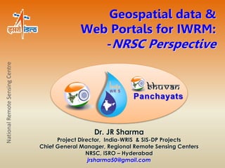
- 1. Geospatial data & Web Portals for IWRM: -NRSC Perspective Dr. JR Sharma Project Director, India-WRIS & SIS-DP Projects Chief General Manager, Regional Remote Sensing Centers NRSC, ISRO – Hyderabad jrsharma50@gmail.com National Remote Sensing Centre Panchayats
- 2. Bhuvan Multi Resolution Societal Applications 3D Geographic Models Seamless Fly Through Thematic Vectors Gateway to Indian Earth Observation Data Products & Services Bhuvan is an initiative of Indian Space Research Organisation (ISRO), to showcase Indian Earth Observation capabilities for planners, decision makers, social groups, village community and to a common man. Bhuvan gives a gateway to explore and discover virtual earth in 2-D, 3-D space with tremendous value addition possibilities at user end. www.bhuvan.nrsc.gov.in Open EO Data Archive Open Source Development OGC Compliant Services
- 3. What is unique in Bhuvan!!! Availability of Uniform high resolution data Multi- Sensor, Temporal, Platform IRS series of satellites Rich Thematic Information Weather Data from ISRO AWS Ocean Services Collaboration/Sharing/Community Participation Online Shape file Creation Thematic data sets to consume as Web Services Terrain Profile Multi-Lingual Free Data Download Crowd Sourcing Visualization to Governance
- 4. Bhuvan Tools and Capabilities Bhuvan Cell, NRSC,
- 5. Bhuvan Services and Applications
- 6. Disaster Service (NDEM Public) Disaster Services – Flood, Drought, Forest Fire, Landslide, Earhquake, Cyclone S E R V I C E S
- 7. Data Download Services (NOEDA) NRSC Open Data Archive Cartosat-1: DEM: 1 arc Sec Version 1 ,1.1 Resourcesat-1: AWiFS Ortho: 56m Oceansat-2: OCM2: NDVI, VF, Albedo: 1Km Resourcesat -1: LISS III Ortho: 24 m Tropical Cyclone Heat Potential IMS-1: Hyperspectral Imager: 500 m Ocean Heat Content Water Fraction NICES Daily Products : Depth of 26 deg Isotherm, Tropical Cyclone Heat Potential Daily North Indian Ocean ( OSCAT based) Wind Stress, Wind Curl, Wind Vector S E R V I C E S
- 8. Thematic Services Bhuvan Thematic Services Land use Land cover Geomorphology Lineament Wasteland Glacial Lakes/ waterbodies NUIS Maps S E R V I C E S
- 9. MANU : Map the neighborhood in Uttarakhand Bhuvan Collaboration Portal L Two Trainings conducted by Bhuvan team at IIRS
- 10. Crowd Sourcing On Bhuvan
- 11. A 'Single Window solution’ for comprehensive, authoritative and consistent data & information of India's water resources in a standardized national GIS framework for IWRM in the country. Accurate, adequate and contemporary information on the state of water resources is must in public domain for involvement in IWRM. Increasing public awareness elevates the importance of water information & enlightened public involvement in water management / decisions http://www.india-wris.nrsc.gov.in/
- 12. 12 Data types & Designing information system Real Time Database Dynamic Time series datasets Related Thematic Database Foundation Geo-database Administrative Foundation Geo-database Water resources Features of the Portal: Web portal for all sections of society Map policy, data policy, and CWC guidelines Scalable database Mobile Version System has three categories of users and datasets: • All General users • Premium users • CWC Intranet users Data collection, standardization & organization More than 332,000 Softcopy files in different formats More than 5160 Hard copy reports
- 13. Major Information System and Sub-Info System Main Information System – 12, Sub information System – 35, Layers – 95, and Attributes - > 4500, 5-100 years data Sl. No. Main & Sub Information System I. BASE DATA INFO SYSTEM 1. Administrative Info System 2. Infrastructure Info System 3. Terrain (DEM) Info System 4. Region Info System II. SURFACE WATER INFO SYSTEM 5. Water Resource Region Info System 6. Basin Info System 7. Watershed Info System 8. River Info System 9. Surface Water Body Info System 10. Water Resources Projects Info System 11. Command Area Info System 12. Minor Irrigation Info System 13. Canal Info System III. GROUND WATER INFO SYSTEM 14. Aquifer / Litholog Info System 15. Ground Water Level Info System 16. Ground Water Potential Info System IV. HYDRO – MET INFO SYSTEM 17. Meteorological Info System 18. Climate Info System 19. Hydro-Observation Info System 20. Flood-forecasting Info System V. WATER QUALITY INFO SYSTEM 21. Surface Water Quality Info System 22. Ground Water Quality Info System Sl. No. Main & Sub Information System VI. SNOW COVER / GLACIER INFO SYSTEM 23. Snow Cover/Glacier Info System VII. INLAND NAVIGATION WATERWAYS INFO SYSTEM 24. Inland NavigationWaterways Info System VIII. INTER-BASIN TRANSFER LINKS INFO SYSTEM 25. Inter-basin Transfer Links Info System IX. HYDROLOGICAL EXTREMES INFO SYSTEM 26. Flood Info System 27. Drought Info System 28. Extreme Events Info System X. LAND RESOURCES INFO SYSTEM 29. Land Use / Land Cover Info System 30. Land Degradation Info System 31. Wasteland Info System 32. Soil Info System XI. WATER TOURISM INFO SYSTEM 33. Water Tourism Info System XII. SOCIO – ECONOMIC INFO SYSTEM 34. Rural Info System 35. Urban Info System
- 14. Spatial Layer Details Number/ Area No. of Attributes WATER RESOURCES PROJECTS • No. of Major & Medium Irrigation Projects 1747 55 • No. of Lift irrigation Schemes 352 15 • No. of ERM Projects 131 50 • No. of Hydro Electric projects 222 17 • No. of Powerhouses 293 39 • No. of Dams 4575 34 • No. of Barrages/Weir/Anicuts 540 51 • No. of Reservoirs 4517 38 • Total Length of Canal 324600 km 3 • No. of Hydro-Structures 114709 6 • Waterlogged Areas in Major & Medium Command 17192.79 Sq.km 5 • Salt Affected Areas in Major & Medium Command 10345.41 Sq.km 5 • No. of Surface Water bodies 798909 5 • Area under Surface Water bodies 48379.89 Sq.km - • No. of Inter Basin Transfer Links 30 8 • No. of Inland Navigation Waterways 6 (4487 km) 15 WATERSHED ATLAS • No. of Water Resource Regions 6 • No. of Basins 27 • No. of Sub-basins 101 • No. of Watersheds 4707 • Total Length of River (Line) 3617662 km • Total Length of River (Polygon) 627726 km ADMINISTRATIVE LAYERS • Total Length of Roads 2702136.38 km • Total Length of Railway line 69023.46 km • No. of Water Tourism locations 1328 ENVIRONMENTAL DATA • No. of Hydrological Observation Stations (CWC) 953 68 • No. of Surface Water Quality Stations (CWC) 419 2 • No. of Flood Forecasting Stations (CWC) 175 20 • No. of Meteorological Stations (CWC) 851 23 Water Resources Assets of the Country
- 15. India-WRIS Mobile App. Features 1. About WRIS A page explaining WRIS project. 2. Explore WRIS: Facilitating users to query or perform a textual search under following headings. • Basins • Dams • Rivers • Hydro Observation Stations • Tourist Spots 3. Search Nearby Will fetch the locations of following • Dams • Tourist Places • Hydro Observation Station Near the user location or near a specified city or town 4. Updates : Latest updates of WRIS Automatic Report Generation
- 16. India-WRIS Technical Documents A. Project Planning & Management Document (PPMD) 1. PPMD Part – I (General Guidelines for Management Practice) 2. PPMD Part – II (Financial Guidelines for Management Practice) B. Software Design 1. Software Design, System Architecture and Data Security 2. Database Organisation and Geodatabase Standards 3. Metadata Standards C. Technical Common Guidelines 1. General Technical Guidelines – An Overview 2. Theme-wise Database Generation Methodology 3. RFP Manual for Mapping D. Quality Assurance Documents 1. Quality Assurance of Database – Standards & Guidelines 2. Quality Assurance of Software – Standards & Guidelines E. Publications 1.River Basin Atlas of India 2.Basin-wise Reports 3.Watershed Atlas State Workshops 16
- 17. Highlights Visitors from India: 5,82,326 Visitors from other countries : 71,514 17 1. Project duration & cost : 5 years & Rs. 783.2 Million 2. Website & WebGIS Portal Launch in Public domain Website Launch - 10th December, 2009 India-WRIS WebGIS Version 1.0 launch - 7th December, 2010 India-WRIS WebGIS Version 2.0 launch - 22nd March, 2012 India-WRIS WebGIS Version 3.0 launch - 4th December, 2012 India-WRIS WebGIS Version 4.0 launch - 19th January, 2014 Total Visits: 653,840 Total Downloads: 20,192 153 countries 3. A multidisciplinary expert team of 81 engineers of NRSC / ISRO. Out of total 36 research scientists were recruited on all India selection basis for this work/project. Technology Components Software / Technologies WebGIS Front end 2D Adobe Flex, HTML, PHP 3D ArcExplorer, .NET, ArcGlobe Mobile .NET(Windows) / Flex(Android) / JAVA(Symbian) Meta Data Visual Basic Data Generation (Digital Image Processing / GIS) ERDAS Imagine, ENVI, ArcMap, ArcCatalog, ArcSDE, AutoCAD 3D, IGIS, Map Window Library, Geodatabase XML Publishing / Web/ Geodata Services ArcGIS Server Geodatabase / Back end Oracle 11g Software/ Technologies Used
- 18. CWC Data Portals & India-WRIS • Hydro Observations Data (Gauge, Discharge, Silt & Quality) of 953 stations, earlier available through SWDES. • Surface water quality data of 179 CWC stations of the period 1965-2010. • Live (current + past 72 hours) water level data from 466 Live Telemetry stations. • Flood Forecasting stations (175 stations static parameters). • Historic water level data of 84 monitoring reservoirs. • India-WRIS Wiki has information from various CWC documents viz: – Technical Advisory Committee (TAC) notes. – Legal Instruments. – Inter-state water disputes. Way forward New facilities in India-WRIS Version 5.0 (upcoming) National Water Informatics Centre:
- 19. GUI - India-WRIS
- 20. Space Based Information Support for Decentralized Planning Panchayats Portal (SIS-DP) National Remote Sensing Centre http://bhuvan-panchayat.nrsc.gov.in/ Empowering Communities for Reshaping Economy, Society and Environment
- 21. Scale of Operation Number of Elected Representatives in the three tiers Panchayats in the Country + PIA, NGOs Category PRI No. General SC ST Total Women Village Panchayats 232913 1851166 490986 314324 2656476 975116 Estimated no. of functionaries requiring training & data National Remote Sensing Centre Intermediate Block level Panchayats 6094 112371 32898 11340 156609 58094 District Panchayat 537 11311 2734 1649 15694 5779 Grant Total 2,39,544 19,74,848 5,26,618 3,27,313 28,28,779 10,38,989 Centre/State Level 3,600 District Level 27,500 Block Level 2,70,000 GP Level 15,98,900 Total 1900000
- 22. THE CURRENT REQUIREMENTS: DATA & ENABLING ENVIRONMENT
- 23. SIS-DP Conceptual Framework 1. Database Generation and Organization Spatial & non spatial data NRSC & States Centres / partners 2. Enabling Environment for PRI’s Web Based System for PRIs – Four modules NRSC / ISRO 3. Outreach PRIs & Citizens NRSC & States Centres /partners Capacity Building Implementation & Monitoring Village (Gram Panchayat) & Urban local bodies Block (Panchayat Samiti) District (Zilla Parishad) Identification of sector wise issues at all levels of PRIs Asset Mapping & Activity Planning Geo- Visualization Search , Access, Understand State Centres & NRSC / ISRO PRIs, State Centres, NGOs, Citizens PRIs, State Departments NRSC / ISRO Field Data Socio-economic Data Climate Data SIS-DP Database Earth Observation Images Bhuvan Panchayats
- 24. Activities Sectors Ministries Schemes • MoPR • MoRD • MoUD • MoDW&S • MoP • MoWR • MoA • MoEF • MHA • MHUPA • MHRD… 1. Land and Water Development Activities 2. Productive Activities 3. Civic Amenities and Infrastructure Development Activities 4. Social Welfare Activities 5. Governance Activities Activities for rural areas (29) Activities for urban areas (18) Activity Planning 1. Mahatma Gandhi National Rural Employment Guarantee Act (MGNREGA 2.0) 2. Integrated Watershed Management Programe (IWMP ) 3. Indira Awas Yojana (IAY) 4. Pradhan Mantri Gramin Sadhak Yojana (PMGSY) 6. National Rural Health Mission (NRHM) 7. Integrated Child Development Services (ICDS) 7. Nirmal bharat abhiyan (TSS) 8. Mid-Day Meal Scheme (MDM) 9. Sarva Siksha Abhiyan (SSA) 10. Jawaharlal Nehru National Urban Renewal Mission (JNNURM) 11. Accelerated Irrigation Benefit Programme (AIBP) 12. National Social Assistance Programme (NSAP) 13. Backward regions grant fund (BRGF) 14. National Rural Livelihoods Mission (NRLM)- Aajeevika 15. Rashtriya Krishi Vikas Yojana (RKVY) 16. National Rural Drinking Water Mission (NRDWP) 17. Rajiv Gandhi Panchayat Sashaktikaran Abhiyan (RGPSA) 17 Flagship Schemes of Government of India: 2013-14
- 26. Space Inputs, Spatial Enablement and G - Governance Thank you